Catherine loves painting and photography as well as the great outdoors. Cycling, kayaking, pack-rafting and hiking are favourite activities as well as scuba diving when the location permits. A self confessed geek, she’s the reason details are included in our stories!
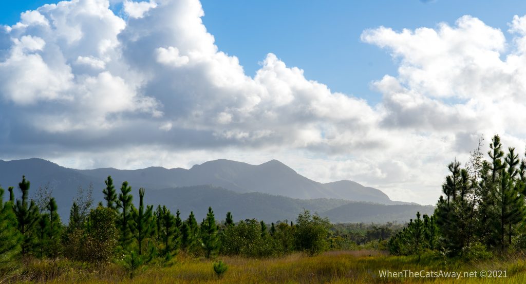
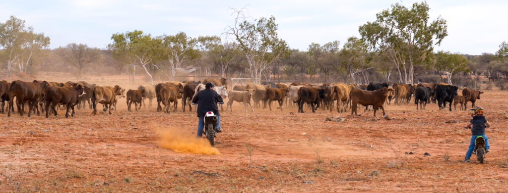
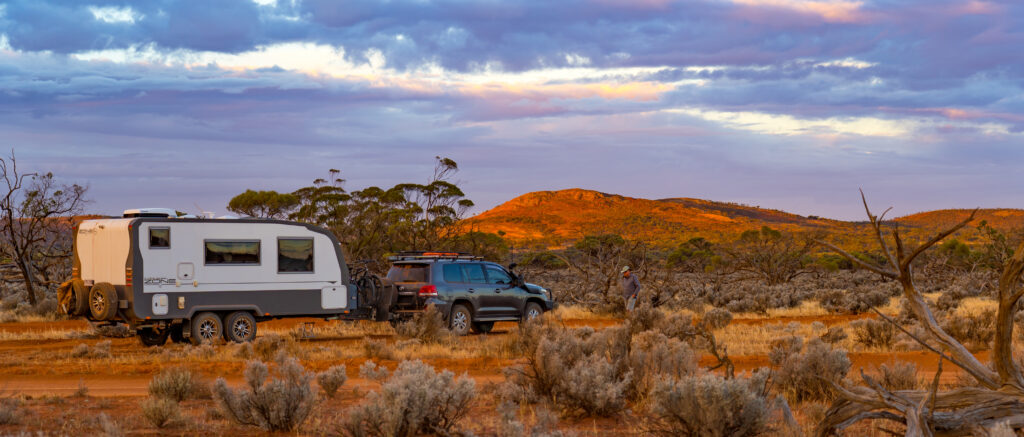
We’re not that keen on staying on traditional campgrounds, and when reading comments such as ‘packed in like sardines’ associated with campsites in Bowen, we decided to look elsewhere. A mango and cattle farm, for example. So when we farewelled Midge Point and headed north, our destination was Glen Erin Farmstay.
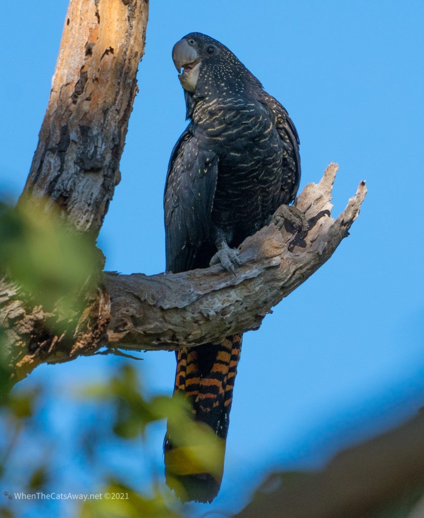
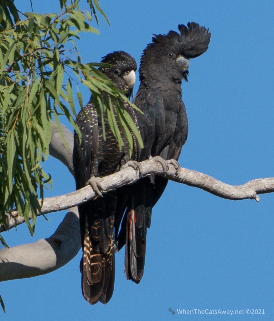
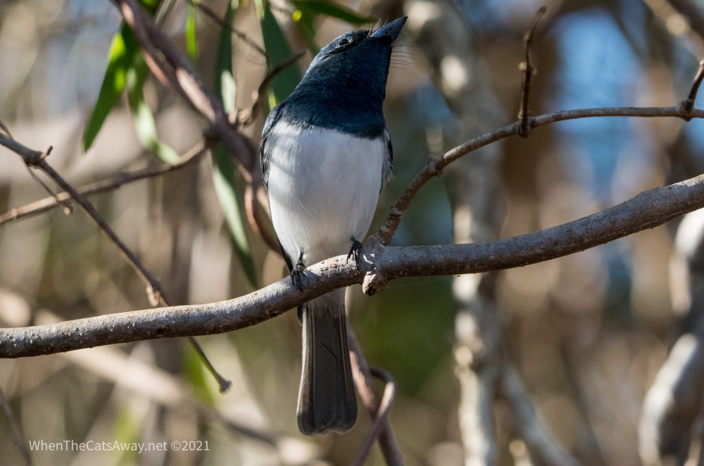
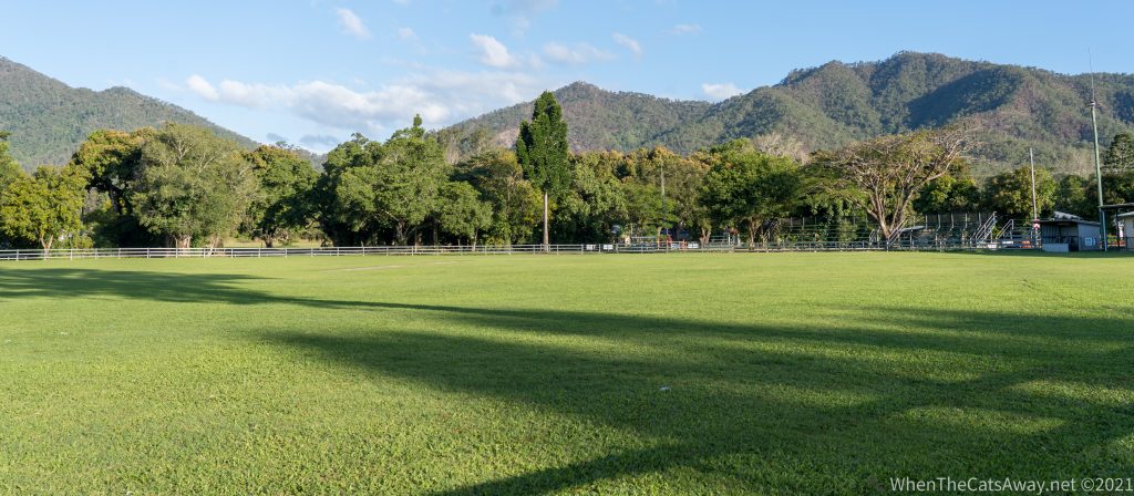
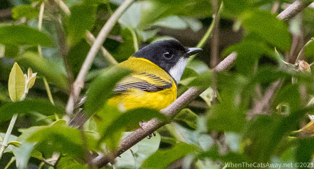
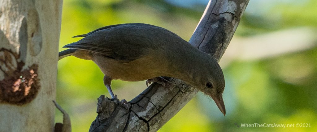
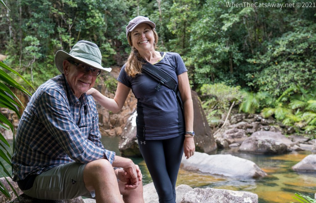
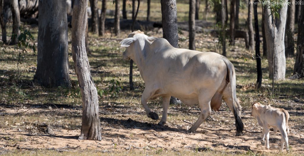
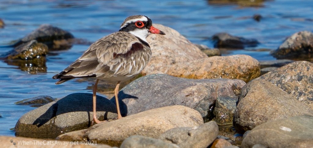
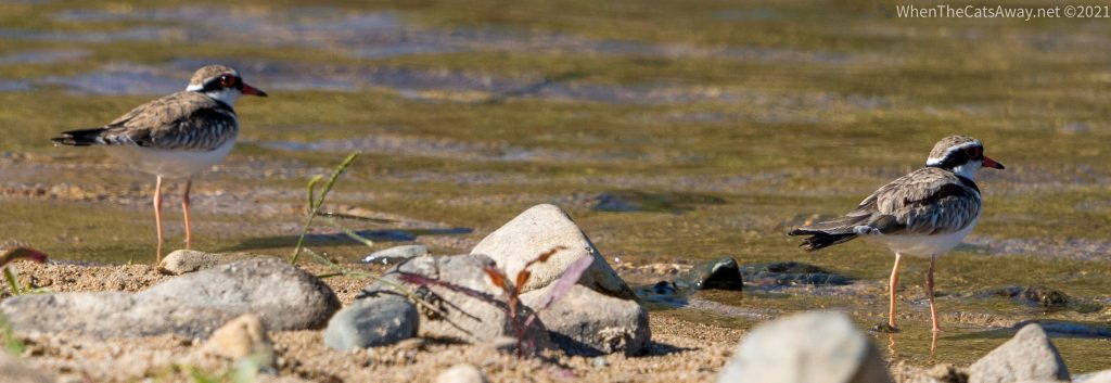
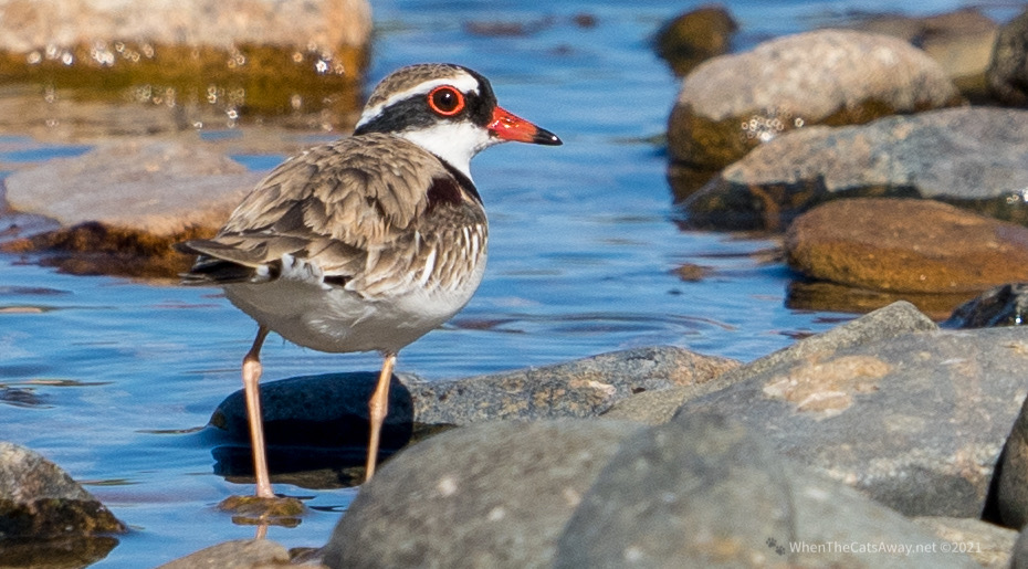
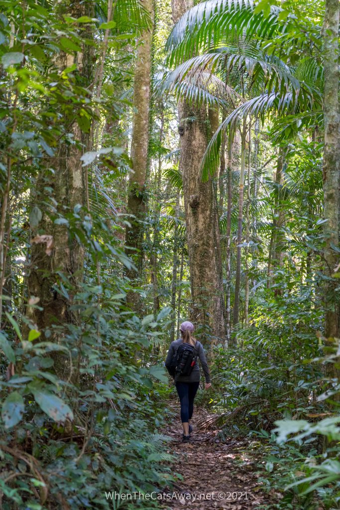
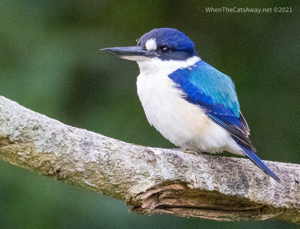
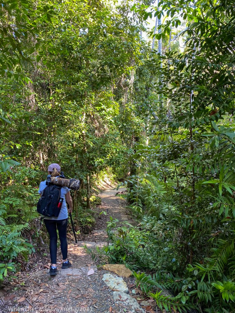
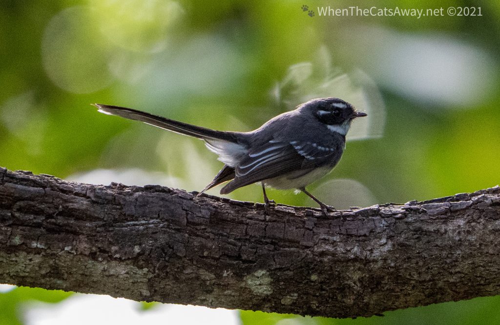
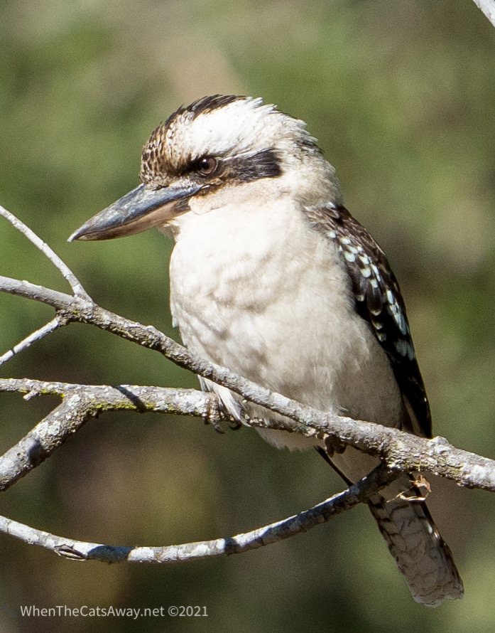
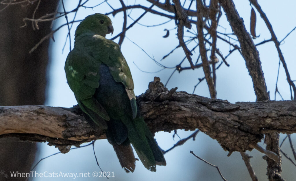
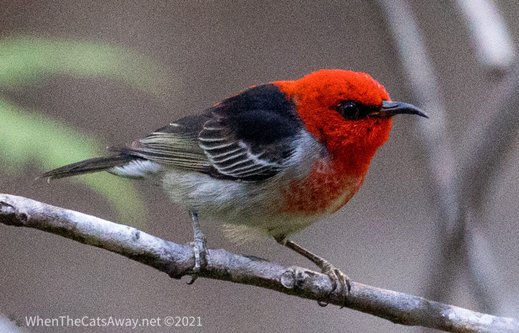
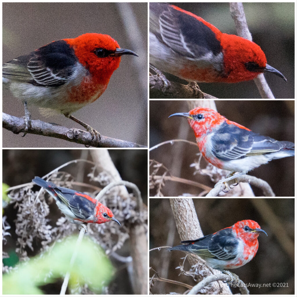
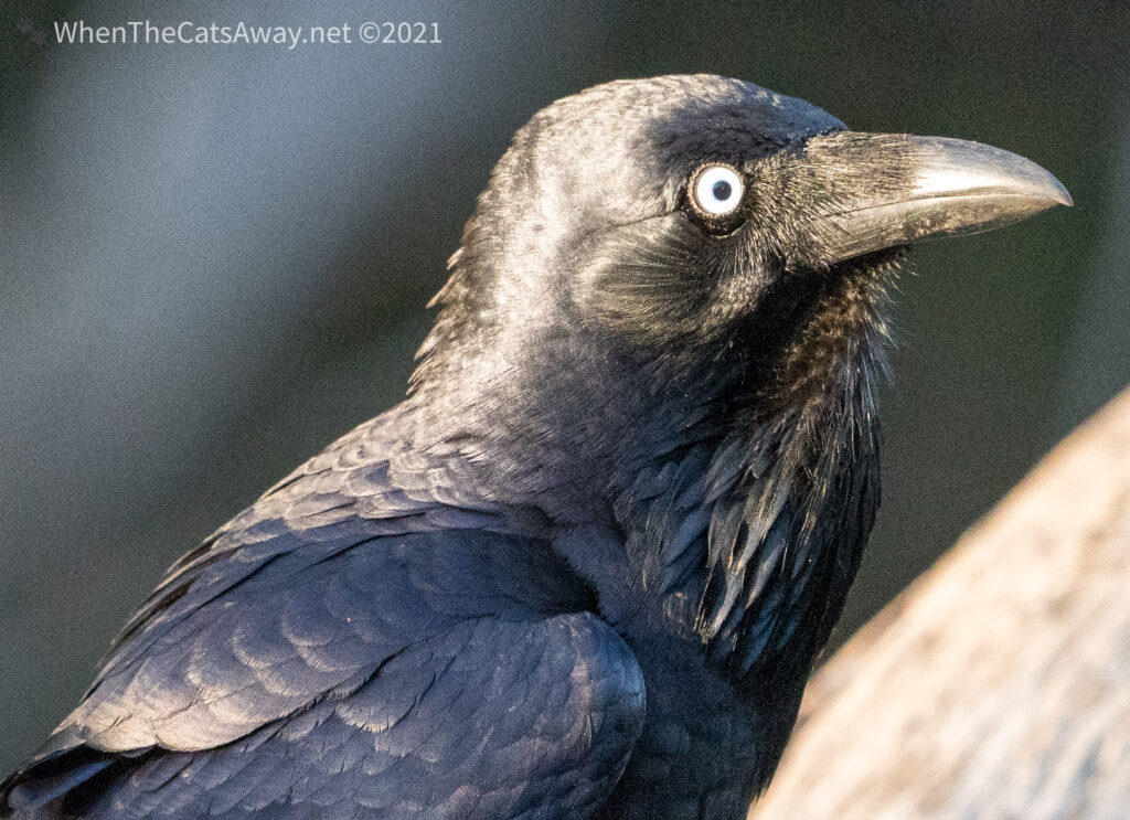
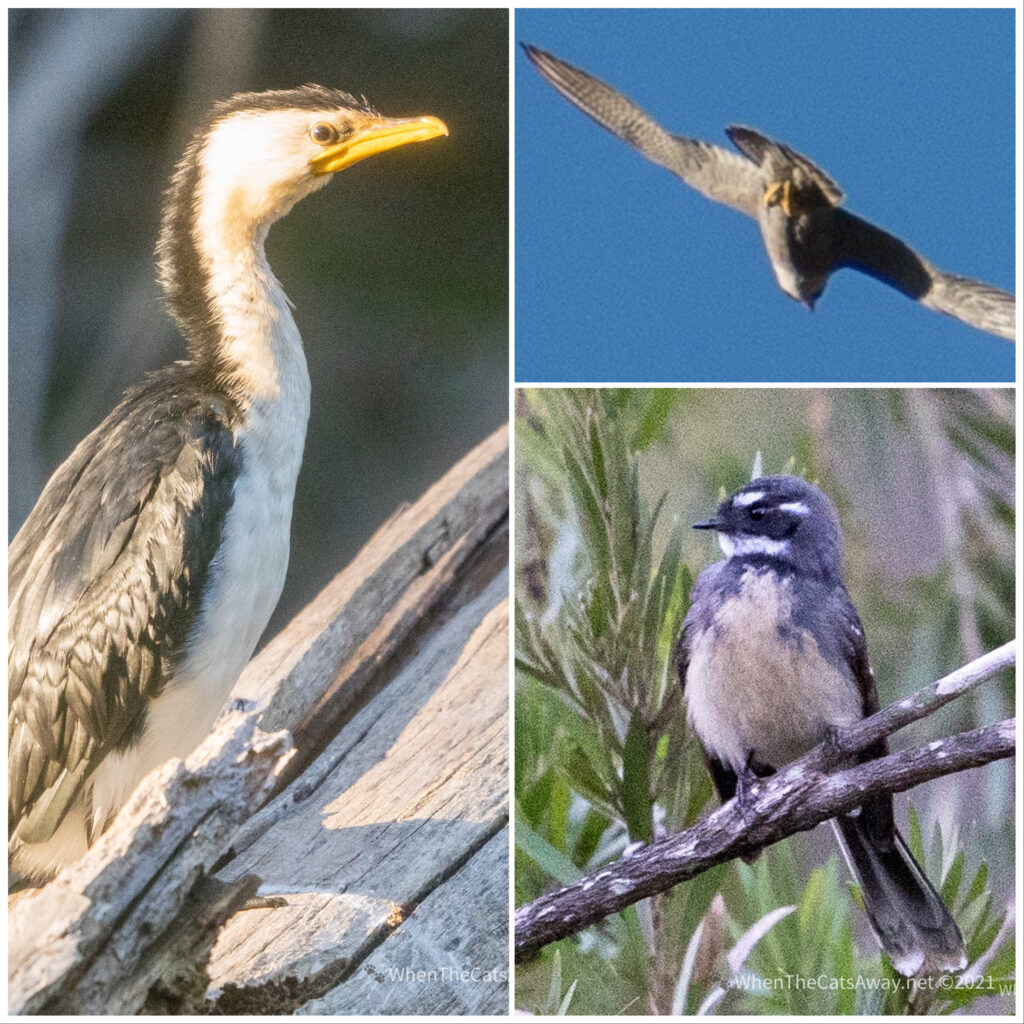
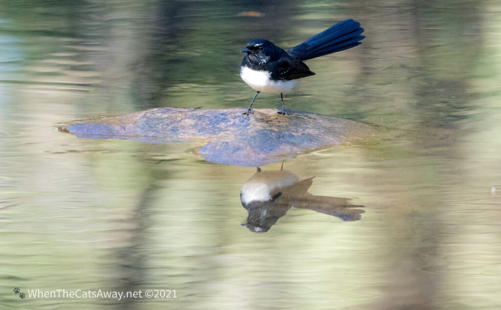
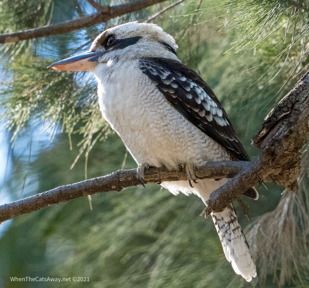
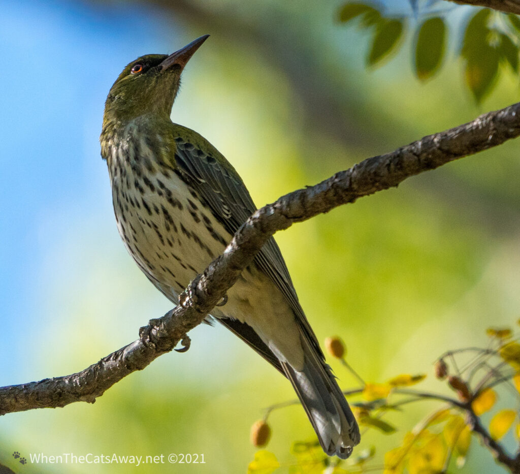
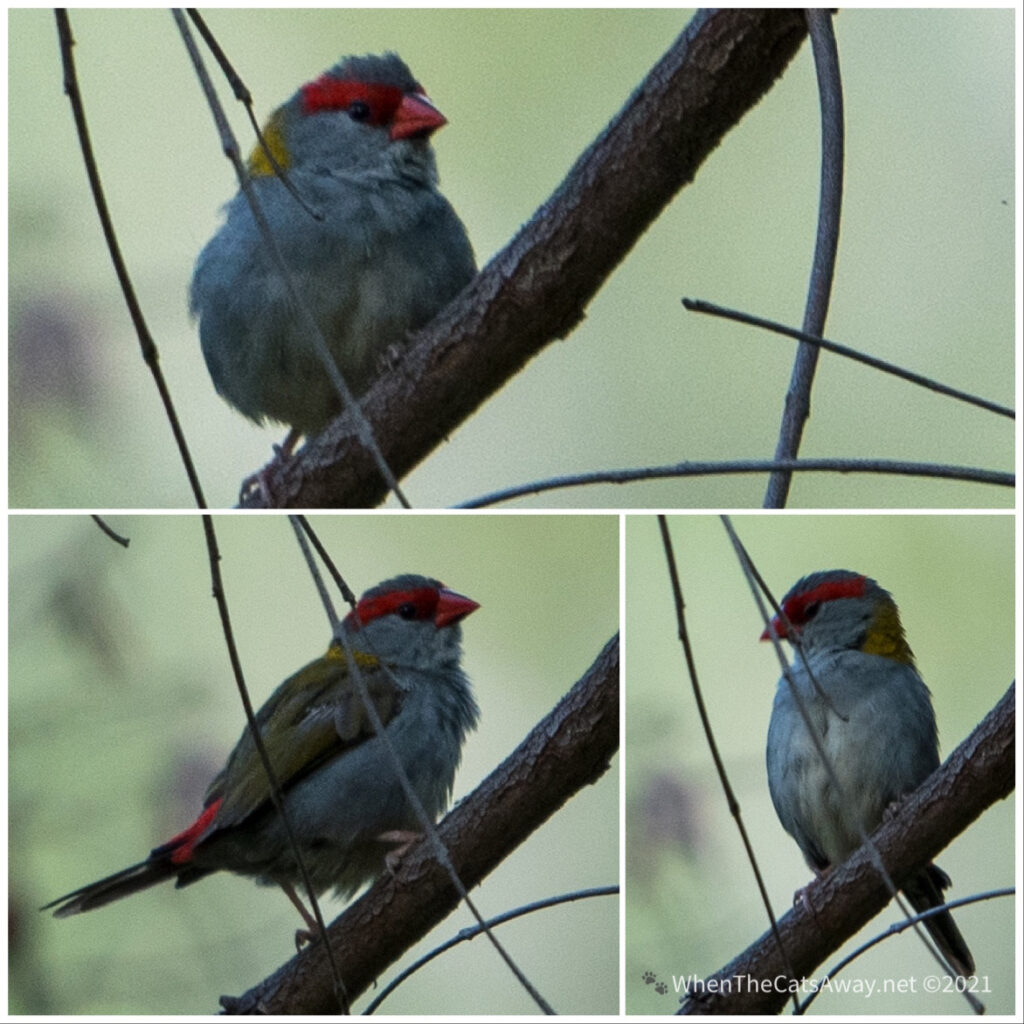
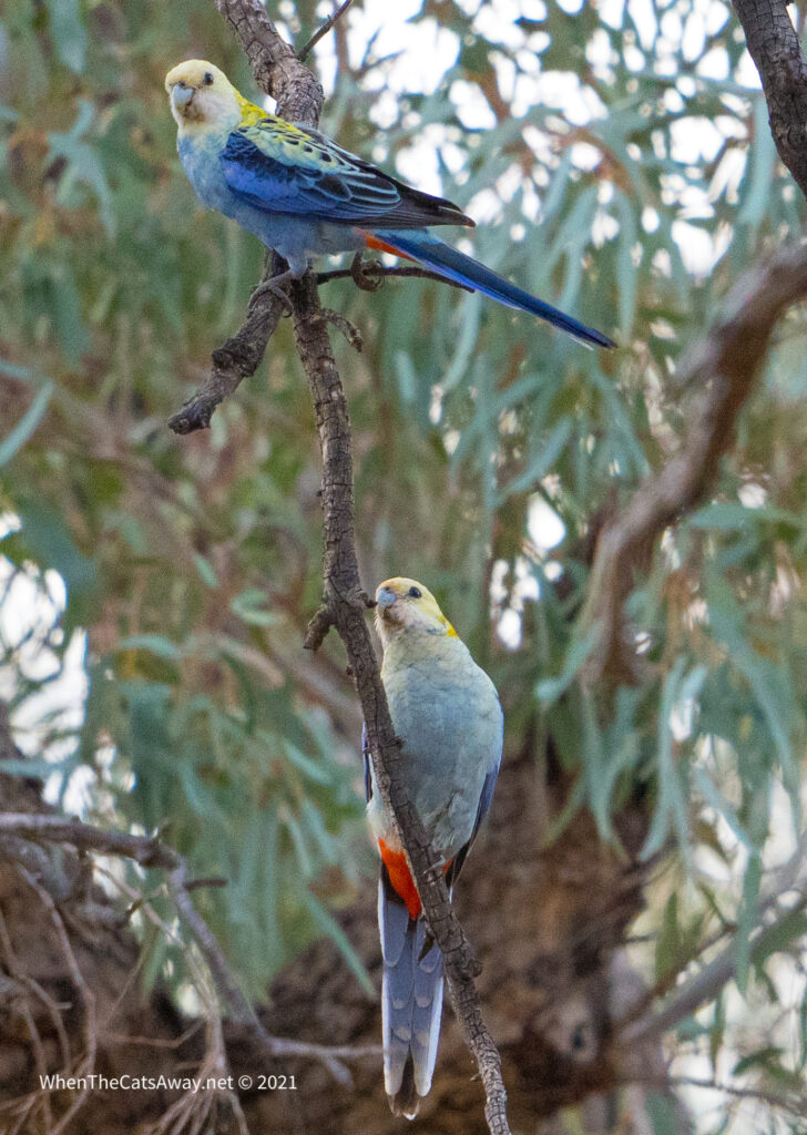
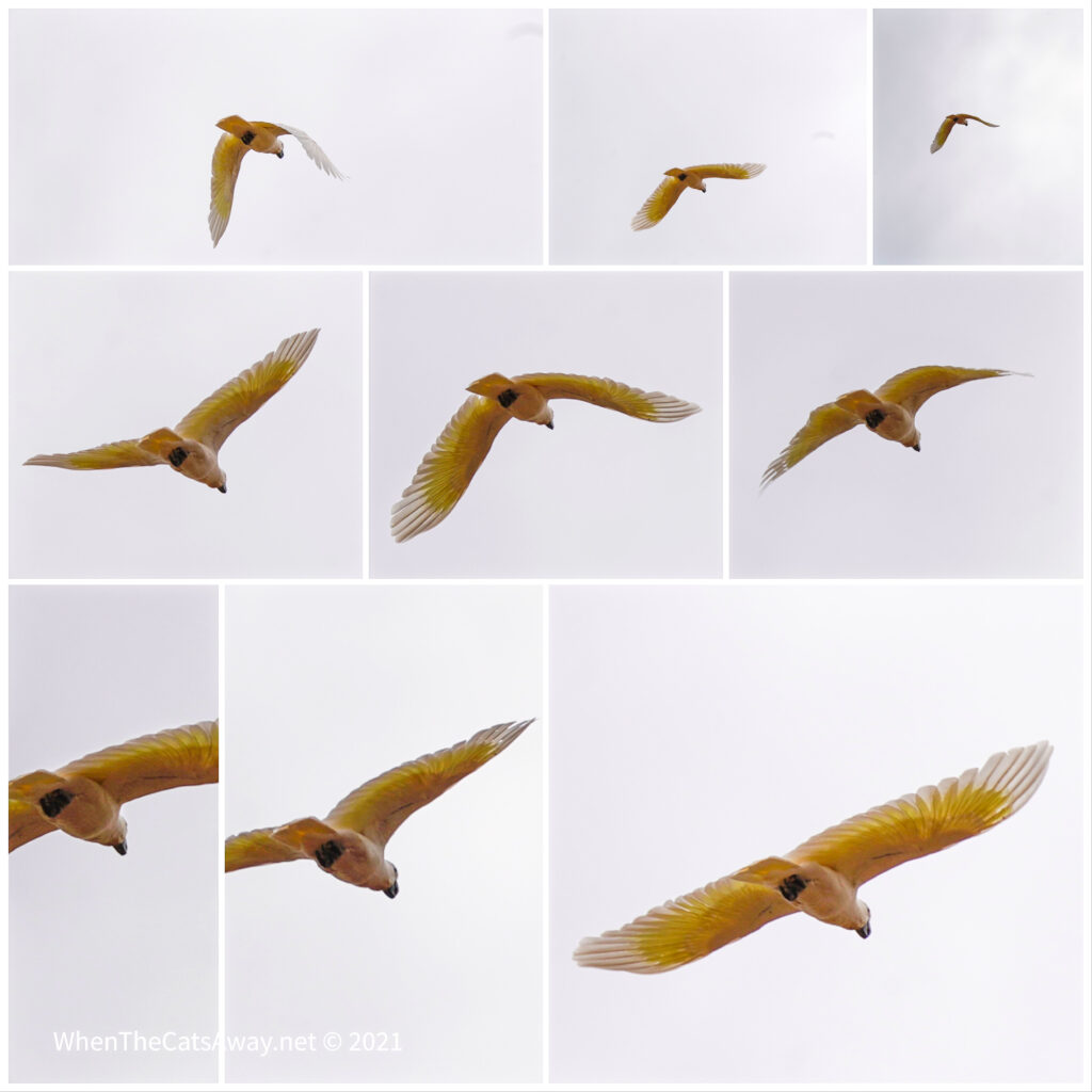
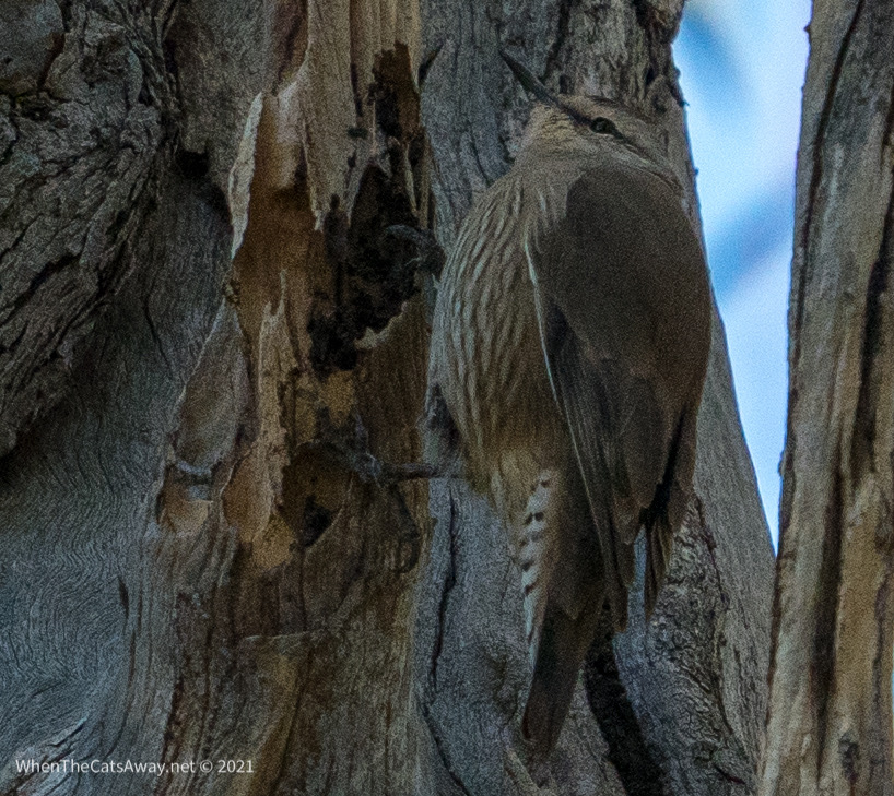
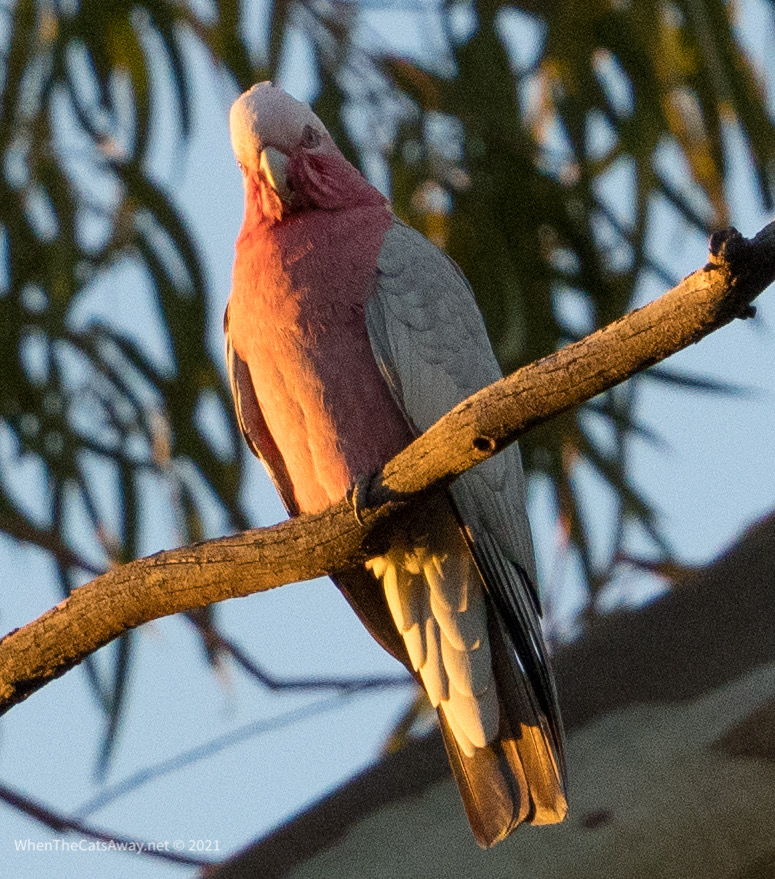
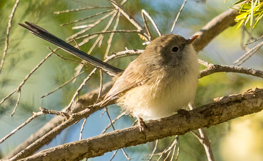
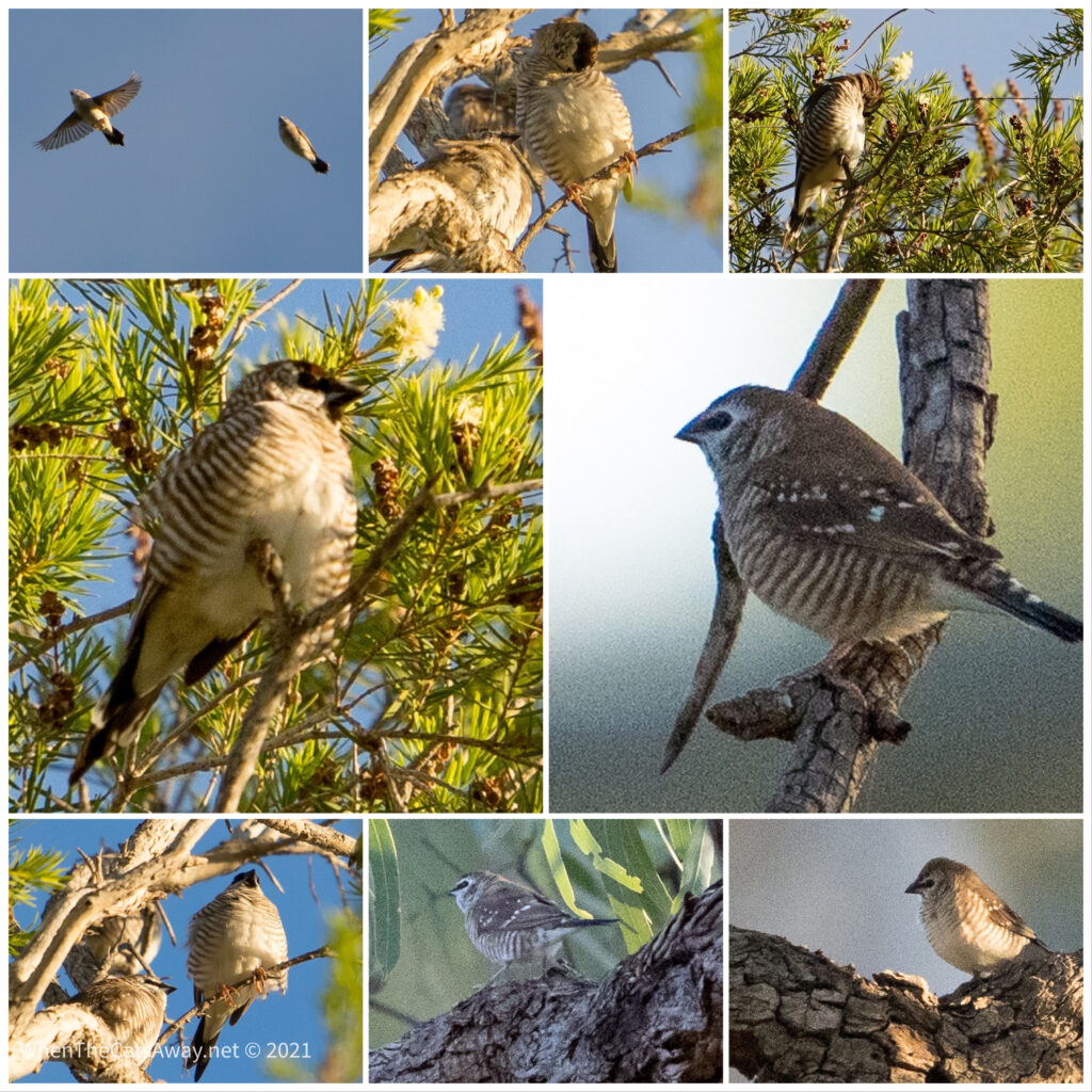
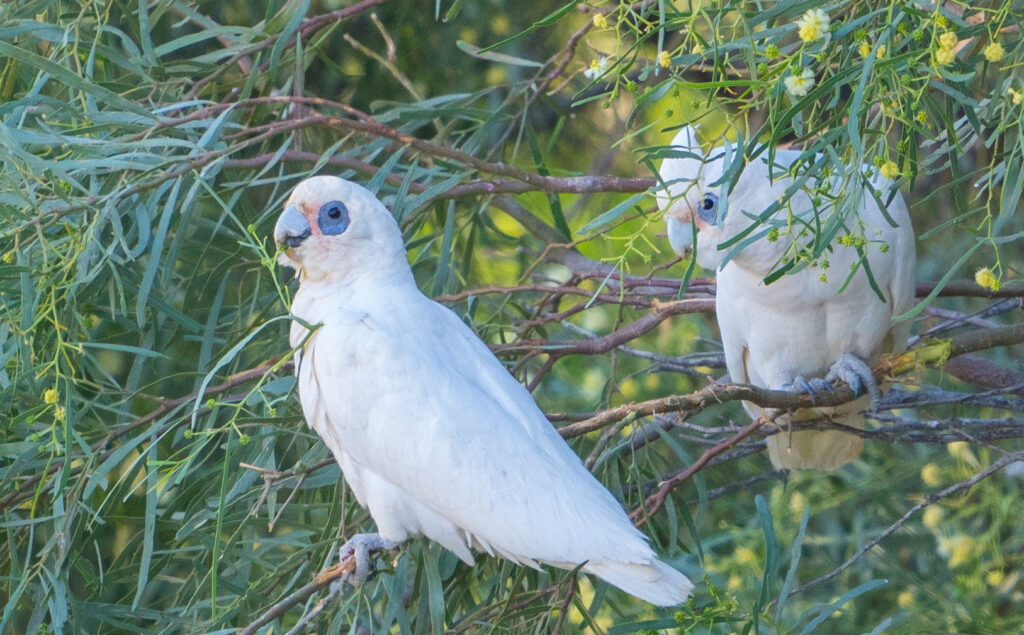
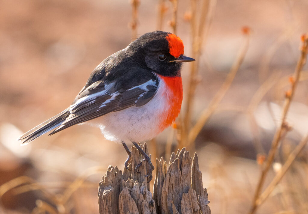
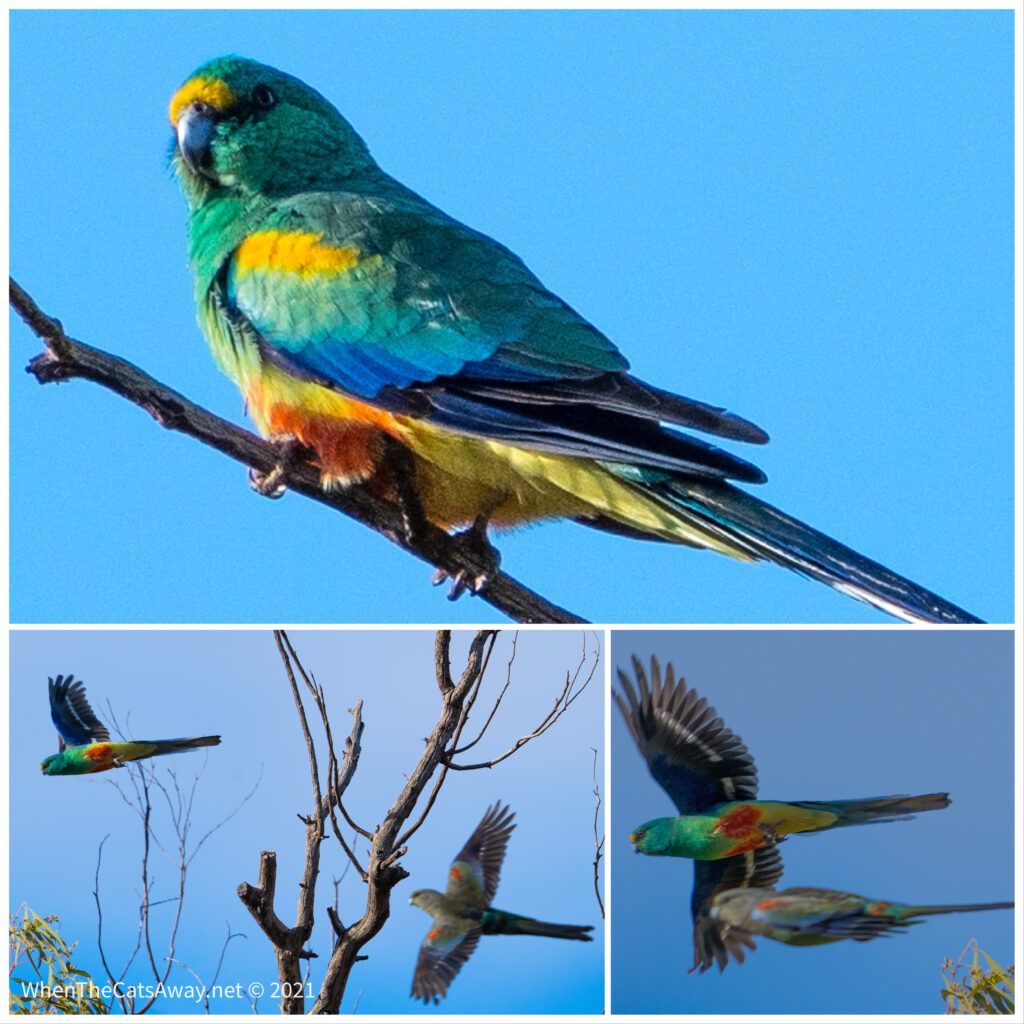
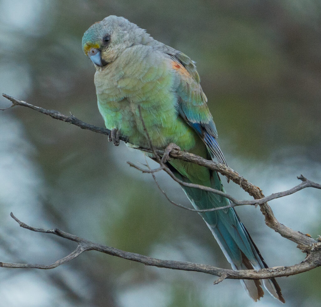
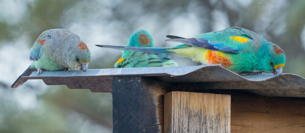
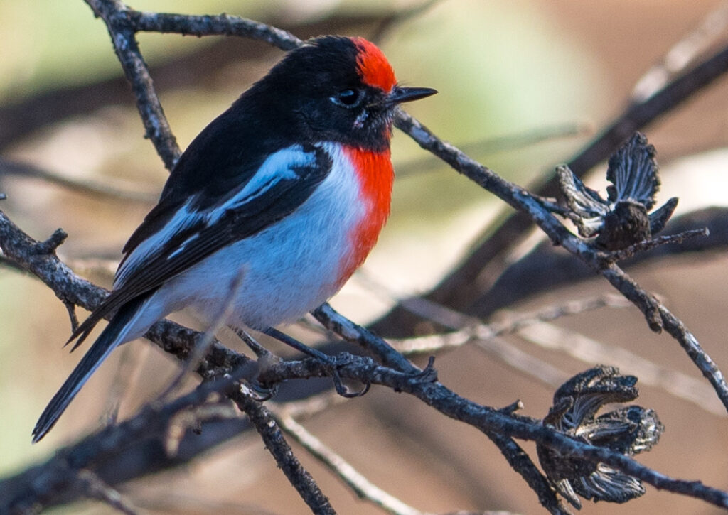
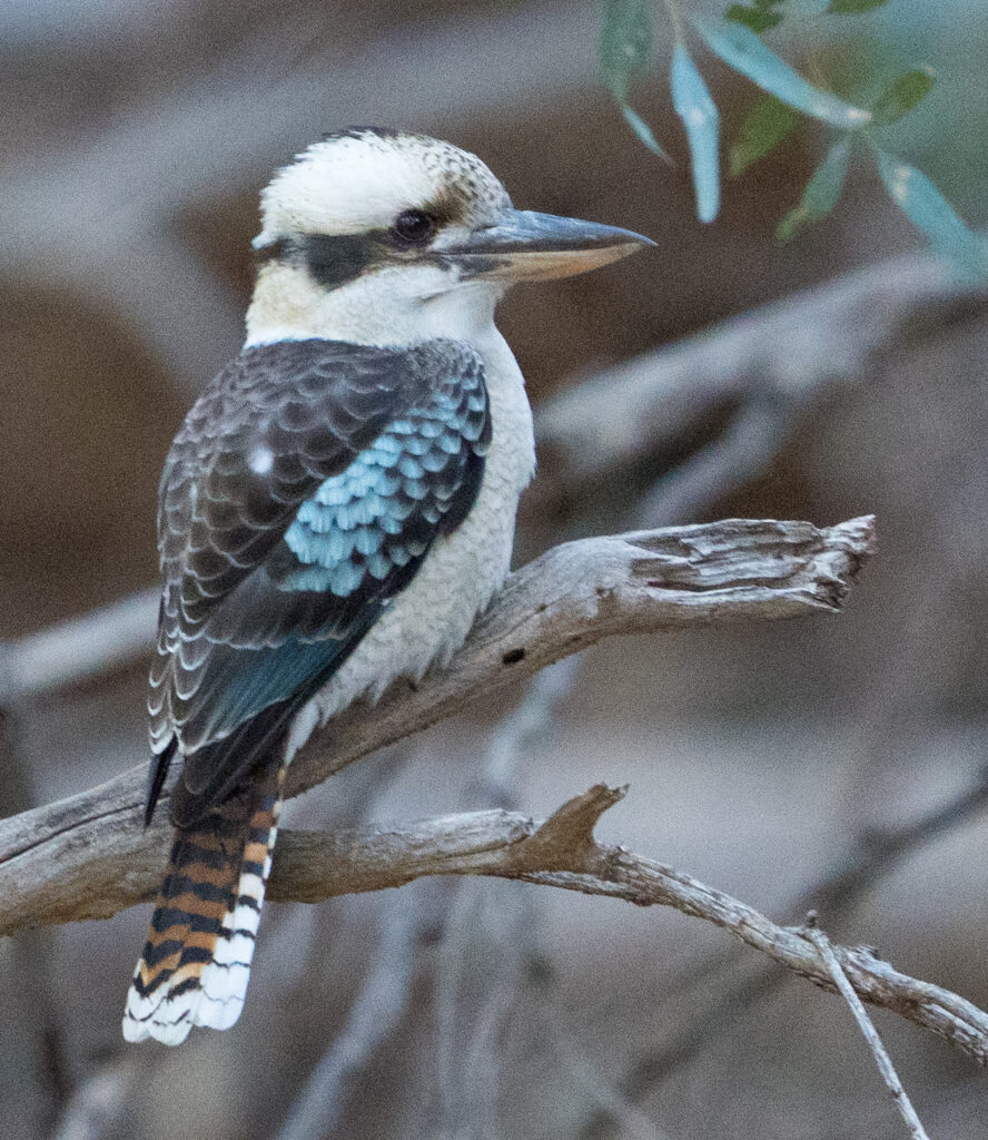
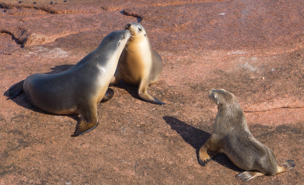
After setting up we had an explore along the farm tracks, through a mango orchard and along quiet grass lined pathways. Red tailed black cockatoos were the noisy locals that first caught our attention.
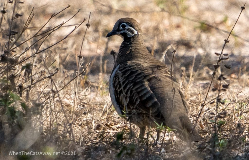
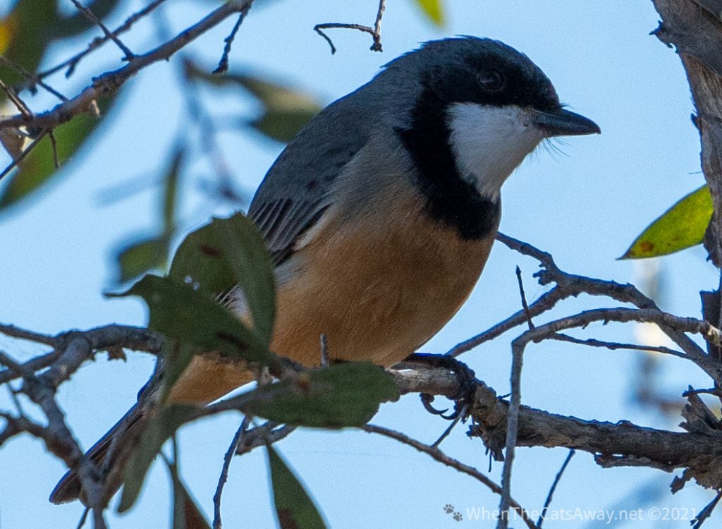
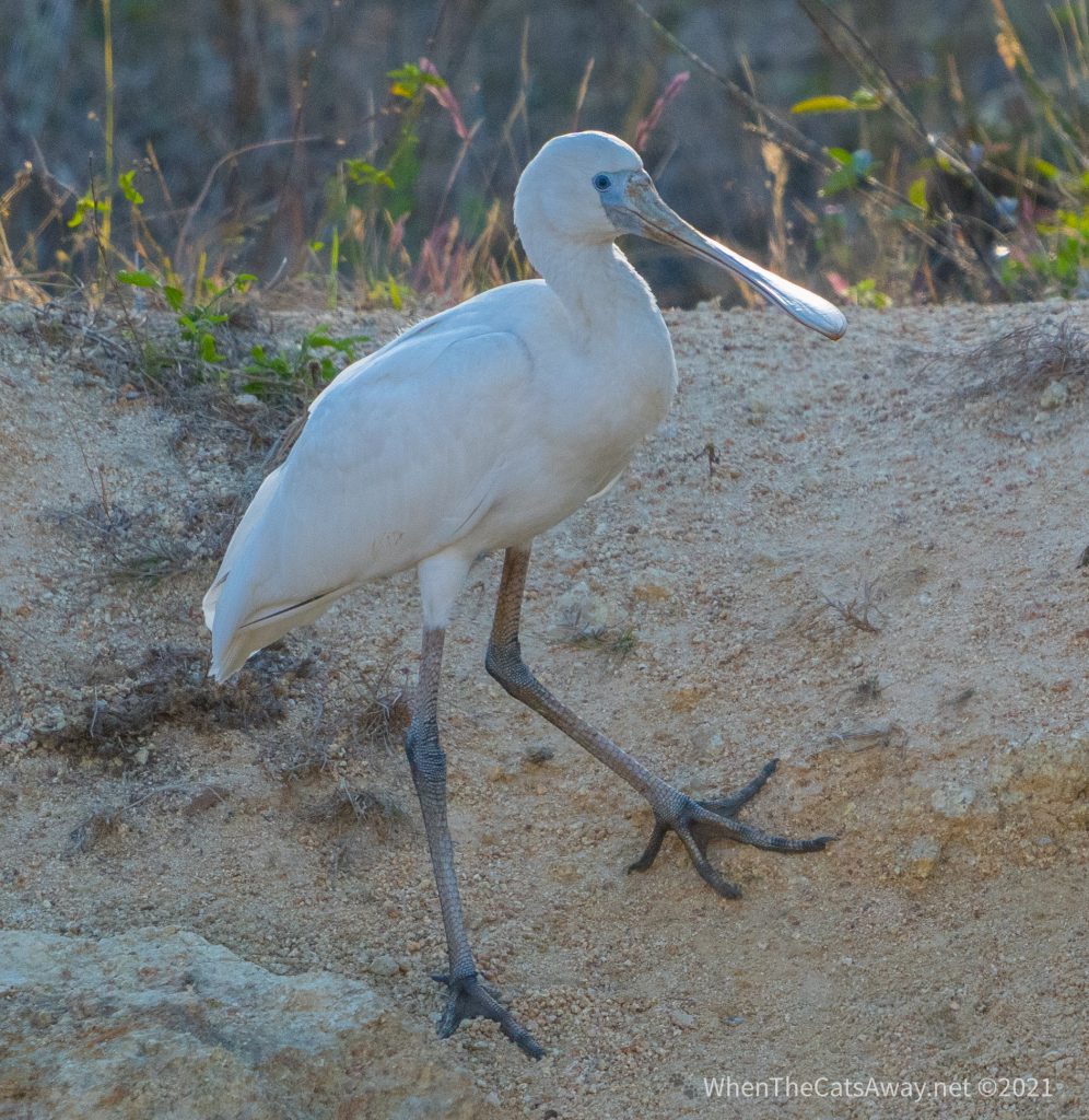
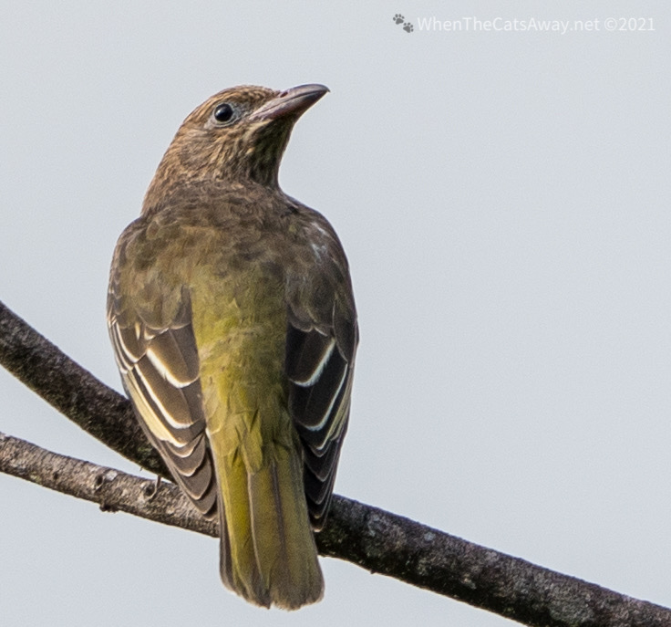
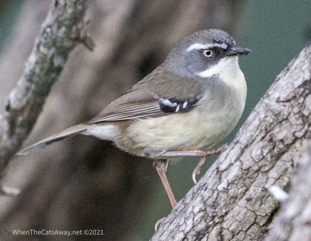
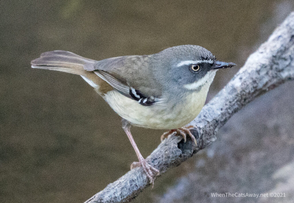
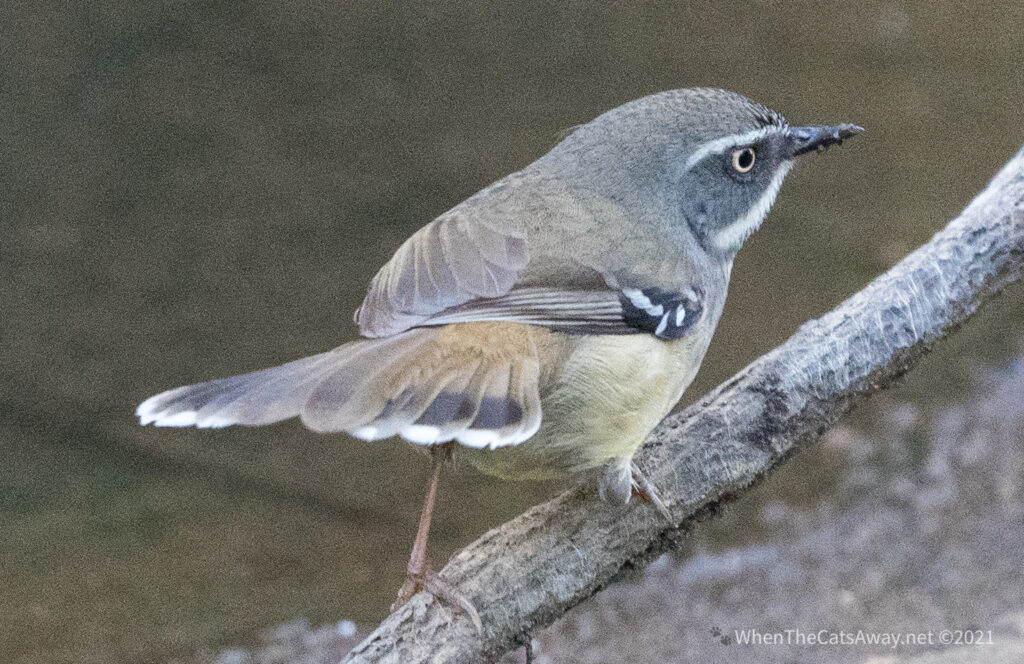
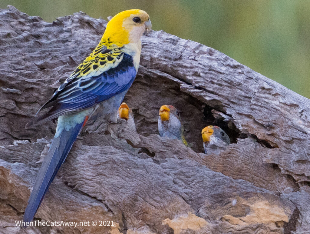
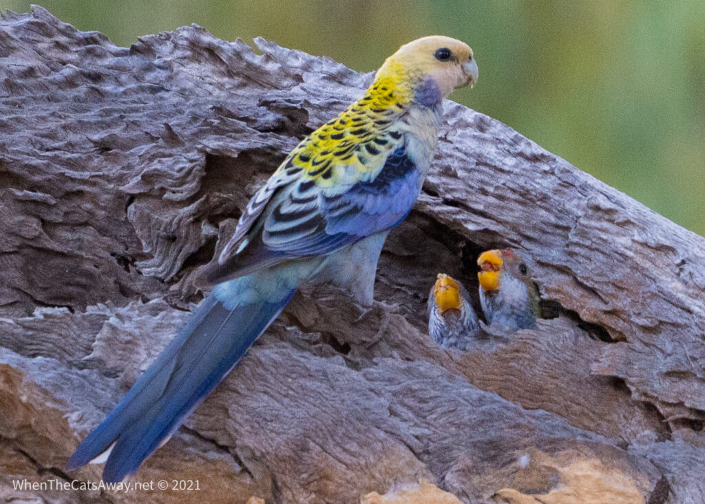
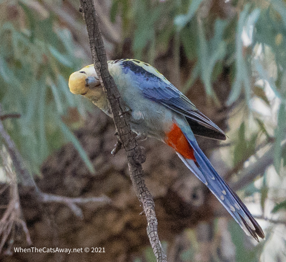
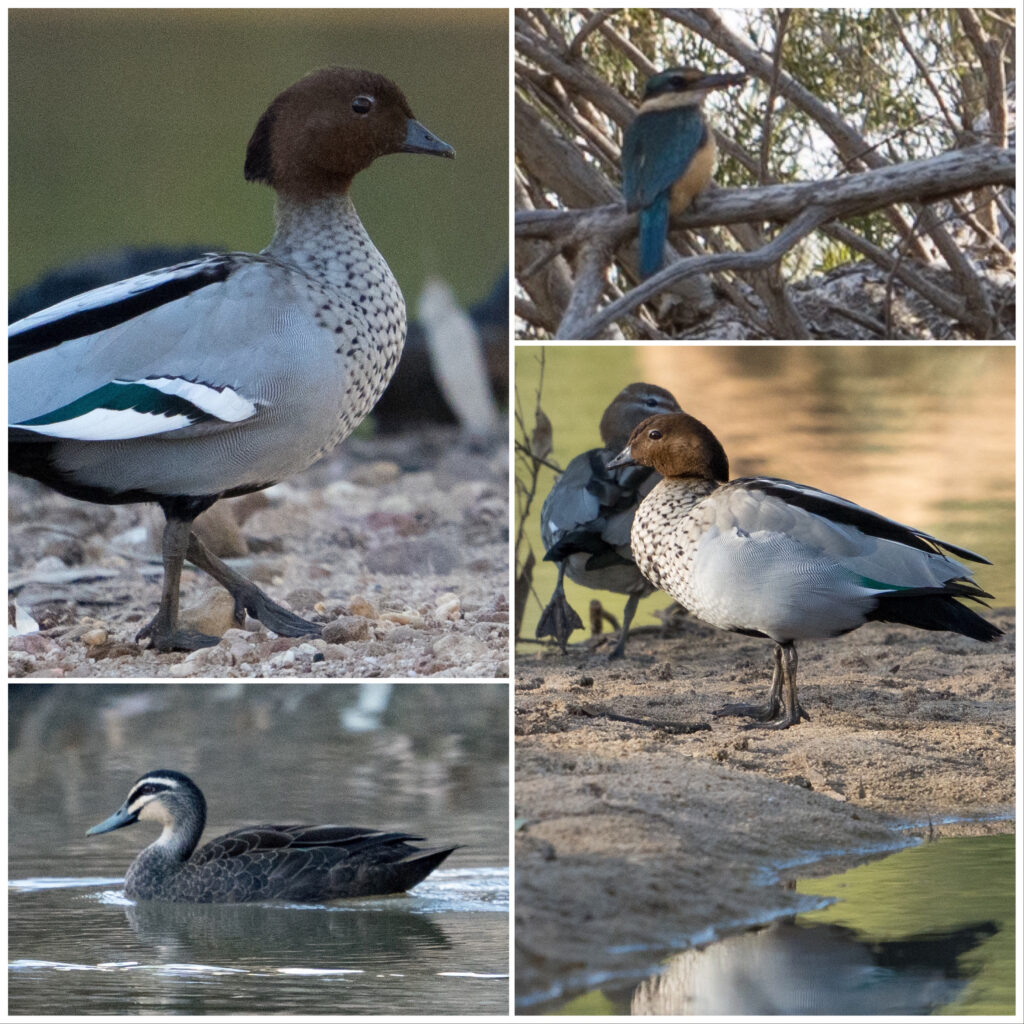
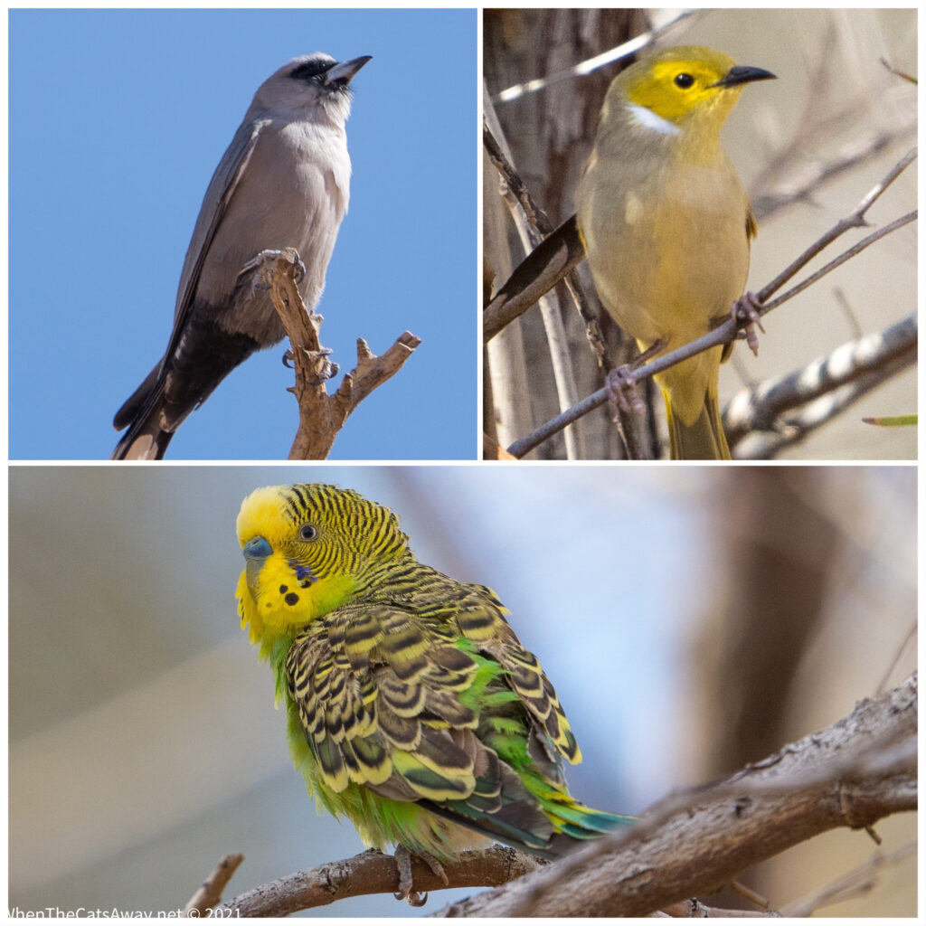
Strolling down the quiet tracksA happy female Red-tailed black Cockatoo‘Elvis is in the house!’ – Mr & Mrs Red-tailed Black-cockatooA Squatter Pigeon looks shocked to see usA Rufous Whistler flits along through the bushes searching for insectsWe have a surprise visitor to a small dam – a Yellow Spoonbill A Leaden Flycatcher keeps its eyes peeled for flying snacks
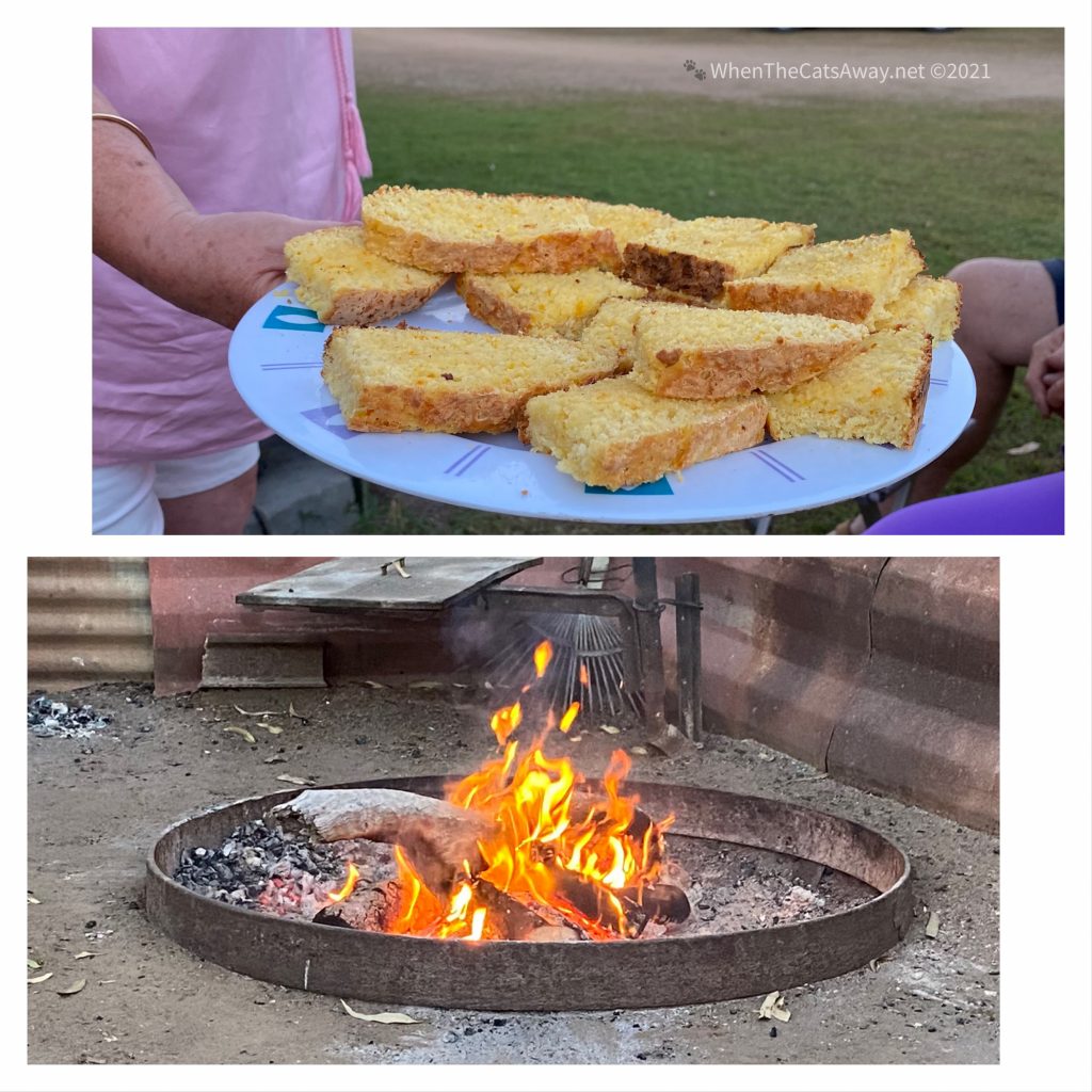
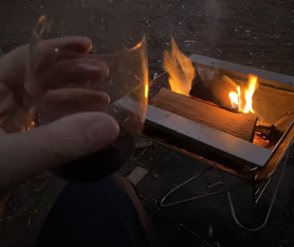
The farm-stay was pretty rustic, but a friendly affair with 5 o’clock BYO drinks each evening around the campfire, with the camp host cooking a couple of loaves of damper to share amongst the guests.
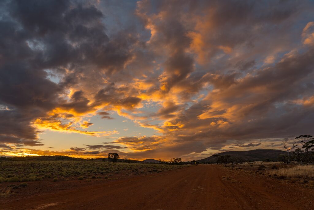
The farm is about half an hour’s drive from the town of Bowen, so we drove in the following morning, hoping to find somewhere nice for lunch.
Bowen is the oldest town in Queensland, settled in 1861 and the filming location for the movie ’Australia’ (2008). It built up around a port which was essential for the newly established farming community shipping its produce across Australia particularly mangos and sugar. There is quite a large immigrant Pacific islander nations population (such as workers from Tonga, Vanuatu and Fiji) who were recruited in the early 1900s as cheap labour to help with the sugar harvest. Many settled in the area, often marrying into the Aboriginal communities, both groups treated as outsiders for their dark skin.
Prior to this settlement, First Nations people from the Birri, Jangga, Juru, Gia, and Ngaro communities called this area home. We recognise and thank these people for their custodianship of this coastline for many thousands of years. They farmed the area around the port for a parsnip-like root which was a large part of their diet, as well as fishing from canoes. As we have seen in many other areas, the injustices bestowed upon the resident Aboriginal communities were numerous, with people forcefully removed and placed on reserves or in missions because their presence did not fit with the new plans for the region.
Bowen has moved on somewhat from these horrors and next week will see the inaugural Whitsundays Multicultural Festival held in town (July 30th). This will celebrate and recognise all cultures that make up the town through traditional dance, cooking and art activities. It’s great to see a community taking positive steps to recognise their extensive human history and the contribution all cultures have made to the society.
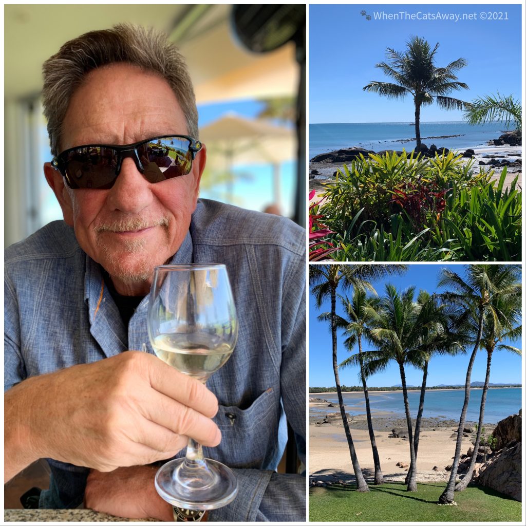
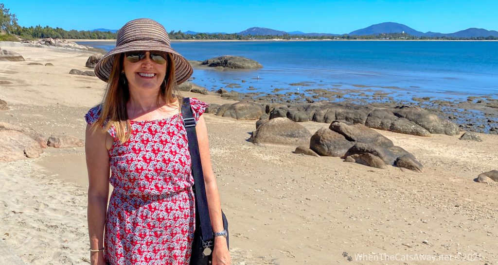
We stayed in Bowen three years ago, enjoying some great walks and incredible views. This time we found ourselves lunching at The Cove, a great Asian fusion restaurant on the ground floor of a smart apartment building, with glass walls opening up to landscaped gardens and fabulous scenery. We treated ourselves to some delicious food, accompanied by a Clare Valley riesling – very civilised indeed!
Lunch with a viewA very attractive coastline
We returned to camp for a lazy afternoon, again joining our fellow campers around the fire for damper, drinks and conversation.
Fire and damper
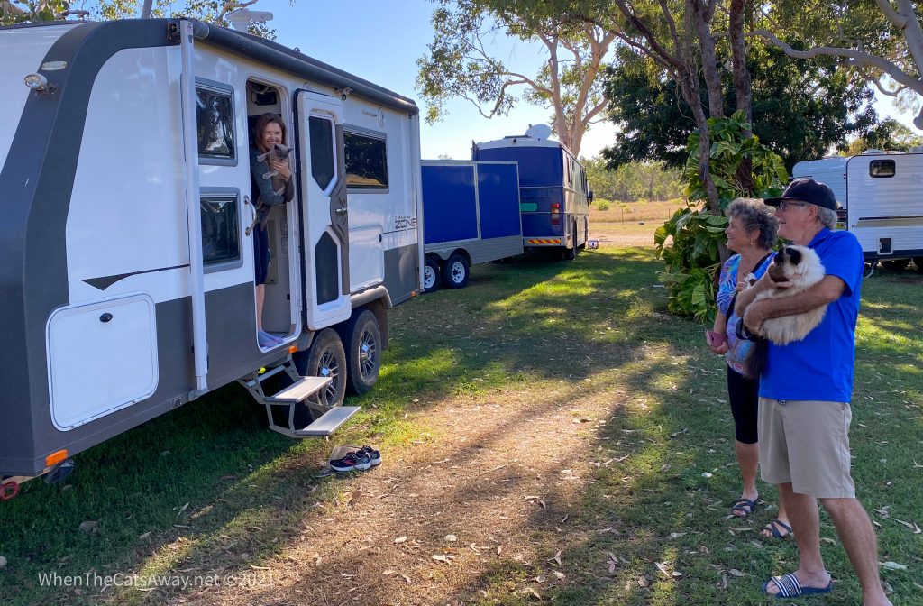
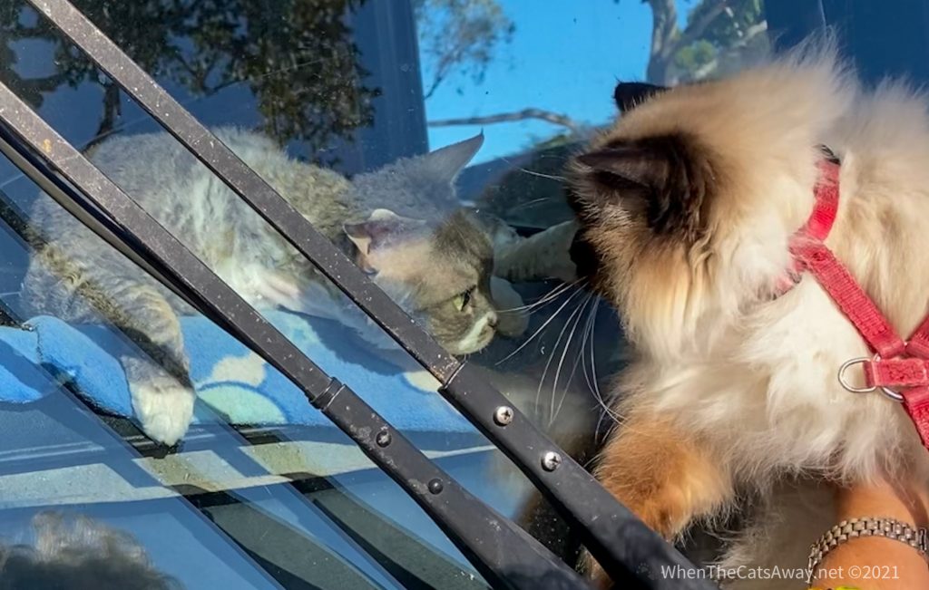
The camp owner has two dogs which wander around freely (Tassie wasn’t so keen!) and one nudged up against the chair of a lady by the fire. “You can probably smell the cat!” she exclaimed. Mark responded; “Oh have you seen us with Tassie then?”…which surprised us as she hasn’t really emerged here, due to the dogs. The answer was no, they also were travelling with a cat. If this coincidence was not enough, the funniest thing happened then, the lady behind us called out “We are travelling with two cats!”, and the gentleman beside her, “And we have a cat, Pippa, too!”
As you can imagine the conversation descended in to the sharing of travelling cat stories, with many laughs at the joy our furry travel companions give us. What a strange coincidence – we all ended up sitting together, and five cats between us.
Before we left the following morning, we had a bit of a cat meetup. Tassie came face to face with Pippa which was not such a good meeting (Pippa is twice the size of Tassie, and gave her a fair warning for coming within a metre or so of her territory), but the humans enjoyed it.
Furry travellers meet at a safe distanceThe two Devon Rex cats travelling in a huge coach have never met another cat before!
It was a short dalliance with the Bowen region, but will be one we will always remember. Time to continue our journey north, heading to the Townsville area next.
Location: Finch Hatton, Eungella National Park, Queensland
It was nearly 19 years ago when Mark and I first visited Eungella National Park. It was August 2002 and were on our honeymoon. After a week of sailing around the Whitsunday Islands with friends and family, we had a few free days to ourselves. hoping to spend some time kayaking around the islands. it was much too windy for kayaking, so we opted for plan B. After a couple of nights camping, we spent a few days in a cabin in Eungella National Park. I remember clearly us seeing our first platypus, and being enthralled by the rainforest birds that visited our cabin surrounded by trees and vines. And so the spell was cast – we had to return.
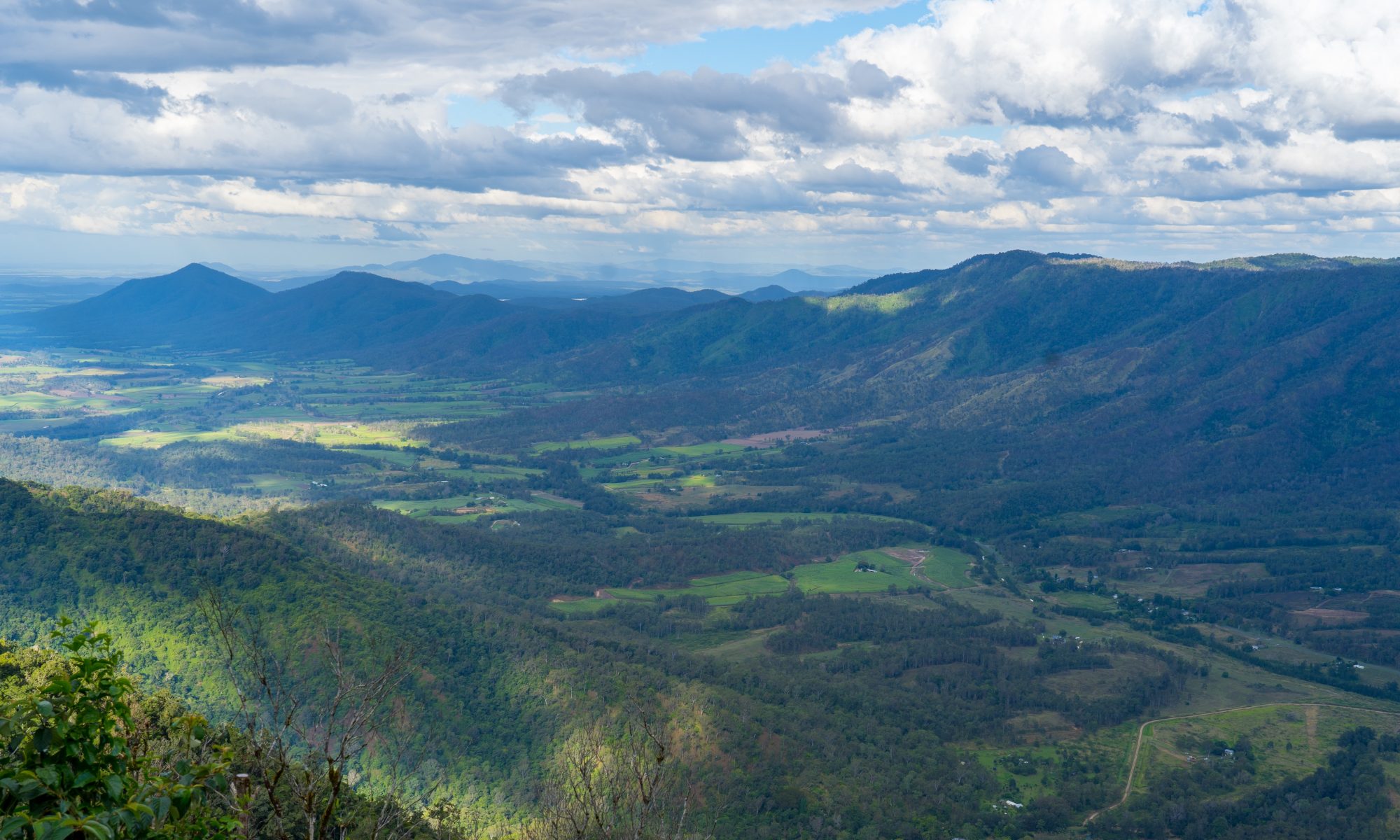
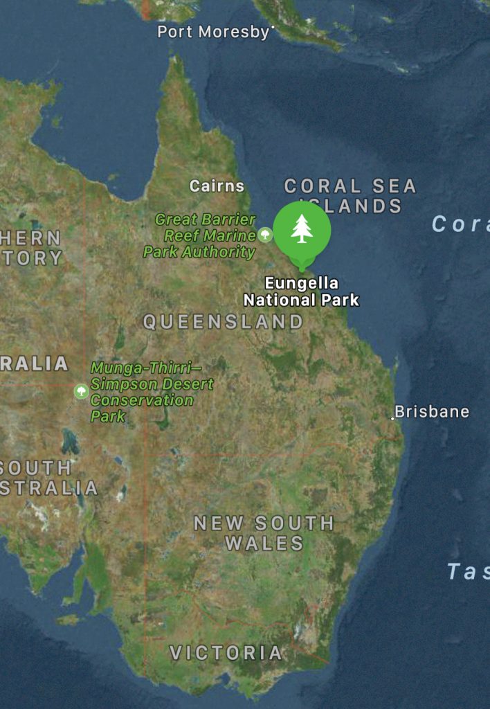
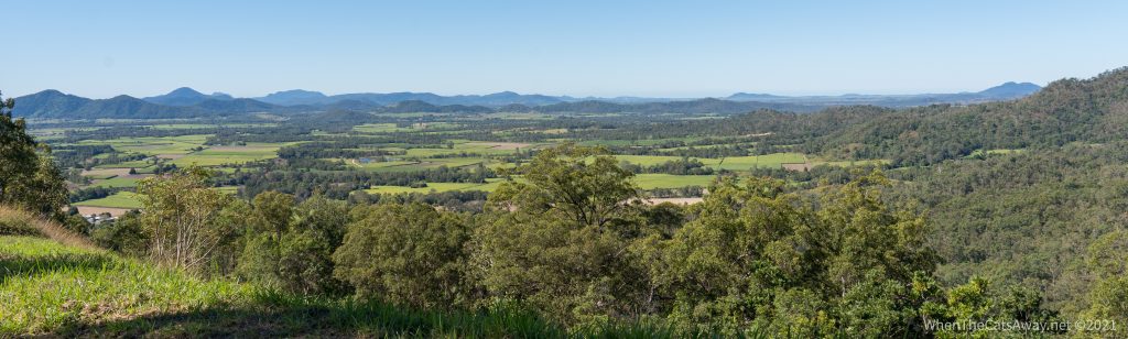
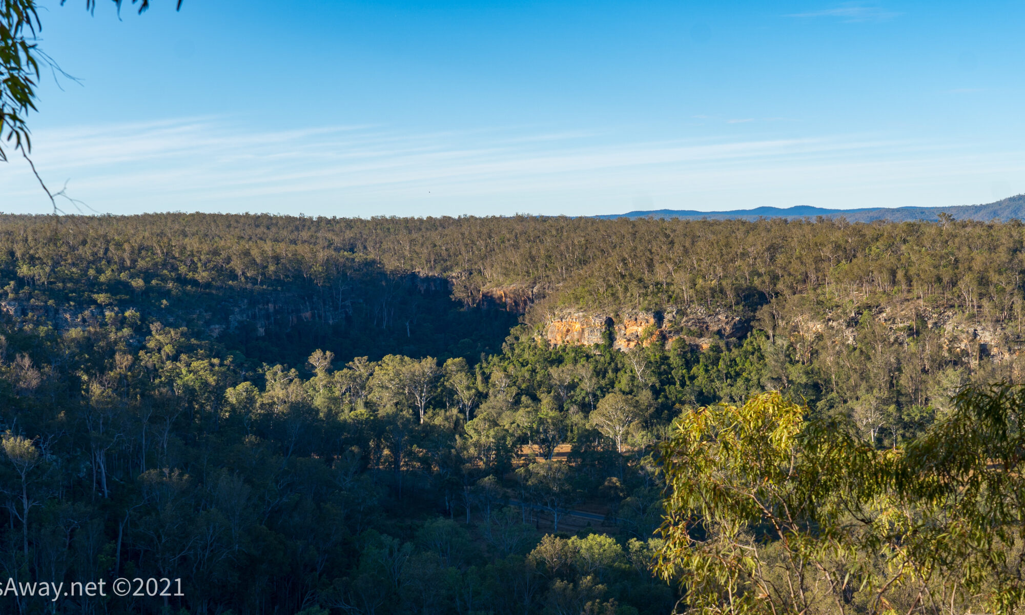
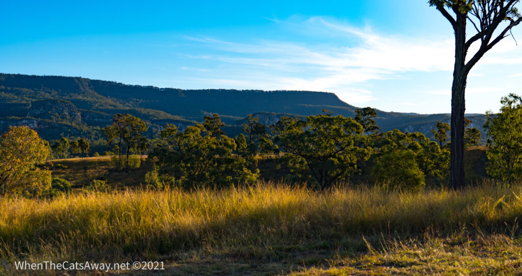
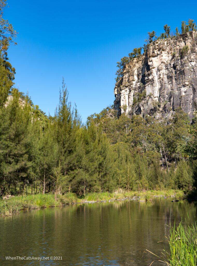
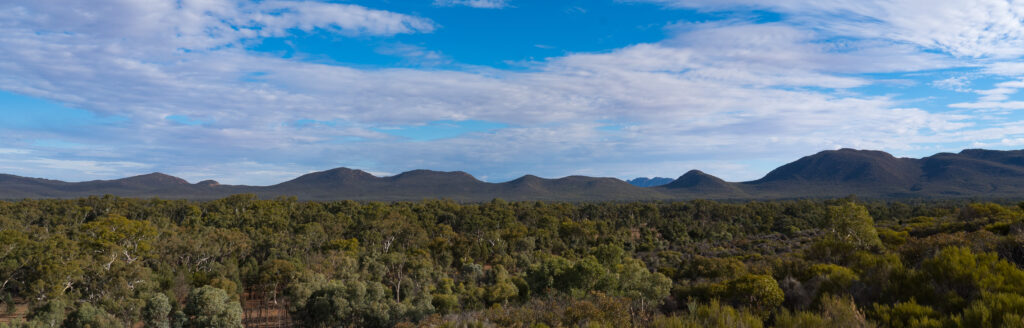
Eungella National Park is situated about 80km west of Mackay, half way between Cairns and Brisbane. Located on the eastern side of the Clarke Range, the landscape is lush and rich, receiving plenty of rainfall.
The location of Eungella National ParkOur campsite at Fitch Hatton Showgrounds is far from fancy but the views more than make up for it
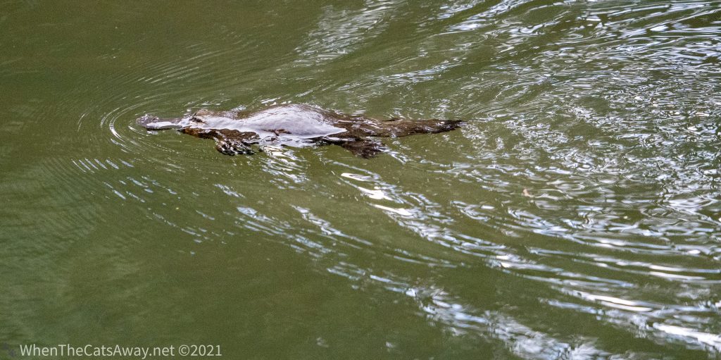
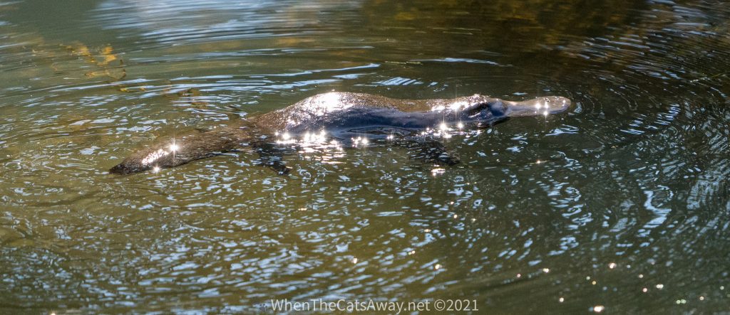
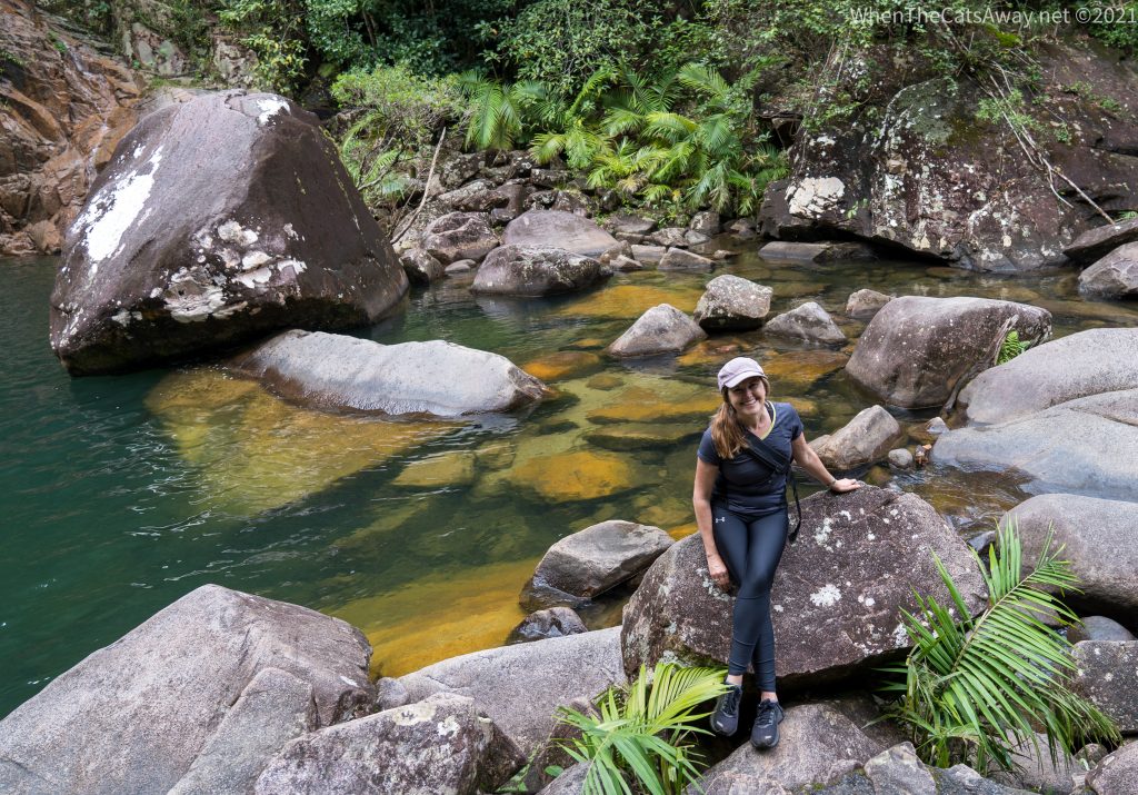
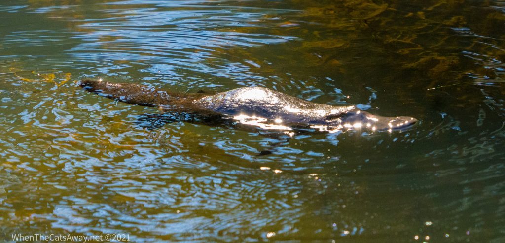
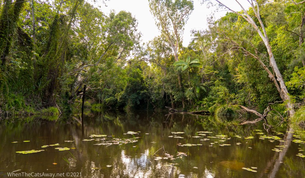
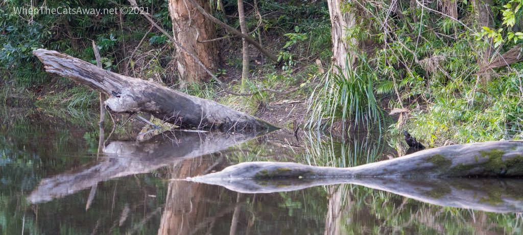
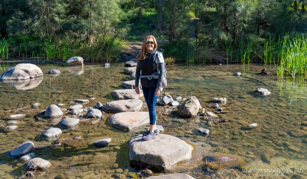
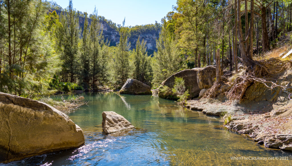
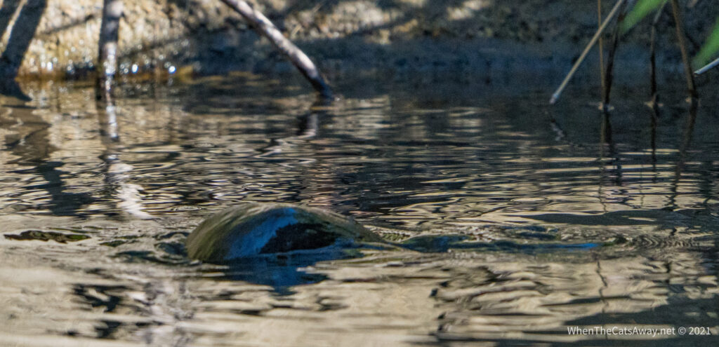
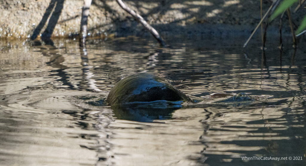
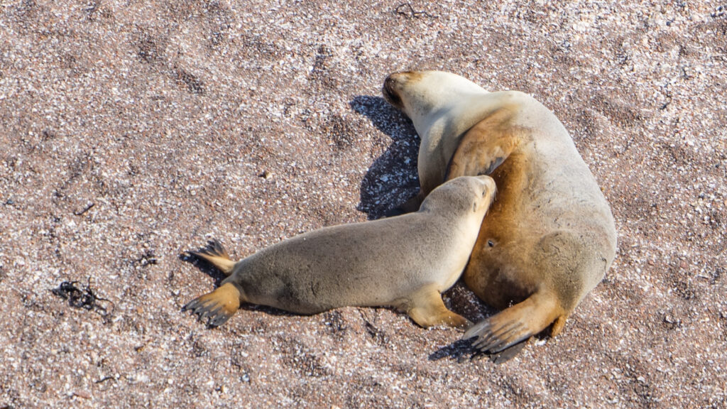
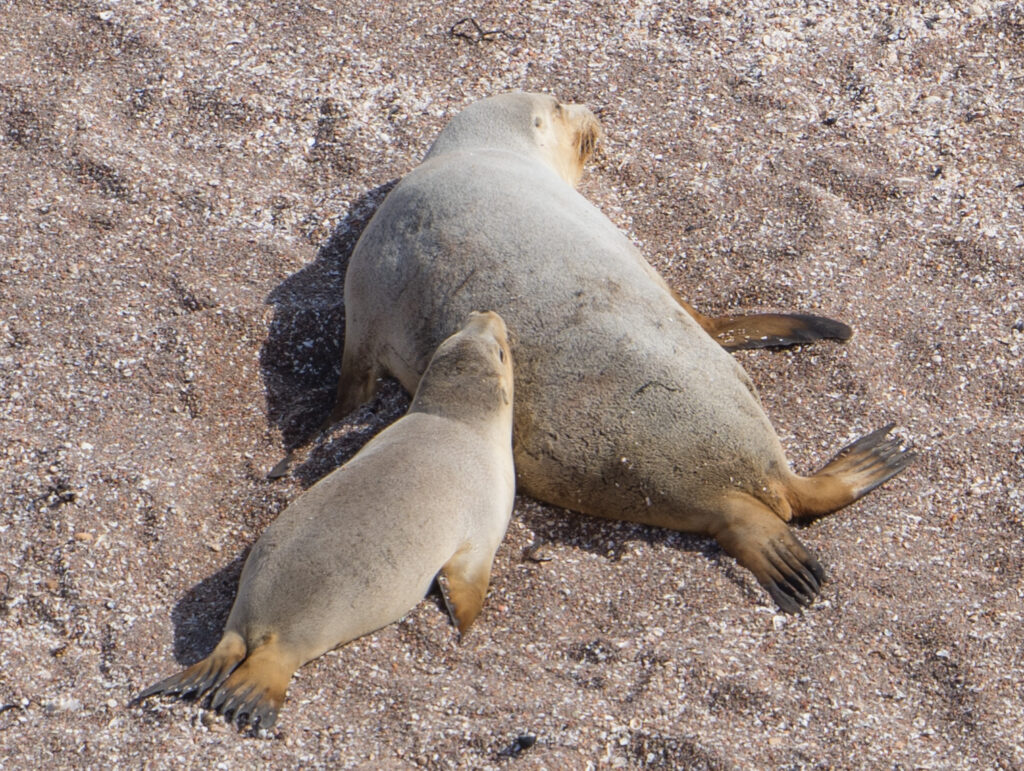
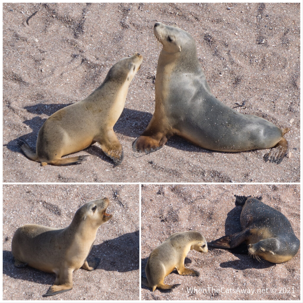
This is in fact our third trip back to this gorgeous location, every time as magical as the first. After setting up camp in the Pioneer Valley at Finch Hatton, we rushed up to Broken River to try and find platypus. As these bizarre looking creatures live for an average of 20 years, it could be possible we have seen the same ones on each of our visits.
We followed a walking trail along Broken River, looking out for telltale ripples and bubbles. It didn’t take long before we spotted one.
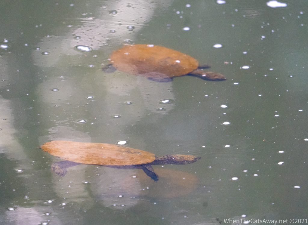
To our delight we find a platypus out foraging for foodIt is hard to know which end is which – you can see the eyes on the right hand side, before the ‘beak’Saw-shelled Turtles also are frequently seen sharing the pools with Platypus
Platypus are an endangered species, already extinct from South Australia (though they have now been introduced to Kangaroo Island), and with reducing numbers elsewhere. This is one of the best places to see them in the wild and we relished the opportunity.
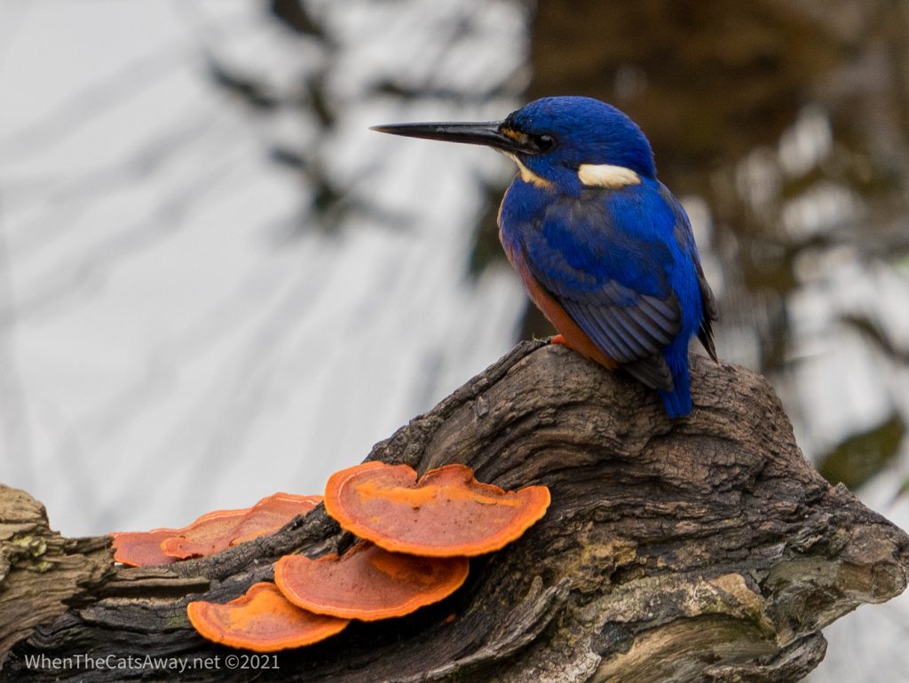
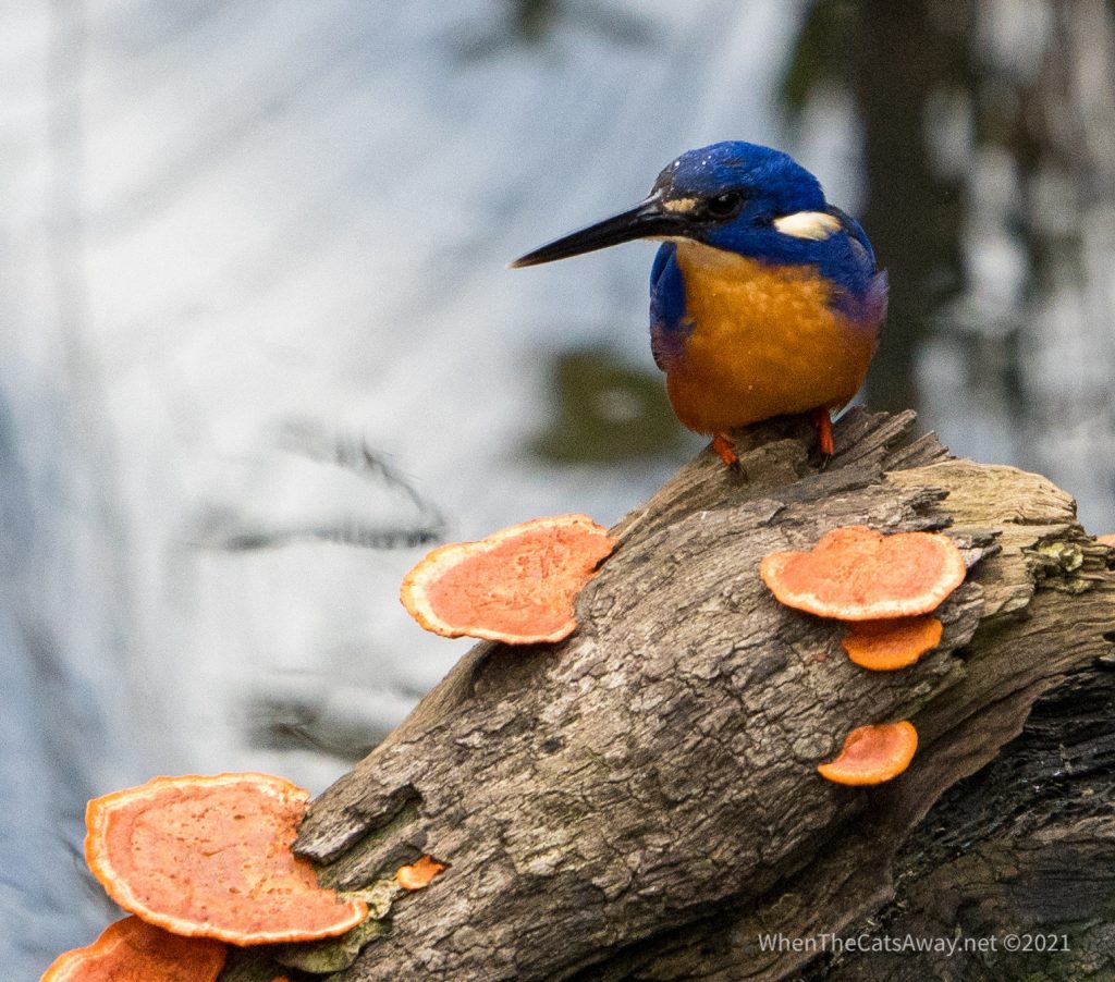
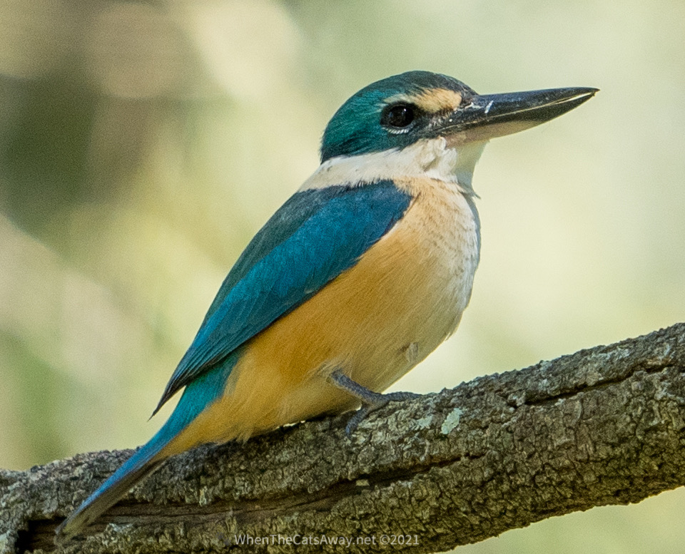
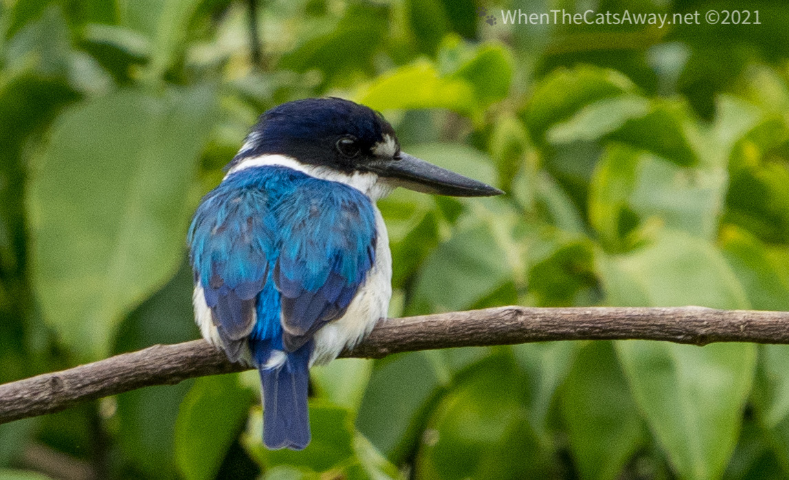
We spotted an Azure Kingfisher which seemed to have a symbiotic relationship with the platypus, following it around the pool and diving in when the platypus disturbed small fish. It certainly gave us a good show, nevertheless!
Spectacular colours of the Azure KingfisherThe Kingfisher kindly lands on a partially submerged branch covered in orange fungi, to bring out the beautiful orange colour of its chest
Due to the diversity of the environment, the bird life is of course prolific, though it is a challenge to see, as most are hiding away in the dense thicket of the rainforest. We managed to spot quite a few despite this, and even caught some with the camera. Walks were constantly accompanied by the rustles and calls of Whip-birds in the leaves and the booming cries of the Wompoo Fruit Doves high up in the canopy.
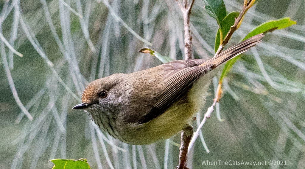
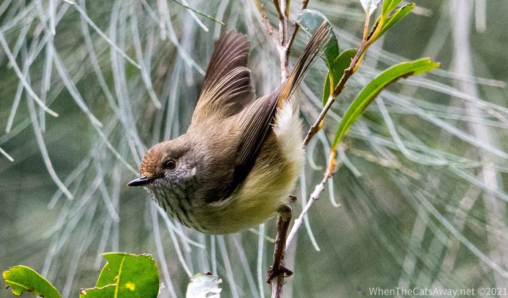
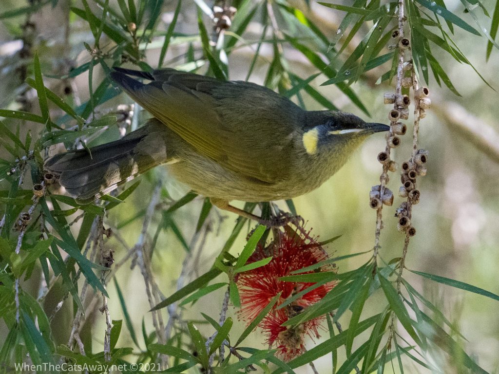
An unimaginatively named Brown Thornbill entertains us in the riverside undergrowthAnd our Brown Thornbill gets ready to take off again – they only stop still for a second or twoGolden Whistler – pretty shy but with an incredible voiceA Yellow-spotted Honeyeater drinks nectar from the bottlebrush flowers
We did a few walks through the rainforest, and despite the numbers of visitors were still able to see a large number of birds just going about their daily business. It just took a few moments of standing quietly listening to the rustling and occasional movement to start seeing them there. Of course the density of the undergrowth made it virtually impossible to photograph them so only a fraction of what we saw is shared here.
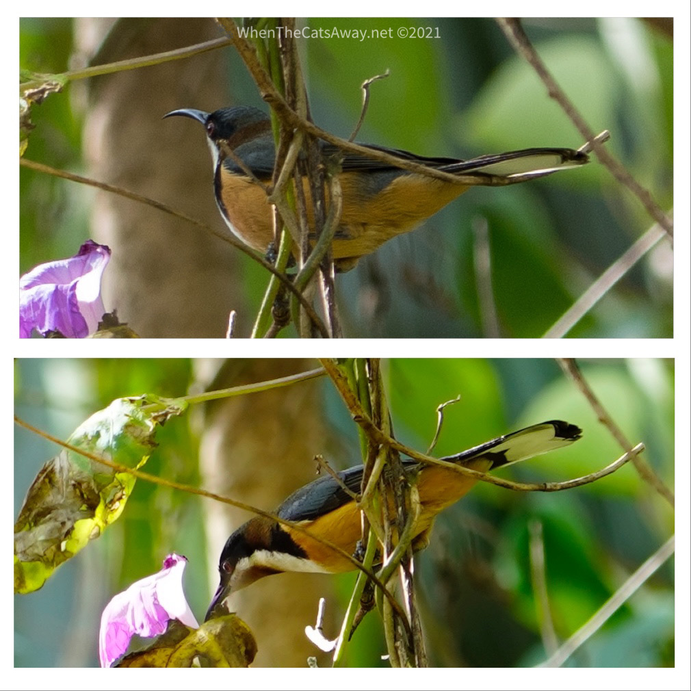
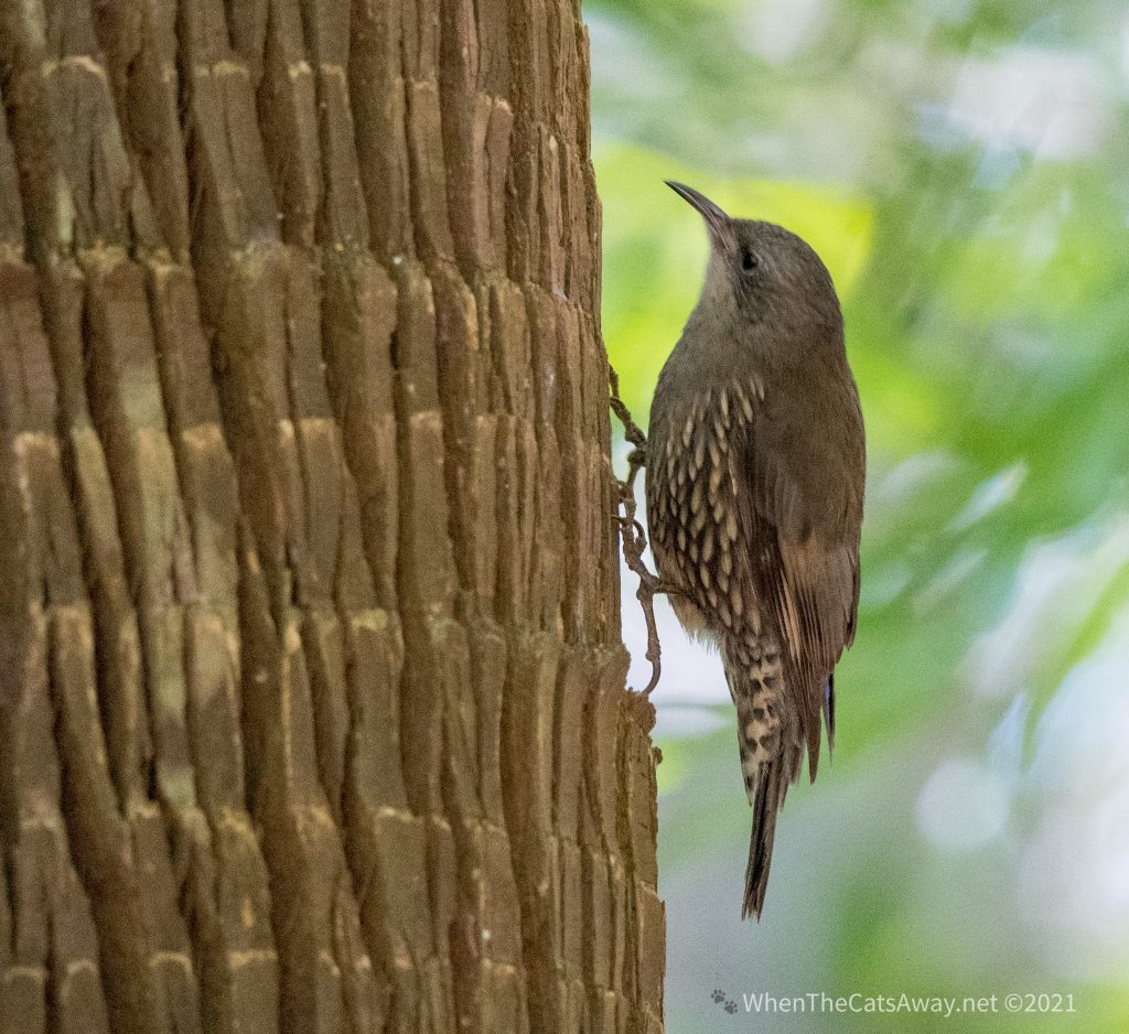
An Eastern Spinebill drinks the nectar from a Morning Glory flower – a pest weed in some of these partsA White-throated Treecreeper appeared on a tree just in front of us and climbed the trunk with its huge feet, hunting for insectsA Little Shrikethrush – another bird that loves hunting for insects, thinking nothing of ripping off bark in its questNo insect is safe from this Little Shrikethrush
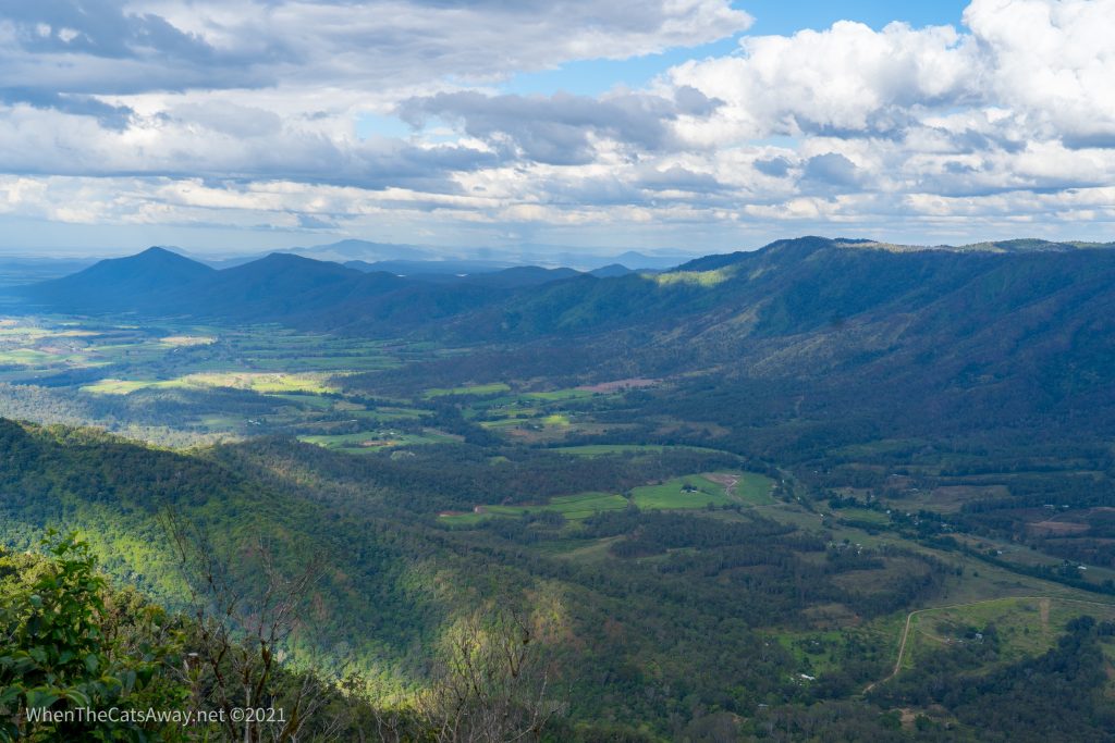
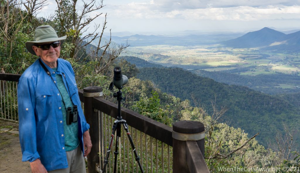
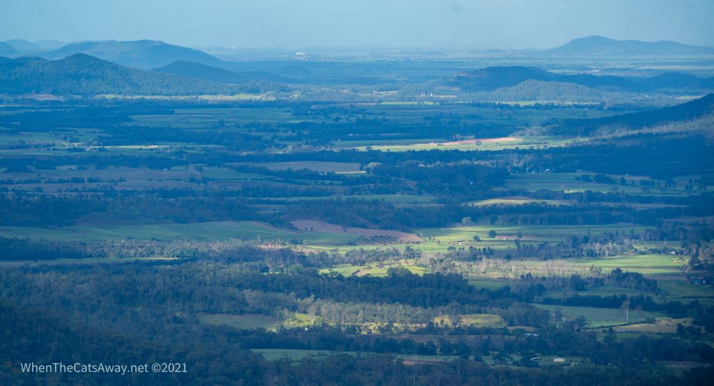
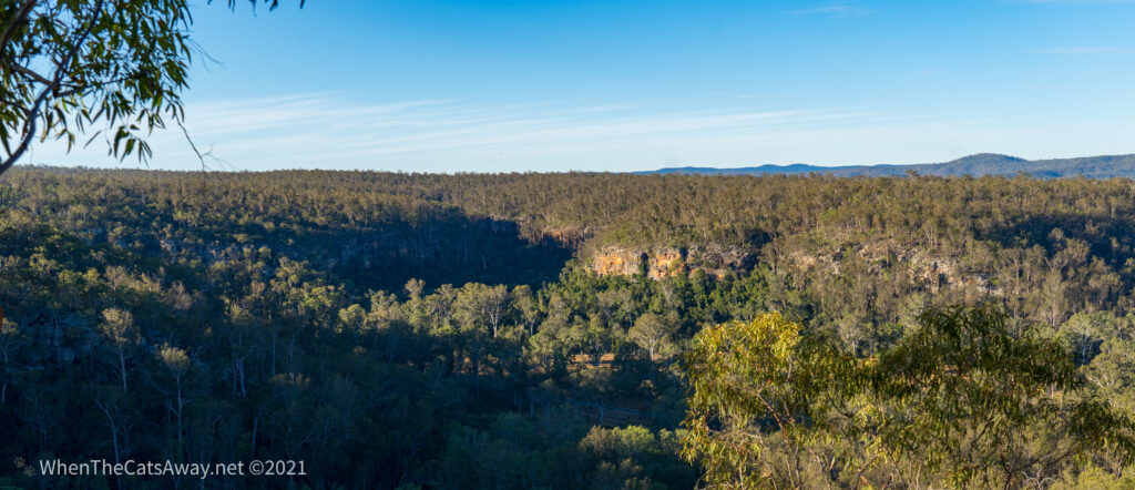
There are many lookouts up on the Eungella Plateau which makes up part of the Clarke Range. The views are simply breathtaking down into the valley where we are staying.
Looking down from Eungella into the valleyMr A finds another use for his spotting scope to look down the valleyOn a clear day you can apparently see all the way to Mackay and the coast from here, just over 90km away
Since European settlement of Australia, around a quarter of the rainforest has been cleared for farming, and this area was originally earmarked for that purpose. While some of the forest was cut down (now used for growing sugarcane and farming cattle), much of it was saved after a 12 year battle and designated national park in 1941.
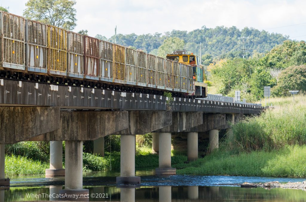
Our visit falls during sugarcane harvest season, with seasonal workers busy chopping the crop and loading up trains and trucks to take it for processing further down the valley. Much of the Mackay region is dedicated to sugar…I would have expected to see more dentists around than I have!
Sugarcane train crossing Cattle Creek
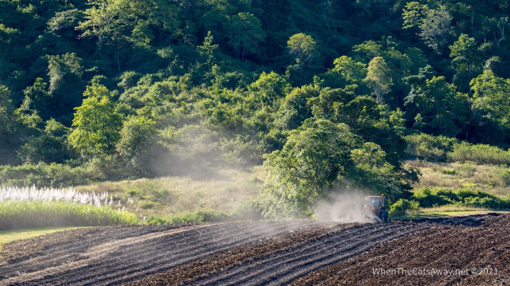
Where cane has already been harvested. the farmers were out busy ploughing the fields ready for planting the next crop. You can see the richness of the soil here, stark contrast to Australia’s land further west.
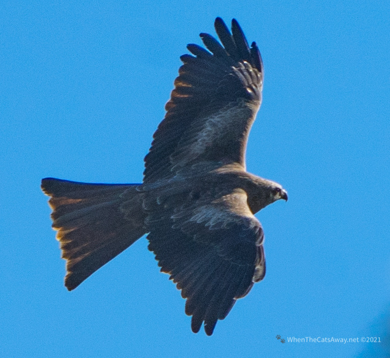
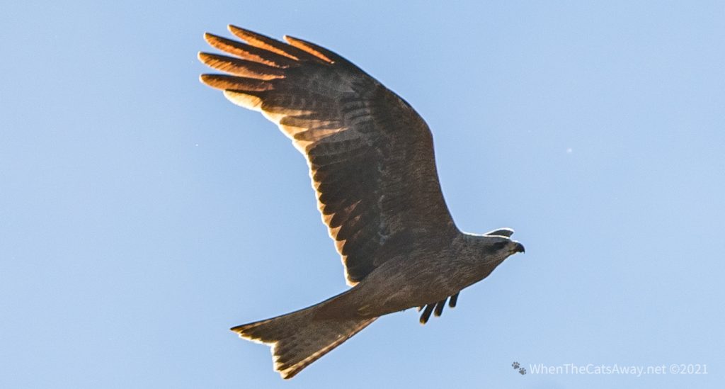
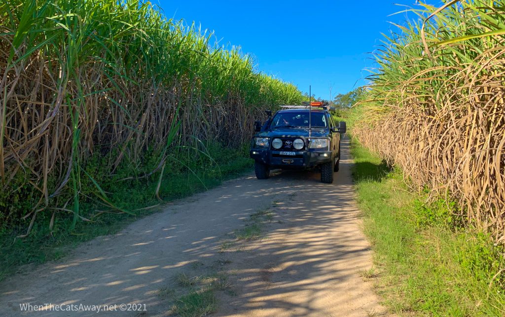
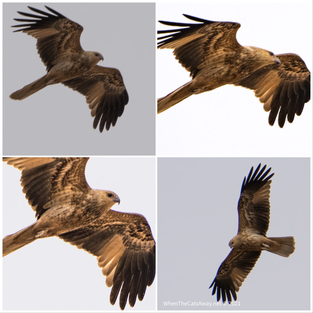
Getting ready for the next cropBlack Kites fill the skies behind the tractor, searching for mice and other goodies turned up by the tractorBlack KiteBlack KiteExploring the farm lanes – it is hard to believe this long grass becomes sugar!
The name Eungella is derived from the First Nations language meaning ‘land of the cloud’. We thank and acknowledge the Wiri-Yuwi People as the traditional custodians of this land. The waters of Broken River have been seen as sacred for the more than 10,000 years these people have called this area home.
Other than a cursory mention, there is little to learn about these nations. A little research reveals they were hunted down in great numbers by the white settlers in retribution for spearing cattle or trespassing on land. Others were enslaved to work on farms or moved to the coast to work on fishing boats. There was little policing in these parts in the mid 1800s, so people took the law into their own hands.
While information boards request visitors to respect the cultural significance of the park, they share no information about this. The Queensland Government National Park’s website talks only of the geological history, avoiding any mention of culture. It is sad to continue to see this when we as Australians should be taking time to recognise the significance of the long human history in this region, and perhaps learning from the way these first nations people lived in this evnivronment.
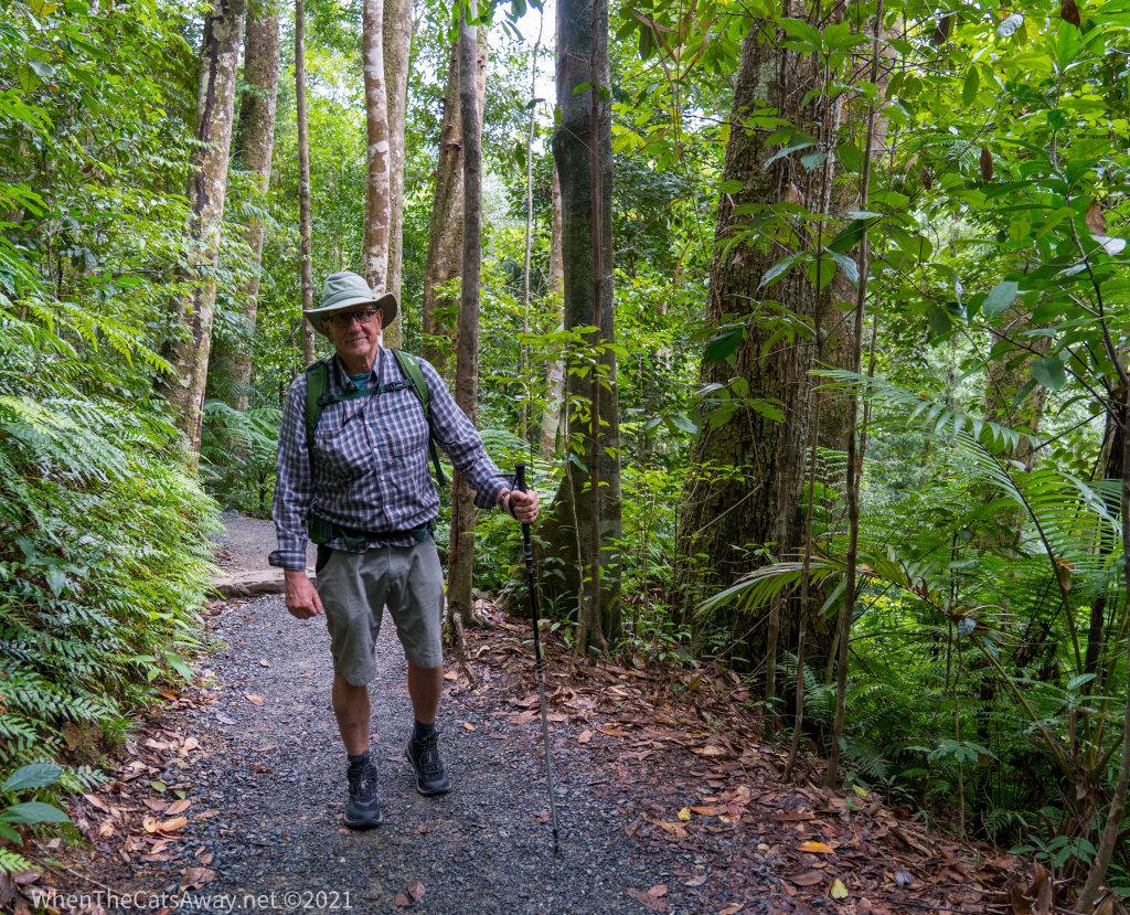
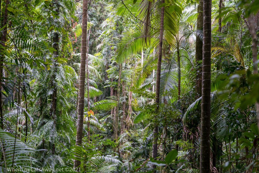
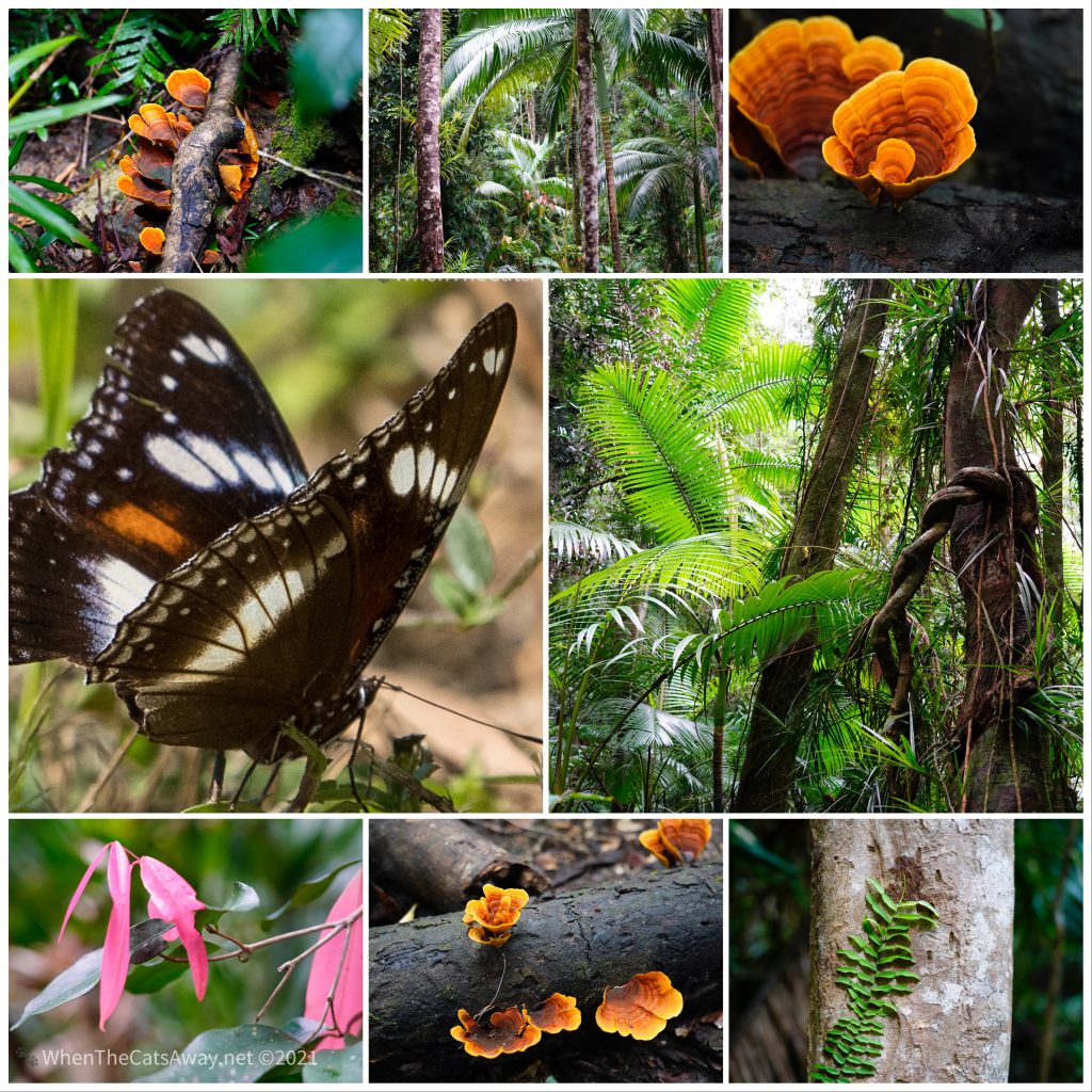
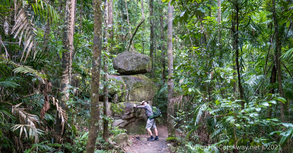
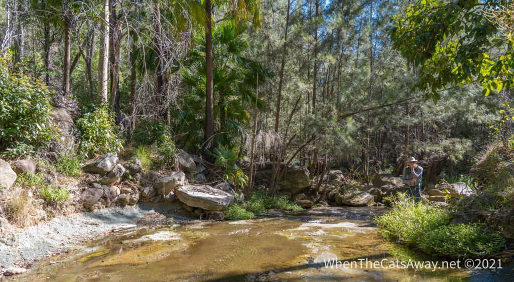
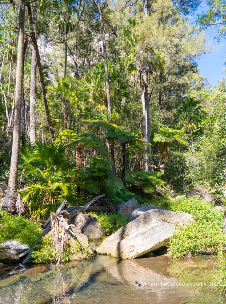
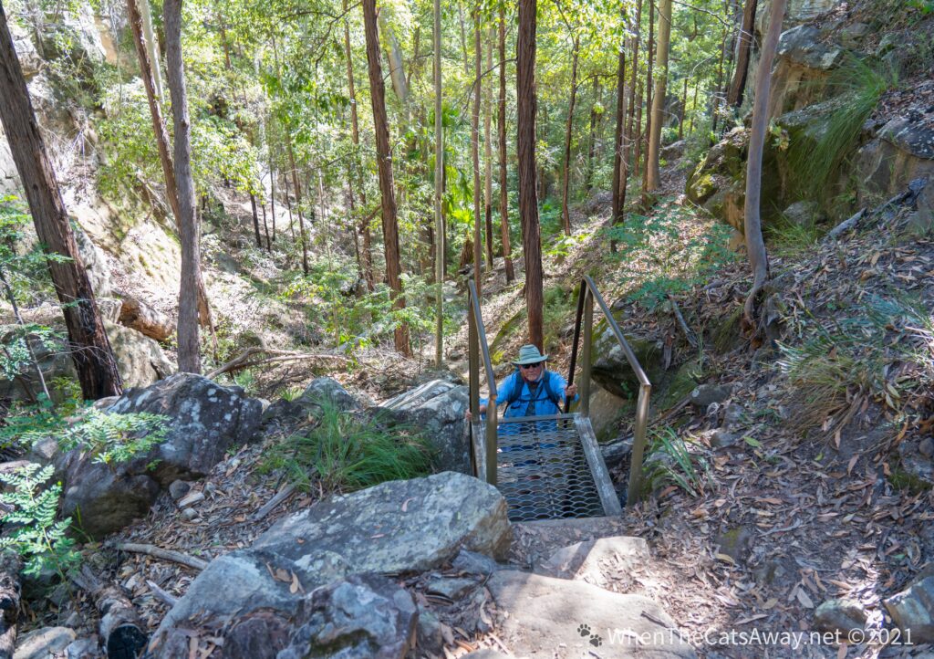
Finch Hatton Gorge is a part of the national park which is accessible from close to where we are staying, so we drove out there for a hike. The temperature in the rainforest is a few degrees cooler than out, reminding me of that feeling when you step in to a magnificent cathedral. Your breath catches as you experience the wonder of it all, the rich organic smell of decaying wood and leaves accompanied by signs of new life all around you.
Setting off on the walk – what a contrast to our time in outback QueenslandThe diversity of plants and trees never fails to entrance usA feast for the senses – a Varied Eggfly Butterfly amongst lovely leaves and fungi in the forest
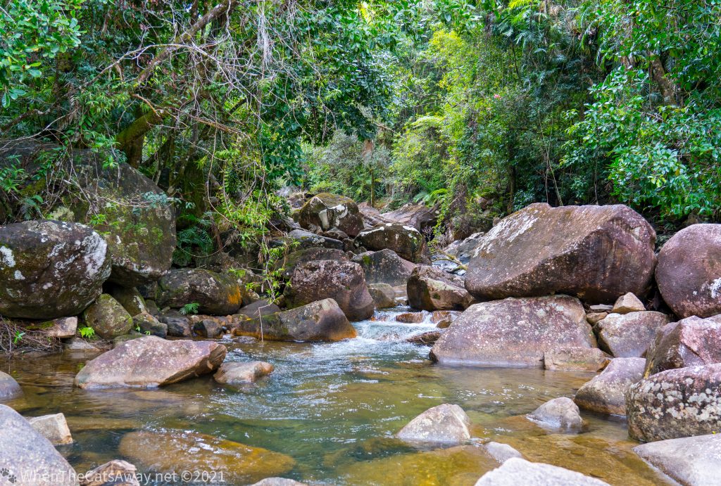
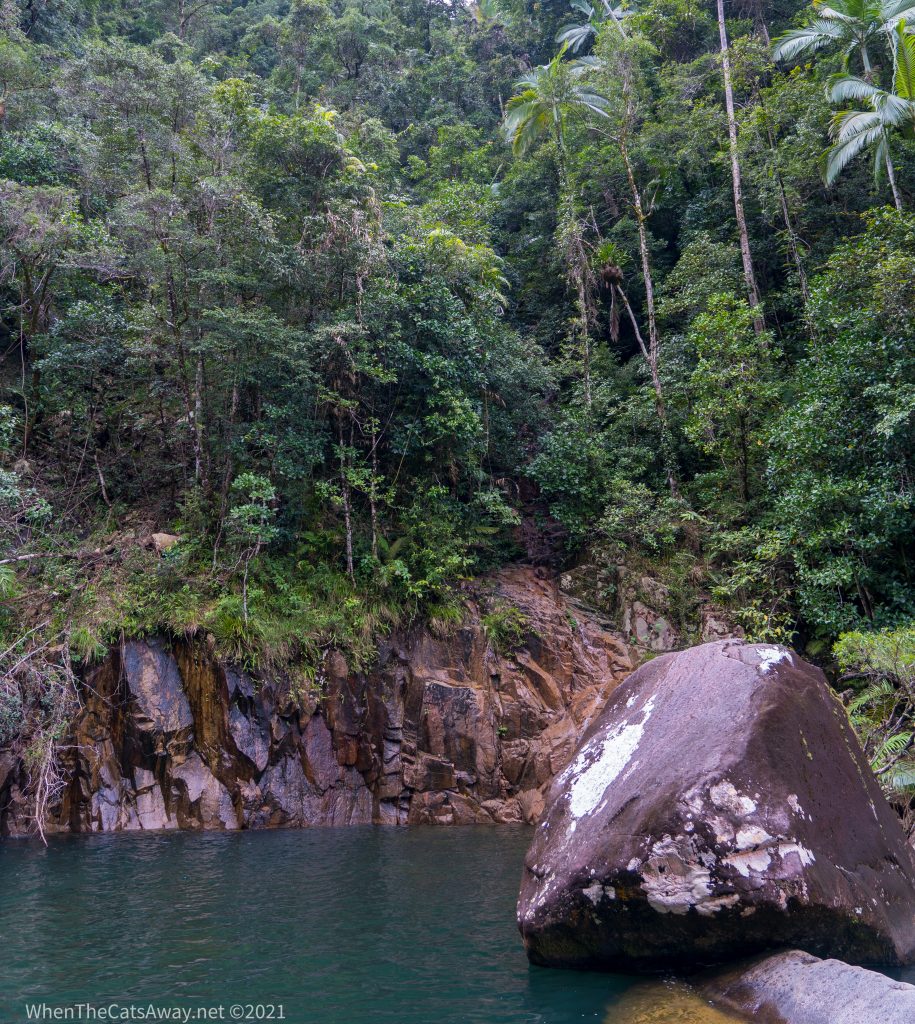
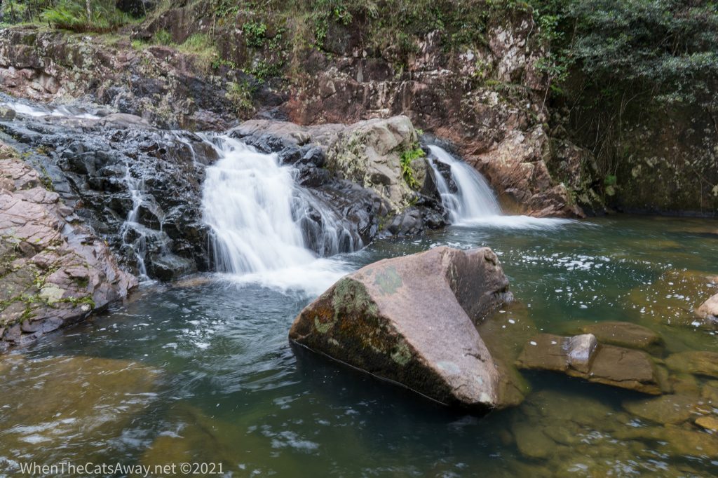
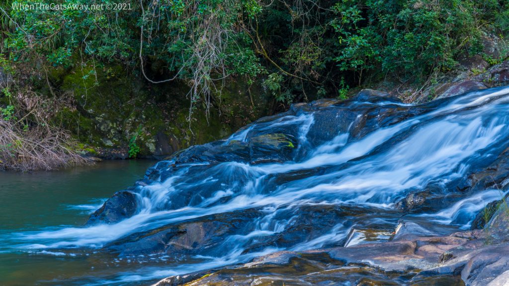
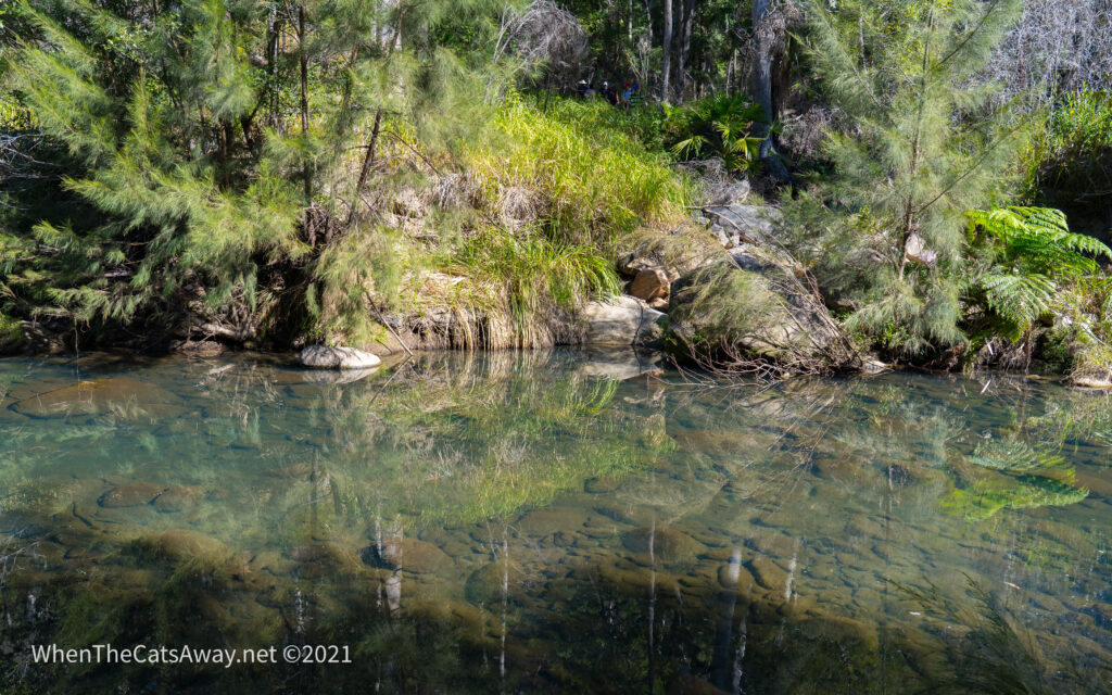
Our walk to up the Wheel of Fire cascades ( named for the red flowers that surround them in the summer months) entailed a precarious rock-hop over Arulen Creek before climbing many slippery stairs to the top. If you can cross the creek without getting wet feet – you are doing well. Mark hasn’t yet achieved this accolade!
Arulen Creek where we cross -requires balance and agilityIn between the cascades are deep waterholes – perfect for swimming in on a hot summer’s dayNearly to the topWe reach the topLast time we visited here we went in for a swim – not this timeA natural sculpture in the forest
Definitely worth the hike up if you’re game!
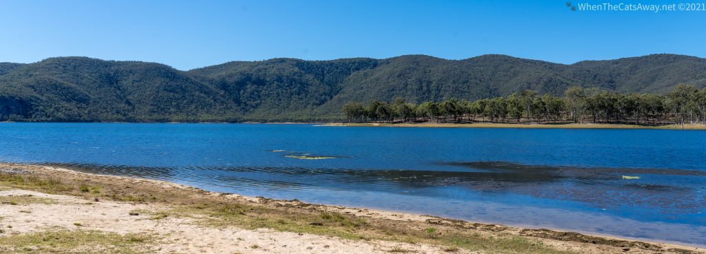
Up on the Eungella Plateau sits Eungella Dam, a large reservoir and freshwater fishery. You can actually camp out here, as long as you don’t need power. It sits nestled in a picturesque valley and is a great spot for birdwatching.
Eungella DamBrahman Cattle share the shores with campers and picnickers
We had lunch on the sandy beach before taking a wander to see what bird life was around.
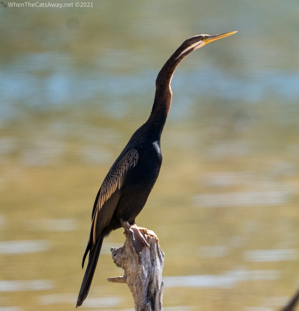
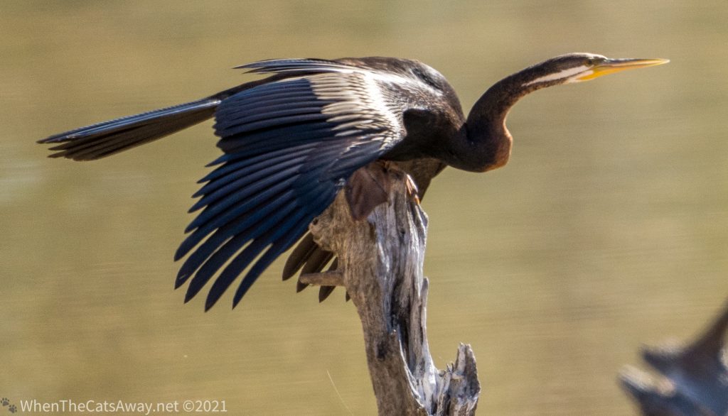
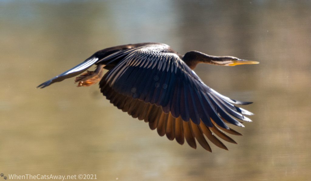
An Australian Darter sits on the shore drying off after its latest fishing expeditionIt decides it is time to head back out for more food….preparing to take offAnd away it goes – just look at those gorgeous wings. From afar, these beauties just look black.
Great Egrets, Cattle Egrets, Pelicans, White-eyed Ducks andsome very pretty Cotton Pigmy Geese were amongst the birdlife spotted.
Straw-necked Ibis – just look at those colours!Little Pied Cormorants, Wood Ducks and Pelicans
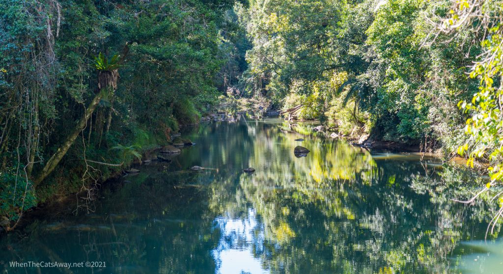
Staying at Finch Hatton for a week has meant we could also visit some locations off the traditional tourist trail, finding our way to creeks and locations that are a little quieter. Cattle Creek winds its way through the valley past our campground and had a wealth of surprises for us each time we went out.
Mr A lining up to spy on a Great Egret across the creekGreat EgretBeautifully disguised among the pebbles on the creek’s edge, Black-fronted Dotterels dash along hunting for foodTiny and well disguised Black-fronted Dotterel A Sacred Kingfisher perched up in a tree with a good view of the waters belowAnother viewpoint across the Pioneer Valley from Teemburra Dam, not far from Finch Hatton
We finished up our visit with a somewhat longer walk along Crediton Creek. This hike actually continues on, forming the Mackay Highlands Great Walk – heading one way for 56km (taking 3-5 days). The short 10km return walk we did was pretty stunning.
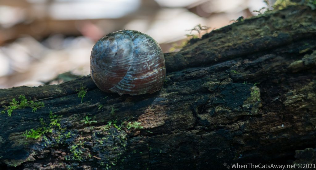
Beautiful waters of Crediton CreekEpiphytes (parasitic plants) growing on treesA Giant Panda Snail shell – these are the size of golf balls – the largest snail in Australia and a favourite of many birds in the rainforestA fabulous array of greens along our pathwayWindows through the trees frame vistas of the creek
Not far from the end of our walk we took ten minutes to sit down by Crystal Cascades (how many falls have this name, I wonder! A lot!) and just enjoy the ambience. Listening to the constant sound of the water running over the rocks as they have done for hundreds of years, to breathe in the clear, clean oxygen from the forest.
Taking a moment on the warm rocksThe water cascading down the rocks, smoothed from centuries of water action
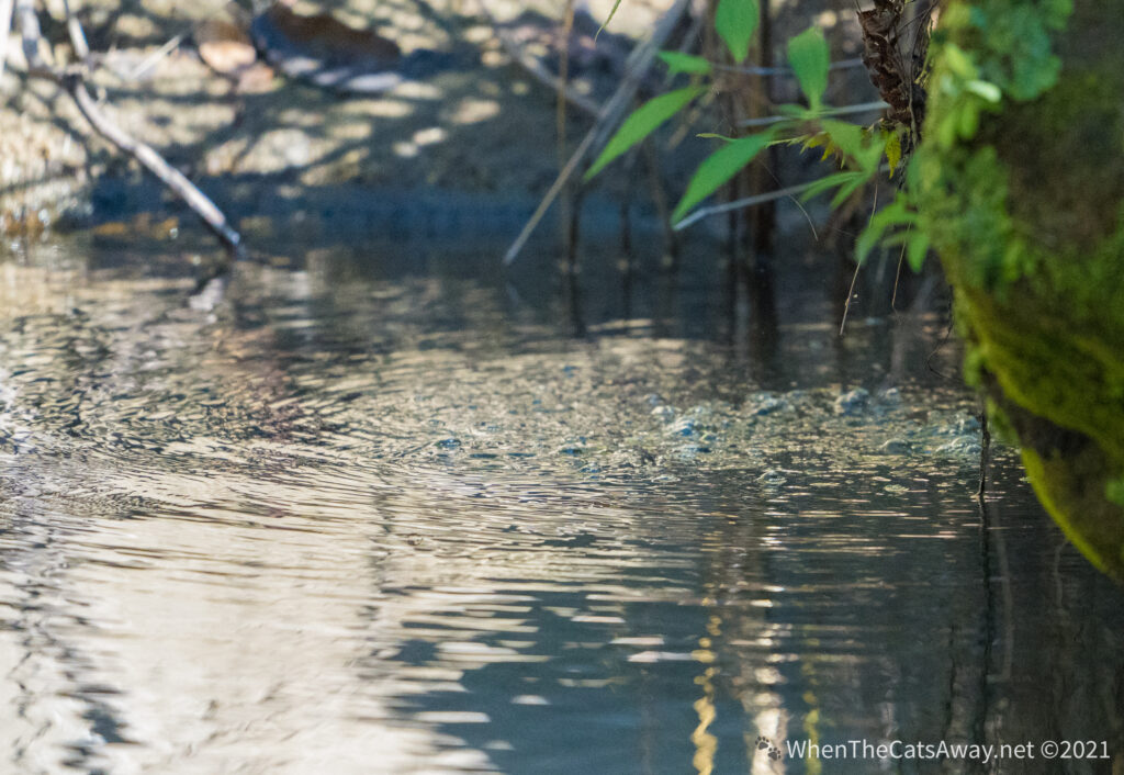
Just before heading back to the car we diverted briefly to see whether we could catch our last glance of a platypus. Lucky us, we were rewarded with two.
Only one photographed – but still a special moment
Our week here has been so incredibly precious. We have relished every morning waking up to our incredible views, breathing in the clean air and drinking in the colours, scents and sounds of this unique location. As we move on back to the coast, we will continue to hold Eungella in a special place in our hearts. 🤍
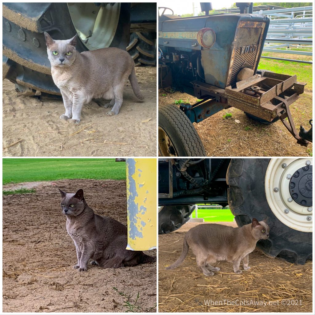
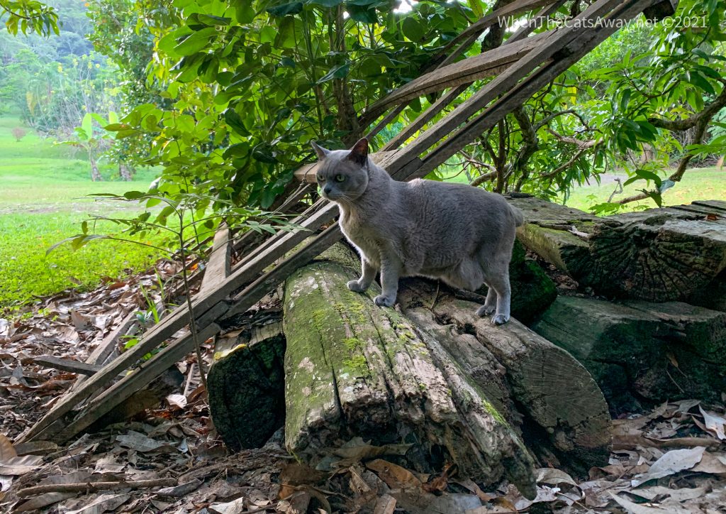
PS Tassie loved it here – walked and walked exploring the sheds and fenced paddocks where cattle would have been kept during the last show day. Her favourite area was the shed with the tractors in.! One happy Burmese!
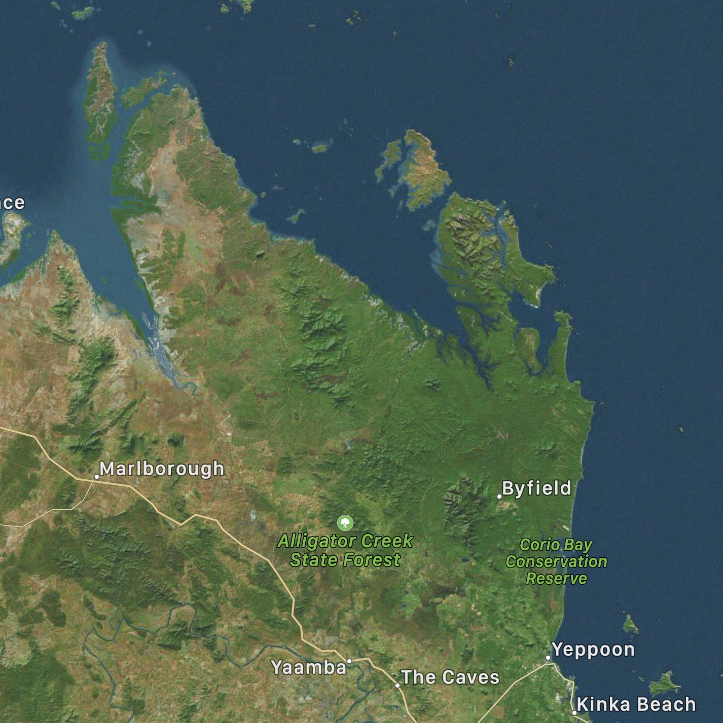
Location: Kinka Beach and Byfield National Park, Queensland, Australia
We said goodbye to Tannum Sands and Mark, Tassie, I and our uninvited mice drove up to Rockhampton then headed back inland to the coast again, heading to a little settlement called Kinka Beach It was a cool day with a strong southerly wind blowing, nicer behind glass than out exploring. But having not been out much the past few days we were keen to stretch the legs and set off, aiming for the Kinka Wetlands, a location rich in birdlife we had read about online.
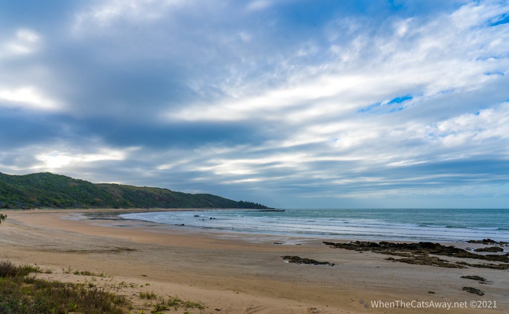
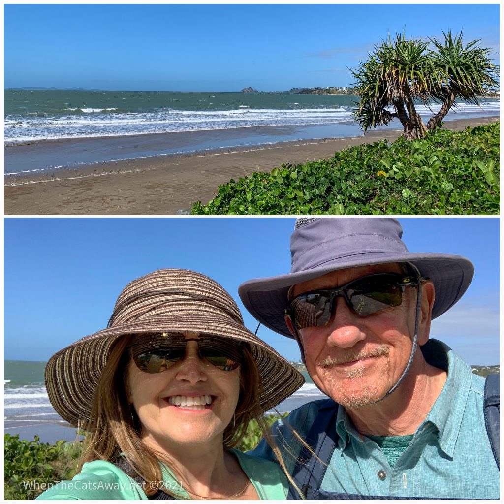
Sadly the wetlands were not to be as we trundled down a very rough narrow road, which looked more like a stream after all the rain we had this past weekend. We gave up and decided to check out the beach instead, finding a stunningly wild setting with the forest stretching down to the sand.
Kinka Beach It feels a little like Scotland!Can you spot the lone walker with his dog, braving the sand and salt blasting?
The chilly wind was unfettered down on the shoreline, icy cold fingers creeping down necks and up sleeves, sending shivers down our spine. We figured most of the feathered creatures this coast is well known for would be hiding in sheltered bays or behind rocks.
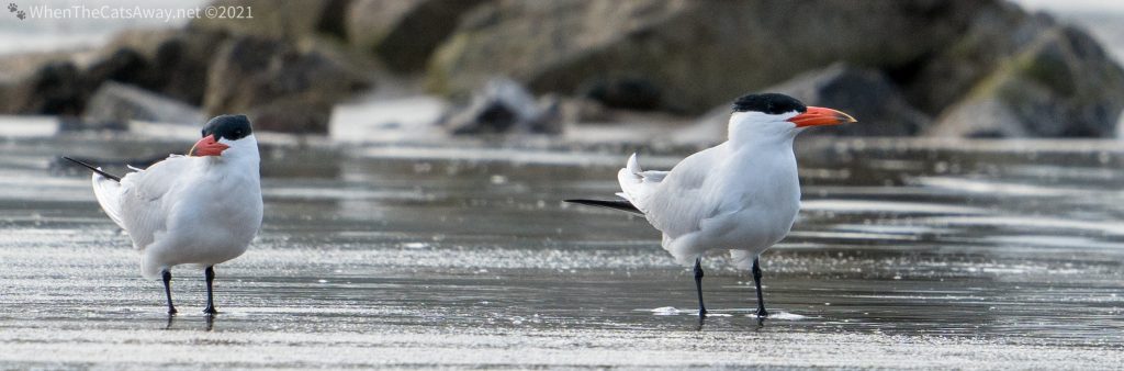
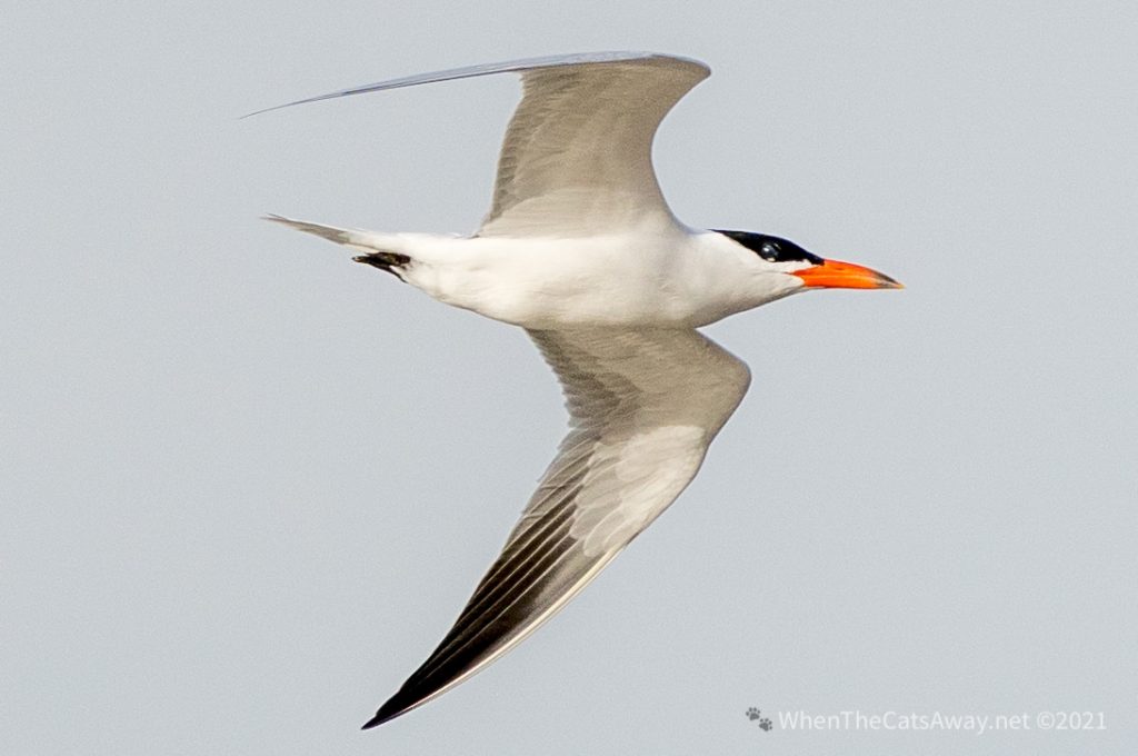
At the water’s edge sat a pair of Caspian Terns, taking off and gliding effortlessly over the waves. These are quite robust birds, but they still remained pointed into the wind so their feathers wouldn’t get messed up!
Caspian Terns on the beach – they are the largest of the Tern family and usually solitaryCaspian Tern – so streamlined in flight – they turn into narrow darts when they drop from the sky to catch fish. Their latin name translates as ‘Water Swallow’ – you can see that here
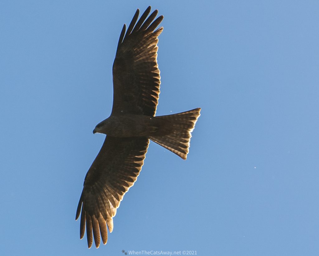
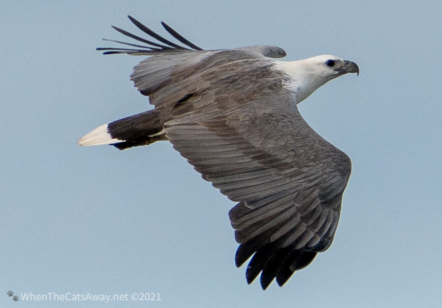
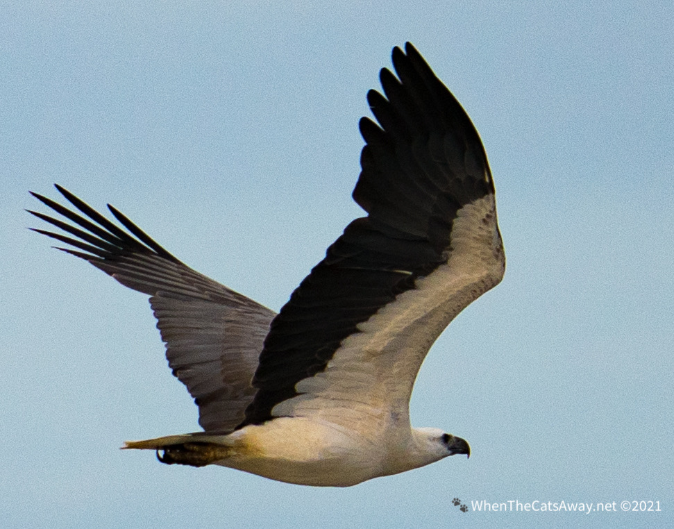
Shortly after they had moved on we were wowed by one of Australia’s three types of eagle swooping past, a White-bellied Sea-Eagle.
White-bellied Sea-eagle – a magnificent birdAnd the eagle soars away along the beach
After a couple of kilometres walk along the shoreline we gave up and drove back to camp to warm up, deciding to have another go with the el-cheapo mouse-trap in the car.
We went outside at 8pm to check – Bingo! Got one. We reset the trap vowing to check again before bed. Yes! it had caught another one…Finally the following morning we awoke to find that a third had succumbed. Since then we have heard nothing, smelt nothing and there is no visual evidence of mice…we are hoping we have seen the last of our hitchhikers!
🐁 🐁 🐁
The following morning we moved on up to the town of Yeppoon where the Toyota service centre was going to have a look at our car and the leaking roof. We had a wander around town, leaving Tassie sleeping in the van in blissful sunshine.
Sun, sand, beach – a lovely temperature up here, if a little breezy!
A few hours later we returned, the problems solved. It turned out some of the people who worked on the vehicle while we were away in Europe last year had failed to screw the roof racks on properly and the rain was leaking in through the holes! Their mistake cost us nearly $400, but at least it was all fixed, holes siliconed up – no more water ingress in our future. Thank goodness we didn’t have any disasters with the loose racks!
Our next destination was the small village of Byfield. This sweet settlement sits nestled in between Byfield State Forest, Byfield National Park and the huge Shoalwater Bay Military Training Area , and is just under an hour’s drive north of Yeppoon.
Kinka Beach, Yeppoon and Byfield
Much of this little known area of Queensland is relative wilderness – thick rainforest surrounded by mountains and leading down to remote sandy beaches. Our kind of place!
The mountains stretch along the coast, inaccessible being on military landThe military training area is a quarter of the size of Wales
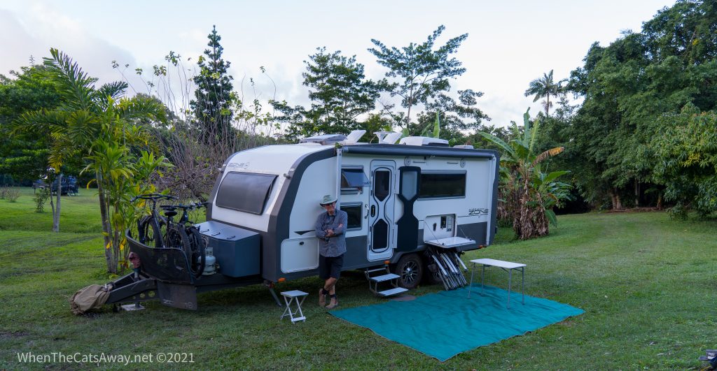
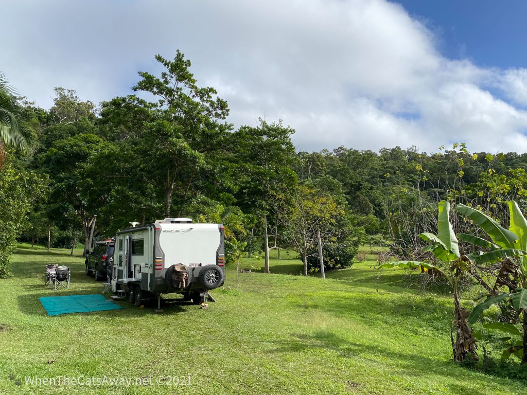
Our home for the next three nights was beautifully lush and grassed, and we learned used to be an old mandarin orange orchard. More than thirty years ago, when Beth and her husband purchased the plot, the trees were hardly producing any fruit, so it wasn’t a hard decision to remove them and landscape the land. We’re pleased, because it resulted in Byfield Camp stay – no facilities other than a couple of long-drop toilets and a rustic shower, but being pretty self-sufficient, it suited us perfectly.
Green lawns! Lush undergrowth! A little piece of paradise in the rainforestBeth, the owner has done a lot of landscaping over the years We are welcomed in by the locals – Grey Fantail
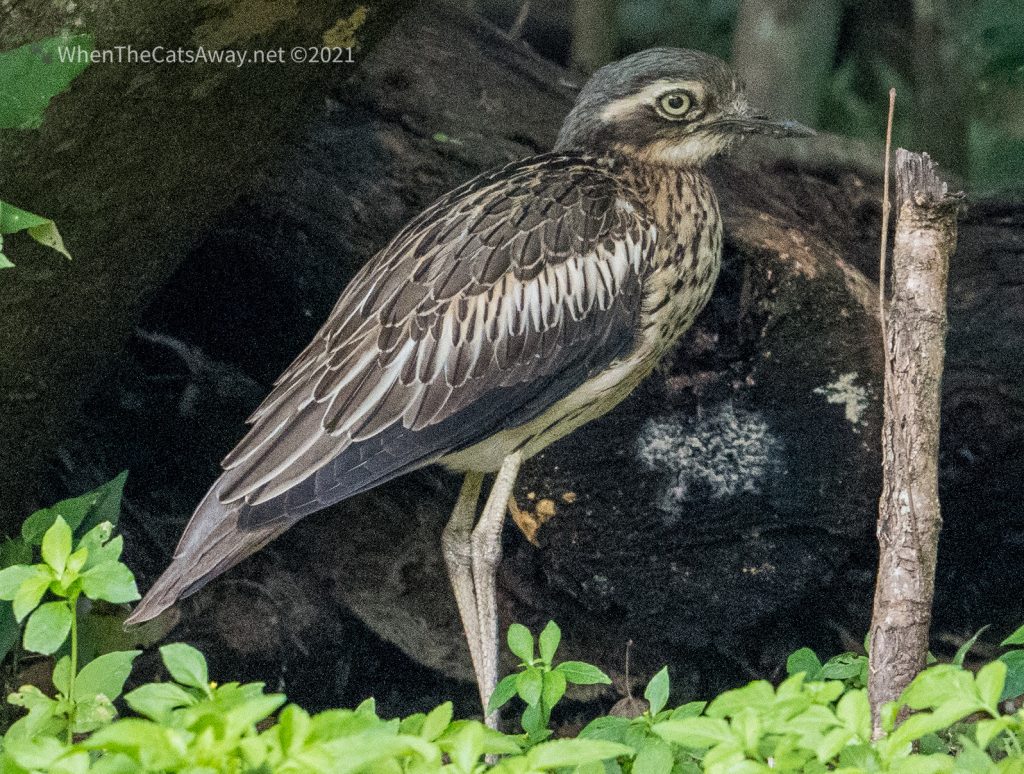
It was so peaceful – after our long day getting the car fixed, we arrived just before sunset and immediately heard blood curdling cries from the forest behind us. It turns out this sound is the cry of the Bush Stone-curlews, which choose dusk to make themselves known. During the day they are rarely seen, choosing to stand still like statues on the forest floor, or pick their way quietly through the undergrowth. We were lucky to spot one on the edge of the forest the next day.
Well disguised and about 50 metres away from us, this Bush Stone-curlew (also known as a Bush Thick-knee) barely rustled a feather for 5 minutes before picking its way back into the dense forest
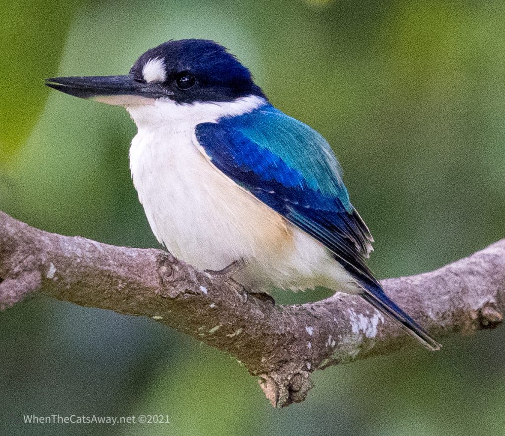
We had a look around the grounds in the morning. We could hear a lot of bird life, much of it very high up in the canopy of the trees and inaccessible. But rounding a corner beside the dam we saw a couple of Forest Kingfishers. They were clearly used to seeing people and comfortably sat in a tree beside the water, occasionally flying down to catch a lizard or frog from the long grass below. Forest Kingfishers are more similar in their diet to Kookaburras, not necessarily relying on fish and other aquatic creatures for meals.
Beautiful coloursLove posing on branchesBeautiful little birds 💙
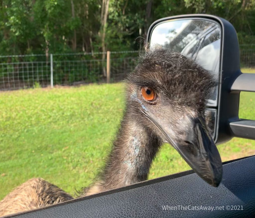
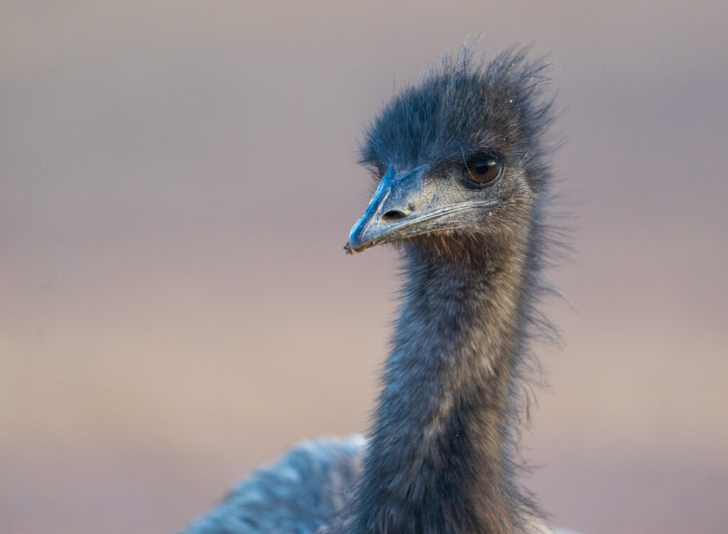
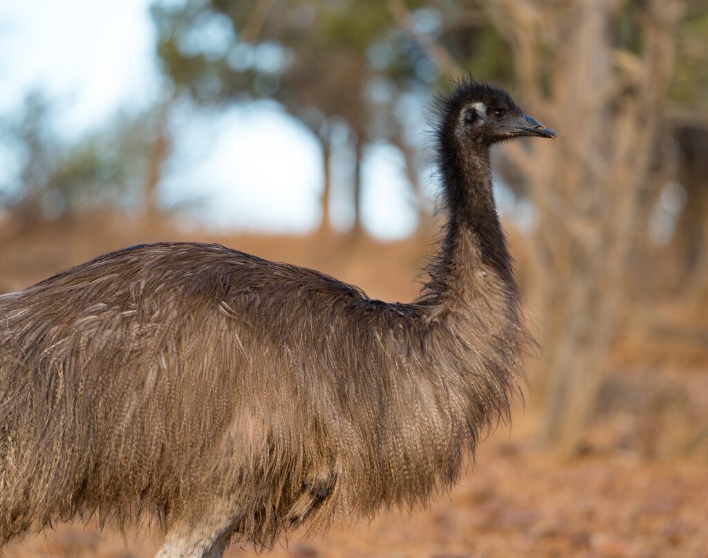
Later in the day we took a drive over to Waterpark Creek in the National Park for a look around. On our way there I spotted an Emu strolling alongside the road, so we pulled over for a look…and he thought exactly the same thing as he strolled right on over to inspect us. Lucky Tassie wasn’t in the car – she already is afraid of birds – this large visitor might have put her off travelling for good!
“Good afternoon, can I see your diving licence please?”
Once in the park we found a lovely pair of Kookaburras and saw the multicoloured Wompoo Fruit Doves, last photographed in Cape Tribulation on one of our earlier trips. This time they stuck to allowing us fleeting glances as they flitted through the canopy, not hanging around for a picture.
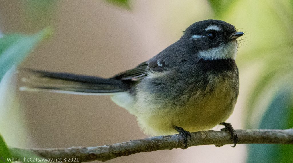
The serenity of Waterpark CreekMirror-like stillness on the creekCamera at the ready…Kookaburras sitting in the treeA Red-browed Firetail sits watching us suspiciously from a branch, keeping watch for the rest of its flock which is munching on seeds in the long grass belowA Grey Fan-tail followed us on our walk, catching insects as we disturbed themGrey Fantail
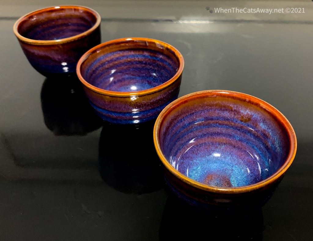
The National Park stretches down to the coast, with a few water crossings leading to a sandy track where you need to deflate your tyres to continue. After all the car issues of the past few days we chose not to risk another puncture or other problem so headed on back to camp via a local pottery. We purchased three lovely little pots.
This land is Darumbal Country. We thank and acknowledge these First Nations people as the traditional custodians of this region of Queensland.
The Darumbal people have a long history in this area, living in and off the land, its creeks and the ocean. When white settlers arrived in the region during the 1800s, the usual horrors of murder and displacement ensured. More than 3,000 Darumbal people were either killed or forcefully removed from the region, and there are many horrible stories about how the new landowners poisoned, chained and drowned community members in order to remove them. Much of the virgin rainforest was cleared for farming, and what we see now is mostly regrowth.
The slow glimmers of turnaround for the Darumbal people has been in relatively recent times, with Native Title claims first made in the mid 1990s, and finally land returned to the community in 2007. In 2016 they were recognised by the government as the Traditional Owners of the land along this coastline and up to Marlborough, north of Rockhampton. Much of the traditional lands sit within what is now the military training area, surrounded by high barbed wire fences. In 2019 an agreement was signed with the military allowing them access to their sacred sights. Things are looking up.
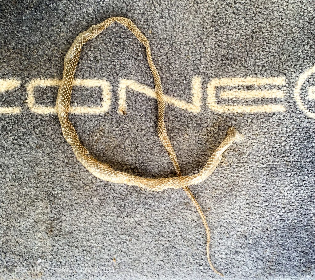
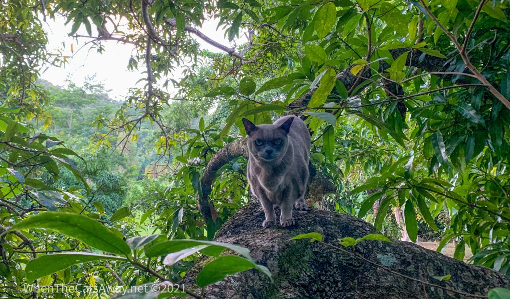
Meanwhile, back at camp, Princess Tassie just loved her new home, particularly after the four dogs and their families had left! She went for quite a few accompanied walks, loving the greenery, new sights and smells as much as us. Fortunately the closest we got to any slithering reptiles was this snakeskin on a woodpile Tassie was exploring. We encouraged her to explore new areas after that!
Perhaps a python?Loving a bit of tree climbing (with some help)What arthritis?A Green Oriole looks on from high up in a treeA male Australasian Figbird – they sound like R2D2 with their pops and squeaks!A female Australasian Figbird
We had a brilliant two days – the second being a little wetter and therefore a little more anxious as we didn’t get as much solar power as we would have liked – but we got though fine.
One of our fellow campers was a maths teacher from Brisbane who was having a little downtime in the school holidays, chilling out in her camper reading books and enjoying the ambience. We discovered it was her birthday, so our campsite owners baked a homegrown kumquat cake for her, and Mark and I provided nibbles and a chicken red curry for dinner. We lit a campfire and whiled away the evening with many laughs and a few too many beverages consumed. All in a good cause!
We moved on the next morning feeling a little dustier than planned!
Location: Cania Gorge National Park, Queensland, Australia
We were woken up in Moura at 4.30am by the idling engines of four wheel drives as the resident mining community headed off to work. We had already had a somewhat disturbed night with the caravan park’s pool constantly gurgling and making unpleasant suction noises as the water level was too low. We couldn’t wait to hit the road and see Moura in our rear view mirror.
Within two hours we were pulling into our little piece of paradise for the next three nights, Cania Gorge National Park. We were staying on the edge of the National Park, surrounded by red sandstone walls, tall forest and many birds at Cania Gorge Tourist Retreat. The park is actually for sale, if anyone fancies a project and has $1.5 million to spare. It needs some upgrading, but is in an unbeatable location.
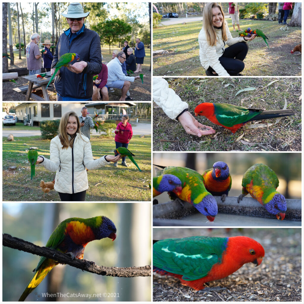
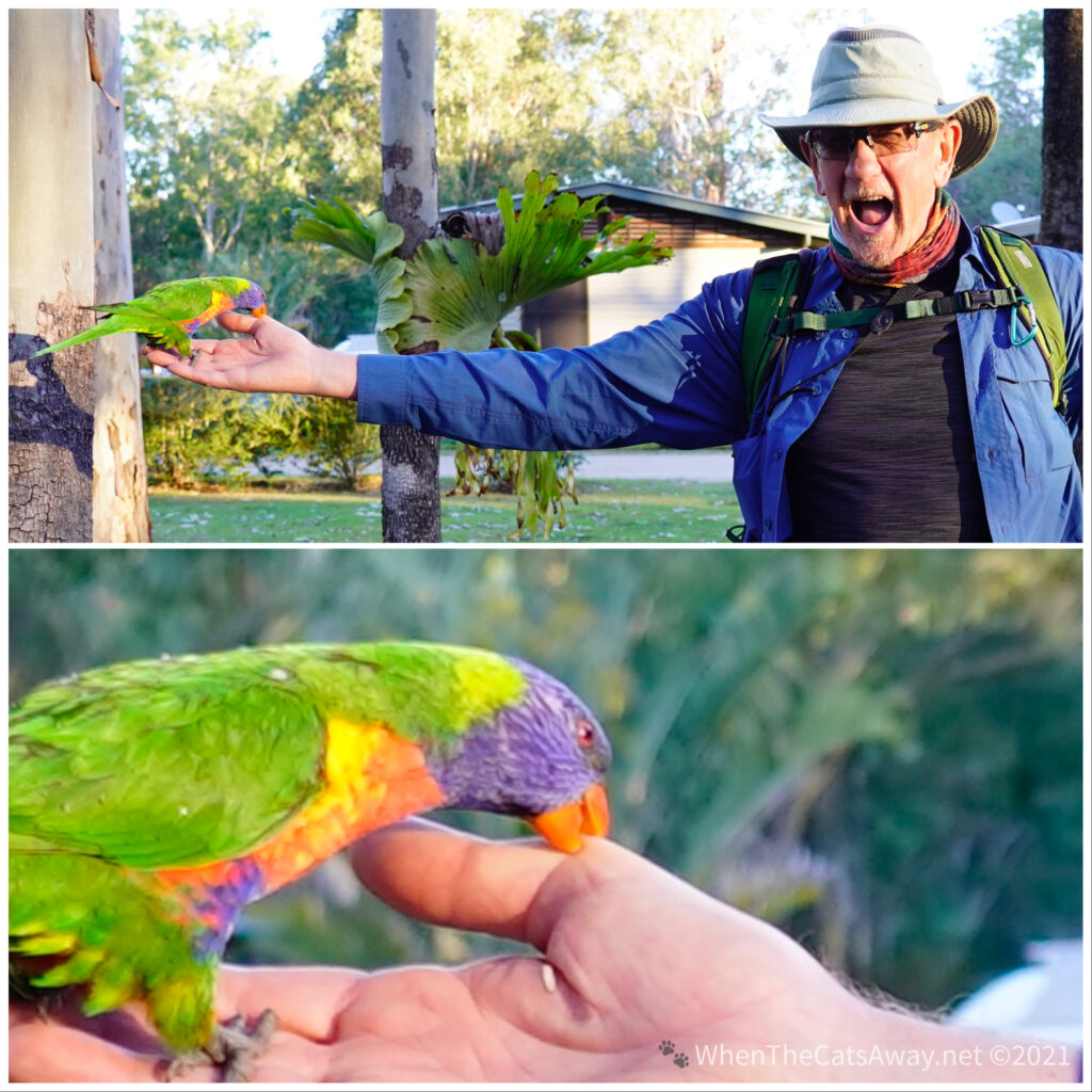
Every afternoon at the retreat is bird feeding time, and while we disagree with feeding wild birds in principle, it certainly brings the inaccessible birdlife down to meet the average person. We were given some sunflower seeds and held our our hands to see which birds were hungry.
Rainbow Lorikeets and King Parrots were the most courageous visitors
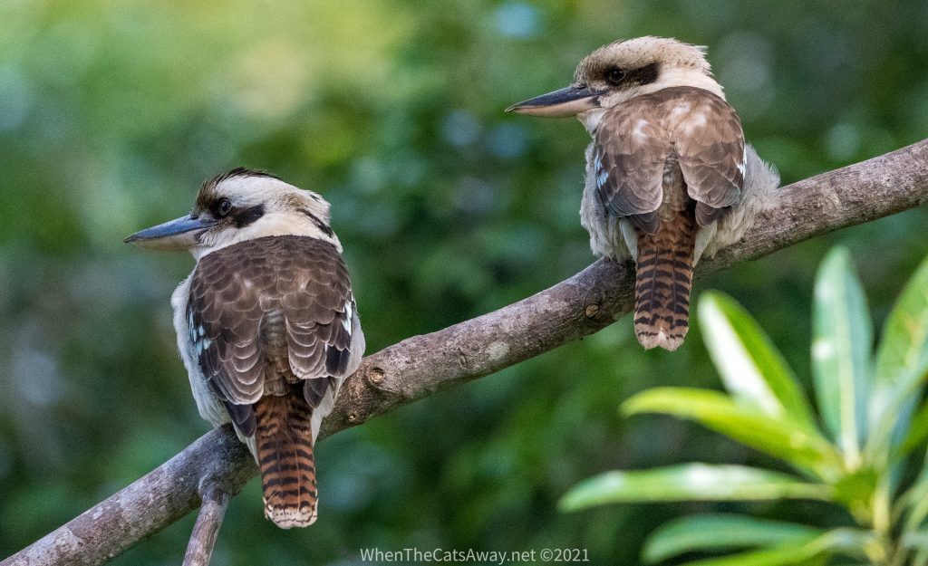
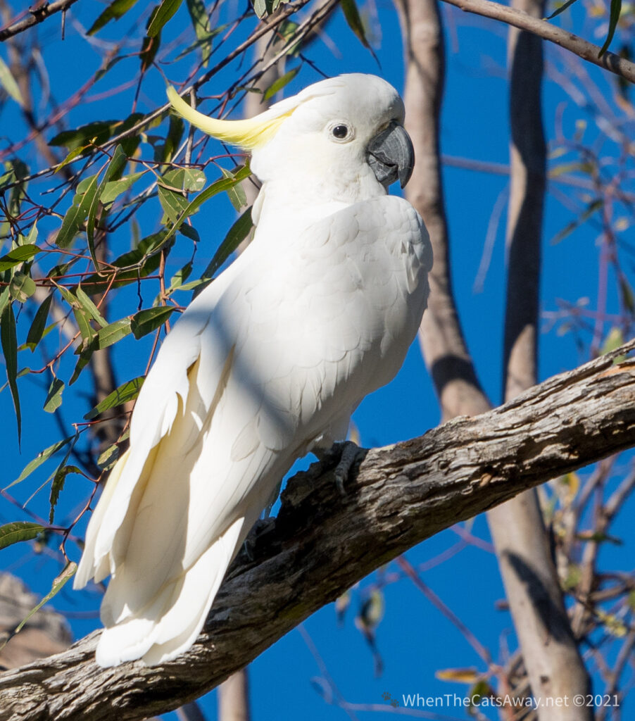
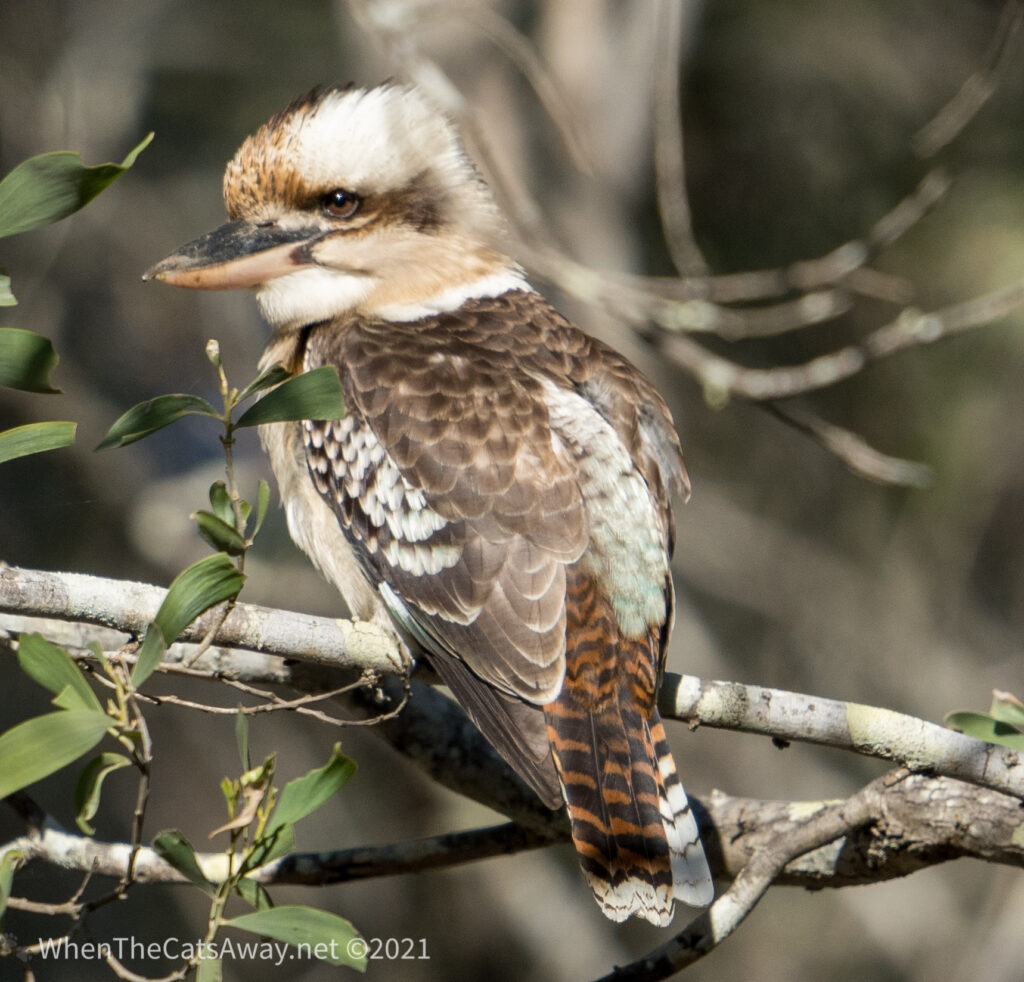
The brightly coloured and gregarious Rainbow Lorikeets flocked to the site, their screeching almost deafening as they squabbled to get to their free feed. Beautiful King Parrots (red and green) were also there, but a little more cautious in their approach. In the trees surrounding us (but not game to come down to the people) were pink and grey Galahs, Laughing Kookaburras, and Sulphur Crested Cockatoos calling from the highest treetops, excitedly.
Sulphur Crested Cockatoo
We had a wander around after the feeding, to see what other birdlife was around.
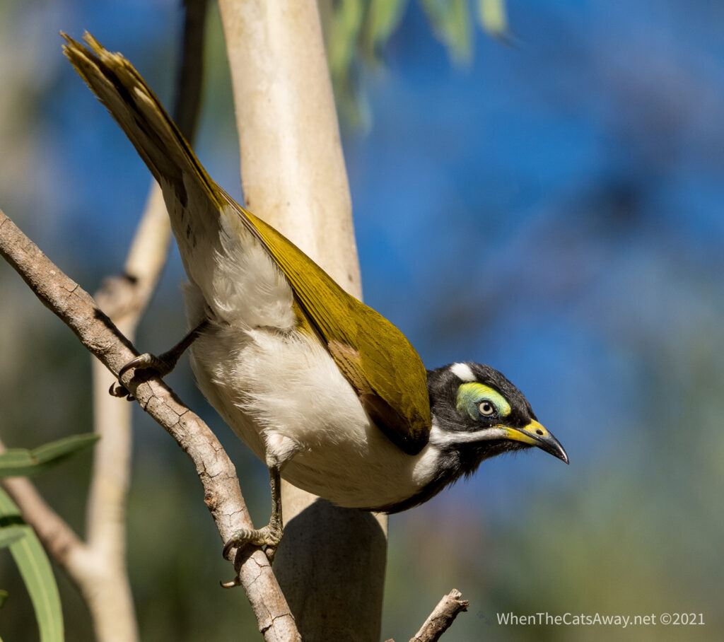
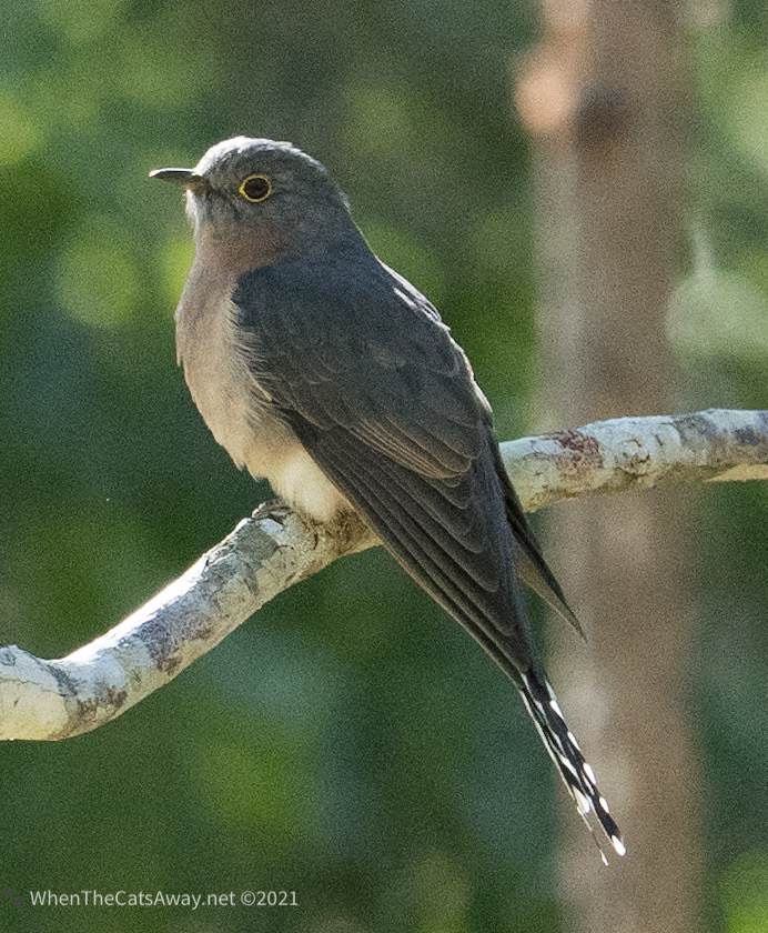
A juvenile Blue-faced HoneyeaterLaughing KookaburraFan-tailed Cuckoo
Cania Gorge has a First Nations history dating back at least 19,000 years, (to the height of the last ice age) with many examples of freehand artwork in the park, but none of the nine art sites accessible to the public. The Gooreng Gooreng people were the custodians of this land, their territory stretching from here all the way to the coast (200+km away). When white settlers arrived in the area, the Gooreng Gooreng, like many other tribes during the 18 and 1900s, were murdered, starved or sent off to settlements such as Woorabinda, Cherbourg and Palm Island (making for very grim reading).
In good news (it is hard to find any!), in the mid 1990s a bunch of academics worked with a Gooreng Gooreng elder in order to save the language from extinction (90% of Aboriginal languages are extinct), and produced an English/Gooreng – Gooreng/English dictionary to teach the next generations. This is so important – Indigenous history is a living thing, handed down and carried on by language via spoken word and the story telling. More than 40,000 years of knowledge about Australia’s flora, fauna, how to cook, how and where to travel, when to harvest particular foods is shared in this way. When a language disappears, so does all this knowledge. We often wonder what we are only now learning that our First Nations people may well have known for centuries.
We acknowledge and thank the Gooreng Gooreng people, present and ancestral, as the traditional custodians of the land we visited.
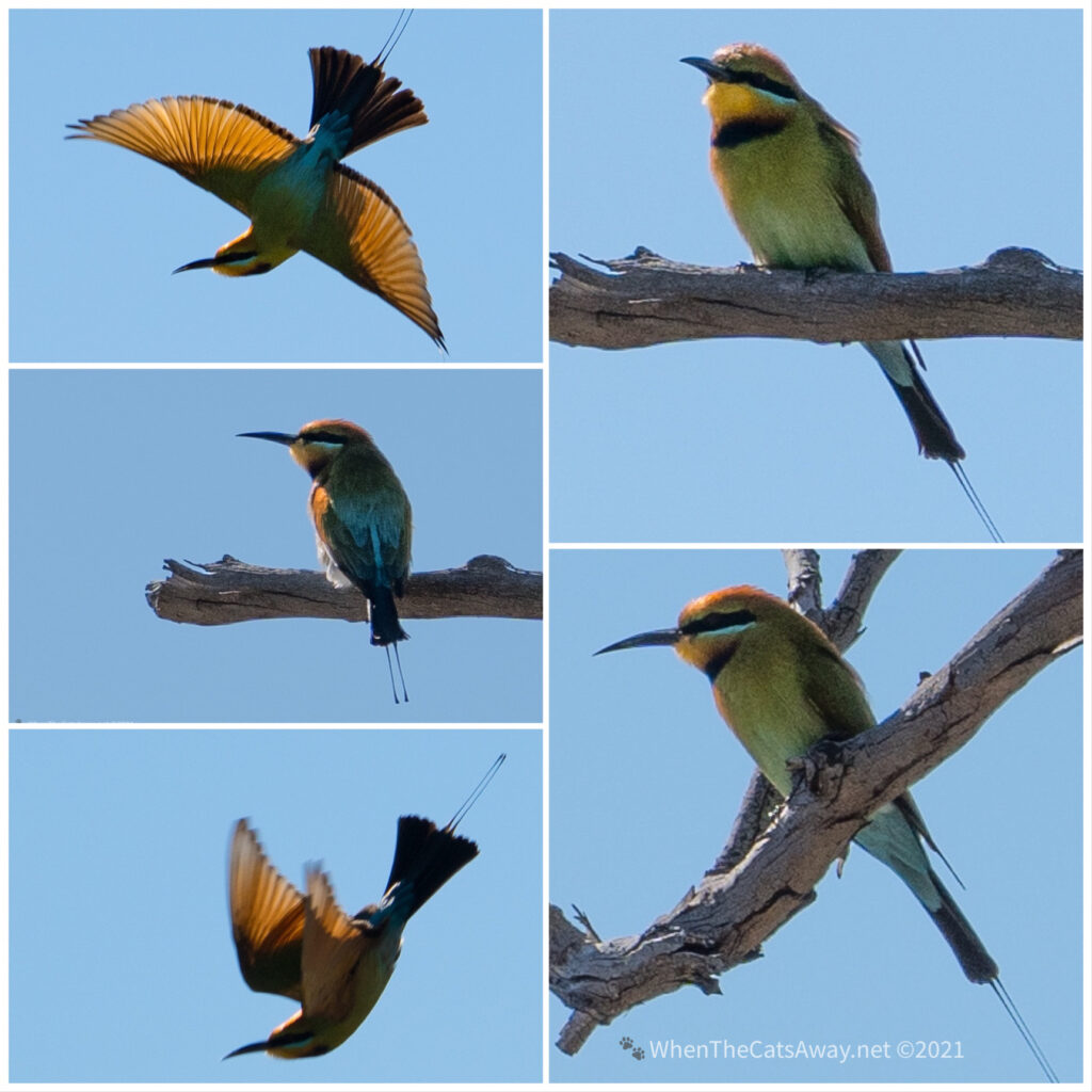
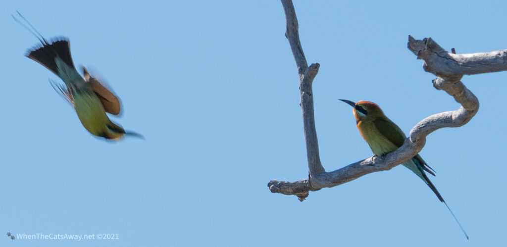
We did a early morning short walk looking for birdlife, just relishing the refreshing temperatures and clear blue skies. Following various birdcalls, we found ourselves climbing up to the Giant’s Chair Lookout, where a pair of Rainbow Bee-eaters were swooping acrobatically through the sky, chasing insects.
Laughing Kookaburra
We breathed in the oxygen from the surrounding forest, finding peace in the greens and blues and just taking the time to stop and be amongst nature. Without realising it, we have really missed the variety of vegetation on our travels the last few weeks.
King Parrot munching seeds on the forest floorKing ParrotKing ParrotBlack-faced CuckooshrikeMr A on his spotting scope watching the Rainbow Bee-eatersRainbow Bee-eaters – the males have the longest tail feathersThe male Bee-eater watches as his mate swoops past chasing an insectMr and Mrs A at the lookout feeling happy
Later in the day we decided to tackle a longer hike, heading up along a dry creek bed to Ferntree Pool, a location we hoped would attract some of the harder to see forest birds. It was a bit of a workout for Mr A as he carried my heavy camera lens on the 7km circuit as well as his spotting scope, but it was worth it.
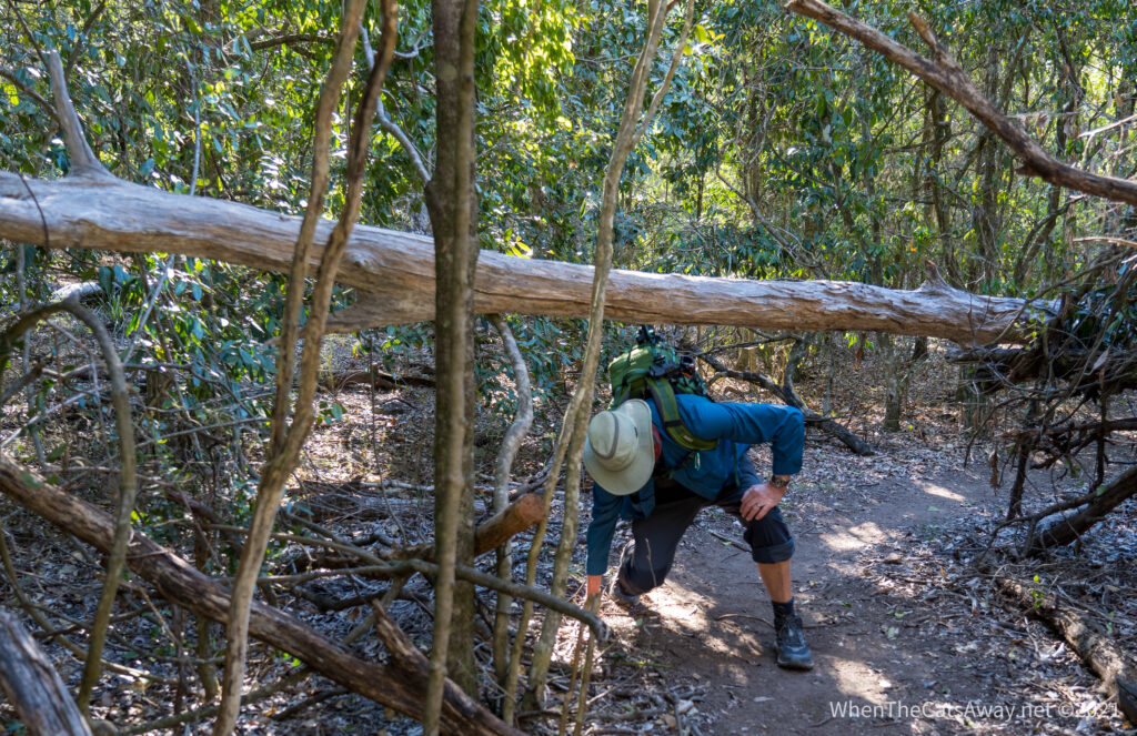
Hiking up through the valley, the vegetation changes to more rainforest with vines and a new variety of treeThere are some giant trees hereMr A has to limbo under a fallen tree trunk
We almost couldn’t believe it when we saw water in the pool, a precious resource for the native birds and wildlife here. We stopped and sat quietly at the water’s edge, enjoying an apple and watching quietly to see who would turn up.
Ferntree Pool
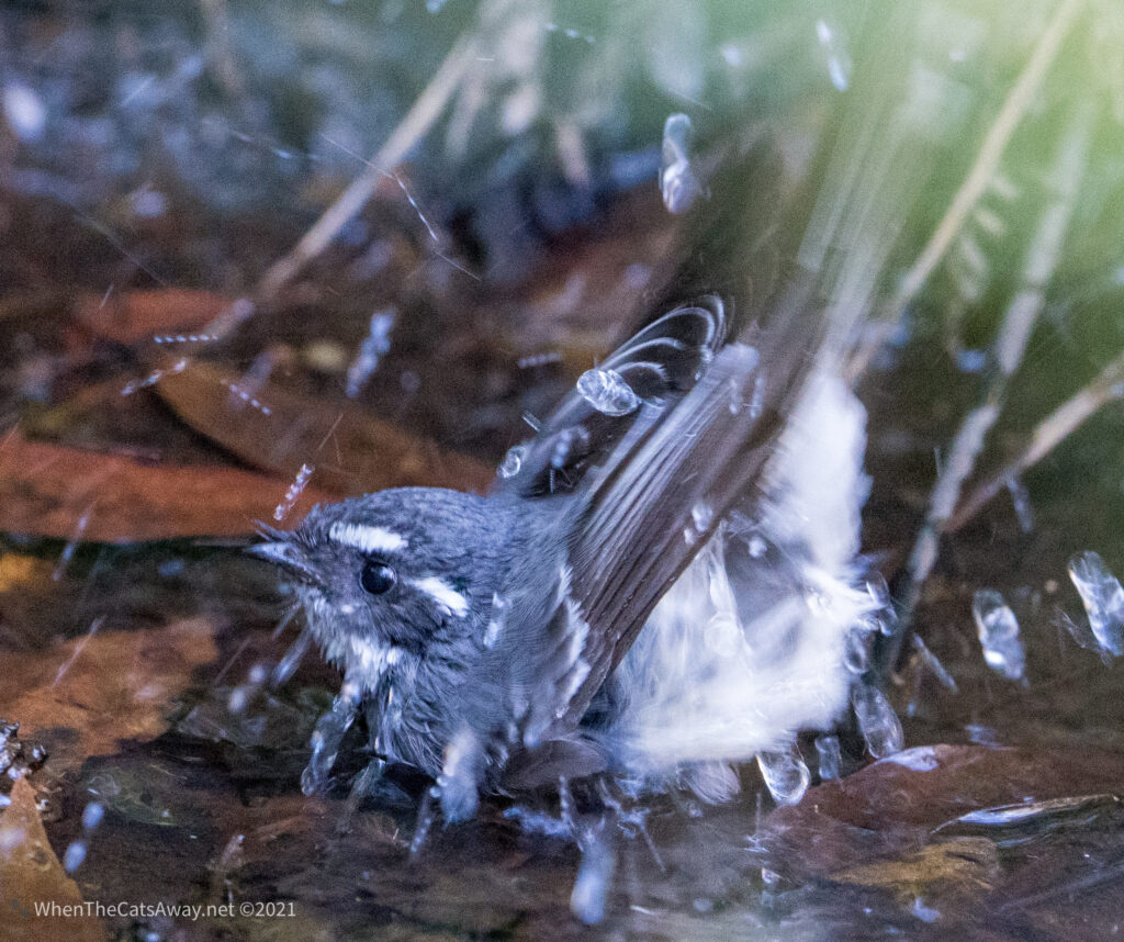
First to arrive was a Grey Fantail. She flitted around catching insects, before finding herself a quiet edge of the water for a bath.
Grey Fantail searching for insects deep inside the fernsA frenzy of splashes as our Grey Fantail has a bath in the shallow water’s edge
Then we gasped as a little flash of red, black and white appeared, then another and another – a small flock of tiny honeyeaters flew down to the ferns, dipping down for a quick drink of water, then up to the safety of the undergrowth. It was so hard to capture them, but we later learned they are Scarlet Myzonelas. They are rarely seen as they feed high up in the canopy, usually identified by their calls.
Male Scarlet MyzomelaJuvenile males have smaller amounts of red, while the females are completely brown
We watched them for a while before continuing on our way, climbing back up on to the ridge and returning back via the Giant’s Chair Lookout.
Picking our way along sandstone wallsFine views at the lookout but no Rainbow Bee-eaters this time
When we returned to the campground we had missed the evening bird feeding, but I persuaded Mr A to hold out his hand and see whether a bird would come down…the answer was yes….but he would be swiftly punished with a Lorikeet nip for not having any snacks in his hand! Oops!
Warning, don’t tease the birds, they will soon let you know you are naughty!
Before long it was our final day at Cania Gorge and still there were many walks we hadn’t done – we really could have stayed here a week, but already had a booking at a site on the coast we didn’t want to lose (things are getting busier now as the wave of travellers heads north from South Australia, Victoria and NSW for the winter).
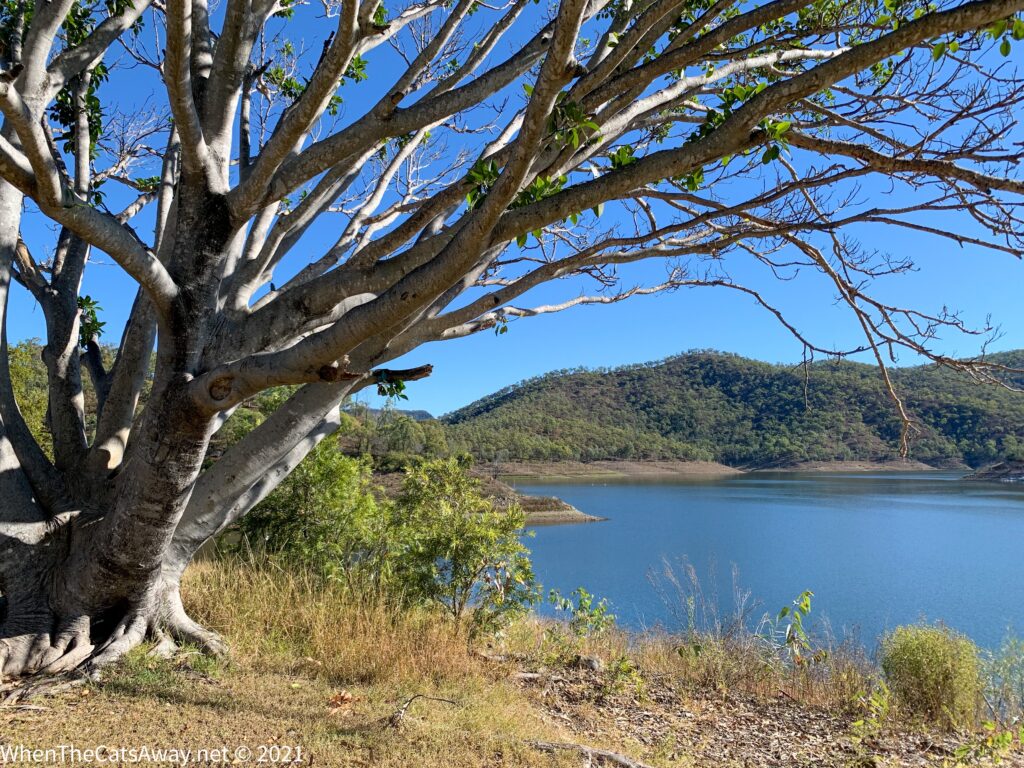
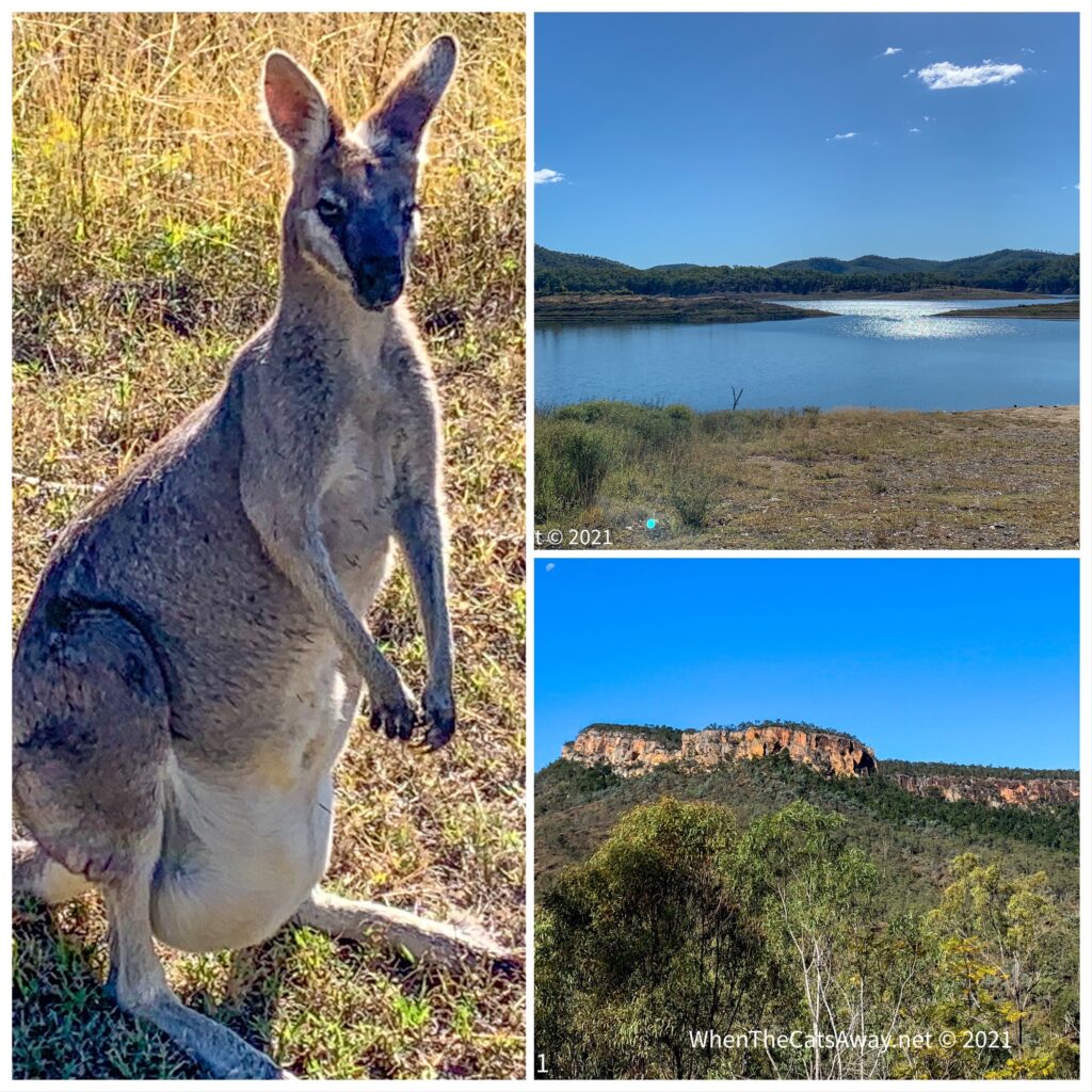
A short drive took us up to Cania Lake, a large reservoir at the end of the valley, and likely the reason for there being so many dry Creeks in the area. Other than some Pelicans and Little Black Cormorants there was little evidence of water birds.
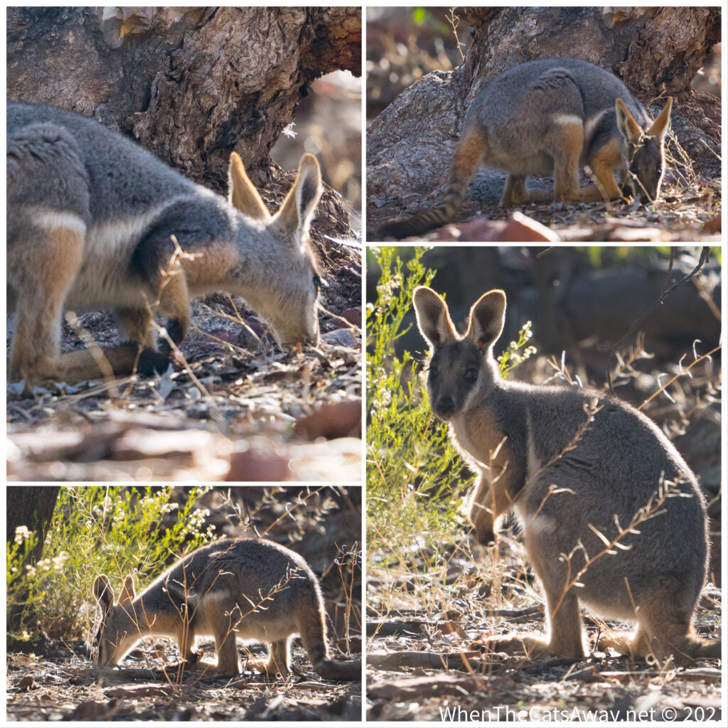
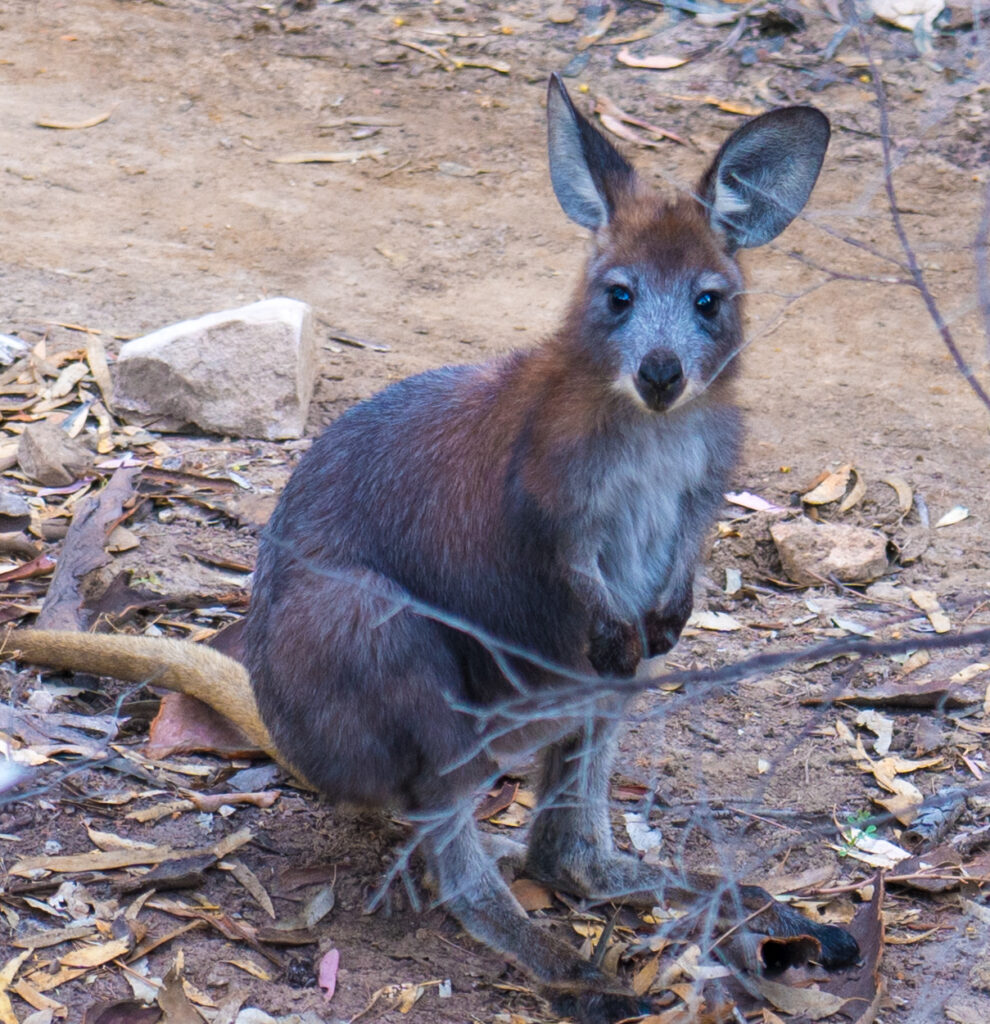
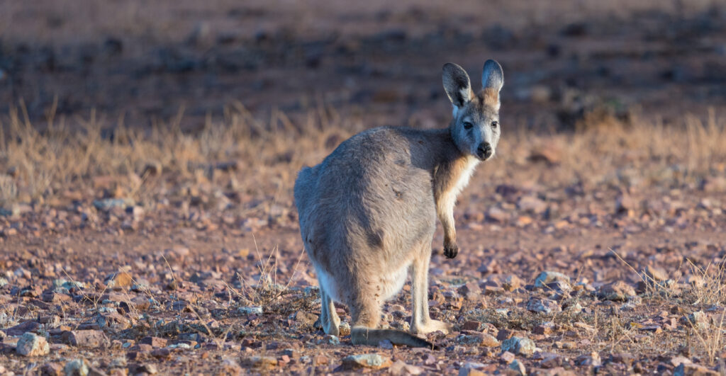
Lake CaniaLots of Pretty-faced Wallabies up by the dam – this female carrying quite a large joey in her pouch
We decided to try our luck at finding some new birdlife down at Three Moon Creek – one of the few waterways with water in it.
It was a good choice. We immediately saw Peregrine Falcons soaring up at the top of the sandstone cliffs, and a frenzy of birds flitting along through the undergrowth. We found ourselves some quiet spots and waited to see what would come to us once we were no longer seen as a threat.
We spent a good hour there, seeing some interesting birdlife, many we had never seen before (thank goodness for the Merlin bird ID app in helping us work out what we’d spotted!).
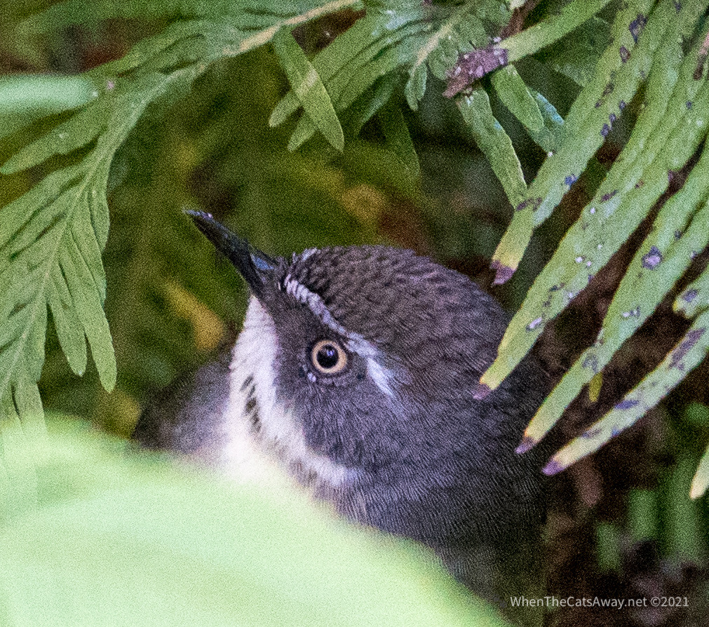
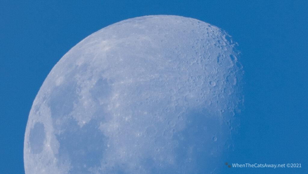
Very little and cute White-browed Scrub Wrens – picking along the creek edge finding morsels to eatWhite-browed Scrub WrenAn Australian Raven stopped for a rest on the trunk crossing the creek right in front of meAustralian Raven – with the sunlight on his glossy feathers you can see the purples, blues and greens in what usually just looks blackA loud fluttering in the bushes behind me and a Brown Cuckoo-Dove had landed just a metre awayThe moon had already risen, its craters clearly seenDusky Moorhen – a noisy little birdClockwise from left: LIttle Pied Cormorant, Peregrine Falcon (long way away!) and a Grey Fantail
We had a great couple of days here, but it was time to move on. We’re finally going to reach the coast again after six weeks of being land-bound, and are quite excited about it!
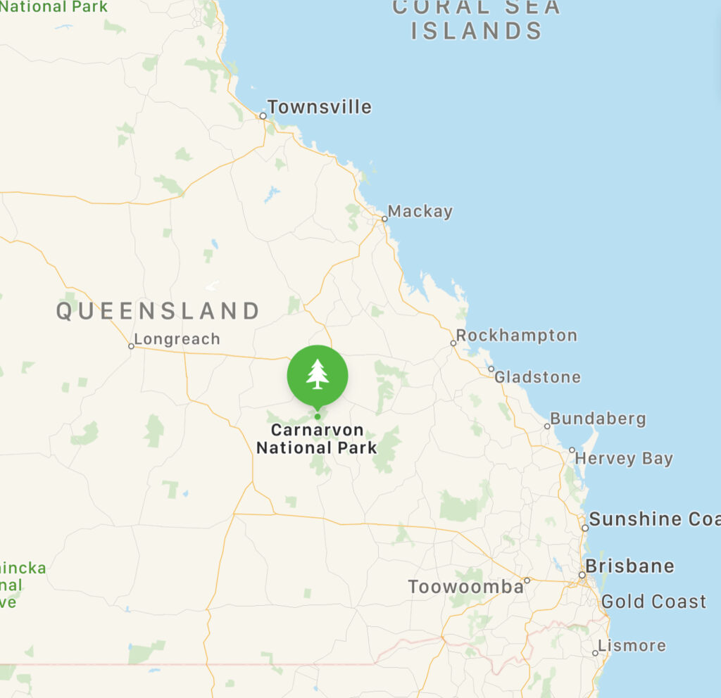
Location: Carnarvon Gorge National Park, Queensland, Australia
Departing Roma we were quite excited about our next location, Carnarvon Gorge National Park.
Carnarvon Gorge is not particularly easy to reach if you are not travelling with your accomodation. It is around a 9 hour non stop drive from Brisbane or the Sunshine Coast, or 4.5 hours from Rockhampton. There are two campgrounds, only one with power and water, the other (Sandstone Park, where we stayed) for self-contained vehicles. There is one resort with cabins, and otherwise no other options unless you are backpacking or prepared for a two hour drive from the nearest town, Injune or Rolleston. For Mark and I, it is this remoteness and status as a real oasis in the desert that really draws us in.
Carnarvon Gorge – a long way from anywhere!
The Gorge has been a sacred location for the First Nations people for at least twenty thousand years, with more than 2,000 examples of artwork in the National Park. It was visited for ceremonies, involving a recognition of the Rainbow Serpent which they believe created the gorge. We recognise the Garingbal/Karingbal and Bidjara peoples as the traditional custodians of this region and acknowledge their ancestors, stories and cultures which helped preserve and protect the land we visited and stayed on.
We were staying at Sandstone Park, a 50 acre cattle station and bush camping area, with sites set up high on a hill with 360 degree views across the gorge’s white sandstone walls. With no power or water on offer, we had filled up our tanks to the brim and hoped for clear skies to help charge up our solar power.
All set up including the screen house – fits the BBQ, chairs and table with room to spare…all we needed were flies!The view from our campsite
The western view from the park overlooks the ‘Milgin’ or Sandstone Belt. According to our First Nation peoples’ culture, this landscape represents the burial sites of their indigenous forefathers. The tree line represents the brow (Milgin) above the eyes of the resting ancestors who continue to watch over and protect people in the surrounding area.
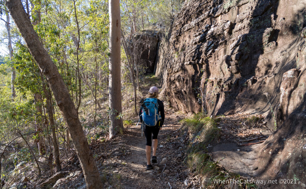
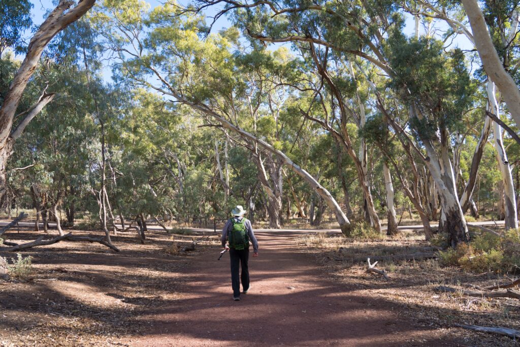
Having visited Carnarvon Gorge twice before and explored most of the walking trails thoroughly, we did not feel pressured to repeat everything again. So on Friday morning we set off along the main walking track with no agenda.
It didn’t take long to see our first wildlife, with a Pretty-faced Wallaby taking its morning drink down by the first water crossing. The water here is semi permanent and has only been recorded as stopping twice since records began. It. was so lovely to see water clear and pristine, not tainted by the mud and damage of the introduced carp as we have seen in so many other waterways.
Starting our 12km hike (map)A Pretty-faced Wallaby coming down to the river for a drink
We just drank up the scenery as we walked. The huge forests of cycads and tree ferns looked incredible after the flat land we had been travelling through, the multitude of shades of green with the morning sunlight breaking through just breathtaking.
Carnarvon fan palms Livistona nitida, ancient cycads, ferns, flowering shrubs and gum trees line the main gorge
Off the main track there are several side walks to other gorges, caves and interesting sights, but we were happy to miss these out on this occasion, stepping away from the crowds of people and find our own quiet spots. Picking our way a short way down the creek we found a lovely quiet pool, a haven for small birds and butterflies – the perfect place for a picnic.
The river is a stunning feature of the gorgeWe did a little rock hopping along Carnarvon Creek and found ourselves a little paradise for lunchStep away from the crowds and you can find peaceful little rock pools looking like landscaped gardens
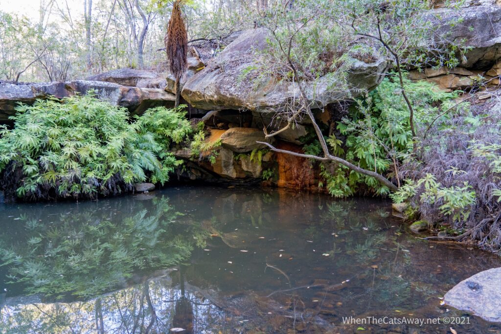
After lunch we continued our walk along the gorge, deciding to head to an area called ‘The Amphitheatre’. We were just walking over the stepping stones and I spotted a Platypus swimming along. It is so unusual to see one of these shy, often nocturnal creatures, we decided to miss out the side-walk in favour of watching out to see whether it would return.
This is the pool where Platypus live!
Our patience paid off – it didn’t take long before we spotted ripples and bubbles coming from the pool, and then there it was, popping up to the surface and making a dive down to catch a yabbie or other nourishing snack.
Platypus! As hard as photographing dolphins!And again…trust me, this IS a Platypus!And for our intrepid Platypus hunters, this is what you are looking for – enthusiastic ripples with a lot of bubbles – a clue that a Platypus has dived under and is finding a meal under the water
It was truly a magical experience, and worth waiting around for.
We concluded our day’s hiking by diverting beside another quiet area of Carnarvon Creek, along the ‘Nature Trail’. We watched a few birds enjoying their late afternoon baths and drinks, before heading back to camp.
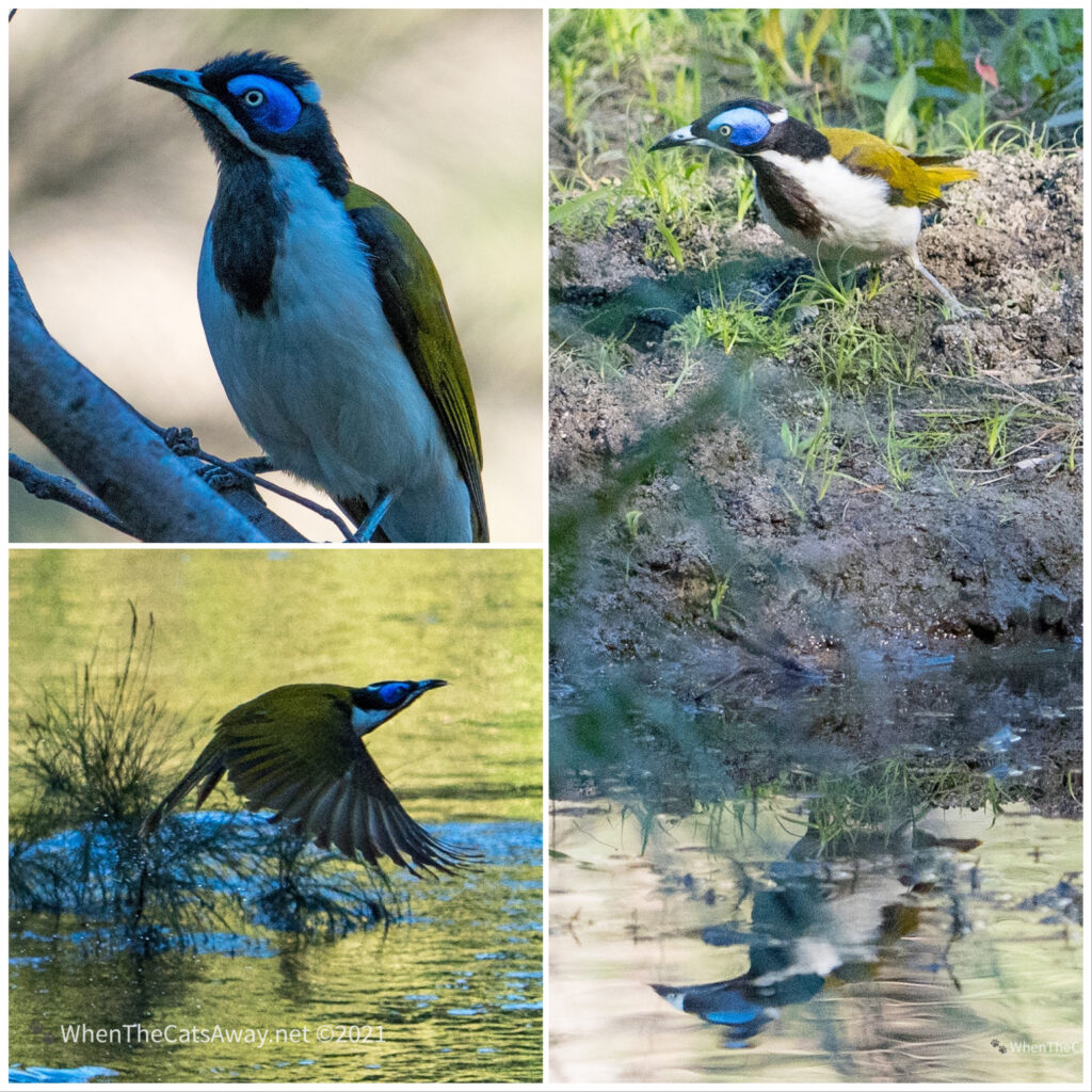
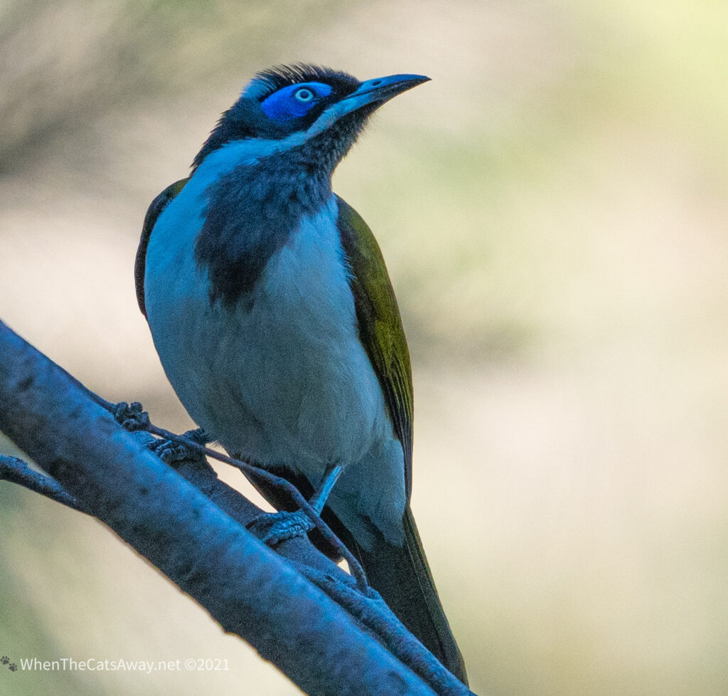
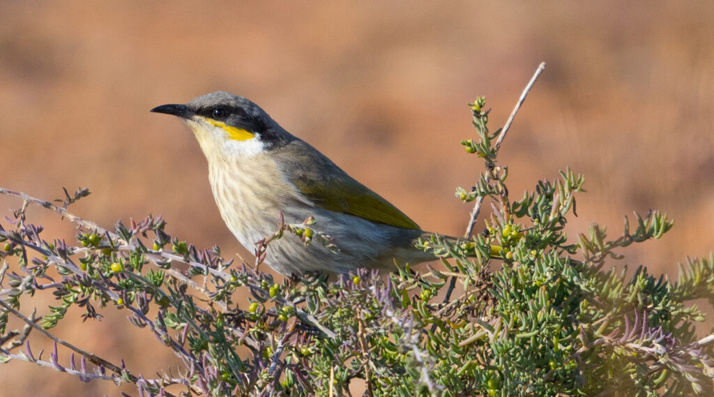
These great sandstone walls tower over us on the walkA Willie-Wagtail catching insects by the waterWalking on water? Willie Wagtail launches off to capture another insectLate afternoon bath and drink time at the creek for this Blue-faced HoneyeaterBlue-faced Honeyeater
We had a lovely evening with a couple of other Zone owners, Sandie and Leigh, popping over for pre-dinner drinks and nibbles, sharing travel stories and all things Zone. There were so many parallels to our stories, and we had lots of laughs.
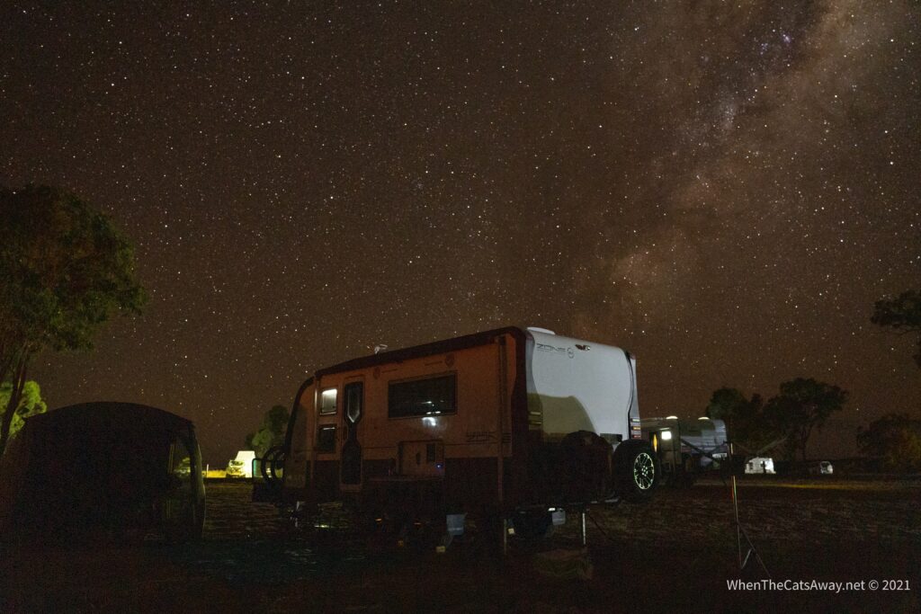
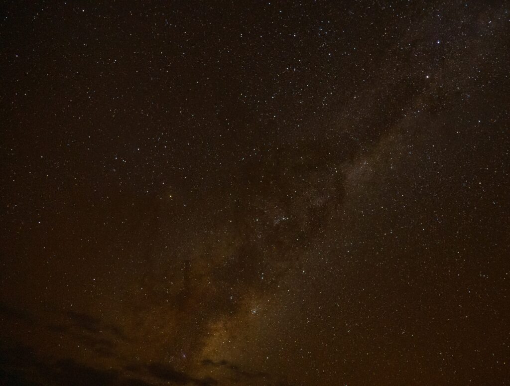
Later, when most of the lights were out and fires dying down, I went out into the cool night (about 5 degrees centigrade) to photograph the stars. The smear of smoke coming from the back of our Zone is in fact the Milky Way – hundreds of thousands of stars, seeming to go on forever. I have still a lot to learn about astrophotography, but I was quite pleased with this effort.
Perfect clear evenings
The following day we had a lazy start, deciding to enjoy the ambience and the campsite before taking a nature and bird watching focus for the afternoon.
Big views and a little catTassie spots an interesting hole…mice!
As I picked up my rucksack I noticed a strange odour…I looked inside and found an apple I hadn’t managed to eat the day before was still inside, however with several bites out of it. Mice! Ugh. Other campers had mentioned there were lots of mice about and we hadn’t noticed until now. I cleaned out the mess and we continued.
We had decided to tackle two of the quieter walks – the Nature Trail and Rockpool walk. Both follow the creek, and walking quietly along it doesn’t take long to find plenty of bird life around, as well as some stunning butterflies.
Never get tired of seeing a Laughing Kookaburra Striated PardaloteMore Striated Pardalote – note the very shy female bottom rightThere are many Grey Kangaroos and shyer Swamp Wallabies aroundOlive-backed Oriole Spiny Cheeked HoneyeaterAnd the rear of a Spiny-cheeked HoneyeaterA White-necked (Pacific) HeronWhite-necked HeronA King Parrot shouting!A White-winged Chough. These live in large gregarious family groups and turn over the ground looking for grubs and insects while chattering away. The white in their wing is hidden unless they fly. They have red eyes.Fan-tailed Cuckoo – hard to see here, but they have a lovely striped tailWhite-faced Heron – he was stood near the White-necked Heron, looking like he was sulking!Red Dragonfly, Meadow Argus butterfly, orange grasshopper, Blue Argos butterfly, Monarch Butterfly
After a lovely afternoon in nature, we returned back to cook a home made pizza on the BBQ – finally we have nailed the technique – two delicious pizzas, perfectly prepared. Brilliant. After dark, I took Tassie out on a mouse hunt – she had a great time at our next door neighbour’s caravan chasing several little critters away from their fridge…she’s a little too slow to catch any these days, but had a good time trying.
You can’t beat a sunset glass of wine and a fire to end the day on
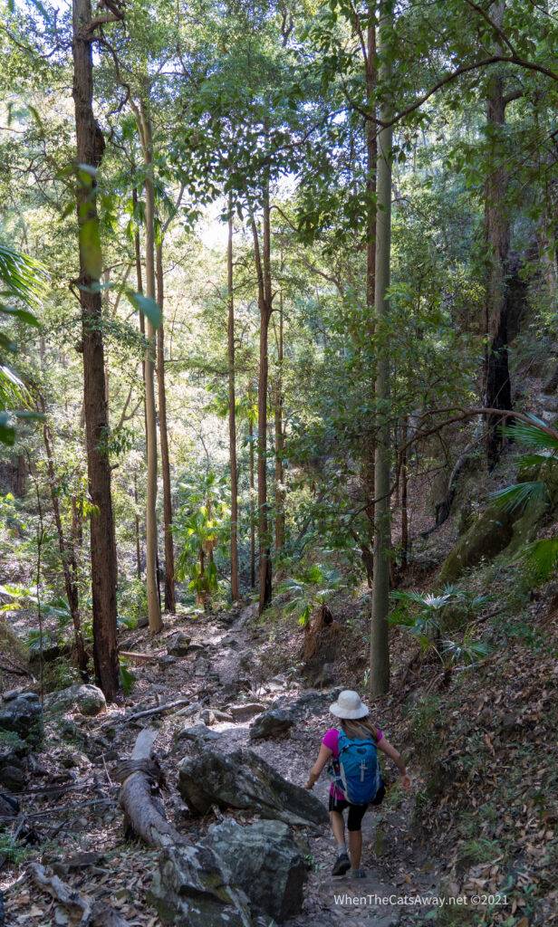
On Sunday morning we decided to hike up to Boolimba Bluff. It’s a walk with a warning: only for the physically fit. Apart from me being unable to breathe unimpeded(!), we both felt fit enough to tackle the climb (54 floors of climbing) via steep paths, steps and metal ladders.
A walk only for the very rugged – Mark proving he is in this category by climbing the first ladder (in distance)Climbing the final ladder before the top
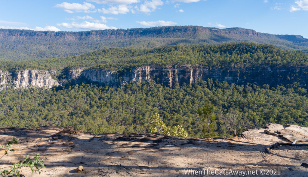
I won’t pretend I found it easy with my restricted airway, but we made it up to the top and were rewarded with a magnificent view, and a bench to catch our breath on.
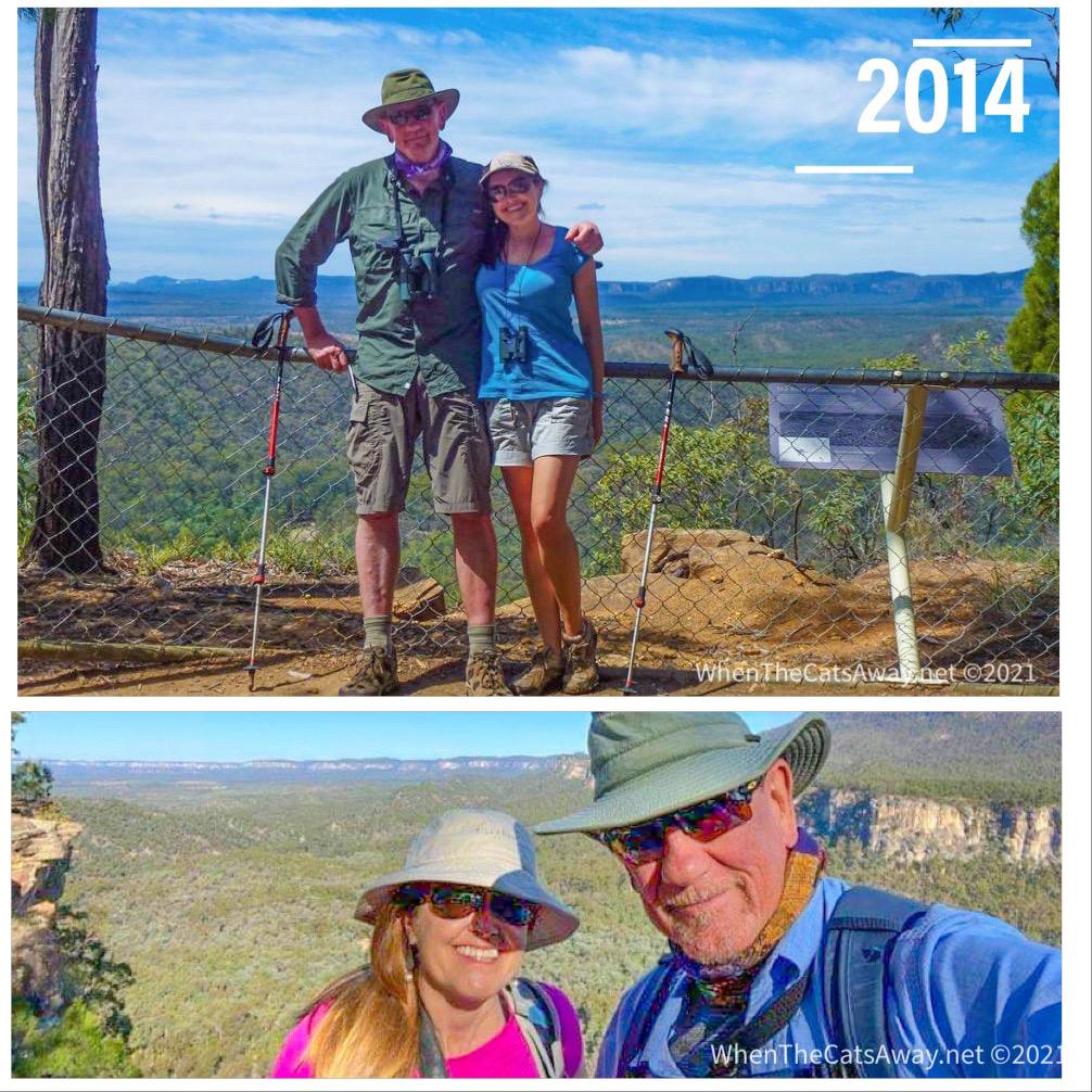
Then and now – our first visit to this National Park and this lookout in 2014, and 7 years laterA view worth climbing up for
The climb down was much easier than the way up!
Climbing down is much easier!
Monday was our last day, so we decided again to have a wildlife spotting focus. After cleaning out the previous night’s mouse damage from the car (this time they had torn up tissues and attempted to eat everything – including the inner soles from Mr A’s shoes!), we drove back down to the National Park.
It was a blissful afternoon. Just taking the time to stop and observe what is around you is so calming, and helps us develop a far deeper connection with the environment we’re in. Mark’s really getting the hang of using his spotting scope for observing birds, and I’m getting lots of practice learning the photography side of things.
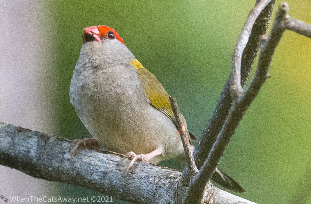
Red-browed Firetail – these are tiny little birds which feed in the grasses – flying up to nearby trees when they are disturbed, often very hard to seeA pair of female Red-backed Fairy-wrensFemale Red-backed Fairy-wren
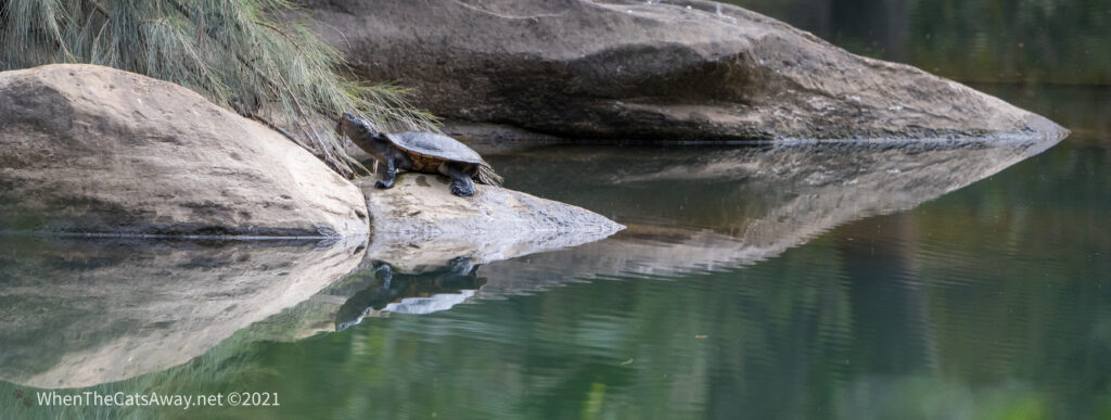
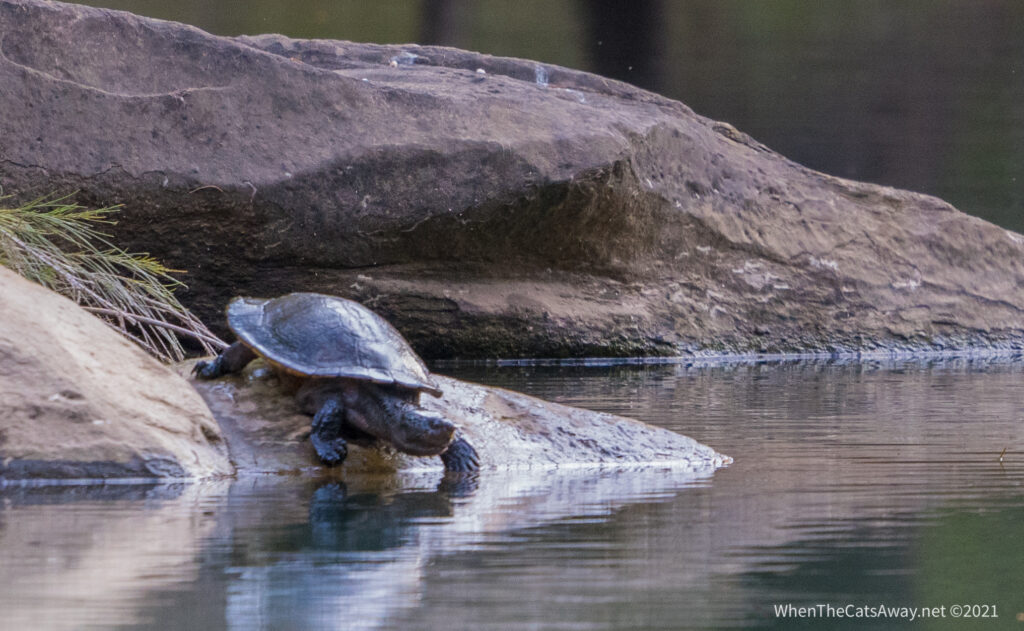
We were just returning back along the river and I noticed a rock looked different from before. Mark looked through his scope and exclaimed “Yes! It’s a turtle!”. We stopped and watched the cutie as it sunned itself on the rock, before ultimately deciding it was time to get wet again and plopped back into the water with barely a ripple. Wonderful.
On our return walk we spy a Keft’s River Turtle sunning on a rockOur turtle friend decides it is time to head back into the water, and vanishes with barely a ripple
We have been watching Sir Richard Attenborough’s Our Planet series on Netflix. While it has some fairly somber messages for the world, it does remind us what still remains and how important it is that we take steps to ensure humans and wildlife can live harmoniously. We hope that by sharing our photos and stories, we can raise awareness of some of the stunning bird and wildlife out there and maybe sway people to think about how to protect these in the future.
Carnarvon Gorge National Park will remain in our memories as a very special location. It is a spiritually and culturally important place and a haven for many birds and animals. Five glider species call this home – we saw a few on our last visit during a night safari tour. The gorge is also full of echidnas, rufous bettongs, kangaroos and wallabies, as well as freshwater turtles, fish, snakes, goannas and more than 170 species of bird (we counted about 30 on our trip!).
While we can never hope to fully understand the significance of this location to our First Nations people, we leave with that continued feeling of connection we had felt in the past. We would certainly recommend this location to anyone that wishes to experience nature at her best…except the mice – hopefully the owls will sort that out before you visit!
A final sunset as we bid this beautiful place farewell
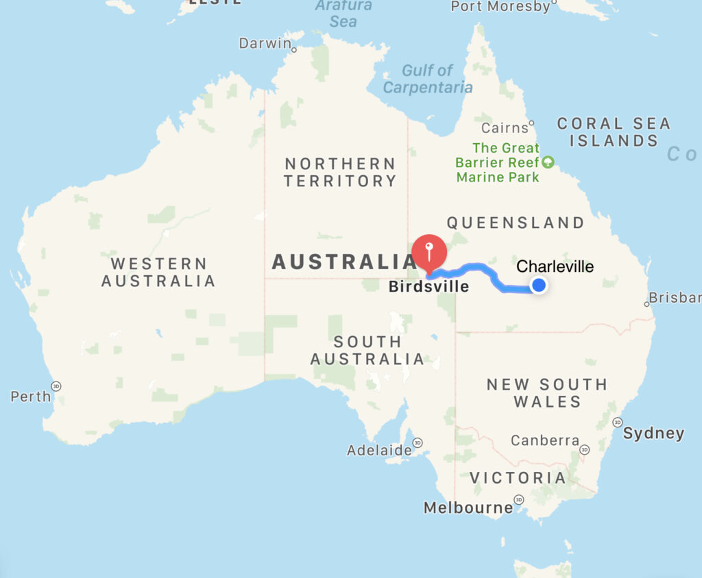
Location: Travelling from Birdsville to Charleville, Queensland, Australia
Farewelling Birdsville we turned on to the imaginatively named Birdsville and Diamantina Developmental Roads and pointed ourselves east. Over the next couple of days we were making our way across to Charleville, pretty much half way to the coast of Queensland.
Driving at the speed limit with no breaks, this journey would take about 12 hours
Much of the journey was along graded gravel road, with occasionally a stretch of single lane tarmac for good measure. Our first day’s driving took us across the outer reaches of the Sturt Stony Desert and Strzelecki Desert into what is known as Channel Country, so named for the numerous creeks and rivers (often dry) which intertwine across the region.
Our lunch spot – we were pleased to hide inside away from the dust and wind
The landscape is largely featureless and flat, stretching across to the horizon. The morning we left there were strong winds which whistled across the desert, nothing to stop the dust flying. As it was a head wind it made driving a challenge too – the Land Cruiser certainly ate up the fuel.
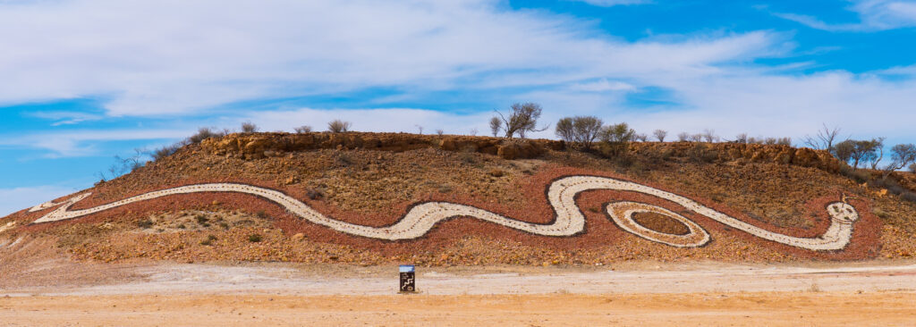
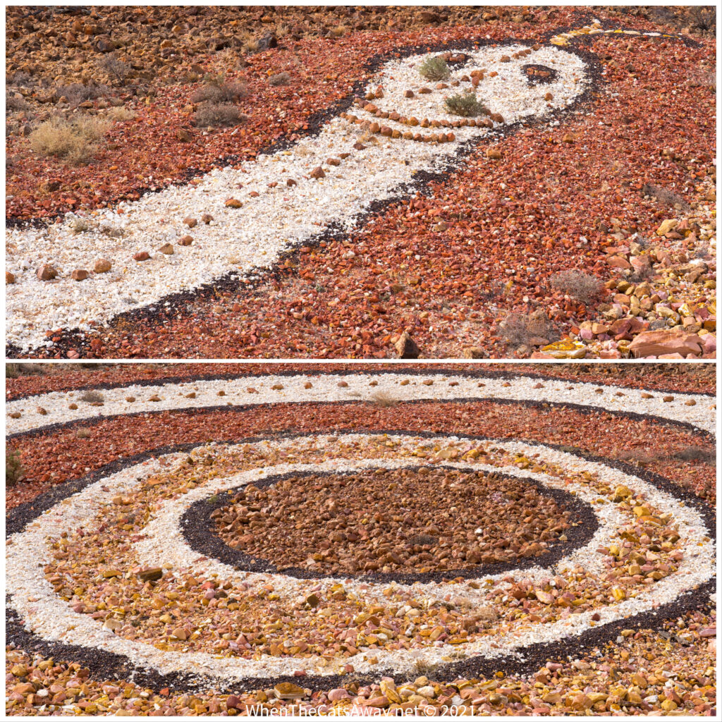
There are occasional rest areas, sometimes with picnic tables and toilets, a chance to break up the monotony of the journey. Mid afternoon we saw a slight uplift on the side of the road, decorated with a giant serpent. The Dreamtime Serpent is an important figure in the Aboriginal creation story, representing the mythological serpent which joined all the waterways throughout Mithaka Country. This artwork had been created with different coloured gravel and gibbers from across the region.
Dreamtime Serpent I was tempted to do some weeding, but thought better of it – any plant that can survive out here deserves to live where it likes!
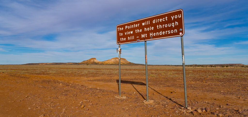
As we continued on through the afternoon, hills became more frequent, and we pulled over at this bizarre sign directing us to the ‘Hole through Mount Henderson’. There is a walk up to a lookout up on top of this, but the sun was getting low in the sky and we still had to reach Windorah for the night.
Interesting sign at the side of the road…Following the arrow you can see an eroded window through the hill
It was at this point the single track of tarmac became continuous, and we knew it wasn’t far to Windorah. There we pulled up on a field behind the pub, donating $10 to the Flying Doctors to park there the night.
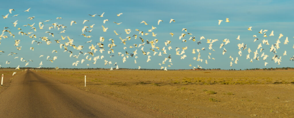
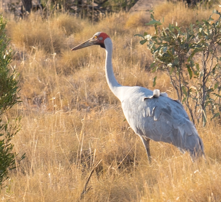
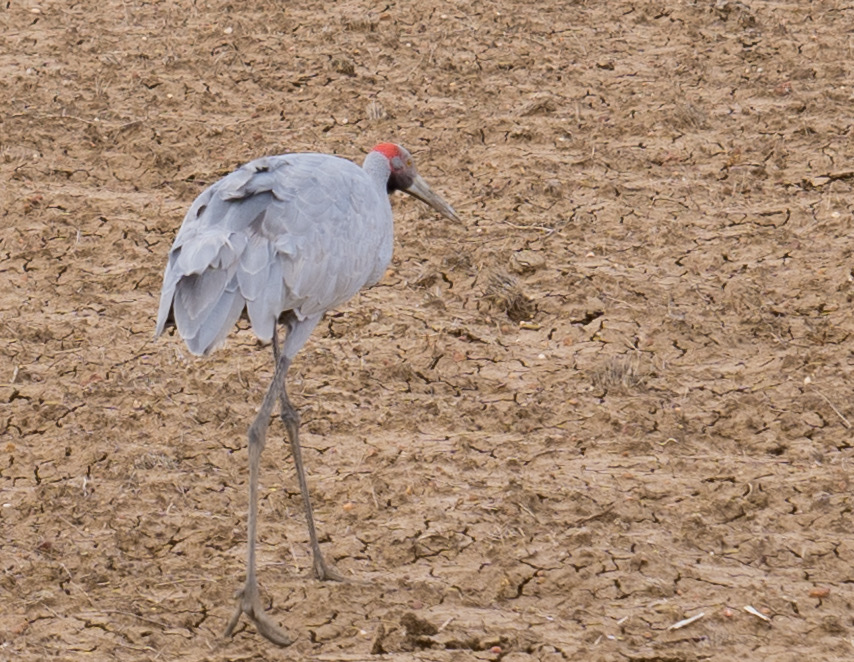
Blacktop making for a much smoother rideA huge flock of LIttle Corellas takes off from the side of the road and flies across in front of us – this is just a fifth of the flock!A Brolga (Australian Crane) strolling along the side of the road!
The following morning (Saturday) we pumped our tyres back up and gave the car and van a good wash with a high pressure hose just outside Windorah. We know it is going to get dusty again, but hopefully slightly less than the past couple of days have been.
We actually passed through Windorah and Cooper Creek when we very first started our big trip – four years ago in 2017! We reflected on how much more comfortable we are now travelling, feeling less stress towing and parking up. We have learned a lot in that time.
Cattle mustering as we leave WindorahAnother Brolga strutting across the dry mud, roadside…
The landscape started to change as we progressed, the small drought tolerant shrubs changing to small trees, then larger trees, paddocks full of dry grasses and more undulating hills on the horizon. We called in for a lunchtime break at a rest area beside a creek (with actual water in it!) I had read was good for spotting birds. It gave us a chance to stretch our legs and think about something other than driving. We saw quite a number of birds, including flocks of budgerigars flying past, Mallee Ringneck Parrots, a White-necked Heron and more.
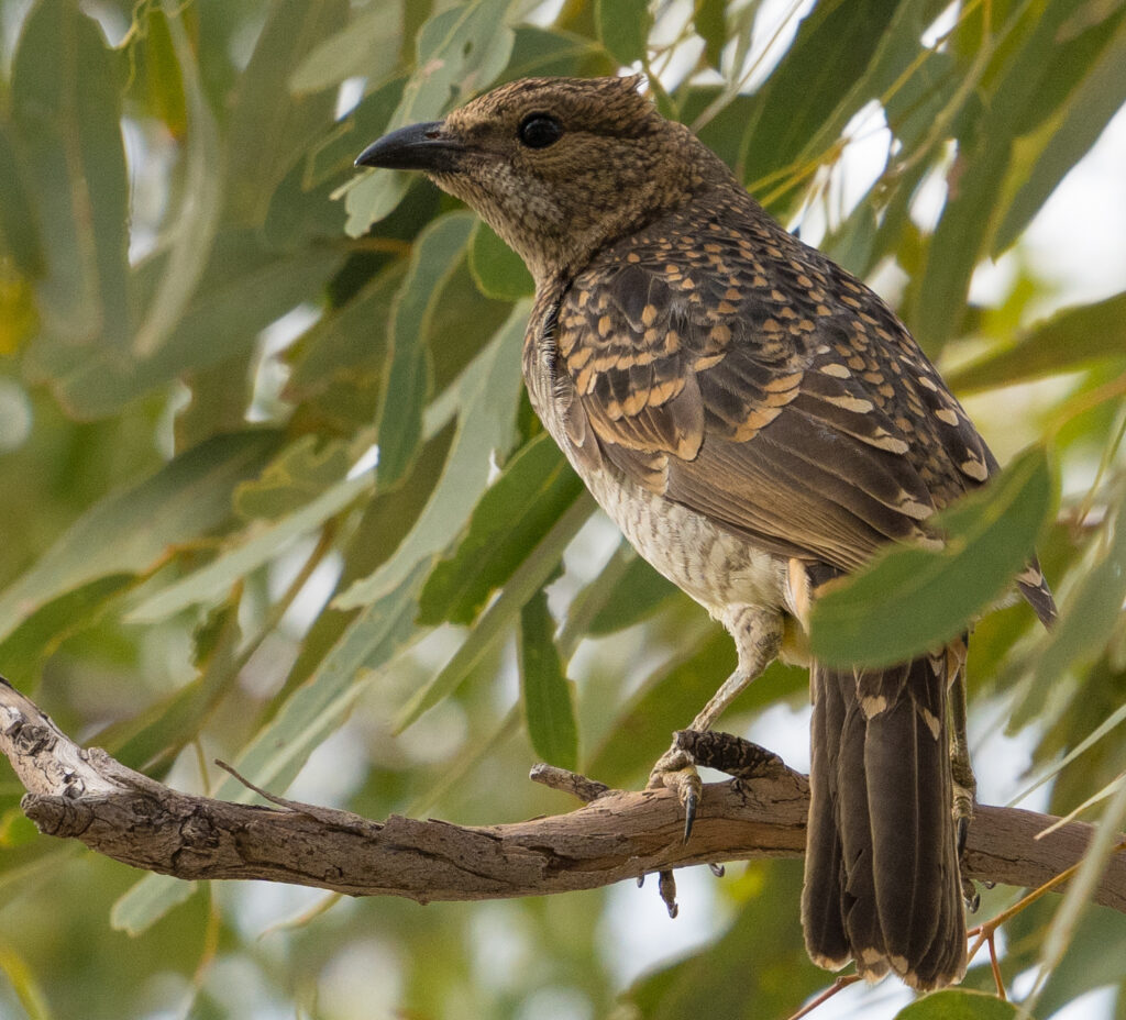
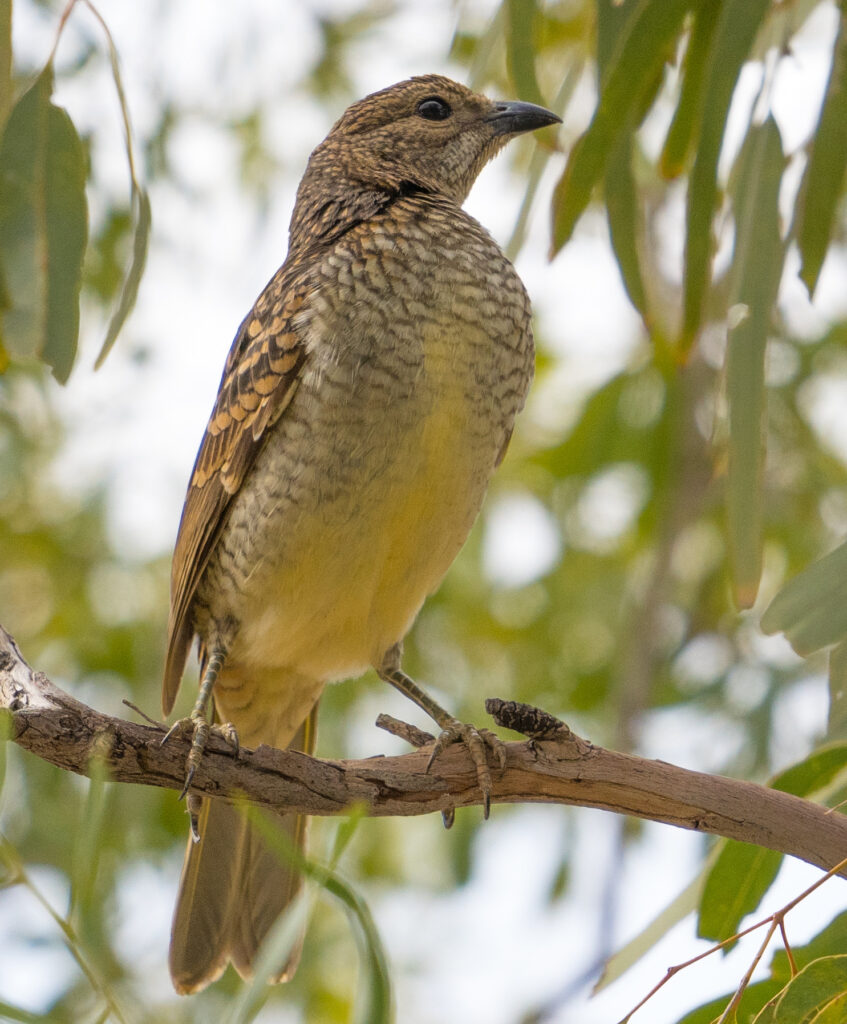
A Spotted Bowerbird – the males make a sculptural bower on the ground and adorn it with white items – mostly shells and bones, but anything else they can find is added too.Spotted BowerbirdWhite-plumed Honeyeaters
Another roadside rest area just outside the small town of Quilpie was our camp for the night.
The journey continued on Sunday morning, with just a few hours’ driving this time to our destination of Charleville. We stopped at a ‘Ghost town’ called Cooladie for lunch on our way over, which gave a chance for some more bird spotting before we settled in for an afternoon of washing.
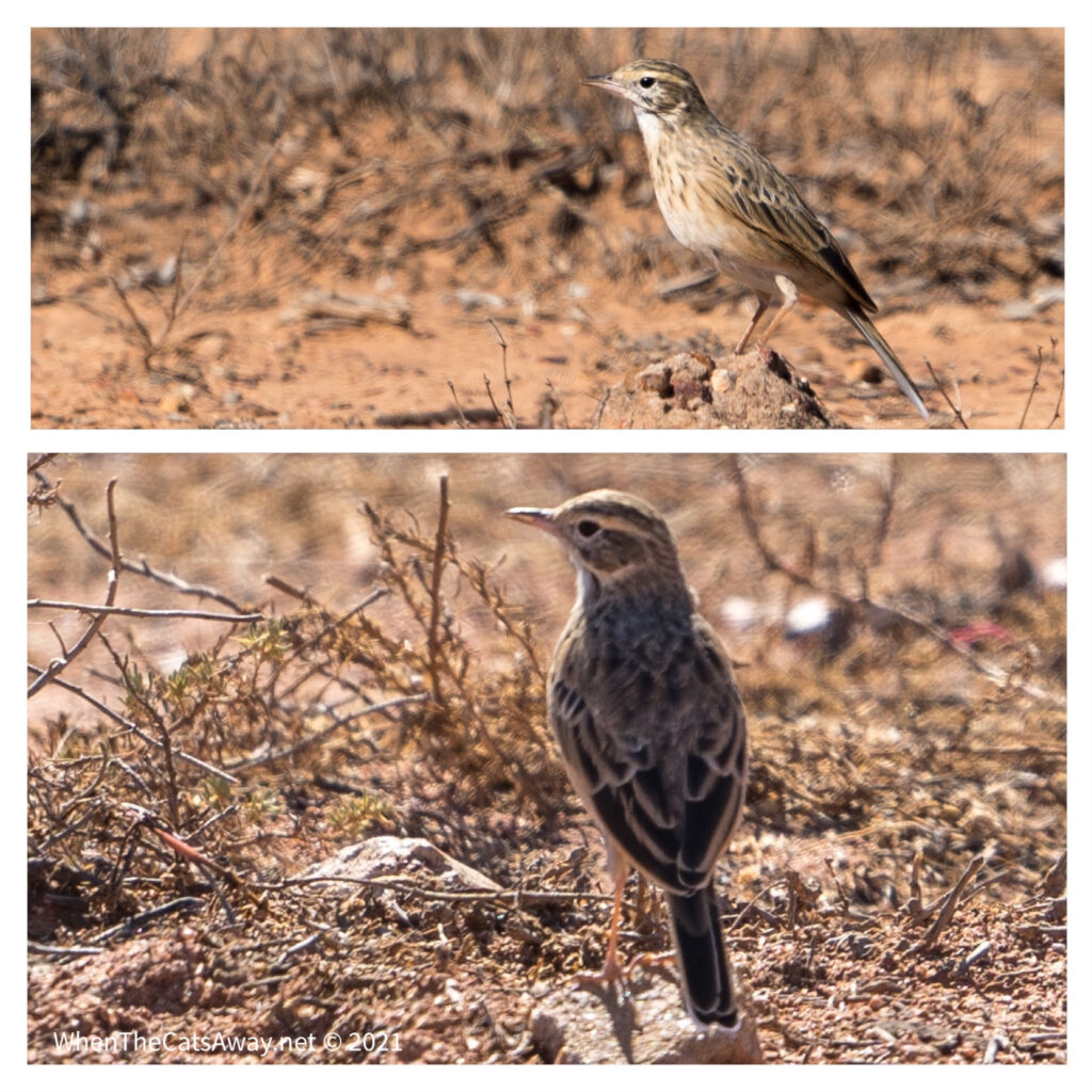
White-winged Fairy-wren – only the male has white wings and is electric blue – he was quite shy and hard to photograph, but she was curious and had a great photo session 🤍An Australasian Pipit – running around in the grasses
Cooladdi was originally a railhead for the local pastoral community. At one time, Cooladdi had a school, post office, and police station with a population of about 270 people. As the railway line extended further west, Cooladdi’s role and population declined. There is little evidence of a town (let alone a ghost!) today, no more than a few wooden floors and a cairn marking the town centre.
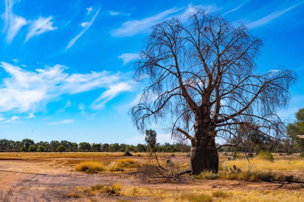
A Queensland Bottle Tree was once probably somebody’s pride and joy
It was only a short while further to our destination for the coming few days, Charleville.
Charleville is a small town located on the Warrego River. Its traditional First Nation custodians are the Bidjara People who historically lived all along the river banks. These people are still an important part of the Charleville society. As of 1980 the Bidjara language was almost extinct, with only 20 elders speaking it in communities along the length of the river. It has now been revitalised and is now being taught in schools.
The settlement built up during the mid 1800s as a service centre for pastoralists across this region. While slightly smaller these days it is no less important, with its hospital serving as the primary medical centre for the whole region. If you get sick in Birdsville, a 2-3 day drive away, it is likely you will be flown to Charleville for your treatment via the Royal Flying Doctor Service. This service is absolutely essential for residents living in remote areas and means we no longer see the high death rates seen prior to the launch of the service in 1917.
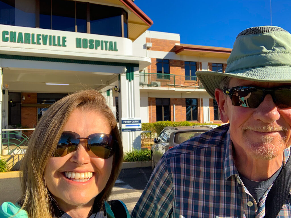
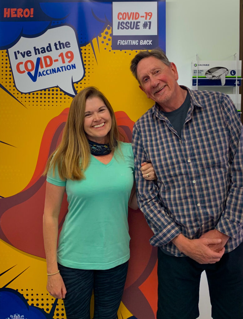
After a morning exploring the small town, the hospital was where Mark and I found ourselves on Monday afternoon, for our pre-booked Covid-19 first vaccination. We are very keen to continue our travels around the world and believe being vaccinated is our first step to being able to do this.
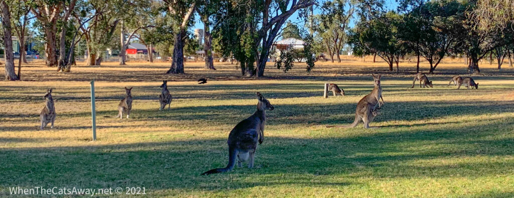
Smiling faces outside a hospital – now that is a rare thing!We both had the Astrazeneca vaccine – next one mid August…I wonder where we will be then?The hospital grounds are home to a mob of kangaroos – enough to make any unwell person smile!
We went out to dinner at the local Thai restaurant (with a Vietnamese chef!) to celebrate.
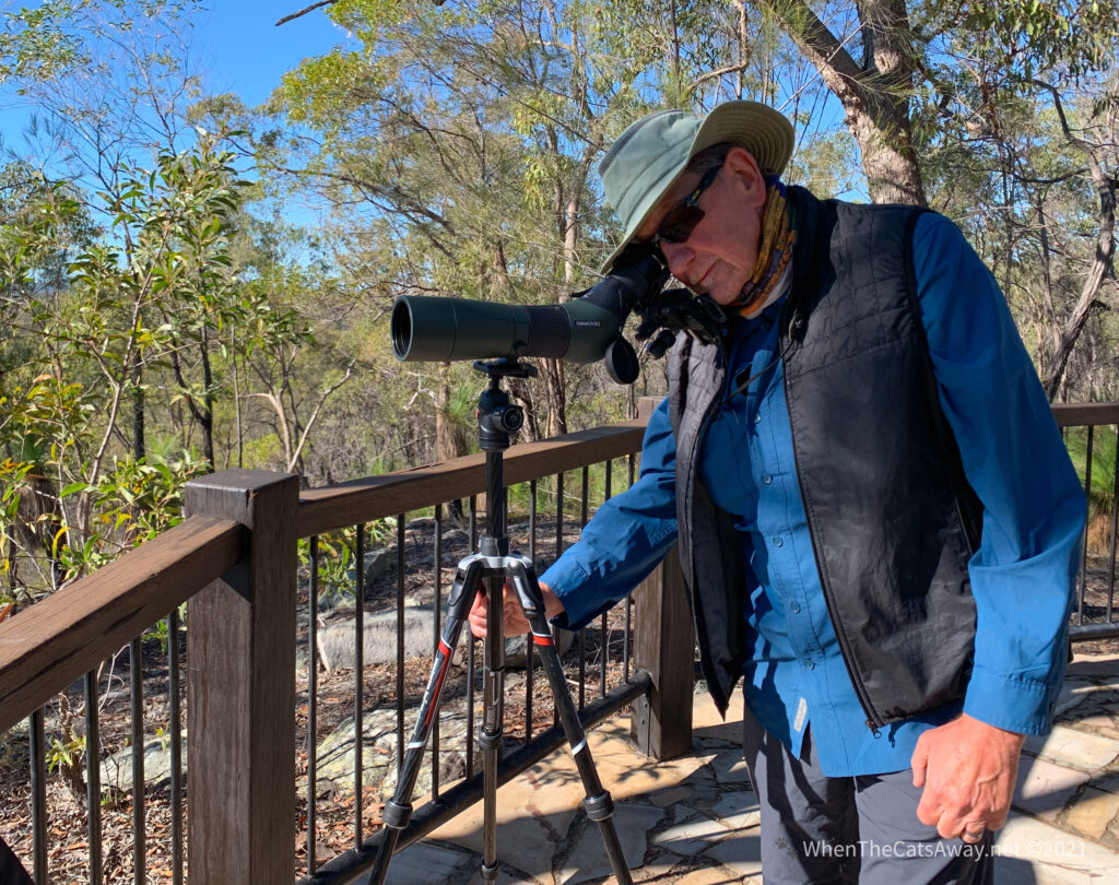
We have spent some time exploring the various parklands and riverside walks for birds of course. Mark has a new tool in his bird watching kit – a spotting scope. It is like a telescope you put on a tripod and can see birds in incredible clarity up to about half a kilometre away. It is like watching a live nature documentary unfold in front of your eyes, just amazing. He has bought an adapter to allow him to take photographs on his phone though the scope. I am certain he will soon be complementing my camera photography.
On the Warrego River Walk we felt very privileged to see a pair of Pale-headed Rosellas feeding their hungry family – just metres from people out for their afternoon stroll or jog. A few trees back I heard a call I recognised from my childhood, and up in the trees behind us was a flock of Cockatiels, their yellow faces and rosy red cheeks looking so familiar. I much prefer to see them flying through the treetops than captive in a cage.
The Warrego River (complete with Galahs having an evening drink!)We watch the Galahs take turns at the bottom of the branchA Pale-headed Corella and its three hungry babies. These were in a hollow branch right above a busy walking path. Just look at those huge orange beaks!This is the female – we watched as the parents flew off to eat seeds in the meadows near the river, before returning to regurgitate them as pulp for their chicks. Their chicks were rarely alone with both parents working in quick rotationPale-headed Rosellas hang out in pairs rather than flocksA pair of Pale-headed RosellasCockatiel femaleA pair of male Cockatiels – Cockatiels fly in huge noisy flocks, landing high up in the top of trees to call out. Another bird often seen as a pet in a cage but far lovelier to see flying free
Another outing near the Charleville Cemetary had us observing Apostlebirds, White-browed Babblers, Whistling Kites, Galahs and more.
Whistling KitesSulphur Crested Cockatoos flying overheadA Whistling Kite – big raptors!Grey ButcherbirdAn Apostlebird – these gregarious birds hang out in gangs (like the 12 Apostles!) which run around mostly on the ground, and seem to love campgrounds for their rich pickings.
A novelty for us was the change in the weather. Just for one day we had rain! I know our friends and family in the UK will scorn us, but we do appreciate the brief change. With the low humidity and dry air comes dry skin and high levels of static. I am a little tired of getting electric shocks every time I turn off a light or get out of the car! The increased humidity definitely helped reduce that for a short while.
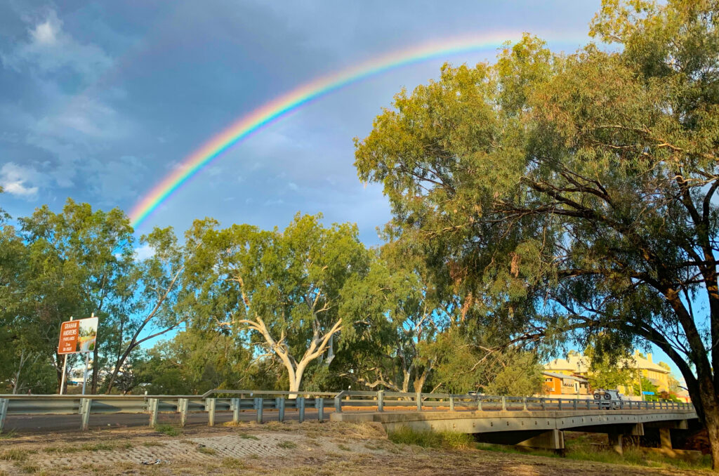
And with a little rain comes a rainbow – a symbol of hope in so many cultures
Other than the river, there is little surface water around, so the lakes at the Charleville Water-treatment Works attract a lot of birds. On the advice of a lady at the Information Centre we popped over for a look. We found five or so large patches of water surrounded by reeds and full of water birds.
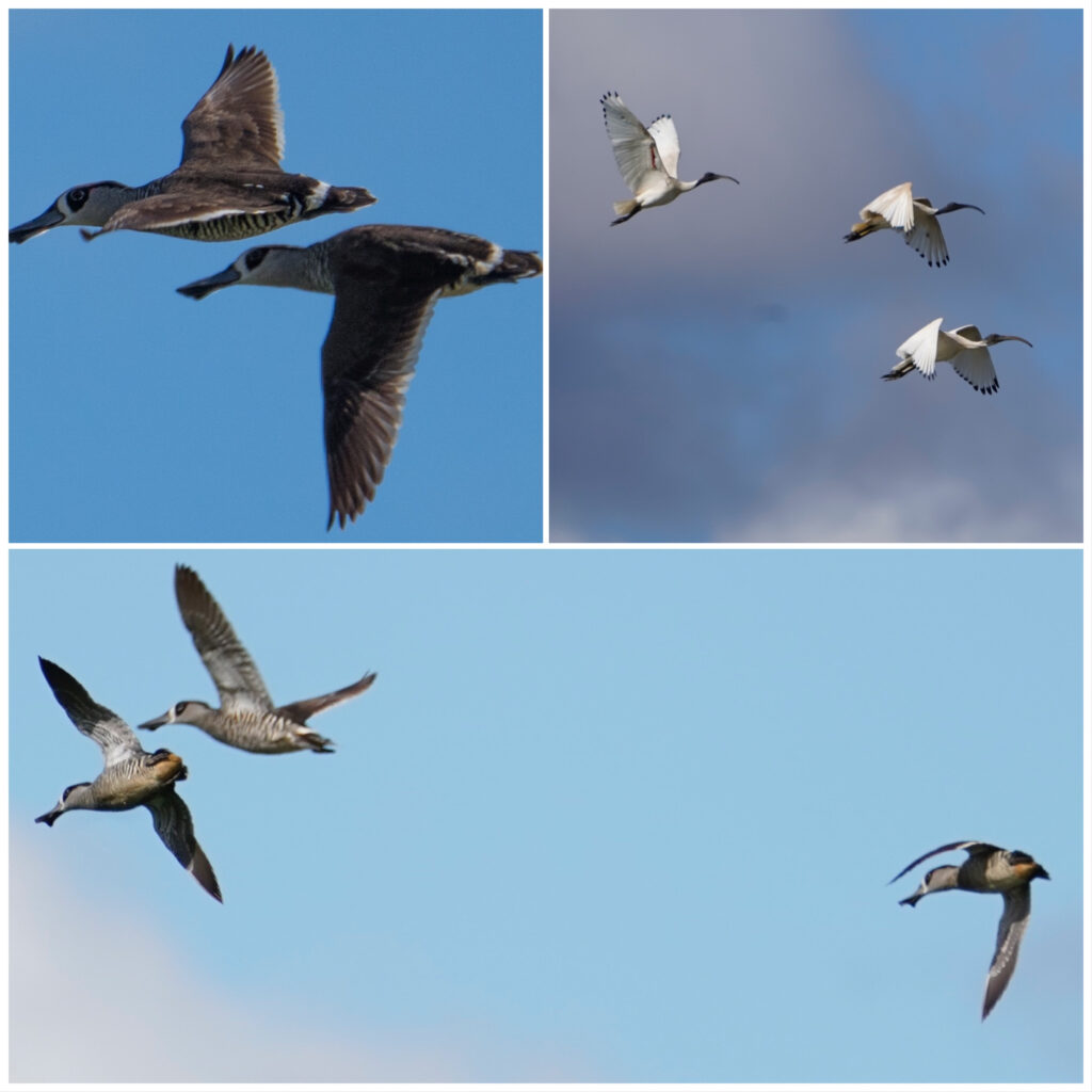
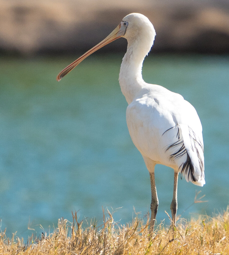
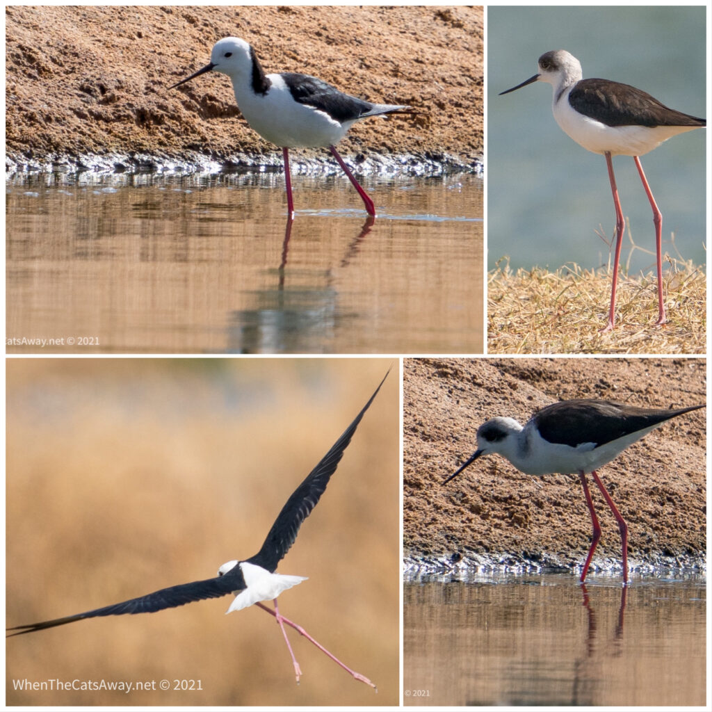
The birds were quite skittery, clearly not used to seeing people. A large flock of zebra-patterned ducks took flight as we arrived. We later learned these are Pink-eared ducks (if you get close enough, you can see they have pink ears just behind their eye), and live only in Australia. Ibis (commonly seen with their long beaks in city rubbish bins!) were here too, as well as Pied Stilts, Spoonbills, Pacific Black and Grey Teal ducks. We had a good look around before leaving them back in peace.
Pink-eared Ducks (have zebra-print feathers and fang-like beaks!) and Ibis flying pastYellow SpoonbillA pair of Pied Stilts with their ridiculously long legs. We watched this pair for a while, as they walked along the water’s edge looking for insects and larvae, their legs barely causing a rippleTiger Milkweed Butteffly
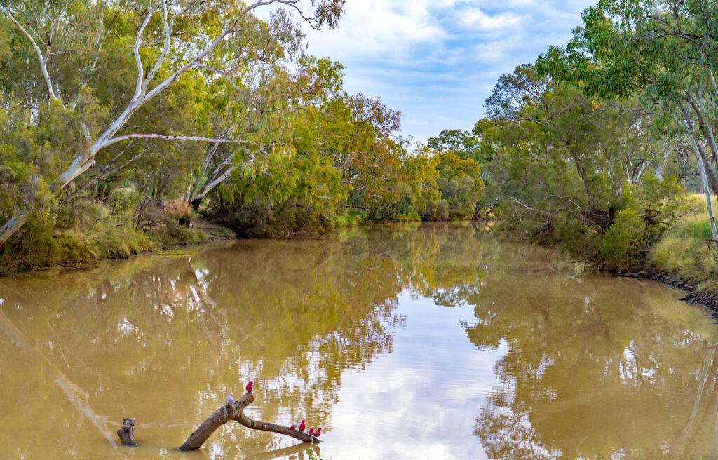
Meanwhile, a couple of walks down to the quieter end of the river near where we are staying yielded some new and old birds for us. Just walking in the forest, listening to the wind and the chatter of our multitude of feathered friends is so peaceful. We ended up walking 10km without realising!
The Warrego River becomes less navigable just a short way up, with billabongs broken up by sandbanks. Far fewer people up this way, and more attractive to birdsAustralian Wood Ducks (with the spotty breasts), Pacific Black Duck and an Azure Kingfisher (a long way away!)A White-faced Heron high up on a branch overlooking the waterBrown Tree-creeper – perfectly disguised as they hunt for grubs in rotten wood A female Galah – the females have pink eyes, while the males have blackA White-plumed honeyeater flying down for a drink. These are usually seen up in the tree’s canopy, drinking from the nectar, consuming berries and seeds and catching insects and larvaeA female White-winged Fairy-wren searching for insectsFlocks of tiny Plum-headed Finches fly out of the long grasses and up overhead like fluttering, chattering butterflies, so hard to capture a glimpse ofA pair of Red-rumped Parrots fly down for an evening drink
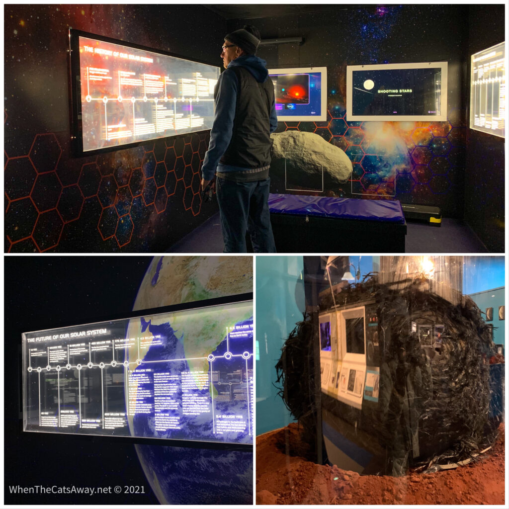
After a pub dinner, we went out to Charleville’sCosmos Centre. We had booked on an hour’s stargazing session with some powerful telescopes and a guide to explain some of the sights we were seeing. We wrapped up warm with our beanies and thick coats against the 10 degrees temperatures, but had a perfectly clear, starlit night with no moon. Ideal for seeing the Milky Way and constellations. It was an interesting evening and a different way to see the stars without sitting beside a warm fire…we were pleased to warm up once the show was over.
Some of the free information available at the centre, the largest observatory and planetarium in Queensland. Bottom right, the remains of a satellite which fell from space, landing in the desert just north of Charleville. It looks like a giant burnt sphere covered in black raven feathers!
We had a lovely week, taking the time to do our cleaning and recover from the relative trauma of our disruptions on the Birdsville Track and in Birdsville. But now we are ready to farewell Charleville (or Barky-ville as we have renamed it, due to the multitude of noisy dogs here) and continue on our adventure heading east.
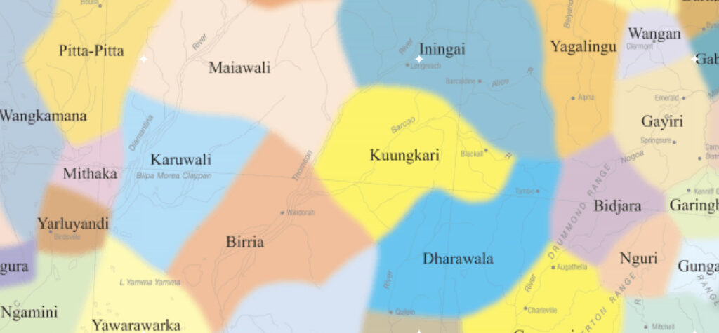
We would like to acknowledge and thank the Yarlayandi, Karnwali, Birria, Kuungkari and Bidjara People through whose traditional lands we travelled and spent time the past few days.
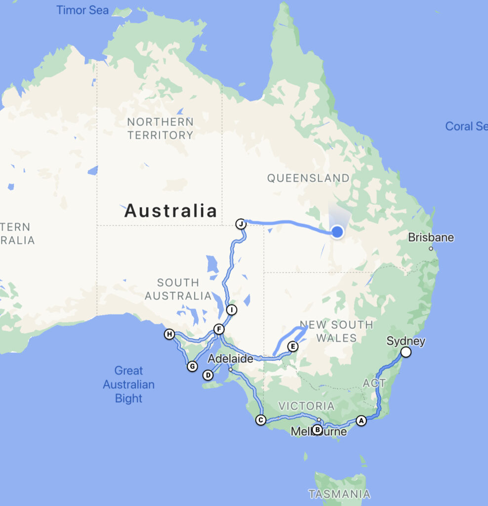
Traditional custodians – a great map at: https://aiatsis.gov.au/explore/map-indigenous-australia Our journey over the past six months since leaving Sydney in early December 2020
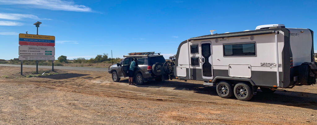
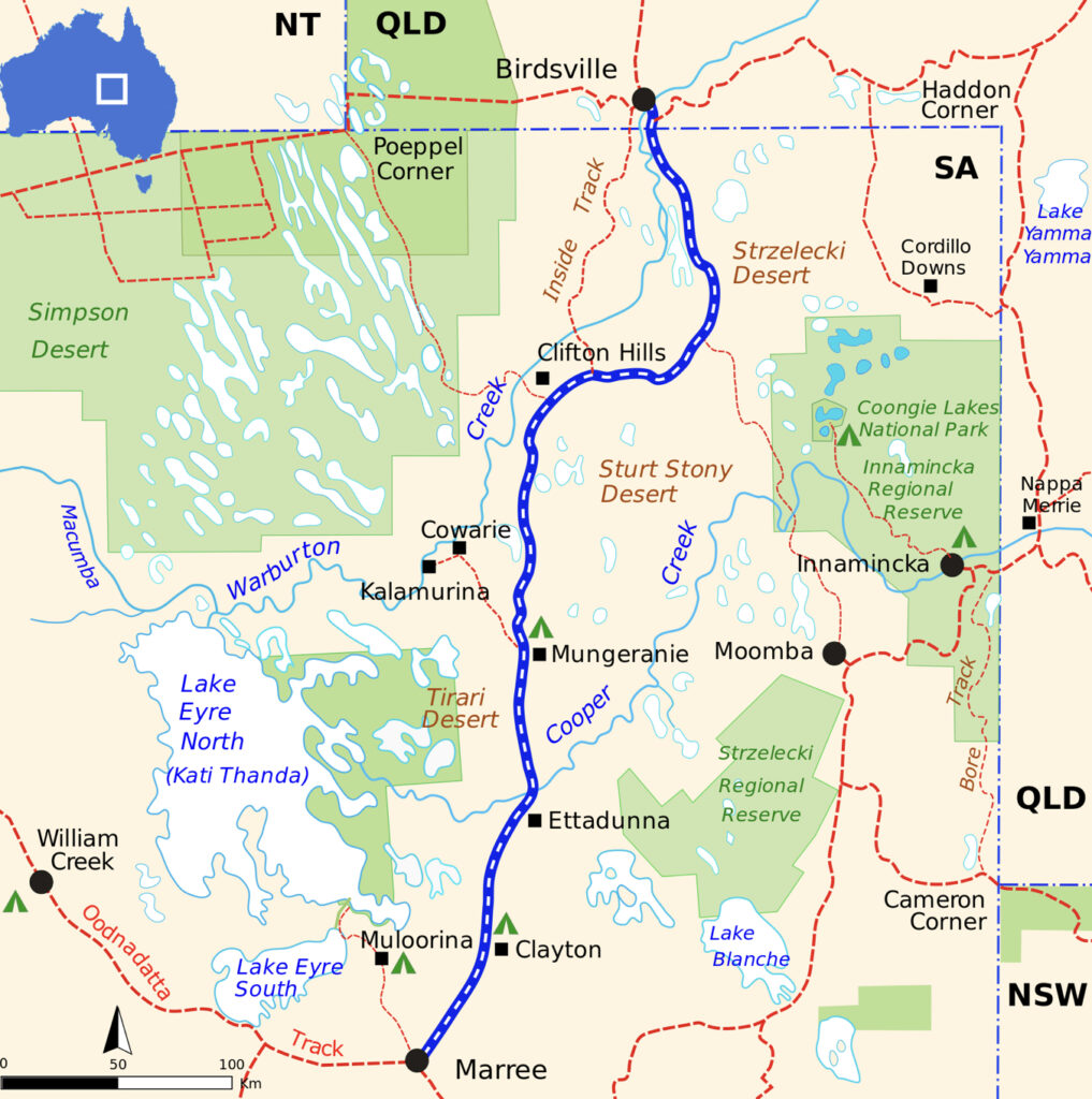
Location: Marree to Mungeranie, Birdsville Track, South Australia
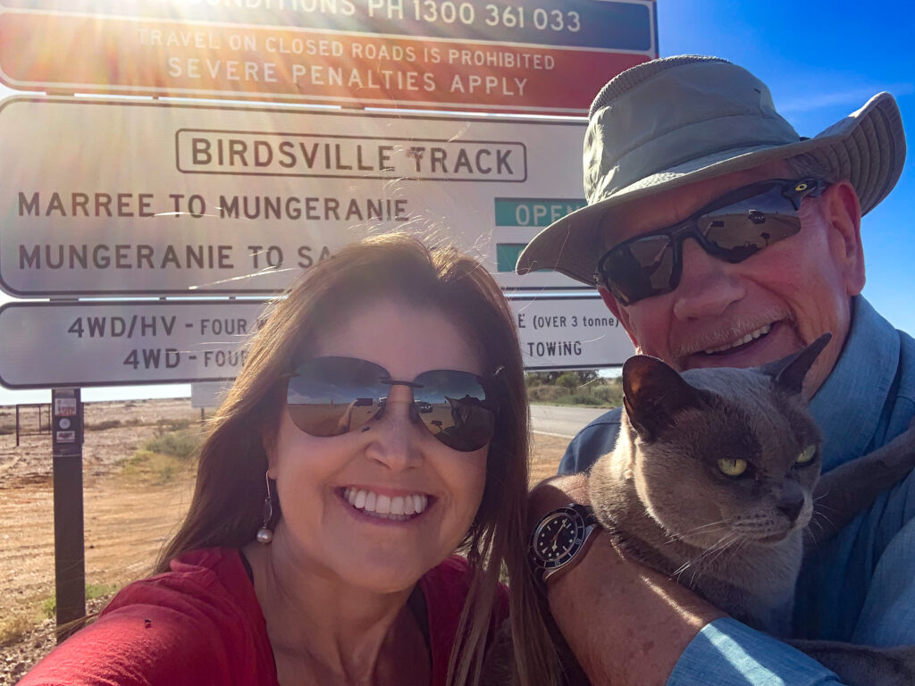
We set off from Marree on a beautiful bright Sunday morning. The track from Marree has been recently graded, and apart from one or two deep sandy bits and the occasional cattle grid, was smooth driving. Even Tassie managed to get some sleep.
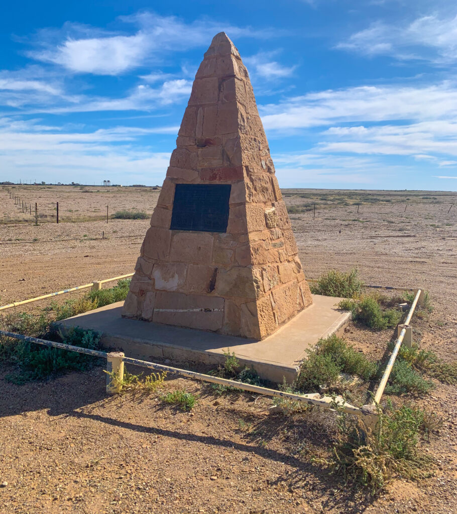
Family photo as we set offCairn marker at the beginning of the track. The plaque reads: « The Birdsville Track – Pioneers brought their sheep and cattle to the vastness of these Aboriginal Lands before Marree was established. Drovers, Cameleers, Teamsters and Mailmen battled the Track making development and even survival possible. Through their deeds the Track became an Australian legend. This Cairn honours these People of the Track and commemorates the centenary of Marree. 1883-1983
The Birdsville Track follows an ancient Aboriginal trading route which links several water holes. The route was then made into a track for mustering sheep and cattle to Adelaide. These days most of the sheep stations have changed to cattle stations, cows being a little more robust and able to protect their new born calves from dingos and wild dogs.
The Birdsville Track is 517 km long and usually takes 2 days to complete
The route traverses three deserts; the Strzelecki, Sturt Stony Desert and Tirari Desert and as you would expect, the land is incredibly dry with no more than 10cm of rain falling per year. The survival of people, flora and fauna is predominantly thanks to the Great Artesian Basin – a huge underground freshwater reservoir which stretches more than 1.7million square kilometres. This huge water source is the world’s largest subterranean water basin and could fill Sydney Harbour 133,000 times.
Bores (a hole, often using a windmill to draw up the water) have been sunk into this reservoir, with approximately one every 40km along the track. In a few areas there are natural springs and seeps which form puddles and small wetland areas, essential for the survival of birds and mammals in this area. When the water emerges the temperature ranges from 30-100 degrees centigrade.
This area is closed to travellers in the summer months, when temperatures have been measured to reach 49.5 degrees centigrade in the shade. Phew! Temperatures are only getting hotter, with Birdsville, our next destination, breaking records only last year with more than 10 days on the trot over 45 degrees centigrade – and that was November, which is still classified as spring!
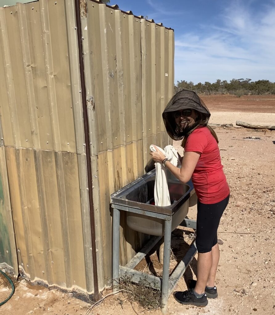
We pulled over for lunch at one of these bore sites, an area where the water comes out warm. An enterprising station owner had put in a large plastic basin and a huge tap, calling it an Artesian bath. As we arrived there were several people sat in the bath wearing fly nets, enjoying the warm water. I meanwhile had less glamorous tasks to do – using the naturally warm water to do some hand washing!
Hand washing in the desert!
Fly nets are absolutely essential out here – you cannot leave your car without looking like an odd bee-keeper, but without it you would have flies in literally every orafice. They are incredibly annoying. Without insect repellant your arms and legs are black with little insects. The only thing in their favour is that they don’t bite, just annoy!
After lunch we had a look around the nearby wetland area to see what bird life was about. I was very excited to see a lone Budgie munching on seeds. He was very friendly and sat on a low branch chatting to me and seemed quite tame (more photos on our Instagram feed).
Black-faced Woodswallow, White-plumed Honeyeater and Budgerigar
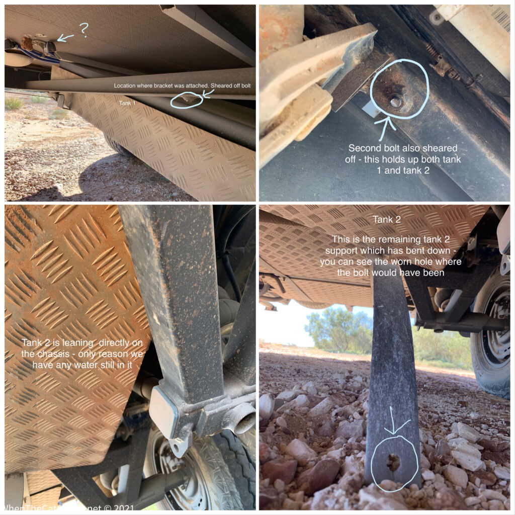
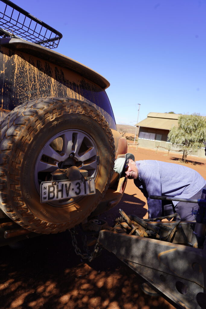
We continued on our way, taking a look at a couple of other locations before deciding to stop for the evening at the Mungeranie Hotel. After checking in at the bar and paying our $20 and were told to pick ourselves a spot along the tree line. We found ourselves a suitable space, and went to level up. It was at this stage I noticed an awful metallic scraping sound coming from underneath the caravan – never a good sign.
I looked and spotted one of our water tanks hanging down at an uncomfortable angle, with one of the two brackets completely missing. The second tank was hanging down and leaning on the wheel axel, one of its brackets hanging by a single bolt, the remainder scraping through the stones on the ground. Nightmare!
The damage to the underside of the van
It surprised us to see this, given the road surface had not been that bad at all. Talking to other caravanners, they weren’t surprised with many saying it just takes one rock to hit a bolt or for it to weaken over time due to vibrations. Either way, we were in the situation we were in and clearly could not continue.
The majority of the Birdsville Track has no mobile signal, and we suspected this would be the same. Yup, checking our Telstra phones, not a single bar. We went into the hotel to ask there and they let us know they had Optus signal. This was hopeful.
We are carrying two mi-fis with us (mobile wifi units), one of which has a UK Vodafone sim card, the remainder of a plan we had signed up to last year while travelling in England and Wales. It has free roaming in Australia, but to be honest, has been pretty useless…until now. We turned it on and amazingly, full signal! Hurrah! We were able to make phone calls, do internet searches, and share our situation with fellow Zone owners on the Facebook group.
Over the next couple of days, our caravan insurance company (CIL) agreed to foot the bill for towing out our van and repairs to the brackets, and we had managed to book a guy called Blake to drive down from Birdsville to collect us.
Once all that was organised, we had some time to try and enjoy our surroundings. It was fly-central so the insect repellant and fly nets were essential ingredients to being outside, but we managed to have a look around. Mungeranie Hotel is located beside a small wetland, and being surrounded by arid lands, the area is teeming with birds, with flocks of Zebra finches and Budgerigars frequently seen flying from the trees and bushes.
We saw a lot of water birds too, many first time viewings for us.
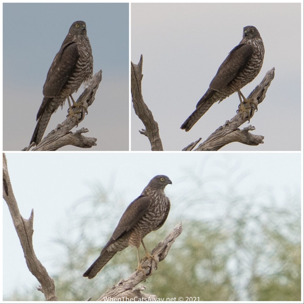
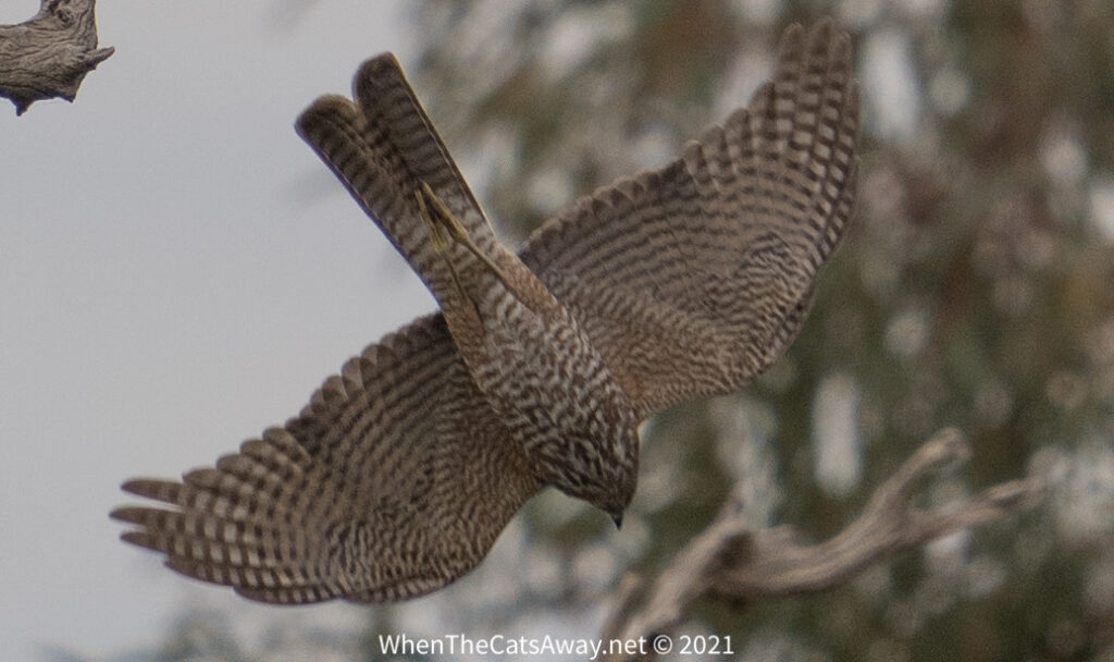
Black-fronted Dotterels poking around in the mud for larvae and aquatic insectsThese are Black-tailed Native Hens and are really well adapted to living in arid lands. They have a sixth sense enabling them to find a pool of water in a desert – nobody is quite sure how they do it.This Willie-wagtail Flycatcher should be obese with the number of flies on offer here!A Lesser-Wanderer Butterfly – only tend to live in semi-arid areas and tropicsMasked WoodswallowHuge flocks of Little Corellas nibbling flowers on the treesA White-faced Heron up on top of a treeCollared SparrowhawkLook at that gorgeous colouring! Collared Sparrowhawks are partial to a bit of Budgerigar which explains why I couldn’t spot any of those around!
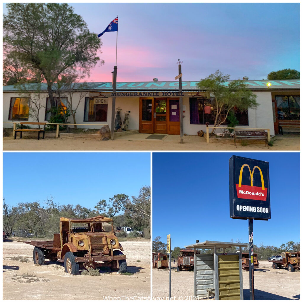
Of course it was impossible to be living 200 metres from a pub and not venture in. The Mungeranie Hotel is typical of Australian outback pubs – absolutely chock full of quirky character. The exterior is quite neatly kept, with a row of rusty old trucks on parade as you arrive up the driveway. Then there are the traffic lights and the ‘McDonald’s opening soon’ sign to give you a chuckle.
There has been a hotel at this location since the mid 1800s when the road was established as a stock route. At one stage there were also stables, a blacksmith, store and a police station, and drovers would let their cattle drink at the waterhole here. Everything was closed by the 1920s and this hotel as it stands was not licensed again until 1989. Today it is a roadhouse, offering very basic rooms, fuel, hot dinners and drinks, as well as space for camping.
Welcome to Mungerannie Station
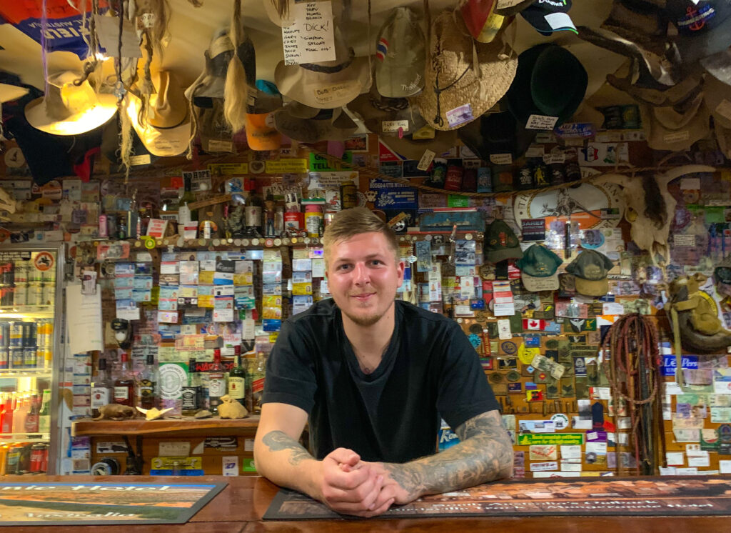
Once inside the pub, the walls and ceilings are literally covered in souvenirs of previous visitors. Hats are the main decor, then there are the strange dangling pieces of hair, which we then learn are rats-tails from old mullet hairstyles and beards!! A little bit gross, and very bizarre.
All the drinks are bottled, nothing on tap given the distance from anywhere. They ran out of red wine while we were there (not our fault) and I had the last bottle of soda water with my vodka, followed by the last nip of Jamison’s Whisky!
Patient service with a smile and a story
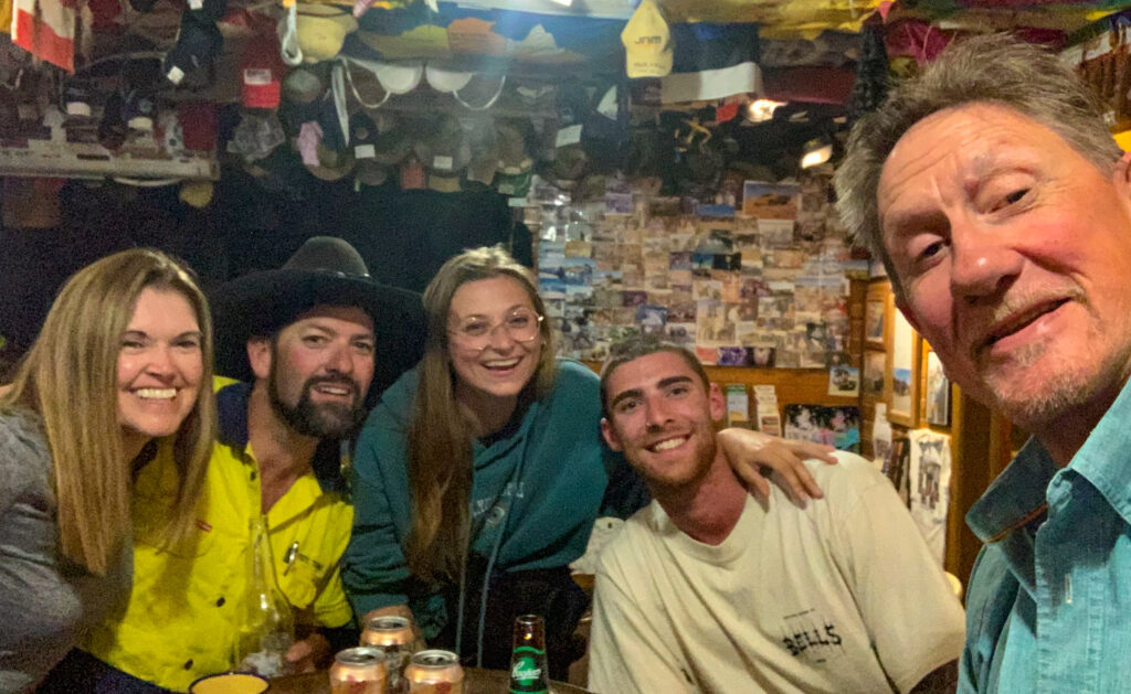
On our second night, Mr A had got chatting to a young couple on their way over to the east coast of Australia to work on a mango farm. We invited them to join us at the pub for some drinks, brought our own music and soon a party was happening. We were joined by a road-train driver who had pulled up for the night after driving 1,200km that day (he insisted no drugs were involved). We had a great night, ending at 1am when the bar started running out of drinks we wanted!
Drinking, laughter, singing and dancing with two travellers from Western Australia and a road-train driver!
The following day we got ready for Blake’s arrival with great anticipation. Although we had made the most of our couple of days at the Mungeranie Hotel, we were not keen to make it our forever home!
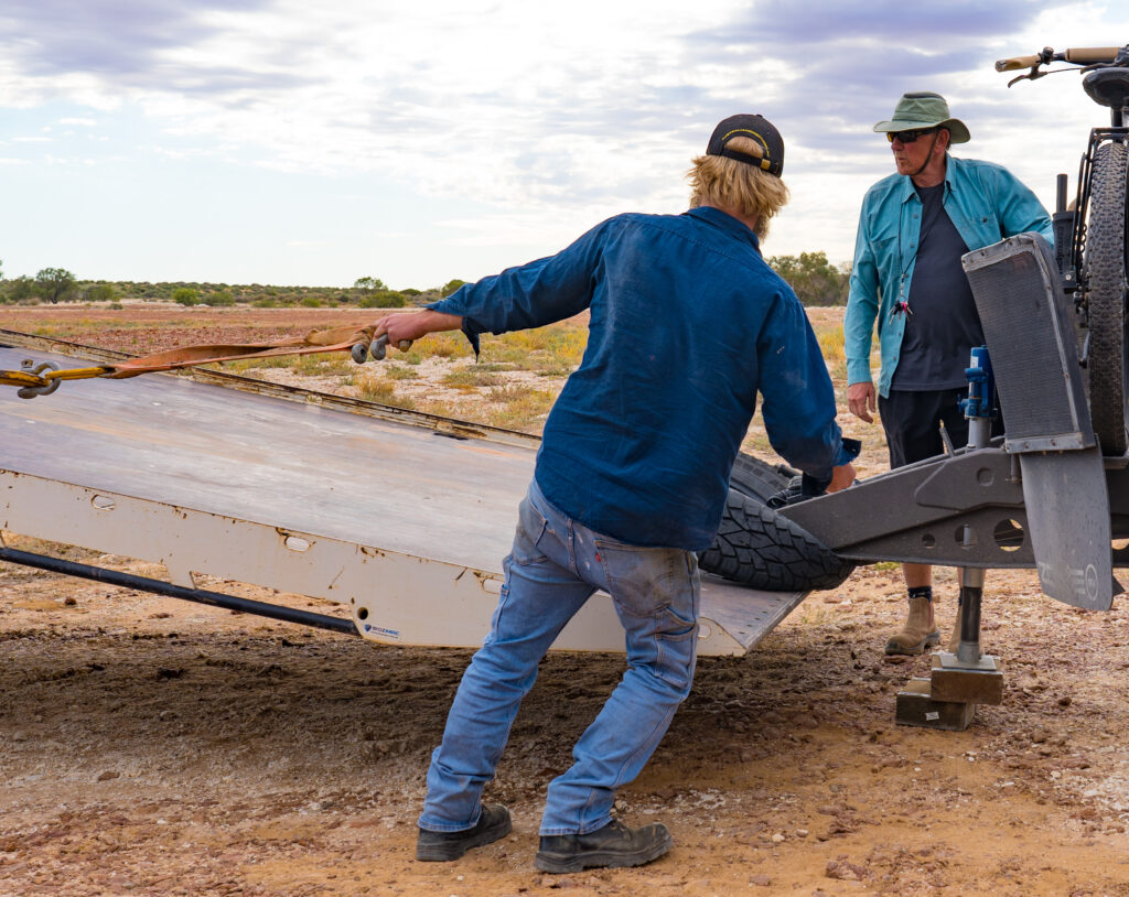
To our relief he finally arrived around 3pm, his drive down the rough track made all the slower by the long empty truck. It had taken him 7 hours in total to reach us, doing a couple of jobs on the way. And after loading our home, he was going to have to do the same trip again in reverse. We looked on in awe of this tenacity and attitude, and hoped our Zone would make it to Birdsville without further misadventure.
Mr A looking on nervously as Blake gets ready to load the vanThe truck from the Birdsville Roadhouse ready to give out Zone a lift
We left Blake to continue with the finishing touches, knowing we would be much faster on the track than him. We farewelled our faithful home and looked forward to seeing it tomorrow in Queensland, our fourth state of the trip.
We would like to thank and acknowledge the Yawarawarrka and Ngamini First Nation people, throughout whose traditional land we travelled on this journey.
Location: Rawnsley Station, Ikara Flinders Ranges, South Australia
We reluctantly pulled away from Quorn, wishing we had booked for longer and explored the region around this little friendly town in more depth, but unfortunately had little choice. Firstly, the campsite in Quorn was fully booked for the upcoming week, and secondly we had booked in to stay at Rawnsley Station, on the border of the Ikara-Flinders Ranges National Park.
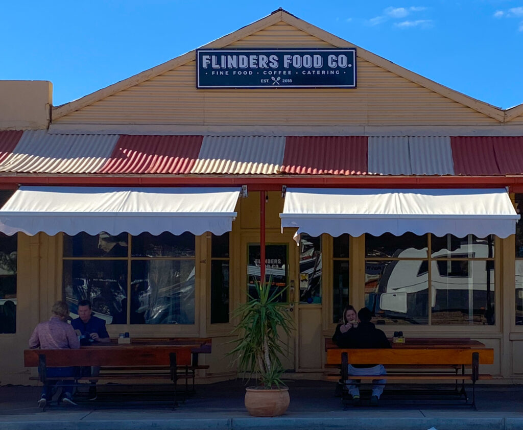
A short drive from Quorn is the little settlement of Hawker. It has an art gallery that is quite well known for featuring some of the region’s most prominent artists, but sadly that was closed on this Sunday morning. Fortunately for us though, the other key attraction, Flinders Food Co, a cafe serving excellent food, was open for business. We called on in and ordered some delicious lunch from the interesting menu – well deserving of its great reputation.
Fine food in an unexpected location
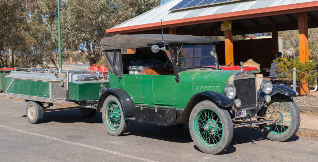
As we drove up towards our home for the next few days we noticed quite a few vintage cars towing camper trailers. Apparently they had just come down the Birdsville Track, the route we are intending to take over the next couple of weeks into southern Queensland. Seeing the skinny wheels, most of the vehicles without air conditioning, heating or electric windows, made us feel more comfortable that we won’t struggle too much on our trip north. Punctures will be our greatest fear – we have changed a few tyres in our years travelling Australia, and it’s hard work with these heavy chunky wheels! Our fingers are crossed our tyres stay inflated. Changing a vintage car tyre would be much simpler!
One of the vintage cars that had traversed the outback track – most of the drivers/enthusiasts are mechanics so do repairs on the go
Our destination was Rawnsley Park Station which was initially settled as a sheep station in the mid 1800s, originally part of Arkarba Station. Previous to this it was the domain of the Adnaymathanha Aboriginal people. Arkarba Station was split up , and in 1951 Rawnsley Park Station was purchased by Clem Smith and his family.
Rawnsley Park Station turned to tourism in 1968 to supplement its sheep business and has not looked back. It’s a pretty well set up operation, with many marked walking and mountain biking trails, and a short drive to the Ikara-Flinders Ranges national park. Scenic flights and helicopter trips offer another way to see the region. Mr A asked about the Aboriginal history, but nobody seemed to know anything.
A bit of online searching suggests that when the sheep station was initially settled there was conflict between the First Nation Adnaymathanha people and the white farmers. Aboriginal people were shot in retribution for hunting sheep to feed their families.
I liken the situation to aliens landing and taking over our water supplies, farms cathedrals, theatres, opera houses and supermarkets and restricting our access to them all. Thirsty and hungry we are then driven to trying to dash in and get some food, and are killed for our trouble. A pretty nasty situation, and one that completely changed the way First Nations people had to live their lives. They gradually adapted to become workers on the stations, stepping away from thousands of years of sustainable living.
Today, the Adnaymathanha people are integral in their work as rangers in the national park, helping to restore the land to its former sustainable state. We thank and acknowledge these communities and their ancestors for their connection to these lands for thousands of years.
The rocky walls tower over us as we start our hike
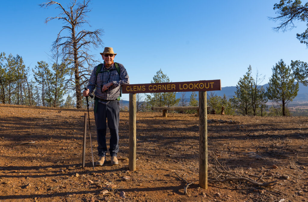
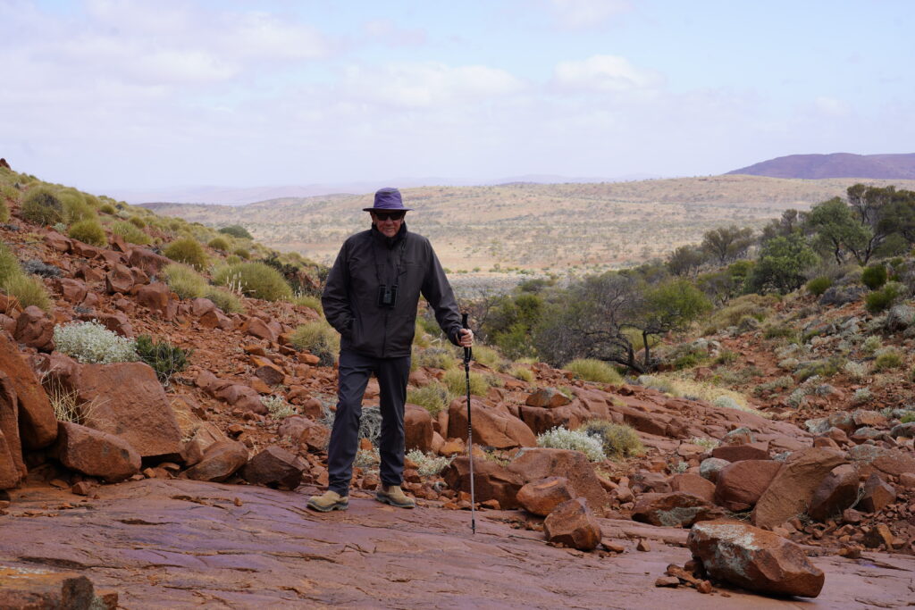
Once we had settled into our site we pulled on our boots and set off for an afternoon hike. Rawnsley Park Station has a number of signed hikes ranging from 2 to 12 kilometres in length. We picked a 6.5km one named after one of the early station owners, Clem’s Corner. Clem is also the name of Mark’s fondly remembered late father, so the name was particularly poignant.
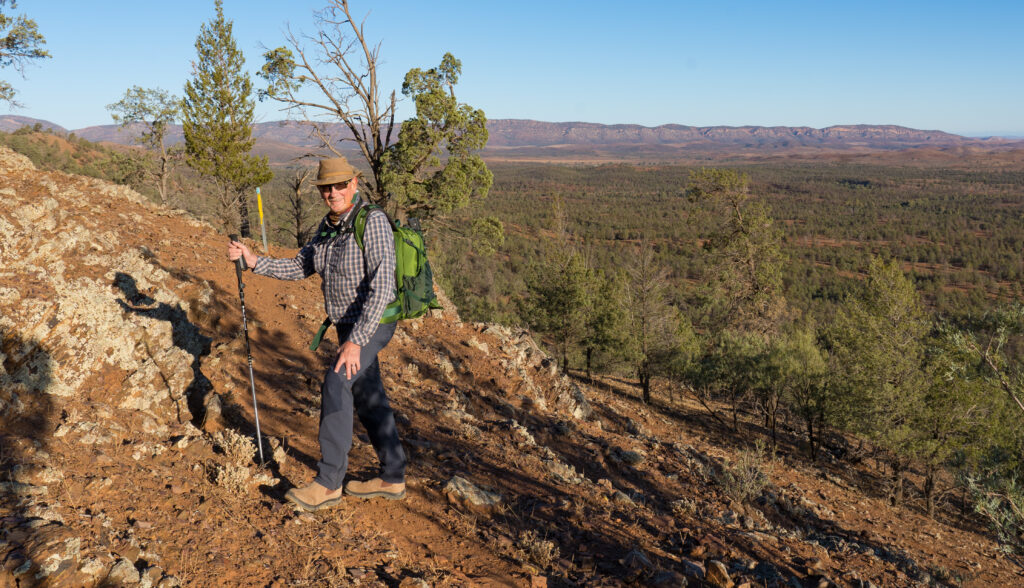
Remembering Clem Anderson at Clem’s CornerA narrow rocky path picks along the hillside – you have to stop watching your feet to enjoy the view
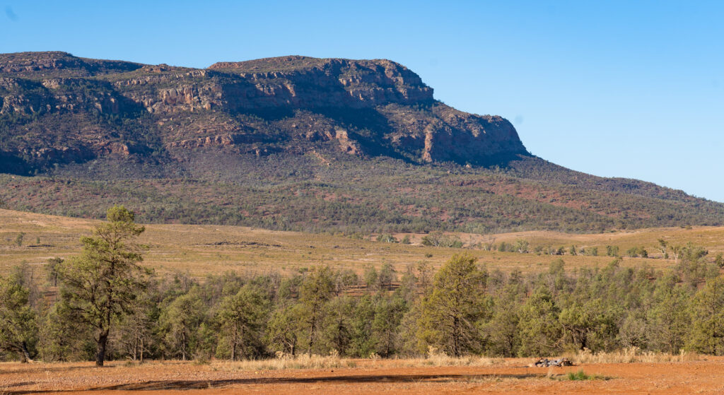
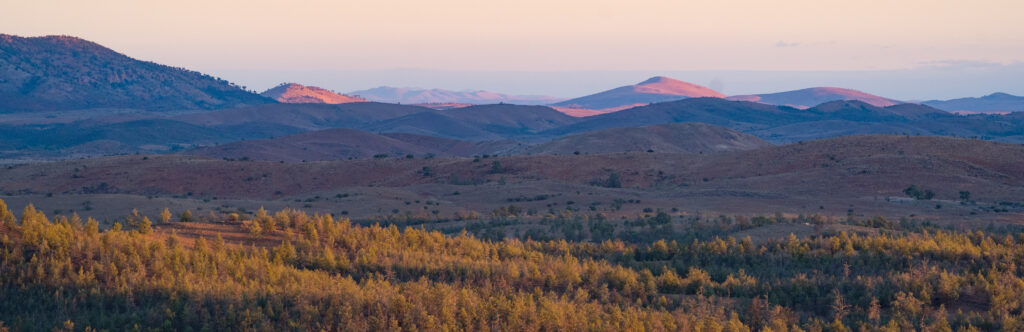
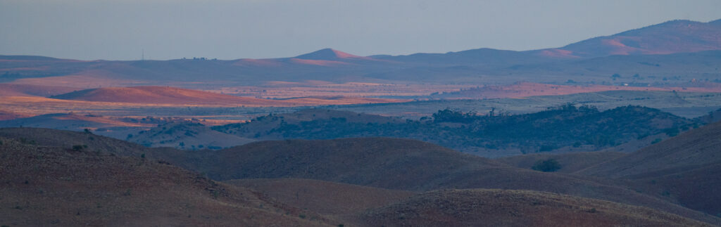
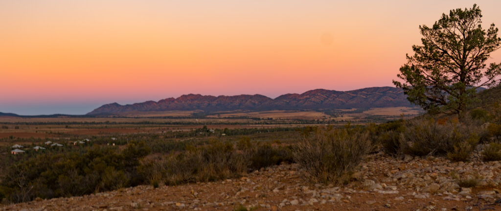
We are approaching the end of autumn now, so the sun is setting earlier and especially where there are mountains (hills) towering above you. Rawnsley Bluff is the highest peak on the property at 943 metres (3093 ft). As we reached the lookout the light was incredible – the shadows long across the land and the colours incredibly vivid, the pinks, blues, mauves, purples and oranges a feast for the eyes.
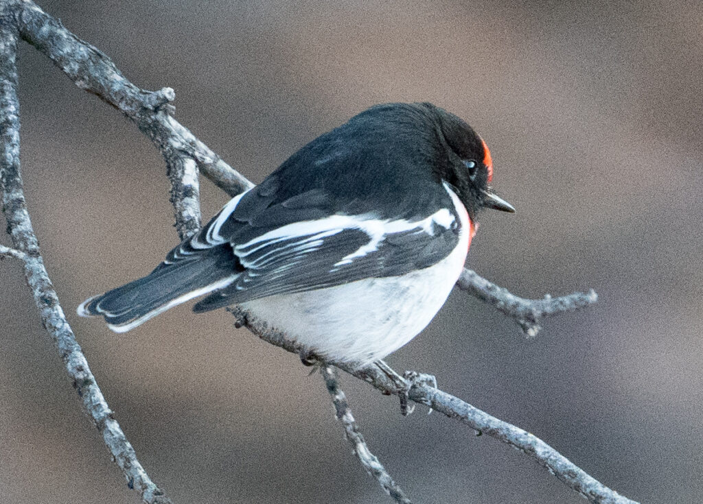
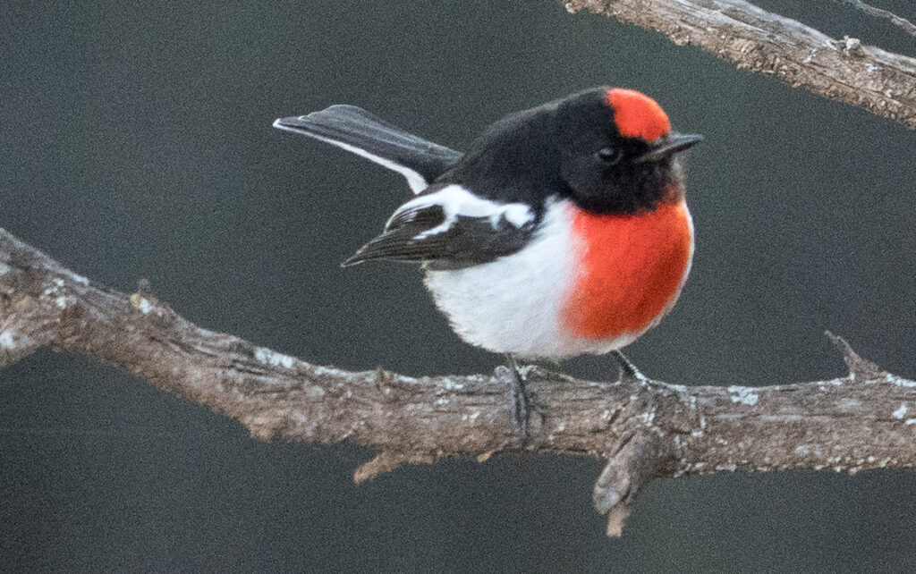
The Station is home to many birds, including the beautiful Red-capped Robin. We had never seen one of these before, and were delighted with this little chap emerged from the native cypress pines surrounded by his multitude of girlfriends.
The Cypress Pines are covered in lichens – you could almost imagine it’s snow or frostRed-capped Robin – looking vibrant in the approaching dusk
Early the following morning we set off on another walk through the Station, rewarded for our prompt start with many more robins, Mulga Parrots, Mallee Ringneck Parrots, huge Wedge-tailed Eagles and Emus.
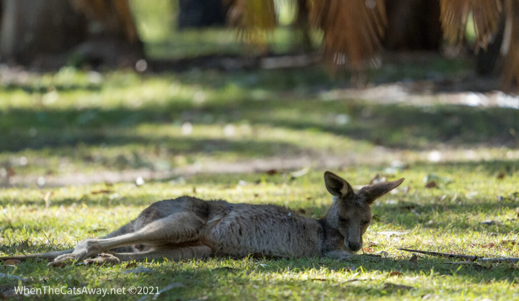
The Red-capped Robin is startlingly crimsonThe female Red-capped Robin has a faint orange foreheadSinging Honeyeaters live here tooA Grey Kangaroo bounds off as we appearMulga Parrots – the males are brightly coloured in comparison to the females – new to us tooFinishing our walk by climbing up to another lookout
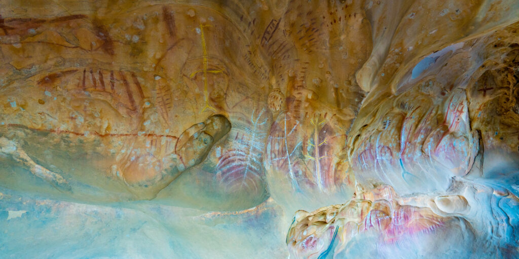
We took a drive out to nearby Arkaroo Rock, a significant cultural site for the Adnaymathanha people of the Flinders Ranges. ‘Arkaroo’ comes from the name given to the petrified serpents which later became the mountains of Ikara.
Without interpretation we can only guess what the drawings depict – we can see trees or leaves…
Unfortunately the National Park folk have neglected to share any interpretive information about the charcoal and ochre paintings. The paintings depict the Yura Muda or Dreaming (creation story) of Ikara.
Watching the walls change colour as the sun setsMulga Parrots at Arkaroo RockDrinking moisture from the tin roof – as the temperature drops at the end of the day, condensation appears
A warm camp fire concluded our day with a nice glass of Malbec. With the nights dropping to between 2 and 6 degrees, we certainly appreciate all the warmth we can get!
The temperature here warms up to the late teens or early 20s during the day, starting to drop as soon as the sun dips behind the hills. It is a perfect time of year to be here. Mark and I last visited the Flinders in January 2004 (17 years ago), when day time temperatures were in the high 30s and we had to start our walks before sunrise to get the cool of the day and minimise flies. There are virtually no flies here currently, which definitely helps the situation. Walking without fly nets over your hat is impossible in the hotter months.
Another walk around the property revealed more bird and wild life including, of course, more adorable robins.
Male robins are constantly on the lookout for competition Sitting in a native Cypress Pine tree – these are common around the property and take 100 years to grow 6 feetMallee Ring Neck ParrotThe Ringneck Parrots like corrugated iron roofs too
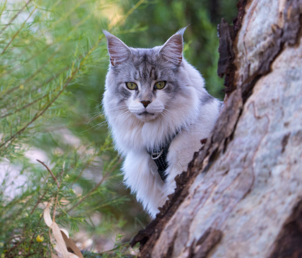
Walking back to the van we stumbled across another guest travelling with a cat. This cat is just 18 months old and huge, like a small lion – he is a Maine Coon – they can reach more than 8kg in weight – double Tassie!
Meet Inspector Gadget…
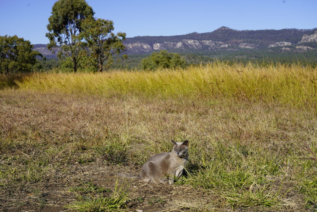
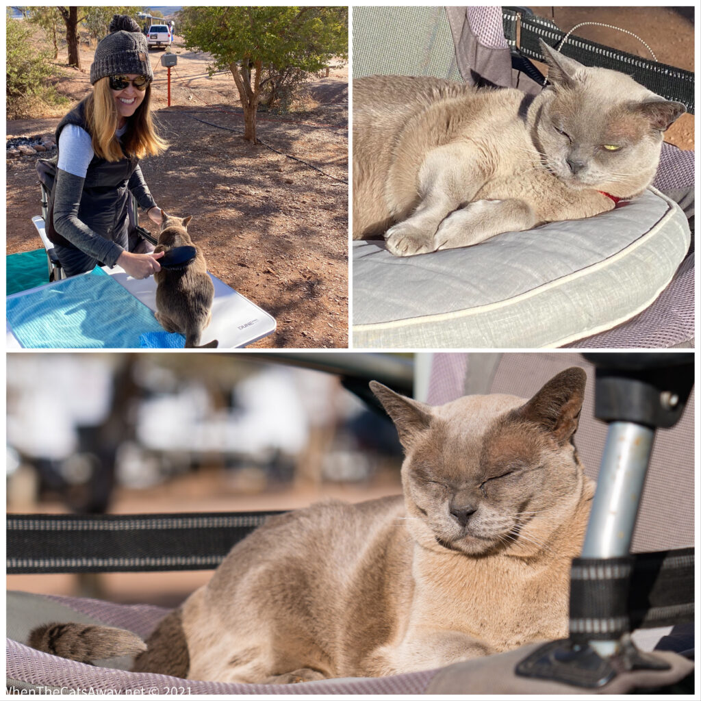
We regularly encourage Tassie to be active and get outside, but being 17 she’s mostly keen to sit in the sunshine and sleep! One one short walk from the caravan she decided to mark her territory…while a dog might do this by urinating, Tassie’s choice was to find a big dust bowl and have a good roll – rubbing her cheeks and therefore her scent on the rocks and ground. One very orange cat emerged – she needed a good brush and wipe down with a damp cloth afterwards! She was not impressed, but forgave us after another nap in the sunshine!
Solar cat in her element, if slightly tangerine
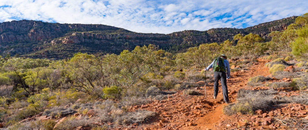
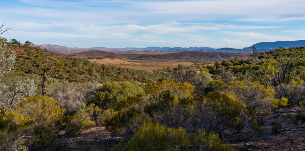
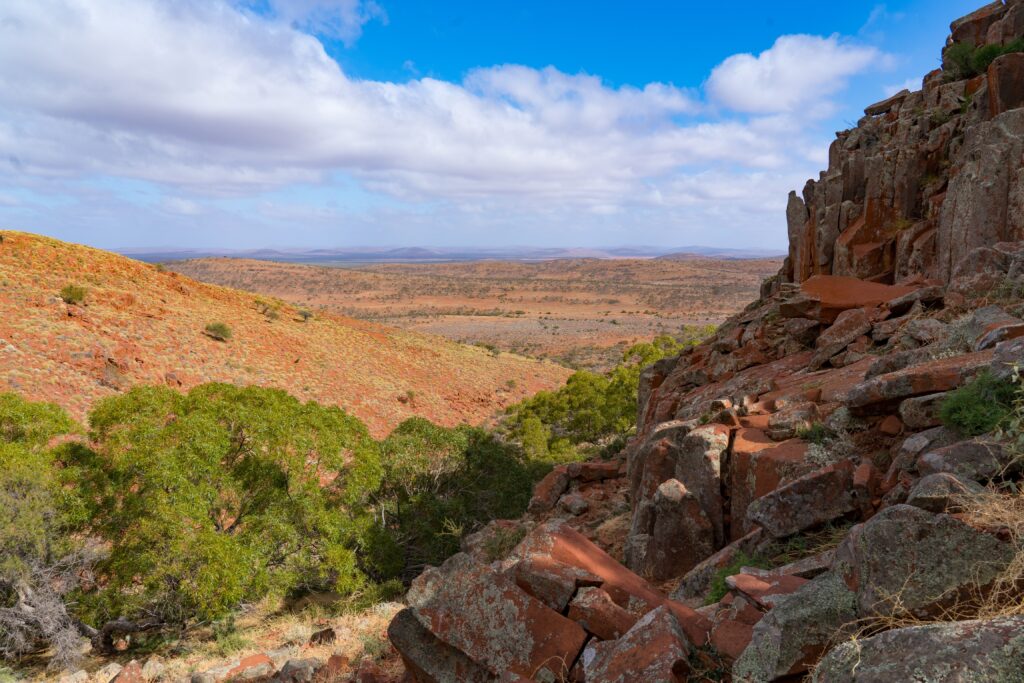
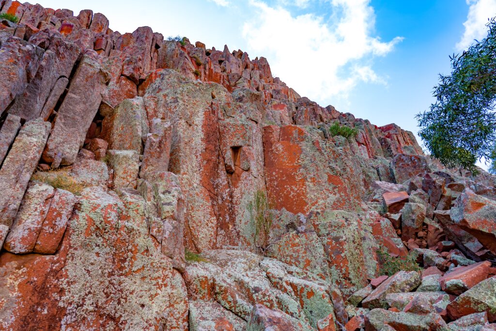
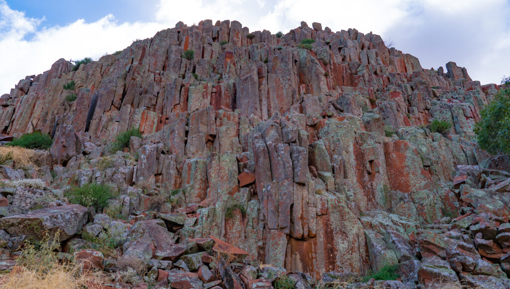
We paid a visit to the Ikara-Flinders Ranges National Park, just under half an hour’s drive away. There are a range of walks available to do there, ranging from the easy 8km hike we did up to Ikara (Wilpena Pound) up to a couple of multi day (multi week even) hikes.
Ikara was a place of initiation ceremonies and corroborees (gatherings and rituals) until it was designated as farming land in the 1850s and farmers from Adelaide arrived with thousands of sheep. Needless to say, the climate of long droughts followed by flood meant the farm did not survive.
The area was designated as a national park in 1945 though it took until 2016 for the name Ikara to be included in the National Park’s name, in recognition of the significance of this place. Ikara features in traditional Aboriginal songs across Australia, showing just how important this location is to First Nation groups from right across the country.
The Adnaymathanha rangers have worked hard to rid the park of pests, including wild cats, rabbits and goats, though there is some work to do still as we saw both goats and a rabbit on our visit. Still, the Yellow-footed Wallaby is now stabilised there, after being driven to near extinction previously.
Check out those yellow feet and striped tail 🤍
It’s a beautiful area and it pays to take the walk slowly, enjoying the sights and sounds, and for us, appreciate the novelty of tall trees after our time on the Eyre Peninsular where they are few and far between.
Not too busy on this walkLaughing KookaburraLaughing Kookaburra Inland Thornbill hunting for grubs and insects on a fallen treeA Euro looks up at us from the path below
We climbed to the lookout and admired the view. The Flinders are the highest mountains in South Australia, Ikara stretching out before us filled with native pine and eucalypts.
Ikara – formerly known as Wilpena Pound
The Woolshed Restaurant was our evening treat – located on Rawnsley Park Station itself. As we are on a sheep station, the menu was no surprise – specialising in lamb, with fish, kangaroo and vegetarian options for those preferring something different. We decided to share a lamb tasting platter, including chops, sausages and rump. Delicious, but a whole lot of meat! Somehow we managed to find space for dessert – a vegan panacotta for me and an affrogato for Mr A.
A delicious feast and break from cooking for ourselves
On our final day we took a walk up towards Rawnsley Bluff, the highest point on the range surrounding the sheep station. Magnificent views were our reward, plus more wildlife – Euros (stocky, hairy kangaroos!), Emus and more Mulga Parrots nesting in the hollow branches of a dead tree. A fitting end to a brilliant few days here.
A group of emus strut across the plainsMagnificent views as we hike upCan you spot the Euros amongst the spinifex grasses?Mr A hiking up the hillMore views and no other people on our walkMulga Parrots flying to their night’s roostMulga ParrotsEuroWe stood really still and this curious Emu came over to check us out! Too close for my camera!Sunset Emu
We will never forget our time here, it has been truly magical. But it is time for us to continue our journey north, we have some exciting things to see over the coming few days!
Location: Pildappa Rock & Mt Ive Station, Eyre Peninsula, South Australia
With Venus Bay in the rear view mirror we turned north, heading to the drier interior of the Eyre Peninsula, the South Australian outback. We were aiming for the outskirts of the Gawler Ranges National Park.
Within an hour we were pulling up at Pildappa Rock just outside Minnipa. Jutting up out of the flat landscape like a miniature Uluru, this pink granite monolith was a central point for the Kukatha Aboriginal communities, who used its surface pools for drinking water. Locals liken this rock to the more famous ‘Wave Rock’ in Western Australia, said to look like breaking surf in its erosion.
Geologists have found that this rock was originally formed about 7km below the earth’s surface (1500 million years ago!). The surrounding soil has weathered much faster than the rock, hence it now towers over the surrounding area. It is estimated it erodes about 50cm every million years.
On our visit, all the pools were dry, the lack of rainfall evident in the dusty surround, our climb up revealing stunning views of the landscape around us.
The First People traditional owners, the Kukatha community, cared for and tended to these lands, and we thank and acknowledge this. Being the only source of surface water for some distance, the people protected this rock and recognised it as a special and sacred place. When European settlers first arrived in the area seeking water, the Aboriginal community introduced them to this rock and shared their precious water, only to have it then taken over by the new settlers who built dams and drains to secure the water for themselves, restricting their access. Yes, yet another sad story of cruelty and selfishness from our ancestors.
Today much of the surrounding land is used for growing wheat, being autumn all harvested now. It is hard to imagine how anything grows in these dry, dusty conditions, Willie willies (mini dust tornadoes) are frequently seen racing across the huge fields, spinning up what is left of the topsoil.
This hole is known as a gnamma. When it was full of rain water, the Aboriginal people would cover it with a rock to prevent evaporation and use by animals. Other water holes would be left open for exclusive use by birds and animals, sometimes laid with traps to catch a lizard for dinner..More gnammas and fine viewsMr A walking below meA rock slowly being sculpted by the elementsHello Tassie (she is asleep on the bed in the sunshine!)
We continued our journey, next stopping for lunch at a nearby camping area by some more sculpture-like granite rocks at Wattle Grove.
Miss Tassie enjoyed some interesting smells on her exploration
Once we left here, we joined a long red sand and gravel road heading further north towards a remote sheep station, Mount Ive. We let the tyres down a little to smooth out the corrugations and enjoyed the journey. The scenery was magical. The sun was just starting to dip in the sky and in doing so lit up millions of raindrops hanging in the trees, spinifex, blue bush and saltbush either side of the road. It was quite surreal, following a red-sand road surrounded by sparkling diamonds.
Flat and dry, this is sheep country
With the sun starting to set we decided to find ourselves a wild-camp just off the road for the night rather than press on.
Where were we? Somewhere near Mount Ive, just past Pinkawillinie Conservation Park
A space for the night secured, we had an explore, bewitched by the beautiful sunset and incredible light cast on the red hills and scenery around us.
Our evening viewA landscape dotted with hardy shrubs, and not all trees have won the survival battleOur camp for the nightBeautiful colours cast by the setting sunThe dusty road aheadHome sweet homeSun set
It was a beautifully dark night, a good opportunity to have a practice at some night photography. This shot of the Milky Way was my best first attempt.
A few clouds still around, but the stars are visible in a patch of clear sky
The following morning we had a walk around, in awe of the silence. You could hear your ears ringing and the cogs in your brain whirring! Every sound seemed incredibly loud. The flocks of birds seemed to think so too, most too nervous to hang around for a photo or even to be identified through binoculars. They clearly are not used to humans out here.
A Spiny-cheeked Honeyeater finally sits still long enough for me to capture it with my cameraGetting ready to head off
We drove the final 45 minutes to Mt Ive Station, arriving mid morning and set up on the dusty dry paddock they had assigned to campers. It was a bit disappointing really. After some of the wonderful station stays in Western Australia (especially Hambleton and Woolleen) it felt like there had been no effort made here. We had so many questions for the owners, but they were not present and the managers were fellow travellers and only had been working there for a couple of days.
A rather orange looking car and caravan – the dust gets everywhere
Visitors are attracted to the area because of its proximity to Lake Gairdner National Park. We paid for a mud map of a track and a key to a locked gate giving us access to the lake. Lake Gairdner is a huge salt lake, famous for land speed record attempts during Speed Week each March.
After setting up camp we took a drive out to the lake. No driving is allowed on the lake outside of the allocated event.
Our first view of Lake Gairdner takes our breath away
The lake is considered to be the third biggest salt lake in Australia. It is 160 kilometres long, and 48 km across, so the area we visited was all but a tiny corner.
Looks like snowfields
Stepping onto the lake it is hard to convince your brain it is not snow. It crunches like snow, but is not at all slippery, with little give when you step on it. In some places this salt is more than a metre deep.
We enjoyed our experience so much we went back the following day – the grey skies changing the whole scene, and being wrapped up in our winter gear it felt even more like a snowfield.
Mysterious skies change the sceneCrunchy salt surfaceMr A on the race courseThe sun breaks through the clouds, and the salt lights up
The Mt Ive Station property also has a volcanic geological area known as the Organ Pipes. We hiked up a dry creek to explore.
Beautiful views down the valleyUp at the tocksThe Organ Pipes – they face east, so get only the early morning sun. They are covered in green lichen.You can almost imagine yourself being in a grand cathedralMore magnificent views and colours from higher upOn the western side of the valley rocks are covered in orange lichenOur lonely car in big country
The station is mostly set up to encourage four wheel driving, with visitors given the option to buy another mud map with further routes to explore. Rather than spend more time in the car, we decided to try some more walking, picking our way up through the rock and prickly spinifex plants to the top of one of the hills surrounding the property.
Mt Ive StationPanoramaPrickly spinifex is home to many little critters, including marsupial mice and lizardsAn old cart on the property
We had a good couple of nights here, but especially enjoyed our time wild-camping. We hope to do more of that in the coming months. For now, however, we had to head back to the coast and Whyalla – I had a plane to catch…
Location: Streaky Bay, Eyre Peninsula, South Australia
As our regular readers will know, it is quite rare for us to spend much longer than three or four nights in one place, but on this trip we are making a habit of slowing right down, and with few hard deadlines to meet, we are following our guts. Streaky Bay has been a perfect location to stop and pause at. Not only a great camp site, but lots to see and do in the area.
We had visited the Department for Environment and Water to ask where the the best areas for seeing birds were, and one area highlighted was Sceale (pronounced scale) Bay Conservation Park, in particular a saltwater lagoon which lay behind the dunes. We drove over for a look.
We found quite dramatic scenery with the wind whistling across the water, a shallow lake edged with salt encrusted mud, but not a single bird in sight, not even footprints on the water’s edge. We had a short look around and decided to continue down to the coast and Sceale Bay itself.
Sceale Bay Conservation Park – a bird-free zone
We found yet another stunning beach stretching along towards some small shacks and houses which make up the settlement, and just two people on the beach. It is just incredible how few people there are everywhere, and we are just lapping up the isolation.
Sceale Bay Beach – stunning turquoise waters with a clean surf break
We returned to the Zone to get ready for dinner. Yes, after my nasty food poisoning episode, we had decided to brave it for a night out in town.
We had chosen a small cafe with water views called Drift. They had an interesting menu, with ingredients sourced from local areas, so we had great expectations.
Sadly, we were disappointed. While the shared plate of steamed dumplings were tasty, they seemed no different from the frozen ones we occasionally have in the caravan. We both chose a seafood marinara for our main dish, only to find all the prawn, calamari and scallop flavours completely swamped with bucket-loads of an incredibly sickly sweet tomato sauce. So disappointing.
The wine we chose was nice, but tainted by the young lady serving us snapping that we couldn’t take unfinished wine home, and therefore she wouldn’t give us the cap! Responsible service of alcohol regulations anyone? In their favour, neither of us ended up sick, so that was good. Overall, it was such a shame. We so wanted to support this small business.
A fine view for dinner, even if the food was disappointing
Saturday dawned overcast, so we followed part of the Westal Way loop drive (one of three loop drives from Streaky Bay which take visitors to several natural attractions) and made our way to Tractor Beach, just 20 minutes south. There’s council camping in a site by the beach and they provide free wifi and solar power charging at the beach shelter.
Charge up and get online by the beach shelter.
The sign at the beach was our first and only sighting of any mention of the local Aboriginal Wirangu communities which previously made this coast their home. We recognise their connection with this country and thank them for their custodianship over the past thousands of years.
We were the only two people exploring the beach of course, which stretched along to an ever-decreasing headland, slowly being worn away by the sea. Another picturesque afternoon’s outing, but still no sight of the sea-eagles or osprey which apparently call this coast their home.
A picturesque beach, particularly as the sun breaks through and shines across the bayWIth tinges of pink on the skyline it almost looks like sunset – an eerie afternoon light
Our surprise sighting of a female Sea-lion last week had left us wanting more, so we took a drive out to Point Labatt, about a 50 minute journey south of Streaky Bay. The drive took us along the stunning Baird Bay, a relatively calm but expansive area of water surrounded by sand dunes and not a boat in sight. We are constantly amazed by the spectacular beauty we find here, with so little human impact to spoil it.
Finally at the point, we found ourselves at a viewing platform above one of Australia’s last remaining Sea-lion colonies. As mentioned in our last post, it is heart wrenching to think that these beautiful creatures could be extinct in the next 40 years unless something is done to change their demise now.
It was incredibly windy at the lookout, and we had to wrap up warm to stand there and watch the goings on below us. Both Australian and New Zealand fur-seals and Australian sea-lions make this location their home, protected from their main predators, the Great White sharks, by a reef out at sea.
Sea-lion paparazzi disguised as a cloud!
Female Sea Lions carry their pups for just under 18 months before they give birth, and then are pretty much ready to mate again within a week. Sadly only 3 out of every 10 pups will reach maturity.
A Sea Lion Pup feeding from mum on the beachSometimes mum is just good for a warm chin rest
Sea Lions differ from seals in that they have external ear flaps, and rather than flopping along on their bellies, they can walk on land using all four flippers. All females are light grey with yellow-cream chests and bellies, while the males are much darker and up to four times larger.
You can almost imagine a storyline here – the young pup having a whinge to mum and then hanging her head in shame as she’s told off by dad….A couple of females facing offIt all gets a little more serious….The battle is taken to the rock pools where they can move faster….there is a lot of splashing and others join in…is this mating ritual perhaps?Still seem to be a few issues, some time later….Later, there is a relationship counseling session which helps sort things out…they appear to kiss and make upAnother young pup wandering around the rocks calling out An adult Sea Lion fresh from the ocean, having run the shark gauntlet and now relishing the feel of the sunSunbathing on the rocks – Sea Lions sharing their safe haven with Fur Seals (you can see one towards the back of the rocks, much darker and furrier than the Sea Lions) , gulls cormorants and terns
On Sunday we kept things more close to home, and took a walk up the coast from the campsite. We saw one person all afternoon, and he was stood at the shore fishing, just four metres from his car! We have the feeling that not too many people pick their way along this shoreline.
The coast is pretty rocky right to the waterA pair of Sooty Oystercatchers fly along the rocks
On Monday we drove south to Speeds Point. Speeds Point was the location of Australia’s first ever big-wave surf competition in 2009. It was certainly wild – what they call a high energy coast, with several collapses on the cliffs evident. Apparently scenic flight operators along this coast notice cliff collapses every day…something to bear in mind when standing near the edge capturing another spectacular scene.
Arriving at Speeds Point – you can see the huge waves in the background and the calm waters below Speeds Point – relatively calm water on the right with wild surf on the leftA White-faced Heron and several Pied Cormorants rest on the rocks between fishing expeditions
From there we followed the Westall Way touring loop around, visiting Smooth Pool (an area of rock pools – it was busy with four wheel drives literally everywhere, so we didnt stop), Point Westall, and The Granites.
Mr A admiring Point Westall
The Granites was incredible. It’s a popular surf beach with some pretty big waves, especially off the point. We spent some time on top of the cliff watching the exhilaration of the surfers as they rode the breakers.
Woo hoo! This looked like fun…Even bigger waves off the point – this surfer looks like an ant, but he’s actually over 6 foot tall!
Our final day in Streaky Bay has been spent doing final jobs and stocking up at the small supermarket in anticipation of not having any shops for the upcoming week. I encouraged Mark to join me on the historical tour of the town – it took us around the old hospitals, shepherd’s hut, monuments and official buildings. It was a nice opportunity to stretch our legs without getting sandy or dusty, or having to watch our step walking over rocks. We also got our flu vaccines – given we cannot get our Covid vaccines here yet (and it is extremely unlikely we are going to catch it anyway) we thought we should be protected from something!
Our time finished off with another fine sunset. I made sure to take advantage of seeing it set over the water. It’s likely to be a while before we get to enjoy such sights again.