Day 71: 8 August – Weather!

Author: Mrs A

Location: 14-Mile Beach, Warroora Station

Distance hiked: 3.5 km

Weather: Scattered clouds all day, wind and rain from 9pm

I’m writing just after 9pm and so excited to report we have our first experience of weather since mid May! Yes, I know that if you are in the northern hemisphere or southern part of Australia you don’t really understand, but where we have been travelling for the past two months it has been pretty consistent – blue skies during the day, clear starlit skies at night. Every day, every night for 70 days and nights.


Today we awoke to blue skies with scattered white clouds. This was unheard of for us, and we were very excited. I even got out our weather station – first purchased as a Christmas present from a long out of business company (Gowings) for Mr A about 14 years ago, it is famously always right. 

Straight out of the drawer it forecast sunshine with scattered clouds…impressive…but not long after being released from captivity it changed, forecasting rain, with a drop of -3 in the pressure system, showing us it was serious. Rain at this time of year in this area is virtually unheard of, so I somewhat pooh-pooed the forecast, but Mr A took it more seriously, recognising the times in the past it has saved our bacon.

We continued with our day. After paying for another 3 nights here (yes, $60!), we visited the dump point (toilet and rubbish) and then the famed ‘Telstra Hill’, where we could get uninterrupted phone signal. There we spoke to a caravan repairer in Perth about our issues and organised a date for repairs, booked Miss Tassie (our 13 year old Burmese cat fur child) on a flight over in September, and uploaded some blog posts.


After a salad for lunch we decided to explore south, driving to Sandy Point and then walking along the beach. The colours were spectacular, and at low tide, the beach scattered with perfect and stunning shells. Such an interesting location. 

We returned in time for sunset. I predicted it would either be spectacular or a complete fizzler due to the clouds – and sadly it was the latter – no sunset to note. It went down. It got dark. We retreated to the caravan to hibernate, Mr A first packing away the BBQ and chairs, despite the clear starlit sky above us. If the weather station says rain, then beware…


So. 9pm and we suddenly notice the caravan is rocking with the wind, and are then aware of the torrential rain blowing from the sea. All I can hope now is that it is washing off some more of the orange dust we have accumulated over the past couple of months. I am really ready to have a clean mobile apartment again.

It feels very cosy, and I’m pleased Mr A trusted our weather station once more…

Day 69: 6 August – $20 rent for a multi-million dollar view

Author: Mrs A

From: Cape Range National Park, Mesa Camp

To: 14-Mile Beach, Warroora Station, just south of Coral Bay

Distance driven: 216 km

Distance hiked: 4 km

Footsteps from a soft fine white sand beach bordering the world heritage Ningaloo Reef, panoramic turquoise water views, fall asleep to a million stars and the sound of the surf breaking 1km away and the gentle lapping of the rising tide on the sand just metres from your bed…all for $10 a head per night. Not bad eh? This is tonight’s camp spot – we think potentially the next two nights as well, given we are well stocked up on water, wine and food.


We rose early and went for a walk along the beach near Mesa Camp, in an attempt to savour the last of the beautiful location, unsure of where our day would take us. We then packed up and pulled out of our campspot at the allotted 10am departure time, heading back into Exie to fill up on water.

From there, we headed south to just south of Coral Bay. We skipped Coral Bay itself – even the Lonely Planet WA book suggests it is extremely overpriced and overcrowded – and decided to be self sufficient for a few days, ‘wilderness camping’ on a sheep station. Warroora Station clearly has been offering camping for some time, with a camp host (volunteers who stay for free and certain perks, welcoming visitors in, taking their money and allocating sites) and a number of camp areas along the coast. We missed out on the last beachfront site by seconds, and instead opted for an ocean view spot on ‘the ridge’. The Ridge is actually only slightly up above the beach (about 5 metres!) on top of a sand dune. Sites are quite large and the views commanding. There is very quick and easy access to the beach, and we are very happy with where we are. 


We had a short walk along the rockpools at low tide – so many interesting shells and creatures, beautiful green crabs and even a huge octopus trapped in a tiny pool, biding his time until the tide came back in. We thought of that time with Jenny and David when we rescued a moray eel from a similar situation…


We watched the sun set with a glass of Pino Grigio and then enjoyed a Thai green curry with the last of our Netflix. We haven’t seen good broadband download speeds in a long while, and have now run out of entertainment…what shall we do now?!

Day 67: 4 August – Diving the Navy Pier…with sharks

Author: Mrs A

Dives undertaken: 2 plus 1 in a swimming pool

Water temperature: 21.5 degrees C (brrr)

Wetsuits worn: 2.5

Mr A and I went out separate ways for the day as I had booked a couple of dives on the Royal Australian Navy Pier, considered one of the top 10 dive sites in Australia. I haven’t dived in a few years, so I was picked up shortly after 8am to do a refresher dive in a swimming pool, remembering how to remove and replace my mask, weight belt and BCD and tank underwater, and how to do an equipment and buddy check.

I had a brief 40 minute break in between that and being collected again, where I quickly ate breakfast and collected some extra layers.

11am the bus returned to collect me plus a few others to do the dive proper. In total there were 15 people doing the two dives and we were paired up with a buddy with similar experience. I got paired with a very tall bearded Simon from Denmark, who had learned to dive in Danish waters, no warmer than 2 degrees!

There was a lot of briefing involved in order to prepare us for this dive. It is located on active Naval land so we had to hand fill out a form with our name, address and date of birth, ensuring it accurately matched our photo ID. It took the 15 of us three turns to fill in this form with no errors! We then had to drive to the Naval base for the key to the pier, and line up at the side of the road while a man in a bullet proof vest with a gun checked us off against the form. Once on Navy land, there was a no photography rule until we reached the pier…not that there was really anything to photograph…

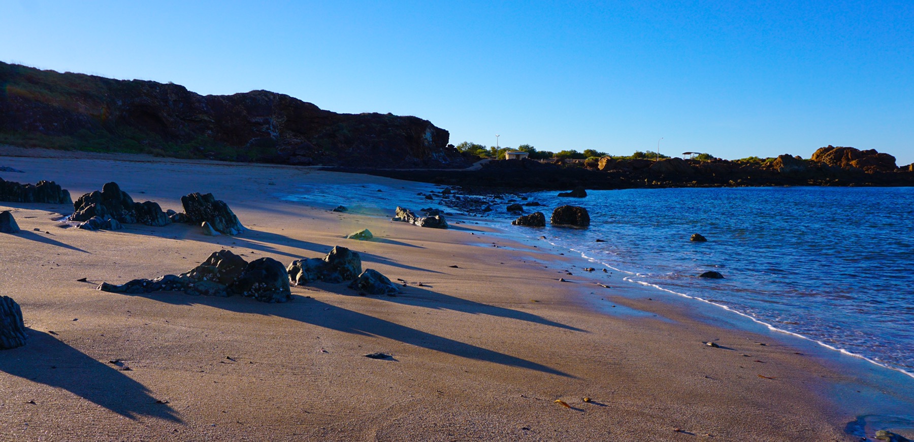
As we arrived at the pier we were immediately entertained by three humpback whales swimming past, just 50 metres off shore – just magical, and a sign of things to come. We we-suited up and climbed carefully down two flights of metal steps (not soft underfoot when you are carrying a heavy tank on your back!) to the platform. 

The jump into the water from the platform is about 3 metres, and it looks much further. It’s important to keep a hold of your weight belt and mask to ensure they don’t get lost on the jump down. I took a big stride off the pier and I was in. They then lowered all the cameras down to us via a hook. There were a lot of cameras – almost every diver had one, and I watched with dismay as mine was accidentally unhooked and sank down to the bottom of the ocean! Oh no!

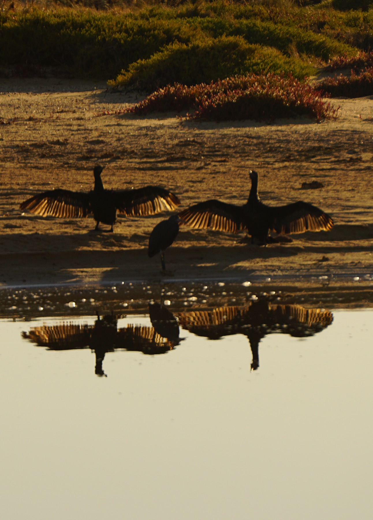
We descended down the line to almost 12 metres below the surface and began our exploration. The sea life was incredible, just like I would imagine swimming in an aquarium. Every surface of the pier’s structure is covered in sponges, corals and fish of every colour and shape imaginable, huge shoals of fish visible everywhere – above, below and beside you as you fly gently through the water.


The sounds are of clicking and crunching shells, as we see fish attacking clams for the sweet meat inside. All this time, however, I was also anxious for my camera, which we hadn’t seen once on the ocean bed. Before long, it was time to ascend for our shore break, and another workout as we carried our heavy tanks up a ladder out of the water, and back up the two flights to the top.

We had a cup of hot soup, connected our breathing devices to a new full oxygen tank, and got ready for dive two. I was handed my camera, to much relief, by another dive guide who had found it and carried it around with her during the first dive. I decided to not put it on the hook this time, and attached it firmly to my wrist and again stepped off the pier. This time I lost both my fins! I watched in dismay as they both sank to the bottom of the ocean. Swimming with no fins is not fun at all! Fortunately a replacement pair were found for me, and again we descended.

This time the dive was even better than the first. We explored much further, seeing groupers, a grey nurse shark, a white tipped reef shark, moray eel, octopus, lion fish, flat worms (sound uninteresting but are stunning)…the list was endless.


A brilliant dive site, mishaps aside, and much fun had by all. We ascended for our final time and packed away our gear. Out came a cry ‘Manta ray!’ And another, and we all rushed to see at least seven huge mantas swimming just below the pier. They were huge beautiful fish, swimming on the surface like giant black rippling birds. Just incredible.


It was impossible to capture the mantas on camera as it was into the sun, but believe me, it was wonderful.

I returned on a high to camp to find Mr A on the phone to the bank trying to organise new cards. This is how his whole day had transpired, after realising he had lost his wallet on yesterday’s boat trip – farewell Medicare card, drivers licence, the lot – probably also at the bottom of the ocean somewhere. A far less enjoyable day for Mr A.

We ended on a positive, however, enjoying a delicious meal out at a local restaurant; Whalers. Crocodile wontons and a smokey grilled kangaroo loin for me, soft shell crab tacos and a reef and beef for Mr A, thank you very much – delicious!

Day 65: 2 August – Exploring Cape Range National Park

Author: Mrs A

Distance hiked: 8 km

Distance cycled: 8.5 km

After a morning of housekeeping (doing the laundry and making use of the free wifi to download some more Netflix) we headed off in the car 20 minutes south of Exmouth (hereby nicknamed Exy – i.e. expensive) and into the Cape Range National Park, driving up into the range itself. The wind had finally dropped, making for a much more pleasant morning.

We’d read about the Badjirrajirra walk online, with people raving about how stunning it is, a circuit leading to a lookout over a ‘mini Grand Canyon’…we had high hopes. I think we have been truly spoiled by the Blue Mountains and the incredible hikes around where we live, as, while I don’t deny it was a pleasant walk, it wouldn’t make my top 100.

High up on the range, it started at a lookout and lead off along the top of the range, through a largely barren, rocky, spinifex filled landscape. There were no flowers, extremely few birds (we saw two in nearly 3 hours!) and the national park authority had offered no information to educate us on the landscape. After about 90 minutes we reached a lovely unofficial lookout where we stopped and enjoyed a cup of tea and an apple, marvelling at the view. It was just as well we stopped there, as the official lookout was closed due to risk of sinkholes.


Given there was no information provided, a quick Google on our return educated us. We learned that here we were looking out onto Shothole Canyon – apparently named in the 1950s after the shot holes left in the canyon walls after explosive charges were let off in the search for oil. Nice!

We returned to Exmouth and decided to finally see the coastline, jumping on our bikes for an explore. Exmouth was on form as we headed down a road that looked like it headed right to a beach – surprise surprise, all the beach access points were shut due to someone burying asbestos in the area!


Instead we continued on and explored a new development, some extremely large houses, most of which enjoy water access and private moorings. It was rather interesting. Mr A later found out that many are owned by people in mining, some local business people made good, and mostly they are for holiday rental.


We returned to camp for hot showers and dinner. Not too bad a day! Off on a boat trip in the morning…lets hope the wind keeps calm and the whale sharks are cooperative!

Day 63: 31 July – Bikes, birds and beaches

Author: Mrs A

Location: Giralia Station (Exmouth Gulf)

Distance cycled: 17 km


We started the day with a mountain bike ride, heading off down several 4WD trails into the property. We cycled until the sand got too deep to pedal, then left our bikes and walked up into the red sand dunes, covered in beautiful wildflowers and a multitude of tracks from the action last night. It was a stunning location, so peaceful we could hear little more than the flutter of wings and the twitter of birds.


On our return we visited the homestead to learn more about where we were staying. Giralia Station had remained (at least partially) in the same family since the 1920s, only being relinquished in 2005 when the Western Australia Department of Conservation & Land Management purchased the land, recognising it as a site of special interest. It has several kilometres of coastline as well as much land which is gradually returning to its natural state since the removal of cattle and sheep.

Our explorations would suggest there are still camels wandering around here somewhere, with evidence of footprints on the dunes, as well as feral cats, having spotted small paw prints in the sand also. 

We decided to drive out to the coast, which felt desolately beautiful with the tide out and beach overtaken by soldier crabs hunting for a feed on the mud flats. We also felt cool (it was only 23 degrees C) for the first time during the day for ages – we almost needed long sleeves…almost…we must be heading south!


We decided to head out for a final bike ride before dinner, to try and spot the cockatiels and budgerigars we had seen flying past last night. Unfortunately it was a fated ride as an evil twig lashed out and attacked Mr A, catching him across the nose and cheek. He now looks like he has been in a fight…I meanwhile was fighting back the giggles as I tried to be sympathetic to his pain and embarrassment…I think he’ll be ok though (brave soldier!)…

Day 61: 29 July – 4.5 miles of 40-Mile Beach

Author: Mrs A

Location: 40 Mile Beach

Distance hiked: 7 km

It was a somewhat disturbed night as the wind got up and flapped our awning around – we had to get up at 2.30am to put it away – along with several other neighbours. We had a bit of a sleep in as a result, not waking until around 8.30am – bliss! It was an unusual start to the day, there were these white things in the sky…c…c…clouds I think they are called. We have not seen any of those since about mid May! They didn't hang around for long.

We packed up a lunch and our swimmers and decided to explore the beach.


We barely saw another person all day – a couple of guys fishing near the camp area, and then a lady on a stand up paddle board coming from a boat moored at the other end of the bay, otherwise just us. We stopped after 3.5 km, where there were no other footprints and jumped into the ocean for a swim – just heavenly.

We were entertained by a pair of White Breasted Sea Eagles on our walk back for hot showers and cold drinks.

The clouds returned just in time for sunset, making for a fabulous display and a fitting end to the day – nature's fireworks. We've really enjoyed our time at Gnoorea Point, but it is time to move on tomorrow, heading a couple of hundred km south to a former 700,000 acre sheep station…should be interesting!

Day 59: 28 July – Point Samson…point disapPointment….

Author: Mrs A

Location: Point Samson

Distance cycled: 5 km


I woke this morning with a puffy swollen face and sore glands again – signs that I am about to have another allergic reaction. Have doubled the antihistamine to try and prevent anything too dramatic, and Mr A has been re briefed on the Epi pen should that be needed. Fingers crossed the antihistamine works.

It was another lovely day, but alas mostly spent cleaning out the red dust from our clothes and van. Another few washes done, even bravely used the campground machines as well, and the floor washed on hands and knees. Mr A emptied the car and did a thorough wash out and vaccuum.

So today, all went well other than:

  • The caravan repairers in Exmouth who had been lined up to fix up our broken/damaged bits and pieces have accidentally double booked us and can no longer fit us in during our visit. We have to wait another month until we get to Perth to get repairs done
  • Our washing machine has a mysterious error ‘OE’ which suggests the drain is blocked, despite us proving again and again it is not…sigh…
  • Mr A’s fat bike has a puncture and he cannot get the tyre off to fix it, so we need to spend the day in Karratha tomorrow repairing that, instead of kayaking down a beautiful river…

But all first world problems really. We managed a short cycle around the neighbourhood – we really have seen all of Port Samson now, and truly praise the talented Marketing writers who managed to make it sound like a seafood dining Mecca. 


We enjoyed sunset beers at Honeymoon Bay, before heading out to dine at the local pub ‘The Tavern’  – a truly delicious Fisherman’s Basket with chips and salad, with a bottle of Taylor’s Promised Land for $30 – not too bad!

The day concluded with a lovely FaceTime conversation with my sister, Helen, letting her know I plan to make a flying visit in September. Very excited about that!

And finally, our current location – the blue spot on the left hand side…’D’ is where our holiday truly started at the beginning of June, at Lake Argyle…

Day 57: 25 July – Biking & paddling Millstream

Distance cycled: 16 km

Time paddled: 90 minutes

Distance paddled: unknown

As always we awoke to a stunning morning – about 16 degrees, blue skies and promise of a 30 something degree day ahead. Life is easy when the weather is totally predictable. We decided to head off out on our bikes while it was cool, and first of all paid a visit to the old 1930s homestead, from back when this National Park was a horse, sheep and cattle station. There was a lot of information about the Aboriginal cultural heritage of the area which continues to this day, plus an interesting depiction of life here early last century. We continued our tour along a wetlands trail to a sacred lake behind the homestead, and then along a fantastic 8km cycle trail completely off road, leading through the gum forest and through spinifex filled open desert to a fabulous viewing point over the Fortescue River.


We returned from our cycle to have a BBQ brunch and relaxed through the heat of the day.

Around 2pm we headed off to find somewhere new to paddle. We spotted a road heading down to the river and decided to park by the closed gate and hike off down for an explore. We were just opening the doors of the car and we saw a WA National Parks Ute reversing swiftly towards us. A stern woman brusquely told us were not allowed off piste, and that down that unmarked trail was an Aboriginal cultural area visitors could not access. 

National Parks in Western Australia are quite different to those in NSW, which rarely patrols its areas (meaning everywhere is open to visitors), and certainly doesn’t seem to fiercely protect Aboriginal zones. This is not the first time we have been told we cannot freely explore a park – a Karijini ranger also told us to stick the the allocated trails there. It does explain why the parks are always so busy, with everyone constantly channelled down the same avenues. 


We ended up going back to Deep Reach along the Fortescue River, inflating our kayaks and setting off for an explore. We saw many birds this afternoon, reed warblers, rainbow bee-eaters, honey eaters, firetails, ibis, herons, black kites…the list was endless, and stunning reflections on the water.


On our way back to the car I managed to stop Mr A from stepping on a rather stunning cream and brown patterned snake which was crossing the pathway. It coiled up and threatened to strike at us, its pink mouth open and hissing in our direction. We waited until it decided to retreat back into the bushes before continuing, unsure whether it was poisonous or not. Back at the mobile apartment I checked it out in our ‘Reptiles and Amphibians’ book – it was a Stimson’s Python – non-venomous…so I didn’t save Mr A’s life after all…!

Nevertheless, we celebrated with a home cooked dinner of Beef Rendang and a delicious bottle of Penfold’s 2013 Bin 8 Cab-Shiraz. 

Day 55: 23 July – Tom Price & Hamersley Gorge

Author: Mrs A

Distance driven: 83 km

Distance hiked: 2.2 km (Yes, mostly in the car!)

Flights climbed: 10 floors

After praising the Savannah Campground for its peace and quiet we were disappointed last night when a group of camper trailer toting friends turned up late and set up right opposite where we were camping. They then cracked open the beers and yelled across to each other until long after midnight, despite Mr A politely asking them to quiet down (he was told to ‘f-off’) and apparently the retreat manager told them on two occasions also. So this morning, we packed up and departed, forfeiting tonight’s booking (‘no refunds’).

We headed first for the nearby town of Tom Price, where we hoped to gain a permit to take the shorter mining road to Millstream-Chichester National Park. Unfortunately the information centre told us it was in terrible condition as there was a new mine opening along it, and that caravans were not allowed. We had no choice but to add 200 km to our journey and go via the ‘highway’ (a rough, corrugated gravel road!).  We stocked up on fruit and vegetables while in town and headed off.


As tends to be the case, our change in direction and plans was not bad. We passed the outer southern side of Karijini National Park and a final gorge which is visited by few. This made it our favourite location as we pulled in for lunch, and then hiked down into the gorge. What a fabulous spot. Absolutely stunning reflections and rippling sediments in the walls which any landscape designer would be jealous of. We sat for a while with our feet in the water, enjoying the serenity and watching the fish swimming beneath us, cautiously eyeing my blood-orange coloured toenails.


We decided against driving any further, and pulled into a bush camp nearby. It is by far one of the most stunning locations we have camped. Yes, of course there are other campers here (‘You’re never alone in WA’), but they are at least 200 metres away from us in any direction. We are surrounded by stunning hills of the Hamersley Range all around us and the chirps of Rainbow Bee-eaters, Firetails and Zebra Finches. I think we are going to be happy here tonight!

Day 53: 21 July – Karijini National Park – the southern part

Author: Mrs A

Distance driven: 75km

From: Karijini National Park – Dales Campground

To: Karijini National Park – Savannah Campground  (Karijini Eco Retreat)

Distance hiked: 5km

Floors climbed: 19

Once again we hitched up the mobile apartment and moved on after a light breakfast, this time heading to the southern part of Karijini and the Savannah Campground. This is a private campground within the national park, coupled with an ‘Eco Retreat’ (canvas cabins with king size beds, luxury hotel quality linen, private en-suites and decks, all set amongst the beauty of the national park – a bit like our mobile apartment but not quite as nice). We get hot solar showers and flushing toilets. The ‘Retreat’ is fully Aboriginal owned, and run by a hospitality company.

We arrived around 11am and after a bit of confusion with their site allocation for us (the first already being occupied by two tents, the second pretty much the smallest on the campsite!) we finally settled down on an attractive spot. This is much more picturesque than the Dales campground with a lot more birdlife – there has not been fire here, which helps.

We decided to tackle the walk nearest to us, to Joffre Gorge. While only 5km was hiked all together, it was a tough one with a lot of climbing. We arrive at the top of the gorge and look down to a emerald coloured pool, about 150 metres below us. We then have to clamber down the cliff to it. This is a class 5 (the most challenging) hike, with no handrails, no man made steps, and quite precarious drops. We get most of the way down, and Mr A is overcome with vertigo and cannot make it further. I have to admit my heart is also pounding after my hiking pole had slipped on a rock and plummeted down. I reach the bottom where the pool is, and find my hiking pole safely landed on a nearby rock.


It is lovely, but there is more. I now need to carefully pick my way along the sediments in the rock along the smooth cliff edge, the pool beneath me, to reach another part of the gorge. Trying not to think about the non-waterpoof camera around my neck, and regretting having the hiking pole (now feeling more of a hindrance than help), I make my way around safely. Around the corner, through a two metre wide crack in the rock is a beach and Joffre Falls. I would say it was really picturesque, and it mostly was, apart from the man with the big beer belly sitting at the bottom of the falls and his wife with the loud sweary voice yelling across at him.

‘You’re never alone in WA’ – our new slogan for Western Australia.


I clambered up and rejoined Mr A, and we continued on the walk along the rim of the gorge. We crossed the top of the waterfall and saw a number of pretty lizards enjoying hunting around the water. Photographs really do not do the scenery justice – it is arid and dramatic, the colours startling in the afternoon sun. When you see the gorges they really do take your breath away.


We returned to camp for sunset beers before showering and retiring for the evening with a bottle of Fat Cat Shiraz, a madras curry and two episodes of Shetland. Another fine day in WA.