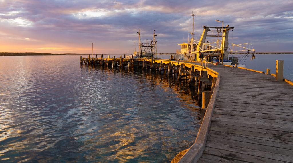
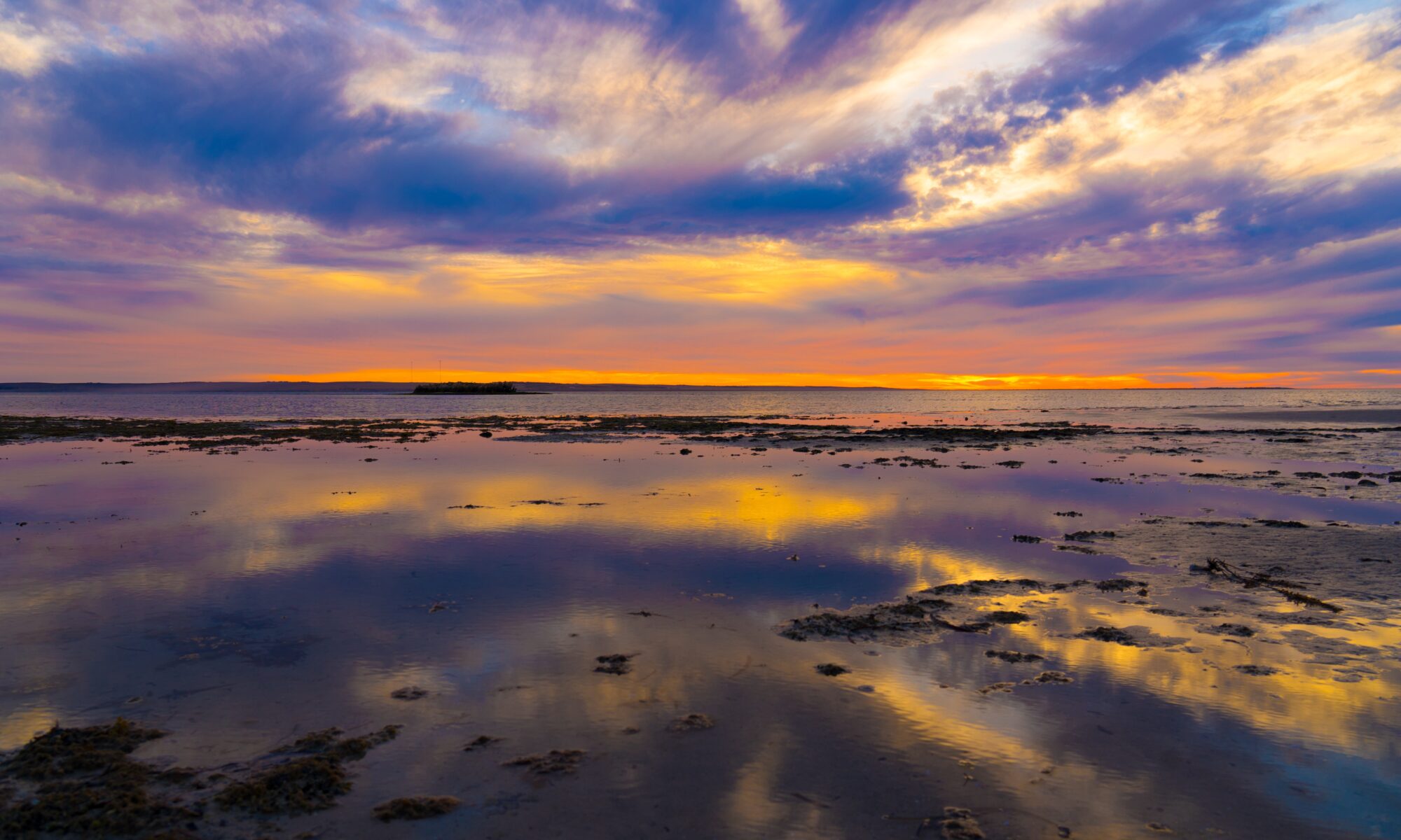
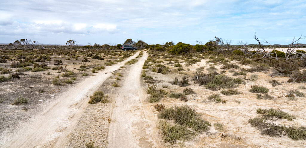
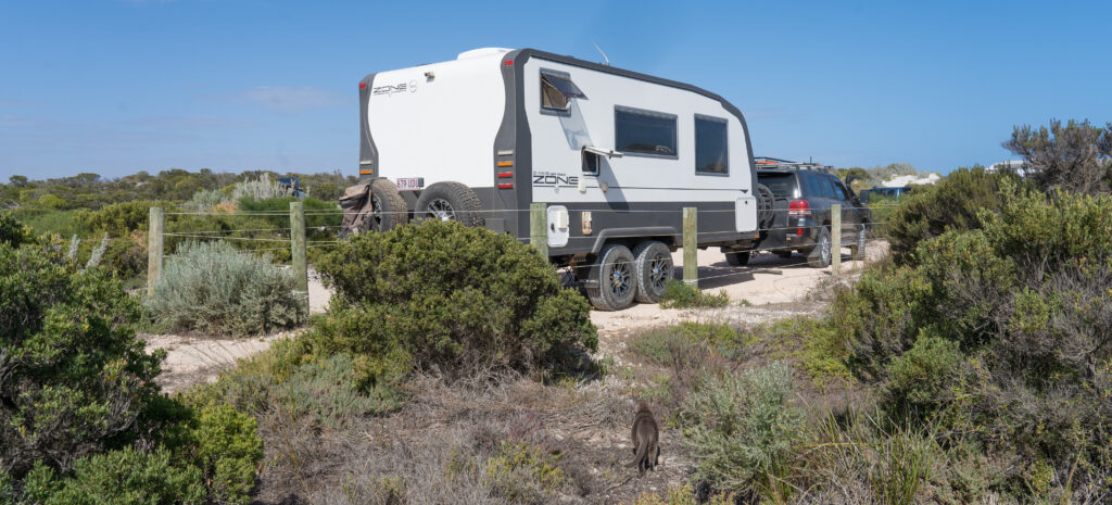
Our South Australia sojourn is drawing to an end after four months, and tropical central Queensland here we come! Our plan is to “head up the track”, as the saying goes when tackling an iconic outback adventure: the Birdsville Track. The track starts in South Australia’s arid north, and winds its way through three deserts before spitting you out, very dusty and thirsty, at the Birdsville Pub a few kilometres over the border in the central west of Queensland. It will be an adventure for sure.
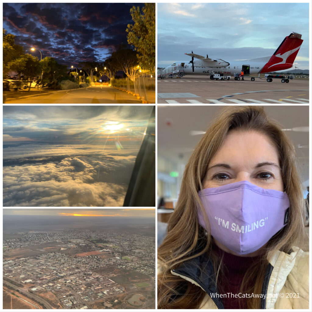
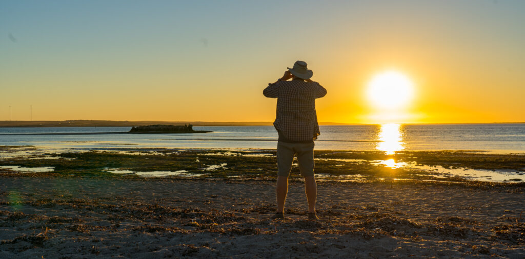
But first we had a bunch of jobs to get done in the small town of Whyalla, where Catherine was once again going to fly back to Adelaide for steroid injections into her airway, a visit to the hairdressers and some retail therapy. I was being looked after by Tassie, and getting some local medical stuff done. Then it was a matter of cramming as much fresh food into the van and car as we could store. 1,700 km lies between us and our next supermarket in Queensland! Yup…thats a long way between fresh vegetables!
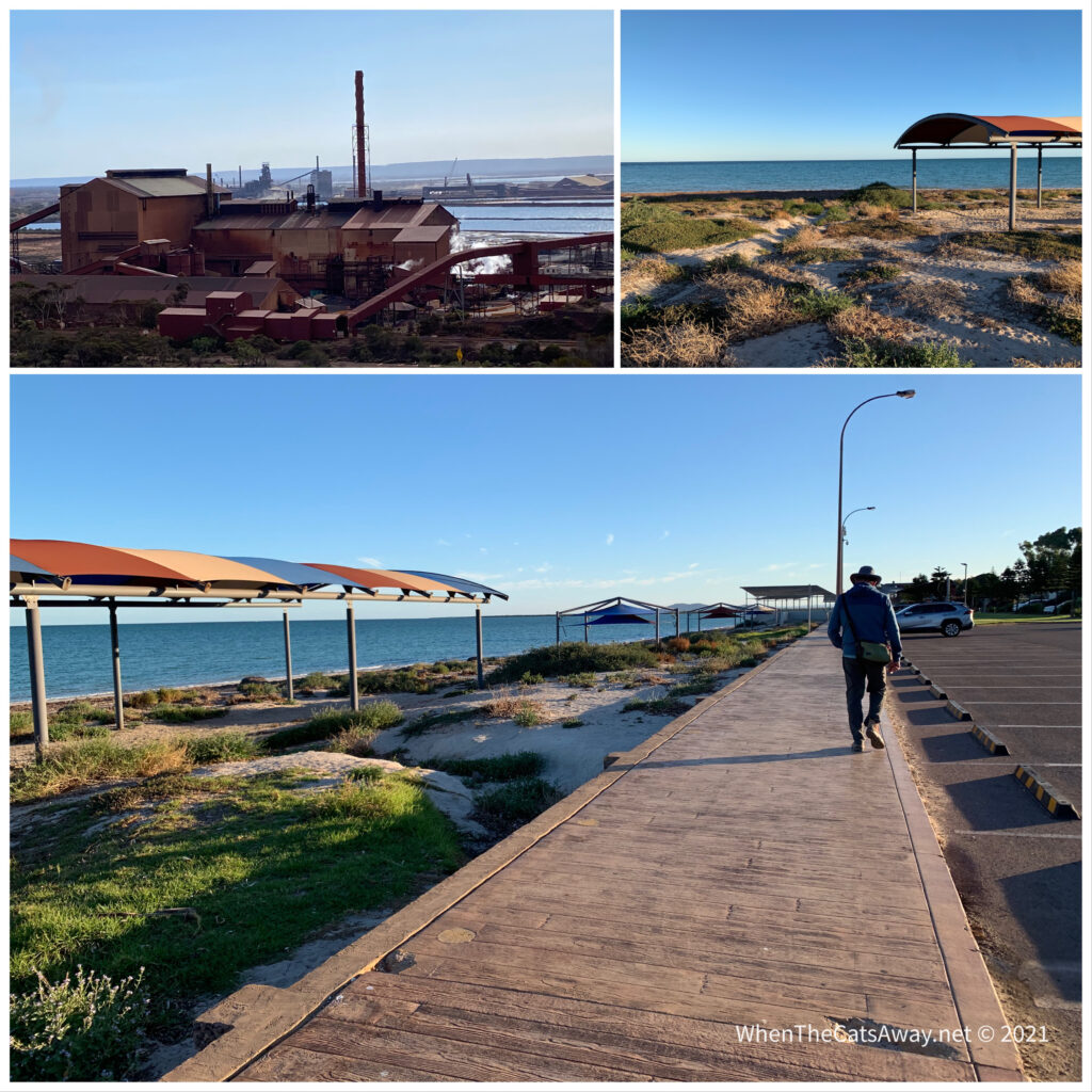
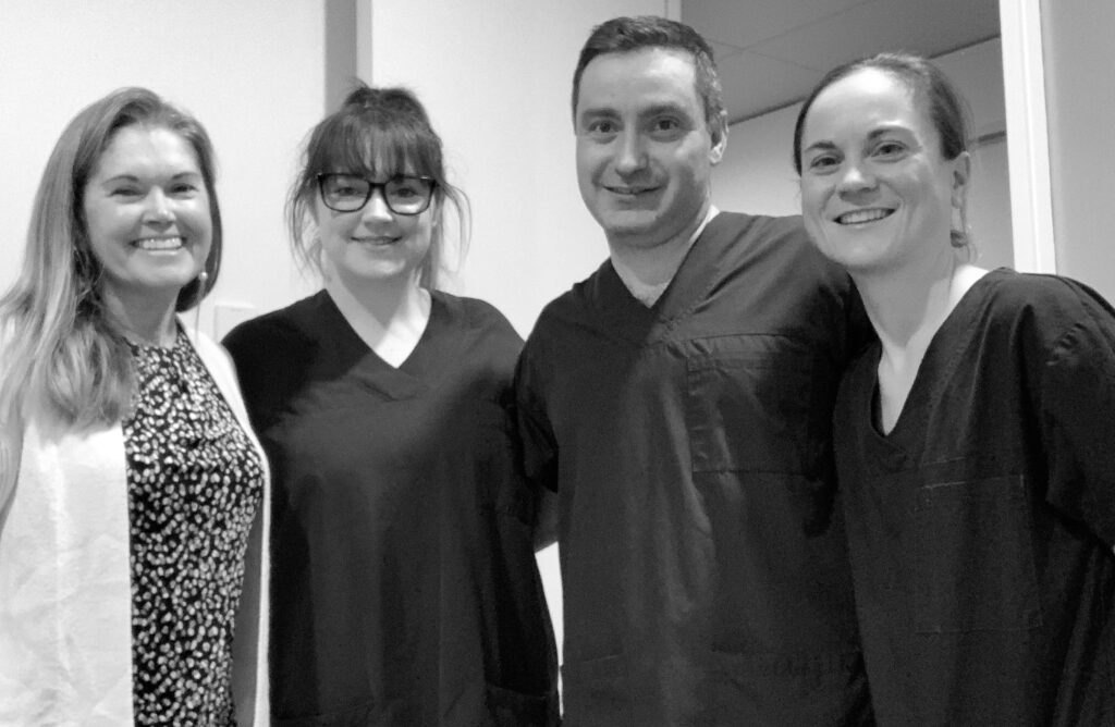
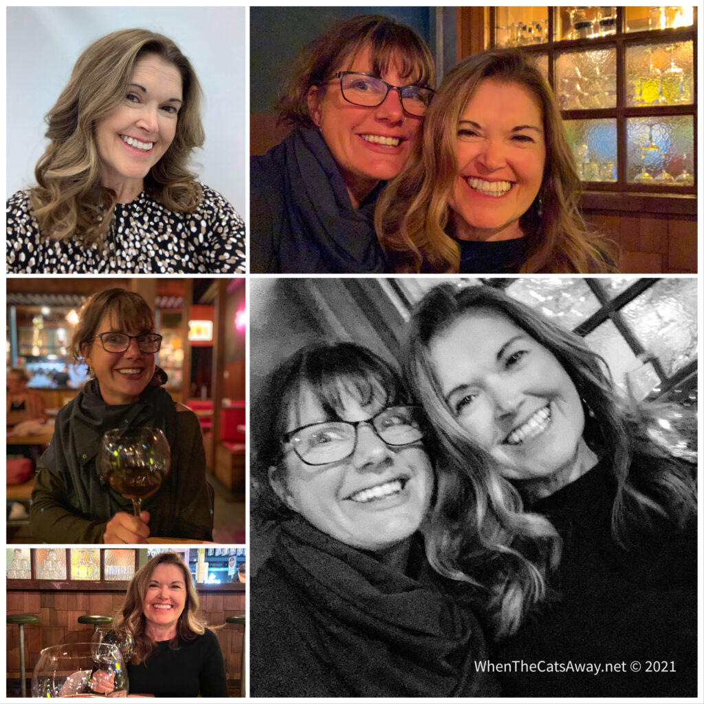
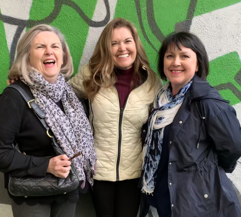
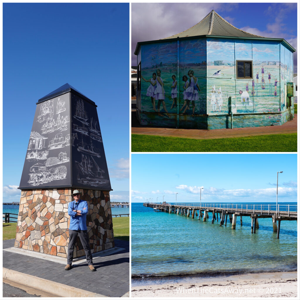
The steel works (top left) and the coastal walkway in WhyallaVery rarely do we need to wear a mask these days but they are compulsory when flying, Top left, early morning at Whyalla airport, bottom left Whyalla from the skiesCatherine farewells the doctor and nurse team in Adelaide – primarily laryngologists Dr Theo and Dr Alice (right). She hopes to do some research with them later this year.Later that day….post haircut and bouncy blow dry, a night out with friend of 35+ years, Ali 🤍Friday farewell lunch with two of the Adelaide ladies from Catherine’s idiopathic subglottic stenosis support group, Carmel and Heather.
Whyalla is a town that has been struggling for years under threat of its biggest employer, the steel mill, closing down. Today the serious crime squad in London announced it was opening an investigation into the mill’s owner, but despite this cloud, everyone was super friendly and a strong sense of community was evident. But, we couldn’t wait to hit the road.
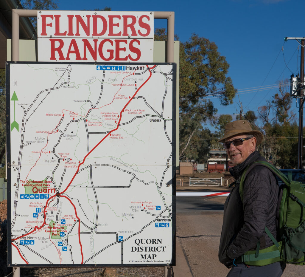
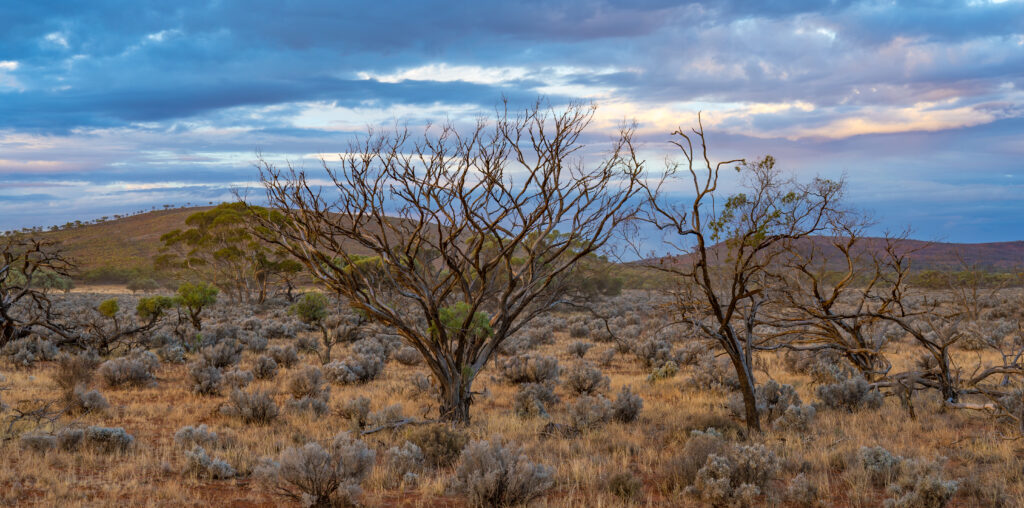
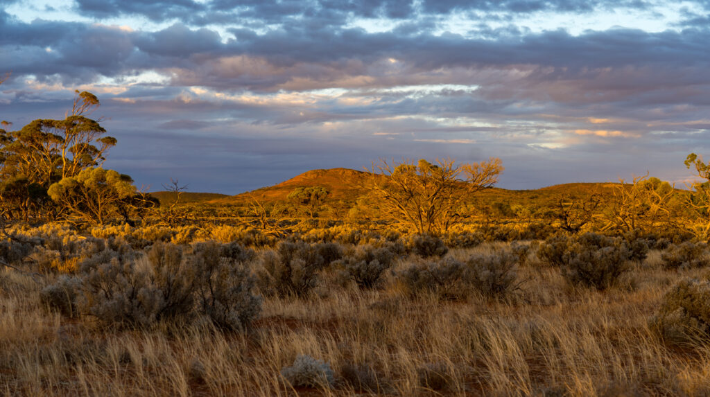
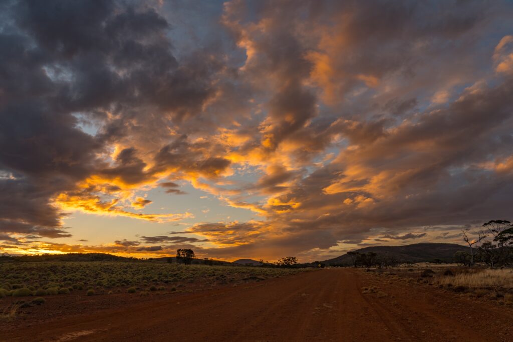
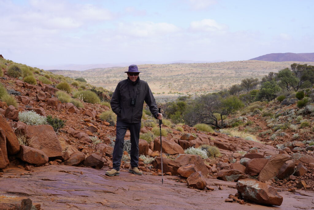
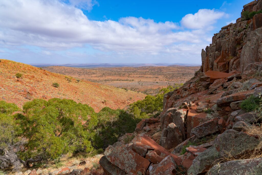
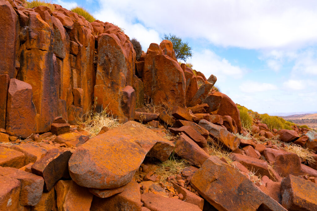
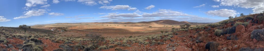
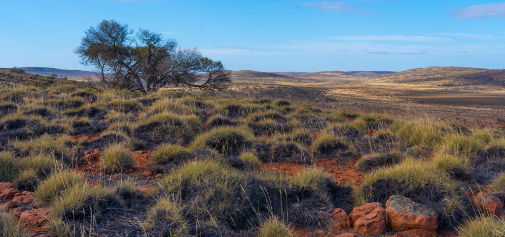
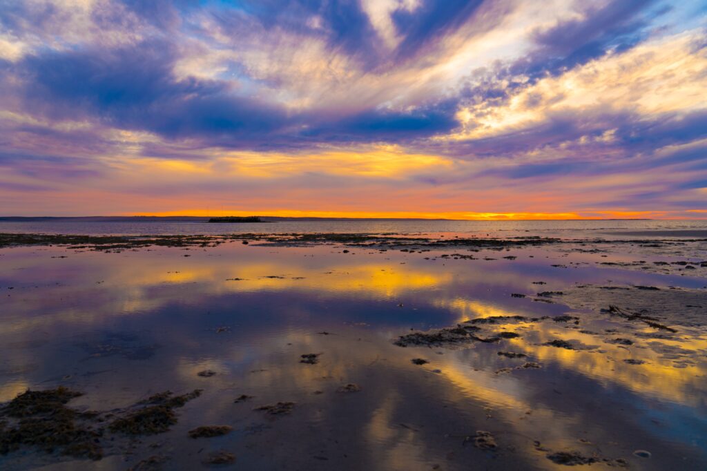
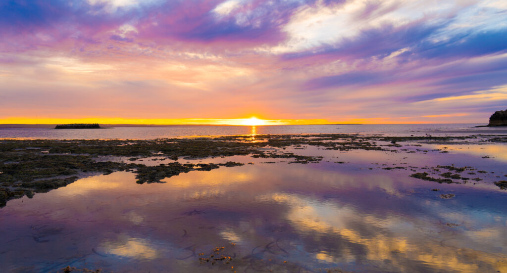
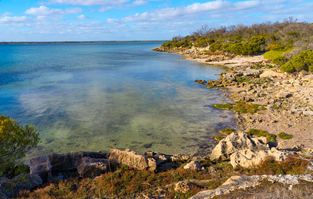
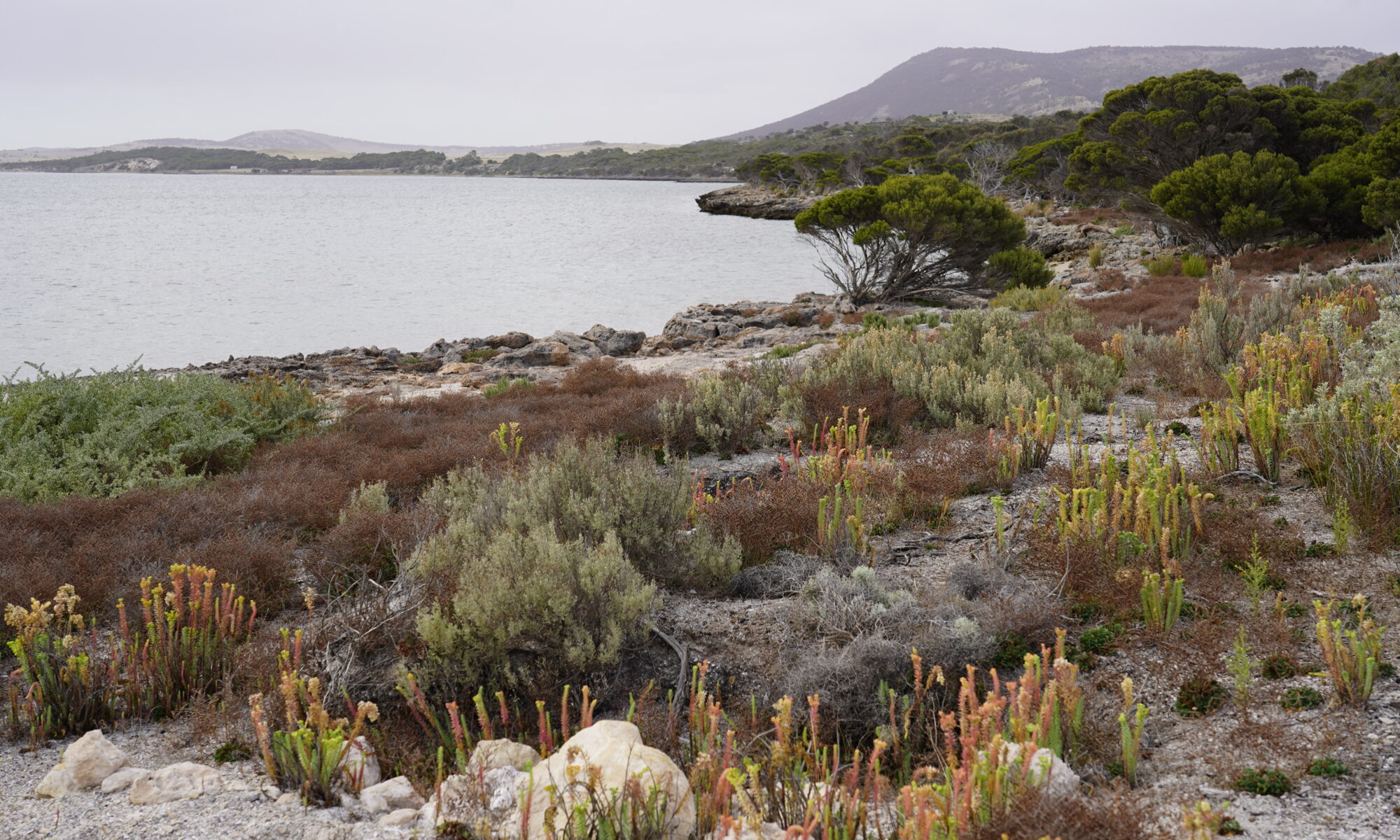
After six weeks on the very flat Eyre Peninsula, it was great to see the country rising up into jagged peaks in front of us This was the southern end of the Flinders Ranges, a semi-arid country containing some of Australia’s most important fossils and evidence of early human history. We had made a trip here back in 2004, but it was January and crazy hot. Now daytime temperatures are pleasant in the high teens and low 20s, and nights in single figures that have us both fighting over a snuggle with our hot water cat in bed!
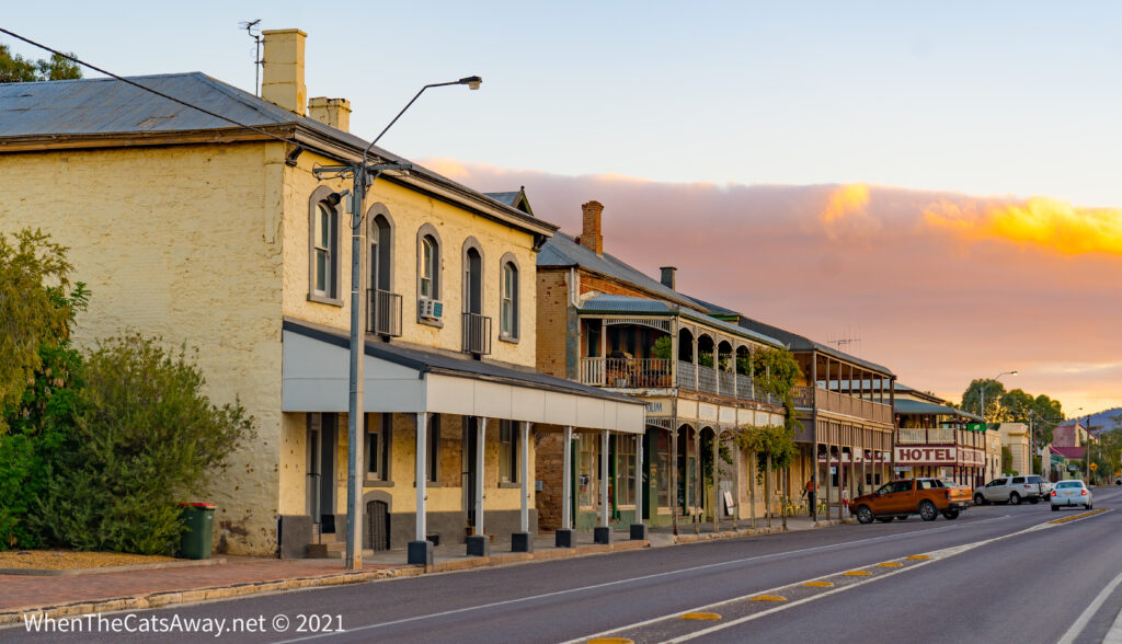
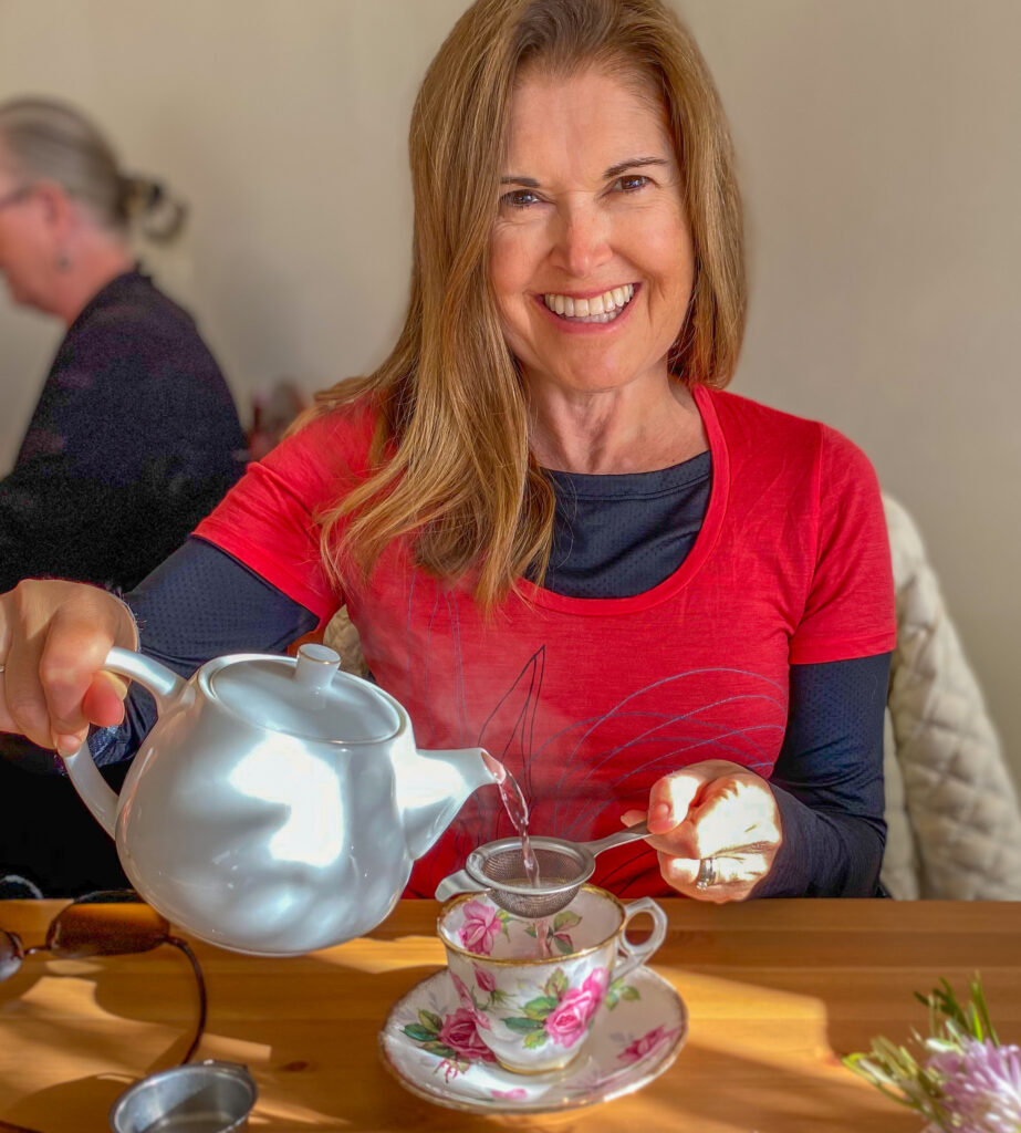
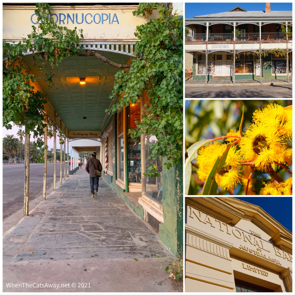
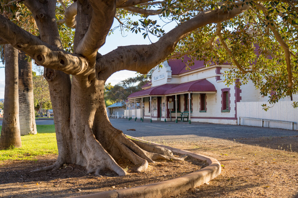
Our first destination was the small settlement of Quorn, a town made famous by having for many years both the main east to west and south to north railroads passing through it. During World War 2, around 40 trains a day passed through the town carrying our troops up to defend Darwin and on from there on to fight against the Japanese in the Papua-New Guinea campaign. Nowadays its a very pleasant stop on the tourist route up into the ranges. It even has a tea shop serving a range of brews in English china cups. So civilised.
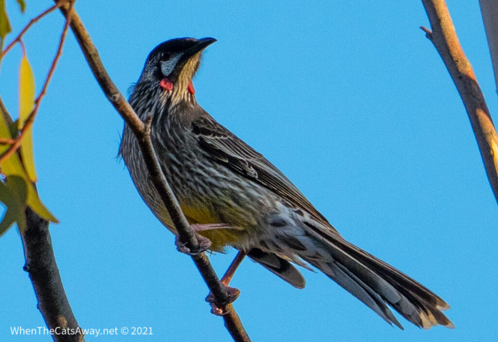
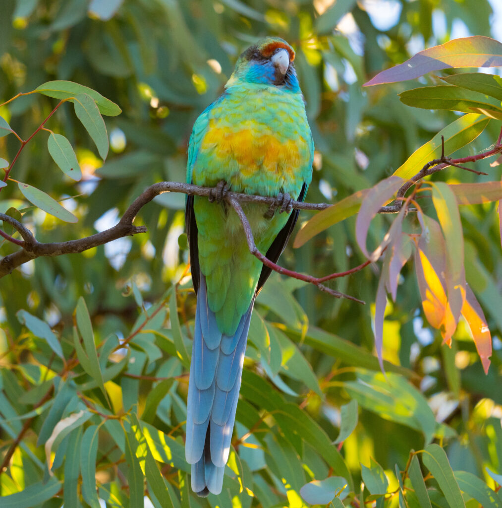
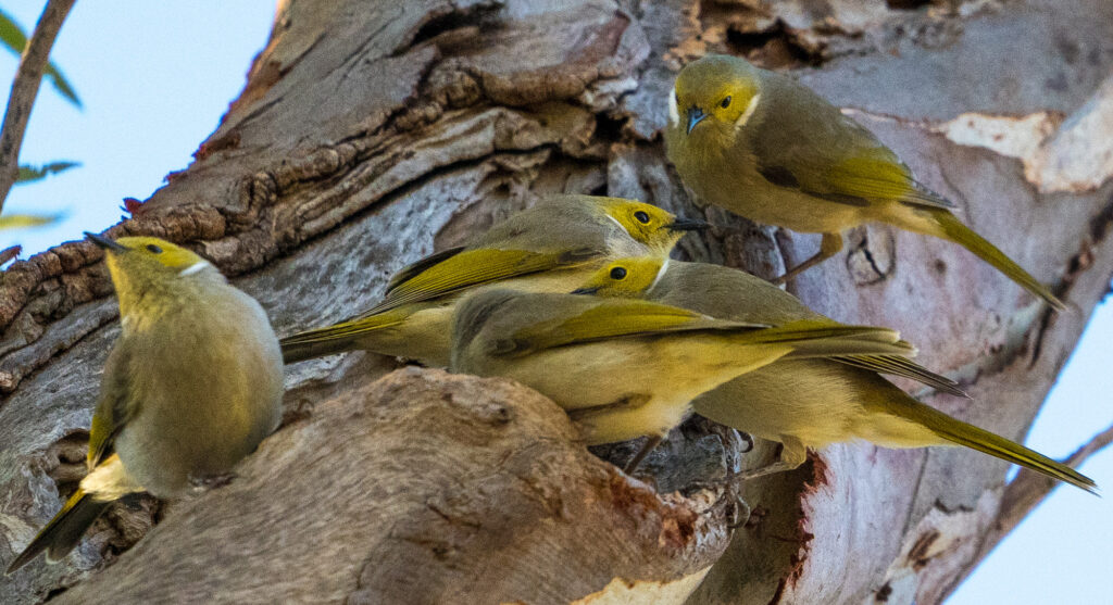
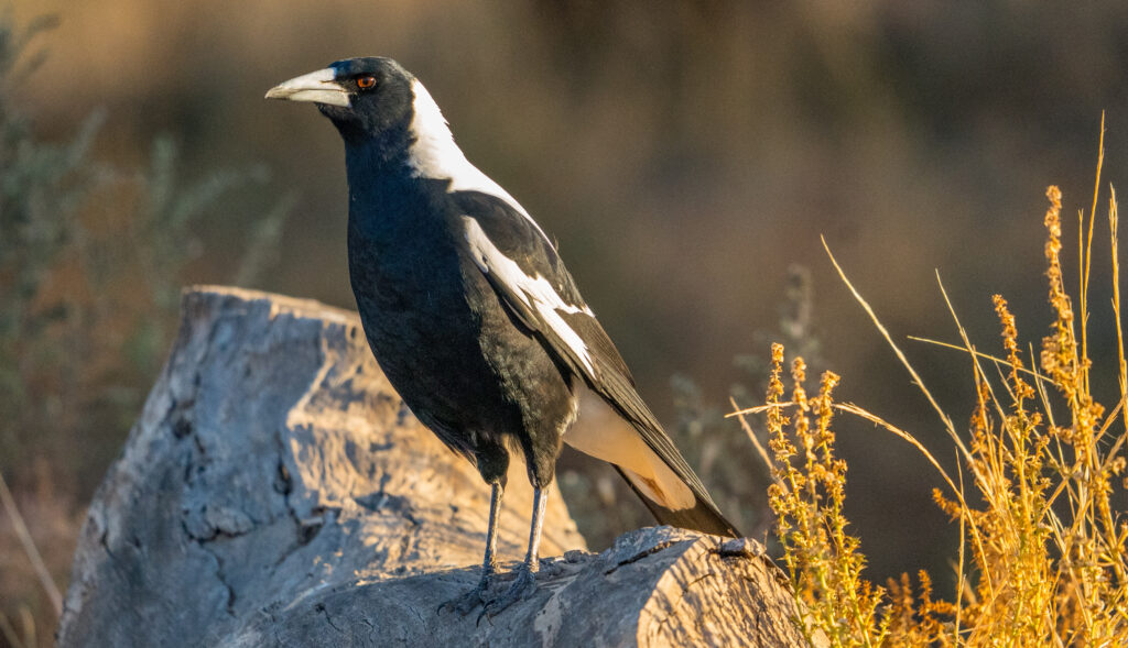
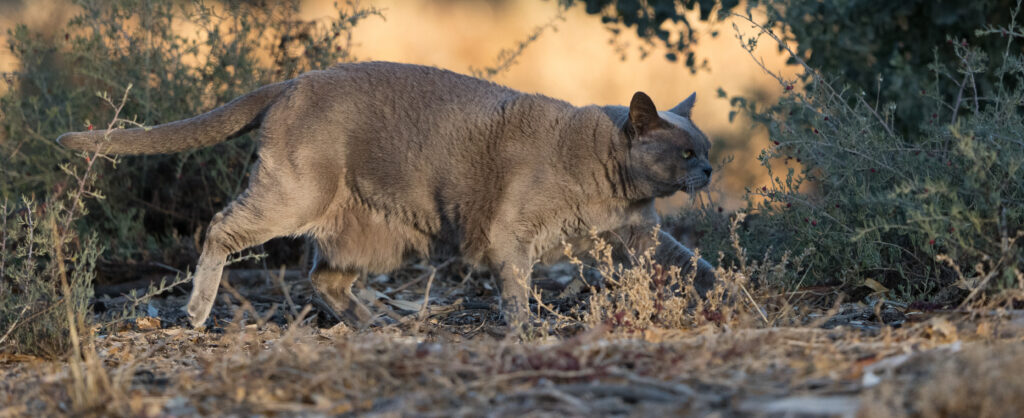
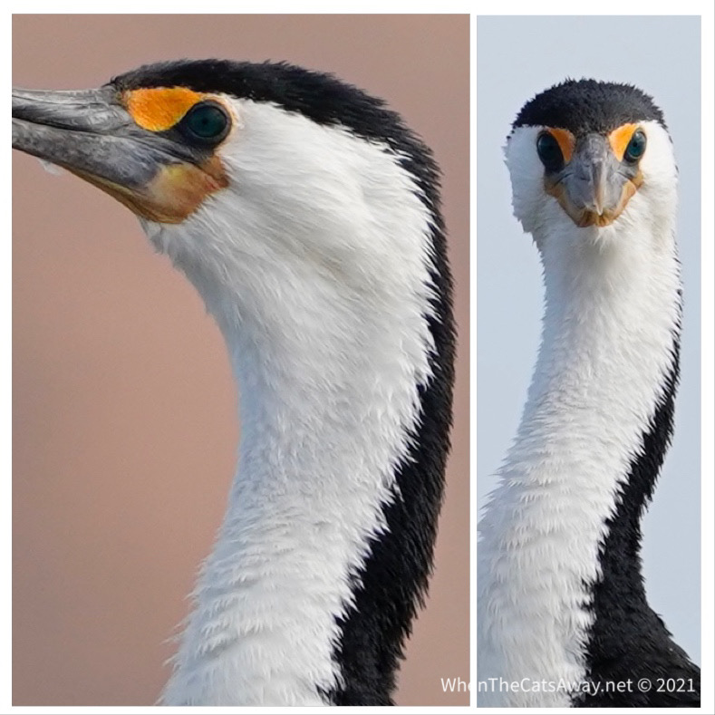
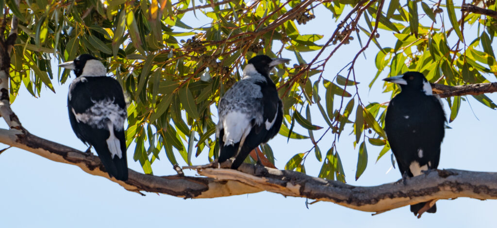
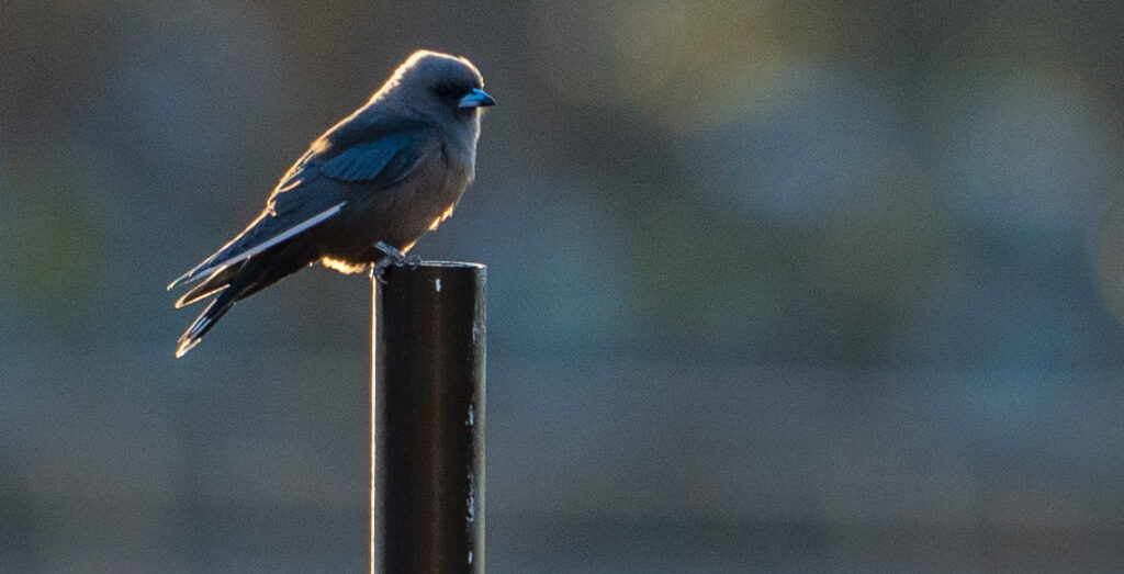
Quorn high streetFine bone china teacups made in EnglandQuorn’s main street has stood relatively still for the past 100+ yearsQuorn Railway Station Wattle BirdA beautiful Mallee Ringneck ParrotA gaggle of White-plumed HoneyeatersAn Australian Magpie on our campgroundTassie hunting interesting smells on an accompanied walk
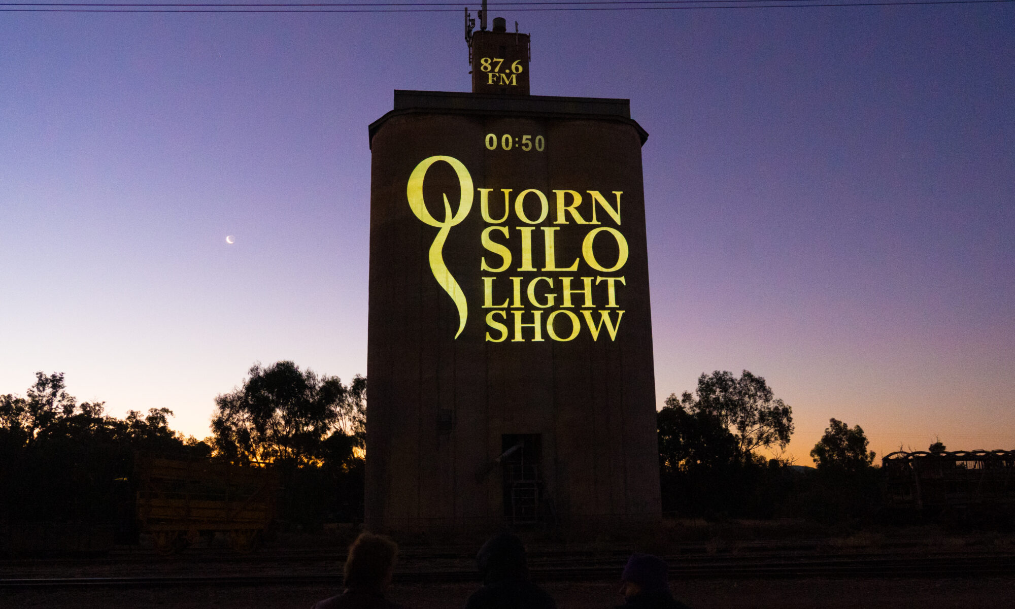
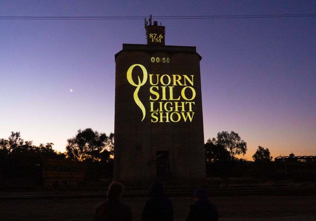
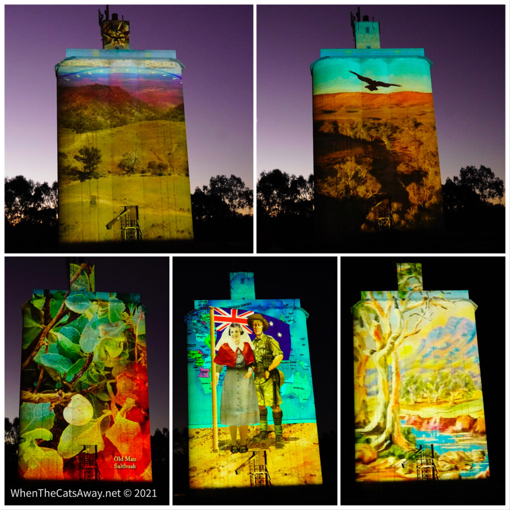
We had managed to snare a cancellation on the only caravan park in town. It is a really busy season up here, and we had heard from friends who stayed locally that there was an outdoor movie shown every evening at sunset. We dressed up warm and headed out. The film was projected onto the side of an old silo, very atmospheric, and had some really interesting content, including from an elder of one of the First Nation groups to live on this ancient land. So inspiring to to see a community pulling a project together like this.
Fifty seconds until the show starts – the sun has set and the new moon risenSome of the projections during the 30 minute show
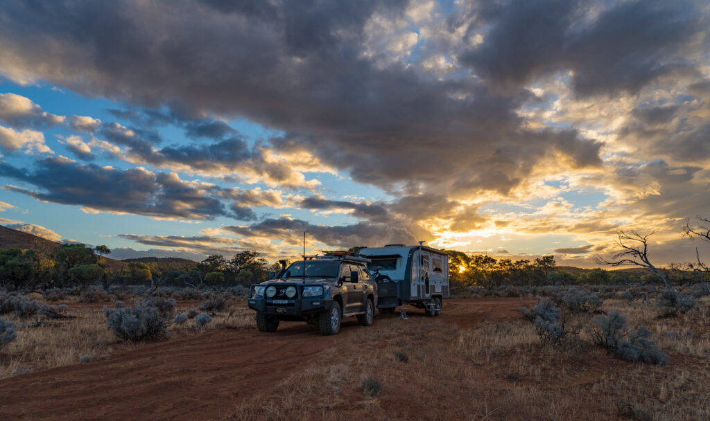
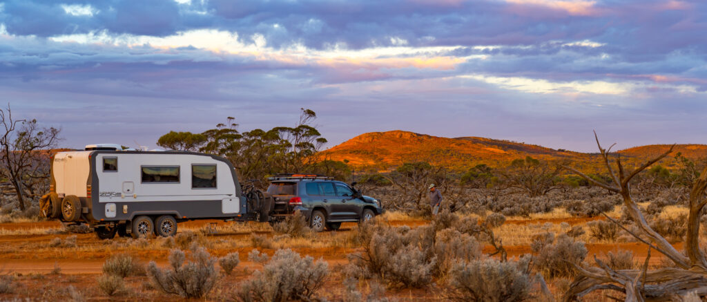
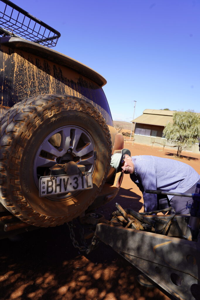
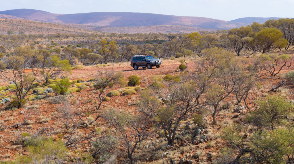
Tomorrow we head further up into the ranges and a three night stay on a sheep station, and then from there up to the end of the tarmac and the start of 519km of the Birdsville Track.
It may be a while before we get enough signal to upload another post, hence the heads up on our plans over the next few weeks. It would be an unusual plan that survives contact with the Outback, so our fingers are crossed, but we think we have prepared well enough. The wine cellar is full, the fridge groaning, and the tanks full.
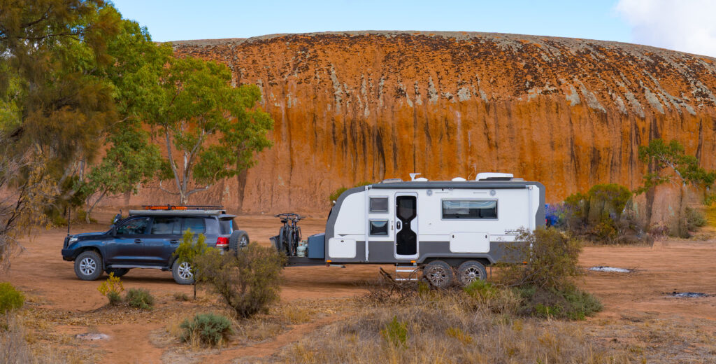
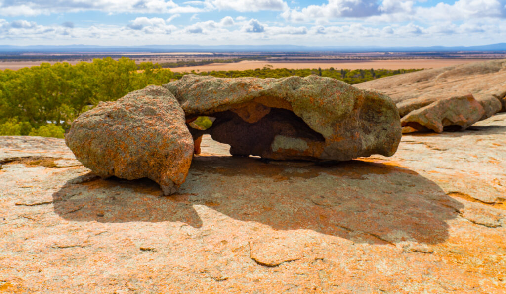
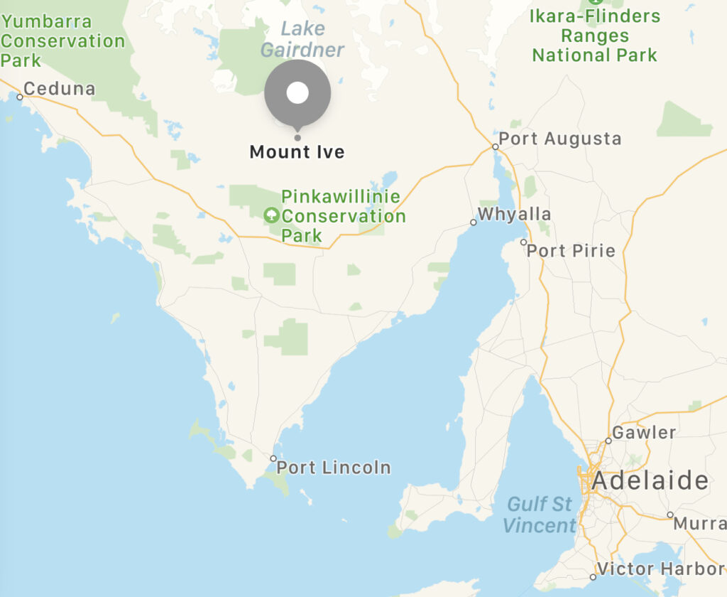
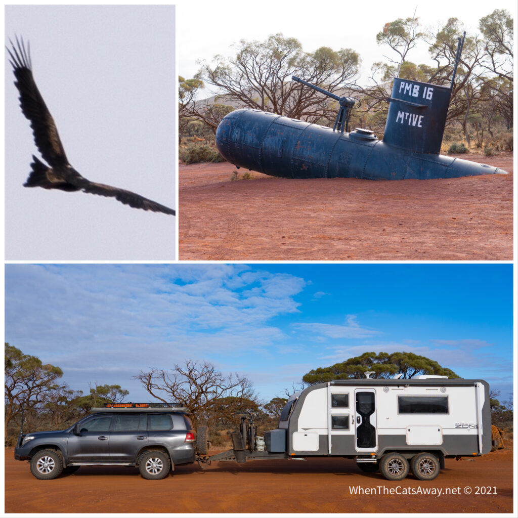
Location: Pildappa Rock & Mt Ive Station, Eyre Peninsula, South Australia
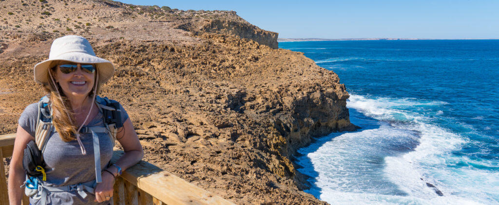
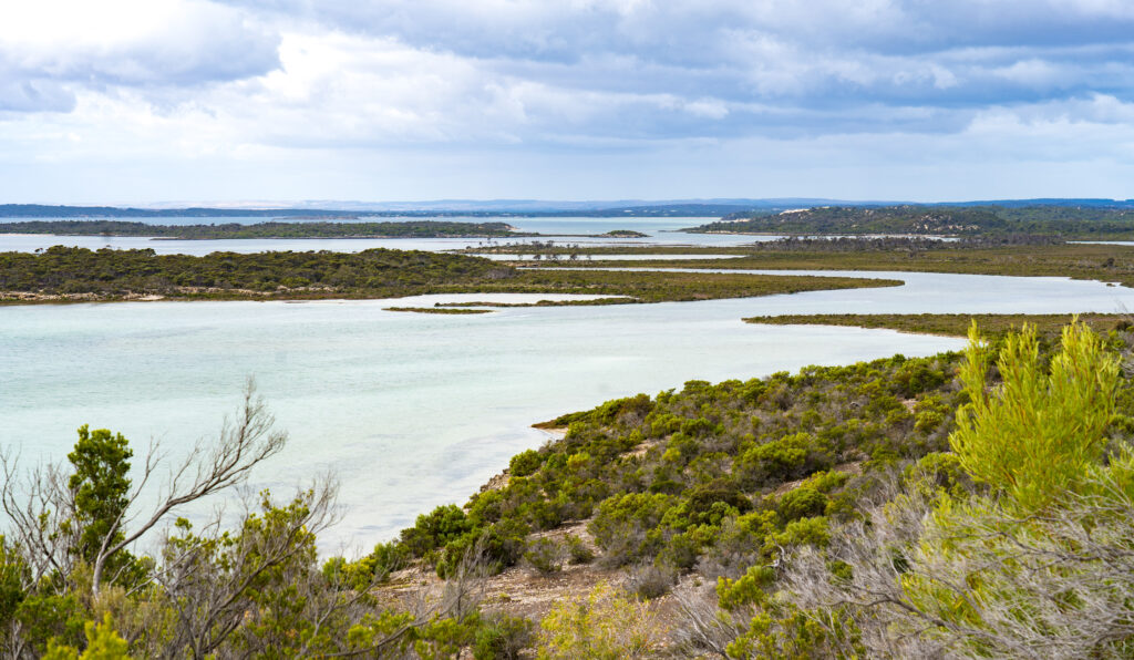
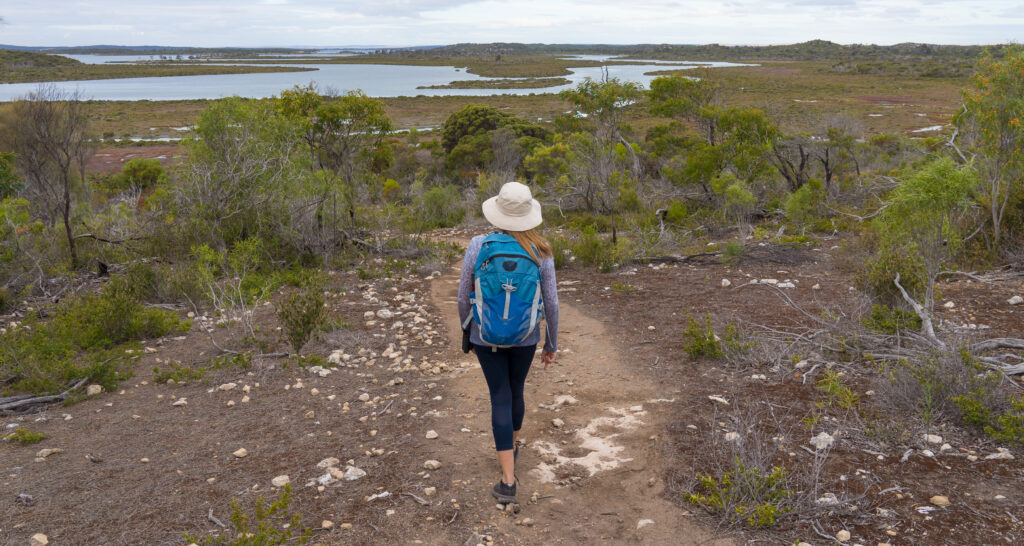
With Venus Bay in the rear view mirror we turned north, heading to the drier interior of the Eyre Peninsula, the South Australian outback. We were aiming for the outskirts of the Gawler Ranges National Park.
Within an hour we were pulling up at Pildappa Rock just outside Minnipa. Jutting up out of the flat landscape like a miniature Uluru, this pink granite monolith was a central point for the Kukatha Aboriginal communities, who used its surface pools for drinking water. Locals liken this rock to the more famous ‘Wave Rock’ in Western Australia, said to look like breaking surf in its erosion.
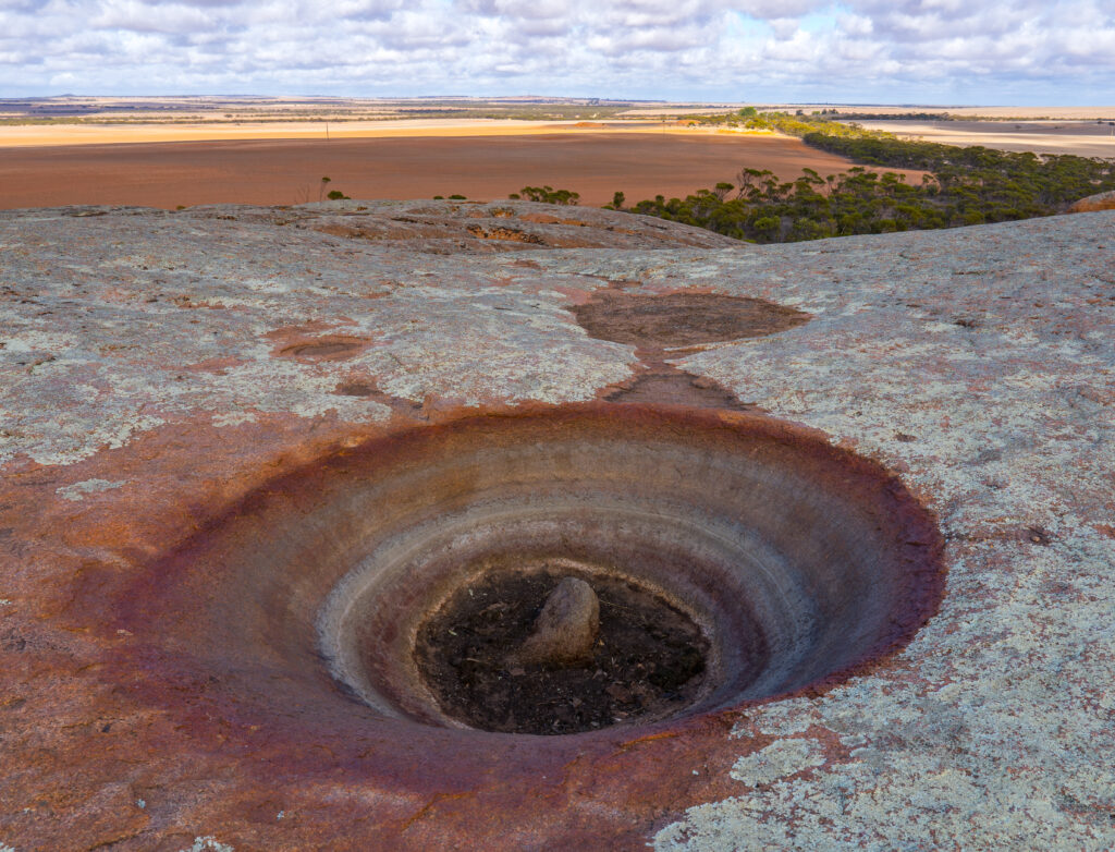
Geologists have found that this rock was originally formed about 7km below the earth’s surface (1500 million years ago!). The surrounding soil has weathered much faster than the rock, hence it now towers over the surrounding area. It is estimated it erodes about 50cm every million years.
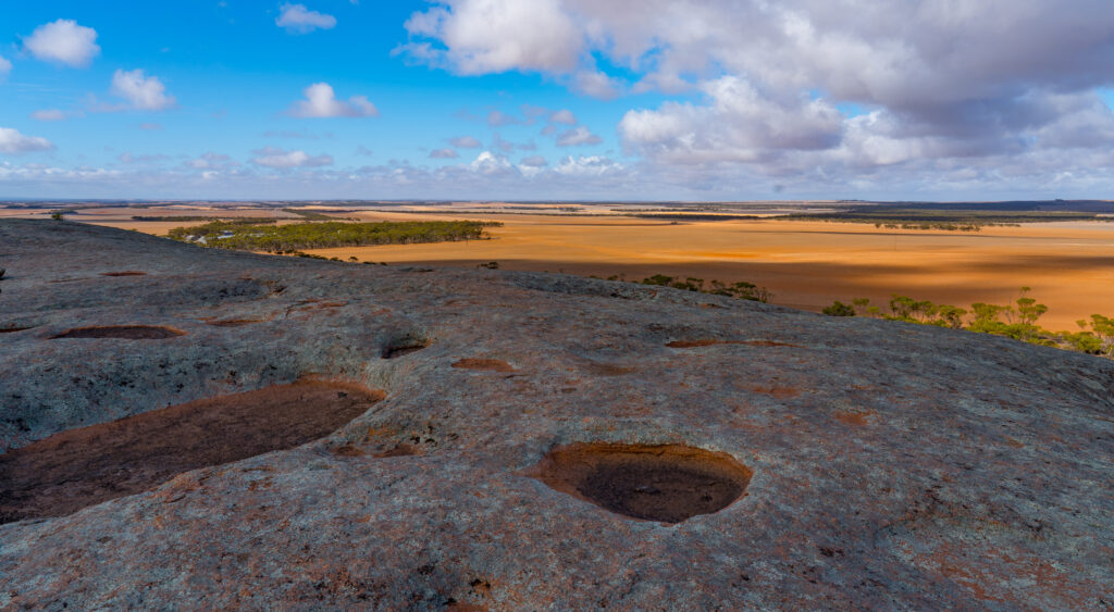
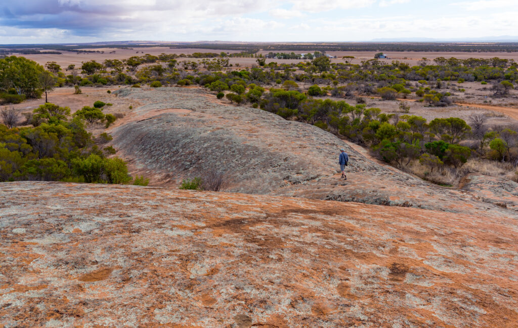
On our visit, all the pools were dry, the lack of rainfall evident in the dusty surround, our climb up revealing stunning views of the landscape around us.
The First People traditional owners, the Kukatha community, cared for and tended to these lands, and we thank and acknowledge this. Being the only source of surface water for some distance, the people protected this rock and recognised it as a special and sacred place. When European settlers first arrived in the area seeking water, the Aboriginal community introduced them to this rock and shared their precious water, only to have it then taken over by the new settlers who built dams and drains to secure the water for themselves, restricting their access. Yes, yet another sad story of cruelty and selfishness from our ancestors.
Today much of the surrounding land is used for growing wheat, being autumn all harvested now. It is hard to imagine how anything grows in these dry, dusty conditions, Willie willies (mini dust tornadoes) are frequently seen racing across the huge fields, spinning up what is left of the topsoil.
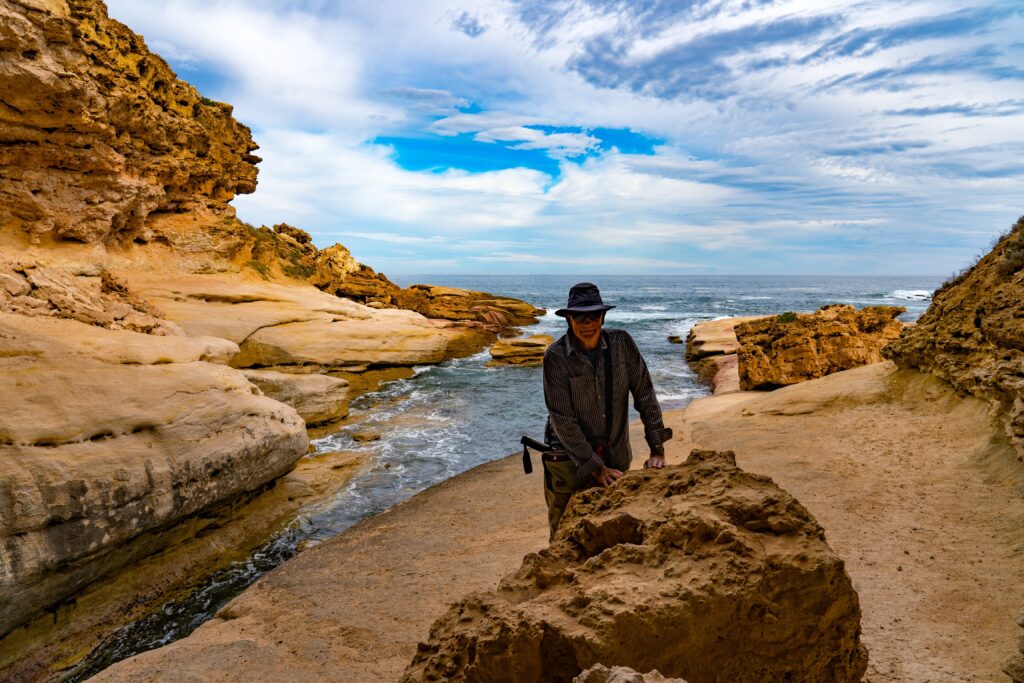
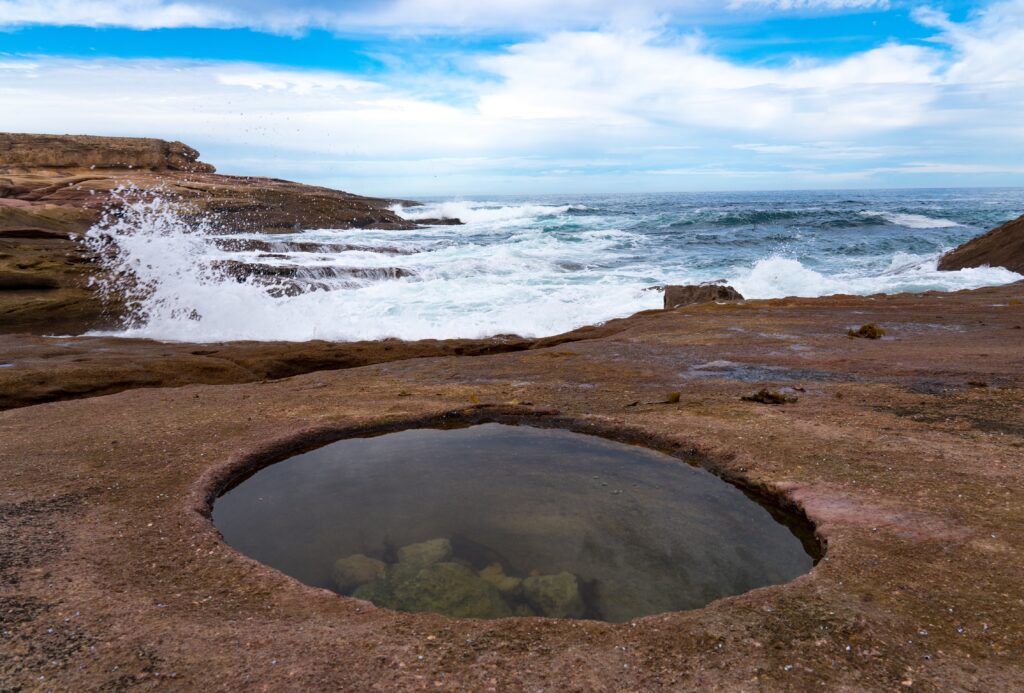
This hole is known as a gnamma. When it was full of rain water, the Aboriginal people would cover it with a rock to prevent evaporation and use by animals. Other water holes would be left open for exclusive use by birds and animals, sometimes laid with traps to catch a lizard for dinner..More gnammas and fine viewsMr A walking below meA rock slowly being sculpted by the elementsHello Tassie (she is asleep on the bed in the sunshine!)
We continued our journey, next stopping for lunch at a nearby camping area by some more sculpture-like granite rocks at Wattle Grove.
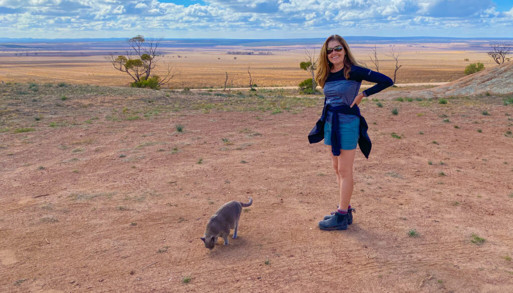
Miss Tassie enjoyed some interesting smells on her exploration
Once we left here, we joined a long red sand and gravel road heading further north towards a remote sheep station, Mount Ive. We let the tyres down a little to smooth out the corrugations and enjoyed the journey. The scenery was magical. The sun was just starting to dip in the sky and in doing so lit up millions of raindrops hanging in the trees, spinifex, blue bush and saltbush either side of the road. It was quite surreal, following a red-sand road surrounded by sparkling diamonds.
Flat and dry, this is sheep country
With the sun starting to set we decided to find ourselves a wild-camp just off the road for the night rather than press on.
Where were we? Somewhere near Mount Ive, just past Pinkawillinie Conservation Park
A space for the night secured, we had an explore, bewitched by the beautiful sunset and incredible light cast on the red hills and scenery around us.
Our evening viewA landscape dotted with hardy shrubs, and not all trees have won the survival battleOur camp for the nightBeautiful colours cast by the setting sunThe dusty road aheadHome sweet homeSun set
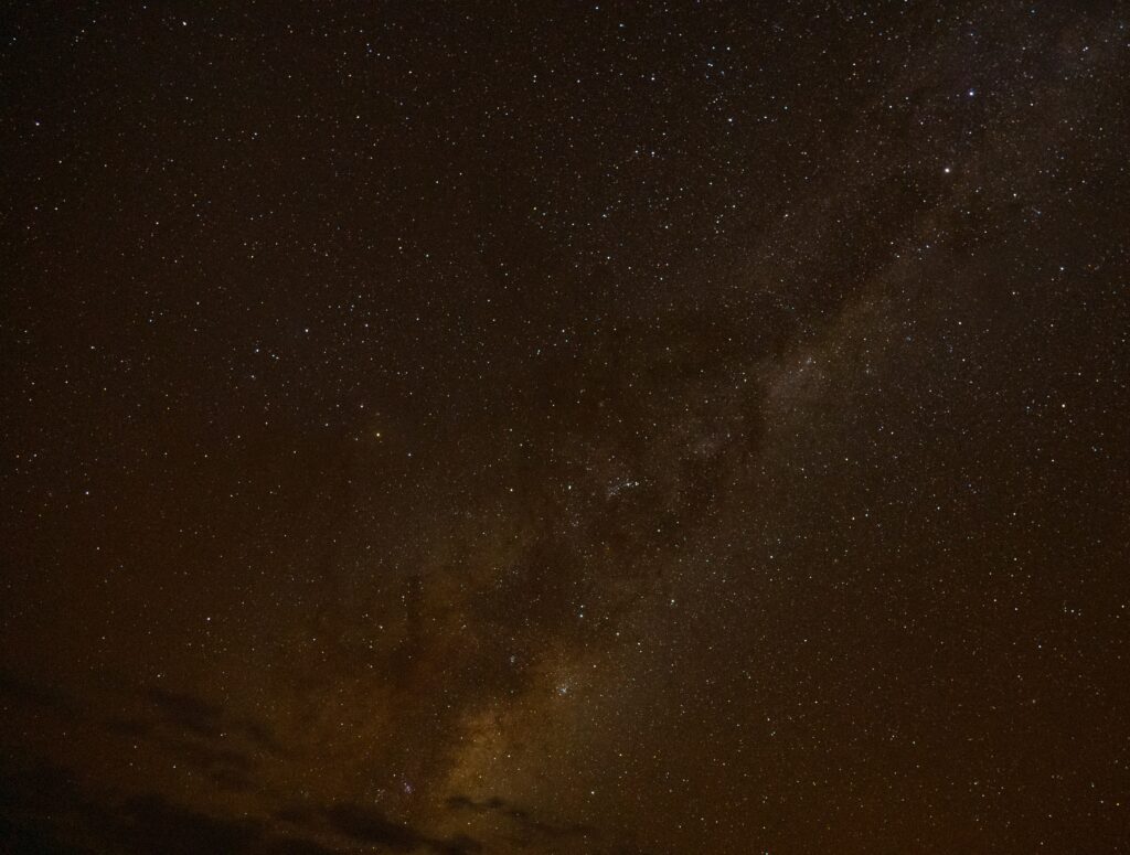
It was a beautifully dark night, a good opportunity to have a practice at some night photography. This shot of the Milky Way was my best first attempt.
A few clouds still around, but the stars are visible in a patch of clear sky
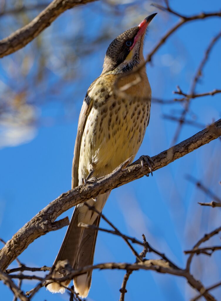
The following morning we had a walk around, in awe of the silence. You could hear your ears ringing and the cogs in your brain whirring! Every sound seemed incredibly loud. The flocks of birds seemed to think so too, most too nervous to hang around for a photo or even to be identified through binoculars. They clearly are not used to humans out here.
A Spiny-cheeked Honeyeater finally sits still long enough for me to capture it with my cameraGetting ready to head off
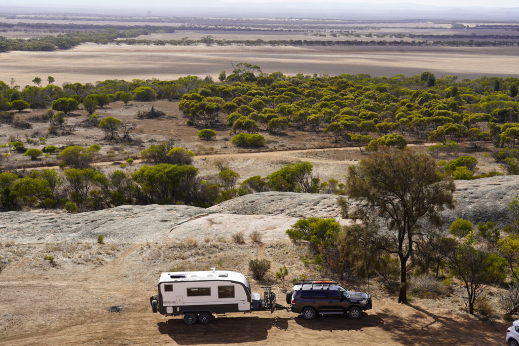
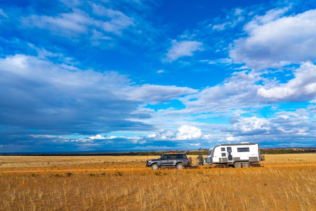
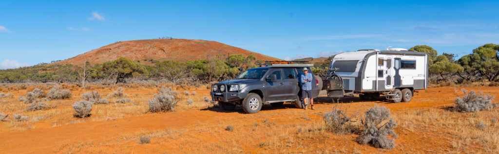
We drove the final 45 minutes to Mt Ive Station, arriving mid morning and set up on the dusty dry paddock they had assigned to campers. It was a bit disappointing really. After some of the wonderful station stays in Western Australia (especially Hambleton and Woolleen) it felt like there had been no effort made here. We had so many questions for the owners, but they were not present and the managers were fellow travellers and only had been working there for a couple of days.
A rather orange looking car and caravan – the dust gets everywhere
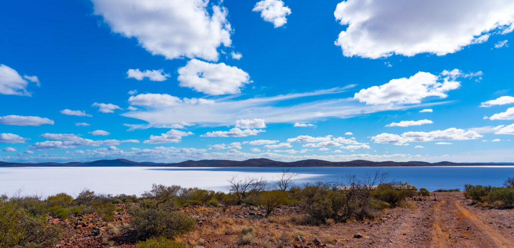
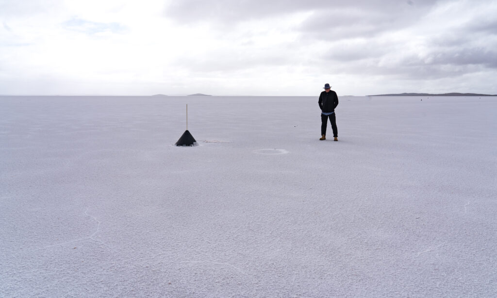
Visitors are attracted to the area because of its proximity to Lake Gairdner National Park. We paid for a mud map of a track and a key to a locked gate giving us access to the lake. Lake Gairdner is a huge salt lake, famous for land speed record attempts during Speed Week each March.
After setting up camp we took a drive out to the lake. No driving is allowed on the lake outside of the allocated event.
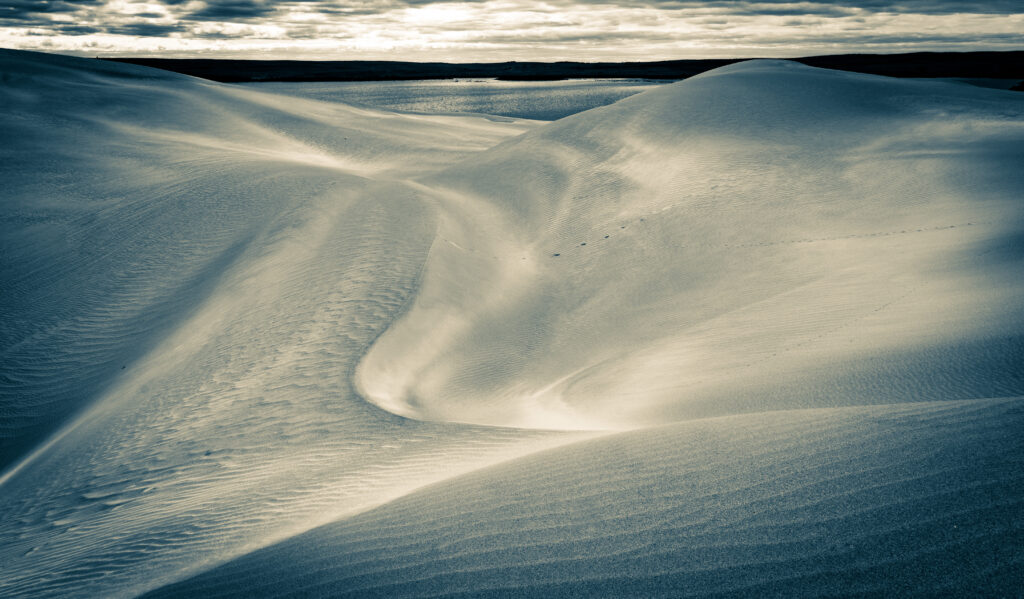
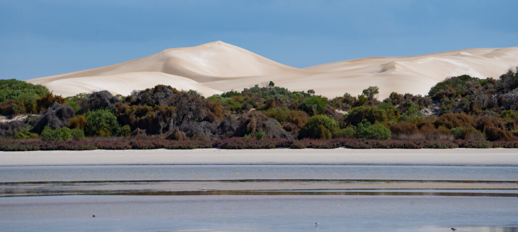
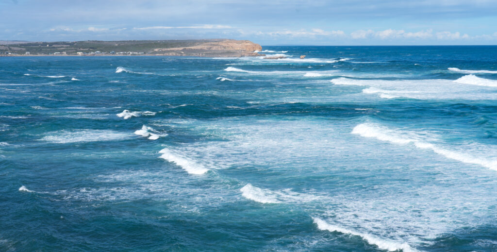
Our first view of Lake Gairdner takes our breath away
The lake is considered to be the third biggest salt lake in Australia. It is 160 kilometres long, and 48 km across, so the area we visited was all but a tiny corner.
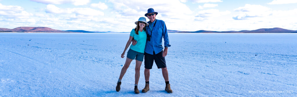
Looks like snowfields
Stepping onto the lake it is hard to convince your brain it is not snow. It crunches like snow, but is not at all slippery, with little give when you step on it. In some places this salt is more than a metre deep.
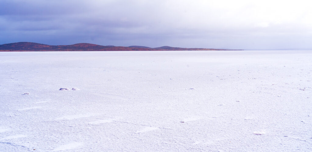
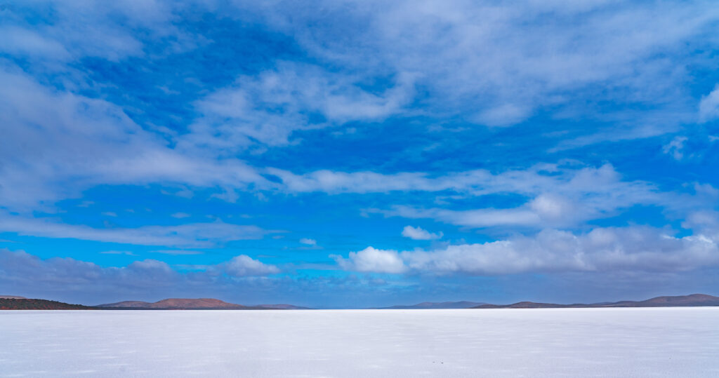
We enjoyed our experience so much we went back the following day – the grey skies changing the whole scene, and being wrapped up in our winter gear it felt even more like a snowfield.
Mysterious skies change the sceneCrunchy salt surfaceMr A on the race courseThe sun breaks through the clouds, and the salt lights up
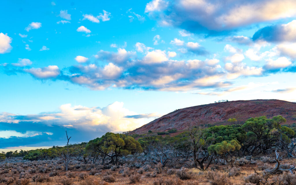
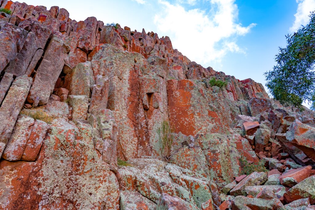
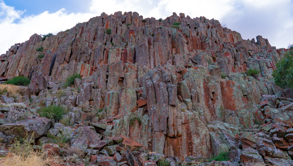
The Mt Ive Station property also has a volcanic geological area known as the Organ Pipes. We hiked up a dry creek to explore.
Beautiful views down the valleyUp at the tocksThe Organ Pipes – they face east, so get only the early morning sun. They are covered in green lichen.You can almost imagine yourself being in a grand cathedralMore magnificent views and colours from higher upOn the western side of the valley rocks are covered in orange lichenOur lonely car in big country
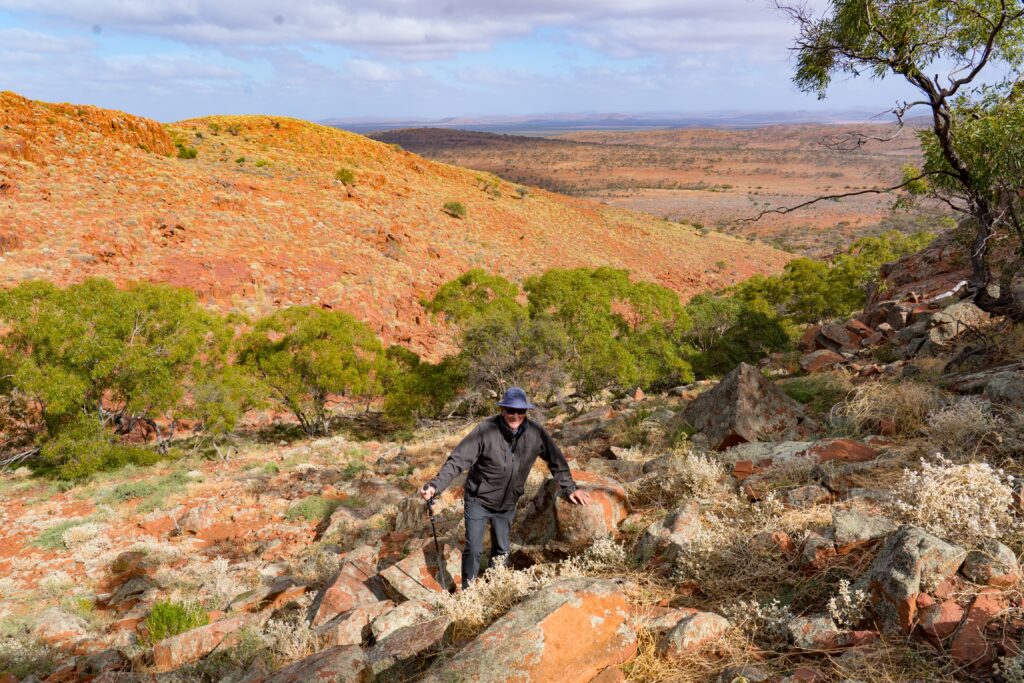
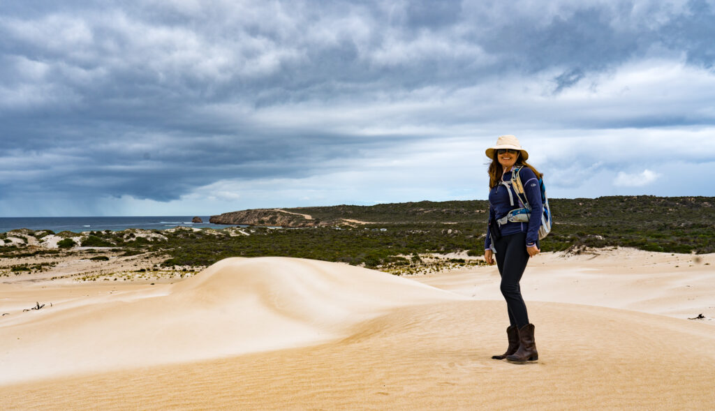
The station is mostly set up to encourage four wheel driving, with visitors given the option to buy another mud map with further routes to explore. Rather than spend more time in the car, we decided to try some more walking, picking our way up through the rock and prickly spinifex plants to the top of one of the hills surrounding the property.
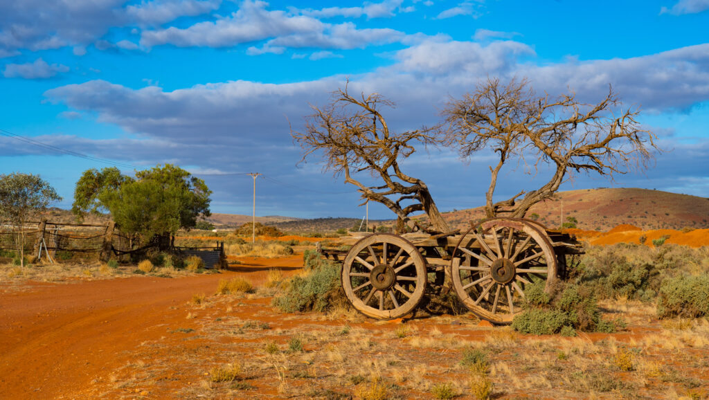
Mt Ive StationPanoramaPrickly spinifex is home to many little critters, including marsupial mice and lizardsAn old cart on the property
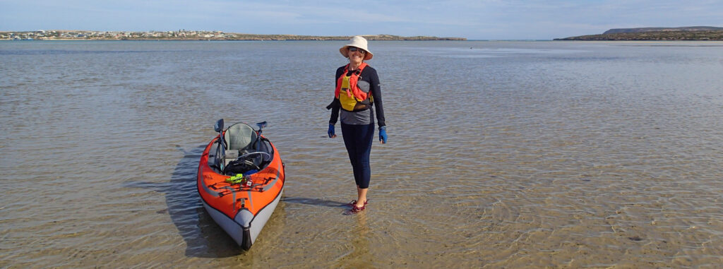
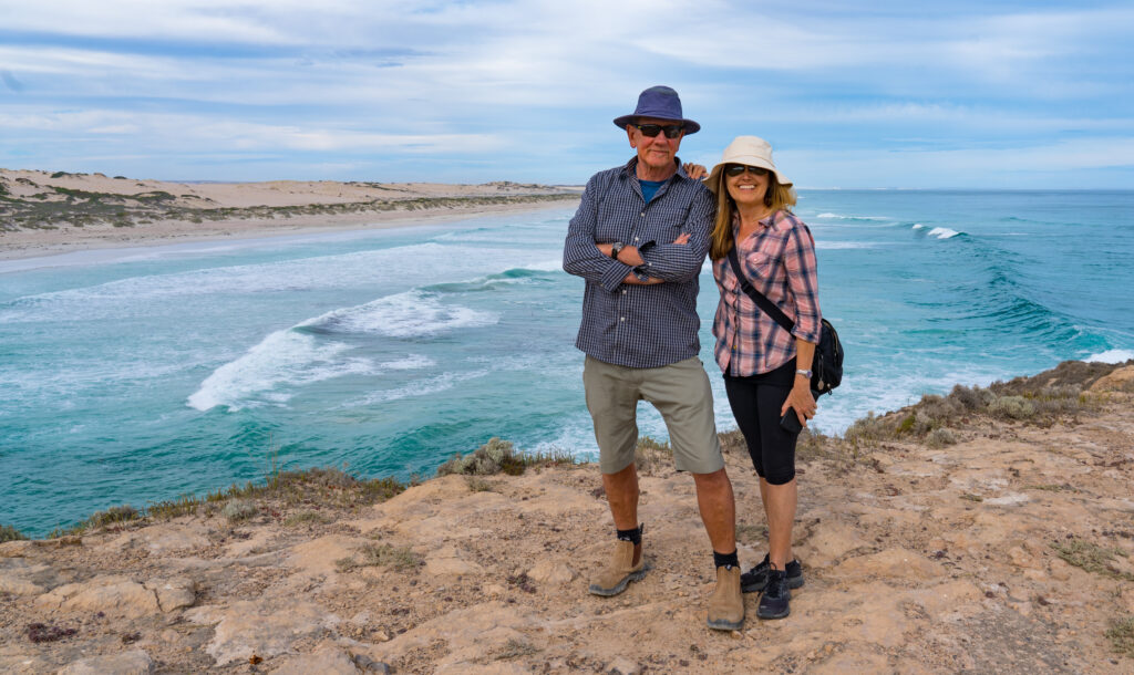
We had a good couple of nights here, but especially enjoyed our time wild-camping. We hope to do more of that in the coming months. For now, however, we had to head back to the coast and Whyalla – I had a plane to catch…
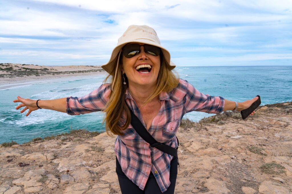
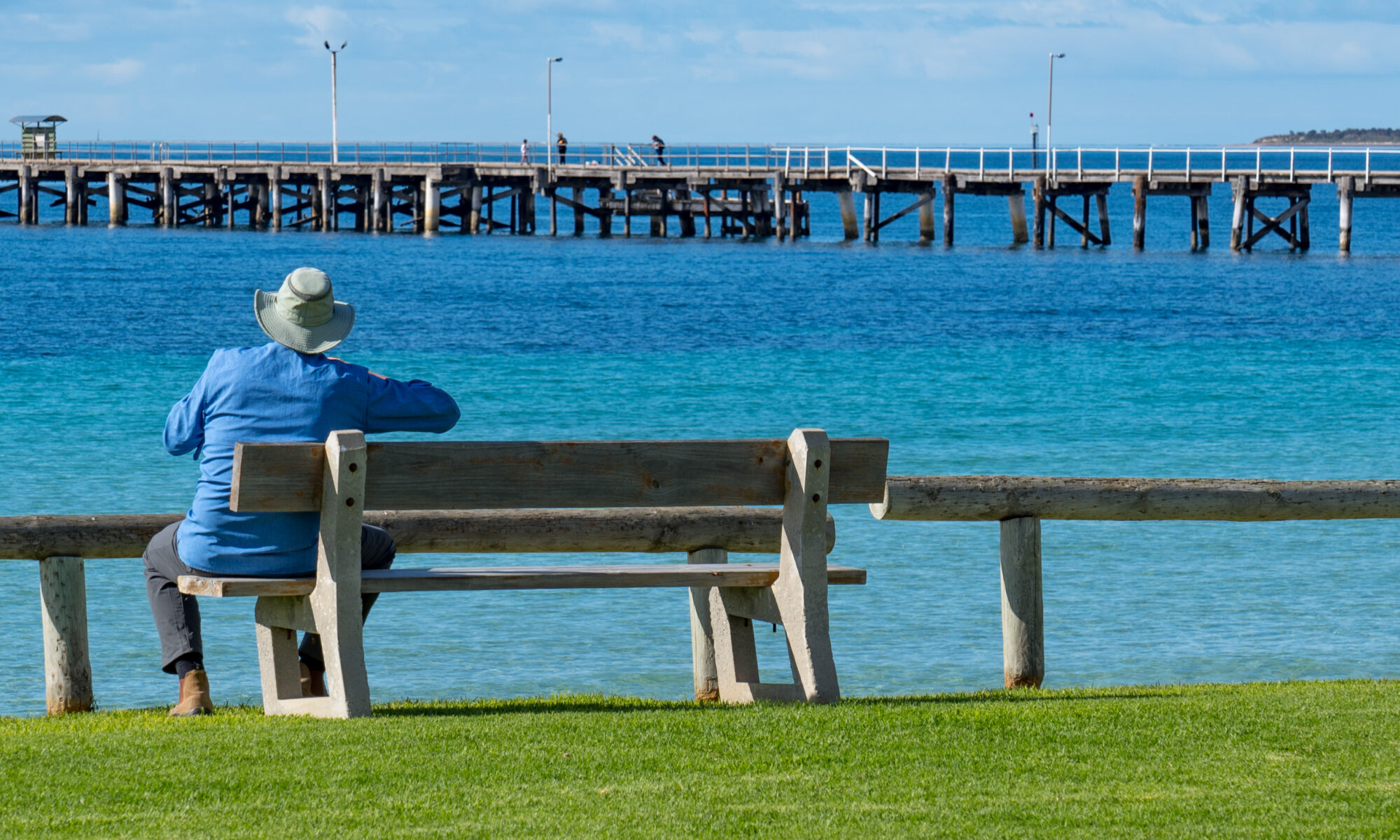
Location: Venus Bay, Eyre Peninsula, South Australia
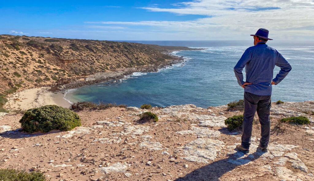
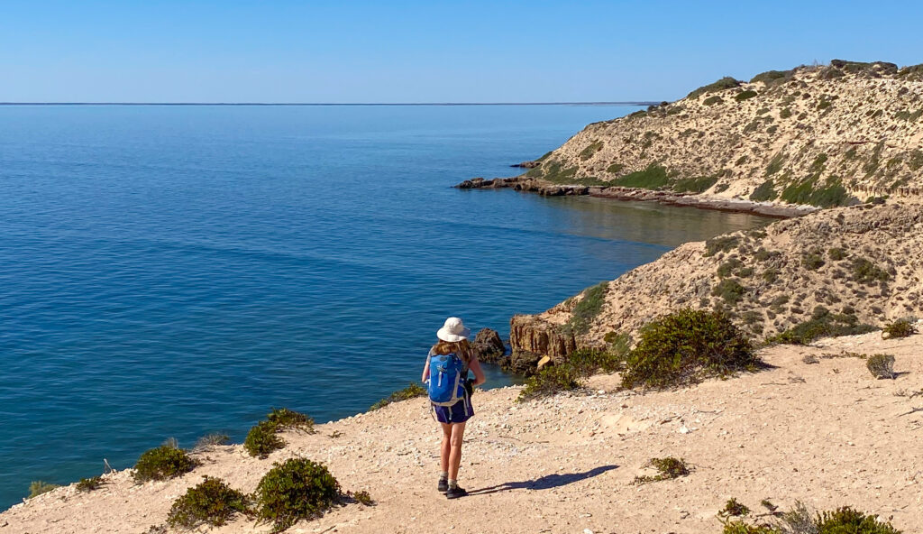
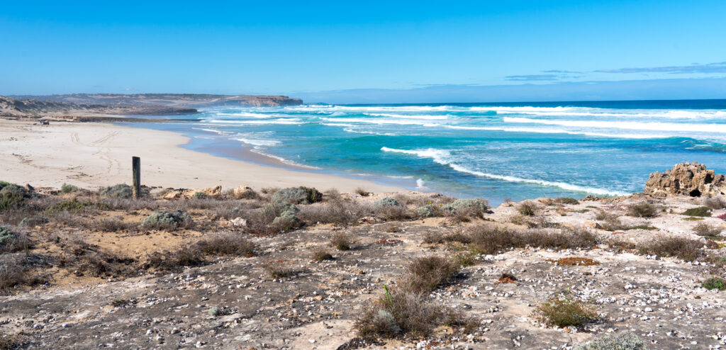
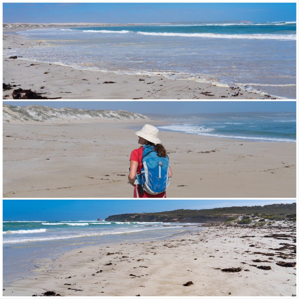
They Eyre Peninsula coastline runs for a staggeringly long 1,726 kilometres, and we have just spent the last five weeks wandering around the majority of it. What a trip segment it has been, so wild and wooly.
It is fitting to finish off by visiting one of the more photogenic places we have ever been to. With both a sheltered bay and a wild surf coast, all within walking distance of our little (very crowded!) caravan park on the foreshore of Venus Bay.
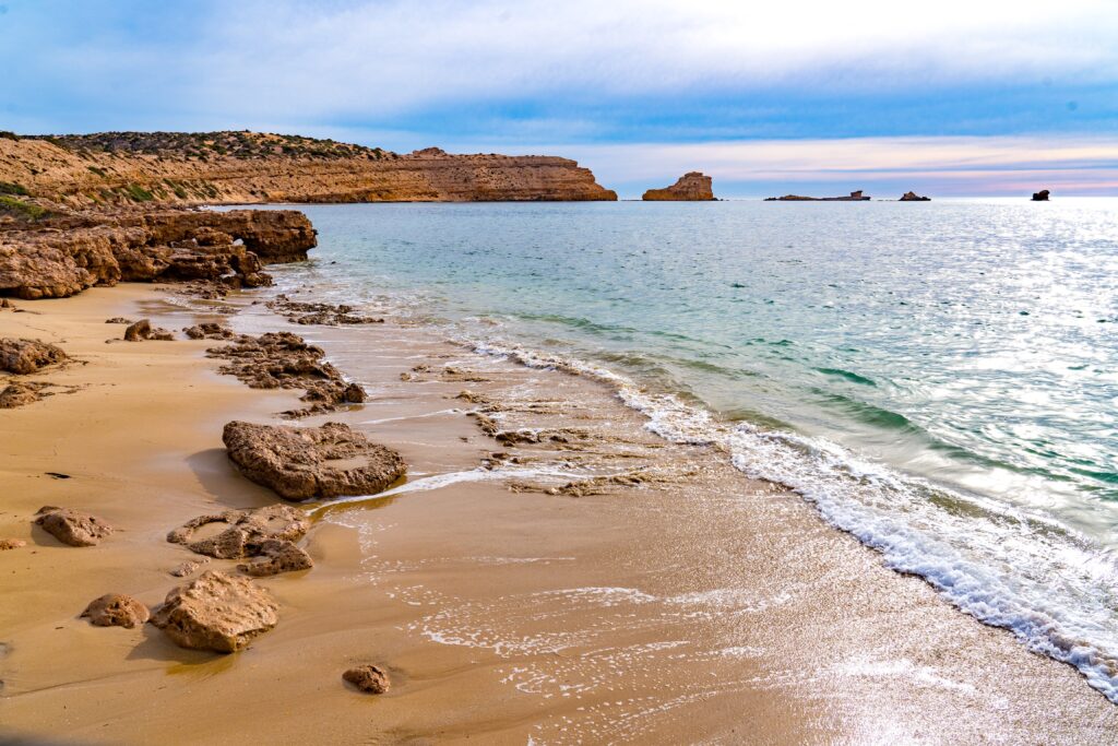
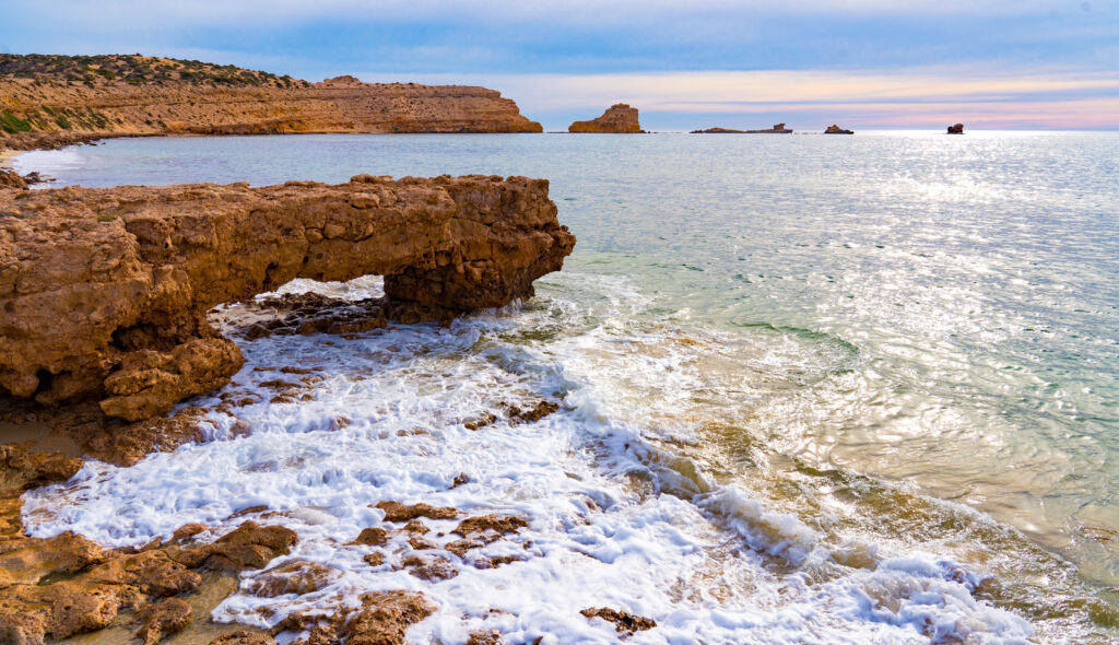
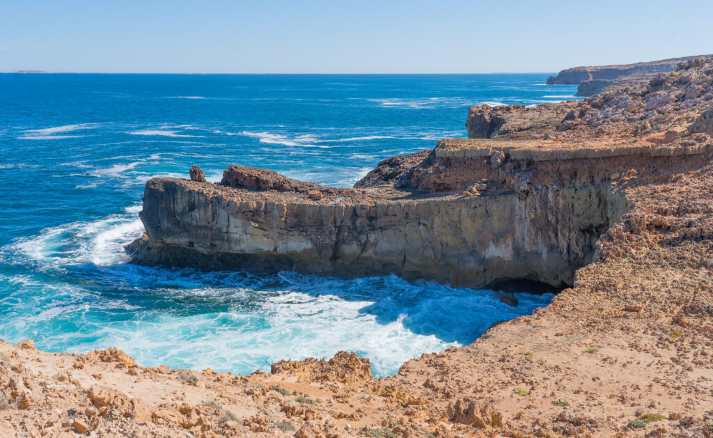
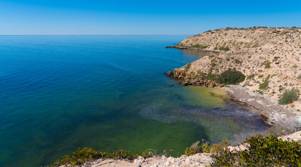
Now, the ancient Italians named the goddess of cultivated fields and gardens Venus, and there sure isn’t anything that civilised here. It‘s nature at its most magnificent, but it is raw, humans haven’t tamed it. There’s not a blade of grass in sight. It‘s all sand, and salt, and wind, and sun. The elements are in charge here. You can see where the sea is winning its millennia old battle against the land, as the limestone cliffs slip, chunk by chunk into the ocean, carving out these magnificent shapes in the rock.
The sediments are visible in this ancient coastline
We acknowledge the Wirangu and Nawu peoples as the traditional owners of the land that was then named Venus Bay (after the first sailing boat that explored this coast) by the early European settlers who started arriving after Mathew Flinders had mapped the coast. Early contact was as usual brutal when these First Peoples were denied access to their traditional water sources and fishing grounds by the settlers. Conflict that resulted in murders on both sides, and a public hanging for two aboriginals.
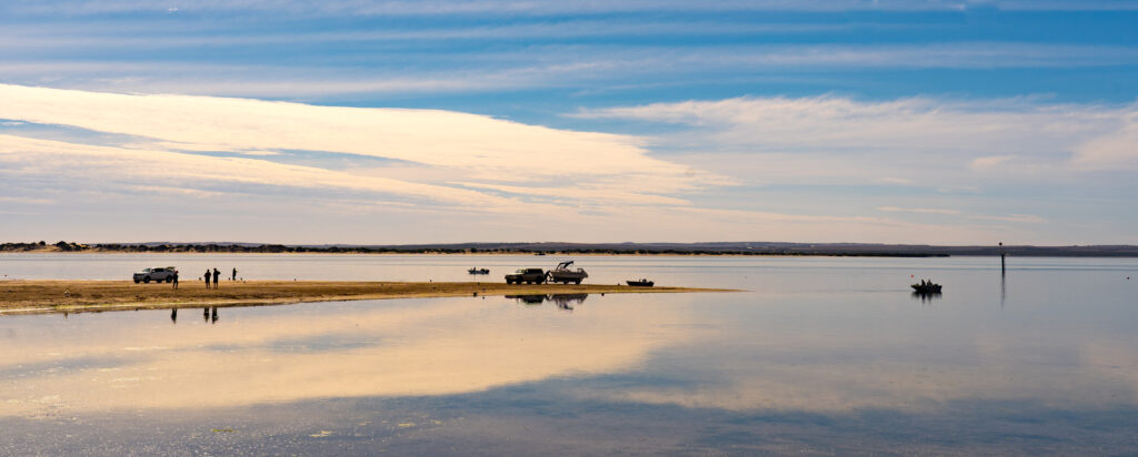
The still waters as we arrive
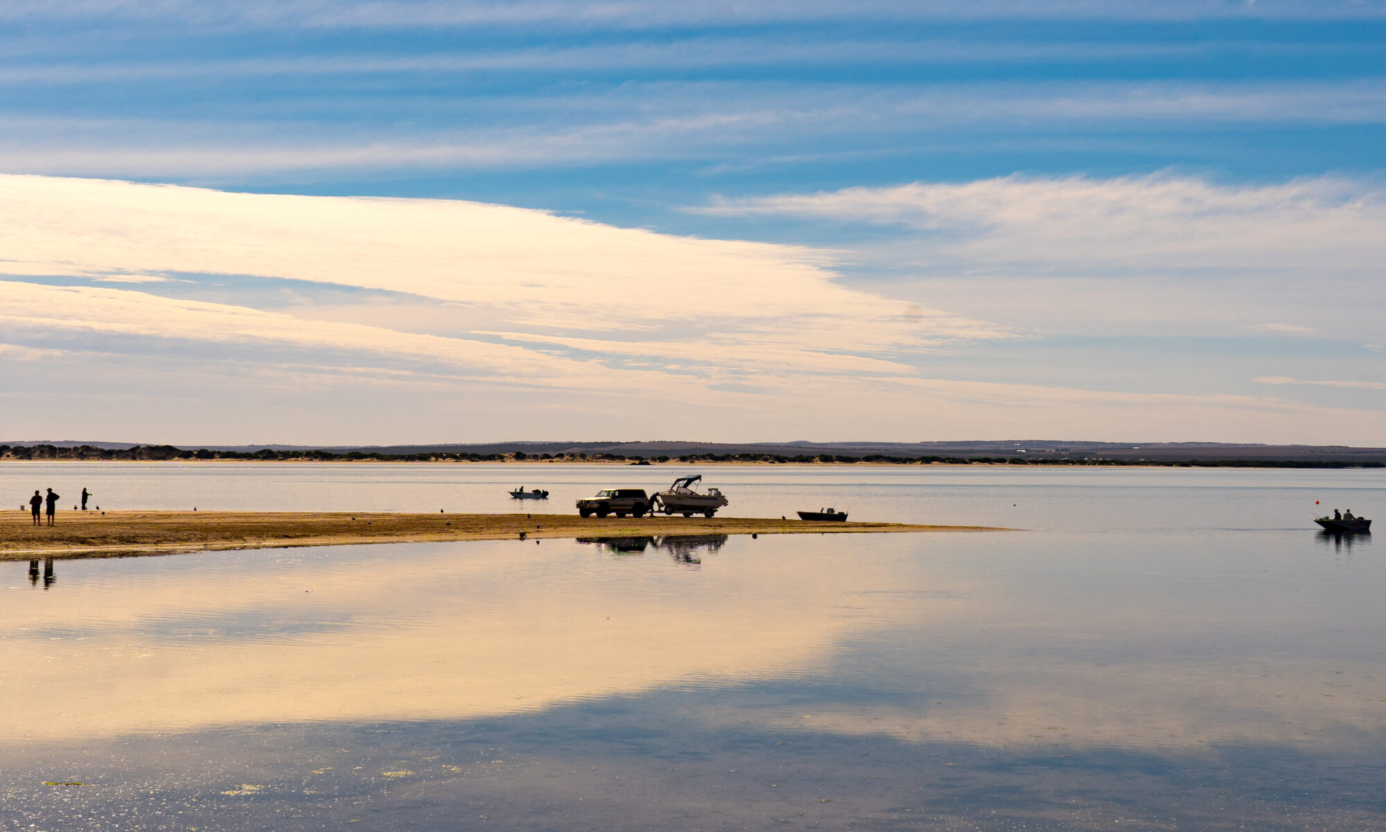
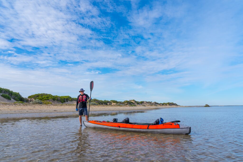
Arriving at lunch time we quickly set up the kayak to take advantage of a calm spell and set off randomly for one of the small islands we could see in the bay, I’d Googled them to try and find out anything, but the last reference was in 2006 in an obscure Department of Environment management plan. From that I learned the islands are (were?) home to some endangered flora and fauna. Well the birds certainly kept well hidden from even Catherine’s long lens. With over 360 offshore islands just in the State of South Australia alone, it gives you an idea of the scale of this country. Unsurprisingly then, there was not a footprint on the beach. We climbed up to the sand dunes and gazed down into the interior and wondered who had last visited. On this crowded planet, this is a special feeling.
Island conquered We are the first footprints of the day at 2pmLooking back towards Venus Bay
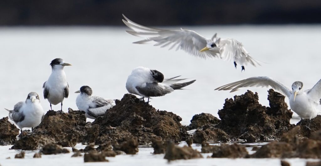
On the paddle back we did see some birds, one crested tern having a very bad hair day.
Even its mates think it could look better!
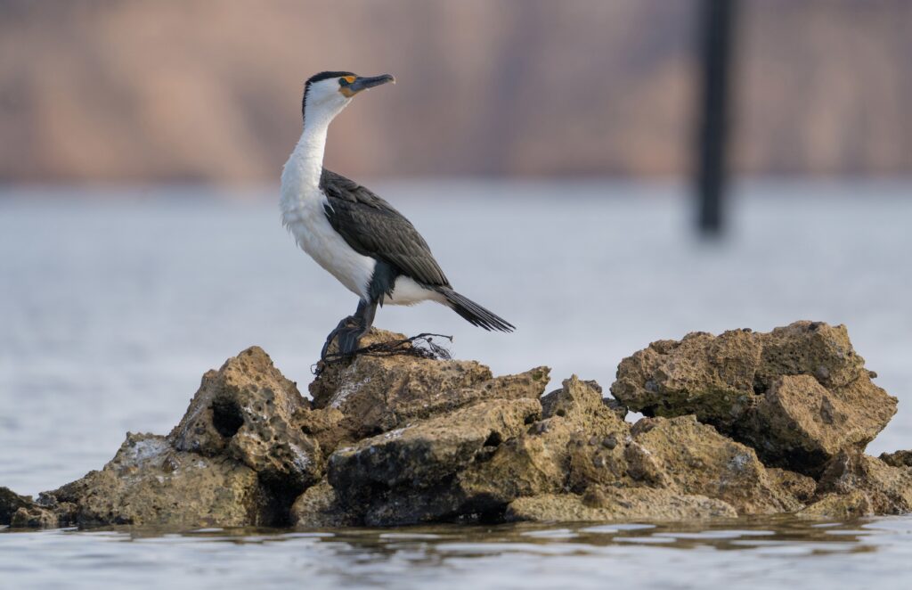
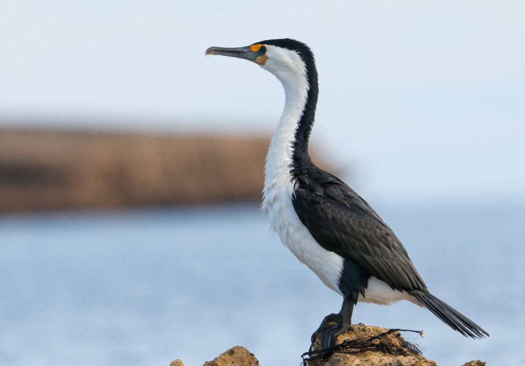
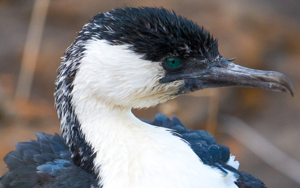
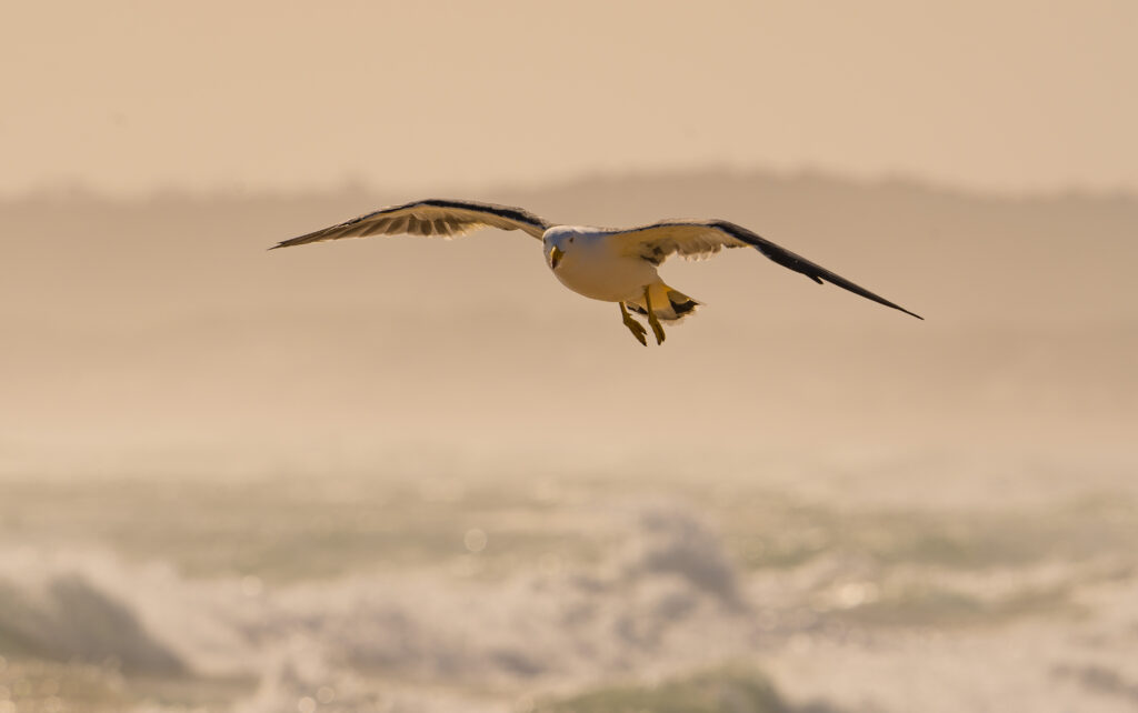
A pied cormorant stood proudly surveying its territory, and other than that the usual pacific gulls and pelicans, certainly not the species range we had been hoping for.
Pied Cormorant resting on some rocks between feedsWings drying in the afternoon warmthWe think we may have been spotted! Love the orange face though!
We did a couple of walks from the campsite around the cliffs, and just drank in the unspoilt grandeur of this place. Yes, there are a few new houses being built, but still we managed on our second walk to see not a soul once we had left the campsite. One set of footprints this time, but that was it.
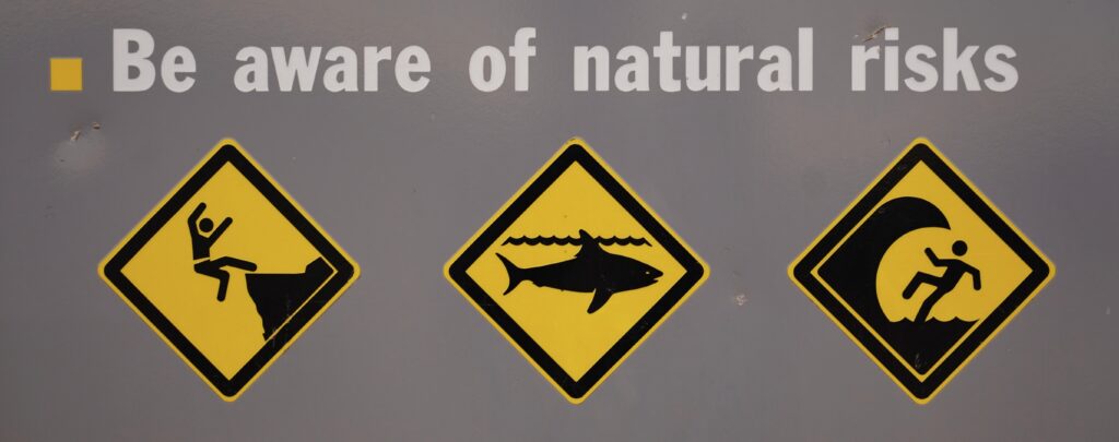
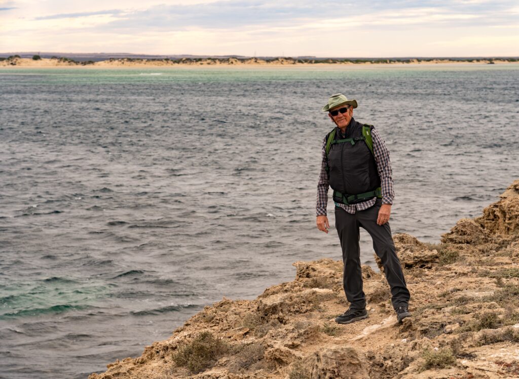
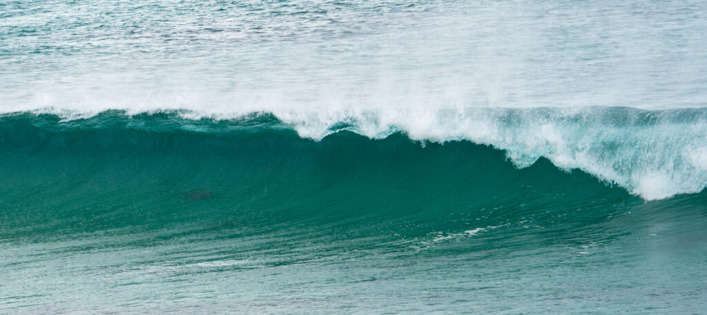
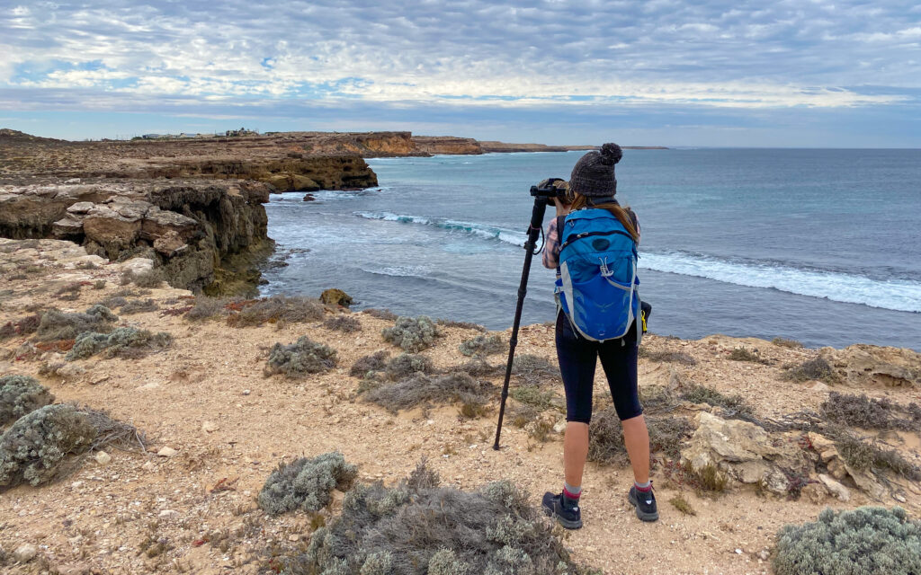
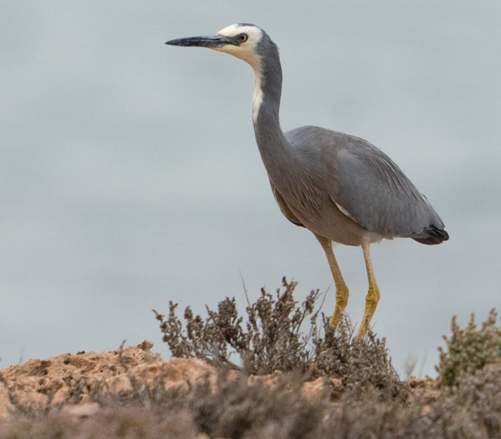
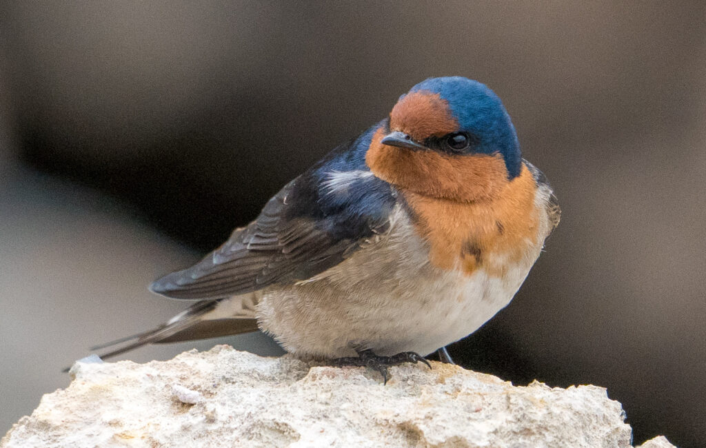
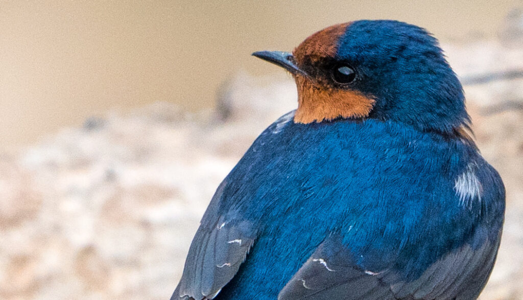
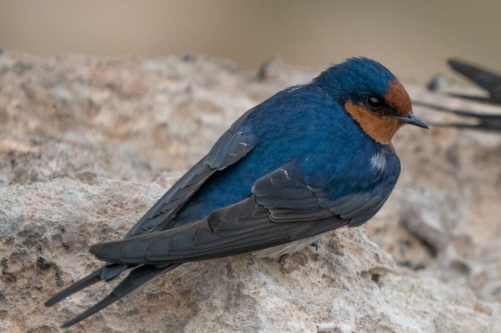
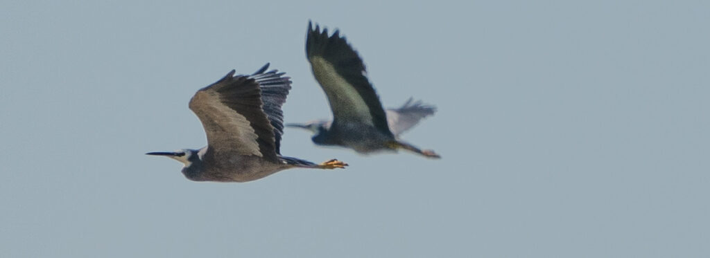
We avoided all crumbling cliff edges, sharks and surfTaking the headland walk on a very cold and windy morning The surf was looking wild with the off shore breezeMrs A spots some White-faced herons sheltering on the next headlandAnd here they are – the big lens meaning they are not disturbed A pair of Welcome Swallows stop briefly from their soaring for some respite from the windTheir break gives us a chance to admire their incredible colouringWelcome Swallow
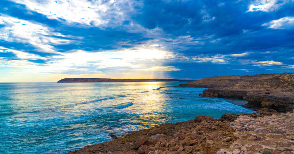
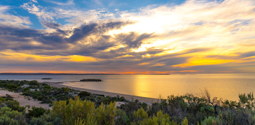
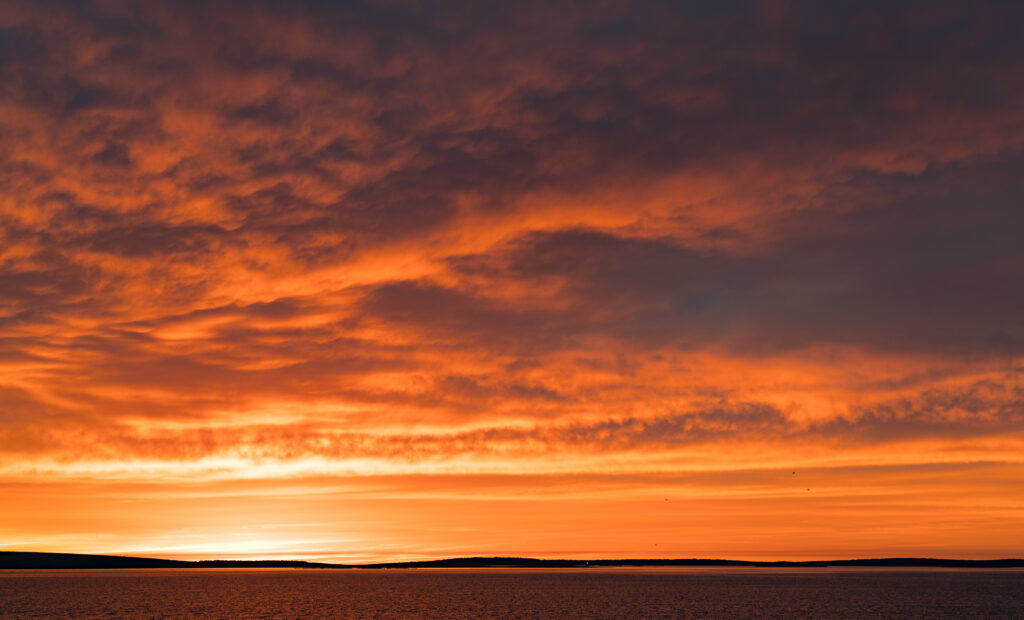
The sunset glorious. very few places in the world can claim to be this unspoilt.
Our clifftop afternoon walk gave us a break from the wind and some incredible viewsWhile the dunes look dry and sparse they are covered in succulents, survivors of drought and saltMore incredible coastline winds off in the distanceAn incredible sunset, seen from the town’s jettyVenus Bay sunsetLooking back to the campsite
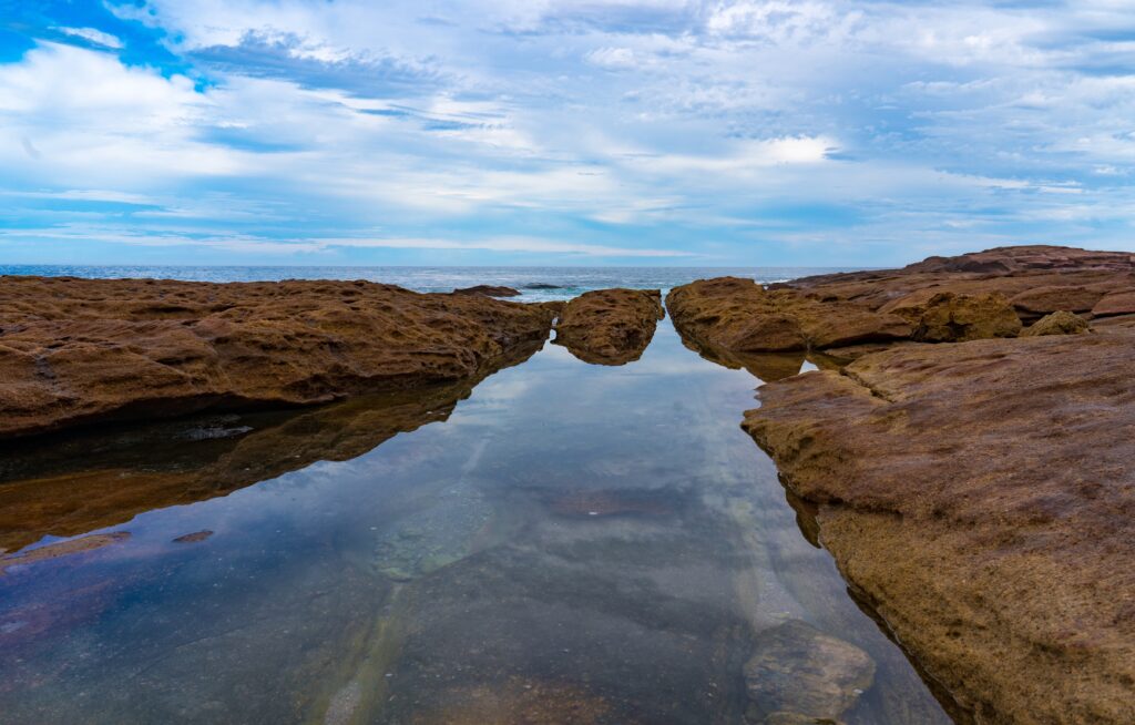
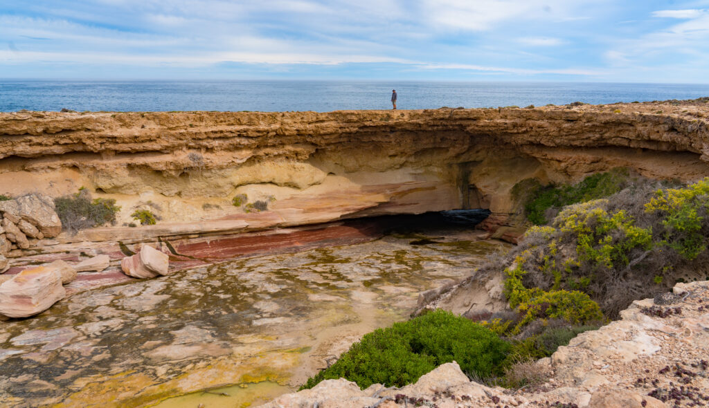
A short drive down the coast took us to a cave we had been recommended, as stretch of coastal sea scape that just had us grinning from ear to ear.
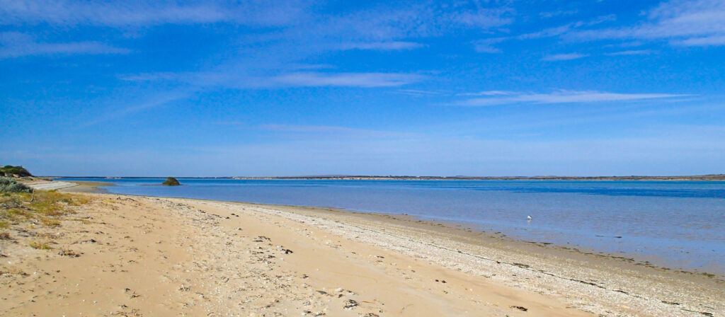
Another spectacularly still morningWoolshed CaveA perfect rockpool at Woolshed CavePristine reflectionsA collapsed cave known as The Tub – spot me on the backAnd just around the corner another endless deserted beach!
Venus Bay, you’re pretty special. But now its time to head off inland, leave behind the coast, and take in an entirely different landscape. And there you have it. The joy of caravanning.
Location: Streaky Bay, Eyre Peninsula, South Australia
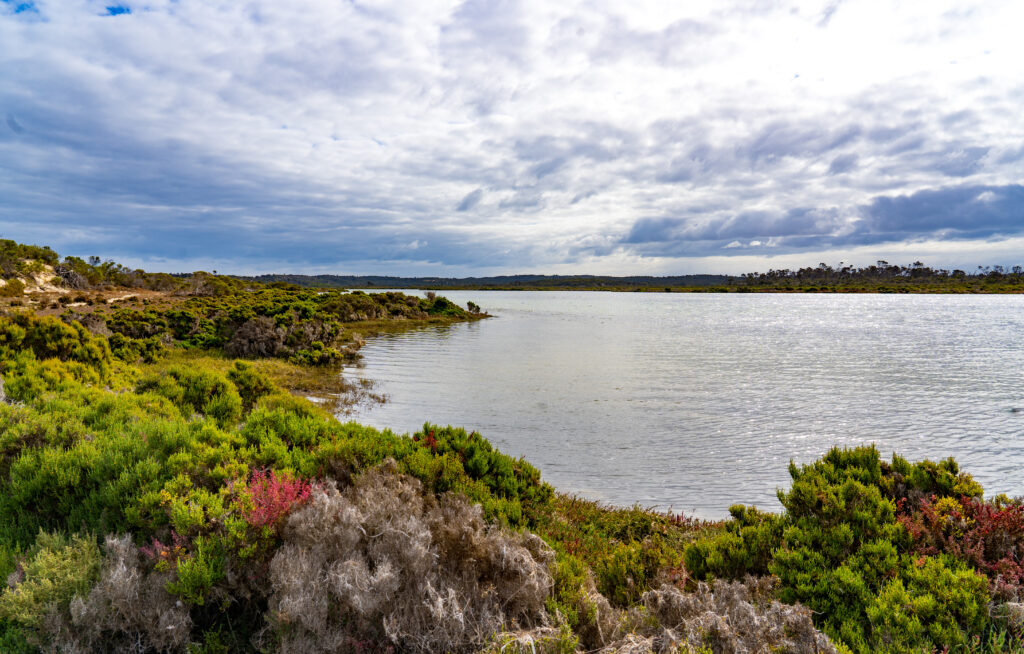
As our regular readers will know, it is quite rare for us to spend much longer than three or four nights in one place, but on this trip we are making a habit of slowing right down, and with few hard deadlines to meet, we are following our guts. Streaky Bay has been a perfect location to stop and pause at. Not only a great camp site, but lots to see and do in the area.
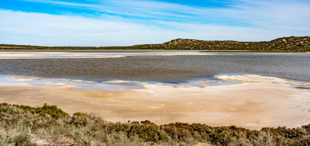
We had visited the Department for Environment and Water to ask where the the best areas for seeing birds were, and one area highlighted was Sceale (pronounced scale) Bay Conservation Park, in particular a saltwater lagoon which lay behind the dunes. We drove over for a look.
We found quite dramatic scenery with the wind whistling across the water, a shallow lake edged with salt encrusted mud, but not a single bird in sight, not even footprints on the water’s edge. We had a short look around and decided to continue down to the coast and Sceale Bay itself.
Sceale Bay Conservation Park – a bird-free zone
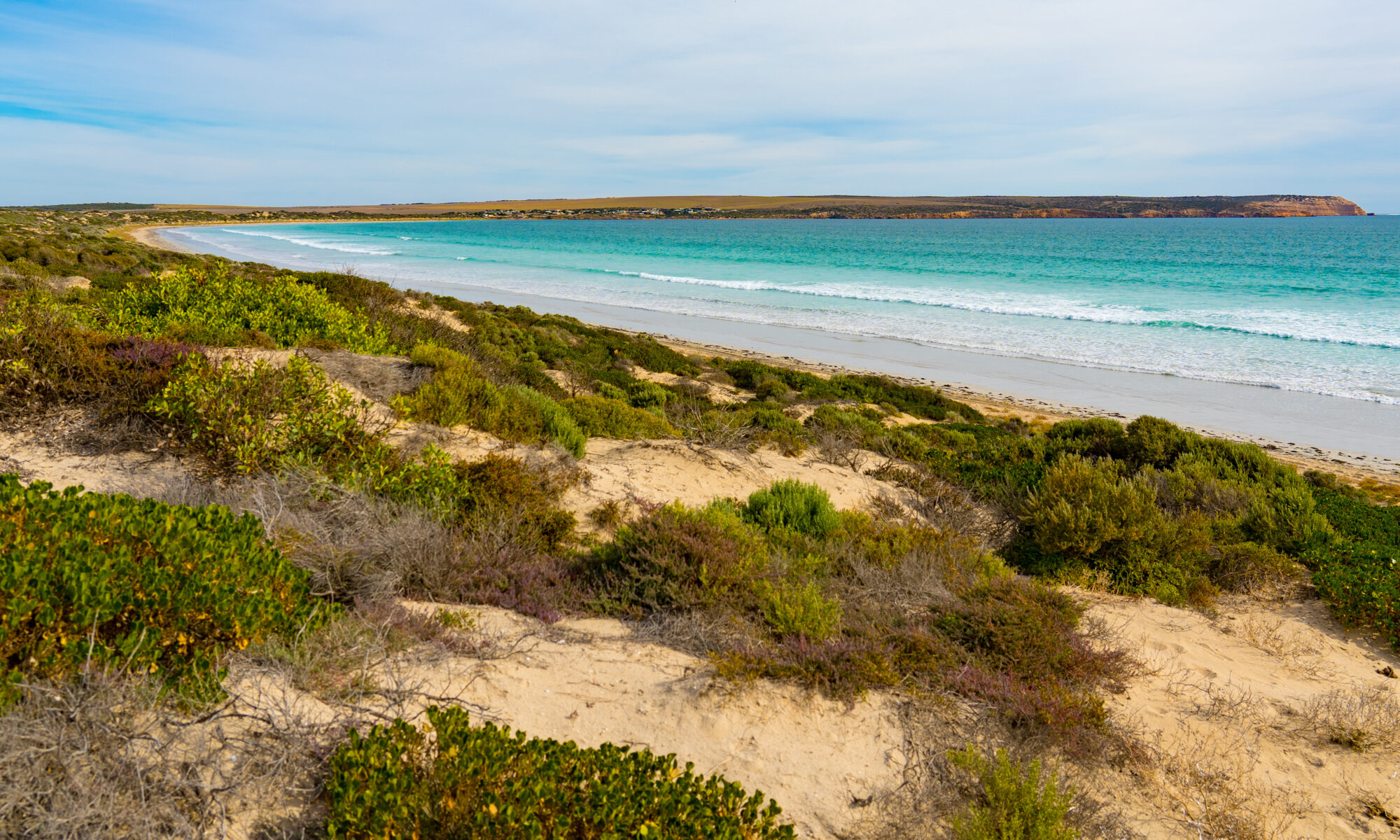
We found yet another stunning beach stretching along towards some small shacks and houses which make up the settlement, and just two people on the beach. It is just incredible how few people there are everywhere, and we are just lapping up the isolation.
Sceale Bay Beach – stunning turquoise waters with a clean surf break
We returned to the Zone to get ready for dinner. Yes, after my nasty food poisoning episode, we had decided to brave it for a night out in town.
We had chosen a small cafe with water views called Drift. They had an interesting menu, with ingredients sourced from local areas, so we had great expectations.
Sadly, we were disappointed. While the shared plate of steamed dumplings were tasty, they seemed no different from the frozen ones we occasionally have in the caravan. We both chose a seafood marinara for our main dish, only to find all the prawn, calamari and scallop flavours completely swamped with bucket-loads of an incredibly sickly sweet tomato sauce. So disappointing.
The wine we chose was nice, but tainted by the young lady serving us snapping that we couldn’t take unfinished wine home, and therefore she wouldn’t give us the cap! Responsible service of alcohol regulations anyone? In their favour, neither of us ended up sick, so that was good. Overall, it was such a shame. We so wanted to support this small business.
A fine view for dinner, even if the food was disappointing
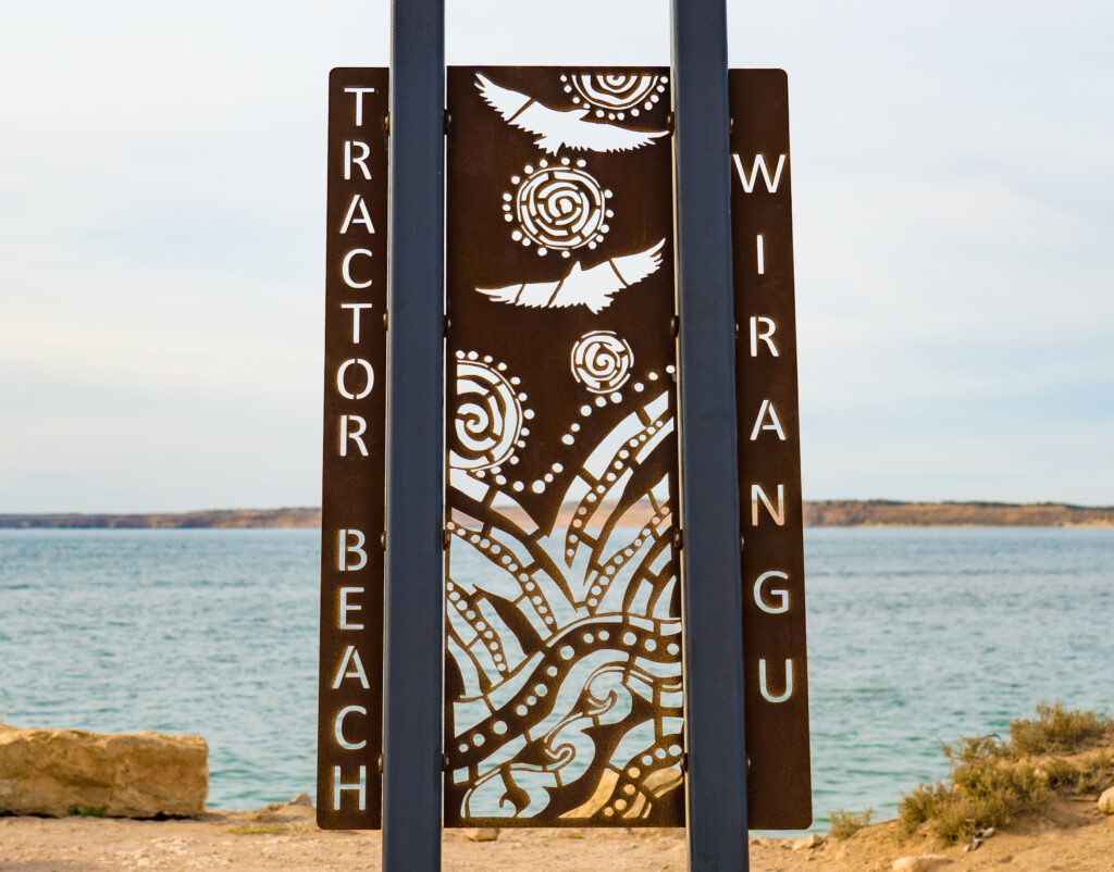
Saturday dawned overcast, so we followed part of the Westal Way loop drive (one of three loop drives from Streaky Bay which take visitors to several natural attractions) and made our way to Tractor Beach, just 20 minutes south. There’s council camping in a site by the beach and they provide free wifi and solar power charging at the beach shelter.
Charge up and get online by the beach shelter.
The sign at the beach was our first and only sighting of any mention of the local Aboriginal Wirangu communities which previously made this coast their home. We recognise their connection with this country and thank them for their custodianship over the past thousands of years.
We were the only two people exploring the beach of course, which stretched along to an ever-decreasing headland, slowly being worn away by the sea. Another picturesque afternoon’s outing, but still no sight of the sea-eagles or osprey which apparently call this coast their home.
A picturesque beach, particularly as the sun breaks through and shines across the bayWIth tinges of pink on the skyline it almost looks like sunset – an eerie afternoon light
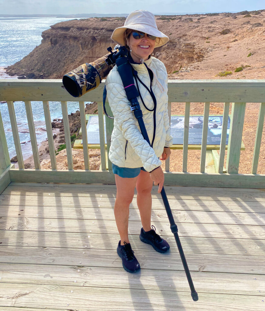
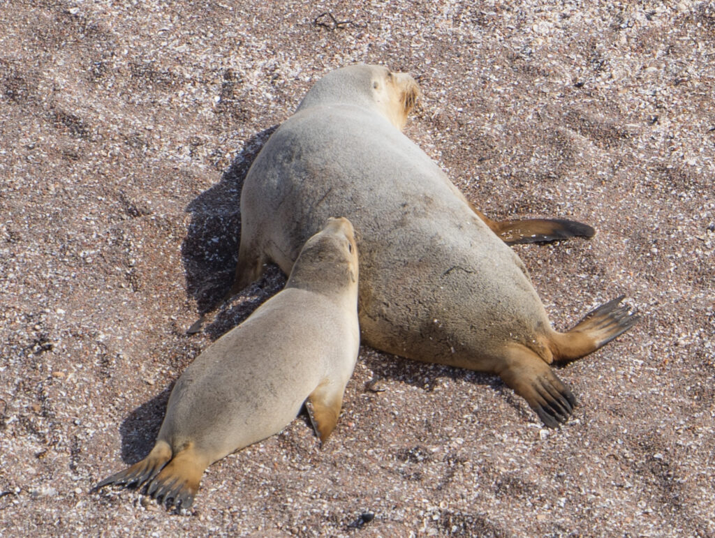
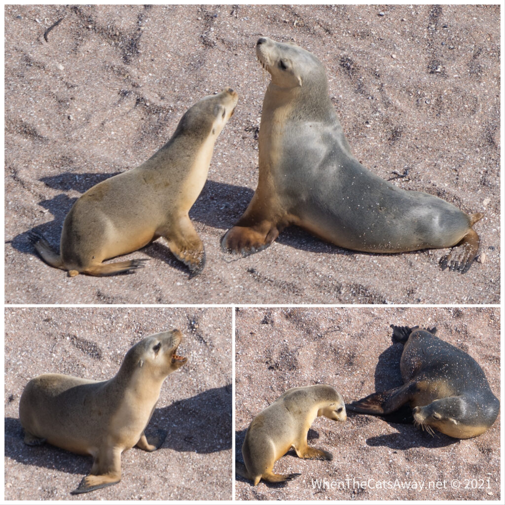
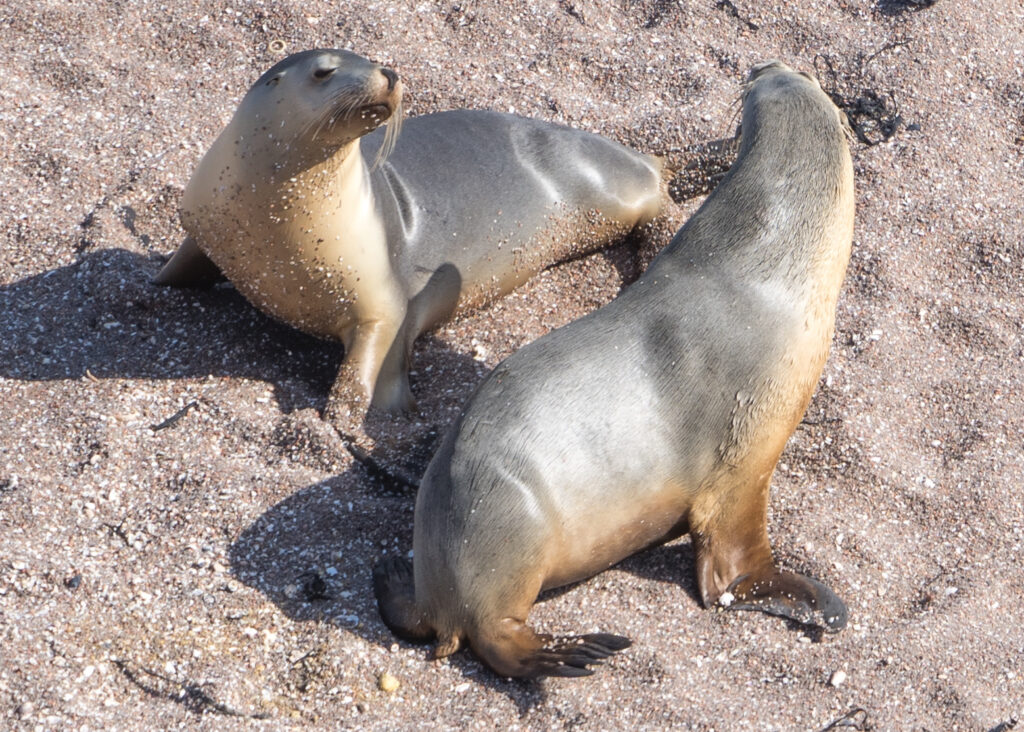
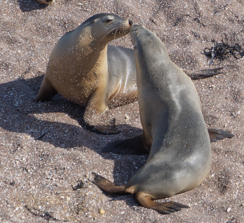
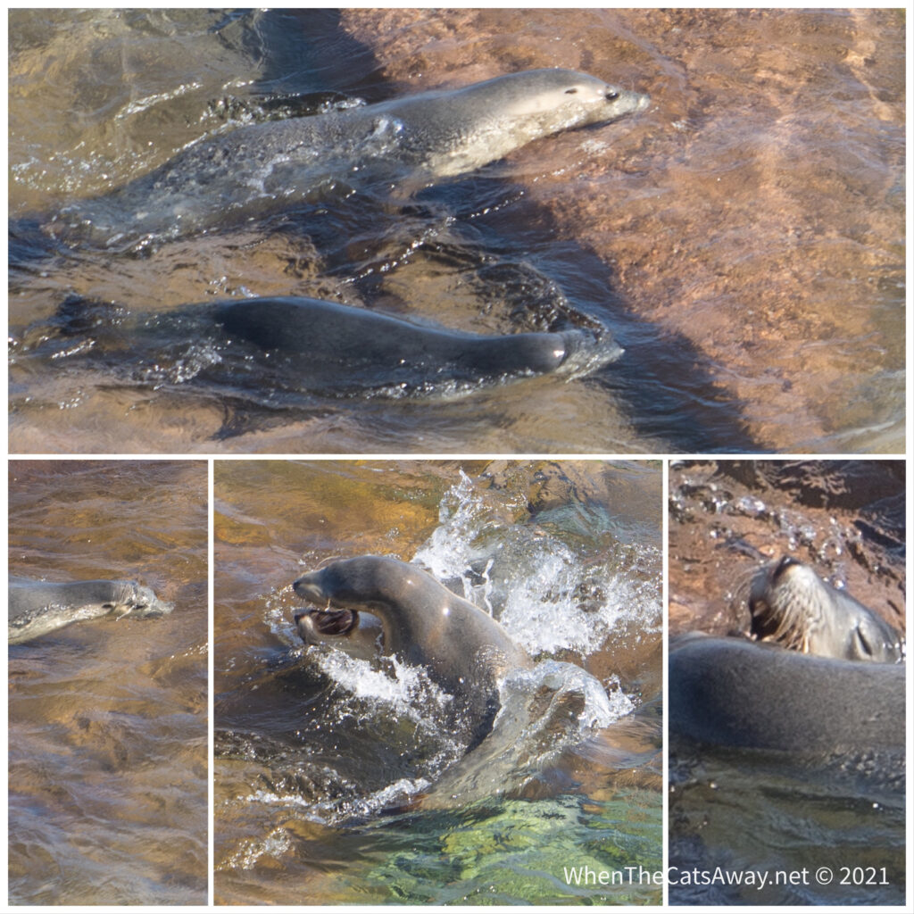
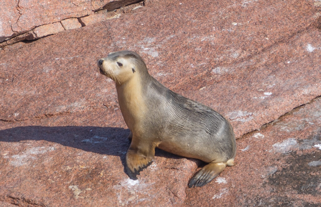
Our surprise sighting of a female Sea-lion last week had left us wanting more, so we took a drive out to Point Labatt, about a 50 minute journey south of Streaky Bay. The drive took us along the stunning Baird Bay, a relatively calm but expansive area of water surrounded by sand dunes and not a boat in sight. We are constantly amazed by the spectacular beauty we find here, with so little human impact to spoil it.
Finally at the point, we found ourselves at a viewing platform above one of Australia’s last remaining Sea-lion colonies. As mentioned in our last post, it is heart wrenching to think that these beautiful creatures could be extinct in the next 40 years unless something is done to change their demise now.
It was incredibly windy at the lookout, and we had to wrap up warm to stand there and watch the goings on below us. Both Australian and New Zealand fur-seals and Australian sea-lions make this location their home, protected from their main predators, the Great White sharks, by a reef out at sea.
Sea-lion paparazzi disguised as a cloud!
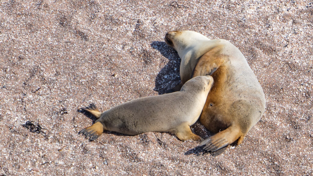
Female Sea Lions carry their pups for just under 18 months before they give birth, and then are pretty much ready to mate again within a week. Sadly only 3 out of every 10 pups will reach maturity.
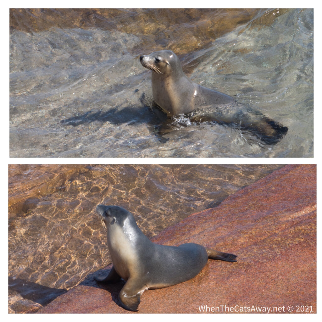
A Sea Lion Pup feeding from mum on the beachSometimes mum is just good for a warm chin rest
Sea Lions differ from seals in that they have external ear flaps, and rather than flopping along on their bellies, they can walk on land using all four flippers. All females are light grey with yellow-cream chests and bellies, while the males are much darker and up to four times larger.
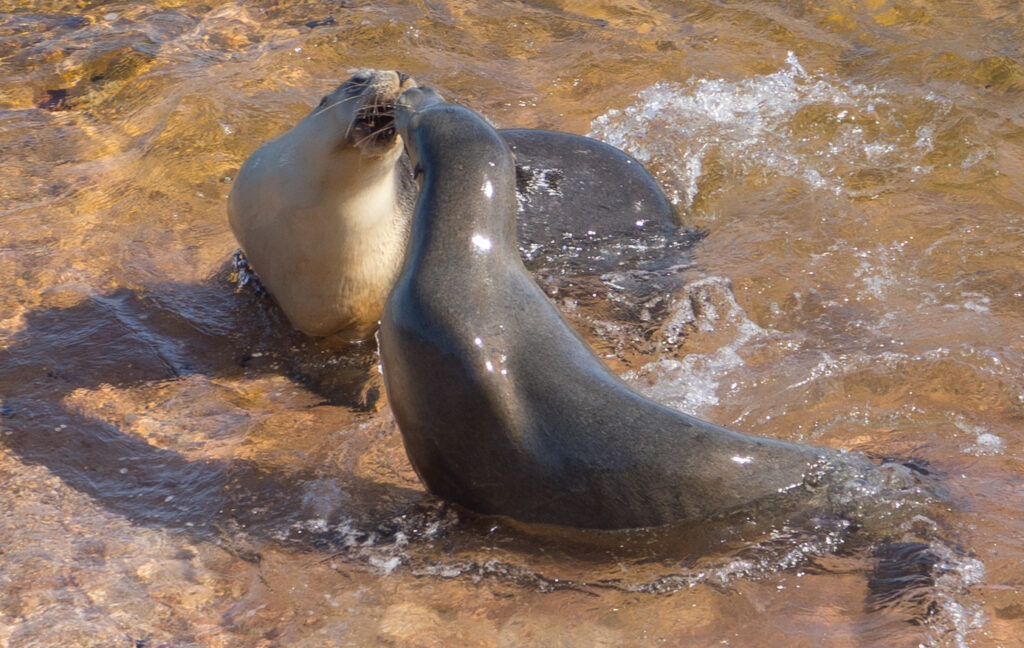
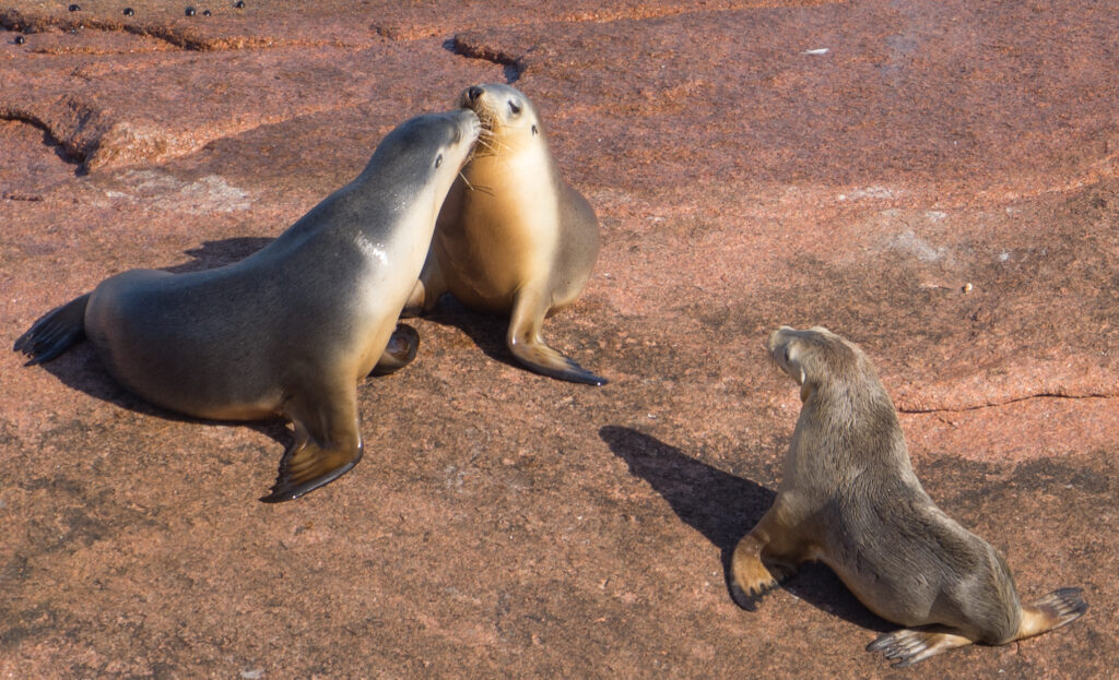
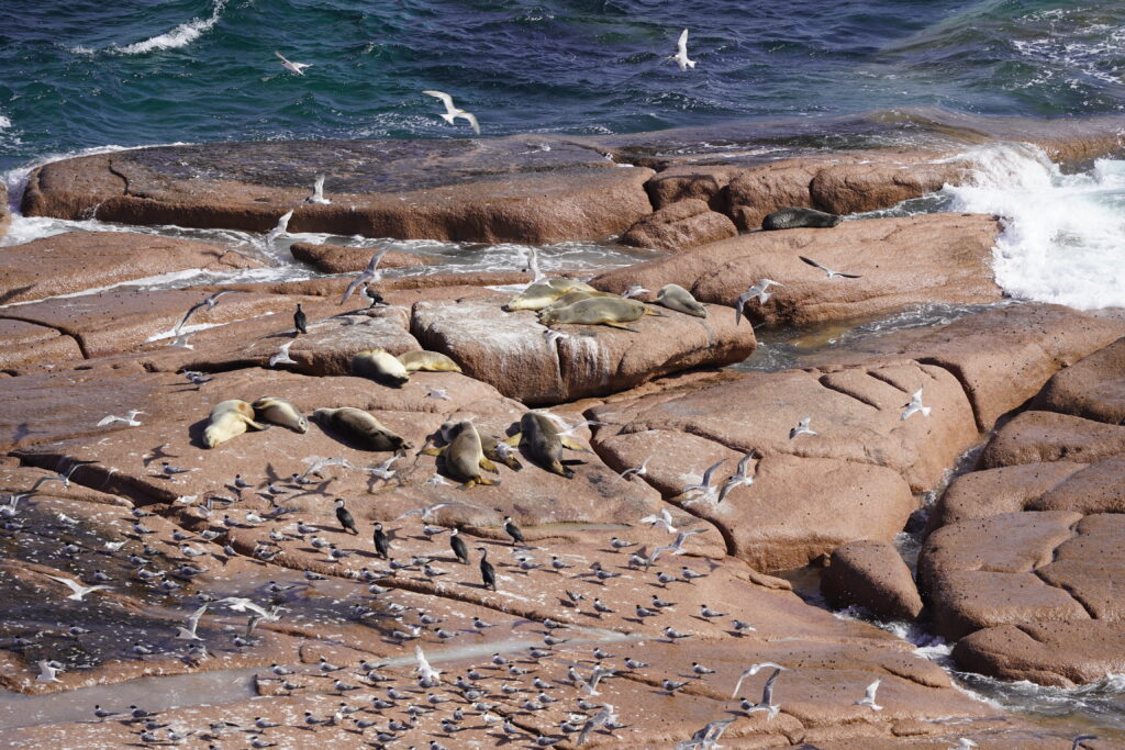
You can almost imagine a storyline here – the young pup having a whinge to mum and then hanging her head in shame as she’s told off by dad….A couple of females facing offIt all gets a little more serious….The battle is taken to the rock pools where they can move faster….there is a lot of splashing and others join in…is this mating ritual perhaps?Still seem to be a few issues, some time later….Later, there is a relationship counseling session which helps sort things out…they appear to kiss and make upAnother young pup wandering around the rocks calling out An adult Sea Lion fresh from the ocean, having run the shark gauntlet and now relishing the feel of the sunSunbathing on the rocks – Sea Lions sharing their safe haven with Fur Seals (you can see one towards the back of the rocks, much darker and furrier than the Sea Lions) , gulls cormorants and terns
On Sunday we kept things more close to home, and took a walk up the coast from the campsite. We saw one person all afternoon, and he was stood at the shore fishing, just four metres from his car! We have the feeling that not too many people pick their way along this shoreline.
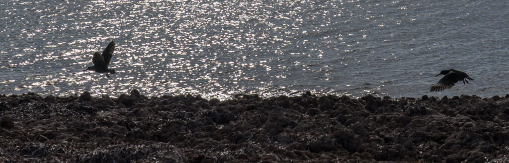
The coast is pretty rocky right to the waterA pair of Sooty Oystercatchers fly along the rocks
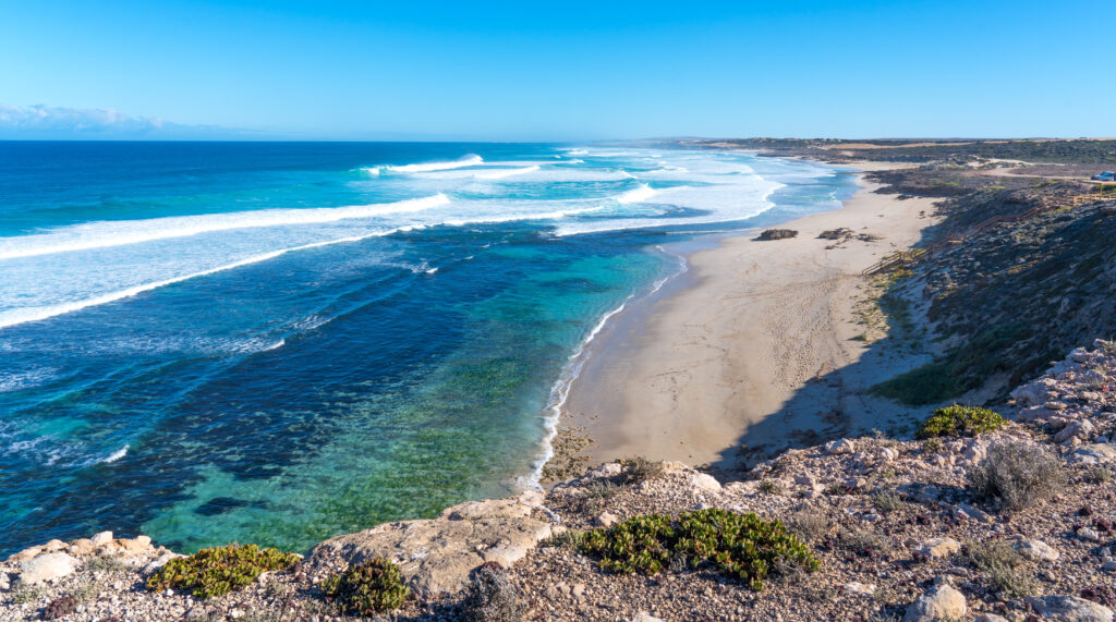
On Monday we drove south to Speeds Point. Speeds Point was the location of Australia’s first ever big-wave surf competition in 2009. It was certainly wild – what they call a high energy coast, with several collapses on the cliffs evident. Apparently scenic flight operators along this coast notice cliff collapses every day…something to bear in mind when standing near the edge capturing another spectacular scene.
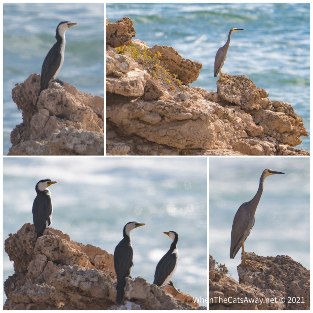
Arriving at Speeds Point – you can see the huge waves in the background and the calm waters below Speeds Point – relatively calm water on the right with wild surf on the leftA White-faced Heron and several Pied Cormorants rest on the rocks between fishing expeditions
From there we followed the Westall Way touring loop around, visiting Smooth Pool (an area of rock pools – it was busy with four wheel drives literally everywhere, so we didnt stop), Point Westall, and The Granites.
Mr A admiring Point Westall
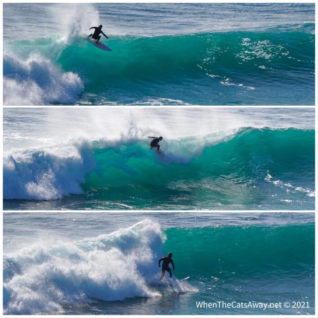
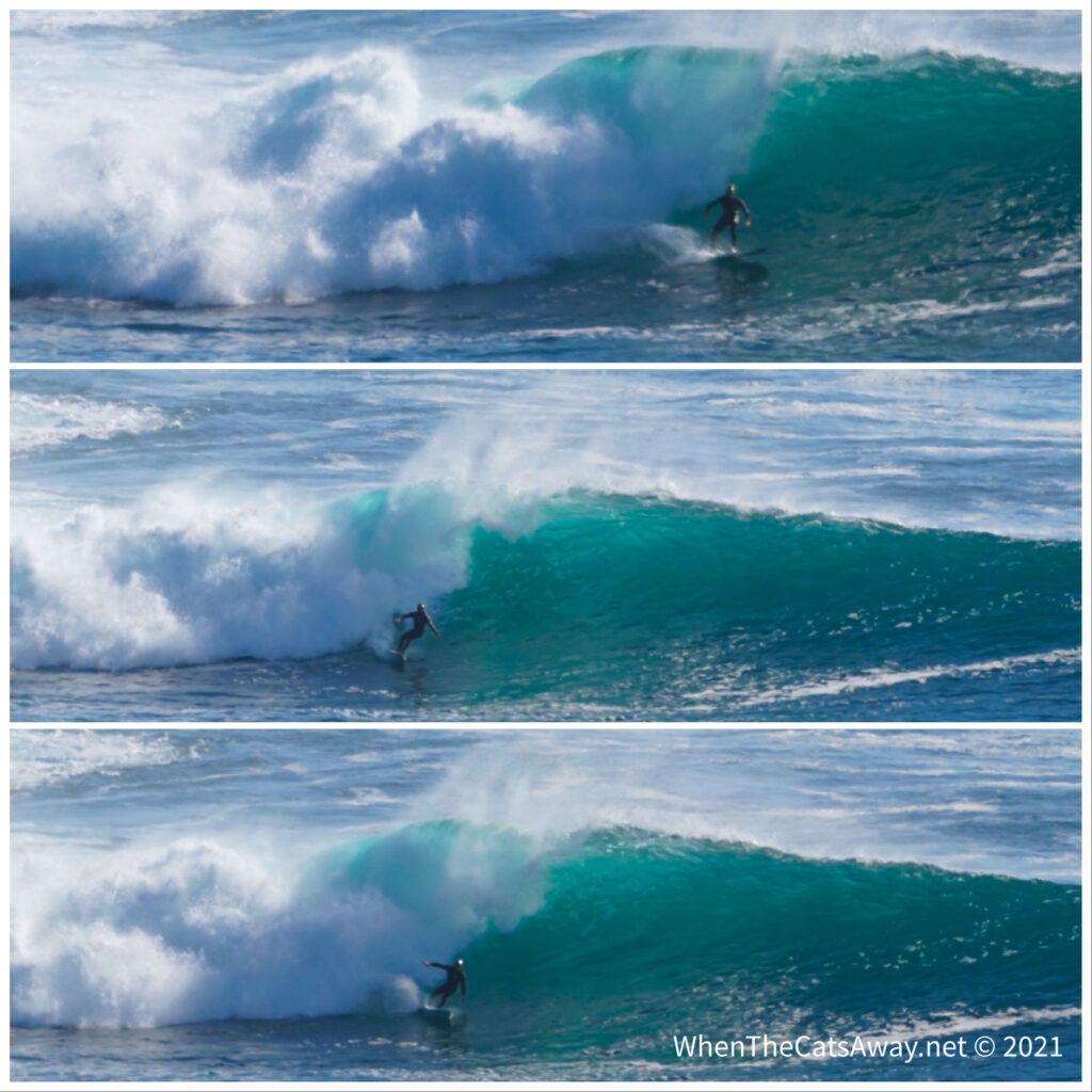
The Granites was incredible. It’s a popular surf beach with some pretty big waves, especially off the point. We spent some time on top of the cliff watching the exhilaration of the surfers as they rode the breakers.
Woo hoo! This looked like fun…Even bigger waves off the point – this surfer looks like an ant, but he’s actually over 6 foot tall!
Our final day in Streaky Bay has been spent doing final jobs and stocking up at the small supermarket in anticipation of not having any shops for the upcoming week. I encouraged Mark to join me on the historical tour of the town – it took us around the old hospitals, shepherd’s hut, monuments and official buildings. It was a nice opportunity to stretch our legs without getting sandy or dusty, or having to watch our step walking over rocks. We also got our flu vaccines – given we cannot get our Covid vaccines here yet (and it is extremely unlikely we are going to catch it anyway) we thought we should be protected from something!
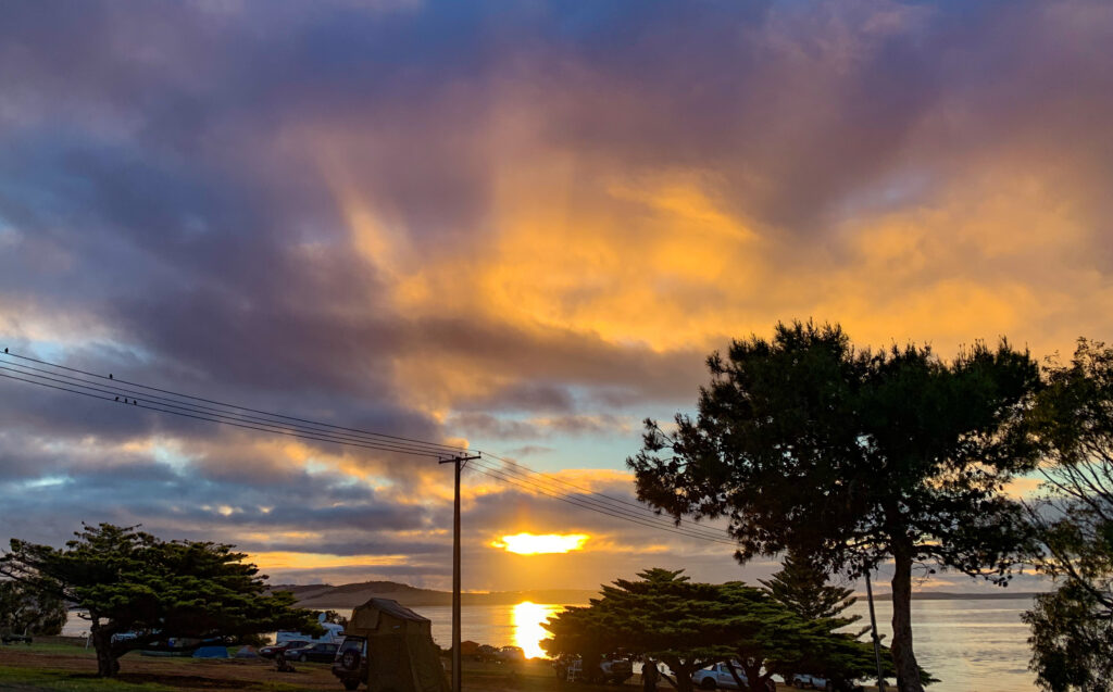
Our time finished off with another fine sunset. I made sure to take advantage of seeing it set over the water. It’s likely to be a while before we get to enjoy such sights again.
Leaving the east coast of the Eyre peninsula for now we decided we had unfinished business with the west coast, and headed off on what turned into a longish drive from Tumby Bay to the small coastal settlement of Streaky Bay. We had briefly visited here before on a previous “lap” of Australia, but hadn’t had time to explore.
Streaky Bay was home to the Wiringu people for “thousands of years”….I hate being forced to use that generalisation, but with almost no archeological research I could find having been done in the area, it has to suffice. So we acknowledge the Wiringu people as the traditional custodians of the land that we now call Streaky Bay. In their oral history they record what is thought to be their first contact with white people, when the Dutch sailing ship Golden Zeepard moored up in the harbour in 1727. After the “Waterloo Bay massacre” that happened in 1849, which is not far away, the Streaky Bay area become a no go area for those First Australians who had up until then survived dispossession of their lands and denial of access to their traditional water holes.
Today Streaky Bay grows as a tourist destination for, amongst other groups, caravaners like us, as well as a small fishing industry and wheat growing inland. The draw for many tourists is getting a line out in the bay, where the delicious king george whiting and garfish lurk. We have sampled both and from the local shop, and they are indeed quite outstanding. The local pacific oysters are also top class, the clean waters of the bay no doubt driving their quality.
We booked for a couple of nights at the Streaky Bay Islands Caravan park, a few kilometers out of town, and yes you can guess why they called it that. Well two nights turned into ten! We found it a really comfortable park to settle in. Clean, spacious sites, nice and quiet at night, it ticked all our boxes. With no town water to draw on, they have even built their own desalination plant!
The view from Streaky Bay Islands caravan park…
Not being into fishing, we find ourselves in a small minority of folk here, so we have to be creative about finding stuff to do. There are a few nice coastal drives to take with photo opportunities. We took one to a place called Whistling Rocks. – where the blow holes createsmore of a thundering than a whistling.
A footpath through the dunesThe high energy coastlineMrs A at the lookout at Whistling RocksA calmer bay just around the corner
An evening walk from the campsite through the dunes rewarded us with an amazing sunset. These are big, big skies.
Signs of a fine sunset to come as we clamber through the dunesThe tide conveniently went out at the same time, giving some perfect reflections in the rock poolsThe last rays of sunshine before it dips below the horizon to the west
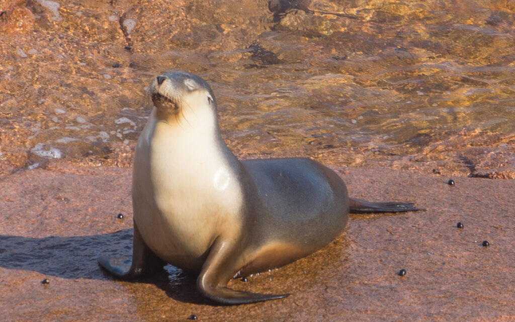
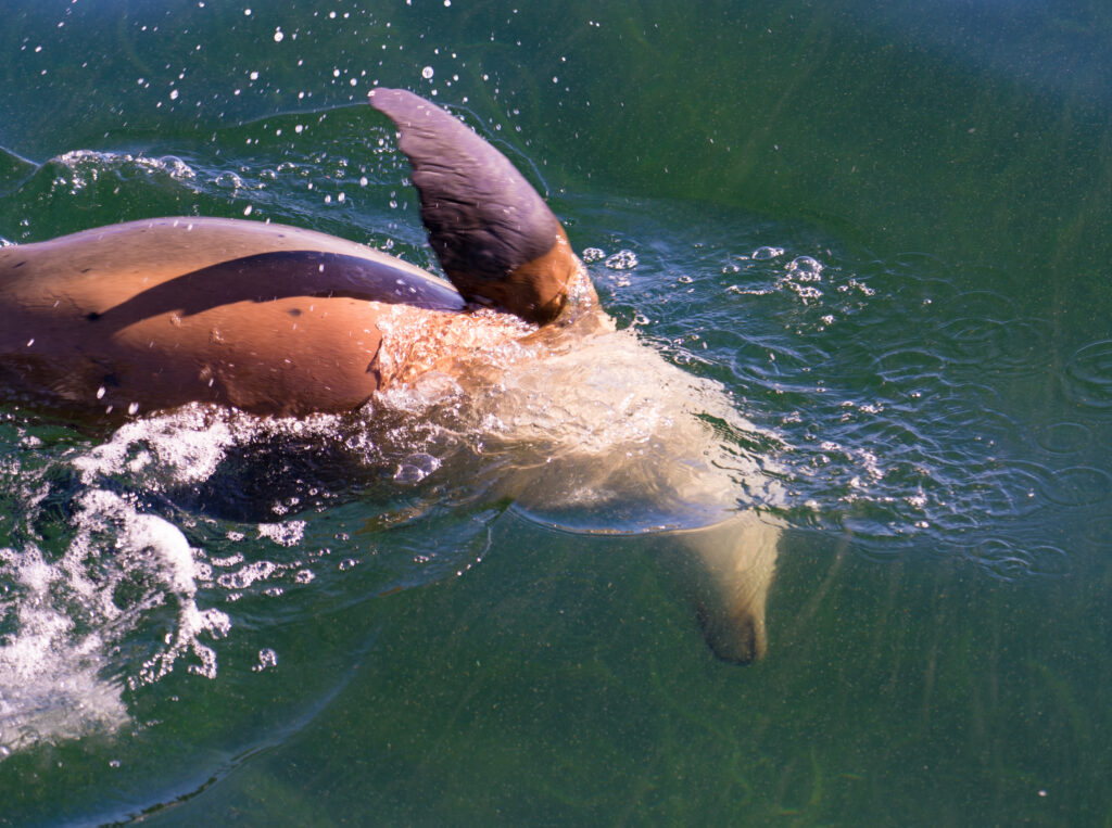
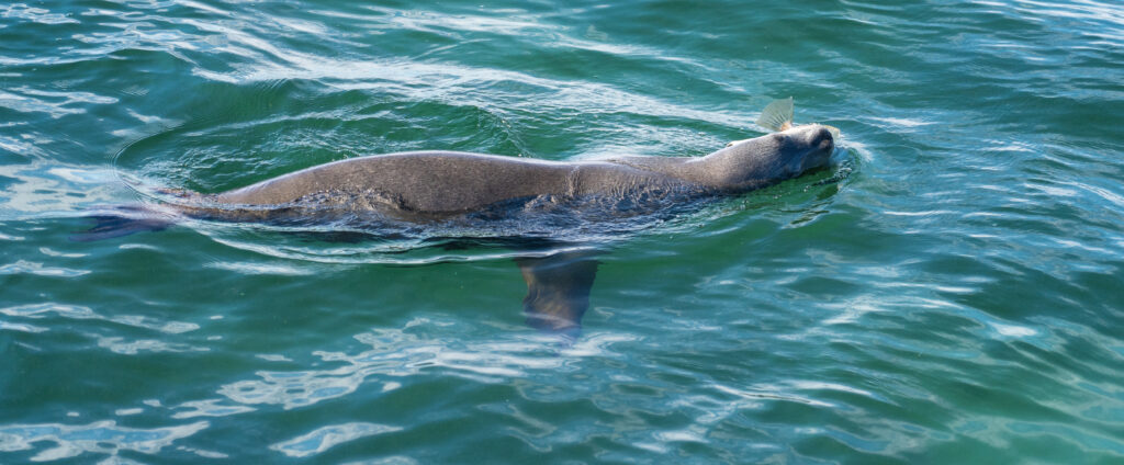
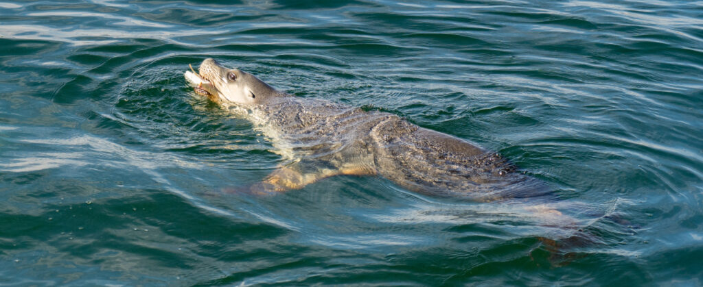
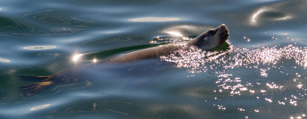
Another day saw us cycling into town, on the well graded shared path. Of course despite hundreds of people staying at the caravan park, we were the only cyclists we saw all day! Eagle Eye Catherine then spotted a sea lion cruising around off the jetty, looking (successfully) for lunch.
The jetty at Streaky Bay – Catherine spotted something looking like a dolphin or seal to the right of this and we rushed over to lookWe find an Australian Sea Lion diving for fishAnd she is successful (females have white tummies) – clearly worth the 40km swim round from the colony then!Those yellow teeth look like they need to see a dentist!And after a few minutes, she’s off, hunting elsewhere
After being hunted in Australian waters in the 19th century, they are like many other of our flora and fauna, listed as endangered. This means they’re declining at greater than 50% over three generations. Commercial fishing, marine pollution and climate change, all are now contributory factors to a continually declining population. as well as an infection that every pup gets called hookworm. You can now find Sea Lions in only 80 breeding colonies along the coast of South (80%) and Western Australia. If you have grandkids, they are likely to read about their extinction in the wild unless something drastic is done now to prevent it. Which, given current initiatives and priorities of budget spending, looks unlikely. Some projects are underway, such as the University of Sydney’s with a vaccine for hookworm on Kangaroo Island, but it’s not looking good. It is all rather depressing I know, but not much point sugar coating it and just sharing the nice pictures?
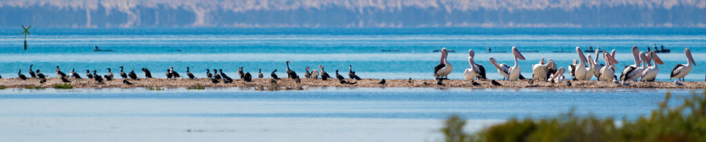
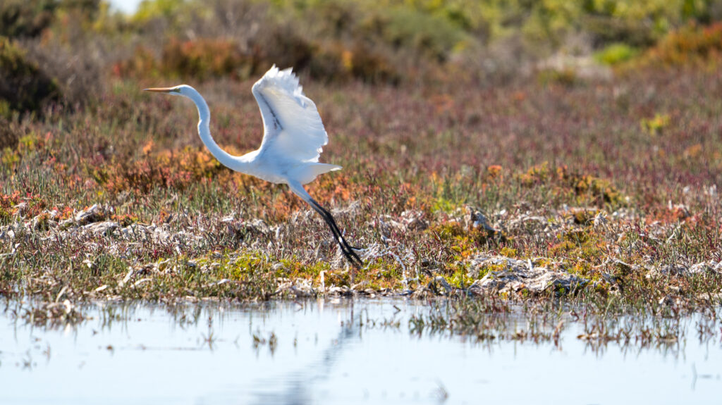
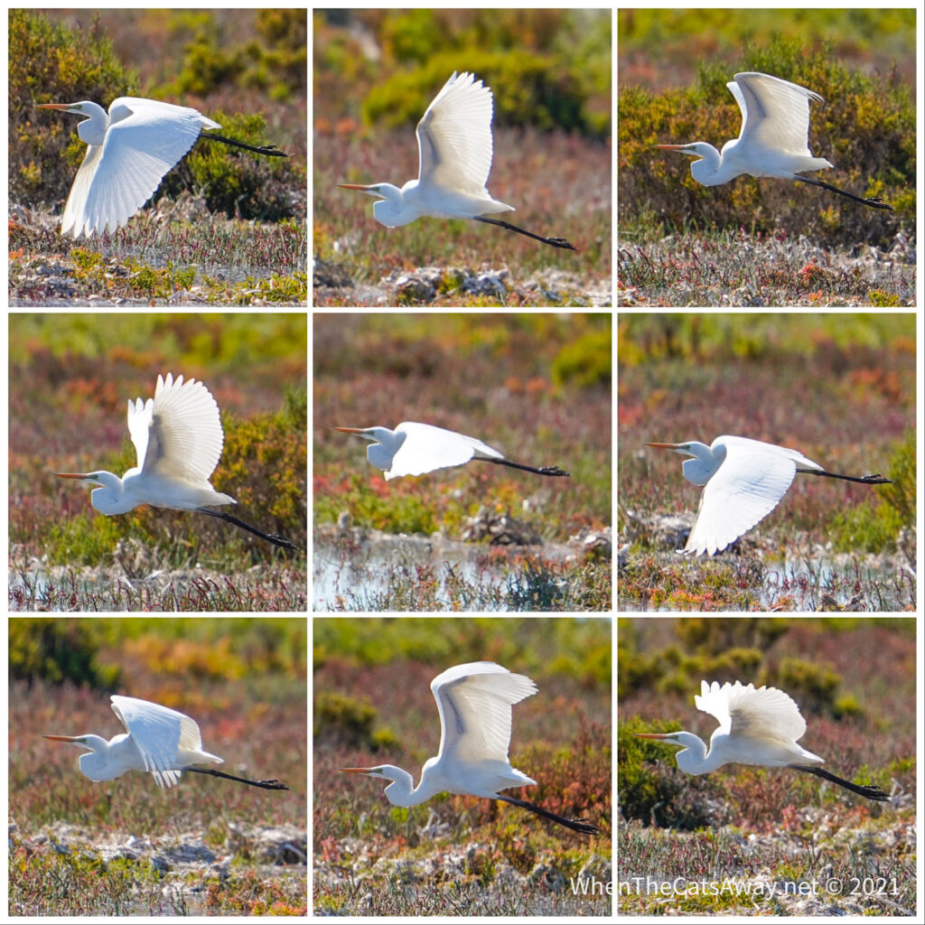
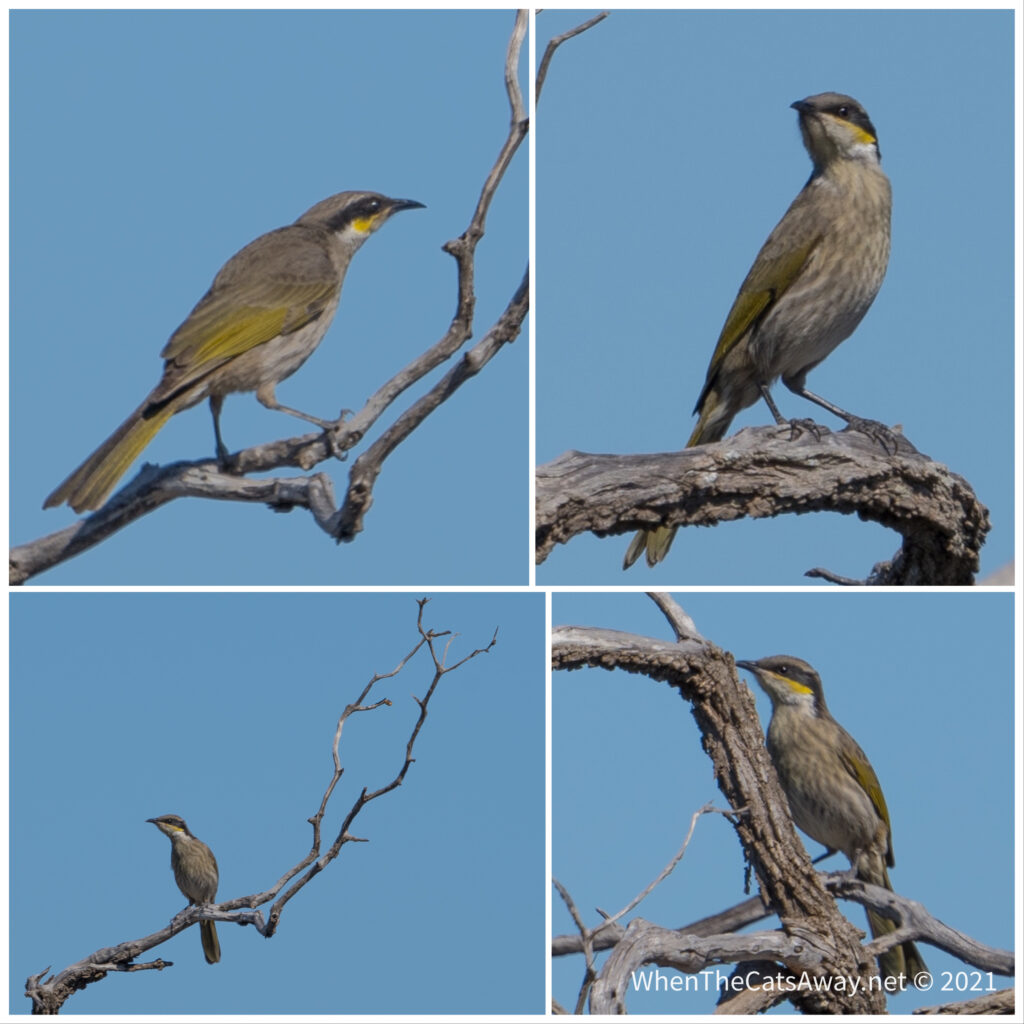
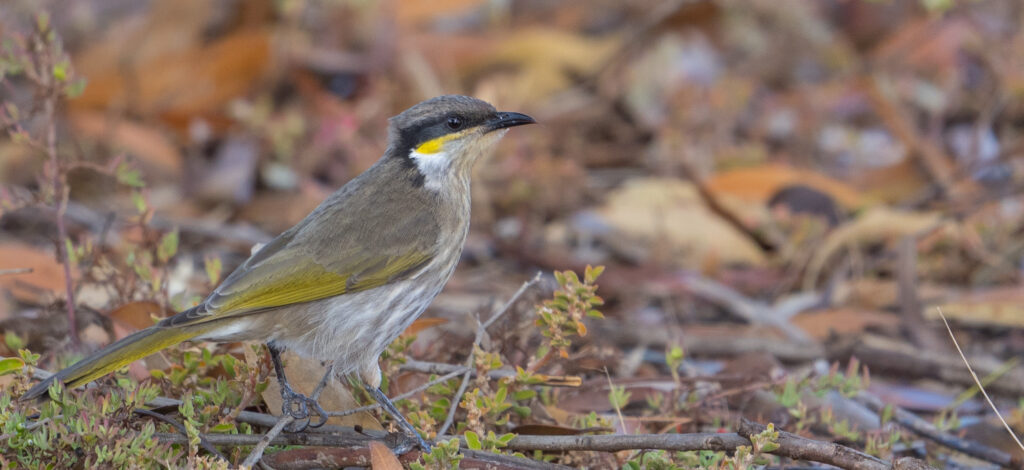
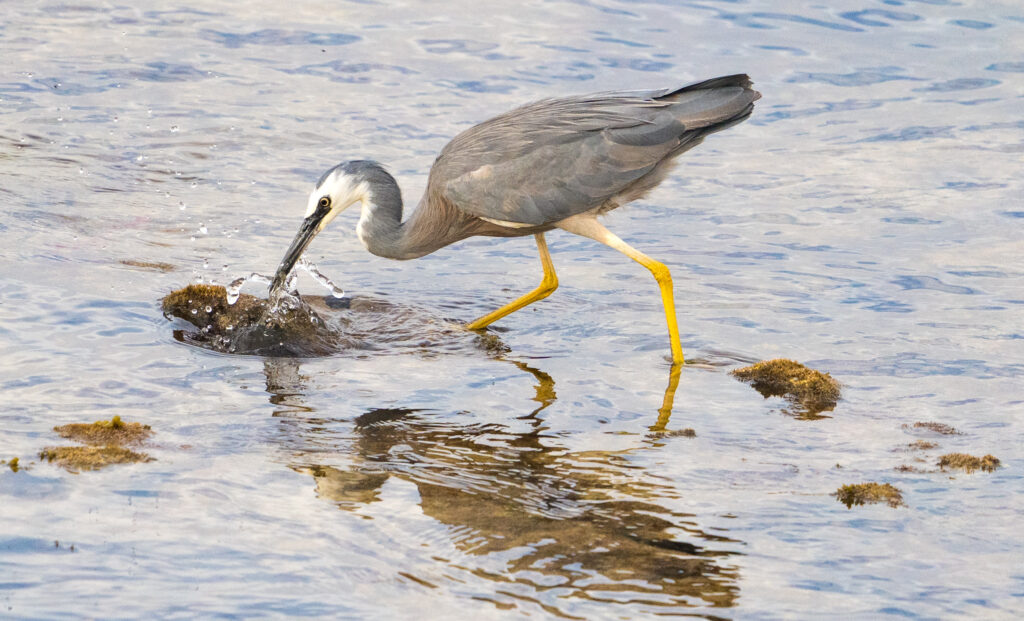
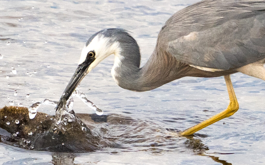
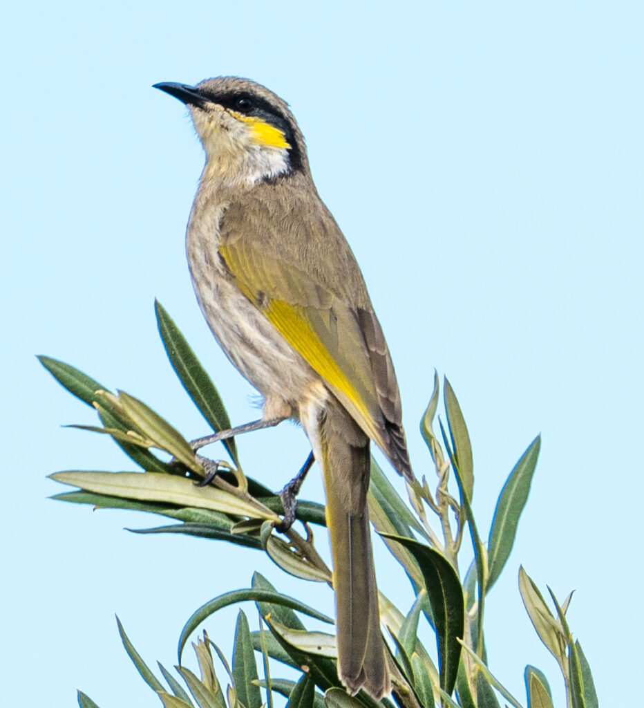
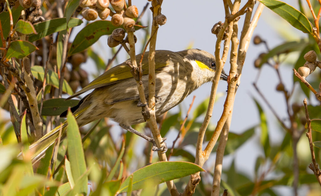
We continued our mission to find shorebird sites, and with the help of a guy from the Department of the Environment, we did. The last part of the trip took us down a sandy narrow track, and after the Landcruiser nudged its way though one to many tight, prickly spots, we abandoned it and walked. It was a hot dusty slog, but we were rewarded with some awesome sightings as we found the spot where the little creek met the ocean. Plenty of fishing going on here. Check out the great egret sequence – I just keep looking at the grace and beauty of this bird that Catherine has captured so beautifully. And these Singing Honeyeaters are everywhere, their song piercing the silence of the bush.
Memories to cherish.
A pair of White-faced Herons fly pastPelicans and cormorants sheltering on a sandbank at high tide Great Egret taking flightGreat EgretSinging Honeyeater
Location: Port Lincoln and Tumby Bay, South Australia
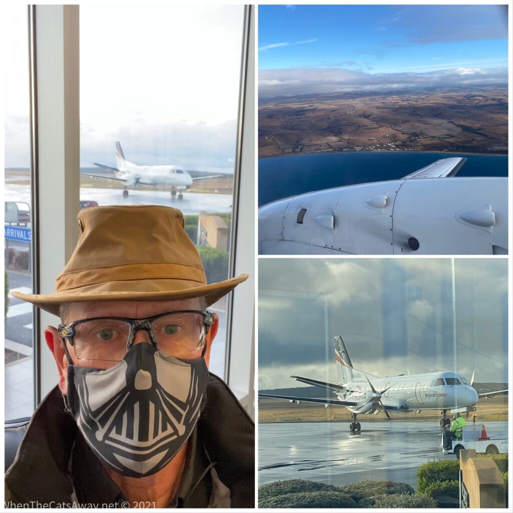
Despite being the same size as England and Wales combined, having such a small population means medical provisions on the Eyre Peninsula are rudimentary at best. Residents (and visitors) requiring specialist tests and scans need to make a several hundred kilometre drive or an hour’s flight to hospital in Adelaide.
Being on the road long-term means Mark and I cannot ignore our health needs, and as such have to fit in tests and checkups as we go. We returned to Port Lincoln for two nights to enable Mr A to pop over to Adelaide for a scan.
Mark took an early flight across to South Australia’s capital, donning a compulsory face mask for the trip, the first time a face covering has been required since we were in a supermarket in Victoria, and arrived in Adelaide right on time about an hour later. He spent much of the day shopping and exploring the city, with some tests at a central hospital mid afternoon.
Mr A in his Darth Vader face mask scaring passengers on the flight to Adelaide
I meanwhile was still recovering from the dreaded food poisoning, my delicate stomach still not happy to receive food and drink. Thankfully with the help of some pills, I was finally able to consume my first nutrition in a week on Friday evening.
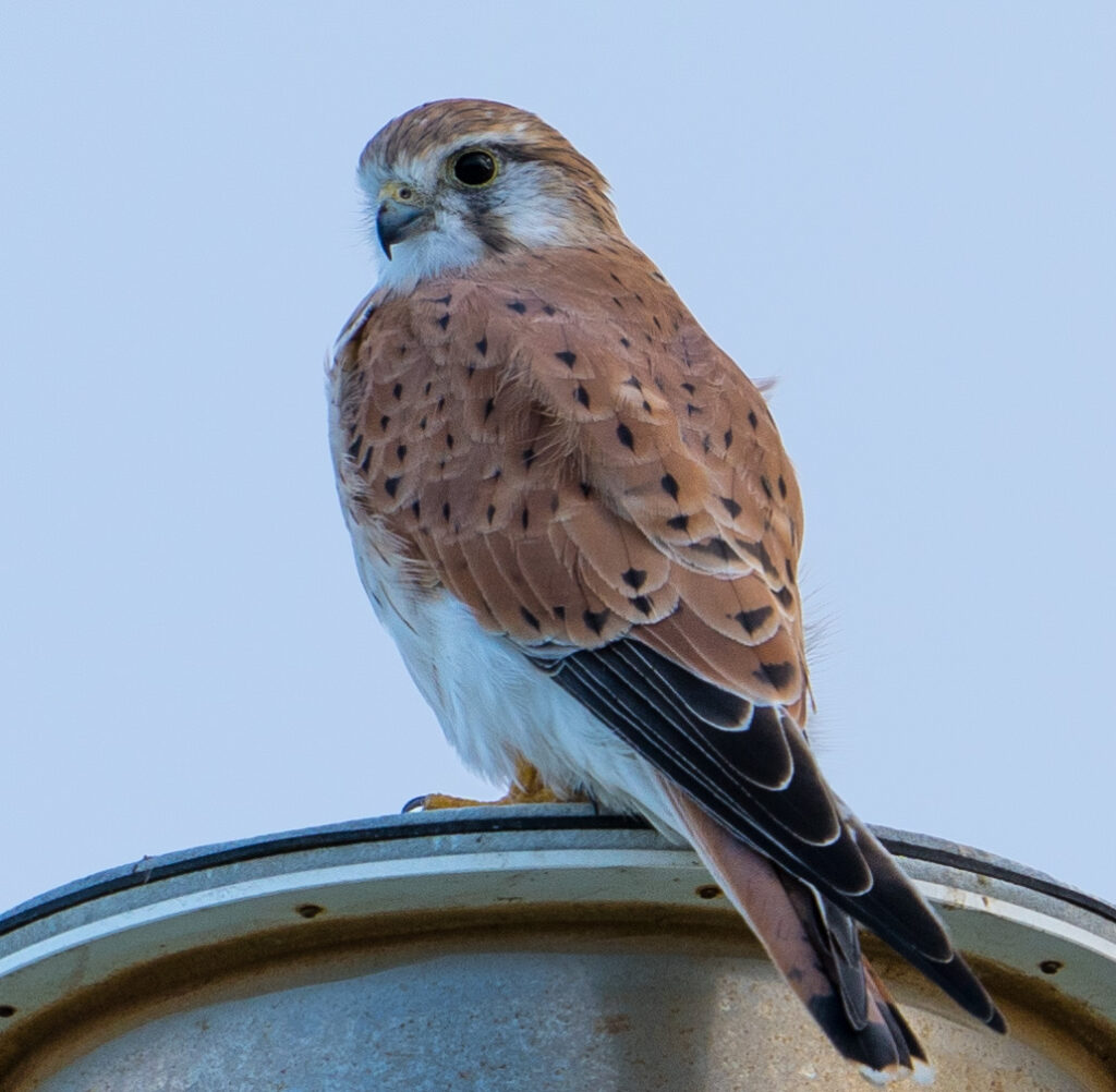
I had a very relaxed morning, using the drizzly weather as an excuse to do some washing and reading. It cleared up by lunchtime, so I went for a walk around Boston Bay to see whether I could find any wildlife – particularly hopeful I might find a Nankeen Kestrel we’d spotted on our last visit here.
Well, I couldn’t believe my luck. When I had walked no more than about 50 metres I spotted her sat there on the roof of a Marine Sciences building. She sat there quietly for a few minutes before taking flight. I didn’t see her again that afternoon.
Right on cue, a stunning female Nankeen Kestrel poses for a photo
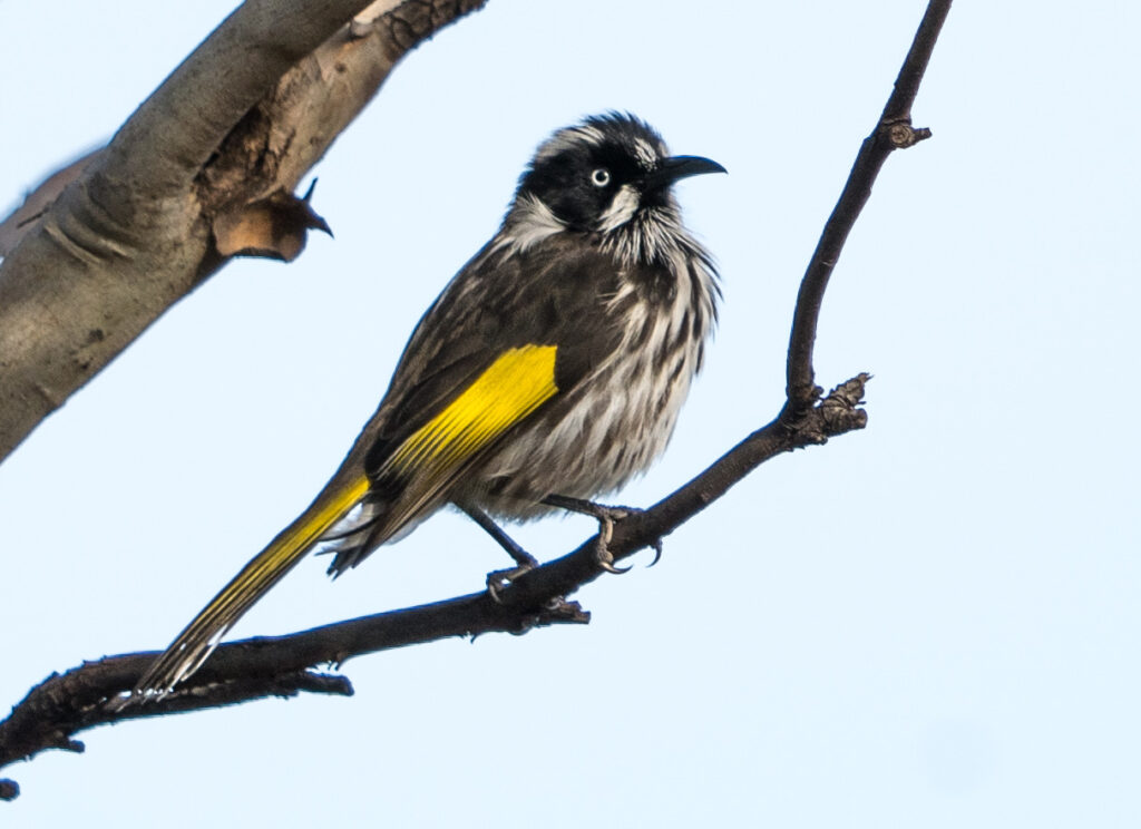
In the flowering gums and trees along the bayside walk were many New Holland Honeyeaters, often feeding their young, quickly chasing flies and drinking nectar from flowers. They have so much character you could watch them for hours.
A New Holland Honeyeater pauses mid chaseDélicate toes curl around a twigA green eyed Pied Cormorant on the shore
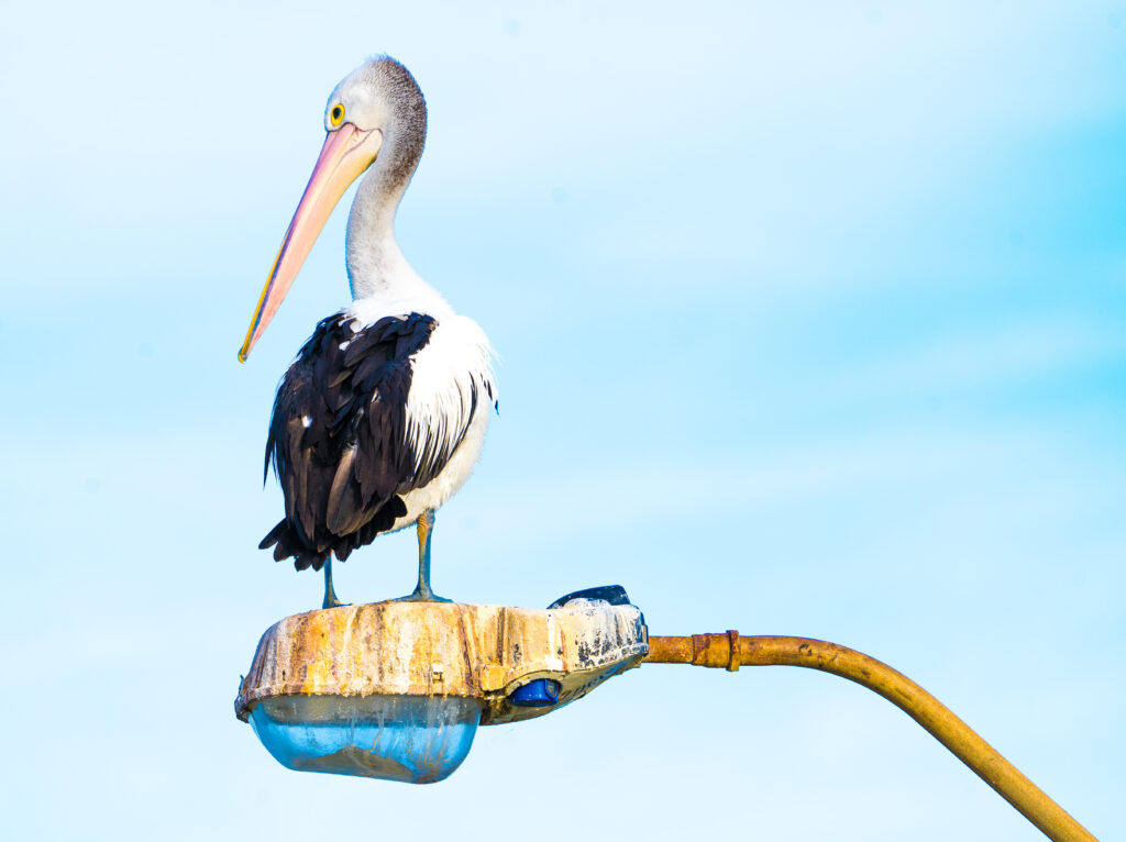
And returning to camp, the local pelicans were out in force waiting for fishing scraps, including this chap who watched from way up high on a street light, a favourite perch.
Patricia Pelican watching from a favourite perch
Mark arrived home safe and sound by 9pm that night, having had his tests plus enjoyed an afternoon shopping in the big smoke.
The following morning we farewelled Port Lincoln, we think for the last time, and drove just 40 minutes up the coast to the little town of Tumby Bay.
Our farewell sunrise at Port Lincoln
Tumby Bay was our opportunity to catch up with some friends, Phil and Libby who are travelling around South Australia with Phil’s cousins. Usually they live up in Brisbane – it’s been more than two years since we last saw them.
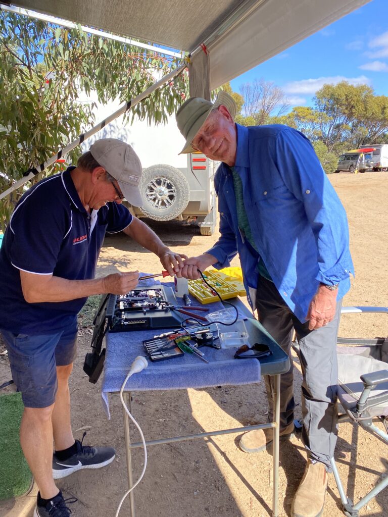
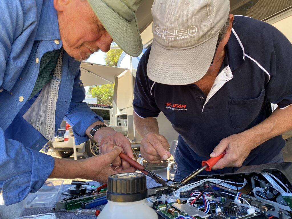
We got chatting about their trip so far, and Libby laughed that both of their caravans’ televisions had sustained some damage on the journey, and Phil had needed to weld a connection back on. Coincidentally, I had noticed just the day before that a connection on the back of OUR television had sheered off this time as well! Phil didnt hesitate to get out his welding gear, unscrew the back of our television and get busy fixing it for us. What super generous people.
Mr A looking a bit nervous handling welding gearMr A helping Phil with the TV repair
Libby is also an excellent photographer, so took me off onto the nearby golf course looking for birds. There were plenty there:
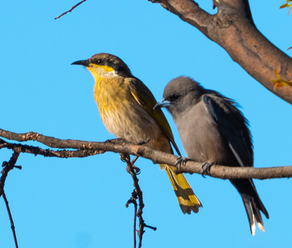
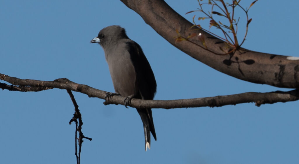
A Singing Honeyeater hanging out with a rather hunched over Dusky WoodswallowBlack-faced WoodswallowPhil and LIbby also own a Zone RV off-road caravan
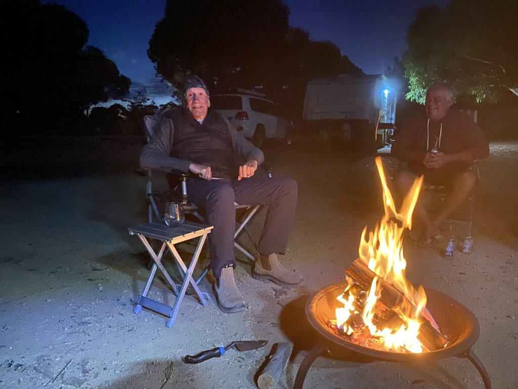
We had a brilliant evening with the four of them, sharing a delicious roast pork and vegetables cooked on two barbecues, and consumed sat around a cosy fire. We had lots of laughs and a wonderful night, reminding us how much we miss spending time with friends in person.
A roaring fire – Mr A and Phil’s cousin Wayne
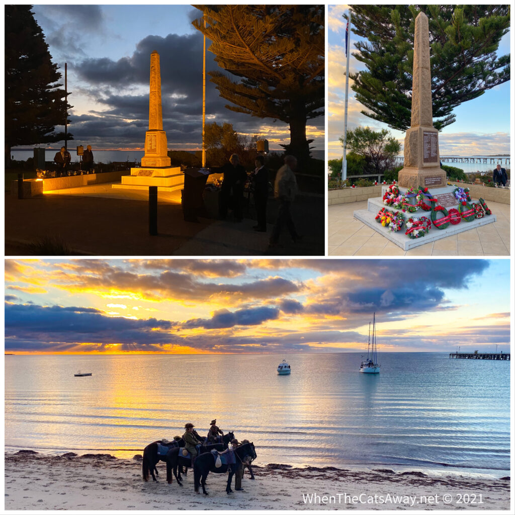
Sunday morning was ANZAC (Australian and New Zealand Army Corps) Day, so Mr A joined Phil and Libby at the dawn memorial service held down at the waterfront. I had not had a good night’s sleep, so took the opportunity for an extra hour in bed, paying my respects later on. Mark said it was a lovely ceremony, with mounted horses marching along the beach and the last post played eerily though the dawn silence.
A beautiful setting for the dawn service
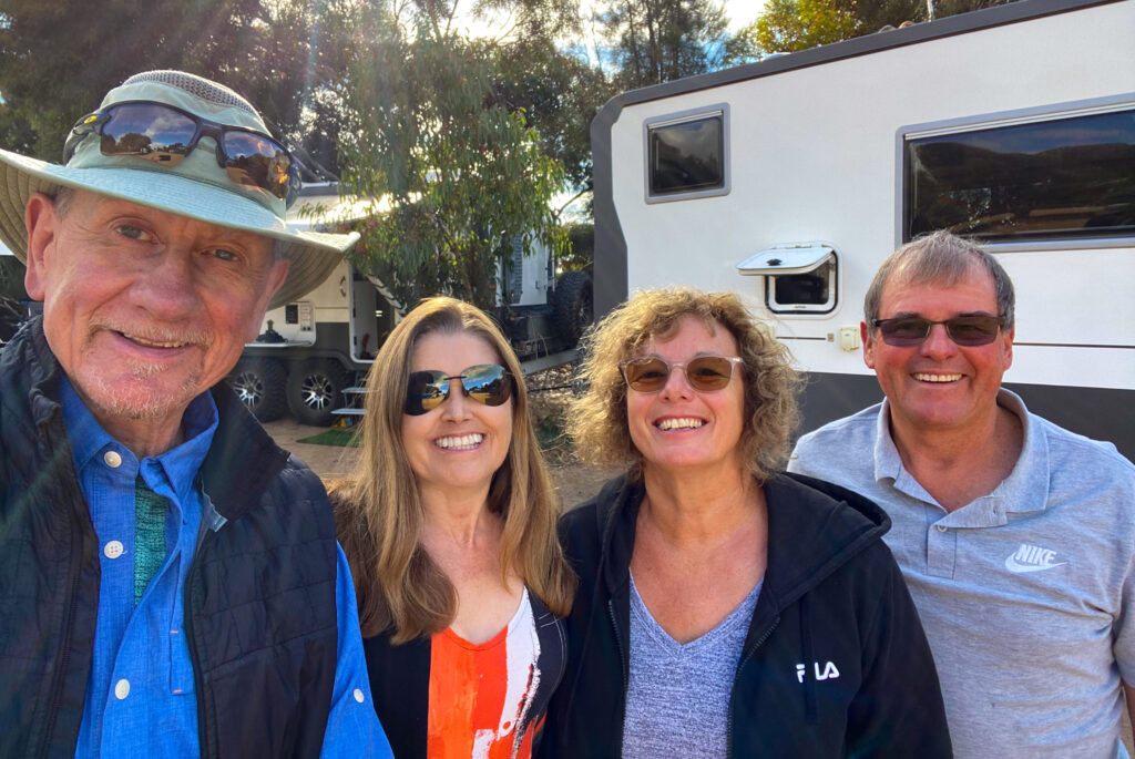
Our friends were heading south to Port Lincoln next, so we said our goodbyes with a final team photo.
Cheese! We hope we meet again some time….maybe later this year?
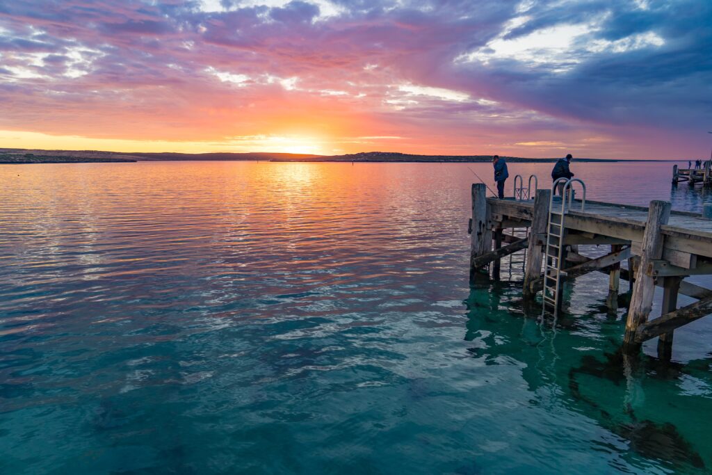
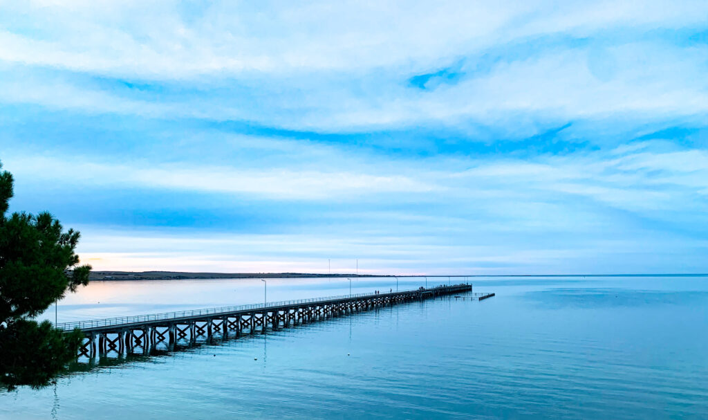
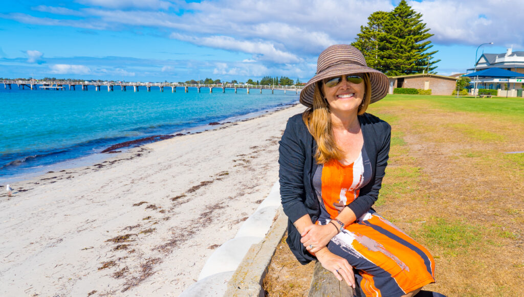
Mark and I went into Tumby Bay for a proper look around in the daylight. It’s a sleepy little town, very well kept, neat and tidy, with a long jetty just perfect for catching fish from. There are quite a few murals, part of the Tumby Bay Street Art Festival held in 2018.
Such a peaceful morning on the seafrontSome of the street art on the waterfront – an old clock tower depicting historical Tumby Bay and a former art gallery with images representing holiday makers on the beachThe huge grain silos tower over the little town, by far the tallest building around. They have a gorgeous mural depicting two boys jumping in the waterWe spotted a couple of dolphins swimming in the bay here
We returned for a relaxing afternoon, and I went for a stroll around the golf course again, spotting more bird life. It’s a great location for seeing our feathered friends.
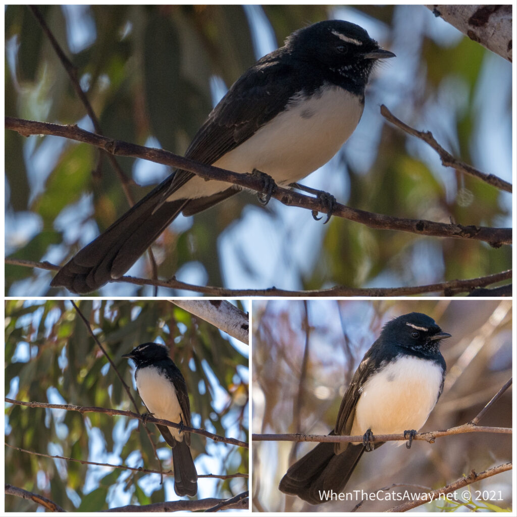
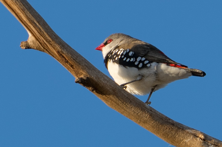
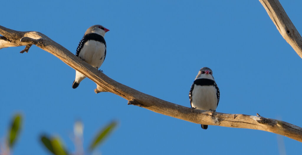
A flock of noisy Gallahs call this area homeHear no evil, see no evil, speak no evil? Three magpies keep watch in the shadeA Willie Wagtail I watched for quite some time as it swooped artfully through the air chasing insectsTiny little Diamond Firetail – they don’t stop still for long. When they fly you see a great flash of red on their tails. Hard to see when they’re seated.Diamond FiretailsRadioactive Dusky Woodswallow in the late afternoon sunA Singing Honeyeater searching for berries on the groundOne of many White-Browed Babblers (often called the ‘Twelve Apostles’ because of the noisy gangs they hang out in!)
It was a lovely couple of nights’ stay before we head back over to the west coast of the peninsula again.
We respectfully thank and acknowledge the Barngarla first nation community for their custodianship of this part of the Eyre Peninsula over the past thousands of years.
Location: Coffin Bay, Eyre Peninsula, South Australa
Unfortunately Mrs A still hasn’t recovered from her food poising, so no Coffin bay oysters for her, and so I abstained in sympathy. Poor thing, it’s been a bad one.
Anyway she was still keen to get out for a couple of walks, amazingly energetic given all she has consumed for the last 5 days have been two pots of apple purée, a couple of bananas, and dry crackers.
We set off from our campsite in the small town of Coffin Bay and immediately almost bumped into some wallabies, as you do. We had a bit of a eye starring competition, we lost and we moved on. A grey flycatcher came to say hello next, this was looking like a promising walk!
Bush WallabyBush WallabyA Grey Flycatcher stopping for a brief rest from chasing insects
The path took us along the side of the bay, and in the late afternoon sunshine it was glorious, with a very brief and distant cameo appearance from a dolphin. They actually have their own species here, first identified in 2015. Only in Australia.
Looking out towards Mount DuttonWe spotted one of Coffin Bay’s rare dolphins from hereSunset over Coffin BaySunset over Coffin Bay
Once again this was a walk completely devoid of other walkers, other than one guy headphones on marching back to his isolated shack on the edge of the bay.
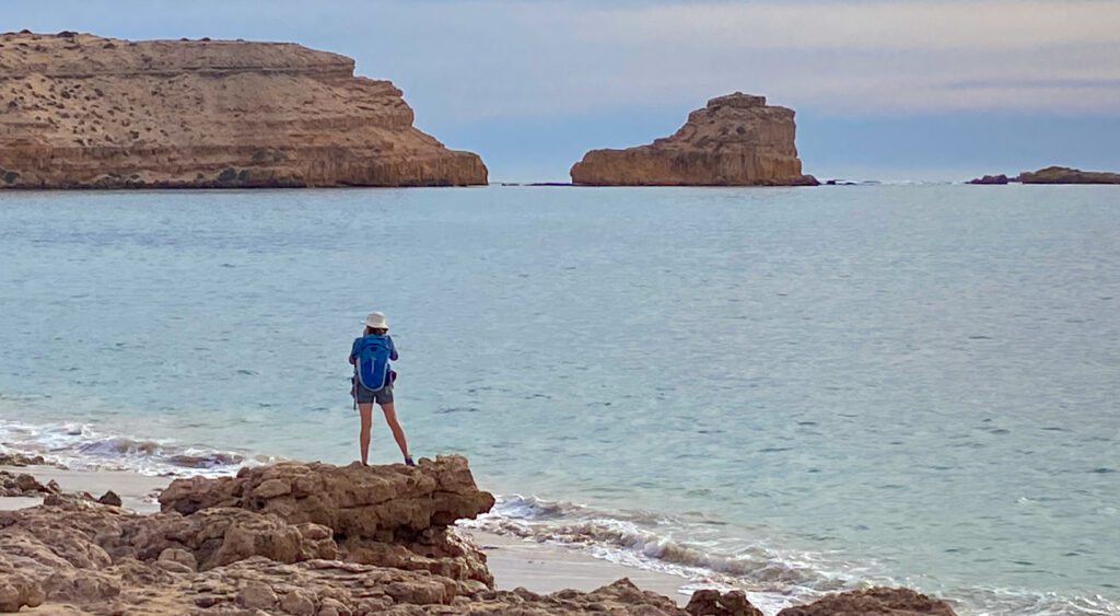
The following day we took a drive to Coffin Bay National Park and did a 9k circuit from Yangie Bay. We saw one other couple and a family. Positively bustling.
Great views over Mount Dutton and the Marble Range as we drive into the parkView over Yangie Bay Marine Sanctuary Zone – a kayaking paradiseLooking out over the bay
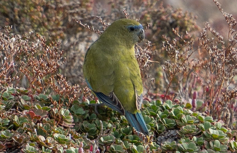
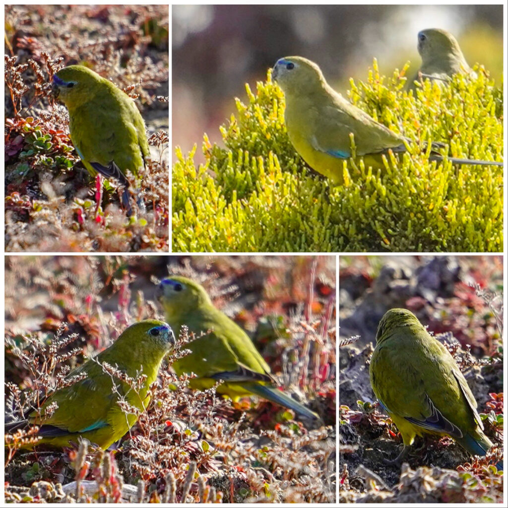
There wasn’t much wildlife about on the walk out to Yangie Island, but after we had quietly sat for a few minutes, Mrs A spotted a small flock of rarely seen Rock Parrots fly down to the samphire salt flats nearby to feed. Out came the big lens, somewhat relieved as I’d carried the thing nearly 5km without a hint of a reason to get it on the camera. It certainly made it worthwhile, we hadn’t knowingly seen this species before. They are quite stunning don’t you think?
Rarely seen Rock Parrots, usually only spotted flying away, if at all. They nest in offshore islets in disused bird burrows or under boulders. The live in this area, and a few discreet regions along the Western Australian coast.Olive green, blue and yellow, they are very well hidden on the ground. There are always a couple on lookout while the others feed. Like with many species, numbers of these little birds are in decline.
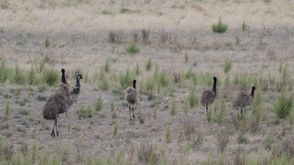
On the way back we realised we were on a wildlife roll when a couple of emus came strutting over the path a few metres in front of us. They are odd looking creatures. Never tire of watching them.
Spot the Emu – they’re very well disguised despite their size
A short while later, we rounded a corner to find a couple of wallabies which were as surprised as us to find each other eye to eye.
Strolling back to Yangie Bay
So a pretty good walk on the bird and animal front, and the views not too shabby either. A nice way to end this trip down the west coast of the Eyre Peninsula.
Tomorrow its “the big smoke” of Port Lincoln and then a bit of a look up the east coast that we dashed down a month ago.
Location: Sheringa Beach, Eyre Peninsula, South Australia
We had decided to move on from Elliston, but that was before I woke early on Friday morning feeling somewhat unwell. Food poisoning. Either from the meal at the pub or the spoonful of ‘past its use-by date’ coconut yoghurt and fresh raspberries I had on my return, either way, I was not in a good state, and unable to stray more than a metre or two from a toilet. Mark tried his best to persuade the caravan park to let us stay another day, but they already had someone coming into our site and were fully booked.
Mark did all the packing up and we drove the longest 30 minutes ever down to Sheringa Beach, where we had stayed the previous weekend, found the same site we were on then and settled down for the long haul. I will not go into detail, but the following three days were pretty awful for me, and worse for Mark who was thankfully feeling well but was amazing, looking after me with kindness and patience.
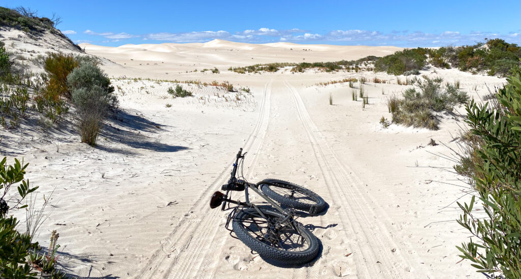
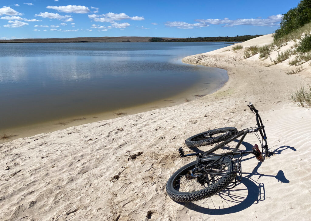
Mark managed to escape on a few occasions to explore by himself, rinding in to the sand dunes and to ‘Round Lake’ which sits behind the dunes and beach.
Dune buggies and four-wheel-drives frequent these sand hills…as well as the odd Surly!Reaching the lake shoreClimbing up into the dunes, the lake in the background
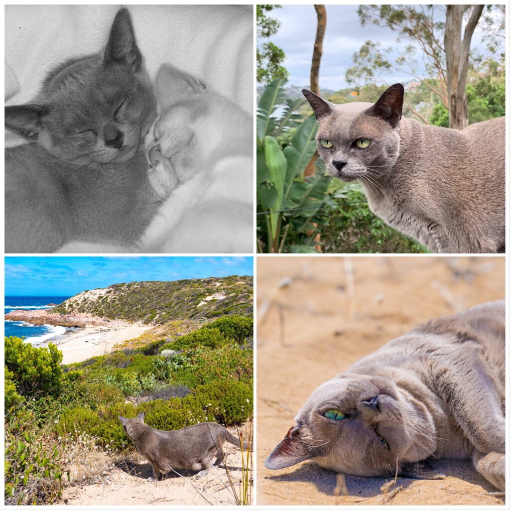
Perhaps most importantly, the 17th was Tassie’s 17th birthday, which was a sunny occasion filled with sunbathing and exploring the dunes – just as she would like! She’s such an amazing and adaptable cat – not many felines can boast having visited every capital city in Australia, climbed sand hills overlooking Uluru, slapped dogs in Cooktown and sunbathed beside a crocodile infested lake near Darwin…but Tassie can. The only state she hasn’t visited is, ironically, her namesake, Tasmania. Maybe in the spring…?
Princess Tassie turns 17
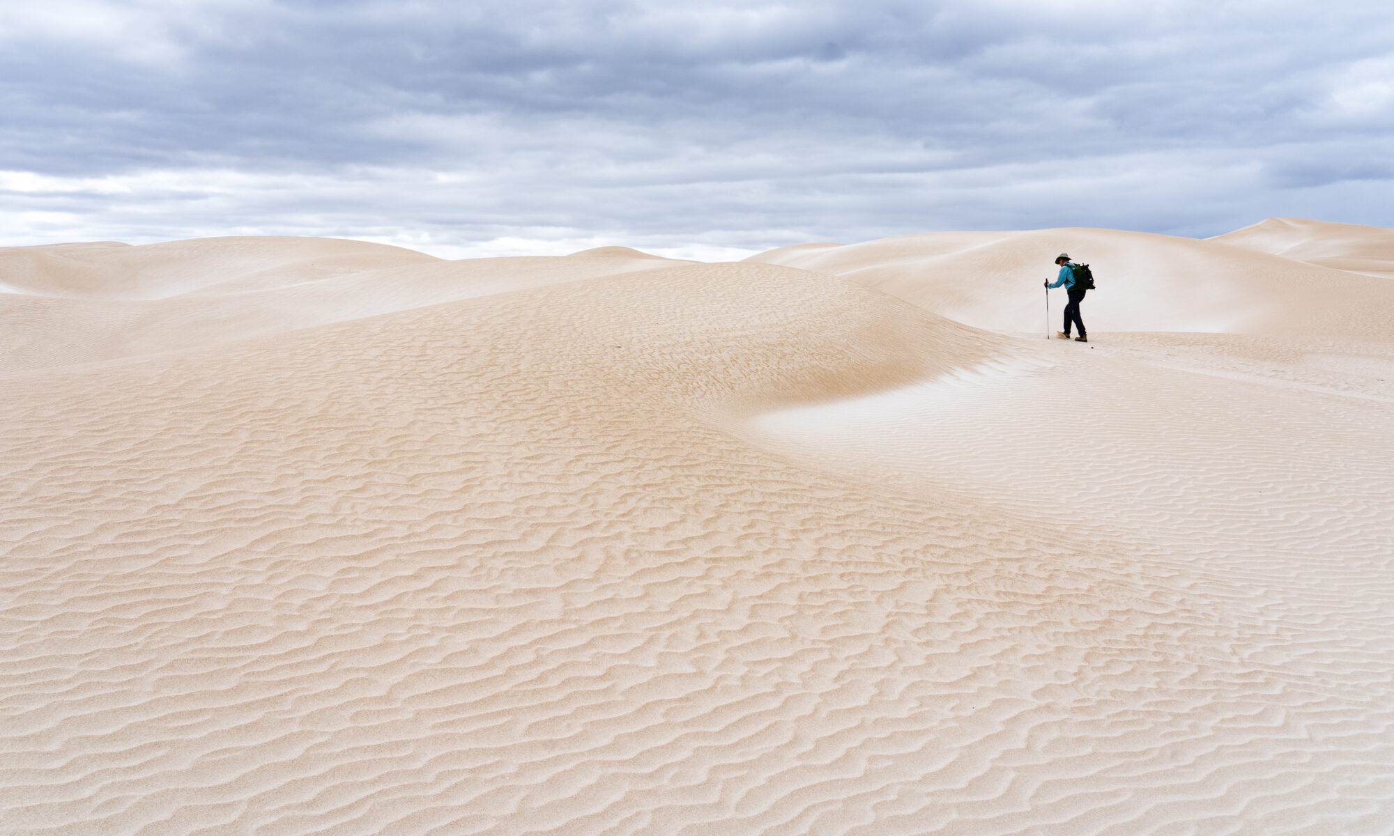
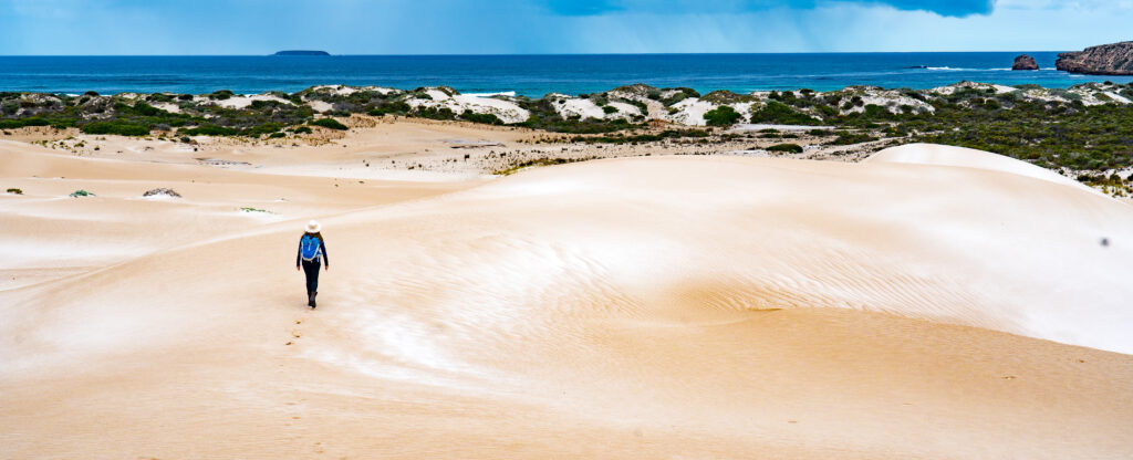
I didnt stray much further than the caravan for the first two days, and on day three managed a short walk for an hour to see the dunes.
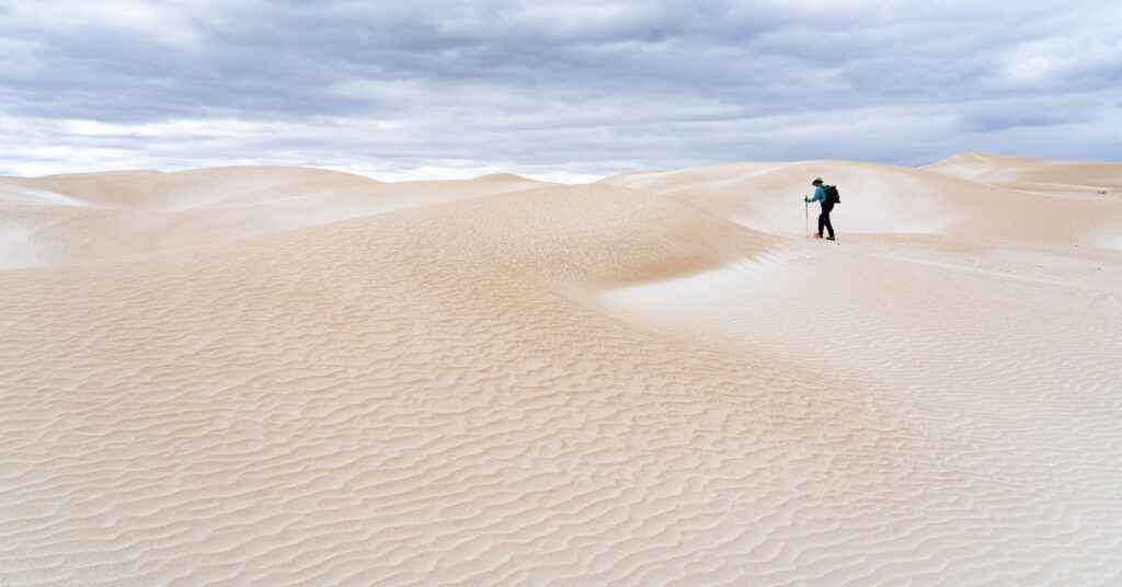
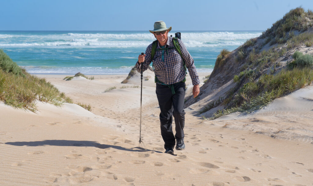
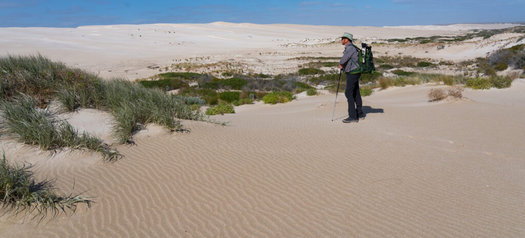
A stormy morning – Mr A looking like he’s hiking through snowfields Amazing textures and patterns in the sandLooking across the swirling sands to a storm approaching out to seaDwarfed by sand, I walk along the top of a ridgeJelly legs
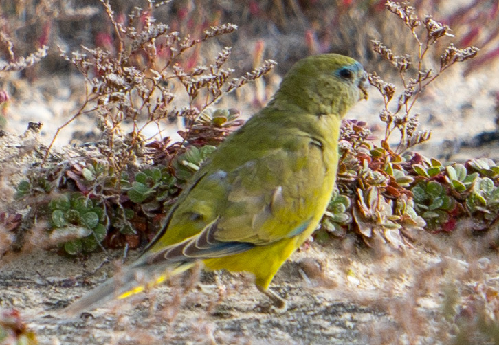
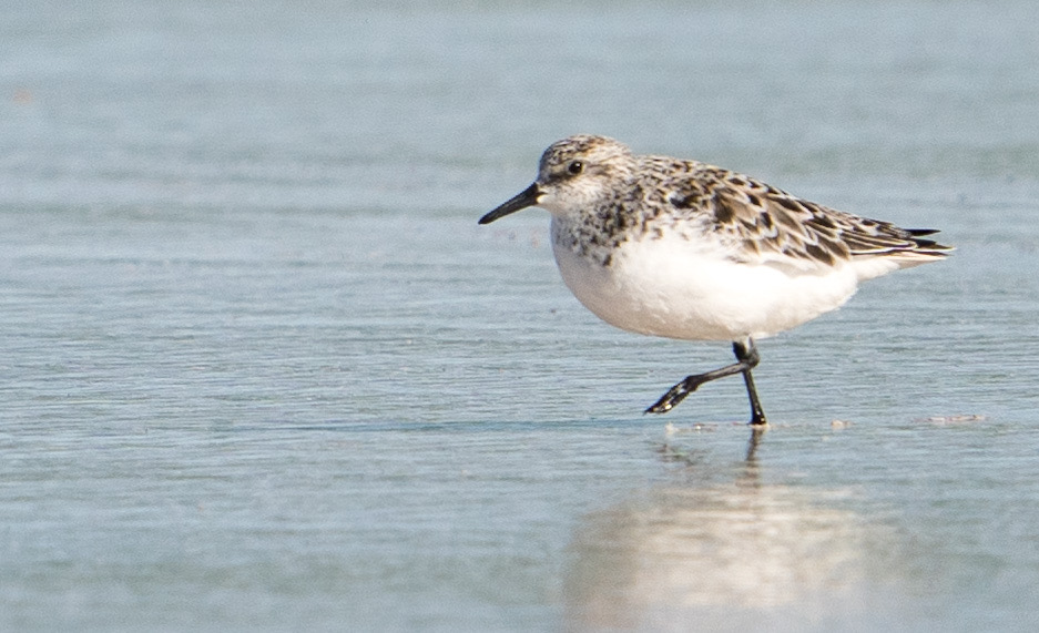
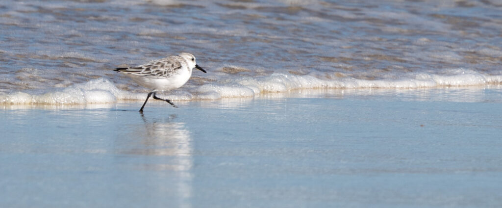
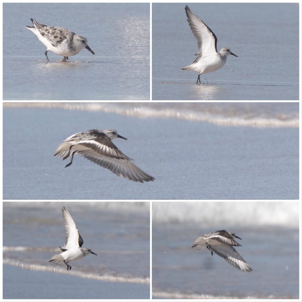
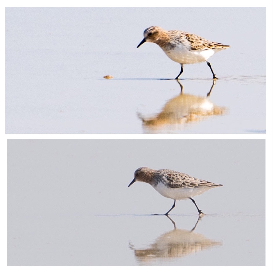
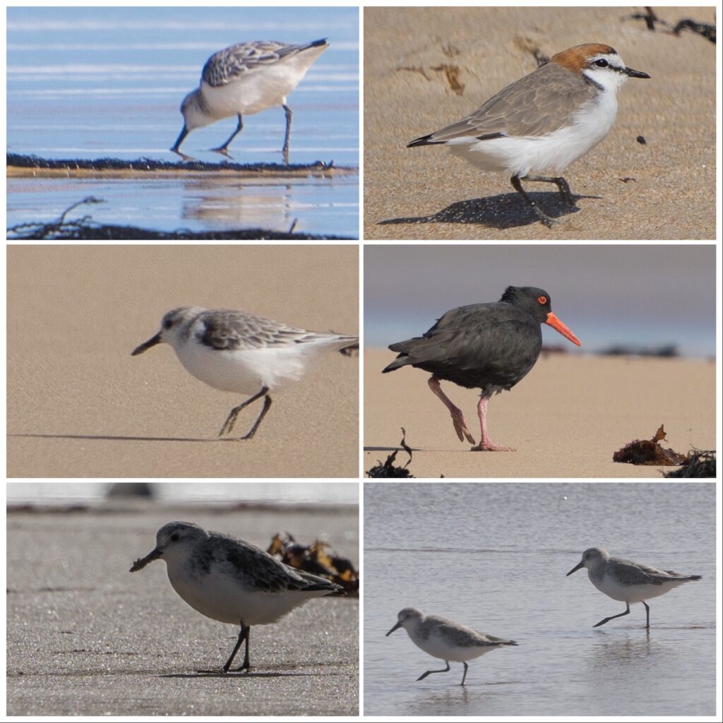
On day four, I managed another walk in the morning. We saw our first ever flock of Rock Parrots, beautiful green birds which nest in the cliffs and spend days in the dunes behind the beach feeding on nuts, berries and seeds. There were several shore birds feeding on the sandy water’s edge, enjoying the natural bounties this coast has to offer.
The next bay around from Sheringa BeachSanderlings run behind the waves, pecking and chasing, darting up the beach as each wave breaksA Sanderling racing behind an incoming waveA Sanderling takes flight, moving along the beach to another foraging locationSilver Gulls being a little wind blown on the shoreYoung Silver Gulls strut along the shore – adults have white eyes and pure red beaks – this youngster has a black eye and beak tipThe huge Pacific Gulls are common down here – around half a metre in sizeLooking up a deserted coast after a short walk on the beach
I managed a few roasted vegetables for lunch without incident and we went on our way, heading for Coffin Bay. After four days without food or water, my head is pounding and body aching and weak, but hopefully finally on the mend. Food poisoning officially is something I never want to experience again!
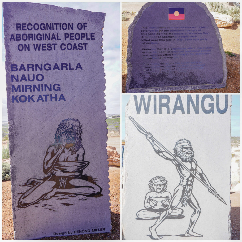
I feel somewhat cheated that I didn’t get to enjoy this spectacular area more, but ultimately feel privileged I was able to see it at all. We offer our thanks and recognition to the traditional owners, the Wirangu, Nauo and Kokatha people for their careful custodianship over the past thousands of years, preserving the integrity and enabling us to spend time in this pristine place.
Location: Elliston, Eyre Peninsula, South Australia
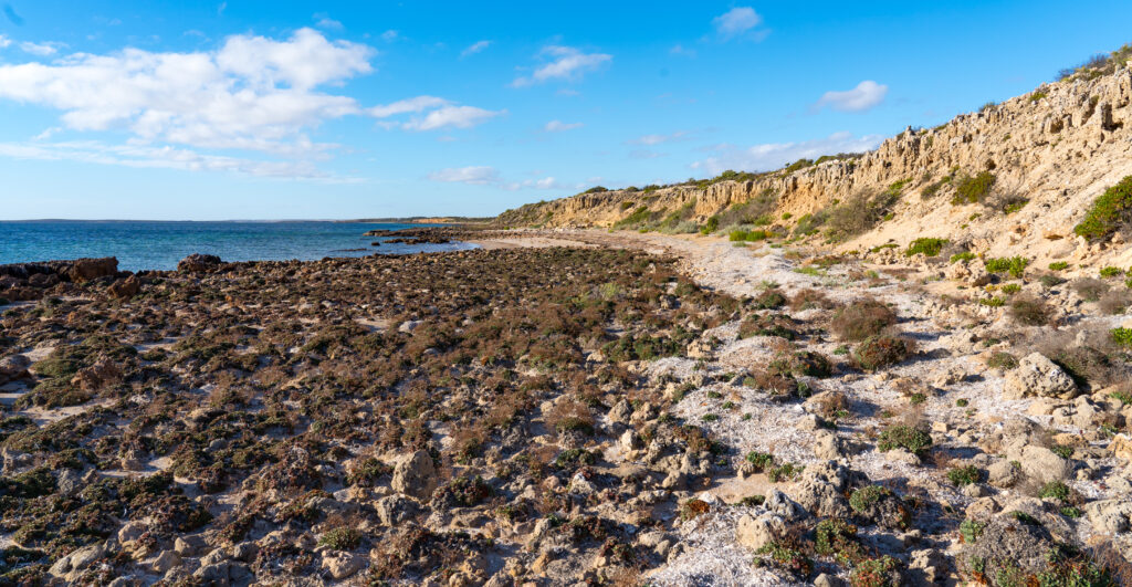
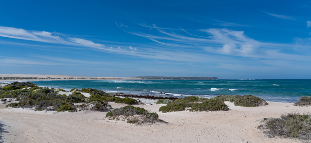
The small settlement of Elliston sits on the edge of the grand seascape of Waterloo Bay, along a wild stretch of coast that is otherwise deserted. The massive stretch of the Nullarbor awaits if you are travelling west. The tip of the Eyre Peninsula beckons 200km to the south east. The town itself was unremarkable, as so many of Australia’s small settlements are, but the natural context it sits in was awe inspiring.
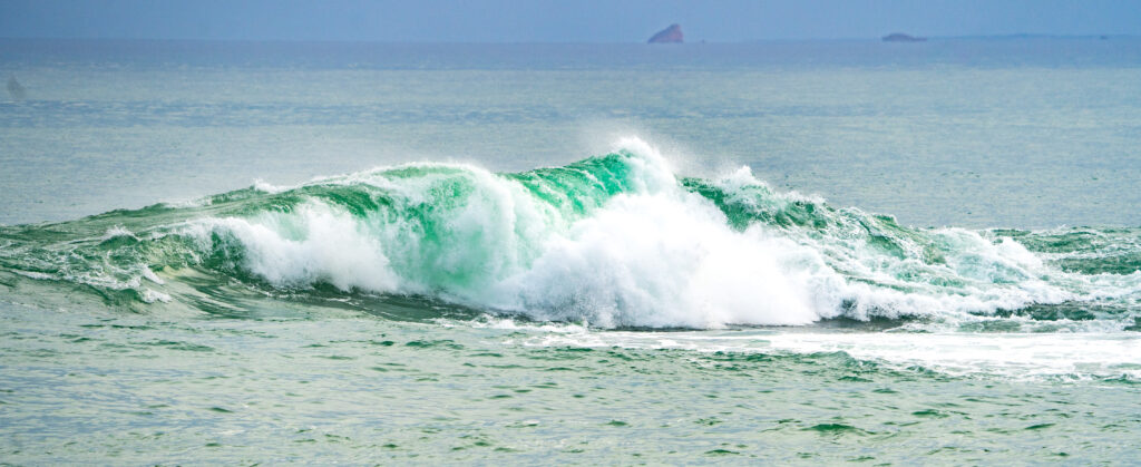
The sun catches this wave as it curls into Waterloo Bay
Home to the Wirangu people for thousands of years. and visited by other Aboriginal groups such as the Nauo and Kokatha, we acknowledge their tenure and connection to the land. The Wiragnu were driven from the area by European settlers and lost their traditional fishing and hunting grounds. There was conflict as the Warangu people fought back against this, with casualties on both sides, culminating in a massacre just outside what is now Elliston, in May 1849.
I immersed in this grim story on a wet afternoon, which has put Elliston on the map as a case study in a chapter of what Australia calls “the history wars”. The ongoing debate about what happened during Australia’s colonisation by the British and the impact that had on the Aboriginal population. In this sad chapter in Elliston, on the one side lie the white setters’ records of what happened, written mainly by the police involved, and on the other the oral tradition passed down by the Warangu elders.
The town refused to accept the Wiragnu version of events, that scores of their people had been massacred by driving them off the steep cliffs of Waterloo Bay, until a mayor sympathetic to their version, brought matters to a head by wanting to raise a memorial to the event, and use the word “massacre”. This was fiercely contested by those who felt the more reliable record was of the white fellahs, that only two of the Warangu people had been killed.
Today we now have police body cams and video from bystanders, to get a bit more of a balanced view of events. The Warangu could only pass down their story. In the end the town hired an anthropologist to investigate. His conclusion was that a large group of Witrangu (he thought around 25) had in fact been slaughtered and that within the Wirangu’s oral history “It’s far more likely that there would be a lot of facts in them than in some of the histories written by settlers who had their own events to portray and their own events to hide.”. Did the initiative help with reconciliation as the mayor intented? Looking at some of the vitriol from anonymous people still posting comments about it, I’m not so sure.
The memorial on the headland. It is carefully worded: ‘This monument commemorates an incident referred to by the traditional owners of this land as ‘The Massacre of Waterloo Bay’. A number of Aboriginal people were killed near this site in May 1849 by a party of settlers.’
And there you have it as a case study of how individuals at local level try to heal this country’s hidden wounds, part of the “historical truth telling”, but there’s a long way to go, (good summary if you’re interested to read more) and certainly at the moment other priorities that will take precedence. Like getting the country vaccinated!
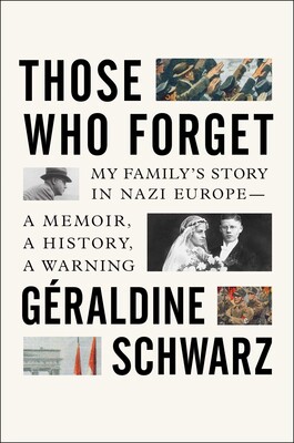
If you are interested in reading how Europe, and particularly Germany, has tackled the their historical truth telling, and acknowledging the role they played in the conflict that engulfed the world, I can throughly recommend a book called “Those Who Forget”. The author, born to a German father and French mother, investigates her family’s role in the Second World War and the how it took until the mid 1980s before Germans found a way to talk about their past honestly at a national level. A message in her writing for any county who hasn’t dealt with its past, you will never properly move on.
We spent a few days exploring the area, around Elliston, walking along the cliffs, admiring the power of the waves, and usually we could do so without another soul about. Given it‘s still school holidays and our caravan park is full, its once again a surprise how few people get out of their cars and walk. Lucky for us!
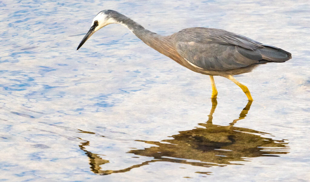
We took our time, watching a White-faced Heron fishing for supperAnd it’s got one! Our Heron snaffles a little fishA huge wave crashes into Little BayA Little Tern flies in to land on the beach
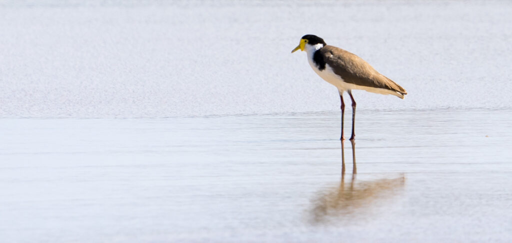
We drove a short way up the coast and had a wander around a large wetland area, looking pretty dry at this time of the year, and again saw no one. Not many birds either sadly, but thats your chance. A few sandpipers and lapwings, plus a Nankeen Kestrel as we drove in (minus camera to hand!).
A dry dusty salt pan – not looking likely to be any birds aroundA little water where there are springs – towering sand dunes behind the lakeCommon SandpipersMasked Lapwing
Full timing in a mobile home, with plumbing not really designed to be more than a holiday escape pod, means you will get some issues. This time it was only a blocked shower drain, and the purchase of a plunger and some help from the lovely park owners with their drain cleaning fluid, and our pipes were once again sorted. At least there was no $100 an hour plumber’s bill. Most stuff is fixable, especially with the knowledge base of the group of owners that we tap into through a Facebook site.
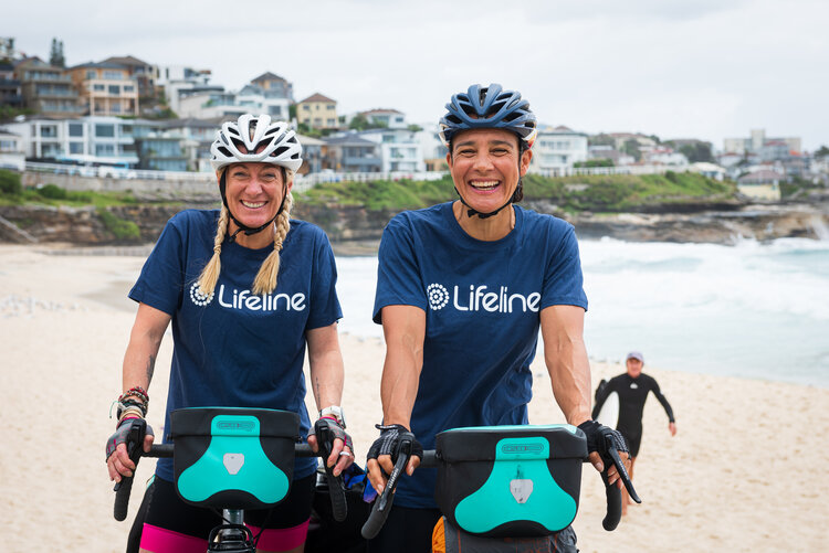
We took advantage of being close to a pub and had a couple of hearty dinners there, meeting the new landlord who has (bravely I think) taken on the project of making this place pay. Its a very small town, with two seasonally busy caravan parks on the route to or from Western Australia. We also met a couple of long distance cyclists having a much needed refuel there over dinner, Tara and Sara, who were riding across Australia west to east on push bikes. (https://www.cyclingoz.com). What a heroic pair!
Tara and Sara before they left on their courageous trip
They are raising money for a couple of charities to support their work with those suffering from mental health issues. I can imagine having ridden a few (relatively) long distance rides what a gruelling challenge they have taken on. If you can spare a few dollars, I’m sure they would appreciate it. We lost a friend a few years ago to depression, and it will haunt me forever thinking of what could have been done differently to have him still in our lives. Lifeline was the recipeient of our donation, a charity that deserves our support when so many of their traditional fund raising events have been postponed or cancelled.
We enjoyed out time in this small town (in England it would be called a village), everyone we met made us welcome. We have not once experienced the “bloody tourists” type of vibe that we have sometimes experienced elsewhere. We took time to have some conversations, and get a little insight into their lives, and perhaps there’s a connection?
In the past, we’ve always had an agenda to drive us, one that involves tackling the huge distances there usually are in between spots that are interesting. We don‘t have that sense of urgency on this trip. And that’s wonderful.
In 2002 members of the Elliston community initiated Sculpture on the Cliffs as part of the state-wide Encounter 2002 commemoration, a bicentennial celebration of the meeting of Matthew Flinders’ and Nicholas Baudin’s navigating vessels on the South Australian coastline in 1802.
We took a drive around the Elliston Sculpture Trail – finding gulls, flip flops (‘Thongz’), fish, seahorse, an eagle’s nest and giant heads. Catherine stands beside a Latvian Mara which is meant to represent Mother Earth.Waterloo BayHeading off for an evening stroll along the coastWe spy rain ahead – time to leave!
Location: Coffin Bay, Mount Dutton Bay and Sheringa Beach
Our final morning in Port Lincoln gave us a pretty special sunrise
With a new set of steps installed on the caravan, we pulled away from Port Lincoln and drove about an hour to an olive grove in Mount Dutton, just north of Coffin Bay.
We are now securely in oyster territory, the clear waters around these parts contributing to succulent creamy molluscs which are famous throughout Australia and restaurants in China and Singapore. Coffin Bay oysters are actually Pacific Oysters, native to Japan, which were first farmed here in the late 1980s. They feed on plankton, which due to the nature of the bay is plentiful here and the oysters grow faster than they would elsewhere. We managed to work our way through two dozen each over our two day visit here!
Our campsite for the following two nights was nestled on the edge of Mount Dutton Bay, twenty minutes drive from Coffin Bay in the grounds of an olive farm. As we pulled in the owners were busy trimming the trees, and there was freshly bottled olive oil for sale. We paid our $10 a night to stay there and of course purchased a bottle of oil.
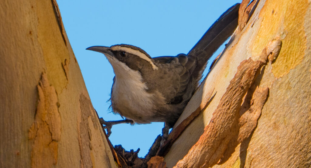
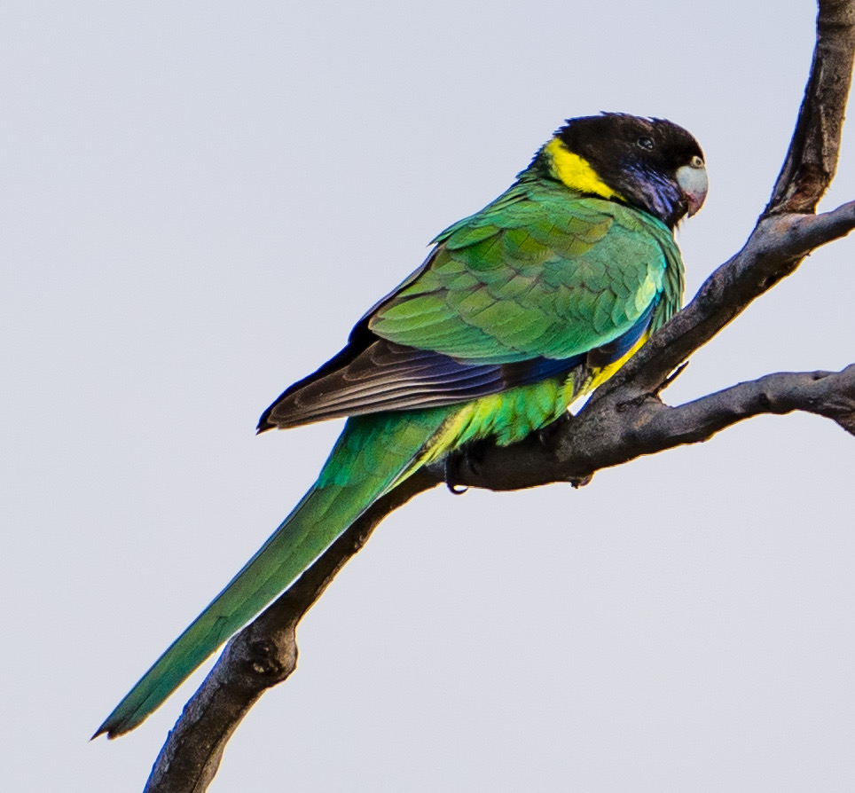
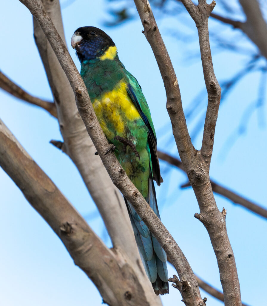
The olive grove was home to many birds, most notably Port Lincoln Ring Necked Parrots – lovely green and blue parrots with bright yellow tummies and a yellow ring around the back of their necks. With very little natural fresh water in the peninsula, they got much of their moisture from dew, rainwater where possible, and their food if able – and woke us up one morning drinking the moisture from our skylight.
Port Lincoln Ring Neck ParrotOne legged perchingEmus are also a regular visitor to the grove and its neighbouring fields
We were also delighted to see Singing Honeyeaters here, their trilling voices often turning to something more sinister when they saw Tassie exploring. She loved this camp and, for her, walked a long way accompanied by her bodyguards, and even disappeared into a cat-sized underground limestone cave for a few minutes which gave us a fright!
Singing Honeyeater on top of an olive treeSinging Honeyeater
We explored the bay from the camp, following a path which looked like it had been walked for hundreds of years, way beyond the handful of campers at the grove. It reminded us to thank and acknowledge the Nauo and Barngarla people, who were custodians of this region for many thousands of years before white settlement. They made use of a wide variety of fish, inland mammals, reptiles and plants and cared for this land.
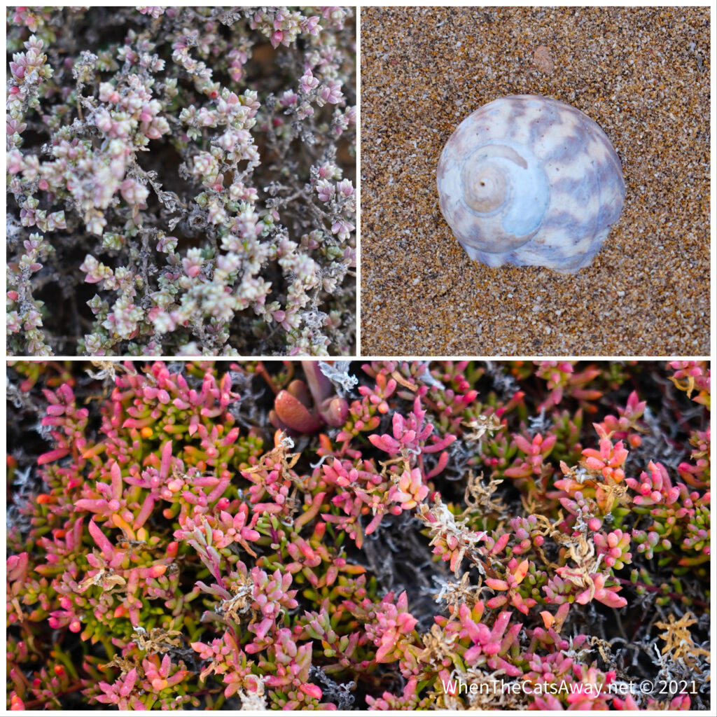
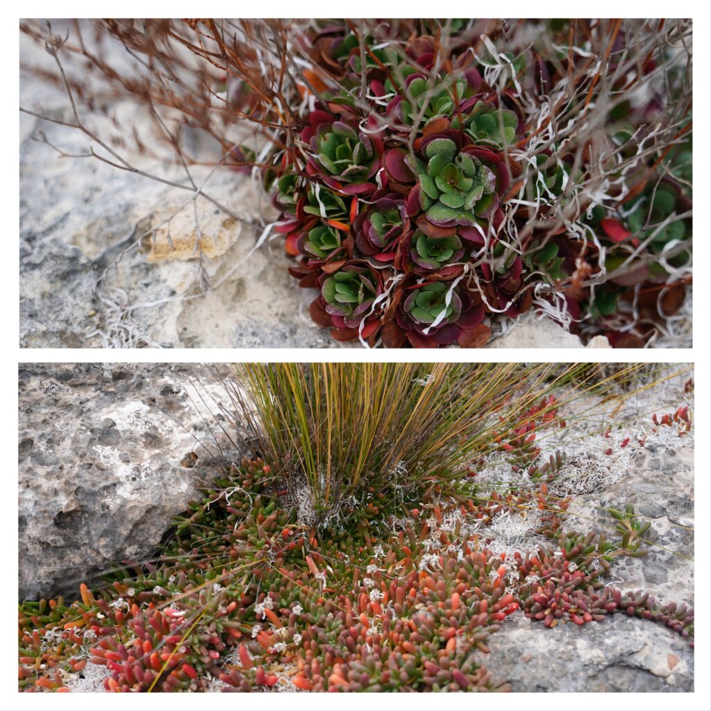
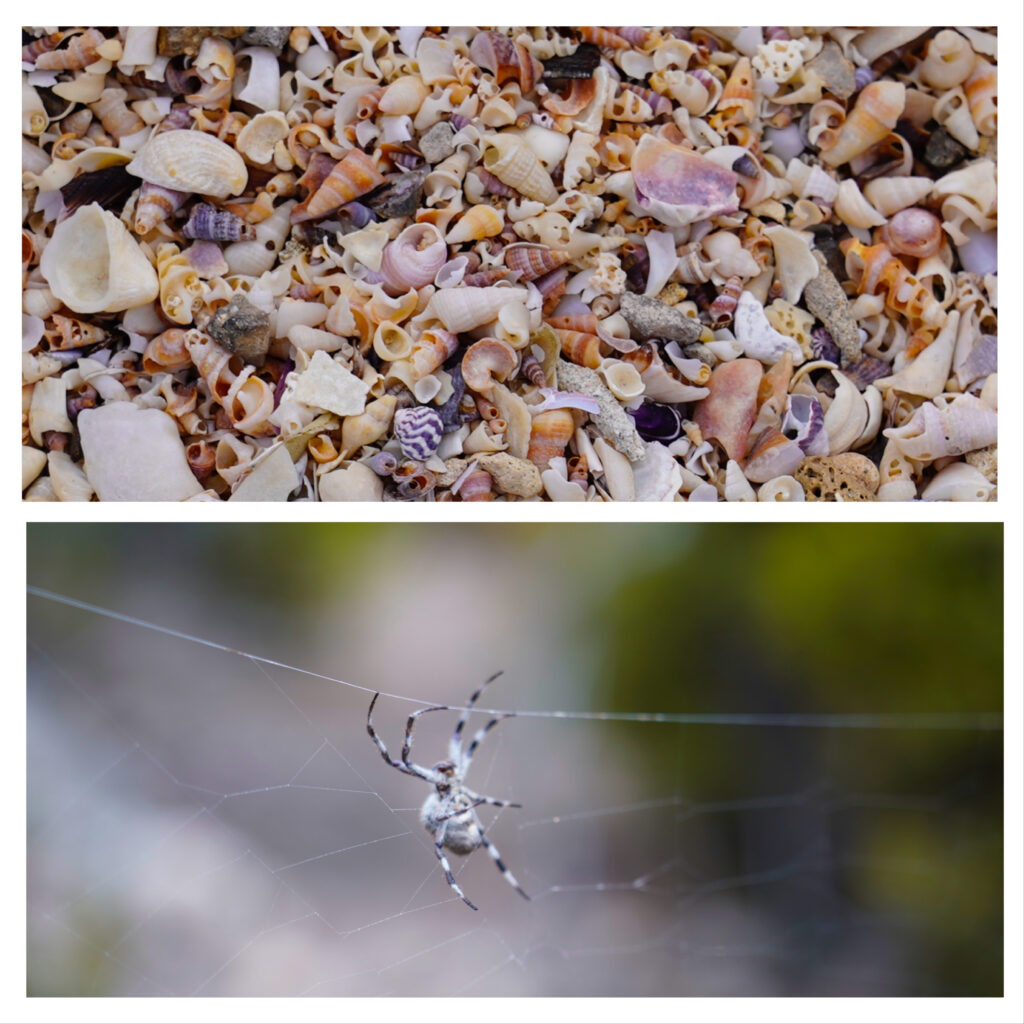
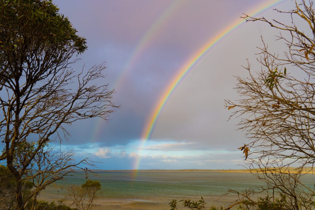
The limestone is tough for most plants to grow on, so salt tolerant and air plants grow along the waterline. We thought this looked like a colourful gardenSalt tolerant plantsHundreds of tiny shells make up a beach we walked over and a salt-tolerant spider in limestone coloursStripes of seaweed on the shore – colours reminiscent of the Scottish highlandsA farewell double rainbow to see us on our way
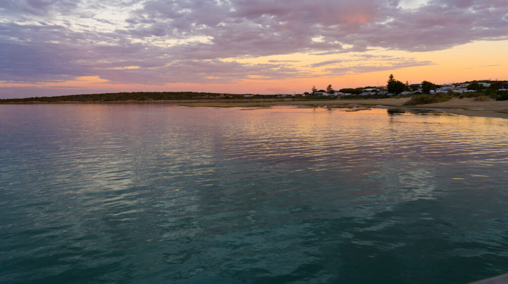
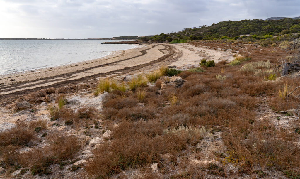
After two nights here we made our way up the coast towards the small village of Elliston where we had booked in to a campsite for a few nights. We had a spare night up our sleeve en route and picked out a random campsite on the coast called Sheringa Beach, again costing a princely sum of $10 a night to stay there.
It was a real surprise to arrive to the spectacular location. Elliston District Council has invested in the area, creating high quality level fenced camping areas amongst the dunes, providing bins and even a new flushing toilet to service visitors. We wish more councils would do something like this.
Can you spot Tassie? Another site gets the paw of approval
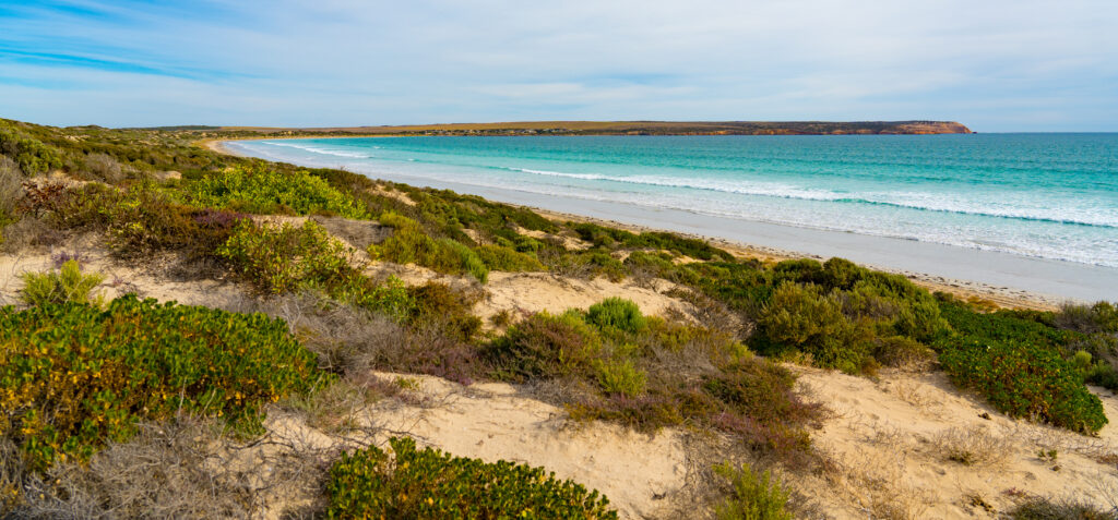
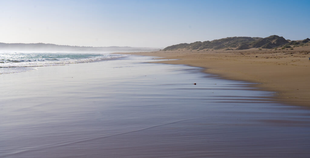
Tucked in behind the dunes, we could hear the sound of the surf on the other side, and followed a sandy path to explore. Wow! A spectacular 4km long white sand beach stretched along the coast to the next headland. We decided to head off for an explore (map).
Walking along the beach
As usual, once we had left the immediate entrance to the beach we didn’t see anyone. Apparently there is four-wheel-drive access to this beach, but it doesnt look like anyone has used it for a long while. The beach is pristine, not a single scrap of rubbish anywhere, and it is clear from all the shore birds present that they appreciate it.
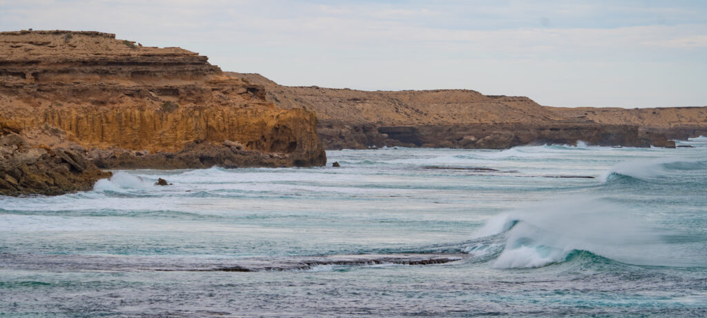
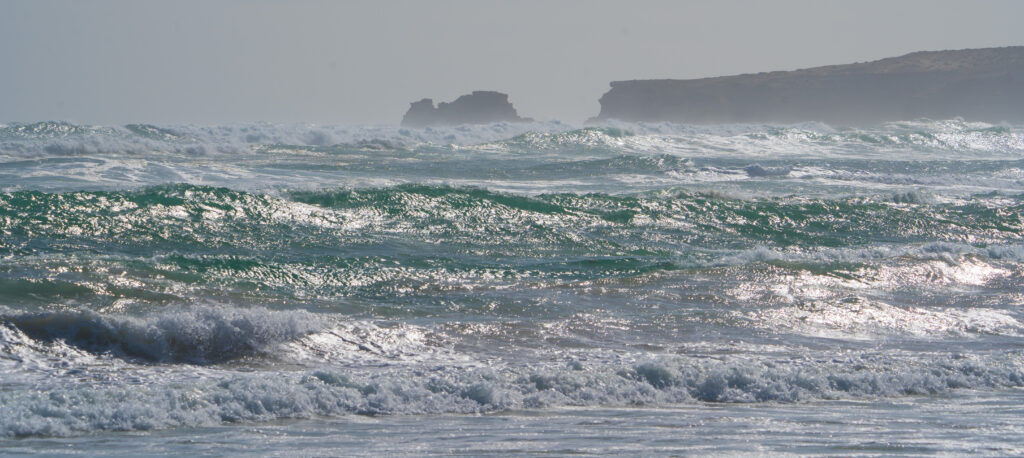
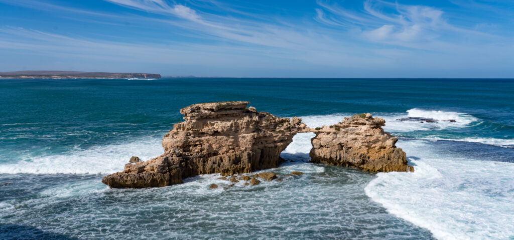
Red Capped Plovers, Sooty Oystercatchers and Hooded Plovers race along the the shoreline hunting for morselsTurbulent seas – at 18 degrees we weren’t up for a dipLooking down the beach you can see the sea spray, misting the viewA pacific gull soars over the waves
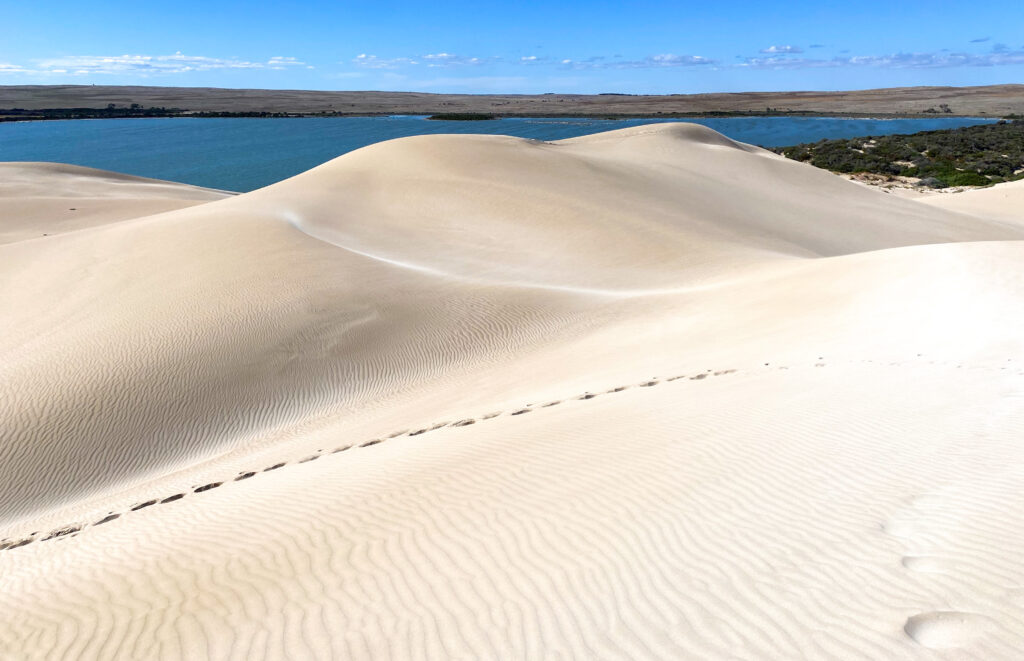
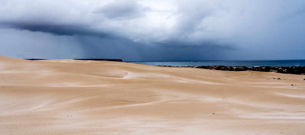
Sitting up behind the beach are huge sand dunes, looking like towering snow capped hills stretching along the coast.
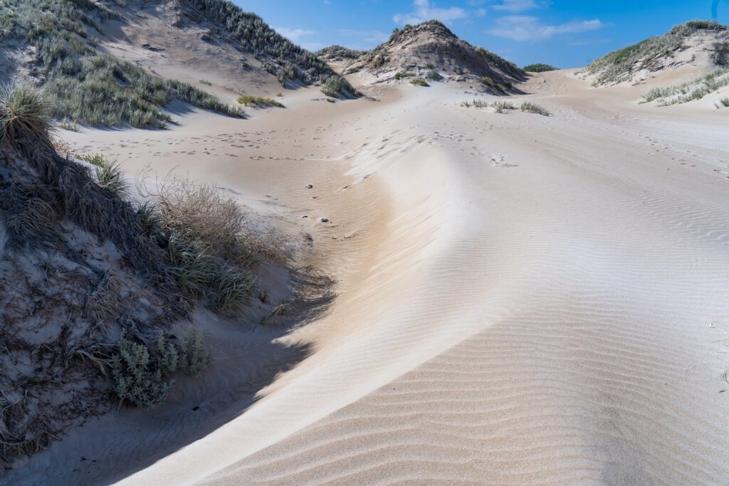
Hiking up into the dunesBeautiful patterns in the sand driftsSand as far as the eye can seeLooking out over the bay
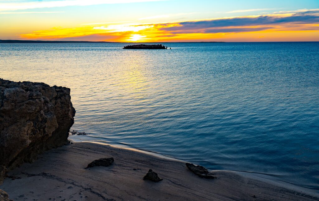
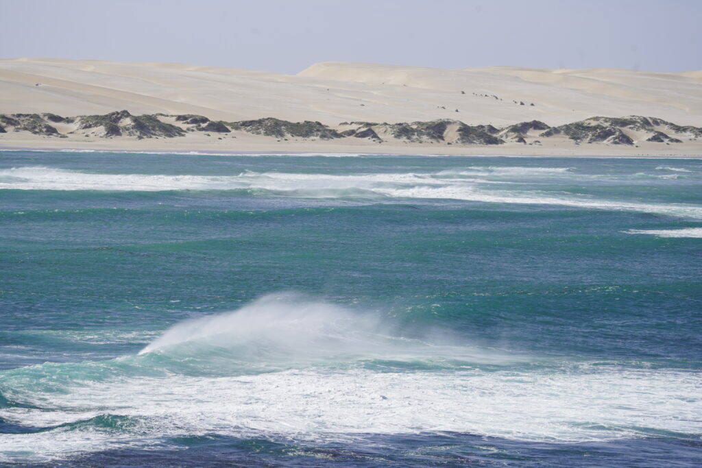
Apparently it is not unusual to see dolphins swimming off the coast here, but they were not playing on our visit. Before we moved on the following morning we hiked up to the headland to see along the coast. The waves were wild and wind blown, the rocks sculpted by the constant force.
A single sediment creates a bridge between these two rocks Off shore wind blowing the wave – see the dunes out the back
It was a beautiful night’s stay and we’re certain to return. We packed up camp, Tassie had a final explore through the dunes, and we went on out way up the coast to Elliston.