Catherine loves painting and photography as well as the great outdoors. Cycling, kayaking, pack-rafting and hiking are favourite activities as well as scuba diving when the location permits. A self confessed geek, she’s the reason details are included in our stories!
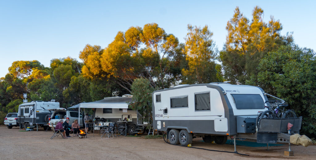
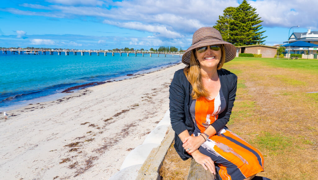
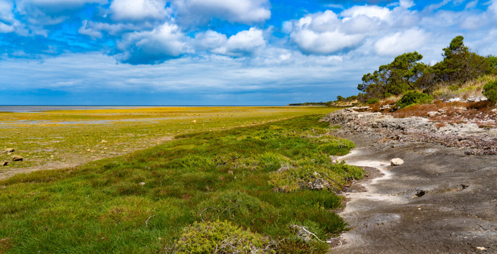
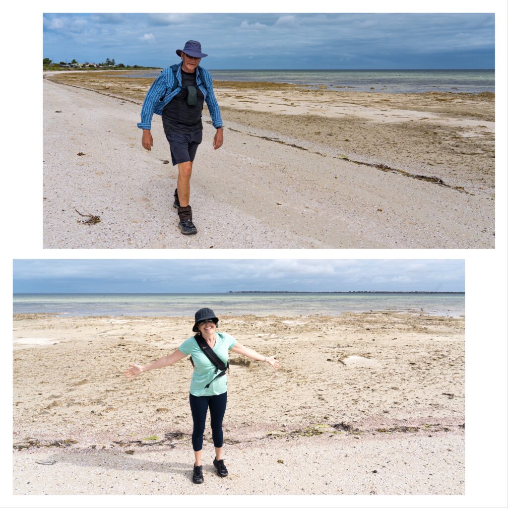
Location: Port Lincoln and Tumby Bay, South Australia
Despite being the same size as England and Wales combined, having such a small population means medical provisions on the Eyre Peninsula are rudimentary at best. Residents (and visitors) requiring specialist tests and scans need to make a several hundred kilometre drive or an hour’s flight to hospital in Adelaide.
Being on the road long-term means Mark and I cannot ignore our health needs, and as such have to fit in tests and checkups as we go. We returned to Port Lincoln for two nights to enable Mr A to pop over to Adelaide for a scan.
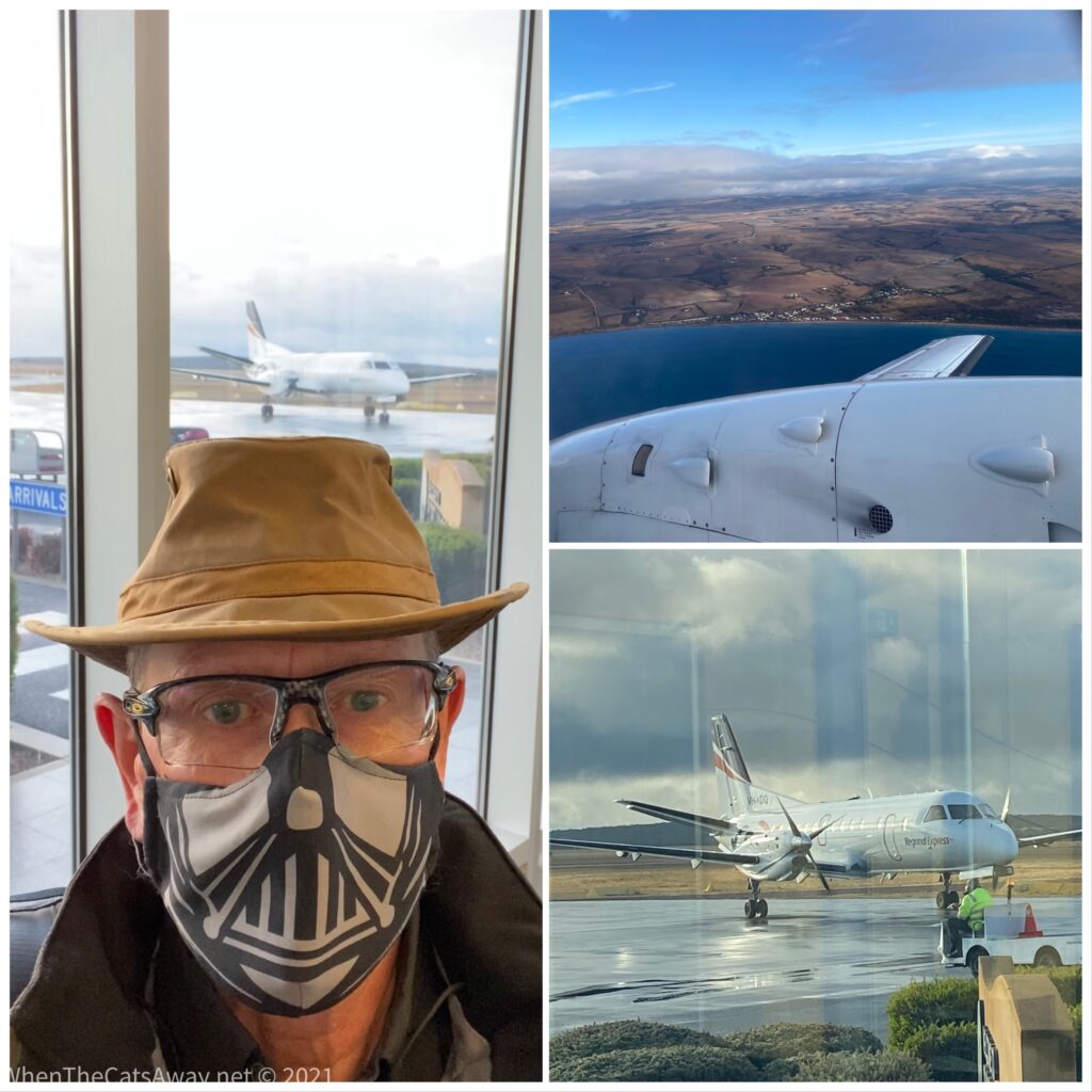
Mark took an early flight across to South Australia’s capital, donning a compulsory face mask for the trip, the first time a face covering has been required since we were in a supermarket in Victoria, and arrived in Adelaide right on time about an hour later. He spent much of the day shopping and exploring the city, with some tests at a central hospital mid afternoon.
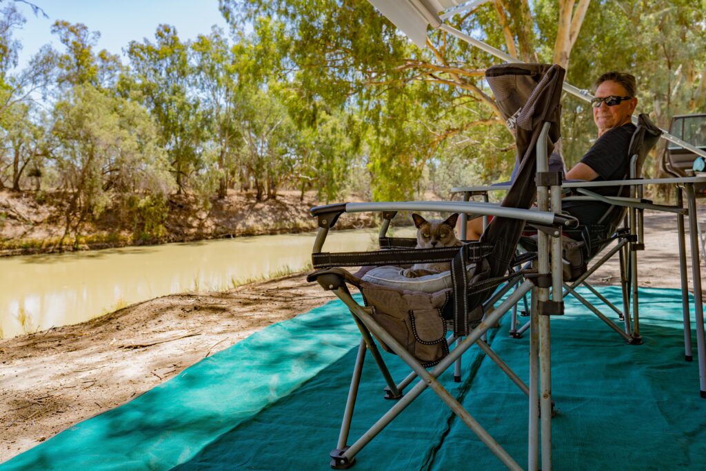
Mr A in his Darth Vader face mask scaring passengers on the flight to Adelaide
I meanwhile was still recovering from the dreaded food poisoning, my delicate stomach still not happy to receive food and drink. Thankfully with the help of some pills, I was finally able to consume my first nutrition in a week on Friday evening.
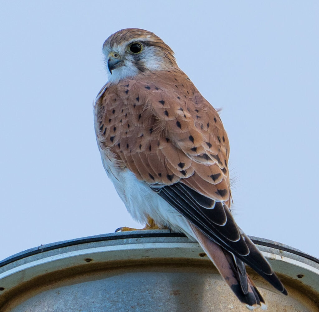
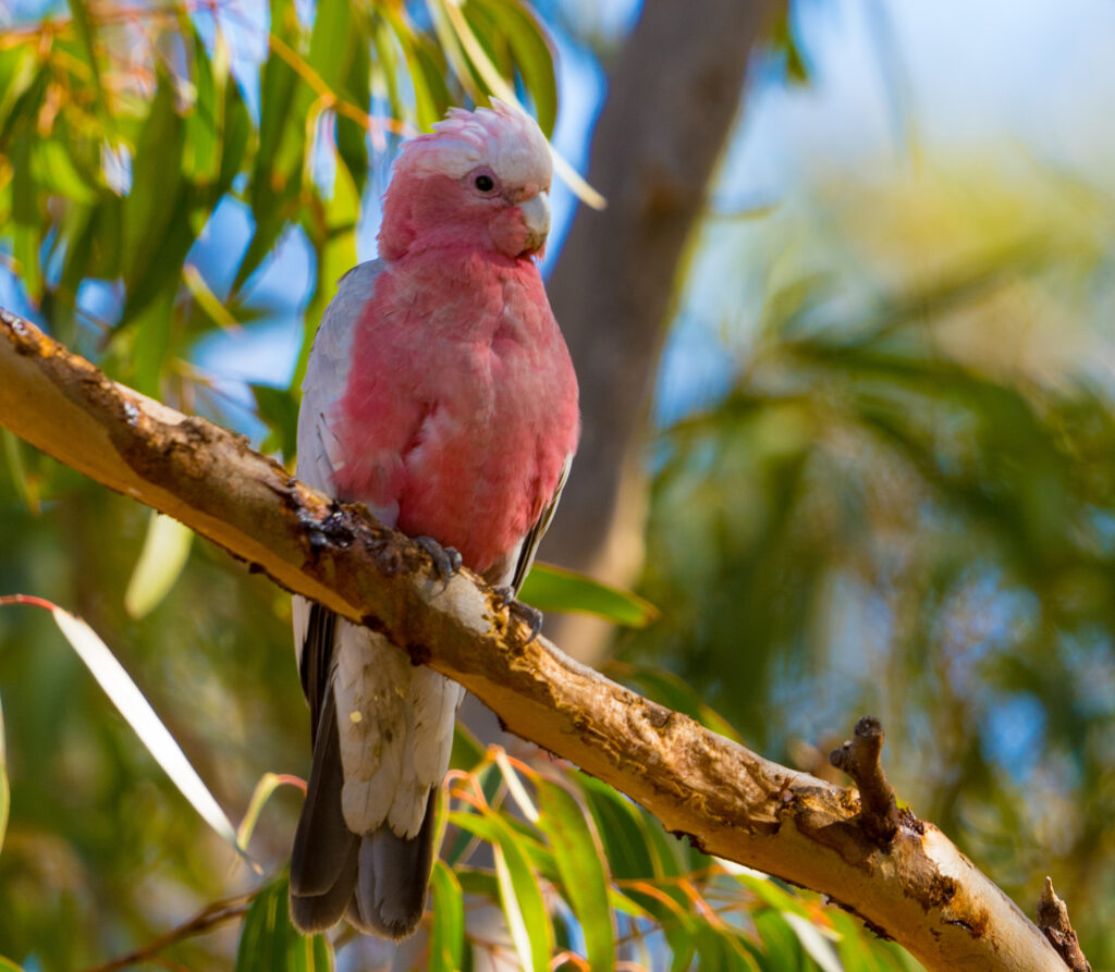
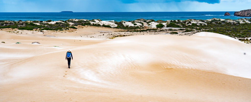
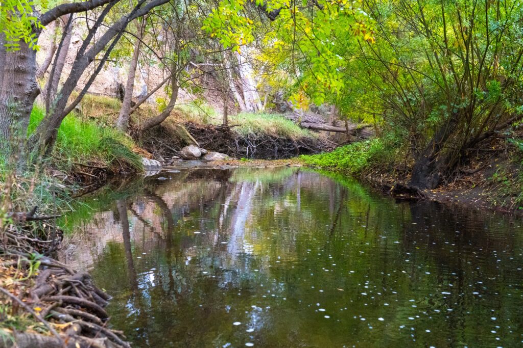
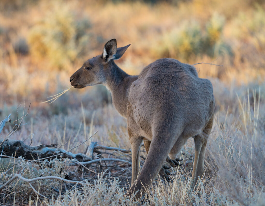
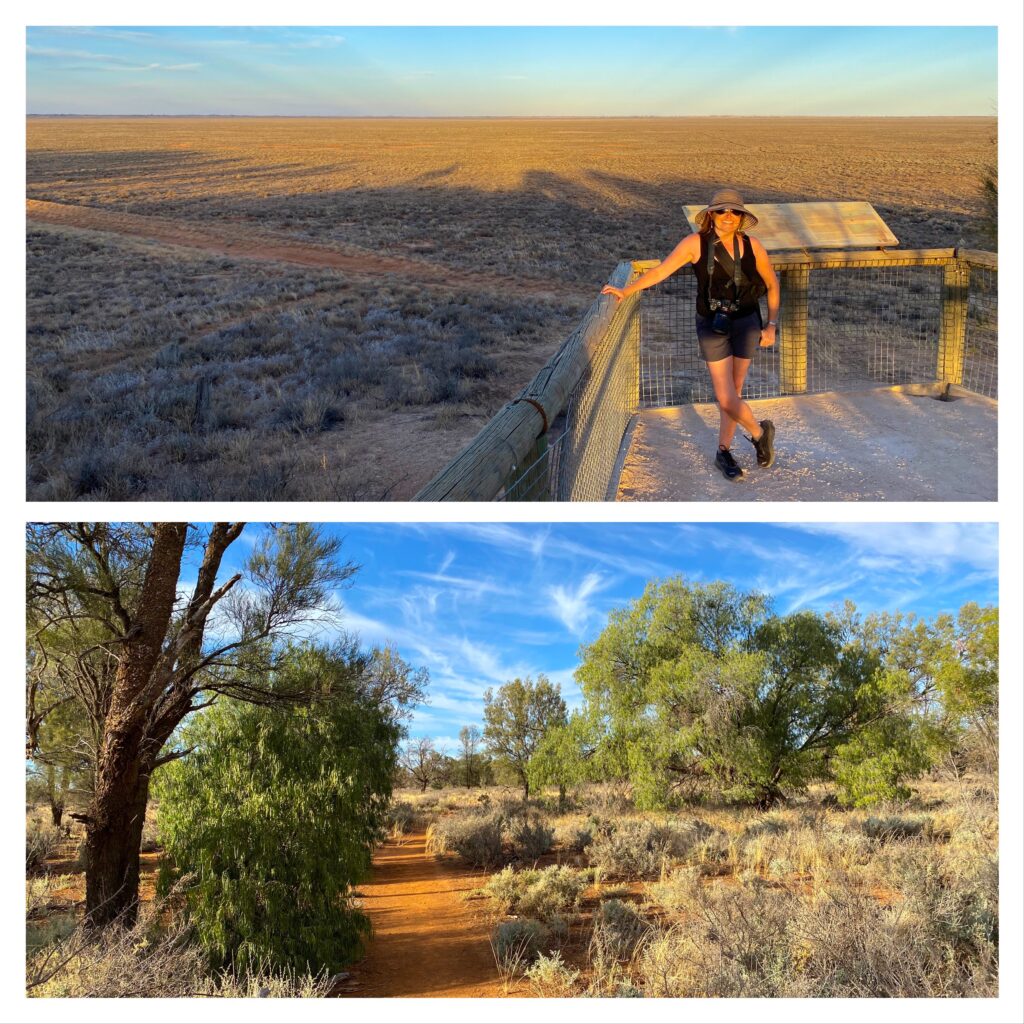
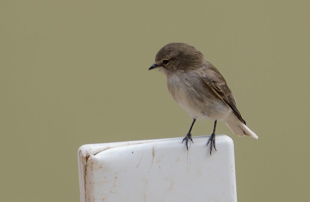
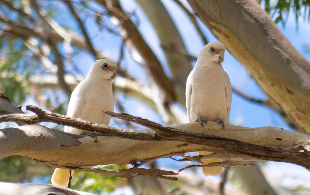
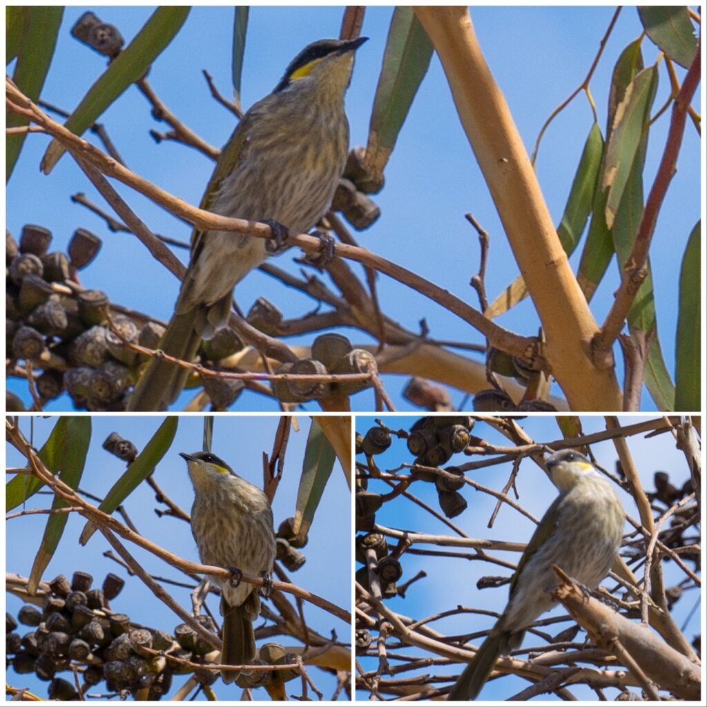
I had a very relaxed morning, using the drizzly weather as an excuse to do some washing and reading. It cleared up by lunchtime, so I went for a walk around Boston Bay to see whether I could find any wildlife – particularly hopeful I might find a Nankeen Kestrel we’d spotted on our last visit here.
Well, I couldn’t believe my luck. When I had walked no more than about 50 metres I spotted her sat there on the roof of a Marine Sciences building. She sat there quietly for a few minutes before taking flight. I didn’t see her again that afternoon.
Right on cue, a stunning female Nankeen Kestrel poses for a photo
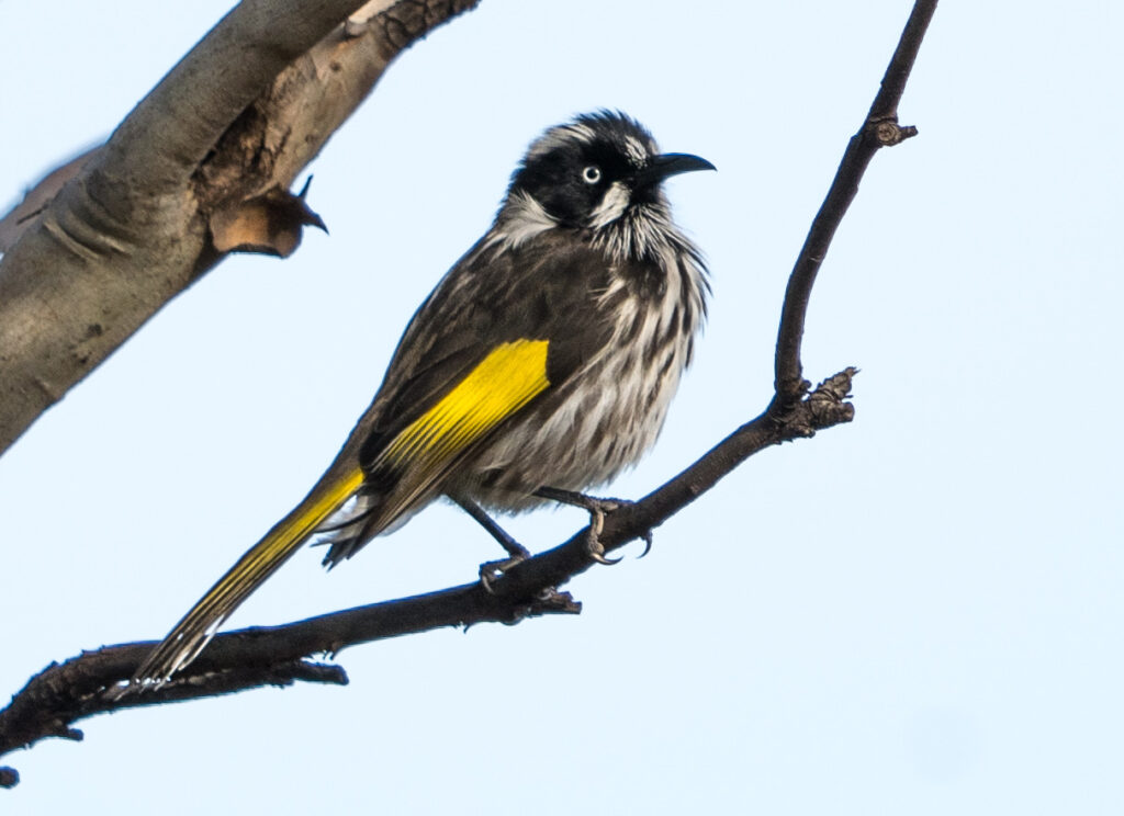
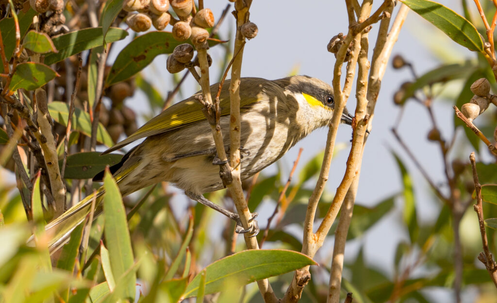
In the flowering gums and trees along the bayside walk were many New Holland Honeyeaters, often feeding their young, quickly chasing flies and drinking nectar from flowers. They have so much character you could watch them for hours.
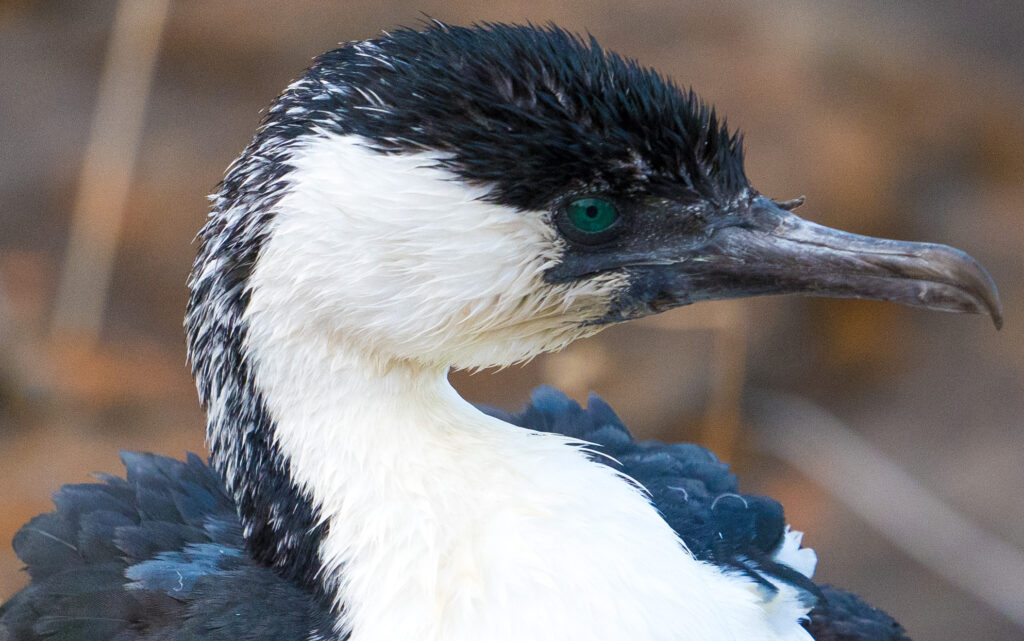
A New Holland Honeyeater pauses mid chaseDélicate toes curl around a twigA green eyed Pied Cormorant on the shore
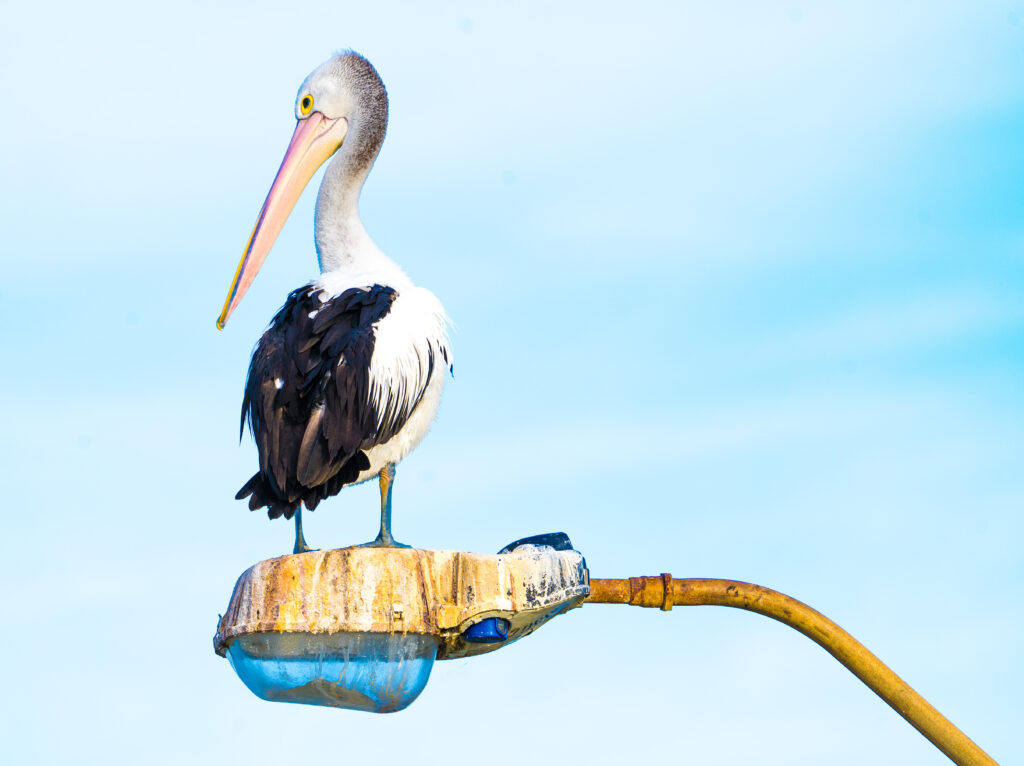
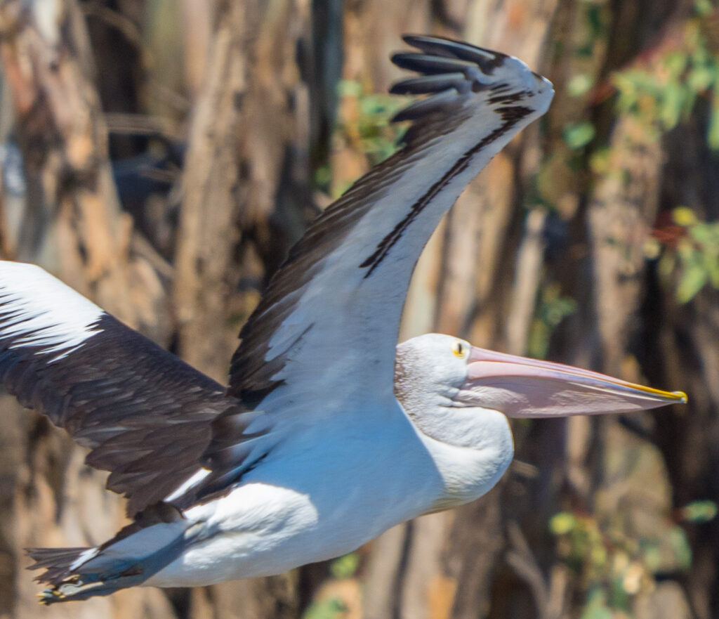
And returning to camp, the local pelicans were out in force waiting for fishing scraps, including this chap who watched from way up high on a street light, a favourite perch.
Patricia Pelican watching from a favourite perch
Mark arrived home safe and sound by 9pm that night, having had his tests plus enjoyed an afternoon shopping in the big smoke.
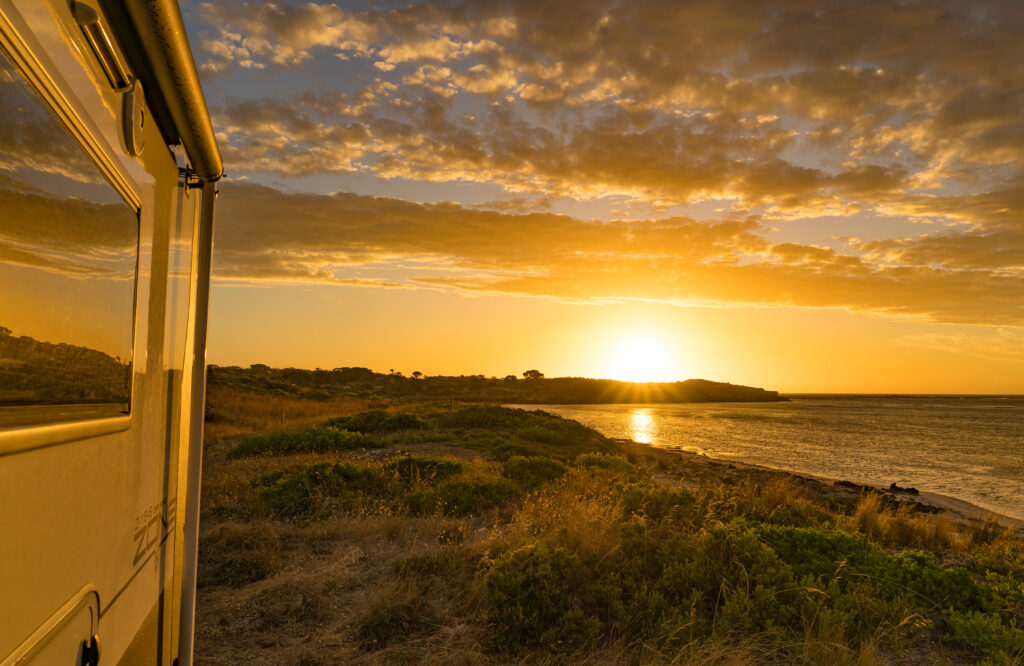
The following morning we farewelled Port Lincoln, we think for the last time, and drove just 40 minutes up the coast to the little town of Tumby Bay.
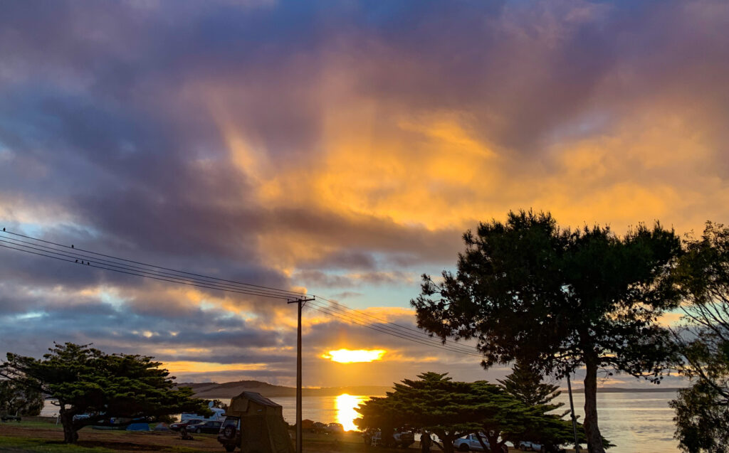
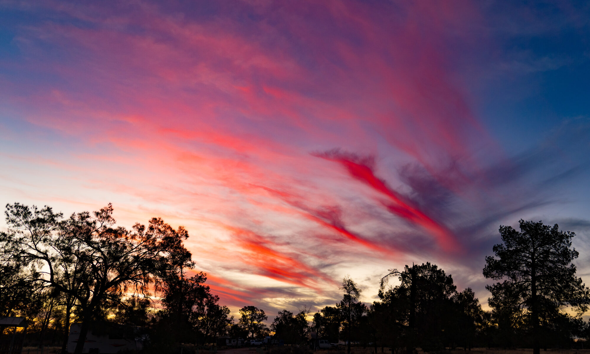
Our farewell sunrise at Port Lincoln
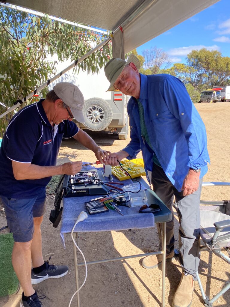
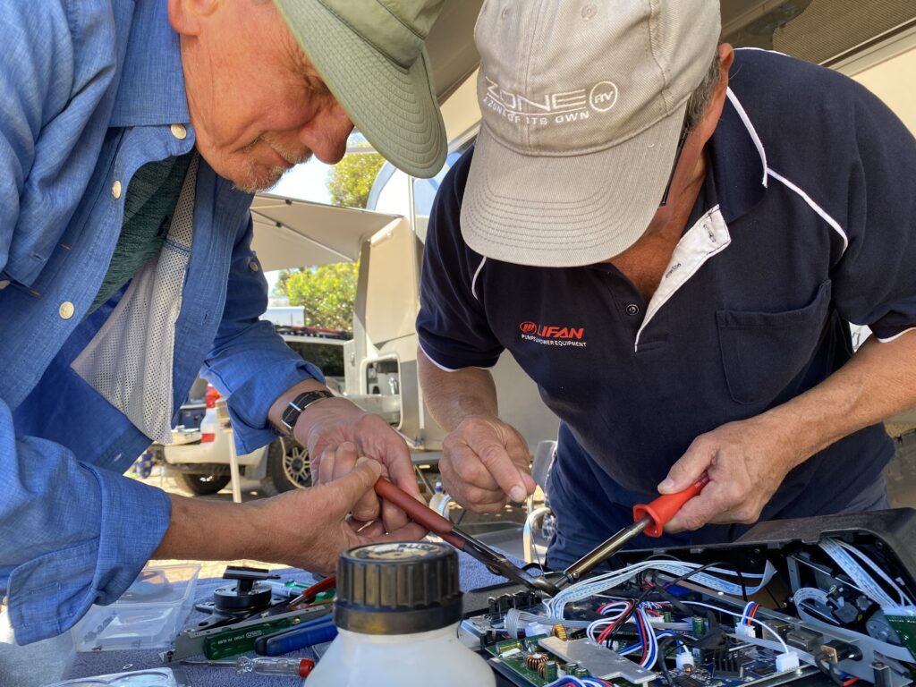
Tumby Bay was our opportunity to catch up with some friends, Phil and Libby who are travelling around South Australia with Phil’s cousins. Usually they live up in Brisbane – it’s been more than two years since we last saw them.
We got chatting about their trip so far, and Libby laughed that both of their caravans’ televisions had sustained some damage on the journey, and Phil had needed to weld a connection back on. Coincidentally, I had noticed just the day before that a connection on the back of OUR television had sheered off this time as well! Phil didnt hesitate to get out his welding gear, unscrew the back of our television and get busy fixing it for us. What super generous people.
Mr A looking a bit nervous handling welding gearMr A helping Phil with the TV repair
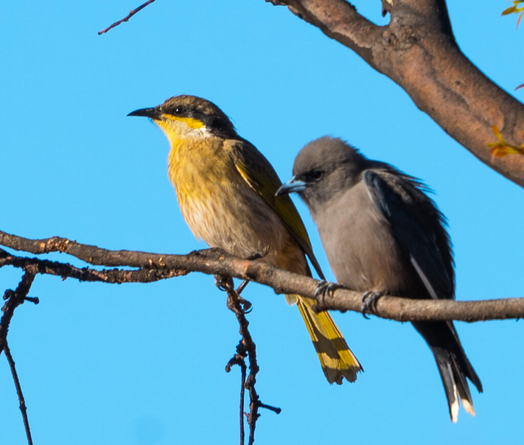
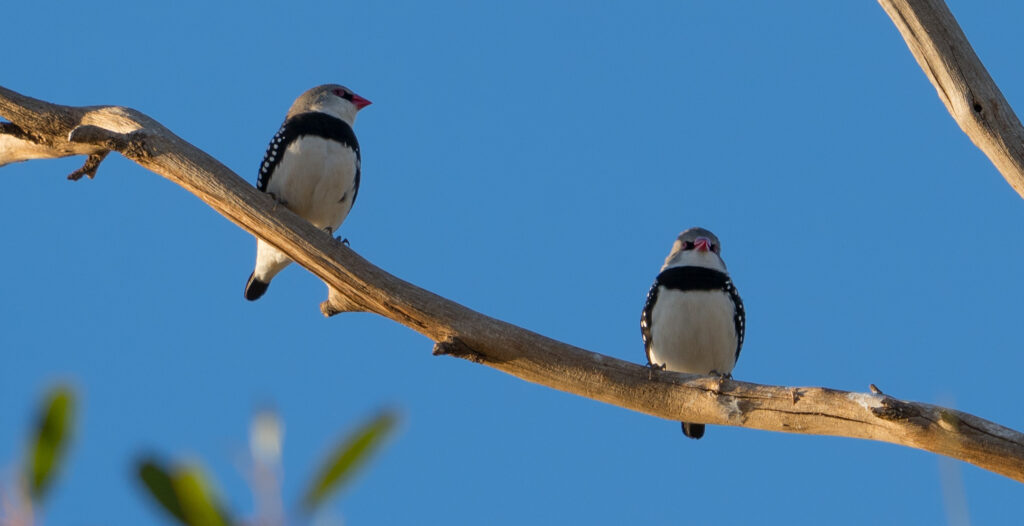
Libby is also an excellent photographer, so took me off onto the nearby golf course looking for birds. There were plenty there:
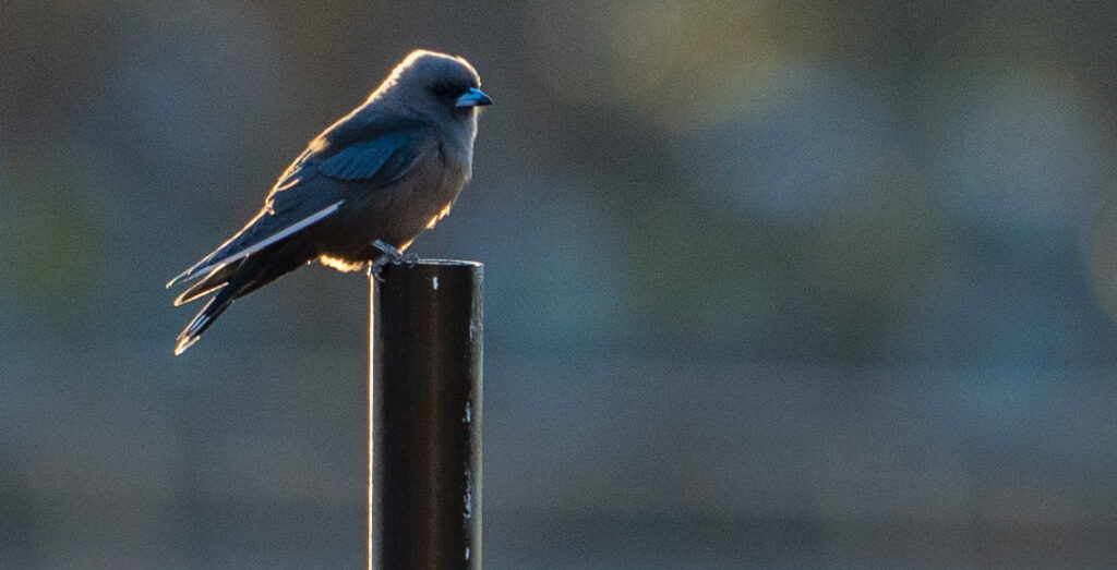
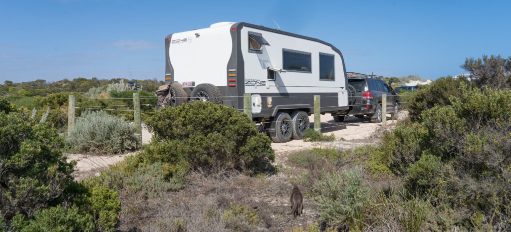
A Singing Honeyeater hanging out with a rather hunched over Dusky WoodswallowBlack-faced WoodswallowPhil and LIbby also own a Zone RV off-road caravan
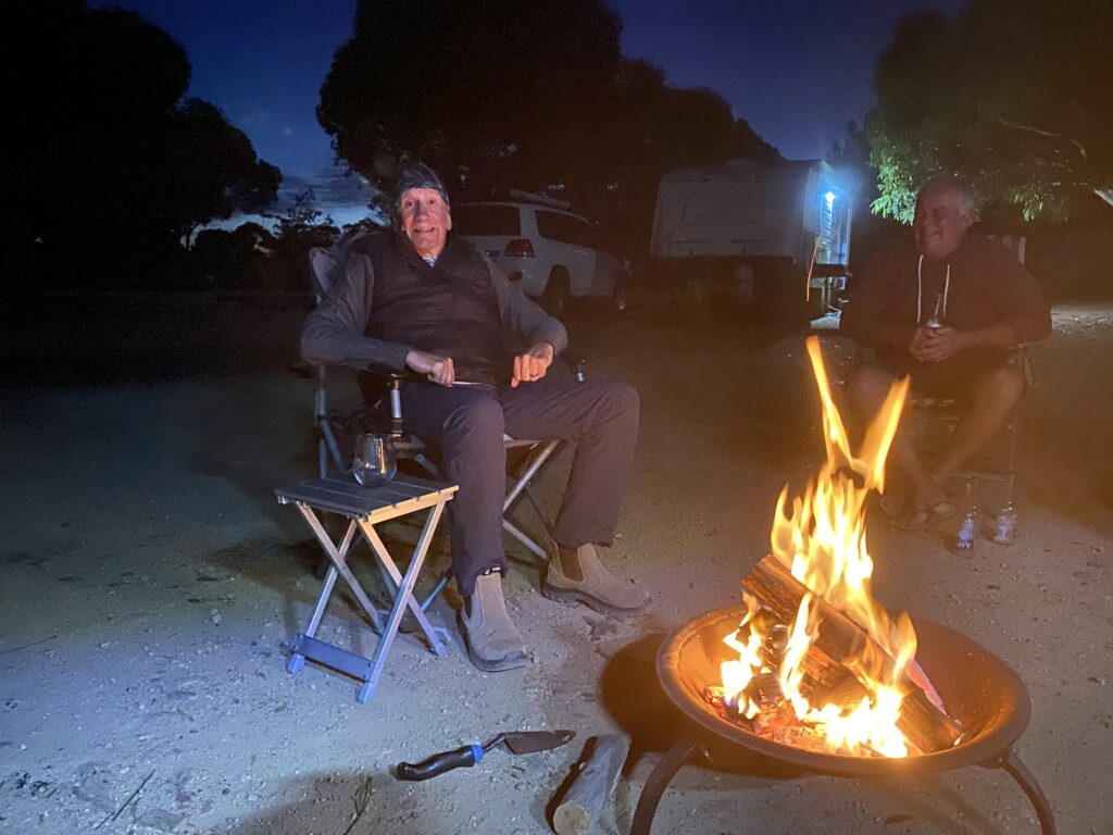
We had a brilliant evening with the four of them, sharing a delicious roast pork and vegetables cooked on two barbecues, and consumed sat around a cosy fire. We had lots of laughs and a wonderful night, reminding us how much we miss spending time with friends in person.
A roaring fire – Mr A and Phil’s cousin Wayne
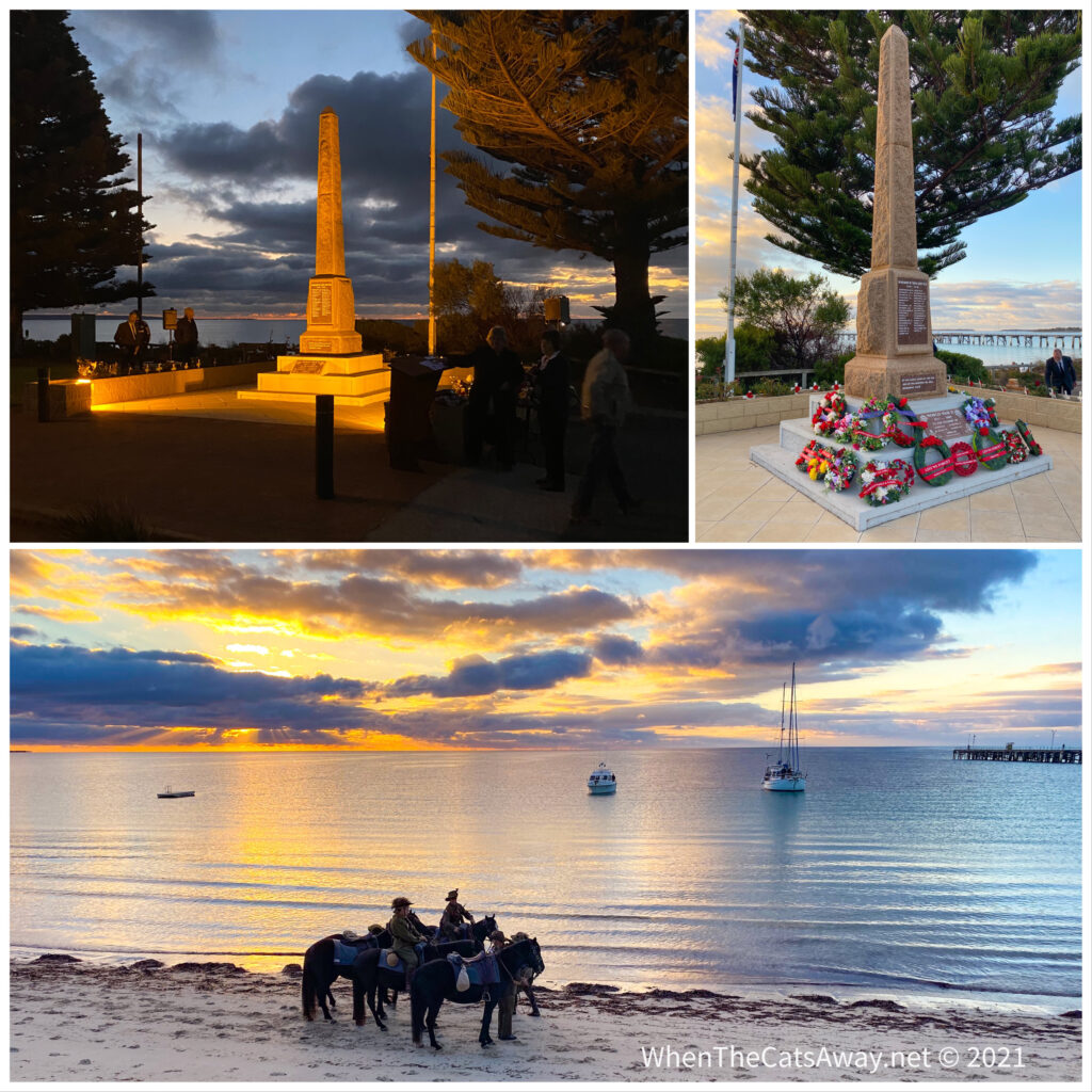
Sunday morning was ANZAC (Australian and New Zealand Army Corps) Day, so Mr A joined Phil and Libby at the dawn memorial service held down at the waterfront. I had not had a good night’s sleep, so took the opportunity for an extra hour in bed, paying my respects later on. Mark said it was a lovely ceremony, with mounted horses marching along the beach and the last post played eerily though the dawn silence.
A beautiful setting for the dawn service
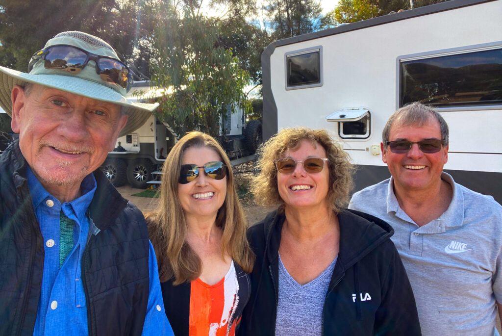
Our friends were heading south to Port Lincoln next, so we said our goodbyes with a final team photo.
Cheese! We hope we meet again some time….maybe later this year?
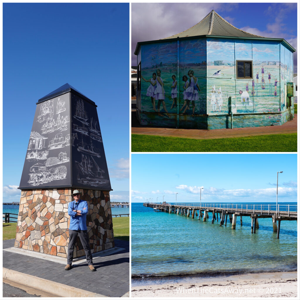
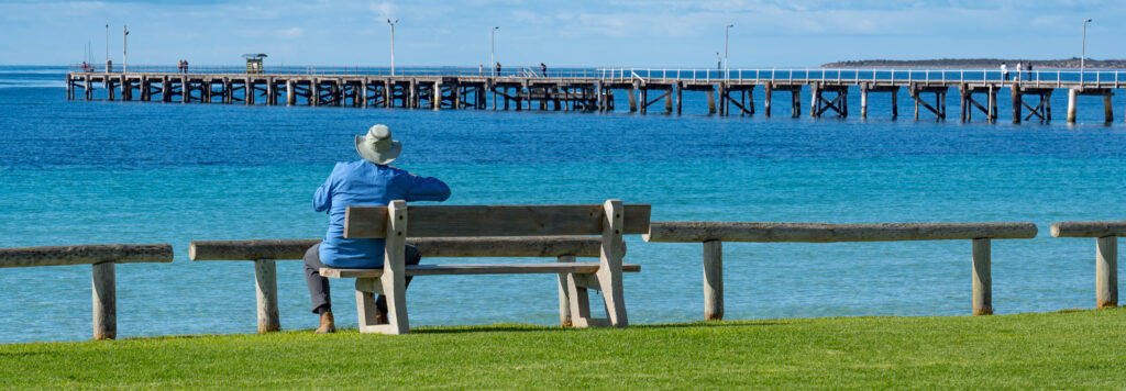
Mark and I went into Tumby Bay for a proper look around in the daylight. It’s a sleepy little town, very well kept, neat and tidy, with a long jetty just perfect for catching fish from. There are quite a few murals, part of the Tumby Bay Street Art Festival held in 2018.
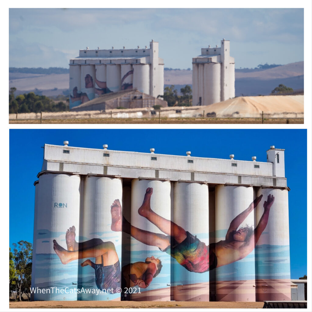
Such a peaceful morning on the seafrontSome of the street art on the waterfront – an old clock tower depicting historical Tumby Bay and a former art gallery with images representing holiday makers on the beachThe huge grain silos tower over the little town, by far the tallest building around. They have a gorgeous mural depicting two boys jumping in the waterWe spotted a couple of dolphins swimming in the bay here
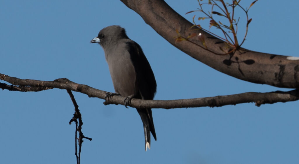
We returned for a relaxing afternoon, and I went for a stroll around the golf course again, spotting more bird life. It’s a great location for seeing our feathered friends.
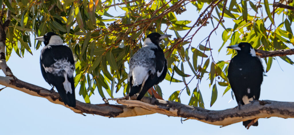
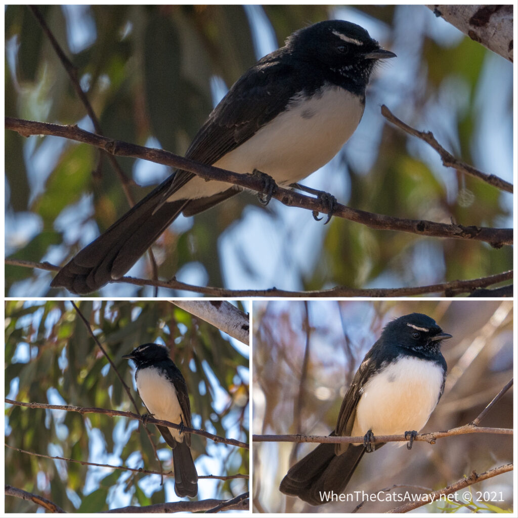
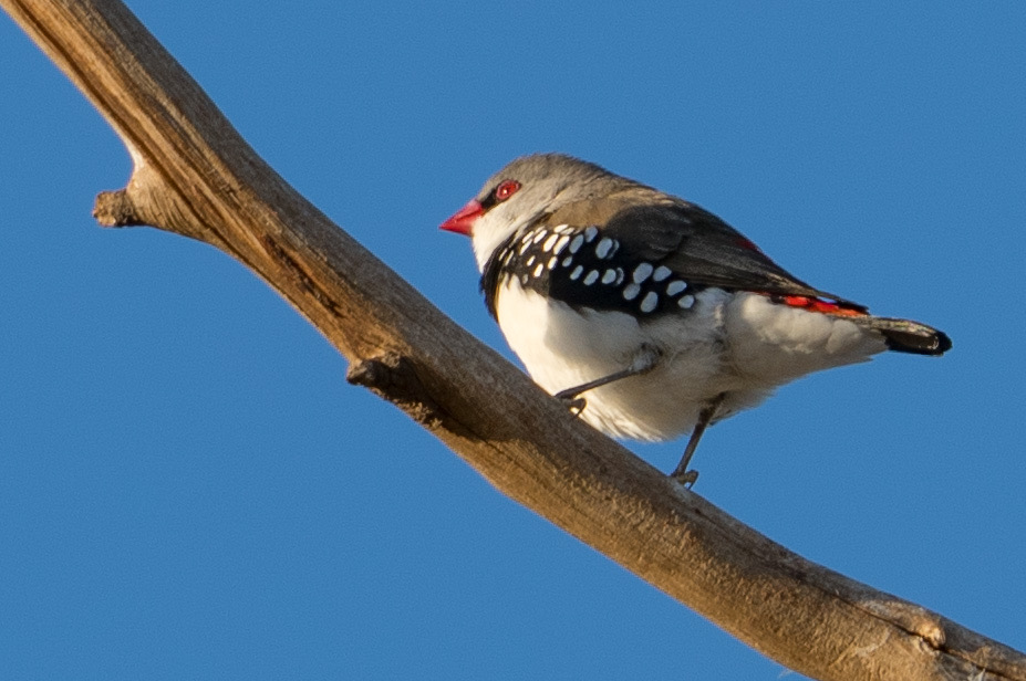
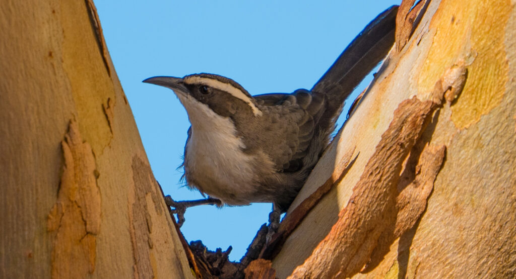
A flock of noisy Gallahs call this area homeHear no evil, see no evil, speak no evil? Three magpies keep watch in the shadeA Willie Wagtail I watched for quite some time as it swooped artfully through the air chasing insectsTiny little Diamond Firetail – they don’t stop still for long. When they fly you see a great flash of red on their tails. Hard to see when they’re seated.Diamond FiretailsRadioactive Dusky Woodswallow in the late afternoon sunA Singing Honeyeater searching for berries on the groundOne of many White-Browed Babblers (often called the ‘Twelve Apostles’ because of the noisy gangs they hang out in!)
It was a lovely couple of nights’ stay before we head back over to the west coast of the peninsula again.
We respectfully thank and acknowledge the Barngarla first nation community for their custodianship of this part of the Eyre Peninsula over the past thousands of years.
Location: Sheringa Beach, Eyre Peninsula, South Australia
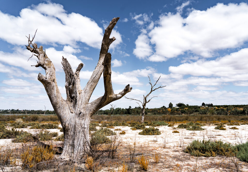
We had decided to move on from Elliston, but that was before I woke early on Friday morning feeling somewhat unwell. Food poisoning. Either from the meal at the pub or the spoonful of ‘past its use-by date’ coconut yoghurt and fresh raspberries I had on my return, either way, I was not in a good state, and unable to stray more than a metre or two from a toilet. Mark tried his best to persuade the caravan park to let us stay another day, but they already had someone coming into our site and were fully booked.
Mark did all the packing up and we drove the longest 30 minutes ever down to Sheringa Beach, where we had stayed the previous weekend, found the same site we were on then and settled down for the long haul. I will not go into detail, but the following three days were pretty awful for me, and worse for Mark who was thankfully feeling well but was amazing, looking after me with kindness and patience.
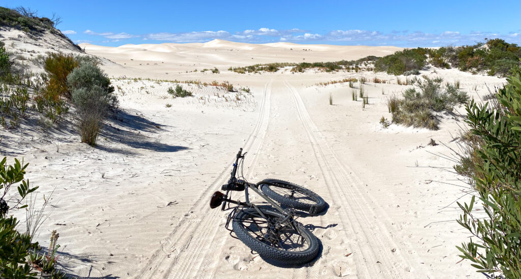
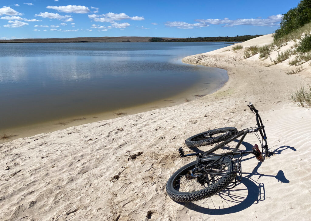
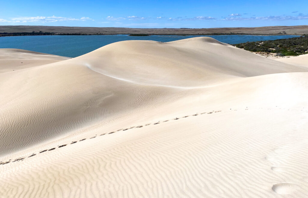
Mark managed to escape on a few occasions to explore by himself, rinding in to the sand dunes and to ‘Round Lake’ which sits behind the dunes and beach.
Dune buggies and four-wheel-drives frequent these sand hills…as well as the odd Surly!Reaching the lake shoreClimbing up into the dunes, the lake in the background
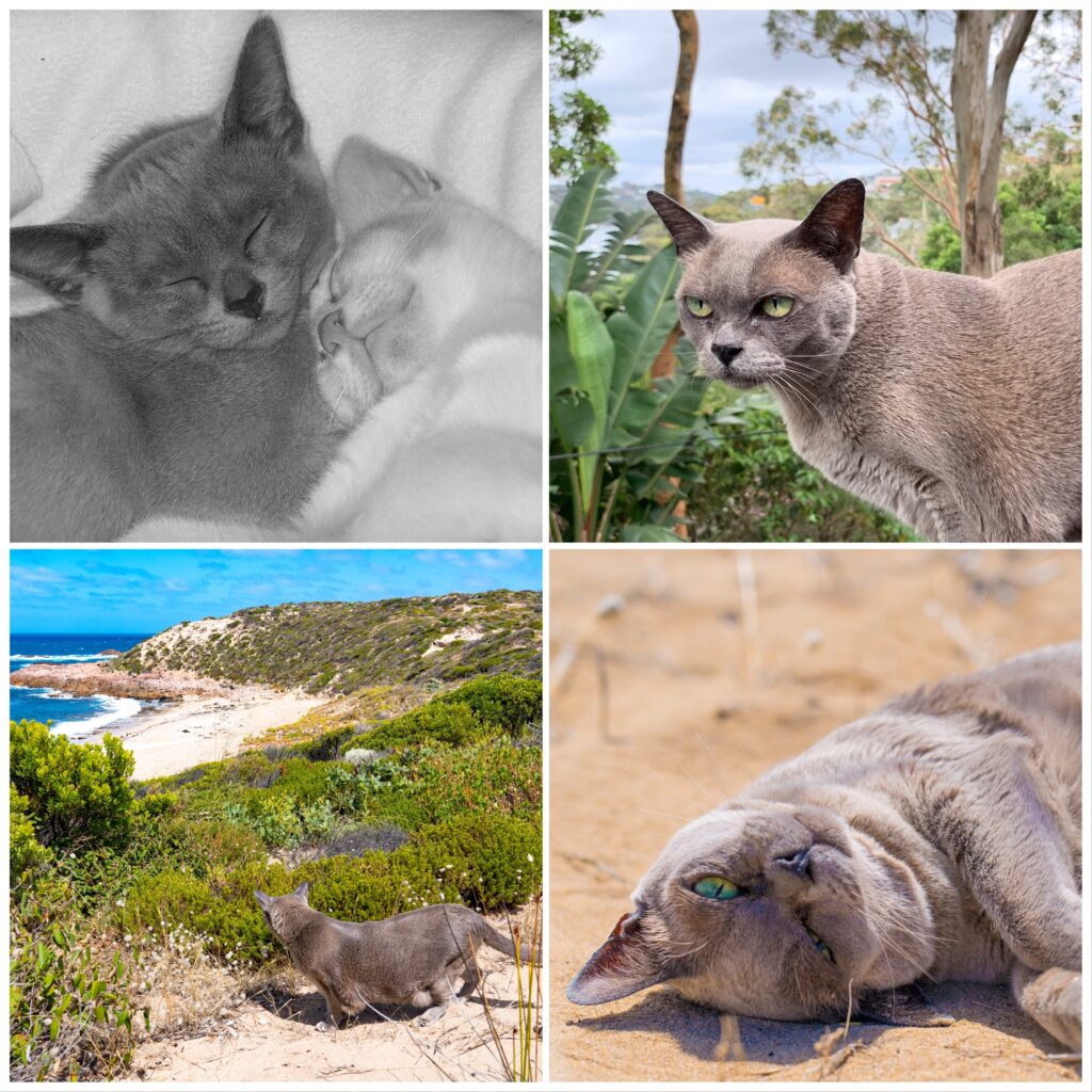
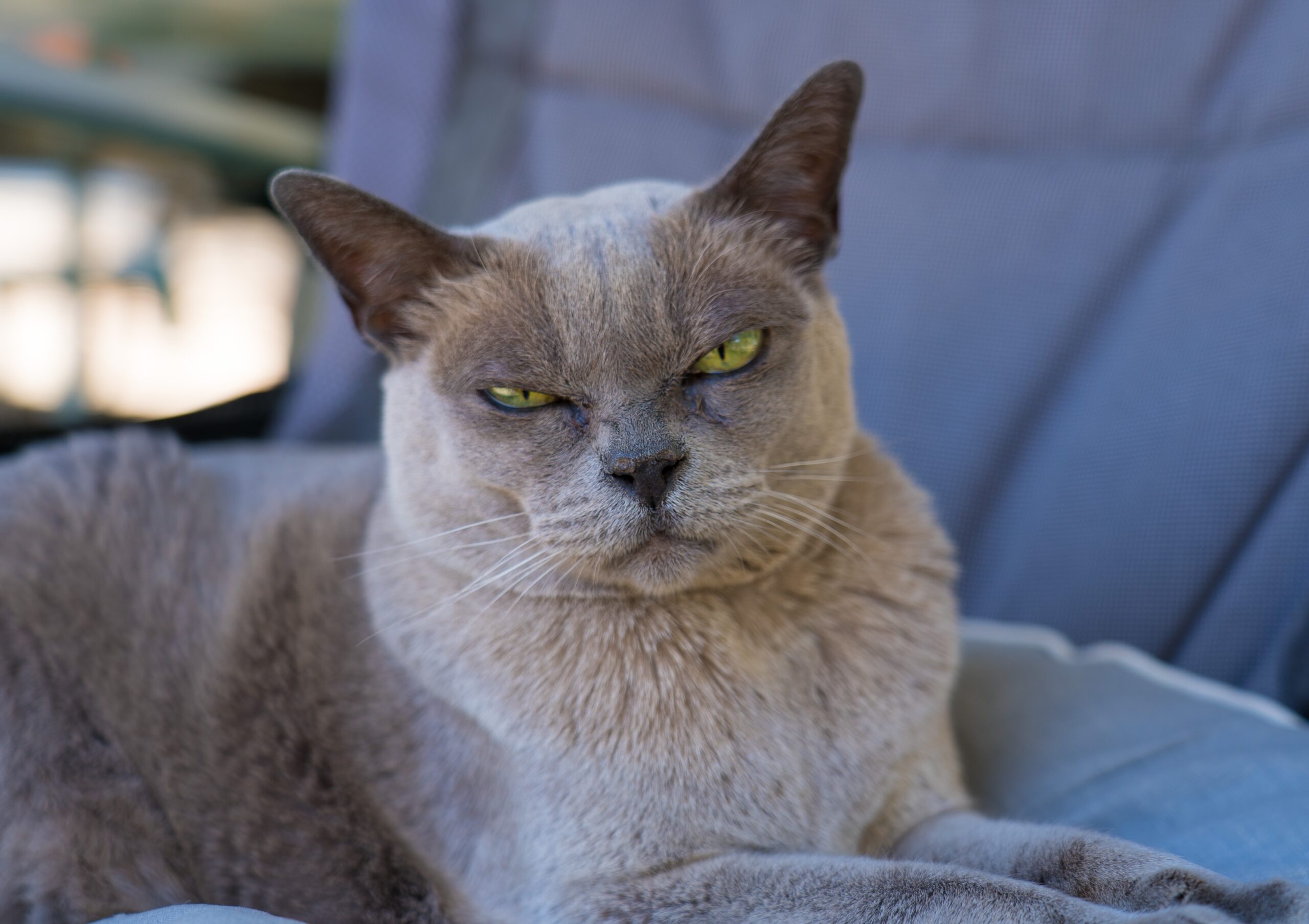
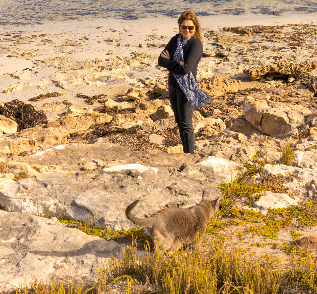
Perhaps most importantly, the 17th was Tassie’s 17th birthday, which was a sunny occasion filled with sunbathing and exploring the dunes – just as she would like! She’s such an amazing and adaptable cat – not many felines can boast having visited every capital city in Australia, climbed sand hills overlooking Uluru, slapped dogs in Cooktown and sunbathed beside a crocodile infested lake near Darwin…but Tassie can. The only state she hasn’t visited is, ironically, her namesake, Tasmania. Maybe in the spring…?
Princess Tassie turns 17
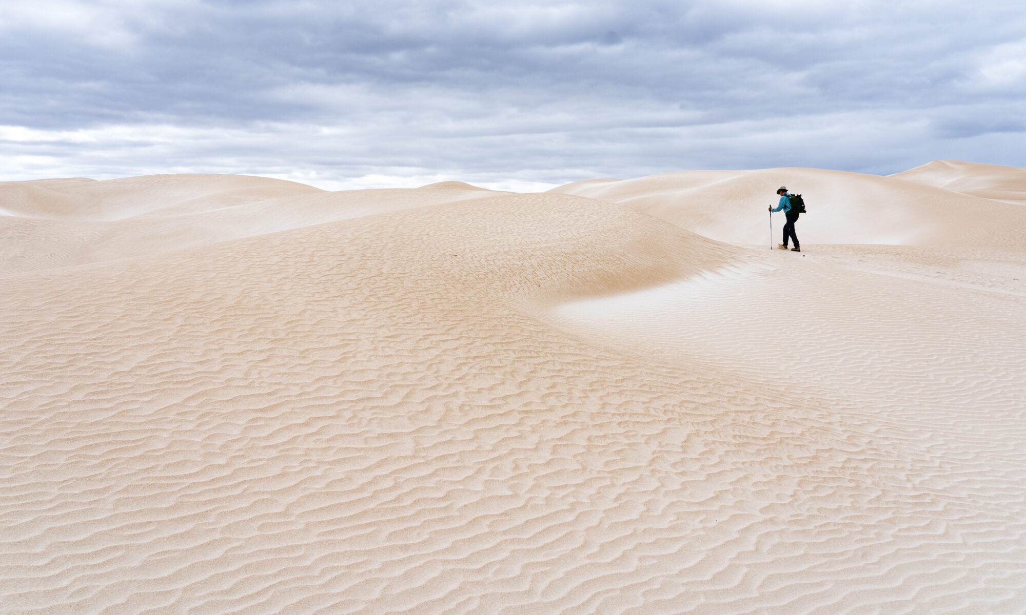
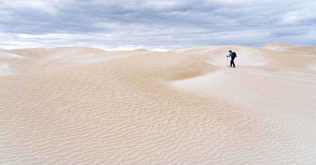
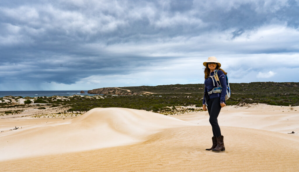
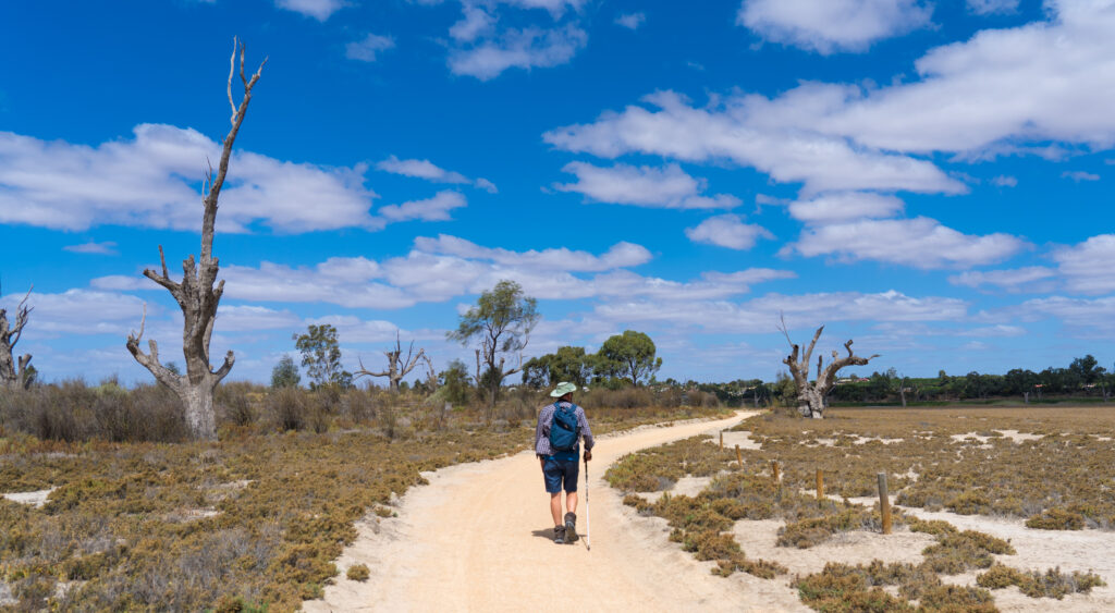
I didnt stray much further than the caravan for the first two days, and on day three managed a short walk for an hour to see the dunes.
A stormy morning – Mr A looking like he’s hiking through snowfields Amazing textures and patterns in the sandLooking across the swirling sands to a storm approaching out to seaDwarfed by sand, I walk along the top of a ridgeJelly legs
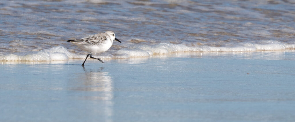
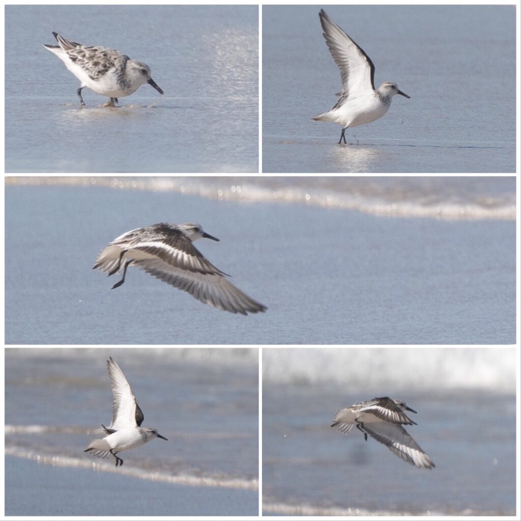
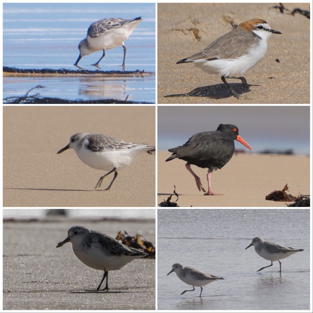
On day four, I managed another walk in the morning. We saw our first ever flock of Rock Parrots, beautiful green birds which nest in the cliffs and spend days in the dunes behind the beach feeding on nuts, berries and seeds. There were several shore birds feeding on the sandy water’s edge, enjoying the natural bounties this coast has to offer.
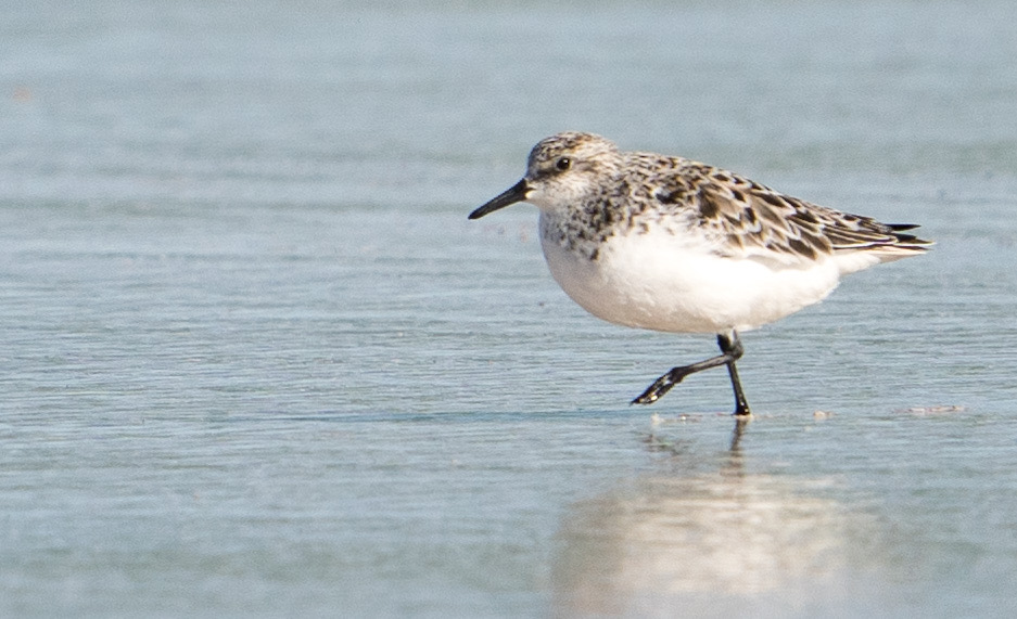
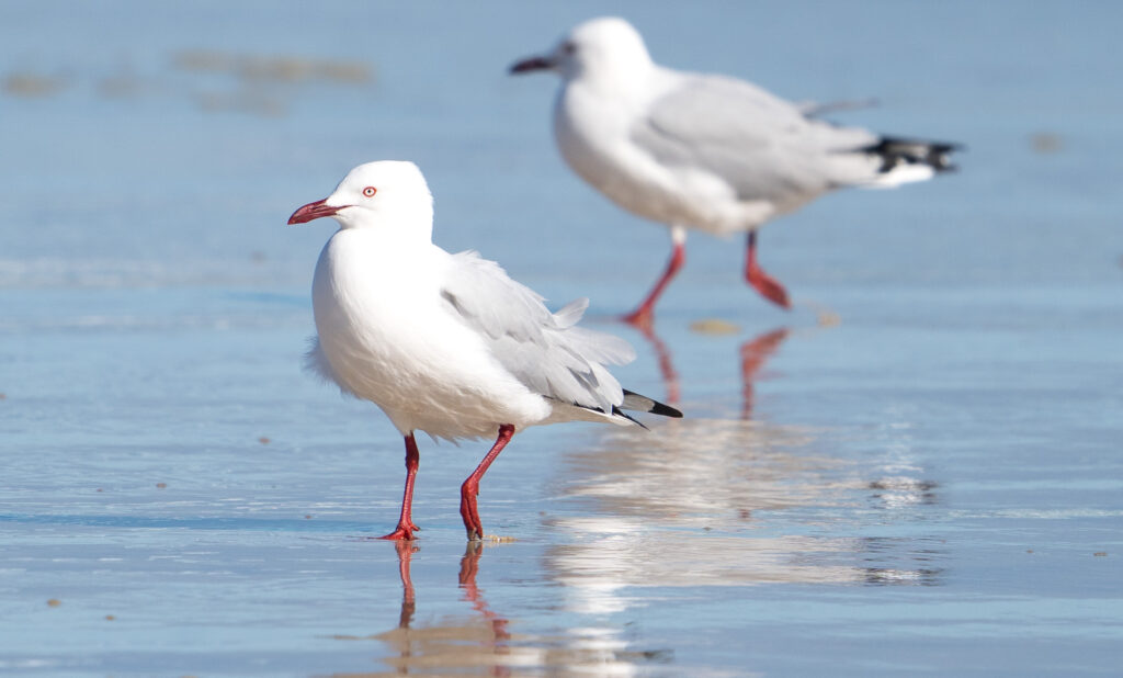
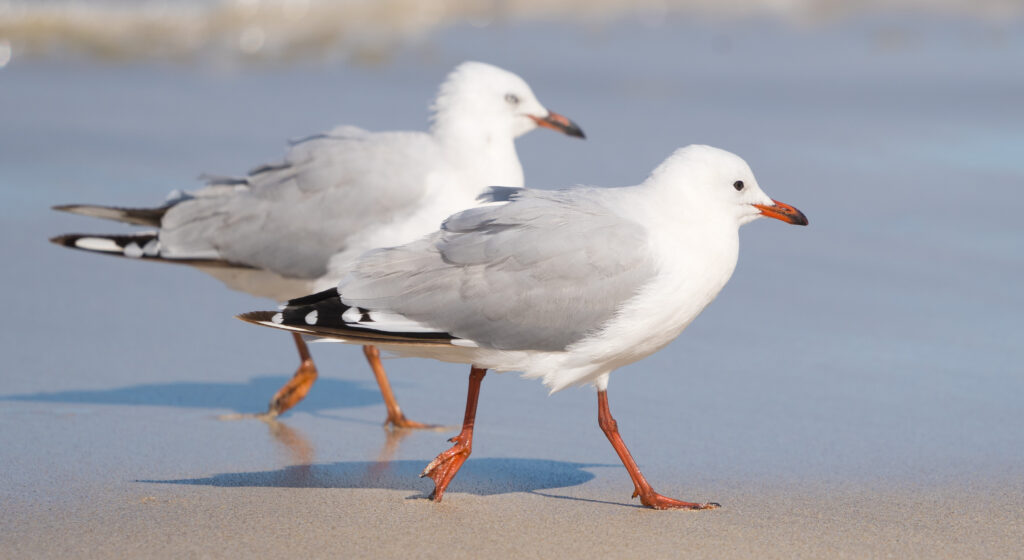
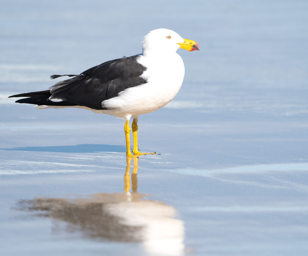
The next bay around from Sheringa BeachSanderlings run behind the waves, pecking and chasing, darting up the beach as each wave breaksA Sanderling racing behind an incoming waveA Sanderling takes flight, moving along the beach to another foraging locationSilver Gulls being a little wind blown on the shoreYoung Silver Gulls strut along the shore – adults have white eyes and pure red beaks – this youngster has a black eye and beak tipThe huge Pacific Gulls are common down here – around half a metre in sizeLooking up a deserted coast after a short walk on the beach
I managed a few roasted vegetables for lunch without incident and we went on our way, heading for Coffin Bay. After four days without food or water, my head is pounding and body aching and weak, but hopefully finally on the mend. Food poisoning officially is something I never want to experience again!
I feel somewhat cheated that I didn’t get to enjoy this spectacular area more, but ultimately feel privileged I was able to see it at all. We offer our thanks and recognition to the traditional owners, the Wirangu, Nauo and Kokatha people for their careful custodianship over the past thousands of years, preserving the integrity and enabling us to spend time in this pristine place.
Location: Coffin Bay, Mount Dutton Bay and Sheringa Beach
Our final morning in Port Lincoln gave us a pretty special sunrise
With a new set of steps installed on the caravan, we pulled away from Port Lincoln and drove about an hour to an olive grove in Mount Dutton, just north of Coffin Bay.
We are now securely in oyster territory, the clear waters around these parts contributing to succulent creamy molluscs which are famous throughout Australia and restaurants in China and Singapore. Coffin Bay oysters are actually Pacific Oysters, native to Japan, which were first farmed here in the late 1980s. They feed on plankton, which due to the nature of the bay is plentiful here and the oysters grow faster than they would elsewhere. We managed to work our way through two dozen each over our two day visit here!
Our campsite for the following two nights was nestled on the edge of Mount Dutton Bay, twenty minutes drive from Coffin Bay in the grounds of an olive farm. As we pulled in the owners were busy trimming the trees, and there was freshly bottled olive oil for sale. We paid our $10 a night to stay there and of course purchased a bottle of oil.
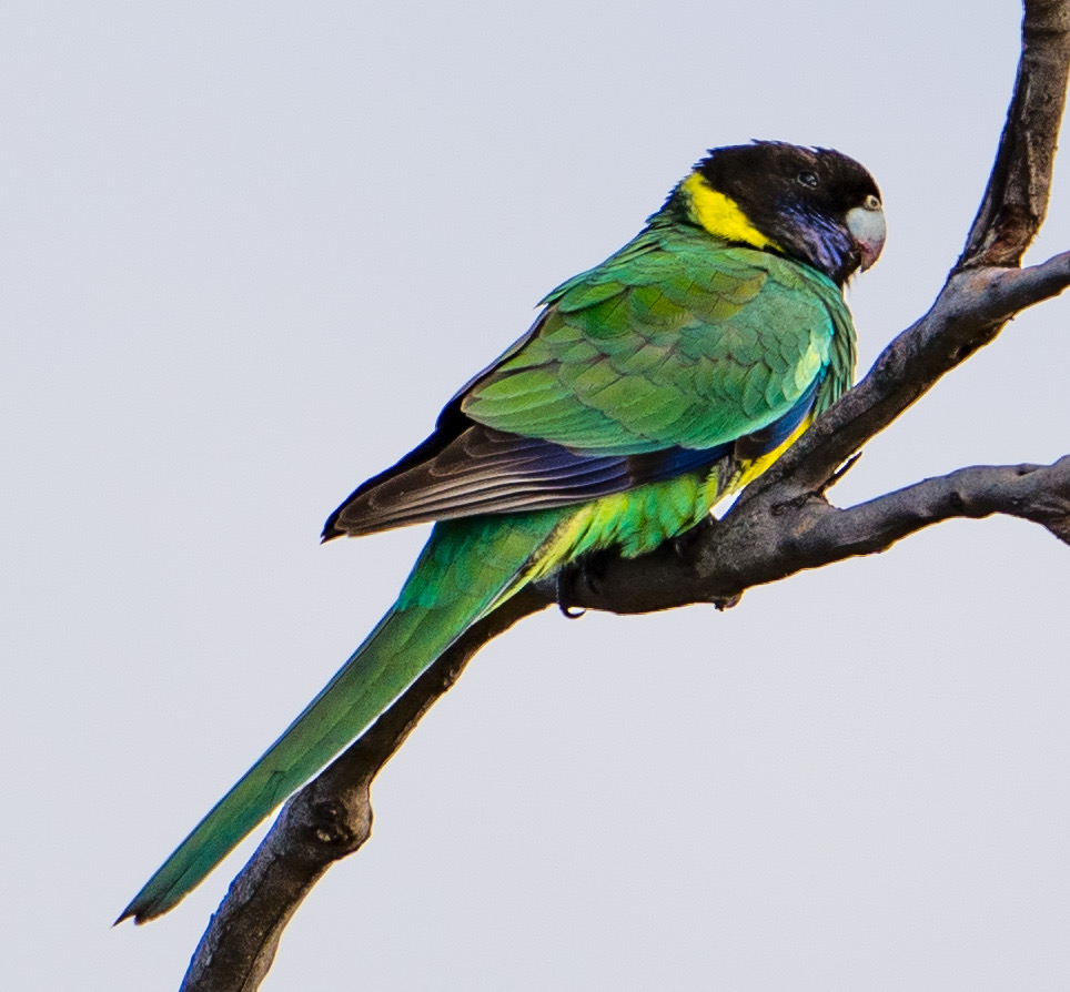
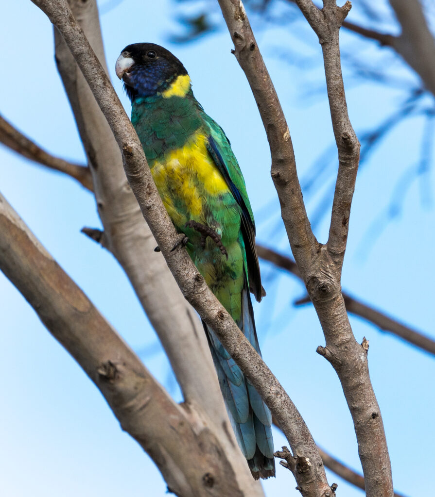
The olive grove was home to many birds, most notably Port Lincoln Ring Necked Parrots – lovely green and blue parrots with bright yellow tummies and a yellow ring around the back of their necks. With very little natural fresh water in the peninsula, they got much of their moisture from dew, rainwater where possible, and their food if able – and woke us up one morning drinking the moisture from our skylight.
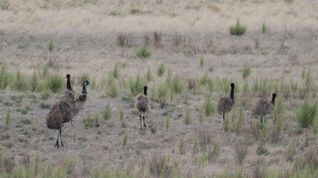
Port Lincoln Ring Neck ParrotOne legged perchingEmus are also a regular visitor to the grove and its neighbouring fields
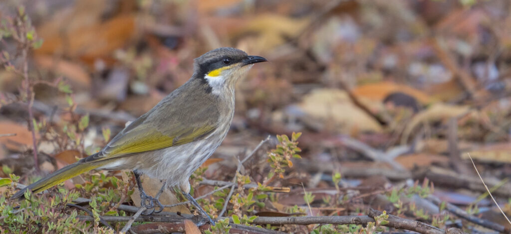
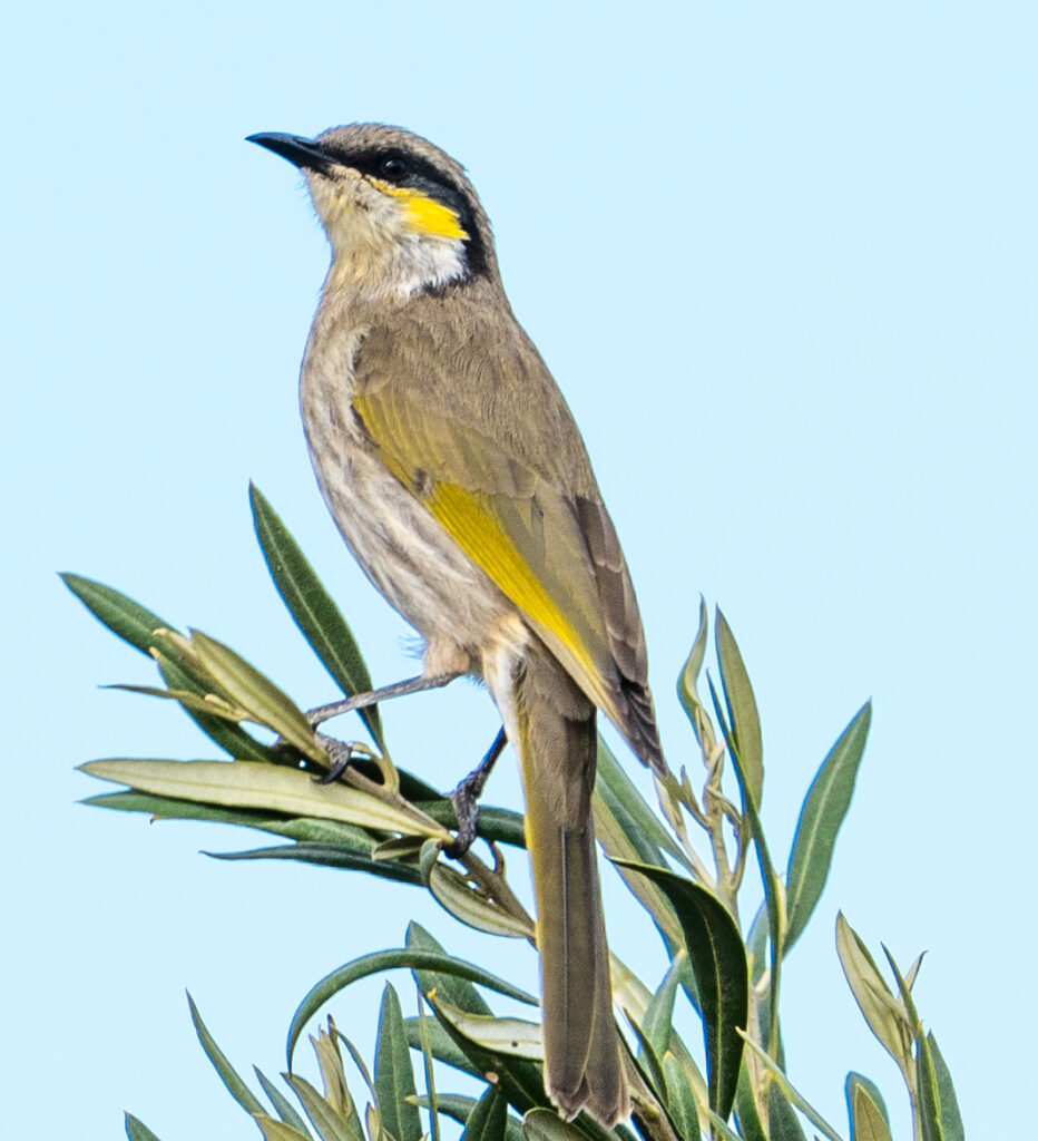
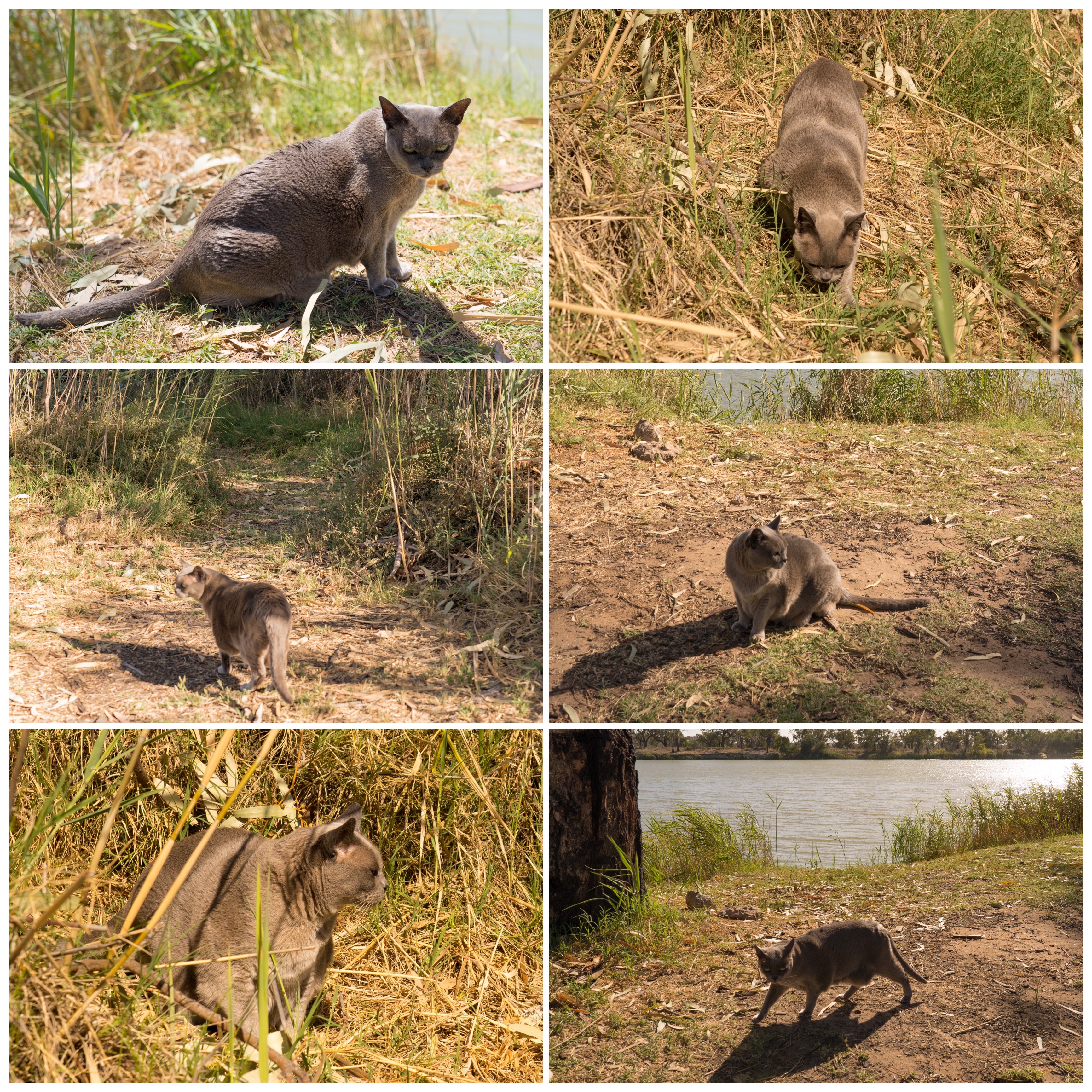
We were also delighted to see Singing Honeyeaters here, their trilling voices often turning to something more sinister when they saw Tassie exploring. She loved this camp and, for her, walked a long way accompanied by her bodyguards, and even disappeared into a cat-sized underground limestone cave for a few minutes which gave us a fright!
Singing Honeyeater on top of an olive treeSinging Honeyeater
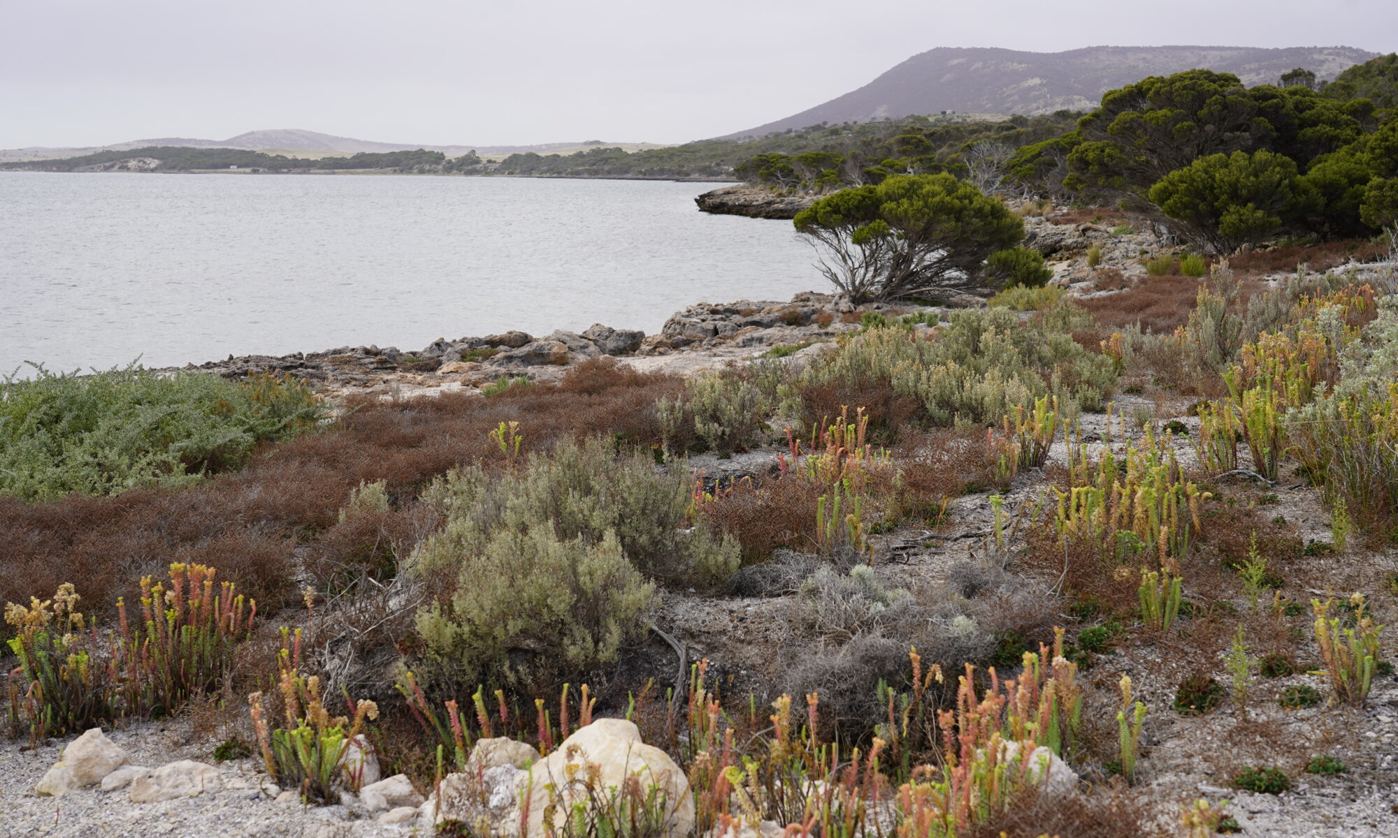
We explored the bay from the camp, following a path which looked like it had been walked for hundreds of years, way beyond the handful of campers at the grove. It reminded us to thank and acknowledge the Nauo and Barngarla people, who were custodians of this region for many thousands of years before white settlement. They made use of a wide variety of fish, inland mammals, reptiles and plants and cared for this land.
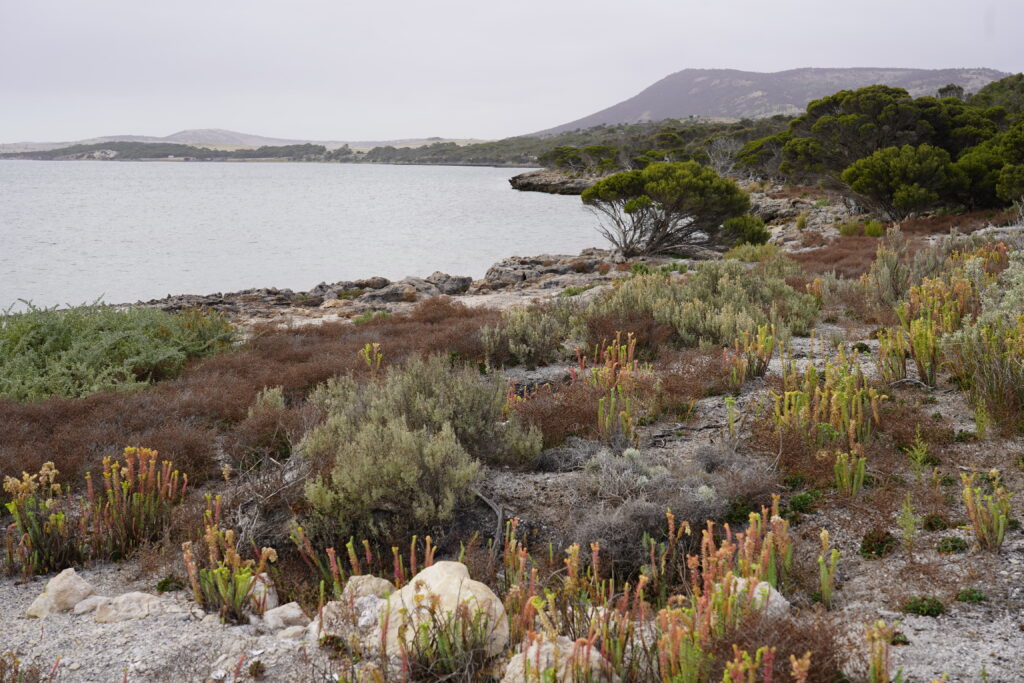
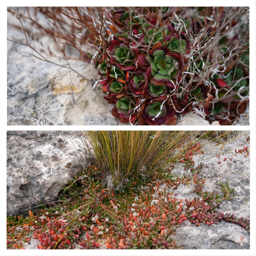
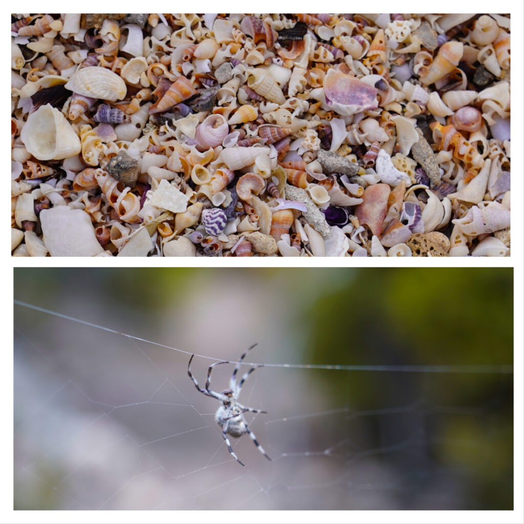
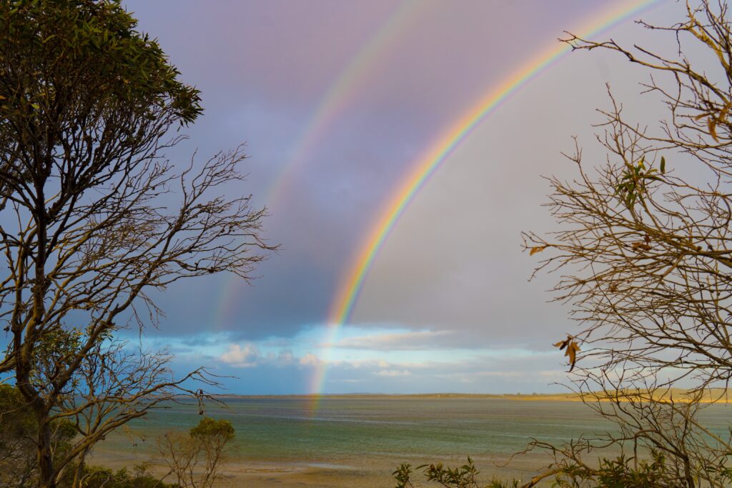
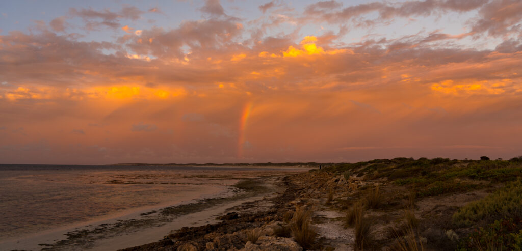
The limestone is tough for most plants to grow on, so salt tolerant and air plants grow along the waterline. We thought this looked like a colourful gardenSalt tolerant plantsHundreds of tiny shells make up a beach we walked over and a salt-tolerant spider in limestone coloursStripes of seaweed on the shore – colours reminiscent of the Scottish highlandsA farewell double rainbow to see us on our way
After two nights here we made our way up the coast towards the small village of Elliston where we had booked in to a campsite for a few nights. We had a spare night up our sleeve en route and picked out a random campsite on the coast called Sheringa Beach, again costing a princely sum of $10 a night to stay there.
It was a real surprise to arrive to the spectacular location. Elliston District Council has invested in the area, creating high quality level fenced camping areas amongst the dunes, providing bins and even a new flushing toilet to service visitors. We wish more councils would do something like this.
Can you spot Tassie? Another site gets the paw of approval
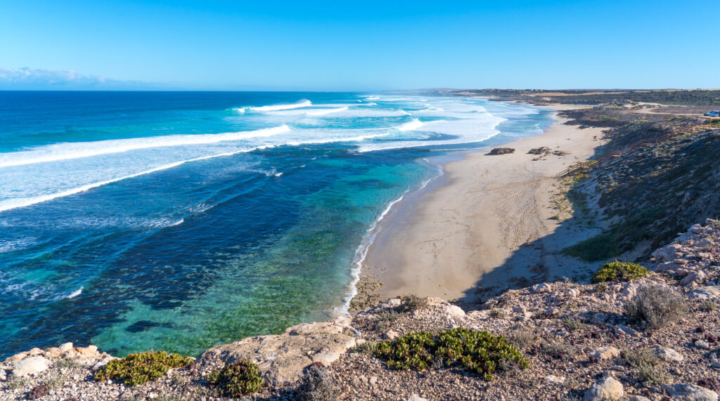
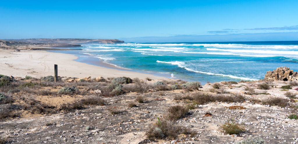
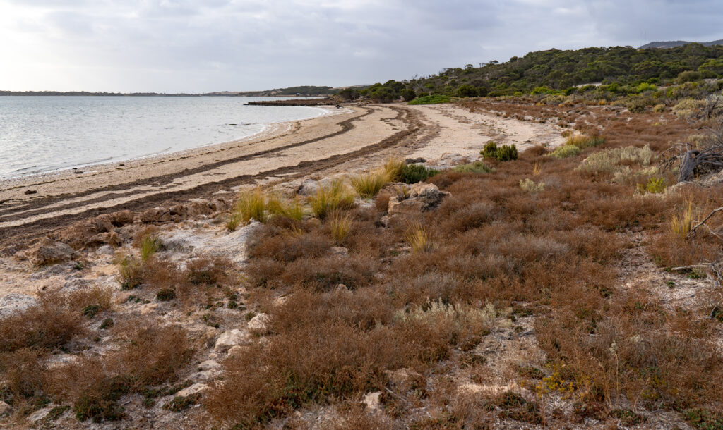
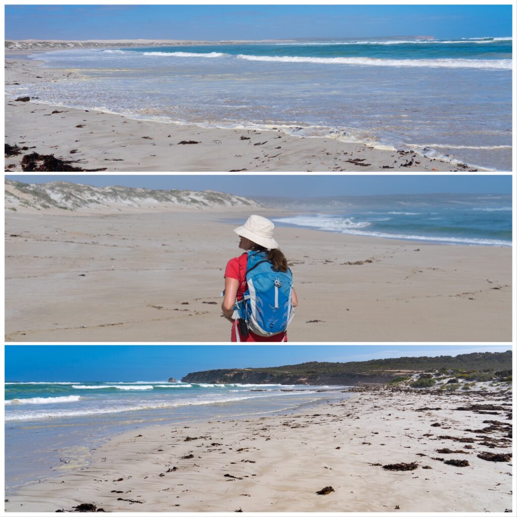
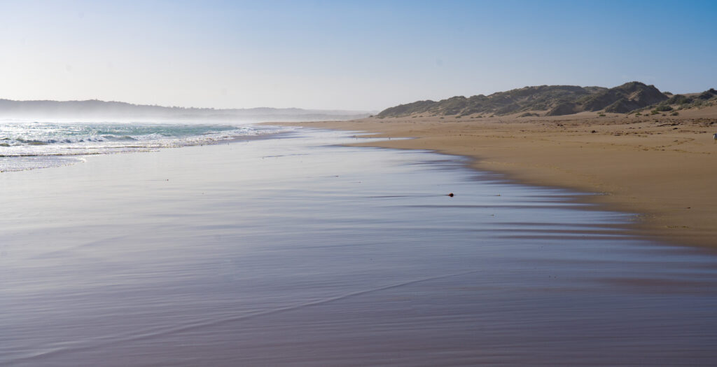
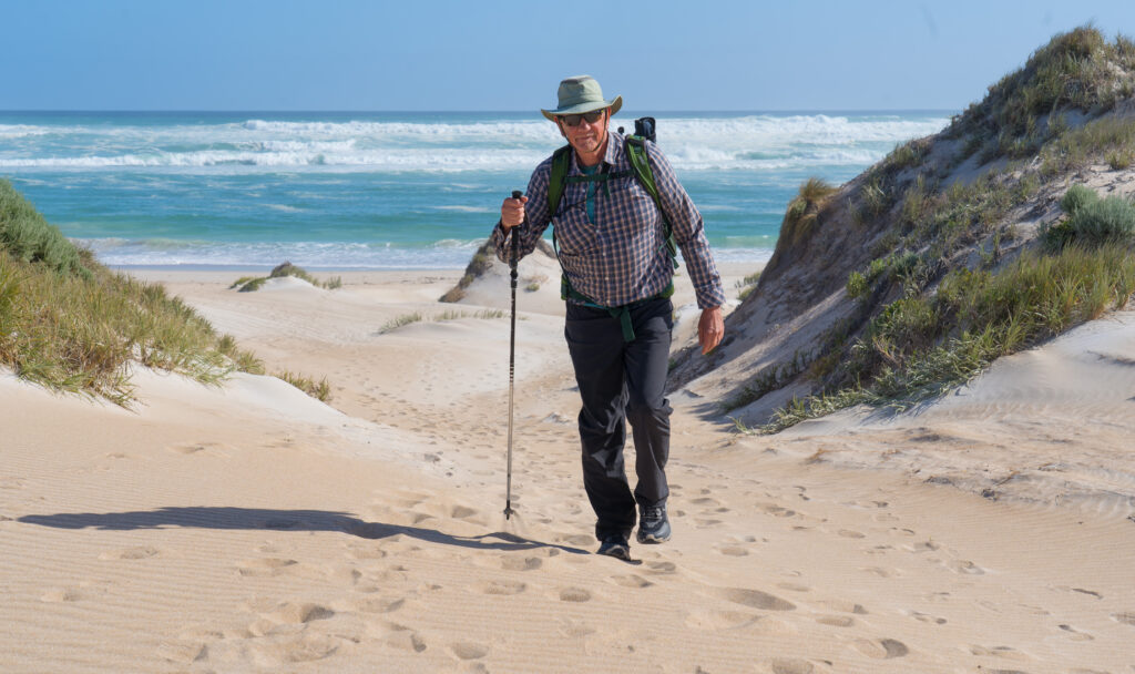
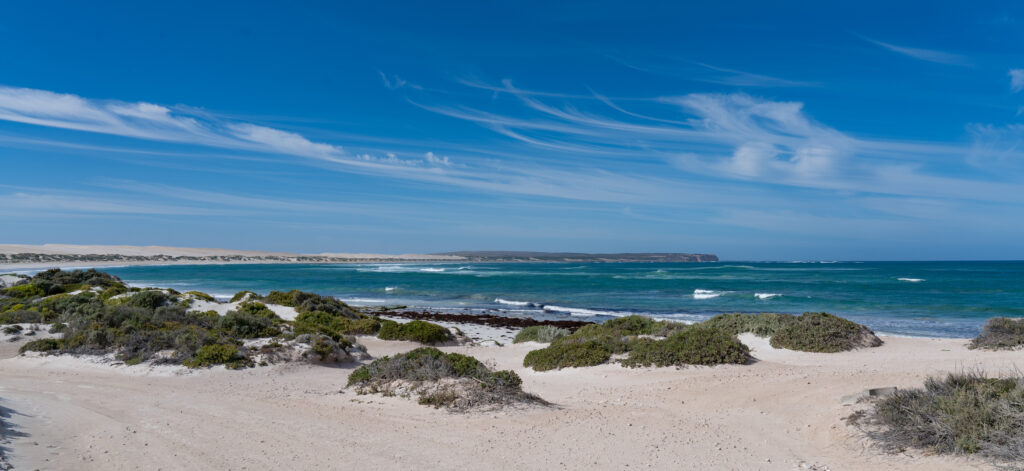
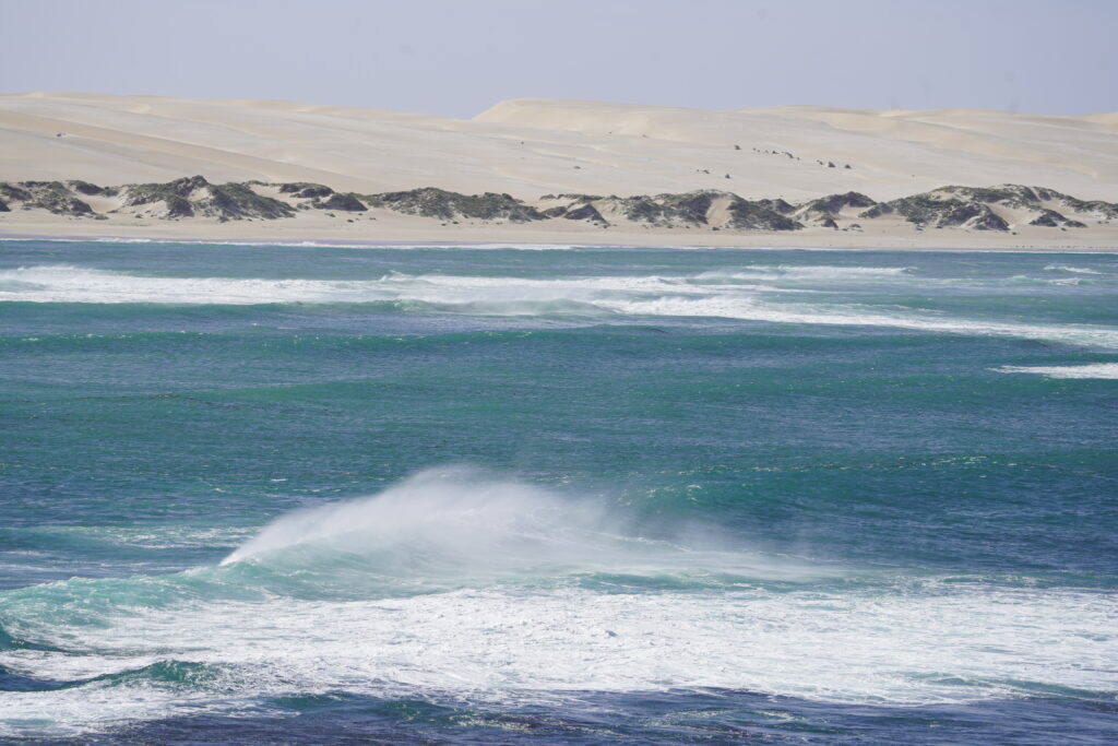
Tucked in behind the dunes, we could hear the sound of the surf on the other side, and followed a sandy path to explore. Wow! A spectacular 4km long white sand beach stretched along the coast to the next headland. We decided to head off for an explore (map).
Walking along the beach
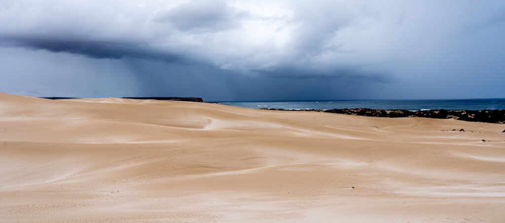
As usual, once we had left the immediate entrance to the beach we didn’t see anyone. Apparently there is four-wheel-drive access to this beach, but it doesnt look like anyone has used it for a long while. The beach is pristine, not a single scrap of rubbish anywhere, and it is clear from all the shore birds present that they appreciate it.
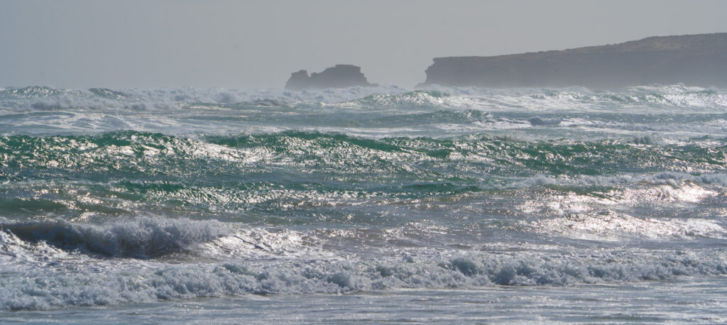
Red Capped Plovers, Sooty Oystercatchers and Hooded Plovers race along the the shoreline hunting for morselsTurbulent seas – at 18 degrees we weren’t up for a dipLooking down the beach you can see the sea spray, misting the viewA pacific gull soars over the waves
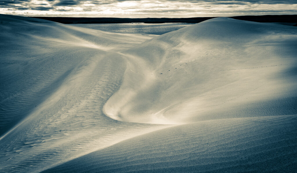
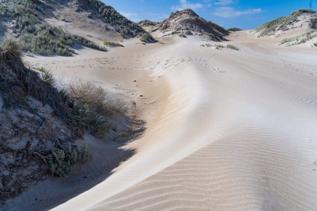
Sitting up behind the beach are huge sand dunes, looking like towering snow capped hills stretching along the coast.
Hiking up into the dunesBeautiful patterns in the sand driftsSand as far as the eye can seeLooking out over the bay
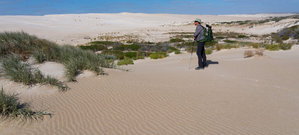
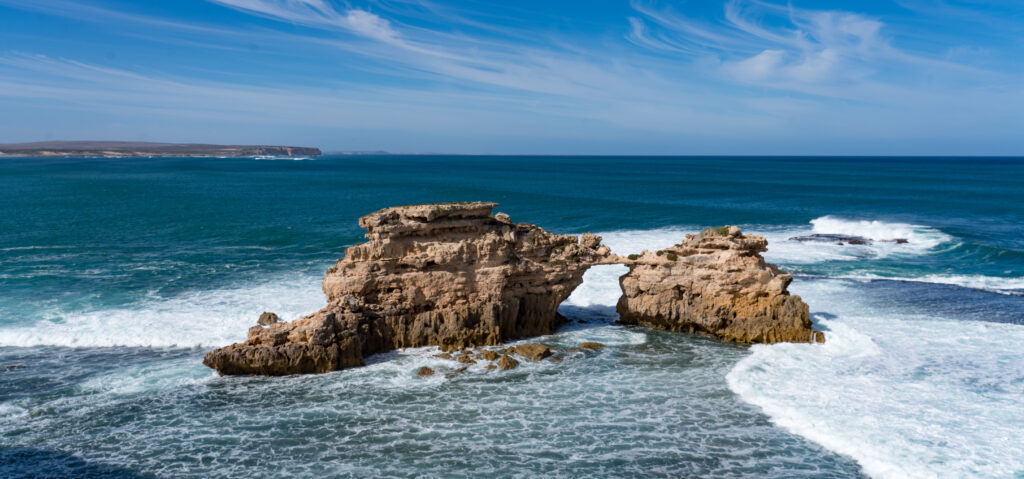
Apparently it is not unusual to see dolphins swimming off the coast here, but they were not playing on our visit. Before we moved on the following morning we hiked up to the headland to see along the coast. The waves were wild and wind blown, the rocks sculpted by the constant force.
A single sediment creates a bridge between these two rocks Off shore wind blowing the wave – see the dunes out the back
It was a beautiful night’s stay and we’re certain to return. We packed up camp, Tassie had a final explore through the dunes, and we went on out way up the coast to Elliston.
Location: Coromandel Valley, Adelaide Hills and Adelaide, South Australia
After the dust storms and dry environment of the Riverland it was a relief to pull up at our friends’ house in the Adelaide foothills, appreciating all the more the lush grass, and tenderly cared for fruit and vegetables. Leaving Berri, we had a big day’s driving across country.
Kim and Mike live in the Coromandel Valley. The valley was named after a ship (The Coromandel) from which a number of the crew deserted in 1837. The deserters hiked up into the hills, climbed a tree and watched until the ship left port, after which they surrendered to the local Governor and became free settlers.
Prior to the arrival of and subsequent settlement by these sailors, the area was home to the Kaurna people. They lived along the creeks and rivers, actively farming – fishing, hunting animals and harvesting native seeds, vegetables and fruits. We acknowledge and pay our respects to the Kaurna people, the traditional custodians whose ancestral lands we spent time on. We acknowledge the deep feelings of attachment and relationship of the Kaurna people to country and we respect and value their past, present and ongoing connection to the land and cultural beliefs.
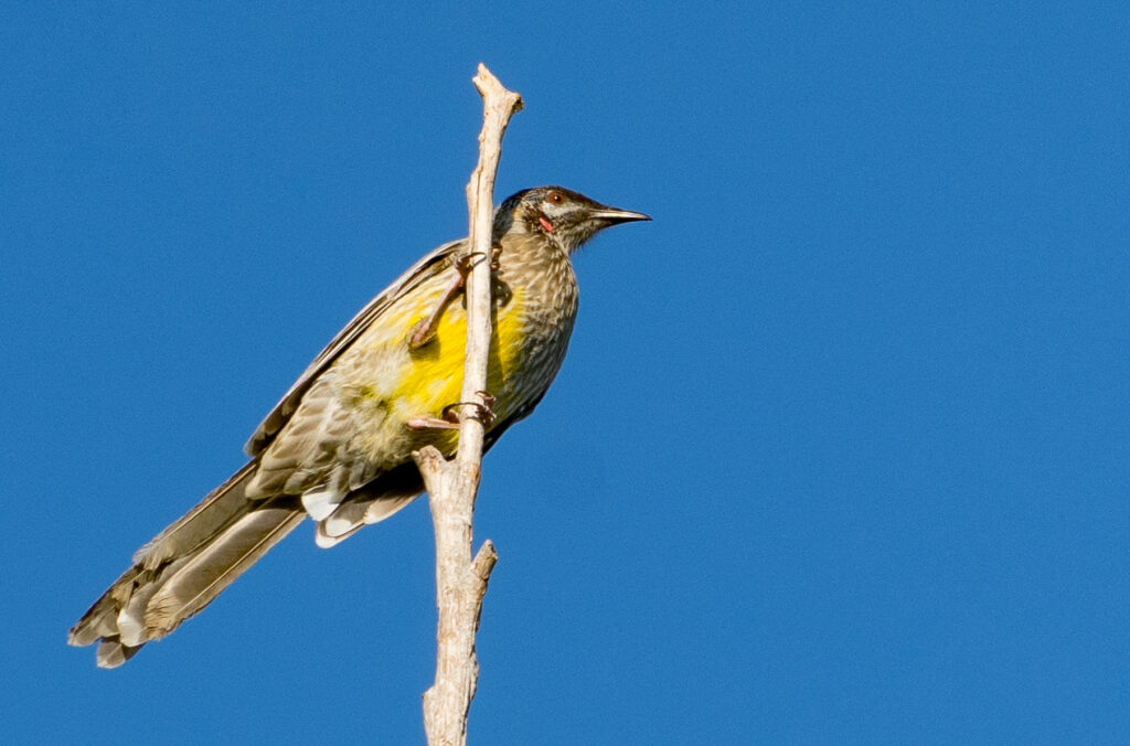
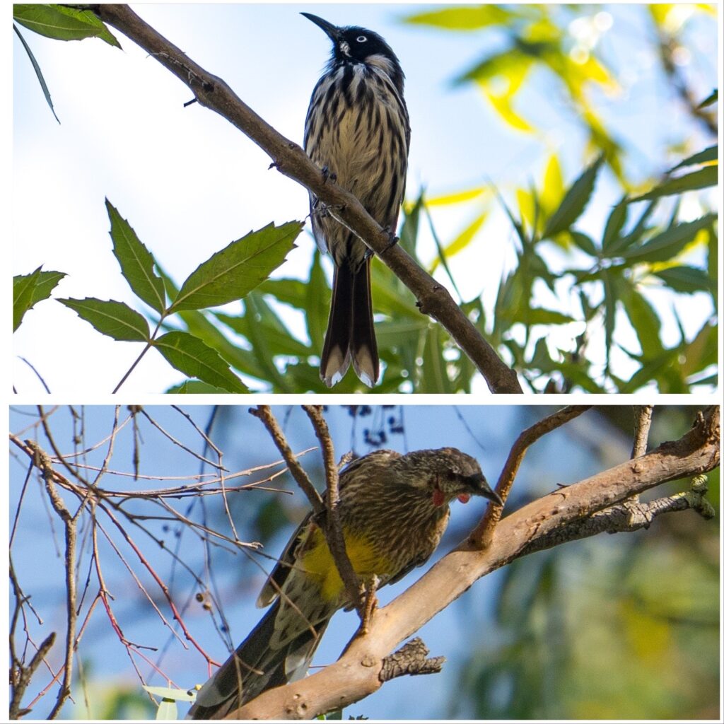
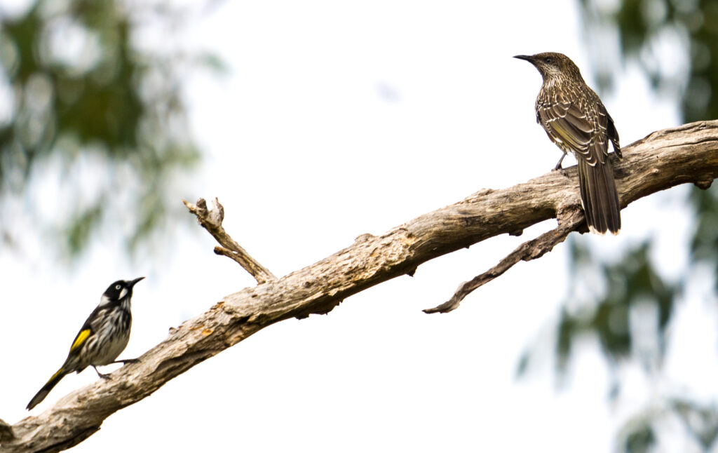
A Red Wattlebird perches in the tree overlooking Kim and Mike’s garden
Not far from Coromandel Valley is Belair National Park. The Kaurna people called it Piradi, which means baldness. This was the description of the area when seen from the plains – the location where the city of Adelaide now sits. The Aboriginal population used to actively farm this area, a practice known as ‘fire-stick burning’ – clearing the vegetation to encourage grazing animals, making them easier to hunt. It also spurred the growth of understory plants such as bush potatoes and grasses which were harvested and used in cooking and flour making.
It was declared a National Park in 1892 and is South Australia’s oldest park. Since the 1920s, only native plantings have been allowed, resulting in a valuable haven for native birds and wildlife. Mr A and I were anxious to get out walking, and Kim kindly obliged us by guiding us on one of her favourite circuits in the park. Unlike many Australian national parks, dogs are allowed here, as long as they are kept on a lead, so we were joined by furry friends, Cooper and Rikki.
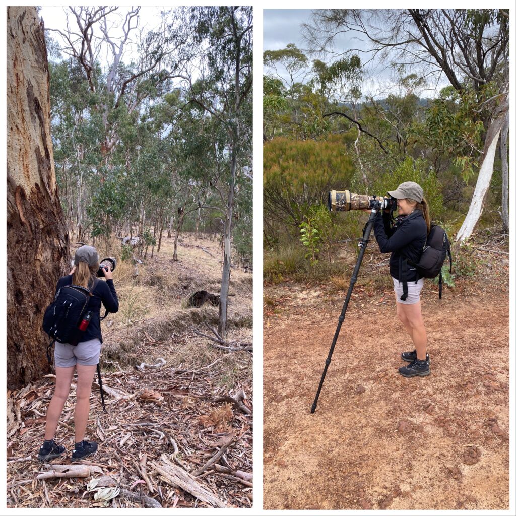
The rest of my birthday present had been delivered to our friends here – a monopod (used to stabilise the long lens when you’re trying to keep ultra still when photographing) and a fancy sounding MonoGimbal which connects the monopod to the camera. I also had a camouflage coat for my lens – to make it blend into the bush a little better.
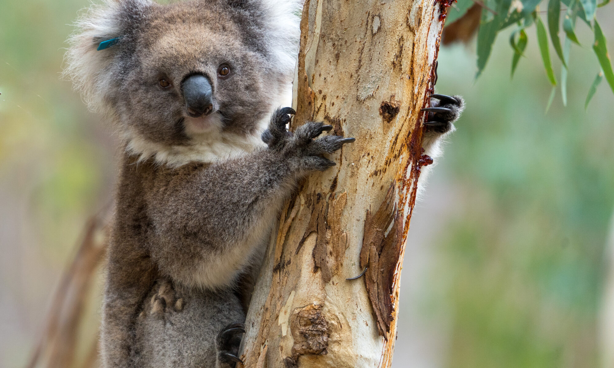
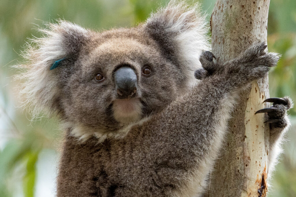
Nothing to see here! Photographing a koala and birds, the monopod takes the weight and allows me to concentrate on framing and focusing!
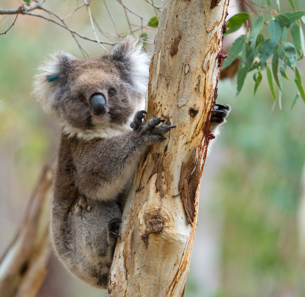
Our 6km walk was the perfect opportunity for me to practice putting it on and I had some great subjects to practice on, with a few birds about in the cool morning, and the first koala we’ve seen since getting back to Australia turning up on cue!
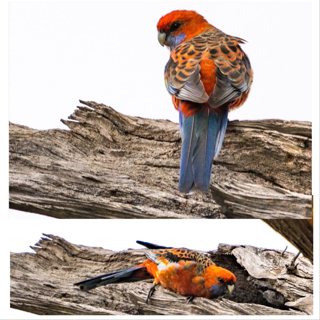
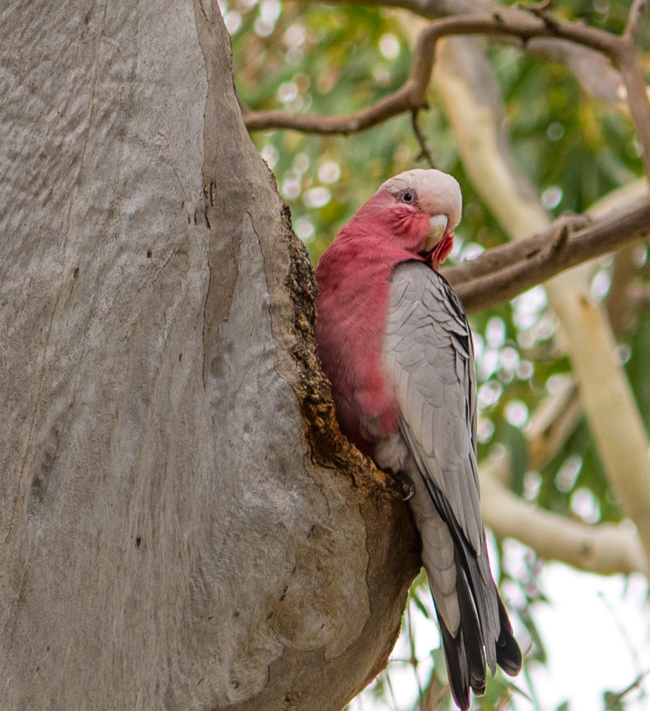
Crimson Rosella coming out of its nesting hole in a hollow branchA Red Wattlebird showing off its acrobatic prowess – these honeyeaters love flower nectar but also supplement their diet with insectsThis koala has been taggedGorgeous – koalas are not bears, but more closely related to wombatsAnother tree holds a nest site for a pair of beautiful pink and grey galahs
I took every opportunity over our visit to practice my photography, not too hard given the number of interesting walks and bushy areas around.
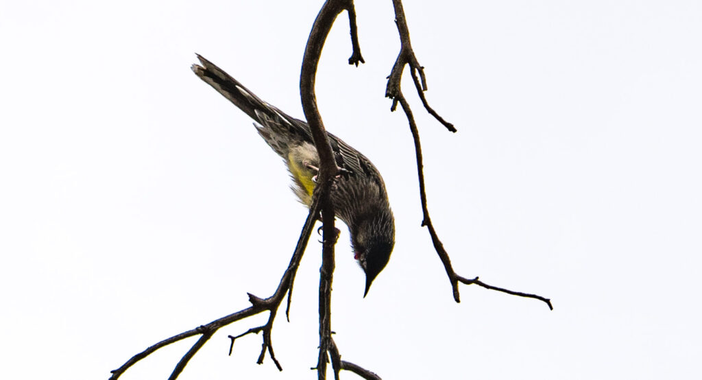
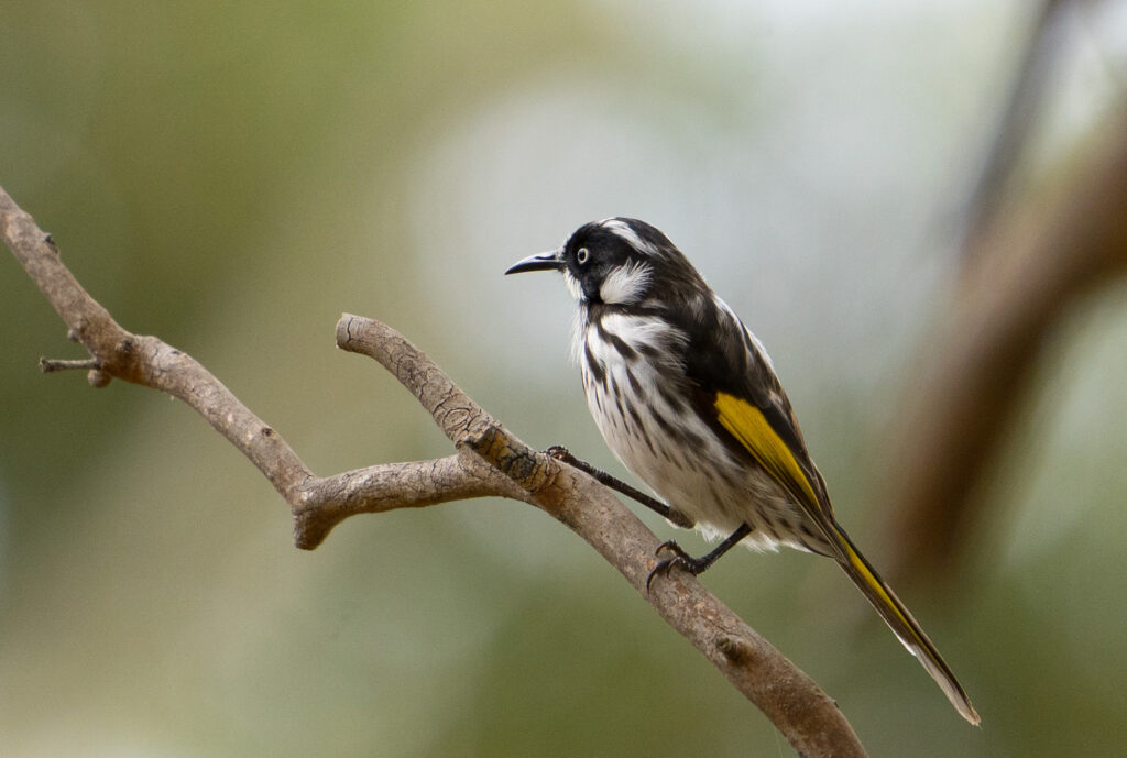
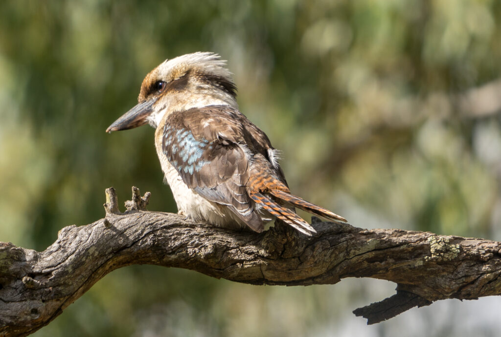
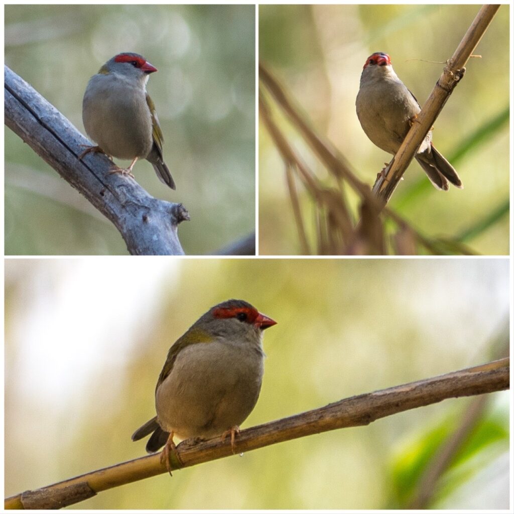
A New Holland Honeyeater – these little birds breed whenever there are nectar producing flowers in bloom, so despite being Autumn, they were busy flitting around courting and too preoccupied to notice me spying!A Laughing Kookaburra – these are actually Australia’s largest kingfisher. We’ve seen them eat fish quite frequently (including goldfish from our pond) but they are also partial to frogs, mice and even snakes.Galahs mostly eat seeds, but they like to chew on wood to keep their beaks sharp – usually close to a nesting hollow to indicate it is occupied.Red Browed Finches flitting through the reeds beside the riverMore honeyeatersMay I share your perch?
One particularly memorable walk took us in a circuit along the Sturt River valley and climbed up through the hills. It was a beautifully cool day and a novelty to wrap up warm. Known as Warri Parri in the native language (windy place by the river), the river valley was traditionally used as a travel corridor by the Kair a people linking the hills with the sea. The population would spend the cooler months on the plains, before heading up via this route in the hotter summer months to spend time in the hills. The riverside path we tracked along followed some of this route.
A beautiful sense of calm and serenity alongside this riverFeet have trodden this path for thousands of years Cooper and Rikki probably ran three times the distance as us on this hike!The water quality is being actively managed – there is far less water than in the past
Sturt Gorge Recreation Park is the second biggest park around Adelaide after Belair National Park. How fortunate for our friends to have both locations literally on their doorstep.
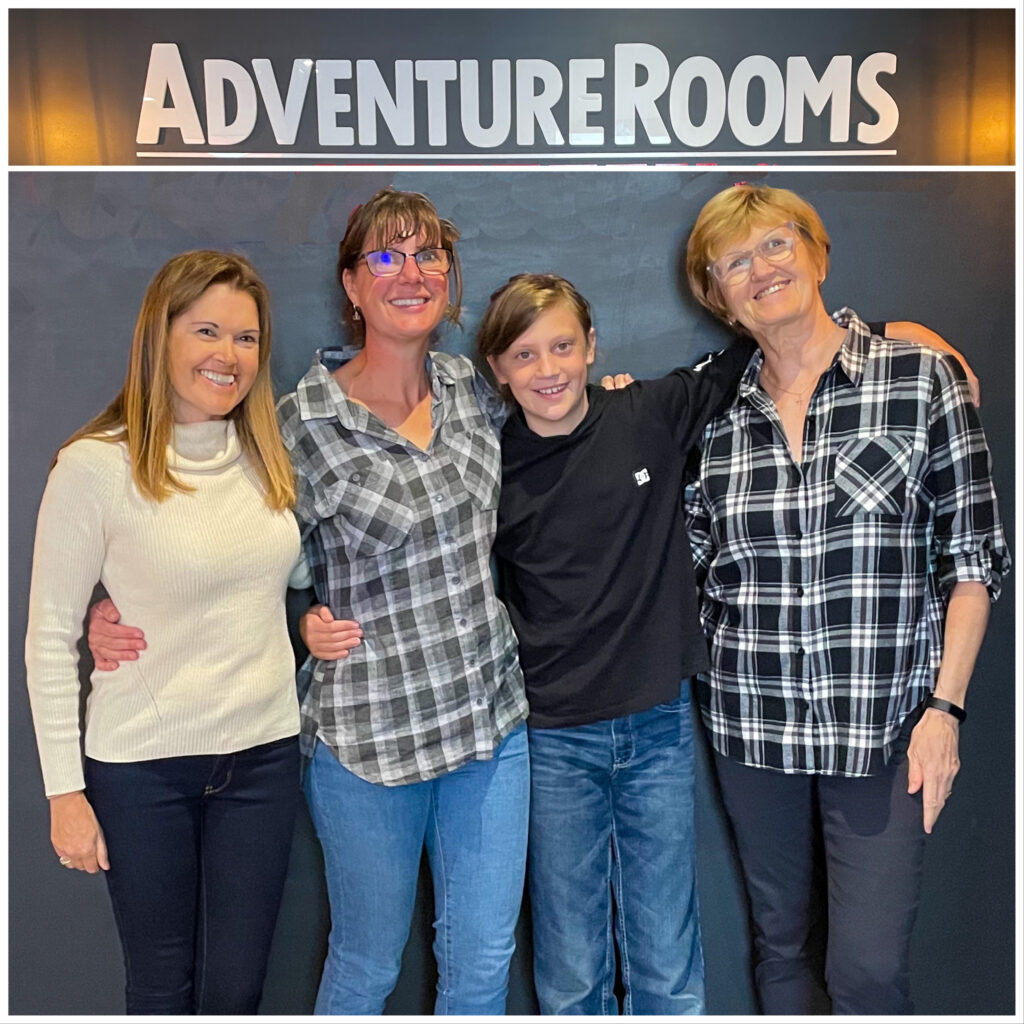
Our friend and Kim’s daughter, Ali came to stay on Saturday night with one of her sons, Lewis. The following morning I joined Ali, Lewis and another friend, Nicky (Ali’s not-at-all-wicked stepmother!) at an Adventure Room. We were handcuffed to bars in a locked room and spent an hour solving puzzles and unlocking padlocks. Much fun was had and we made it out with 40 seconds to spare!
The crack detective team
Later, I joined Mr A as we caught up for drinks and nibbles with Nicky’s husband, and long time friend (and amazing musician and film maker) Pete. A perfect Sunday!
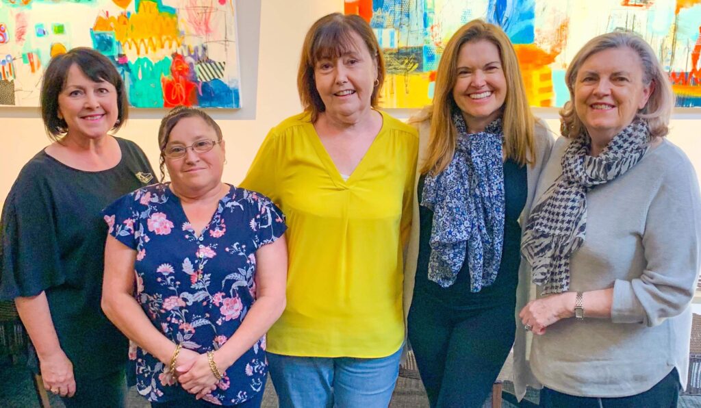
Our time in the city concluded with another set of tracheal injections for me, followed by a lunch catch up with some local patients who sadly share the same airway disease as me and who are members of the support group I run. As always it was an absolute delight to meet these lovely ladies, an opportunity to share stories and our experiences along our journey.
L-R: Heather, Julie, Fay, Catherine and Carmen
It was a great chance to shake out the dust from our lives, reset and do all those things that only a large town or city can provide, but we were soon ready to be on our way. The many walks, laughs, fine wines and dinners shared with Kim and Mike greatly enjoyed and appreciated, we said our farewells, not knowing when or indeed if we will ever pass this way again.
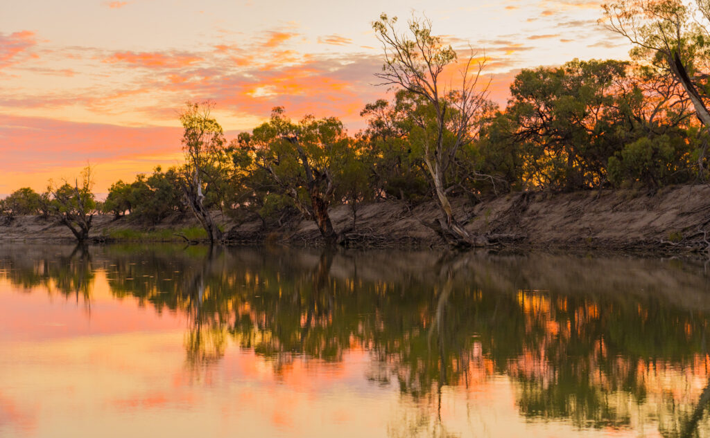
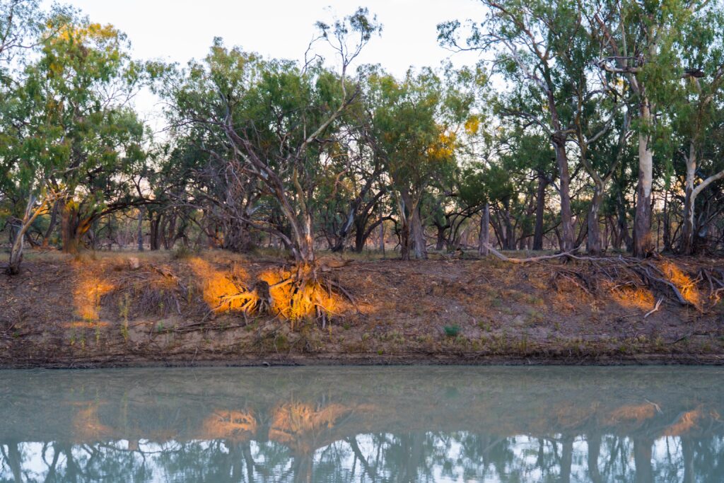
Location: Wentworth, NSW and Chowilla Game Reserve, South Australia
For this post, we recognise the Barkindji , Maraura and Ngarrindjeri people, throughout whose land we travelled the past few days, and thank them for their custodianship over many thousands of years.
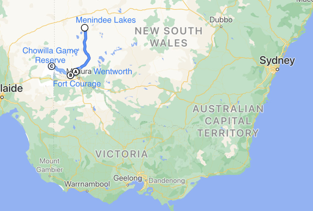
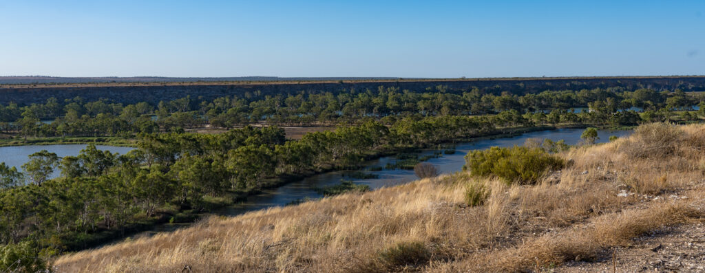
We left the Menindee Lakes, taking a road through the national park which led to the Silver City Highway. The description of highway makes this road sound far grander than it really is – a two way tarmac covered road – though in its defence, it is a long one – over 600km linking South Australia with Queensland via Broken Hill. From here we headed south, making it to a carpark in the little town of Wentworth, located where the River Darling and River Murray meet.
Our route – Wentworth sits at point A
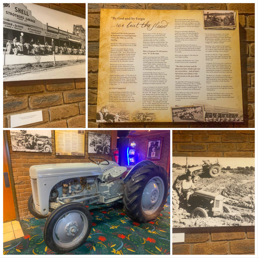
Wentworth was an important settlement because of its riverside location and at one stage was New South Wales’ busiest inland port. It even made it on to a short list to be considered as location for Australia’s capital city! Today it’s a small, neat town with a sleepy feeling. We enjoyed dinner at the local pub.
A restored ‘Fergie’ tractor in the pub helps tell the story of how these little ‘workhorses’ saved the town of Wentworth in the 1956 floods – the downside of being located on the convergence of two major rivers
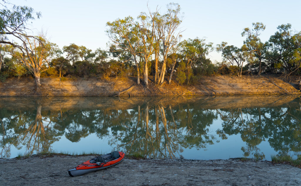
The following morning we moved a few kilometres down the road to a rustic camp called Fort Courage. Apparently named after a brewery which once stood here, it is now mostly a sprawling collection of fishing enthusiasts’ caravans on the banks of the River Murray.
With no drinking water, but filtered river water to shower in, it was a good spot to stop and clear some of the dust out. We were dying for a walk, but there was nowhere to explore – a few metres from the river and you were back into dry, semi-arid landscape, the plants thorny and scratchy, not conducive to picking your way through them.
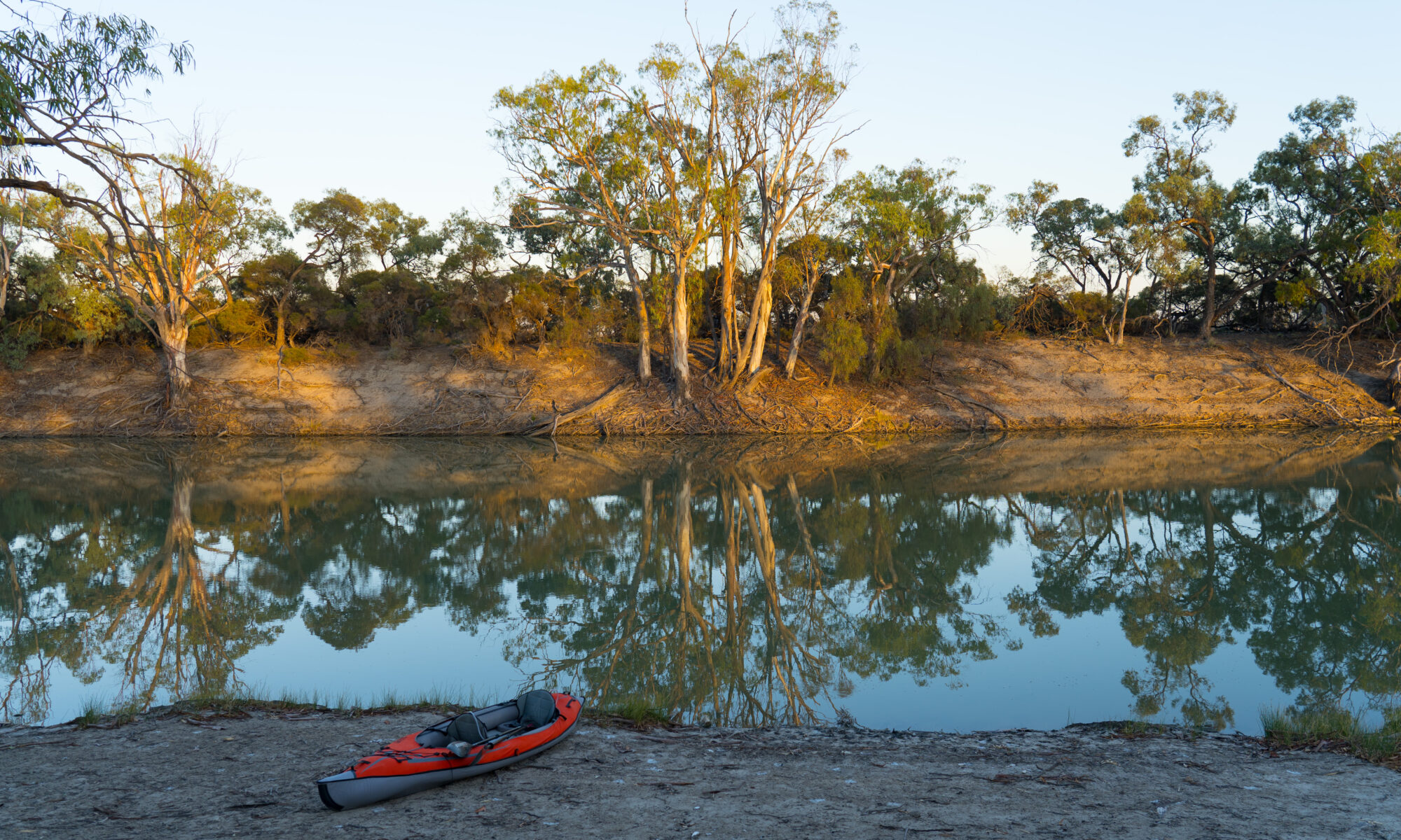
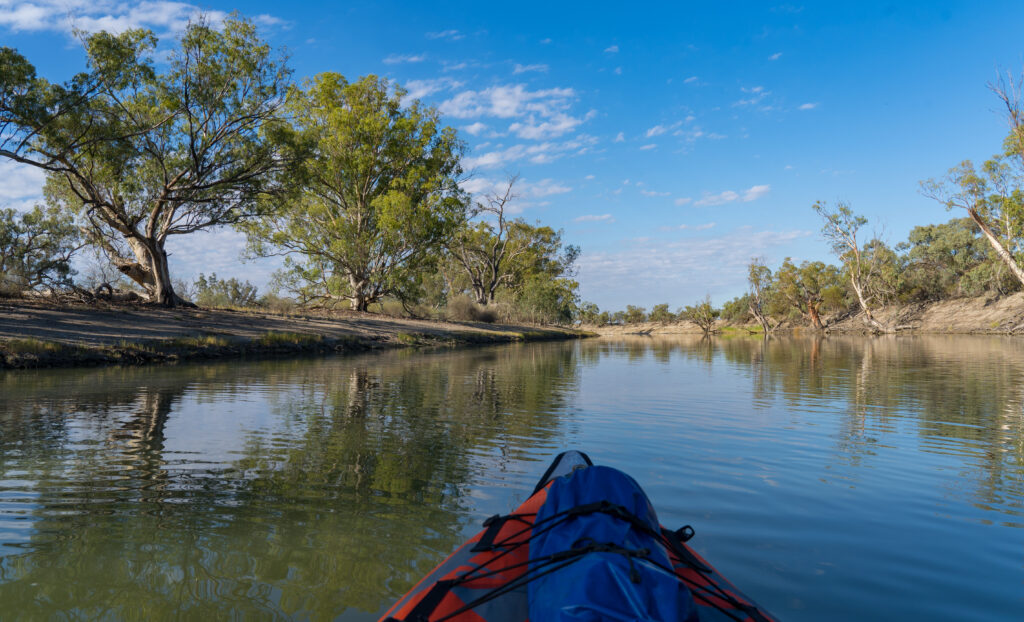
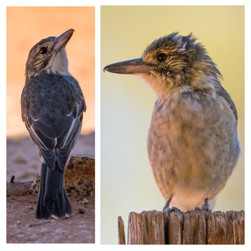
We decided to go for a paddle instead. We inflated the kayak and launched below our site, immediately appreciating the cooler breeze blowing off the water. Much of the bird life we saw was familiar, but as we drifted silently along we managed to get really close to some more unusual feathered creatures which were not frightened off.
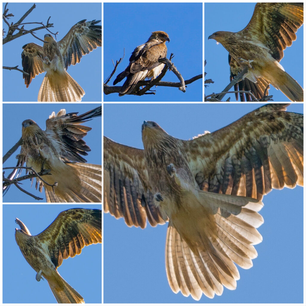
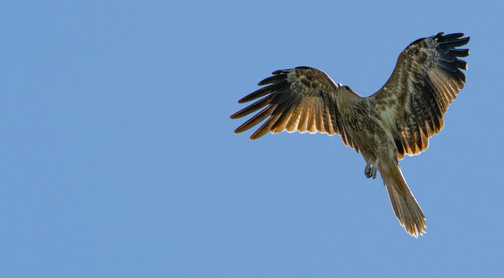
It was with some despair Mark engaged in a chat with a fellow camper who had been coming there for 40 years. He told us about the ‘hawks’ he fed the carp to when he managed to hook one on his fishing trips. He pointed out one of the Whistling Kites soaring past – ‘there’s one’. ‘Oh a Whistling Kite?’ we asked ‘Huh?’ he responded. How someone can not have any curiosity about the species of creature they come across, I don’t know…but vive la difference. Sadly it is attitudes like these that accept extinctions and destruction of habitat as just matter of fact.
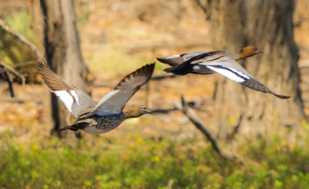
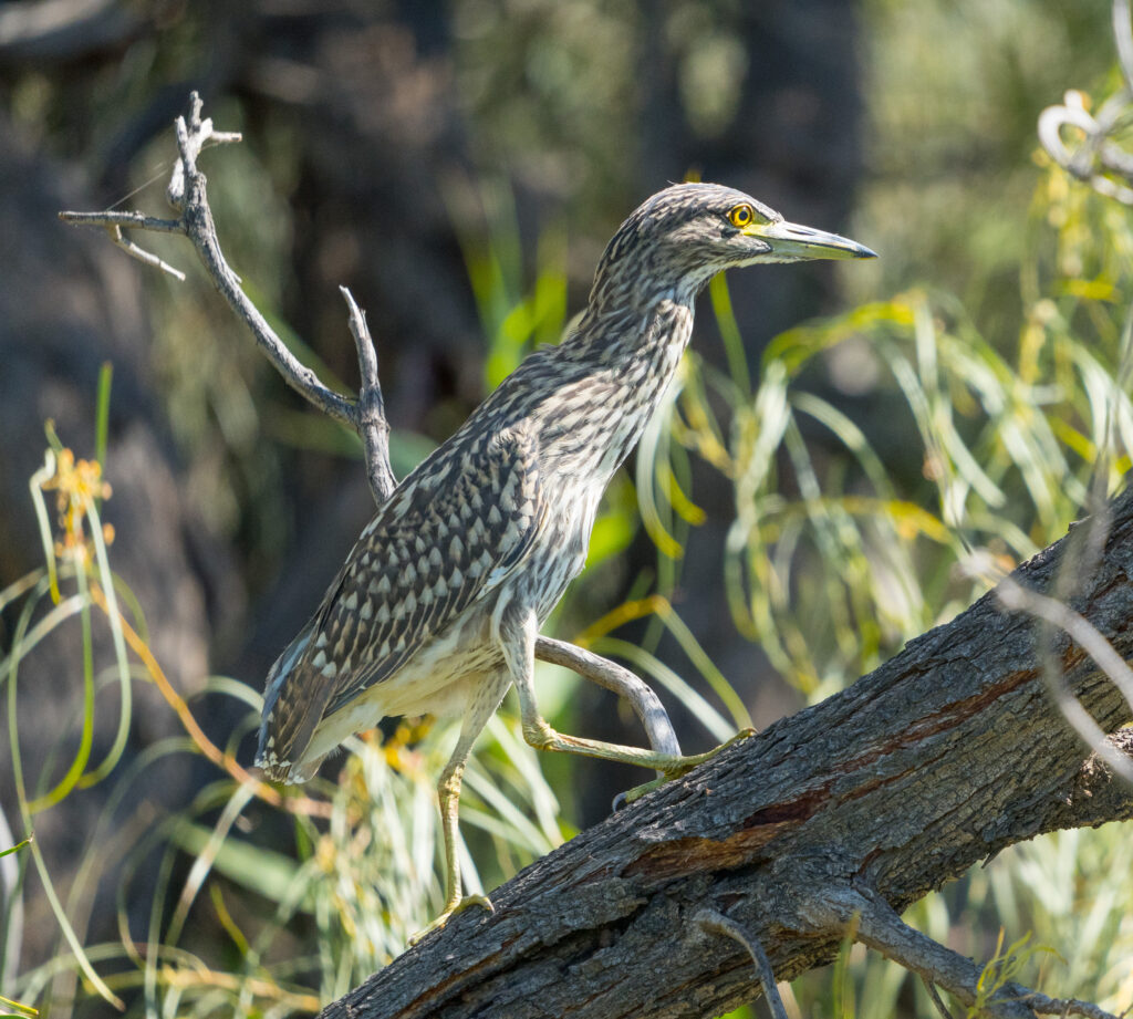
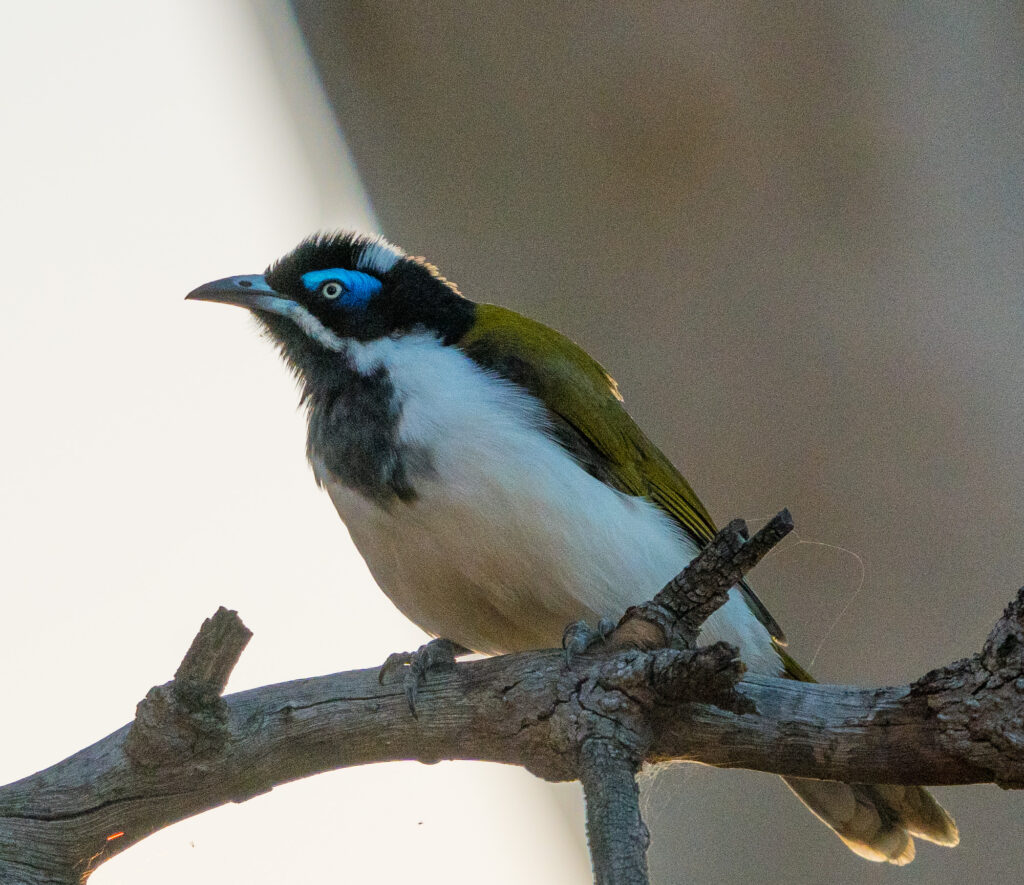
Whistling KitesMore Whistling Kites…getting used to using the high shutter speed to capture them in flightAustralian Wood DucksMore Pelicans…A beautiful Nankeen Night Heron juvenile picks its way up a treeA Blue-faced Honeyeater
While we were out paddling we spotted two guys on a boat dredging the water and then taking note of what they caught, before releasing them back into the river. They didn’t seem like typical fishermen so we enquired what they were up to. They told us they were scientists, looking at the health of the river ecosystem. They told us they had mostly found carp and a few small golden perch. Not much else. Not to harp on about carp too much, but a story has since been released that reveals that carp now make up 97% of the fish in our waterways – it sounds pretty consistent with what they were telling us. How depressing…and how important that this problem is solved
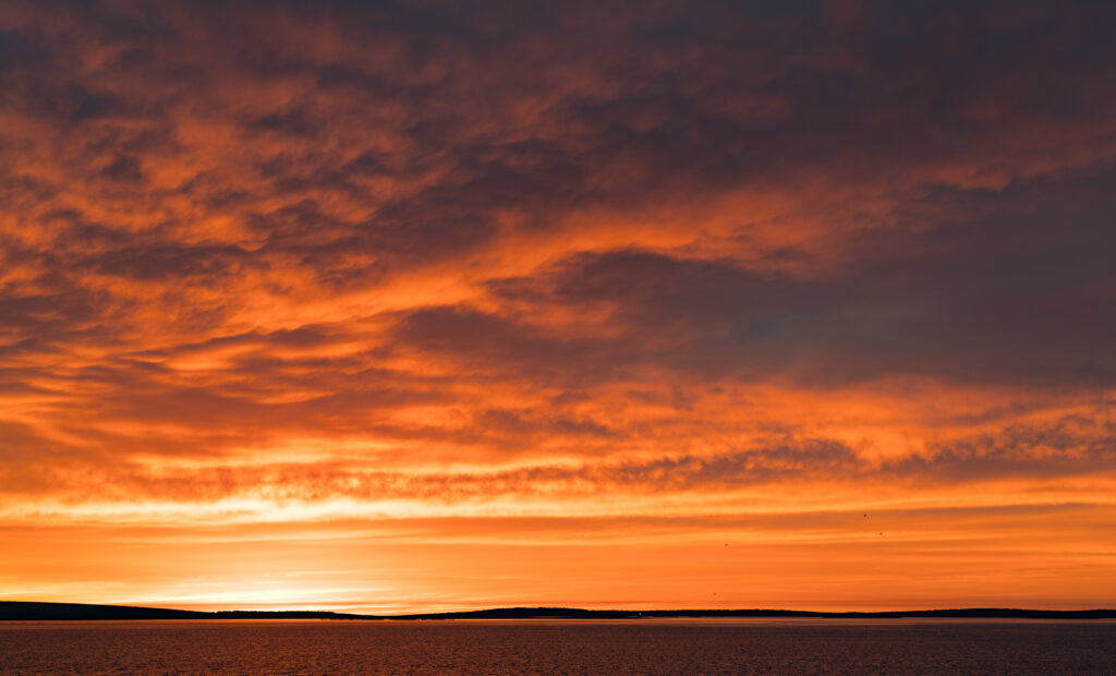
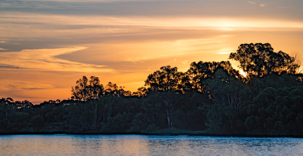
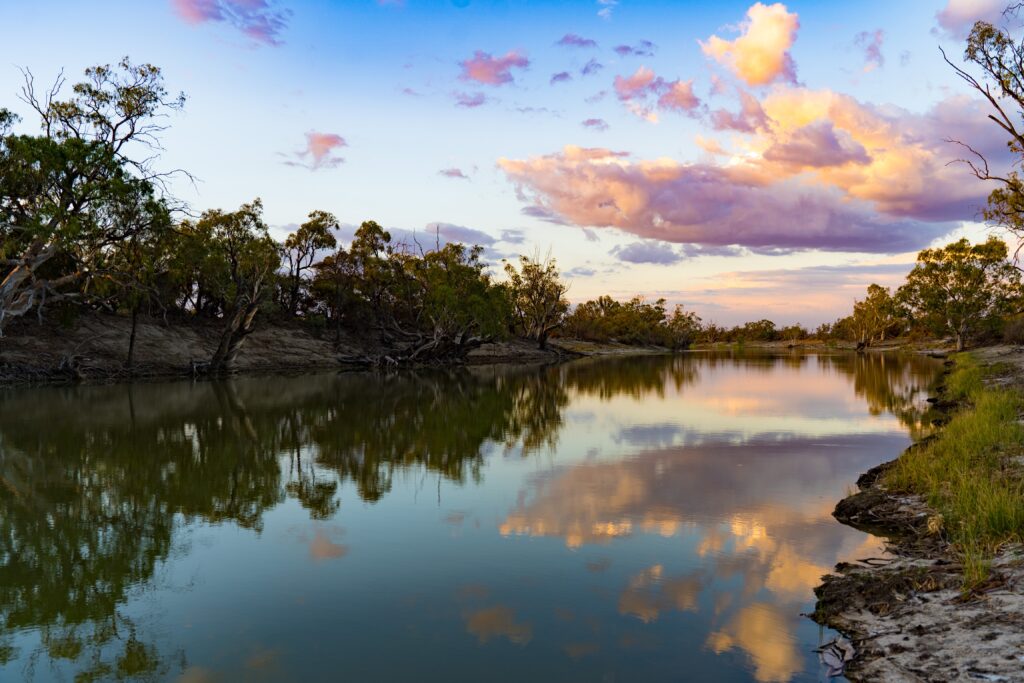
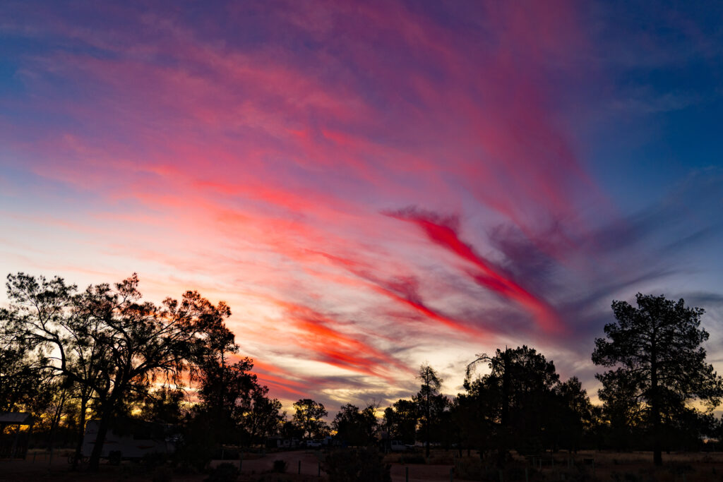
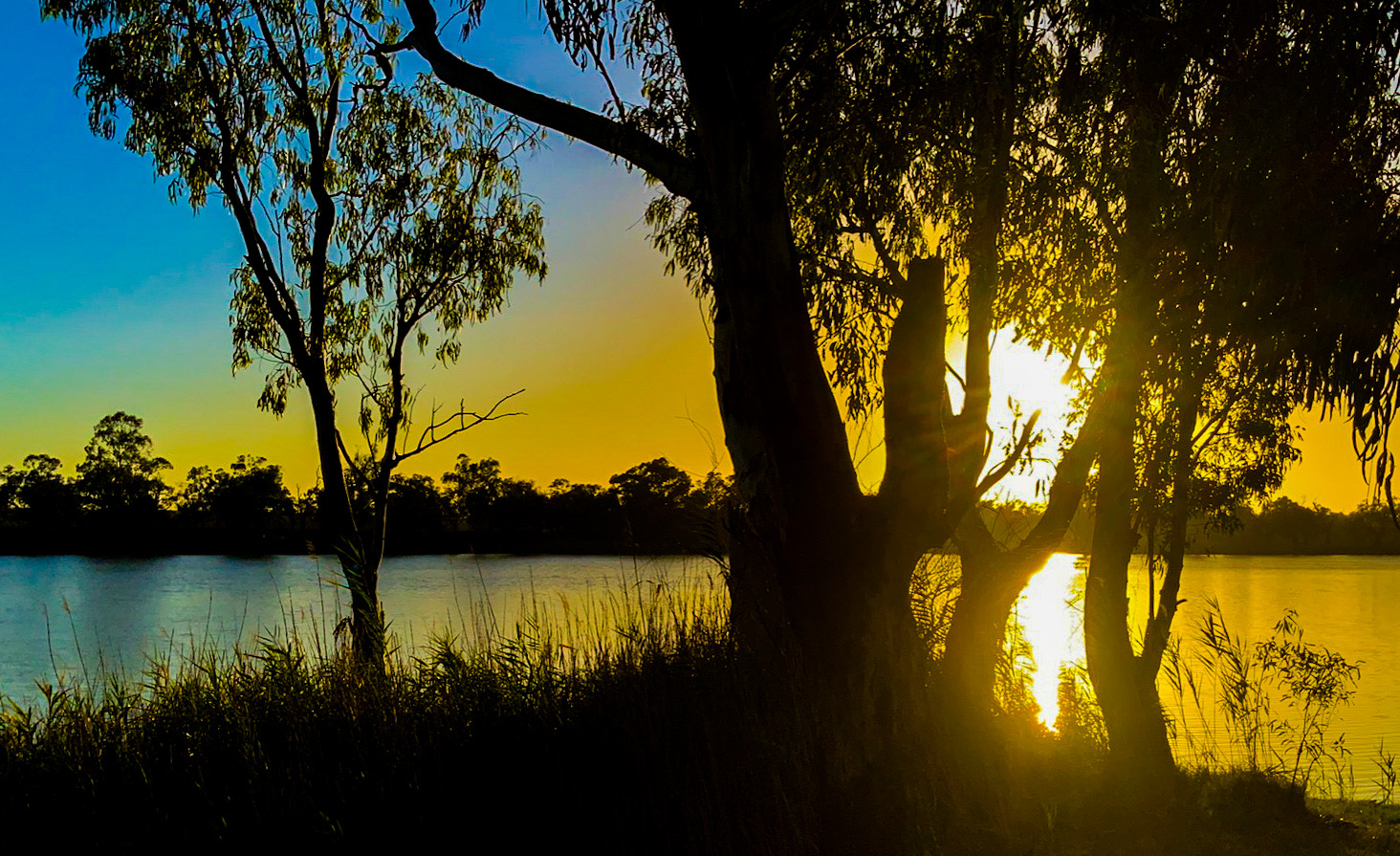
Another stunning sunset concluded our stay.
Another riverside outback sunset
We moved on the following day, heading towards Chowilla Game Reserve, back across the border in South Australia. Before we got there, we first made a stop at Lake Victoria, still in NSW. It is a reservoir managed by Water South Australia.
After prolonged drought, there is little water in the lake
In 1994 when the lake level was lowered for maintenance, a wealth of Aboriginal history was discovered. Artefacts such as camp sites, stone tools, grindstones, shell middens and hearths along with extensive aboriginal burial sites were uncovered. It was estimated that up to four thousand individual graves existed in the burial grounds. The Maraura people have been resident in this area for up to 45,000 years. Today, South Australia Water manages the site, along with local Aboriginal communities to help preserve the site.
A plaque at the lake recognises the Aboriginal people killed here in 1841 at the Rufus River massacre. While official records suggest 30 people were killed here, it is suggested the actual number is likely to be double this. For once, historical information presented seemed to be quite balanced, with copies of records from people present at the massacre as well as stories shared by survivors and passed down through the generations. As is often the case, history is written by the victors, but at least here there is some attempt to tell it from both sides of the story, a refreshing change.
We stopped for lunch, before making our way to Chowilla Game Reserve. This was a location our friends in Adelaide had recommended as one of South Australia’s premier kayaking locations. It’s a network of creeks and inlets which all feed into the River Murray, the hard to reach and remote location meaning it was likely to be quiet and definitely no water-skiers!
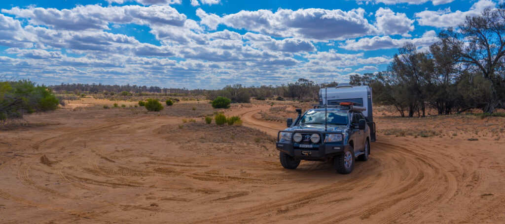
The road in was sandy and soft in places, but with our tyres already deflated to a lower pressure it was not too hard a journey to the park, although finding the entrance was a challenge in itself, with very limited signposts and a call to the Renmark information centre eliciting no help either – they couldn’t even tell us whether there was an entrance from the NSW side!
Where do we go from here? After following a sandy track for several kilometres we came across a gate with no signpost.
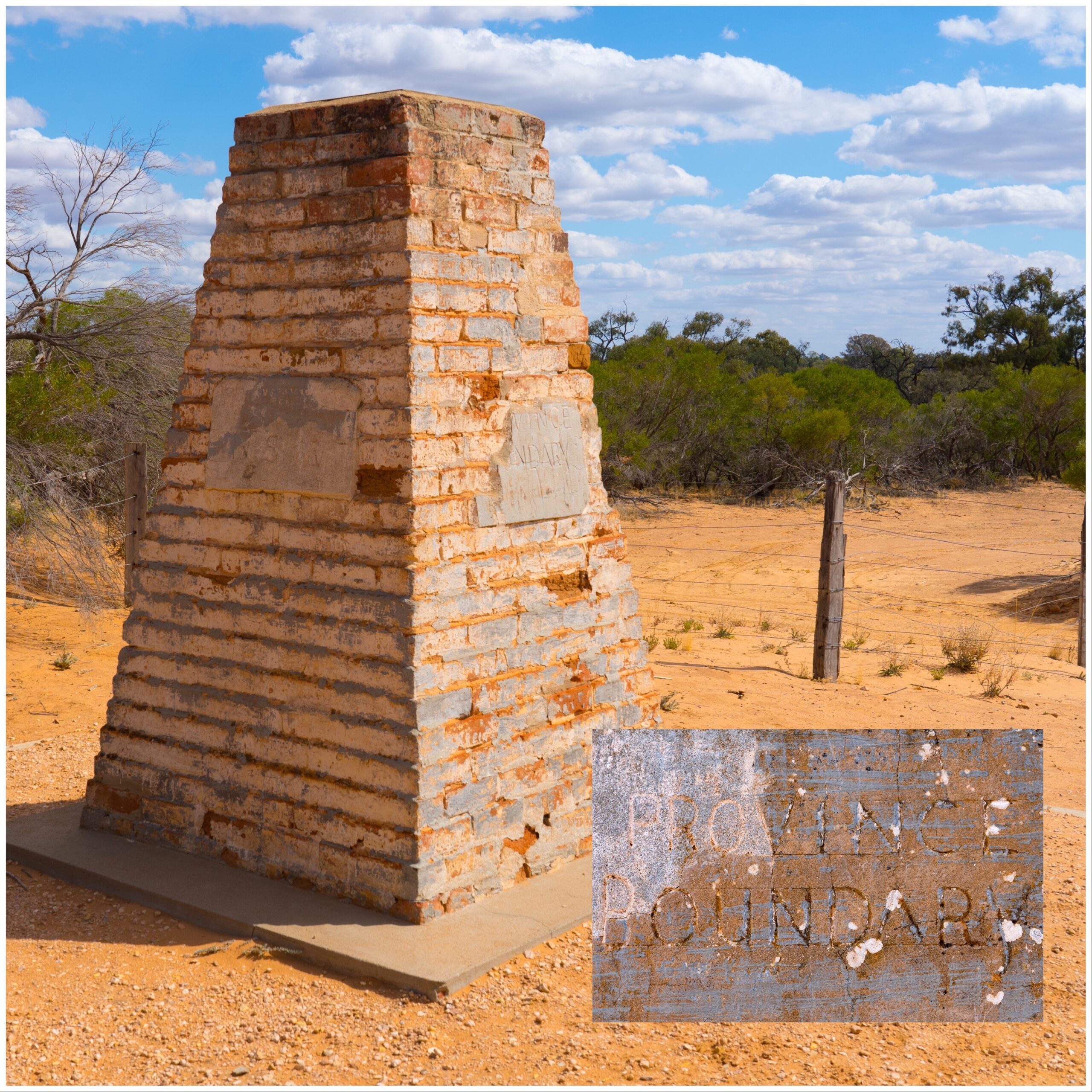
Our first landmark was a cairn marking the border between New South Wales and South Australia. It had been plotted and built by one of the founding European explorers in Australia, Charles Todd, in 1868 using astronomy. The border has been remeasured with modern appliances, and is now about 100 metres away, but the obelisk remains.
Todd’s Obelisk – the marker of the province boundary
Despite there being no signs, we drove through a gate into what we believed was Chowilla Game Reserve, winding our way through some pretty narrow and rough roads. Occasionally we would spot a signpost directing to camp sites, each numbered, but they were not consistent, and we often had to take a guess at a road junction, only to spy another sign through the binoculars directing us another way. It was very slow going, taking about an hour to navigate about three or four kilometres between scratchy tree branches and find our site by the river. Whoever suggested the sites were suitable for caravan access had not driven these tracks lately!
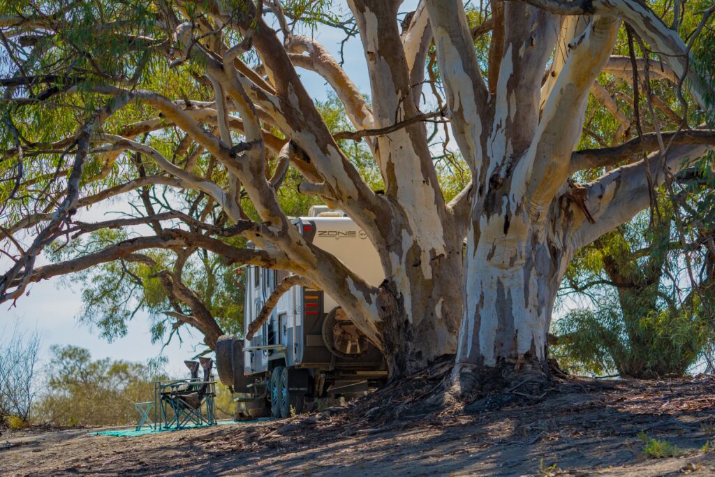
It was a relief to find our spot and park up for the night – a G&T was definitely in order as the sun went down after that journey!
Our haven by the waterOur kayak all ready to launch in the morning
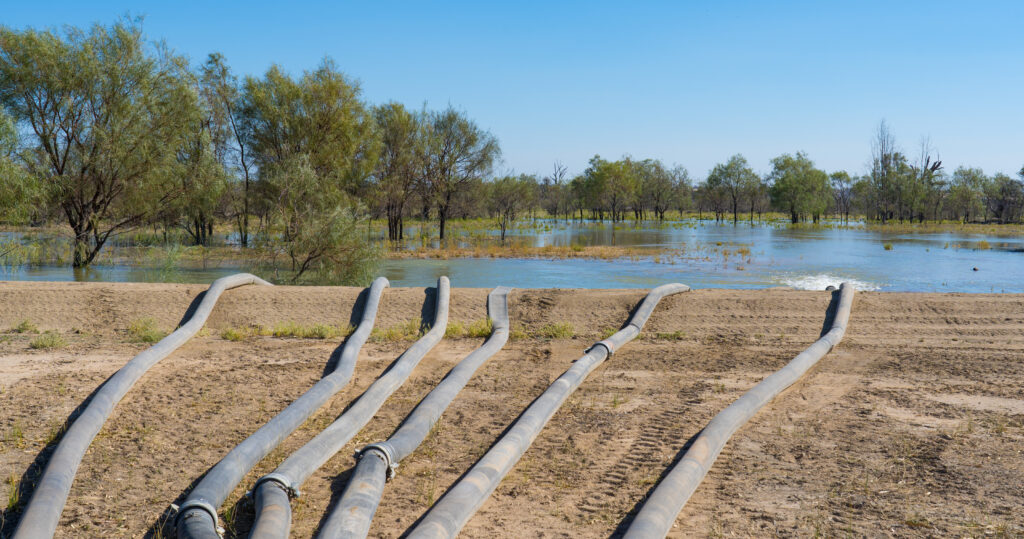
The following day we got up at sunrise and launched into the creek in the hope of seeing some birds. Chowilla Game Reserve is recognised as a Riverland Wetland of International Importance declared under the Ramsar Convention, and one of the six ‘The Living Murray’ (TLM) icon sites in the Murray-Darling Basin. This means it is an area that is actively managed to maintain the health of the floodplain, using artificial means where lack of water (due to agricultural and other human activity usage) means flooding is no longer available naturally.
Our first impression was quite eerie – usually dawn brings a plethora of bird life, but not here – there was barely a tweet. Do the birds not realise this is an important wetland? Perhaps it is the ‘Game Reserve’ bit of the name? We had been dismayed to learn that five species of Australian duck are permitted to be hunted from Saturday 20 March until late June…maybe the ducks had looked at their diaries and decided to exit stage left given this was just three days before that start date? We continued on regardless…
We gently paddle down stream
With great stealth, we silently explored the watery lanes, watching for any movement. We were eventually rewarded with some sightings…
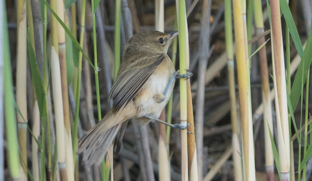
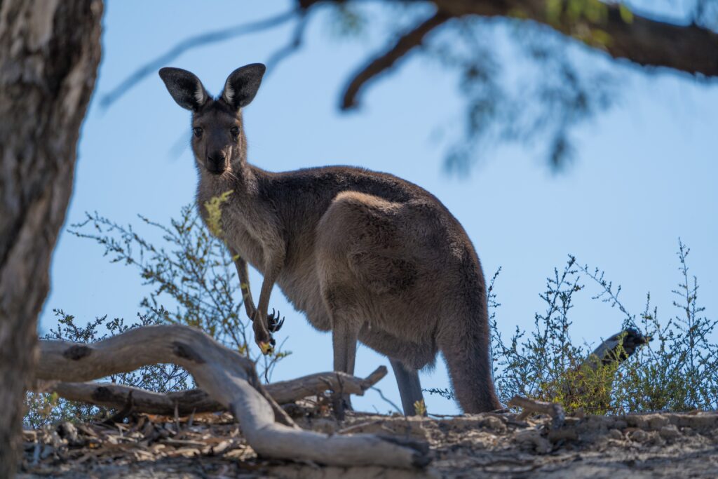
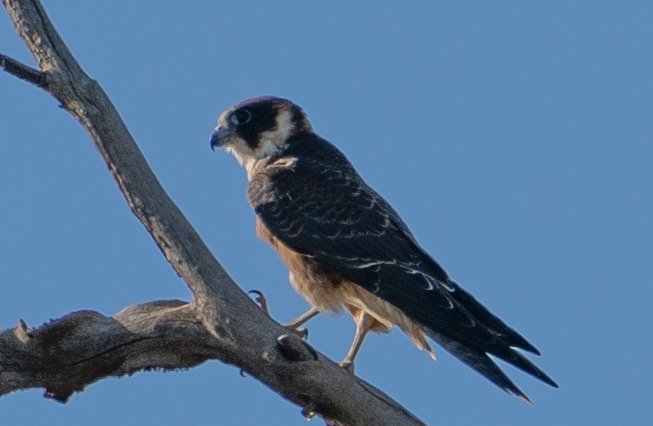
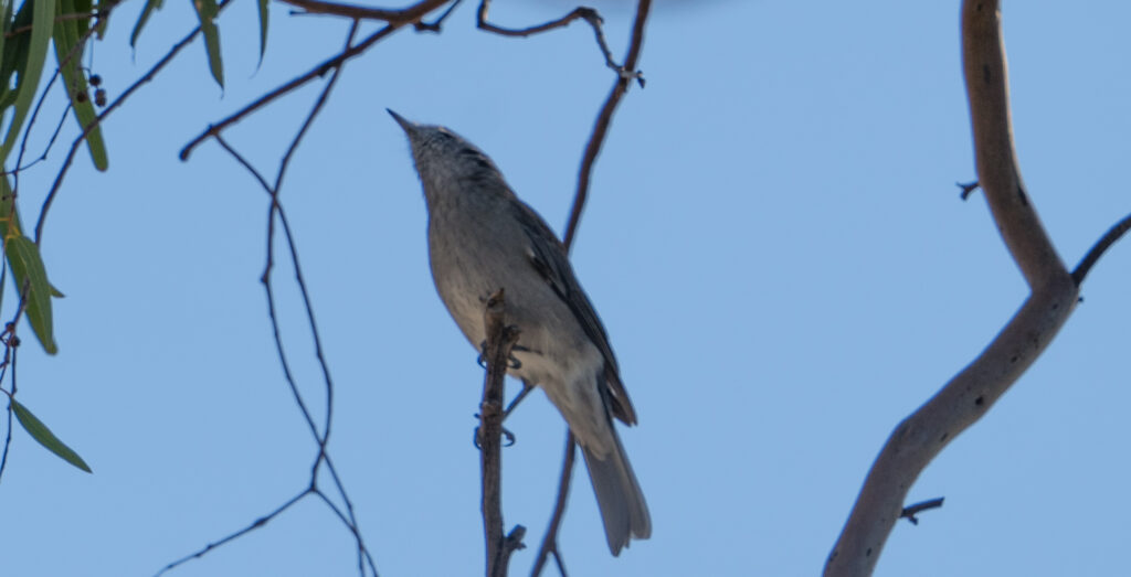
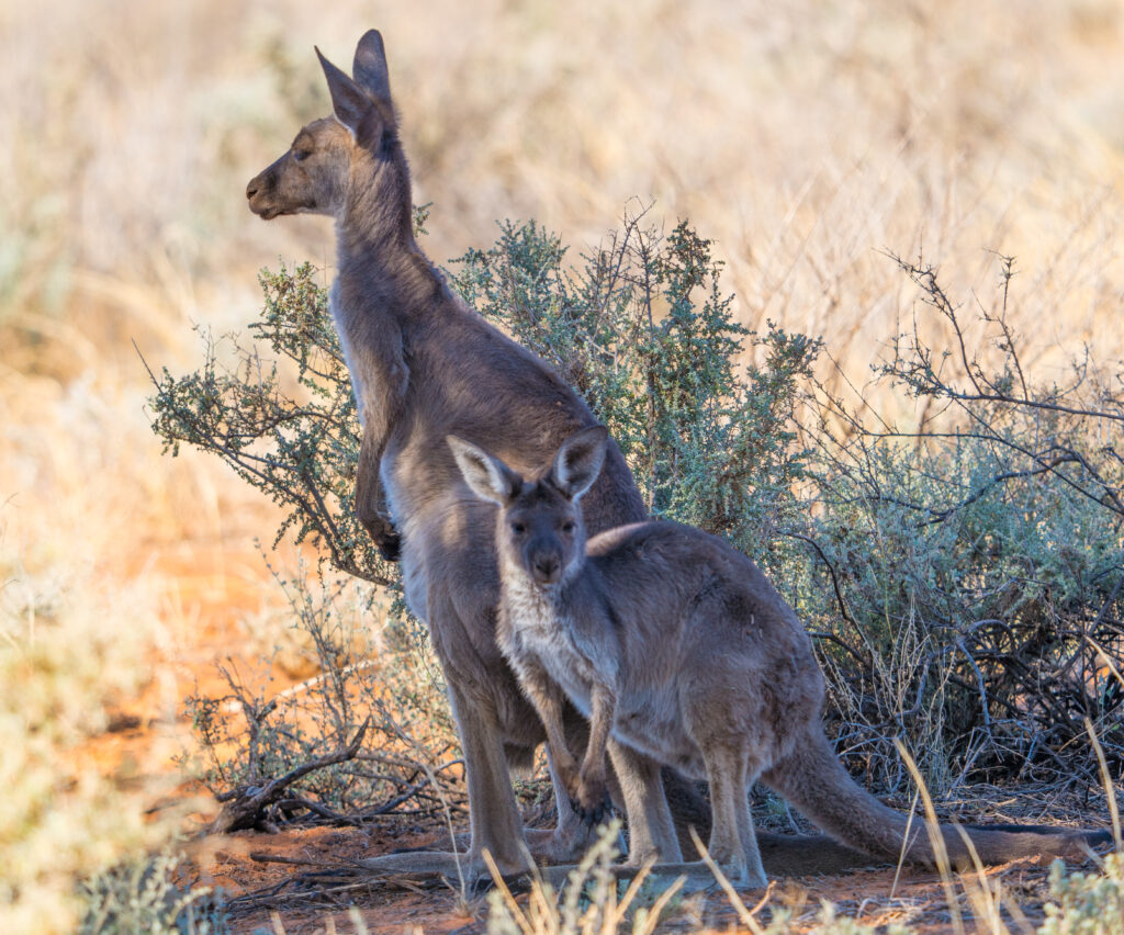
An Australian Reed-warblerGrey KangarooBeautiful bark of a RIver red gum treeAn Australian Hobby
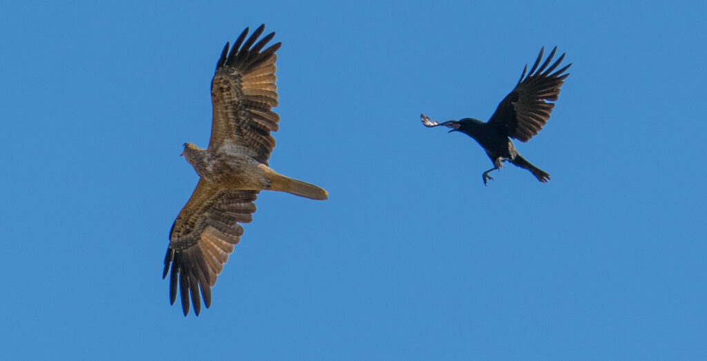
And yes, you’re probably getting bored of seeing Whistling Kites, but we had an incredible front row seat for this courageous Little Crow which chased the kite a kilometre across the sky to deter it from its nest.
Crow versus Whistling KiteMasked Woodswallow
Having redeemed itself, we had a relaxing afternoon and enjoyed a marvellous sunset over the water.
A perfect sunset skyMirror-like perfection on the water
The following morning we braced ourselves for the journey out, heading towards Renmark. Fortunately, other than one water crossing which we managed to divert around, the journey went smoothly, and we covered ground much faster than on the way in.
As we departed we were able to see some of the ‘The Living Murray’ work in progress. The flood plane relies on water for at least three months once every five years to survive. As the water levels very rarely ever reach flood level this is now artificially pumped. Six huge pumps were running 24 hours a day to supply this water up into this area. The contrast between this flooded area and those left dry was dramatic.
Flooding in progress
We saw just one other vehicle in our time in Chowilla, testament to how remote the park is. Again, our breath is taken away by the huge open spaces and unique landscapes Australia has to offer, and we so appreciate the opportunity life has given us to be able to travel them.
Location: Mungo National Park and Pooncarie, NSW, Australia
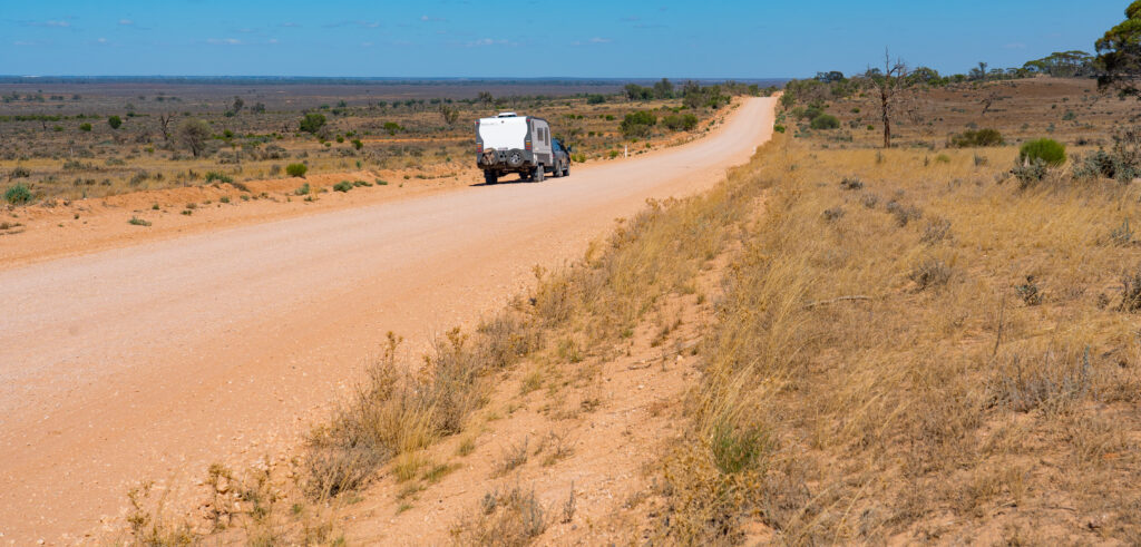
We farewelled Jenny who took off early into town to get her windscreen replaced, and did a final shop before making our way out of town. We had a couple of hours’ driving ahead of us on dusty and corrugated single track roads, and there were not going to any shops in our immediate future.
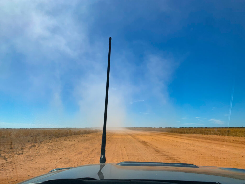
A willie-willie approaching us on the dusty road…this is a dust whirlwind….
It’s been a while since we have travelled on such surfaces, and when we stopped for lunch we were reminded of the impact of the dust. Our Zone caravan is predominantly dust proof, but a week earlier we had discovered a catch on our front door was missing, meaning we couldnt securely close the outer glass. We’d forgotten to tape it closed on departing, and so everything was covered in orange dust. Ugh. A good 15 minutes of cleaning later and at least the kitchen was usable. We remembered the tape before we set off again.
The landscape is dry and flat, with a surprisingly large number of drought tolerant bushes, grasses and shrubs across it. In a ‘I-wouldnt-like-to-live-here’ way it is extremely beautiful, and you have to admire the multitude of creatures that survive in this harsh environment.
It has become standard practice in Australia to use what is called ‘An Acknowledgment of Country” when speaking about a place, and we have decided to include this in our posts from now on. For our non-Australian readers who may be unfamiliar with this phrase, it is a way to recognise the traditional owners and custodians of this country, and their long and continuing relationship with the land.
So why haven’t we being doing it to date? Often when we see this acknowledgment written or hear it spoken, it appears to be an insincere tick of a box, with the following material displaying no further recognition, understanding or respect for the culture and achievements of the people who have made this land home for thousands of years. Mr A has taken a particular interest in researching and learning about this history since we started travelling around Australia, so we feel we have something to say that would make an Acknowledgment of Country more meaningful, and not just being politically correct.
We also think it would be a useful reminder to our readers that Australia has a long and rich history before Europeans started showing up in the early part of the 18th century, and the British first unloaded their convicts in January 1788. For 60,000 years Australia had already been settled, farmed, irrigated, mapped, its resources carefully managed and many world firsts achieved in the process. The world’s first known example of open ocean navigation, the first bakers, the first aquaculture, and the list goes on as we learn more about our Australia’s First Peoples.
We respectfully acknowledge, in hindsight, all the First People of Australia whose country has given us such a wonderful home , so many adventures, and still so many surprises as we learn about the achievements of its traditional owners.
Our destination on this occasion was Mungo National Park. We would like to acknowledge the Traditional Owners of the land we visited- the Barkandji/Paakantyi, Mutthi Mutthi and Ngiyampaa people. We would also like to pay our respects to Elders past and present.
The national park is famous for its huge dry lake bed, alongside which in the 1970s were found the ancient Aboriginal remains of Mungo Man and Mungo Woman, buried there an estimated 42,000 years ago – during the last Ice Age.
This location represented a game-changer in understanding of the human occupation of Australia – at the time of its discovery, this was some of the earliest evidence of humans outside of Africa and some of the most powerful evidence of continuous occupation of a region by a population – more than 2,000 generations. Mungo lady represents the oldest known ritual cremation of a human…though what is being learned changes all the time.
The next find was relatively recent. In 2003, fossilised human footprints from Willandra people made 20,000 years ago were uncovered under shifting sands. This was equally as important, representing the only Pleistocene footprints in Australia and the most numerous yet found anywhere in the world. They show an adult and child walking barefoot around the edge of the lake. The actual prints are not accessible to the public, but there are 3D replicas of the footprints in concrete in a display area on the lake. You can literally walk in and on the footsteps of Aboriginal ancestors.
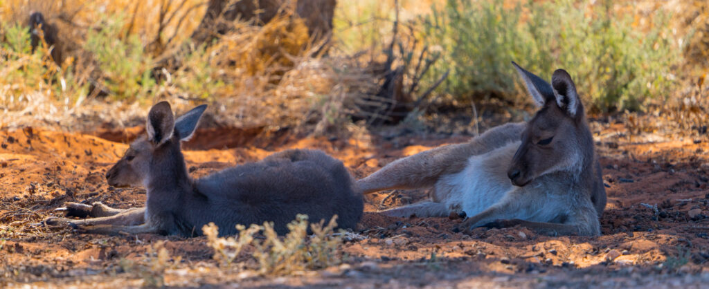
We set up at Main Camp, a bushy setting with widely spaced sites surrounded by shady trees, birds flitting everywhere and kangaroos lazily glancing up from the shade. A perfect place to start really trying out my new camera lens.
Our nearest neighboursPossibly a young Grey Butcherbird? Happy to be corrected!One very chilled out Grey Kangaroo
Mark and I had visited this area about 18 years ago, spending a night here as the only campers in our tent on a dusty site. It was a lot more civilised this time in our caravan, and also much busier with several other people staying.
We had a great afternoon exploring the nature walks and lookouts, opting to not go on the nearby lodge’s sunset tour which for $110 would involve a tag-along drive to the other side of the lake with a talk covering the pastoral history. Apparently the National Parks Ranger organises an Aboriginal tour ‘most days’ which sounded much more interesting, but sadly it wasn’t on during our visit.
Grazing animals were released into this region in the 1880s, and those combined with the introduction of rabbits (wasn’t that a great plan – what could possibly go wrong?) followed by foxes (another bright plan that didnt work so well) contributed to the extinction of at least 10 small mammals in the area and an unknown but huge number of plants and grasses. The land was designated a World Heritage Site in the 1970s after the archaeological finds, but the land still has not recovered and it is suspected never will.
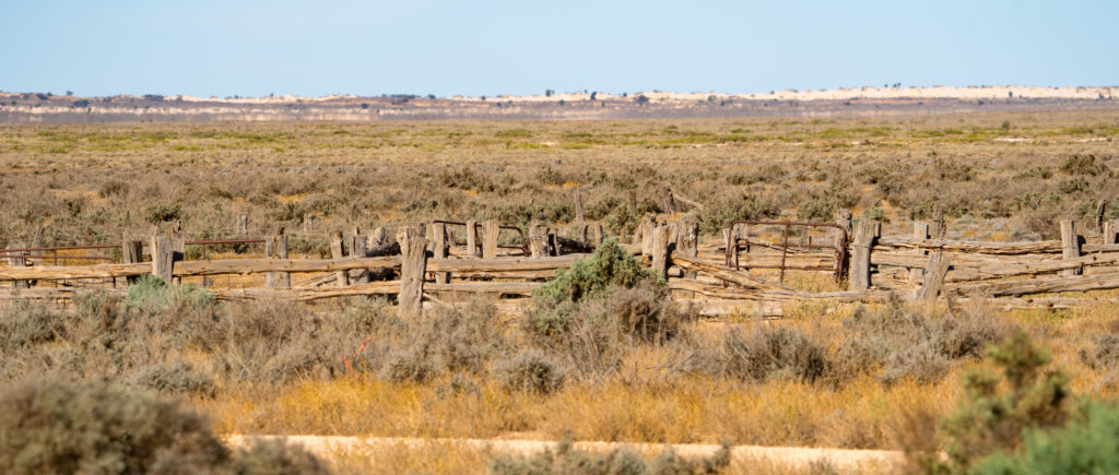
Remnants of the pastoral history of the area
The lake is a vast and desolate area, stretching away to the horizon. The total size is 200,000 square kilometres, and it last had reliable but salty water in it around 18,000 years ago. As we stood together at the lookout admiring the unique landscape, it wasn’t hard to understand why this is such a sacred area to the Aboriginal communities.
A lone tree overlooks the lakeThe sun casts a mysterious light over the dry lake as it dips low in the skyBeautiful coloursCasinova reads poetry to his beauA Spiny-Cheeked Honeyeater flits musically through the trees hunting for insectsSunset over Mungo National Park
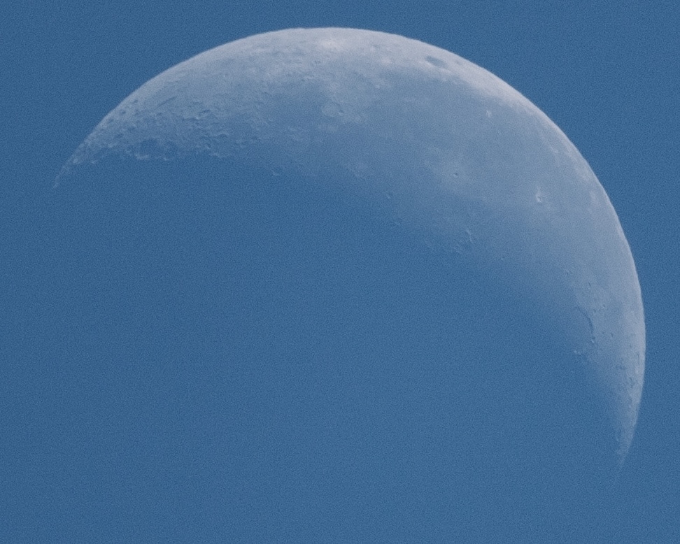
After the activity and sleepless nights of Mildura, it was absolute bliss to enjoy the peace and dark of Mungo. The stars stretched on forever. I’ve not yet got the hang of star photography with my new lens so there’s none of that to share, but I did get a good shot of the moon.
Can you spot the craters?
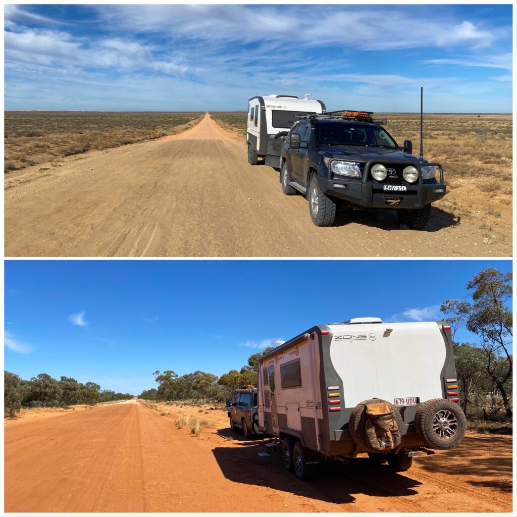
The following morning we departed, driving across more huge dry lake beds, bizarrely showing up as blue on Google Maps, heading to the tiny settlement of Pooncarie, home to 40 people.
Long straight dusty empty roads common on our journey
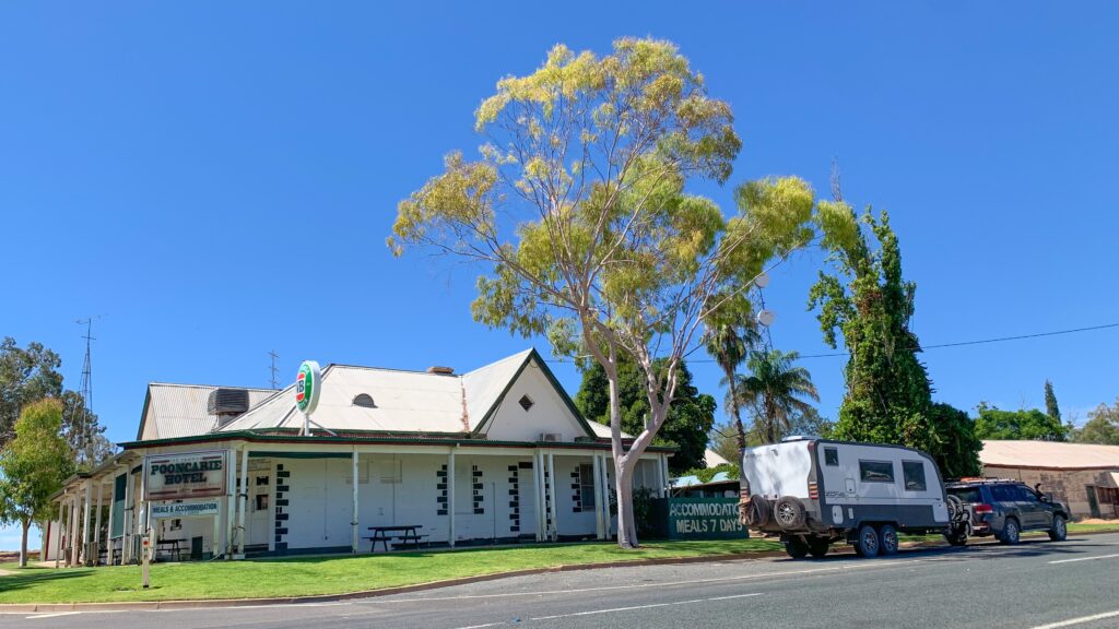
Pooncarie is tiny now, but in the mid 1800s was an important river port, settled on the banks of the Darling River and serving all the sheep and cattle stations in the region. There is still a wharf there, with a cafe and craft shop. Somehow the village is also able to sustain a pub, where we called in and paid our $10 to camp for the night in a serviced riverside area. The Pooncarie area is inhabited by the Barkandji Aboriginal people who have been in the area for at least 40,000 years.
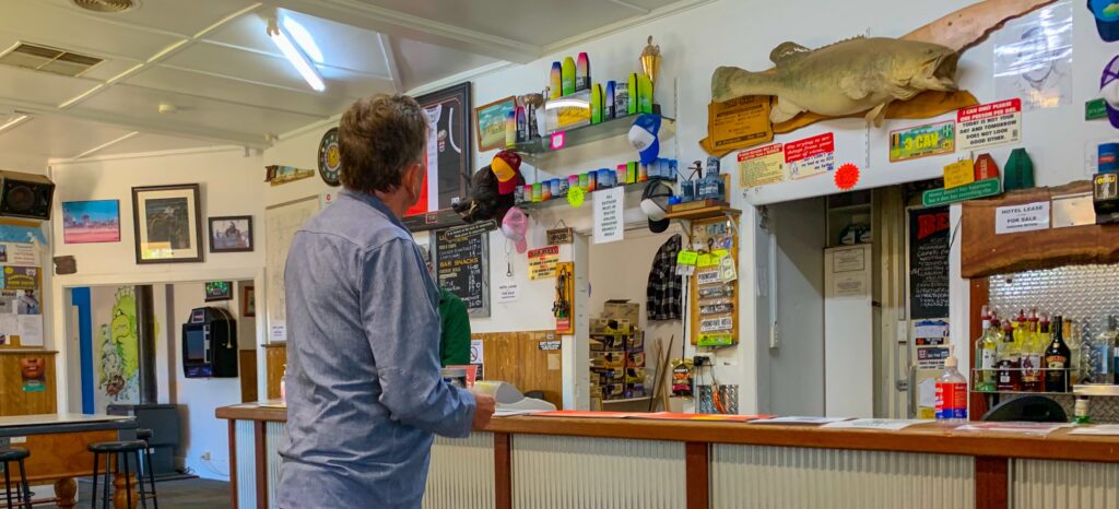
The Pooncarie HotelThe bar is dedicated largely to fishing memorabilia
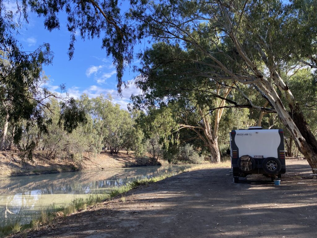
What a beautiful spot – an absolute haven after several hours of driving dusty, straight and corrugated roads. It was a hot afternoon, easily reaching the early 30s in the shade, and unbearable in the sun, but with a breeze blowing off the water it was lovely. We set out our chairs and enjoyed the ambience.
Our home for the night beside the Darling River, Pooncarie One chair for Mr A and one chair for Princess Tassie…seems to be something missing here…One happy cat
It was not only us that enjoyed this relatively cool riverside shade, there were plenty of birds who were obliging enough to occasionally stop still and land in unobstructed locations for a photo.
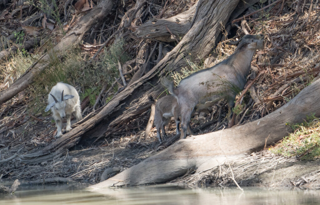
We also saw a family of goats picking their way alongside the river. These are strictly speaking feral – generations of these have been born and grown up in the wild, descended from goats that have escaped from un-fenced farms in the 1800s. They do a lot of damage to the plants, munching up young seedlings and changing the landscape with their hooves. But, it seems, they have now been accepted as a source of potential money, with Australia now being the world’s largest exporter of goat meat – mostly to the USA. Of course they don’t call them feral goats in their marketing – these are known as ‘rangeland goat meat’. There have even been thoroughbred Bauer goats released into the wild to help improve the meat quality through inter-breeding.
’Rangeland’ goats pick their way along the river bank
It was a lovely overnight stay, and Tassie enjoyed a final explore around the area before we took off the next morning, again farewelling the life giving river and travelling the red dusty roads towards Menindie.
The Murray River is the longest navigable river in Australia and despite owning kayaks for 22 years, it is one area we have never paddled, and indeed spent very little time in. A big chunk of the river goes through northern South Australia, so we decided to spend a few weeks exploring it. Watching the weather forecast we saw that the heatwave was breaking on Sunday, and so after a final morning of shopping and washing, our caravan groaning under the weight of fresh eggs, tomatoes and the unusual zucchini tromboncino, we bid farewell to Kim and Mike, and were on our way.
We wound our way up through the hills, and within two hours had our first sighting of water as we took a ferry over the Murray. From there we drove up on top of the cliffs that line parts of the waterway to Len Crohen’s lookout near Walker Flat. We parked up there for the night, a peaceful spot with great views and no other campers.
Our site for the nightLooking down at the mighty MurrayPrincess Tassie enjoyed a short explorationDawn brings a few light showers
We moved on the following morning, heading for Waikerie, our destination for the next couple of nights. We’d read about a free camp just outside of town, and were fortunate to find ourselves a prime location beside a boat ramp with wonderful outlook over the River Murray.
Our view for a couple of nights
Accompanying comfortable temperatures in the mid 20s was a strong southerly breeze (not ideal for paddling), so we decided to pull on our hiking boots and go for an explore on foot. We picked our way along the river bank as far as possible, then followed the road until we reached a wetland area known as Hart Lagoon.
Following what looks like a trail along the riverThe familiar sight of Little Corellas in the gum trees
Hart Lagoon is an important ecosystem and home to many birds, The walking trail surrounding it was created by a number of local groups, including the primary school. We couldn’t help but admire the initiative – Waikerie feels like a town that is really trying to improve itself and attract visitors, as well as encourage the next generations to value the Murray ecosystem.
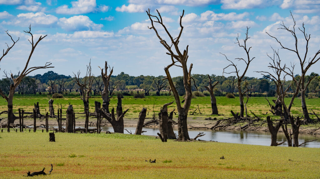
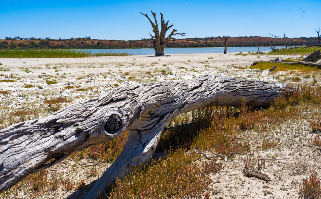
Like much of the area around the Murray River, dead trees are a feature, often home to birds which nest in the hollow trunks and branches. What were once were mighty red river gums are now just skeletons dotting the landscape like giant bleached sculptures. Many of these are casualties of the decades of water use up and down the river, farms taking the water for irrigation and as a result preventing the floodwaters the trees rely on to survive. Due to the reduced water replenishment, the salt content of the water has increased, further putting stress on the trees that rely on its nutrients to survive. It’s that familiar battle we see regularly – livelihoods at the expense of nature
Remnants of trees from the pastVery little shade on this part of the walkGlossy Ibis find a perfect roosting spot in the top of a dead tree
The return loop of the walk provided welcome shade for at least some of it, appreciated on this 12km hike (map), and further evidence of days gone by, when the nearest tip was too far to reach and a wetland was ideal to abandon an old vehicle.
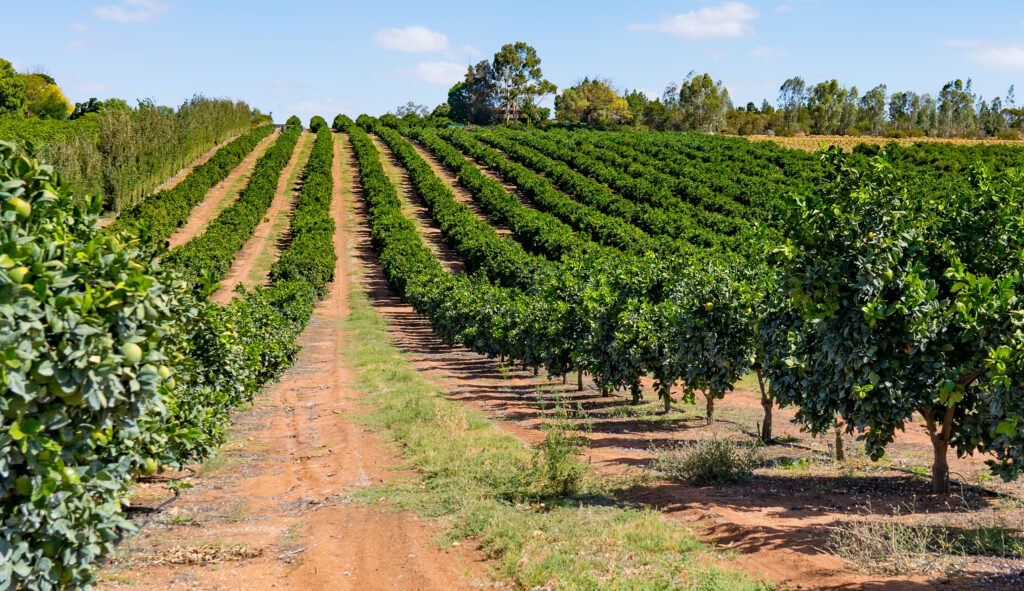
I wonder when this ute found its final resting place…Citrus fruits are a key source of income for Waikerie locals, the river providing much needed water for these mandarin oranges
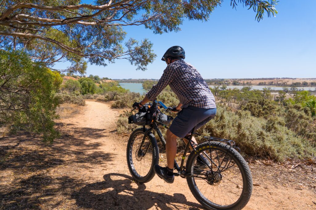
The breeze was determined to continue to be too strong for kayaking . That’s just how it works when you are keen to do something! So the following morning we decided that pedal power would be our transport mode, and we spent the day exploring the region around Waikerie and Ramco Lagoon.
A fine spot to enjoy the sunrise over the river
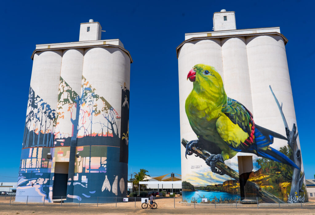
Waikerie is on the Silo Art Trail, a route which takes travellers throughout regional Australia to see huge murals painted on silos, water towers and walls. The trail encourages people to visit some of the lesser known inland parts of the country, each telling a story or promoting local flora, fauna or history. The trail was the brainwave of some fellow travellers from Western Australia in 2018, who wanted to plot the locations of the already painted silos and those planned.
Beautifully painted silos promoting the endangered Regent Parrot which lives along the Murray RIver. Spot Mr A dwarfed by the structures.We cycled part of the Cliff Walk with lovely views over the riverRiding off along the cliff walkOur local lagoon, Ramco Lagoon
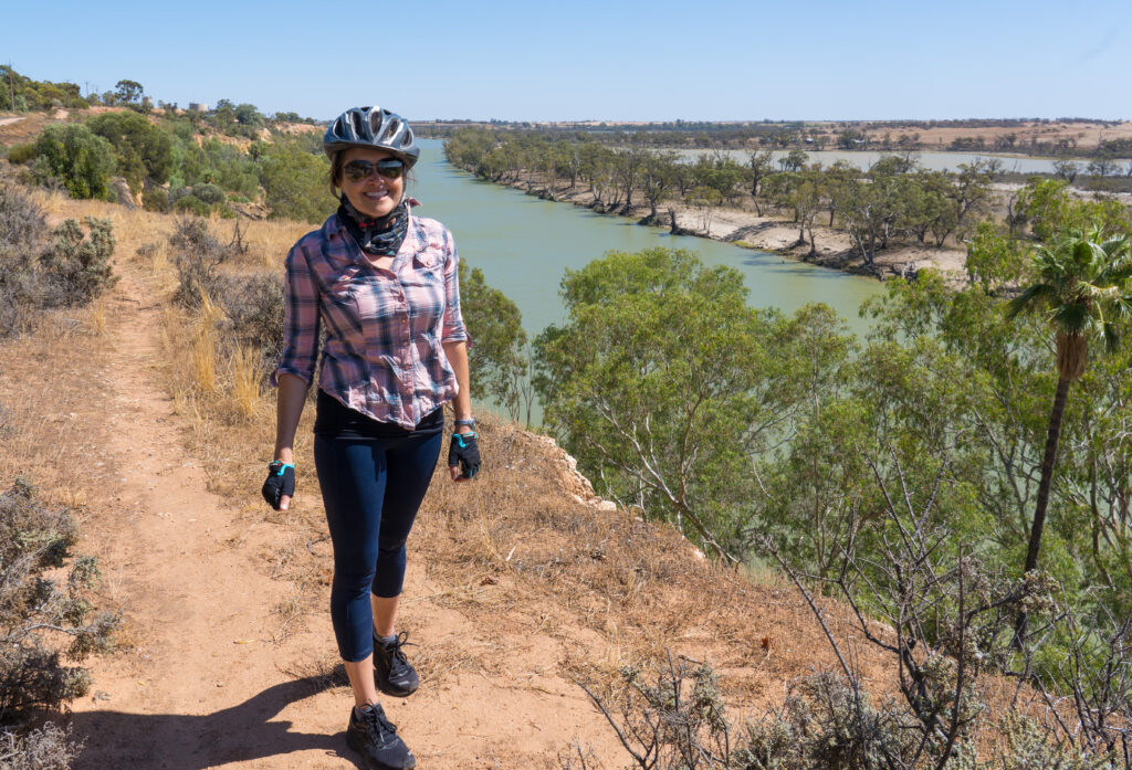
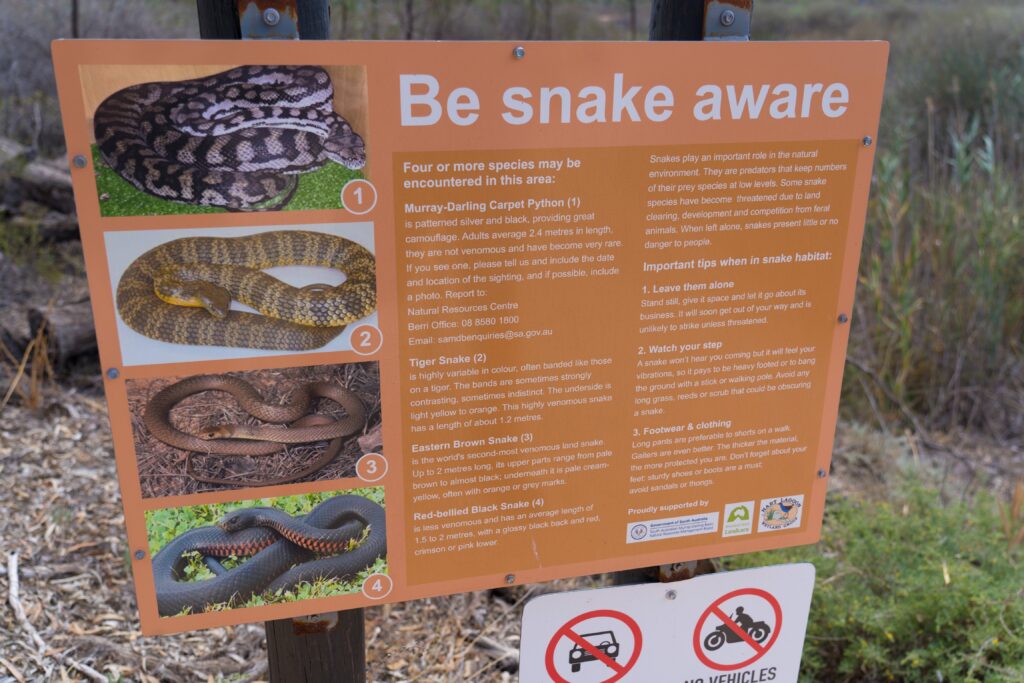
Mr A had a near miss as we were cycling back to camp. I spotted an Eastern Brown Snake crossing the path in front of us and shouted at him to stop. He blundered on through, riding right over the poor thing. I say ‘poor thing’ as I am sure it wasn’t feeling too well after Mr A’s giant bike had cycled over it, but we were also very lucky it didn’t rise up and strike him, given it‘s the second most venomous snake in the world! We seem to be seeing more snakes than usual on this trip.
The four types of snake most likely seen along the Murray waterways
We had a great couple of nights here – finding it peaceful and picturesque. It’s a shame we didn’t get out on the kayak, but we are sure there will be other opportunities. Princess Tassie enjoyed her explorations too (and yes, always accompanied by an eagle-eyed servant to ensure there were no slithery creatures nearby to cause trouble!
Adventure catMoon rising over the riverWith virtually no light pollution, the stars are fabulous here
Location: Gleeson’s Landing and Port Victoria, Yorke Peninsula, South Australia
Packing up and leaving our spectacular camp at Coffin Beach was a challenge, as was farewelling our wonderful camp companions, Kim and Mike. They were off back to Adelaide, while we continued on our way. We topped up our water tanks in nearby Marion Bay, and crossed the peninsula to a council campsite on the other side known as Gleeson’s Landing.
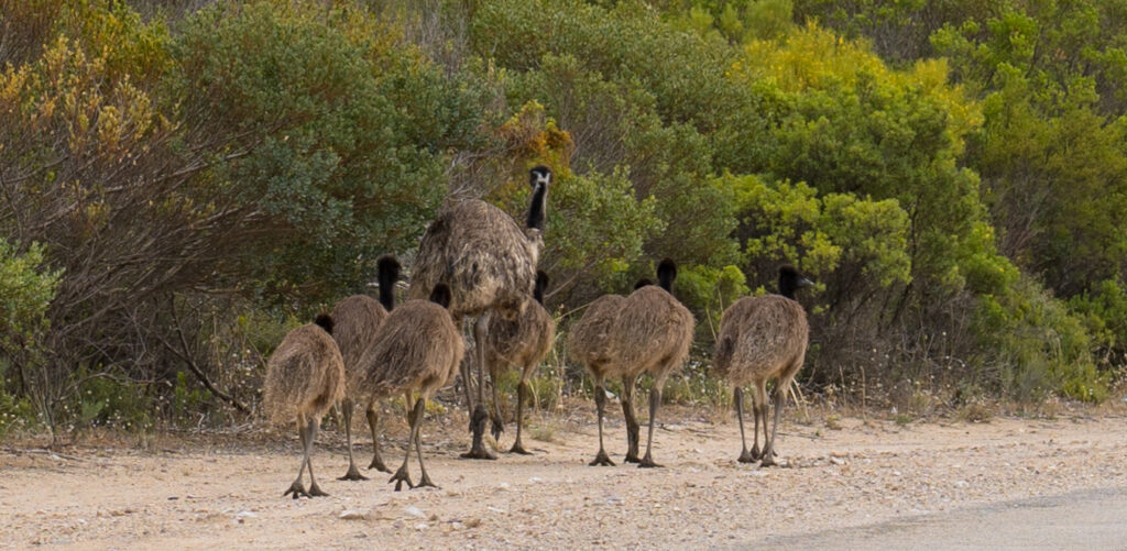
Emus strolling along the road in Marion Bay – this adult male is babysitting the chicks
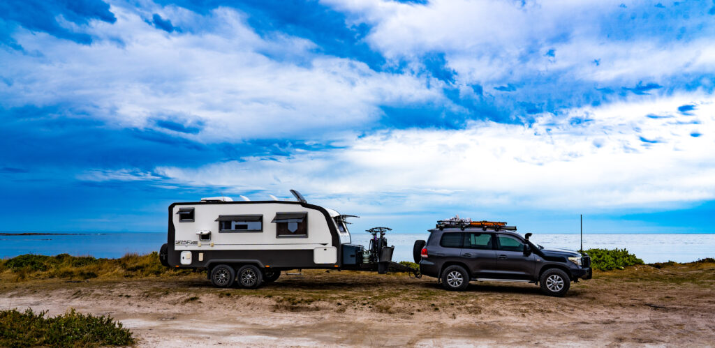
You cannot reserve sites here – it is literally first come, first served, but there are a lot of water’s edge areas to camp. Ideally suited to self contained caravans, there are a few long-drop toilets dotted around, but they are not necessarily well maintained. We found ourselves a recently vacated area on top of a small cliff overlooking the water, setting up moments before the weather changed.
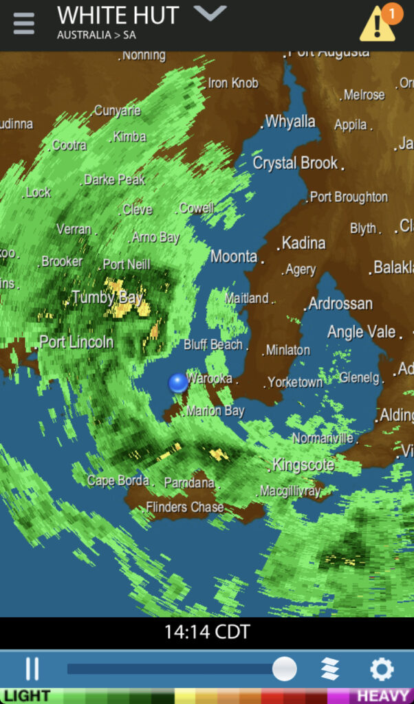
What started as a hot and humid morning, changed as though by a switch of a button, the wind picking up, swinging around to bring a strong, cool southerly storm, accompanied by showers.
We watch the radar show as the weather changes dramaticallyWe get set up just in time before the first fat heavy rain drops fallThe calm before the storm – mirror-like stillness on the water in front of our site
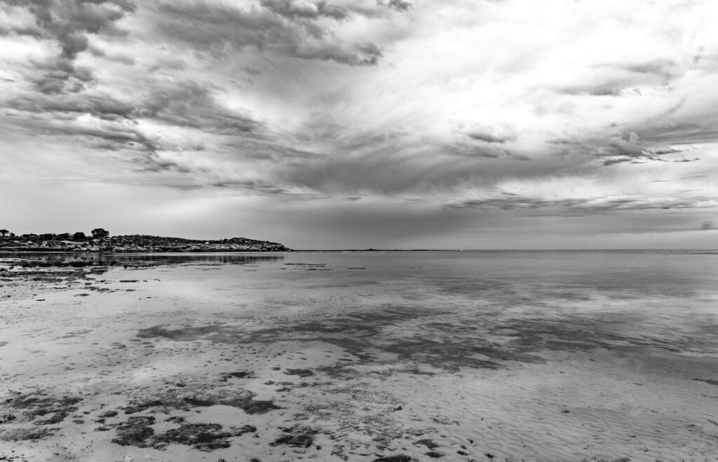
The storm soon passes, leaving us with a spectacular evening about 10 degrees cooler with an incredible sunset.
The sun disappearing behind the headlandAs the tide retreats it makes a great platform to reflect the wonderful colours in the skyLooking up the coast, a double rainbow in the remaining storm clouds And the last splashes of colour to complete our day
The following morning was cool with a fresh breeze, but it didn’t prevent our adventurous Burmese Princess from venturing out for an explore on the cliffs and dunes.
Tassie exploring
At this point we had been without any internet or phone access for five days, which may sound like heaven to some people, but when you are living full time on the road managing your affairs (and an online global support group) completely in the cloud, meant we were getting a bit nervous. Having most of our family living in the UK also meant we felt a little out of touch, hoping everyone was doing ok and keeping well.
We decided to find ourselves a town to settle down in for a couple of nights, and selected a random settlement half way up the west coast, with camping on the show ground having a full mobile phone signal. We packed up and drove to Port Victoria.
We got settled in and had a relaxing afternoon catching up on news and downloading books to read, before deciding to go out to dinner at the local pub.
Well that was a disappointment. Given it was Friday night, perhaps we should have expected it to be a little rowdy, but I guess we are out of practice with these things. It was unfortunate that a group of 20 or so men were dining there, having spent a good couple of hours downing beers as an appetiser. The atmosphere was not very relaxing. We had no other dining options, so little choice other than to eat our fresh fish and salad quickly and leave! It was probably the fastest meal out we have ever had!
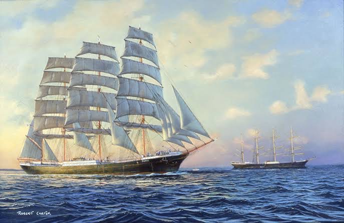
We had a look around town (a tiny settlement with a population of just under 350 people), learning it was once a huge and thriving port. Windjammers were huge multi masted sailing ships which docked here at the jetty to collect grain to be transported to Falmouth (in Cornwall, where we spent Mr A’s birthday, last year) in the UK, and Queenstown in New Zealand.
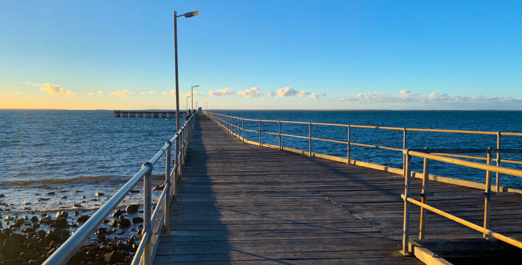
The scale of these ships is almost unfathomable- the masts towered at twice the height of the tallest pine trees in the town (image was commissioned for a postage stamp – source)The jetty still has been maintained, though is mostly used for crabbing and fishing from these daysWe suspect little has changed since the last of the ships sailed into here in the 1940s
There’s a coastal walk/cycle which leads several kilometres to an Aboriginal reserve,
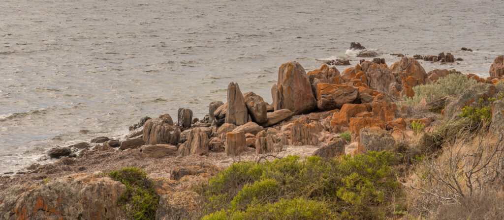
Lichen covered rocks along the coast
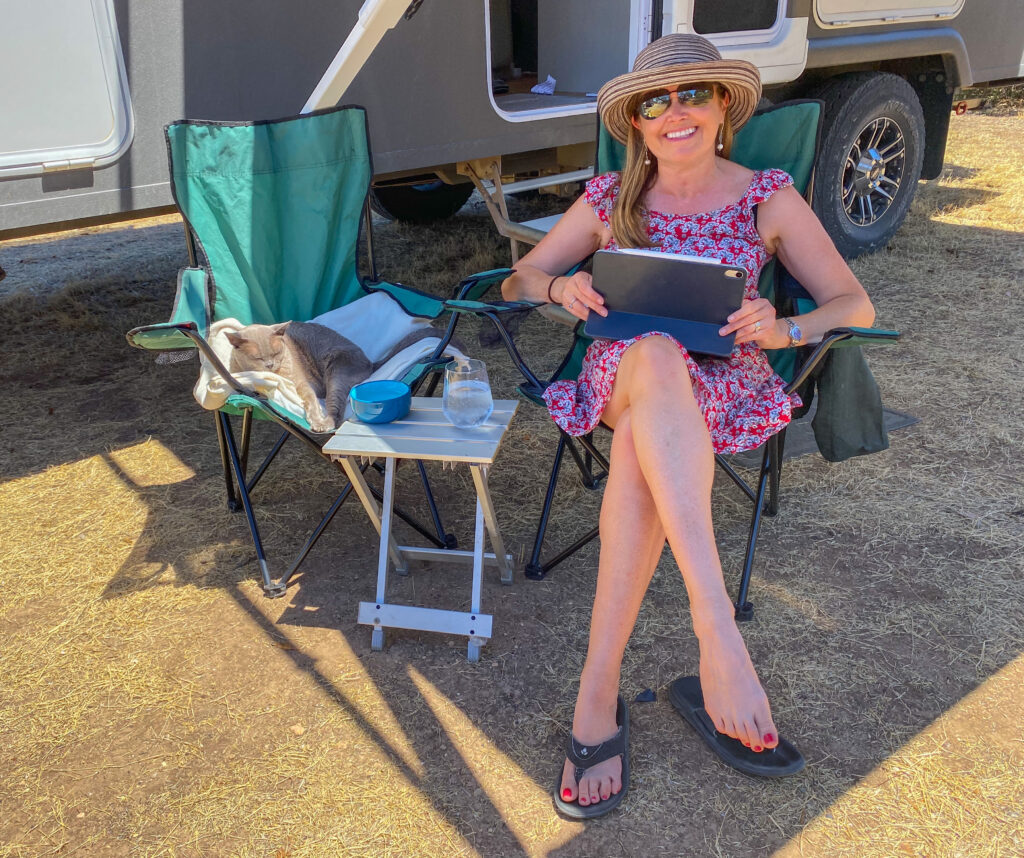
Other than a short walk, we did very little on Saturday, spending the day with Tassie, reading and drinking numerous cups of tea. A great opportunity to recharge the batteries before heading back to Adelaide for a few days.
A good ebook, a cool shady spot, a cold drink, and the company of Miss Tassie – what more could one want?
Location: Price, Ardrossan and Coobowie, Yorke Peninsula, South Australia
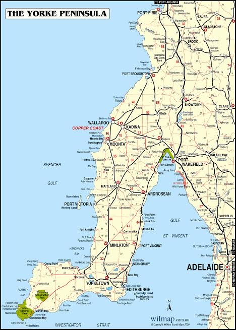
Leaving Adelaide, we drove to the Yorke Peninsula. Within an hour of Adelaide’s CBD life is so different, a flat, sparsely populated agricultural landscape, lined by salt marshes and sleepy seaside towns stretching out down a long boot shaped peninsula.
The Yorke Peninsula sits to the west of Adelaide
Europeans started to exploit it in the 1800s, mining salt, copper and gypsum, and clearing the land for agriculture. As we drove down on a grey Friday morning, the wind was whistling unencumbered across the flat landscape, making for quite a bleak yet beautiful environment. These days tourism is a big part of the region’s income, with 99% of visitors being from Australia, and 88% of these being from South Australia.
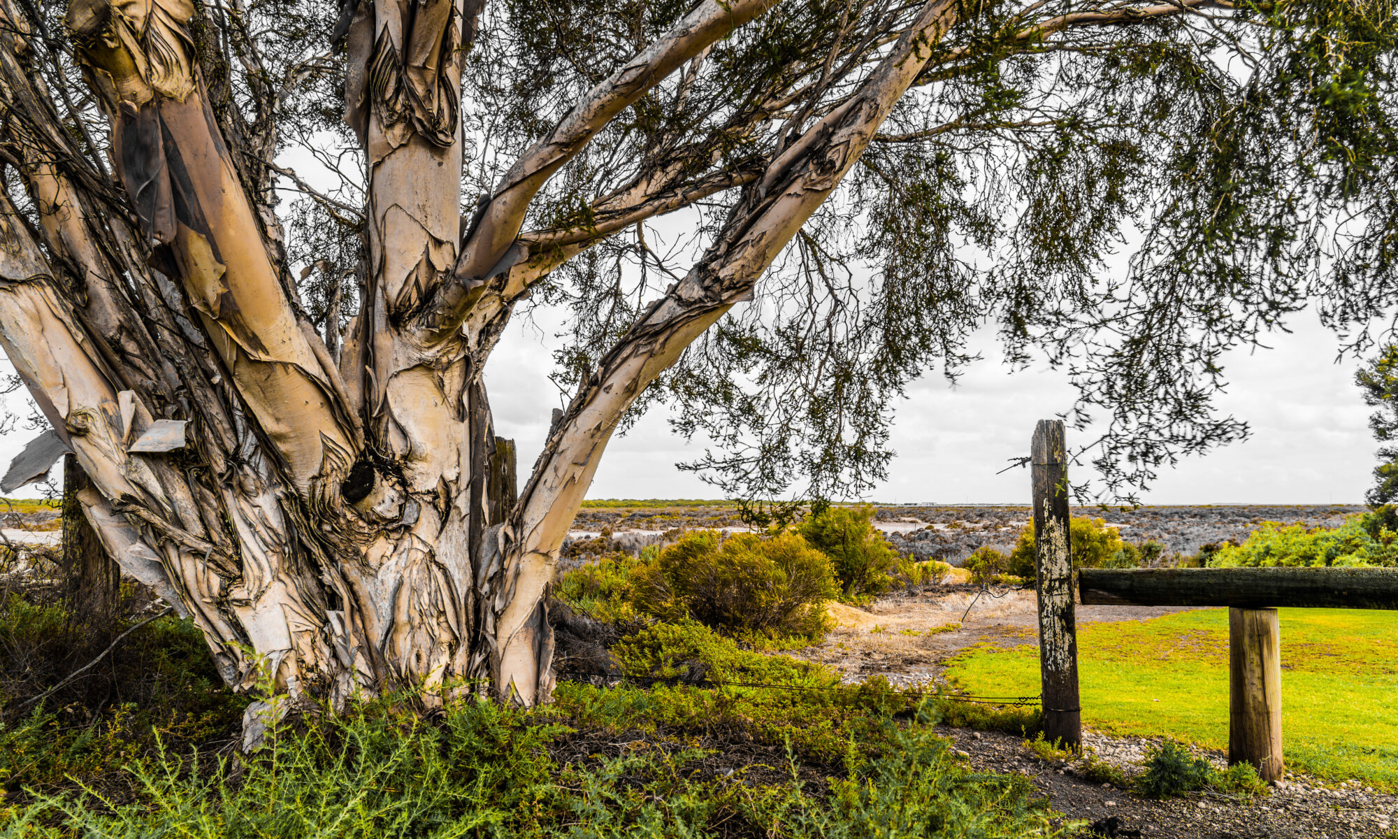
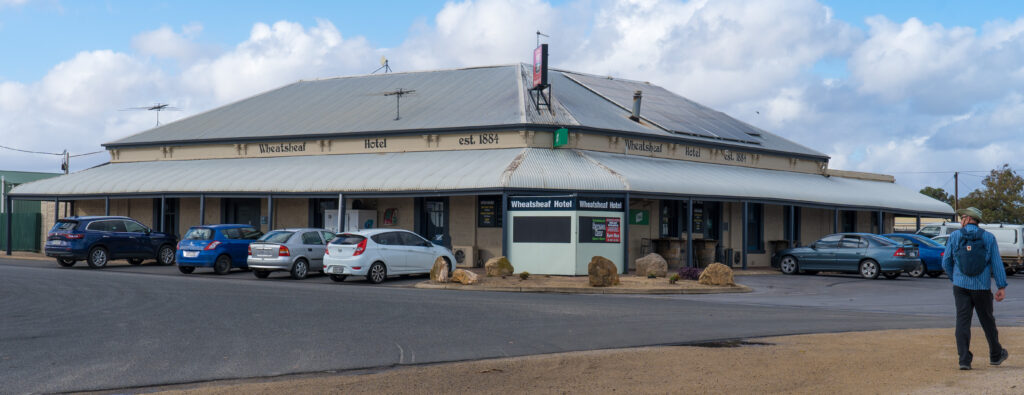
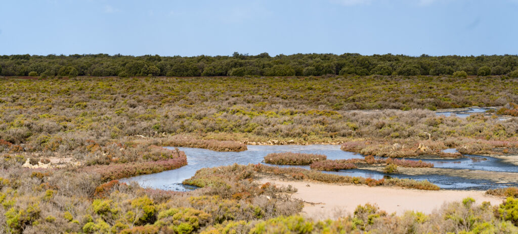
The tiny settlement of Price was our destination for the night. It sits a couple of kilometres from the coast, separated by samphire covered tidal flats. Samphire is a green succulent plant which lives in the salty water, and tastes a little like asparagus but with salty and spicy undertones. It’s apparently quite popular with top chefs around the world who are keen to integrate unique flavours in their dishes. I doubt it was on the menu at the local pub though, with strong smells of chips wafting down the street as we walked past…that plus the fact it is protected in Australia.
The Wheatsheaf Hotel est 1884 – we didn’t go in but heard the locals cackling at the end of the night!The samphire tidal flatsA paperbark tree at the edge of the samphire flats
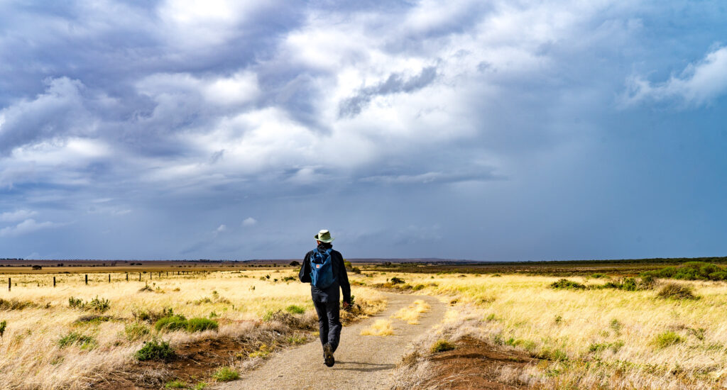
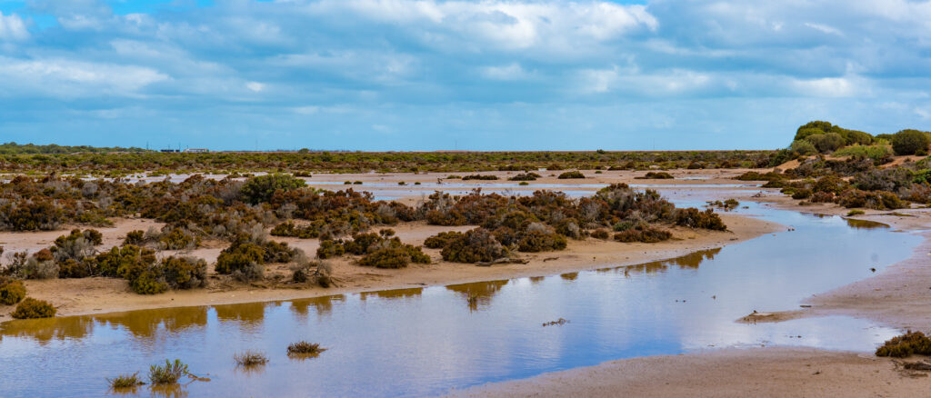
Price sits on the Walk the Yorke pathway, a 500km hike/cycleway which follows the peninsula coast, so we decided to stretch our legs along a nearby section.
Looking pretty stormy, but the worst of the weather is further north nowThe tidal flatsTough trees in these parts
The following morning we continued our journey south, stopping for a tea break and stroll at the next town of Ardrossan. Named after a settlement of the same name in the west of Scotland, the weather was somewhat Scottish, with blustery rain showers and strong wind. It did not take away from the beautiful palette of the scenery, with the coppery red clay cliffs, creamy yellow grasses and turquoise waters inspiring future paint colours.
ArdrossanStripes of colour in Ardrossan
We continued on our way, setting up in a busy campground at the interestingly named settlement of Coobowie. Meaning ‘wild fowl water’, the town is described by the tourism website as a water bird haven, a mecca for birdwatchers. We kept our eyes peeled as we did a windy walk around the coastline, spotting just the usual suspects of pelicans, black swans, seagulls, oystercatchers and lapwings. We walked along another section of the Walk the Yorke trail, but we’d suggest this segment was more suited to cycling, with somewhat uninspiring flat, straight trails.
A shallow harbour – this boat was going nowhereA Singing Honeyeater captures our attentionThe tides go out a long way hereFeeling windblown on the beach
It was a lovely peaceful stopover. The following morning, Sunday, we packed up and continued down the coast to Hillocks Drive, a private property offering bush camping just north of Marion Bay, where we were to be joined by our friends Kim and Mike for a few days.
Location: Lobethal, Adelaide Hills, South Australia
After our cycle ride through the Barossa we farewelled Lindsay and Phil and drove across country to the small town of Lobethal in the Adelaide Hills. We parked up on a reserve beside the house of our friends Ali and Andy.
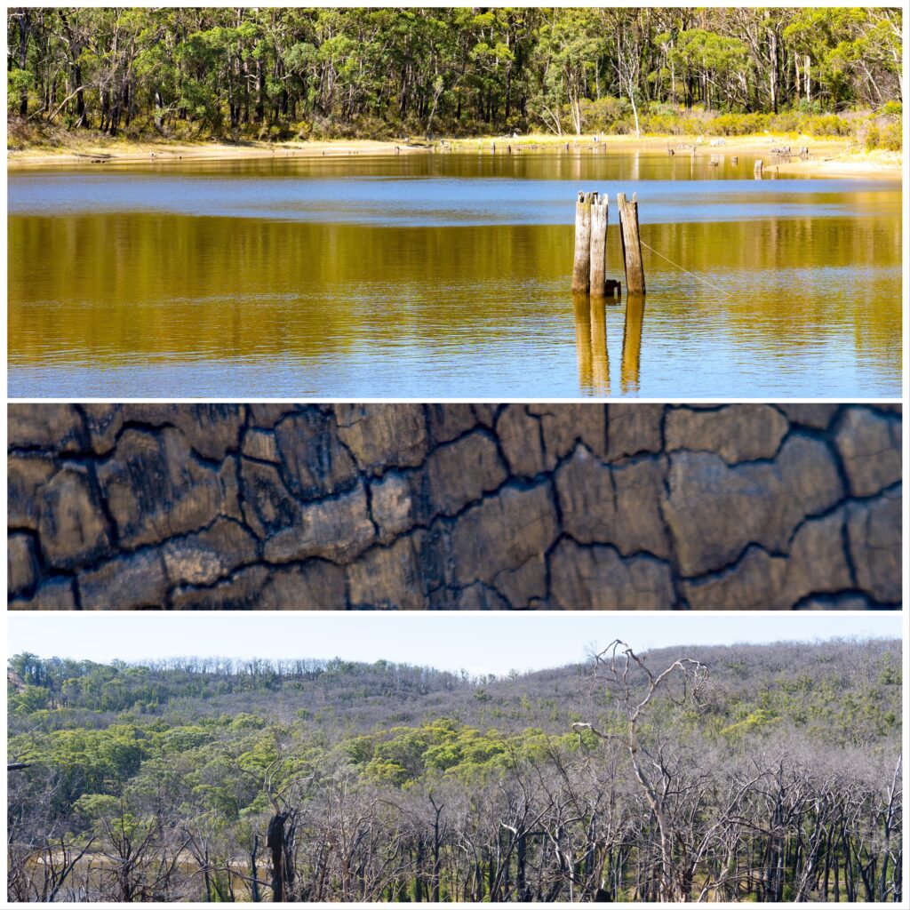
Lobethal went through a terribleexperience in December 2019 when a catastrophic bush fire swept through the region surrounding the town. Many properties, vehicles, livestock and pets were destroyed in the event, but fortunately there was only one human life lost, a credit to the fire fighters’ efforts. That period is now known as the Black Summer.
Our friends were thankfully some of the lucky ones, and despite the flames reaching land just 150 metres away, their house remained undamaged. I am certain the memories of the flames and smoke billowing at all too close a distance will be with them for a while yet. After a couple of nights staying here we noticed a light dusting of very fine black ash sprinkled around our white Zone caravan surfaces, a constant reminder that is whipped up with the slightest breeze.
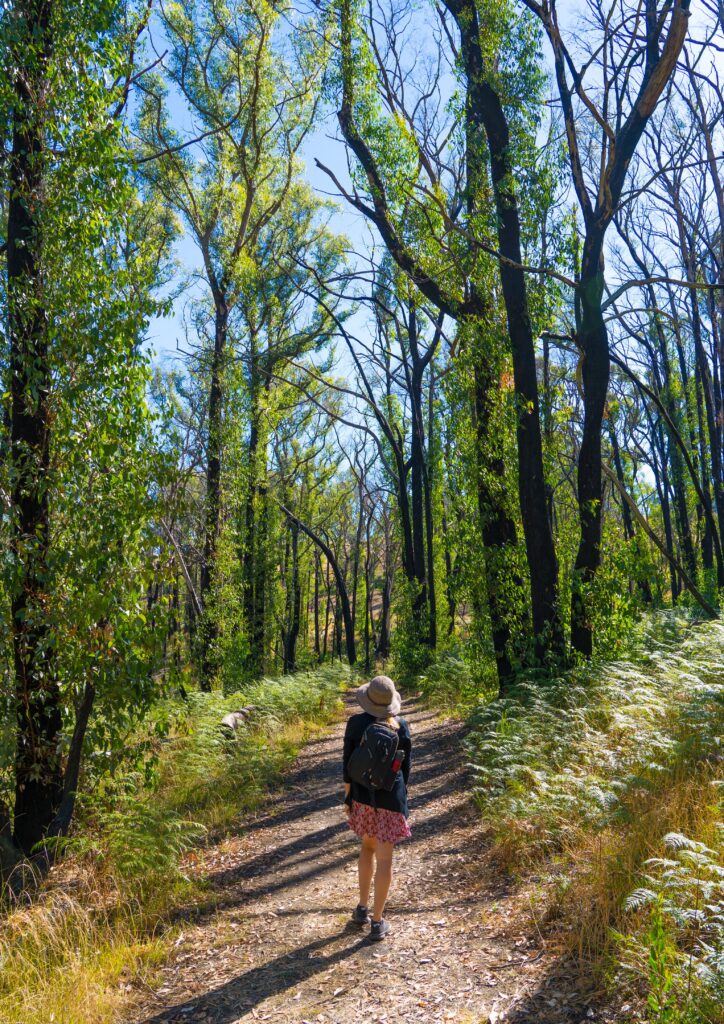
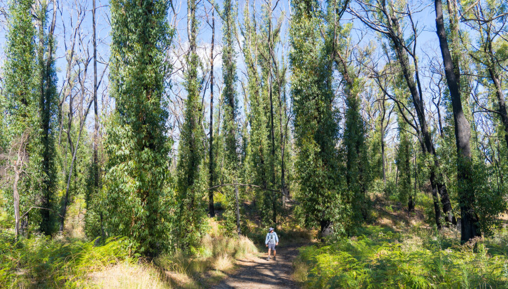
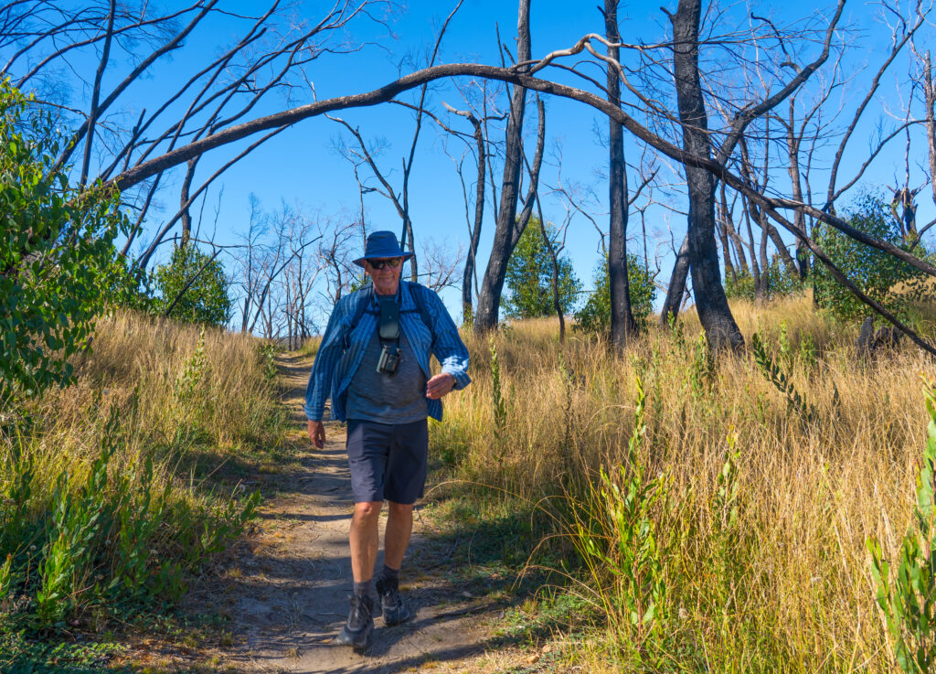
During our stay we noted that much of the surrounding forest is gradually recovering, with many of the trees covered in epicormic growth – new leaf cover and branches emerging from buds set deep within the tree’s bark. Bushland Park sits on the outskirts of Lobethal and was pretty hard hit by the fires. Not all the trees were able to rejuvenate, but many are covered in green 13 months later. We spotted a kestrel soaring above us, rosellas, honey eaters and wrens in the trees, it is clear that life is starting to return.
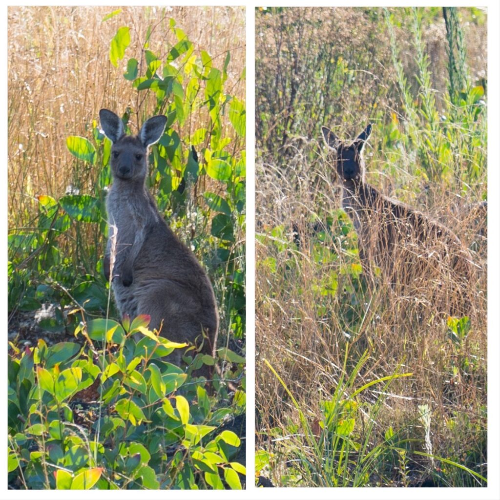
The new growth, where it happens, occurs up the length of the trunks and branchesPatches of surviving trees are surrounded by those that were engulfed by the flamesIt was originally thought these leaves were too toxic for surviving koalas to eat, but apparently they can cope quite well eating this. We saw no koalas on our visit.A couple of kangaroos watch us, totally still and well hidden in the undergrowthMr A walks down a path where the trees did not survive the flames – perhaps too young to cope with the heat and damage they sustained
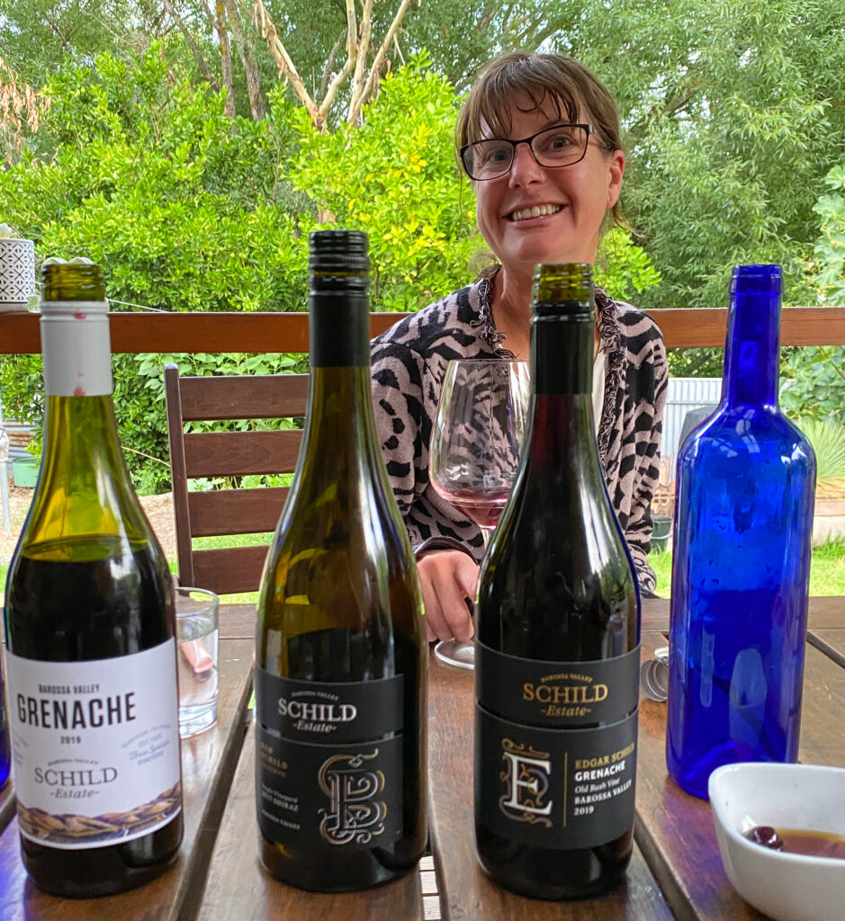
The Adelaide Hills district is full of award winning wineries, but we decided to miss out on the wine tasting this time. Instead we were treated to several outstanding wines from Ali’s workplace in the Barossa Valley, Schild Estate. Rated by wine critic James Halliday as five stars, the drops she shared from here were spectacular…of course we have placed an order!
A small selection of our tastings
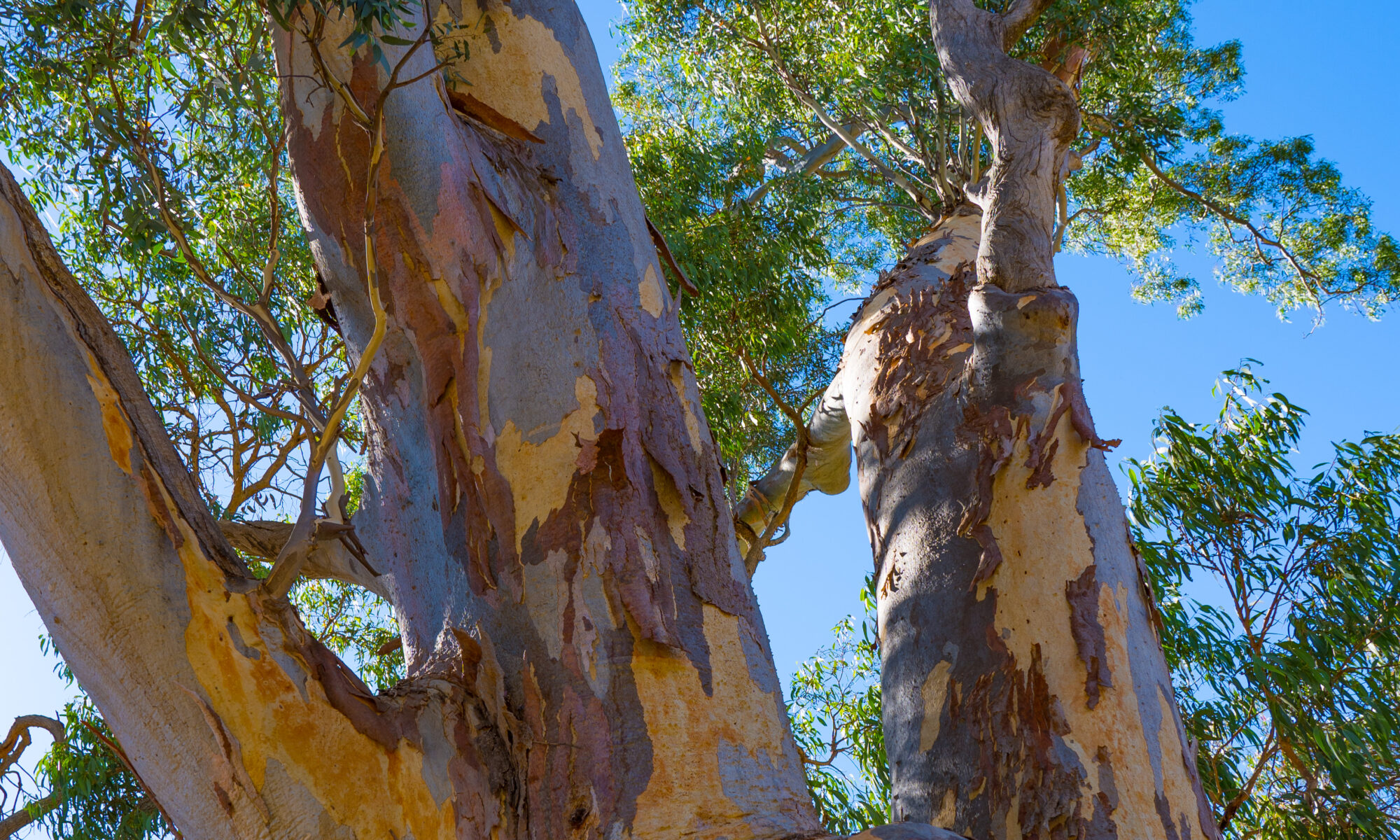
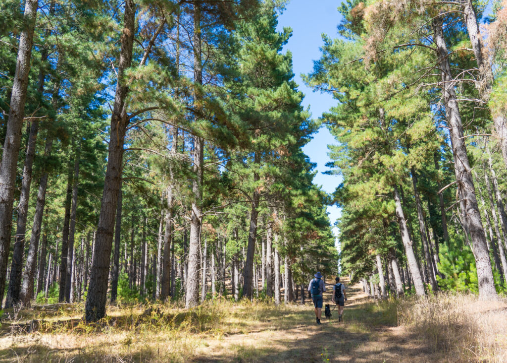
The temperatures had cooled to the mid 20s so it’s perfect hiking weather. Ali took us off to explore some local favourites. Mount Crawford Forest, a sustainable pine plantation intermingled with native gum trees was just 15 minutes drive away, offering picturesque and fairly flat walking with many native birds and a few nervous wallabies.
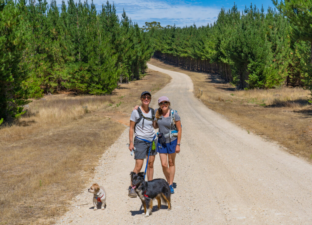
Ali, Mark and dogs Harry and Harvey stroll up a shady avenue between the trees. Crispy, dry grass and gumtrees on the border of the plantationAmazing colours of a river red gum tree’s bark, almost like a paintingI used to babysit this young lady! We’ve known one another for about 37 years now…
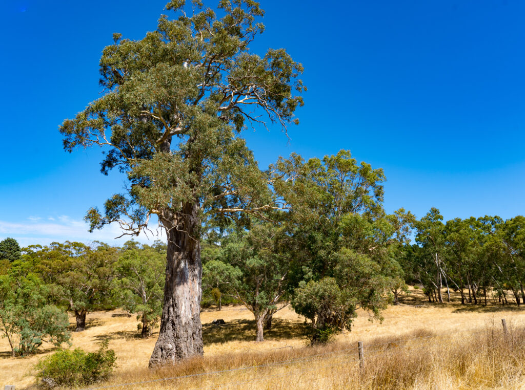
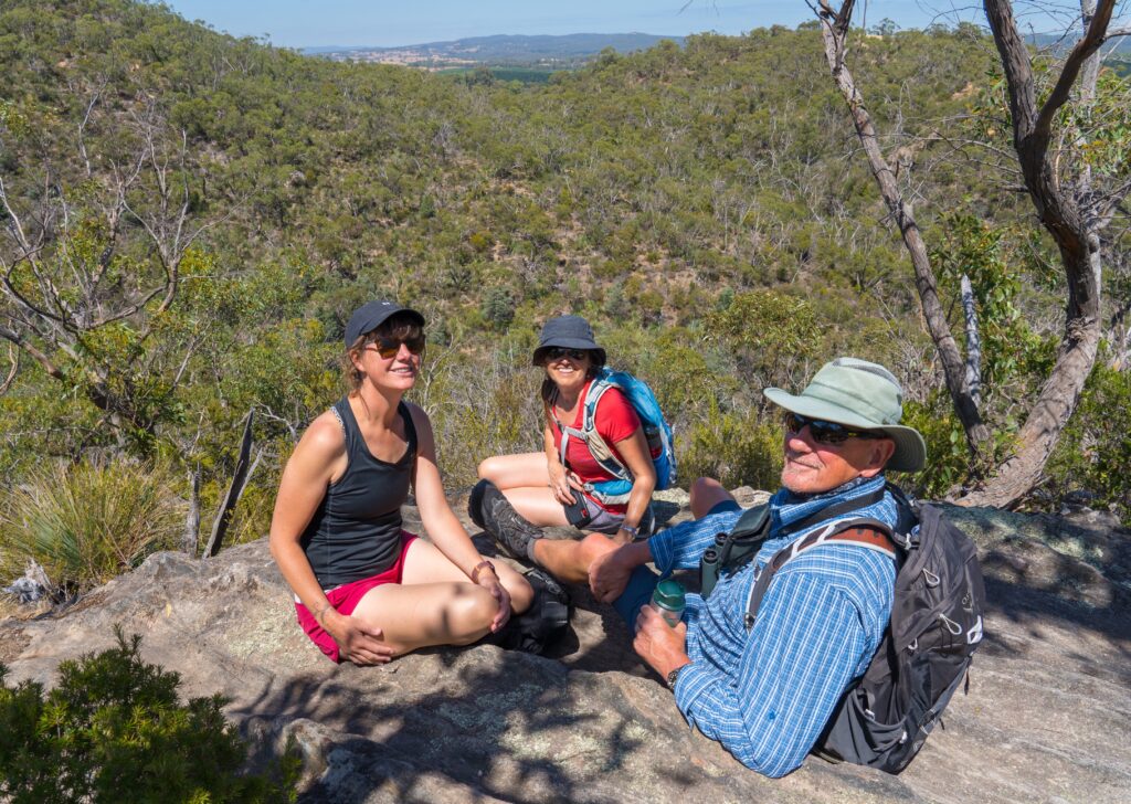
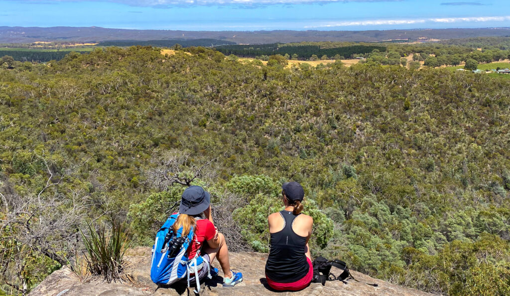
Hale Conservation Reserve was the location for another short walk, which packed a punch with it’s multitude of viewing points across the South Para Valley.
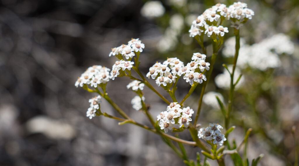
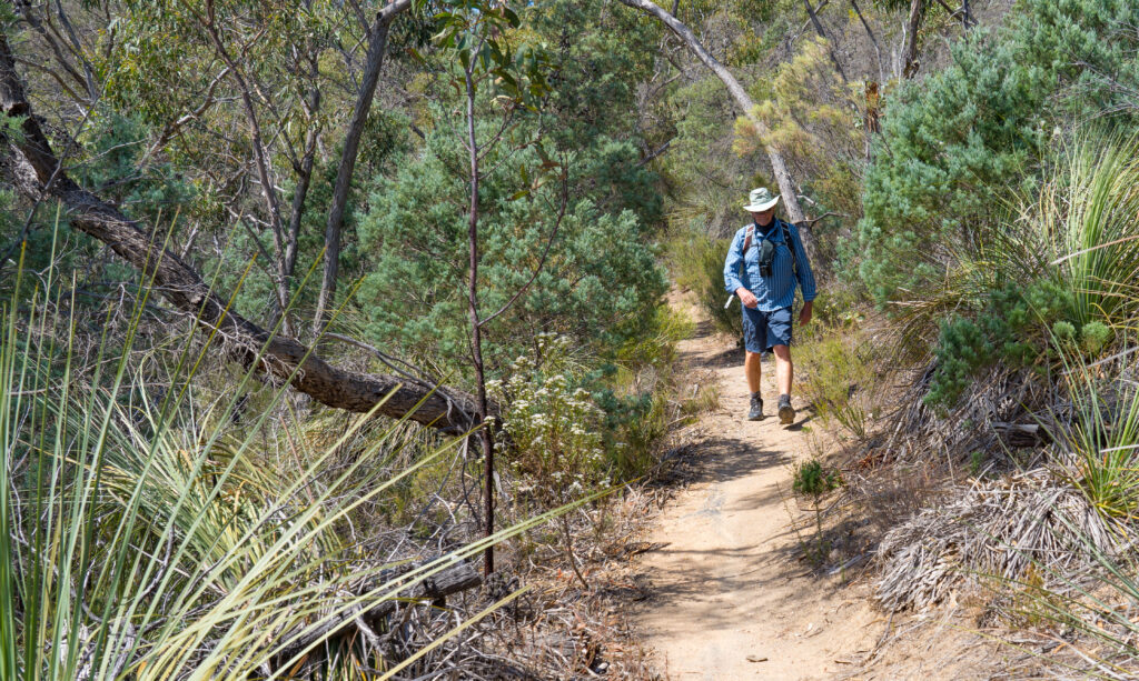
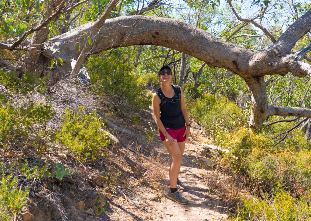
Hardy bushland flowers survive here despite little rainfall and poor soilsHiking up a dry dusty pathWatch your head! The trees have plans of their ownA perfect rock to enjoy the quintessential Australian bushland view – glimpses of scorched earth amongst the scrub and eucalyptus treesIt’s a short walk (just over 4km) but we find a few opportunities to sit down and enjoy the landscape
It was a great walk – only spoilt at the end for me by an angry bee which chased me around the carpark trying to sting my face, eventually getting me on the wrist – ouch!
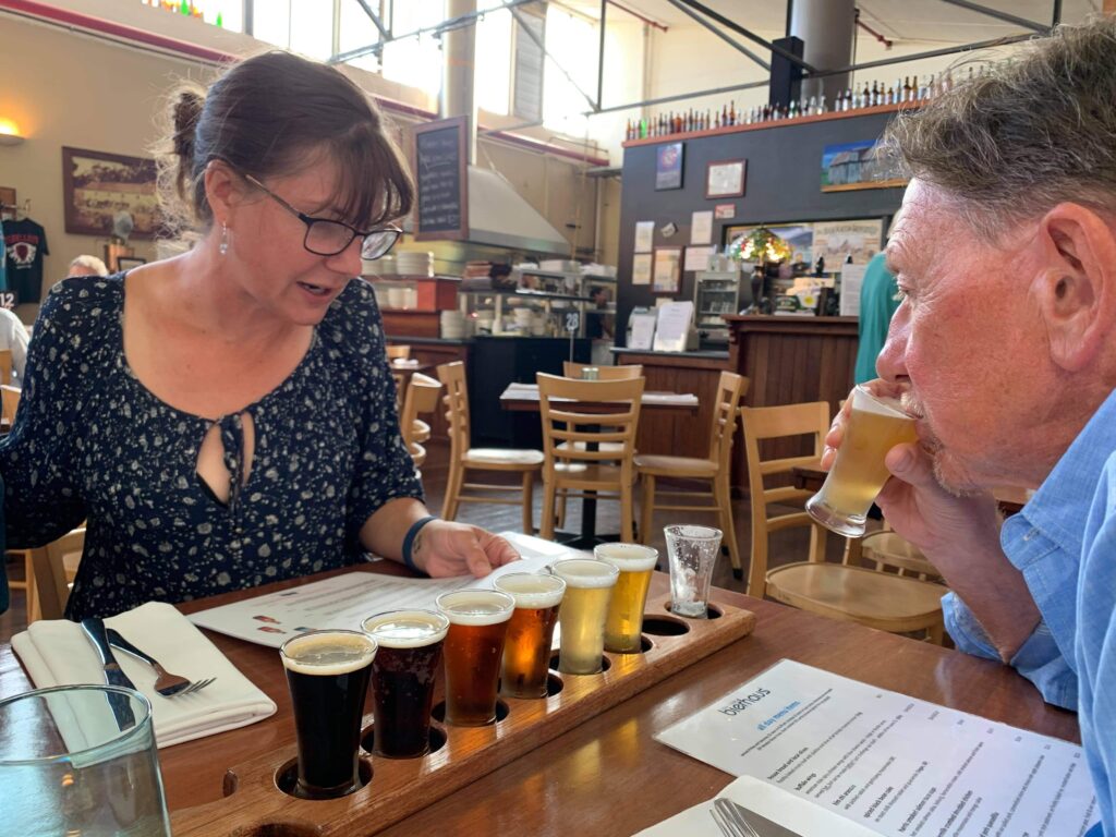
We enjoyed one night out at the local bierhaus for some beer tasting and delicious food. If you’re nearby, pop in for a plate of their hot wings – incredibly moorish!
Beer tasting flights are on offer here
Friendship, fine wine, fresh food and walking in the crisp clean air. All in all a lovely stay with a great family.
Seeing friends and family around the world still locked down and unable to spend time with their loved ones certainly makes us feel all the more grateful for being able to travel and enjoy a meal and drinks with friends.
South Australia has no current community cases of COVID-19 but we are all too aware of how this can quickly change. We will continue to make the most of the freedom Australia’s strict quarantine has afforded us and hopefully those trapped at home can travel vicariously with us….we hope you enjoy the journey!