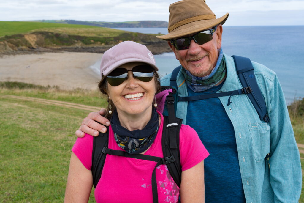
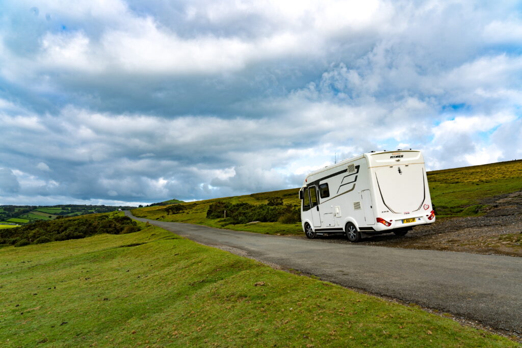
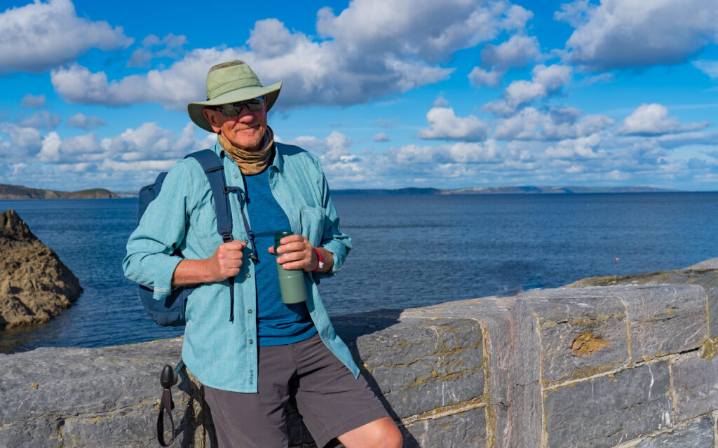
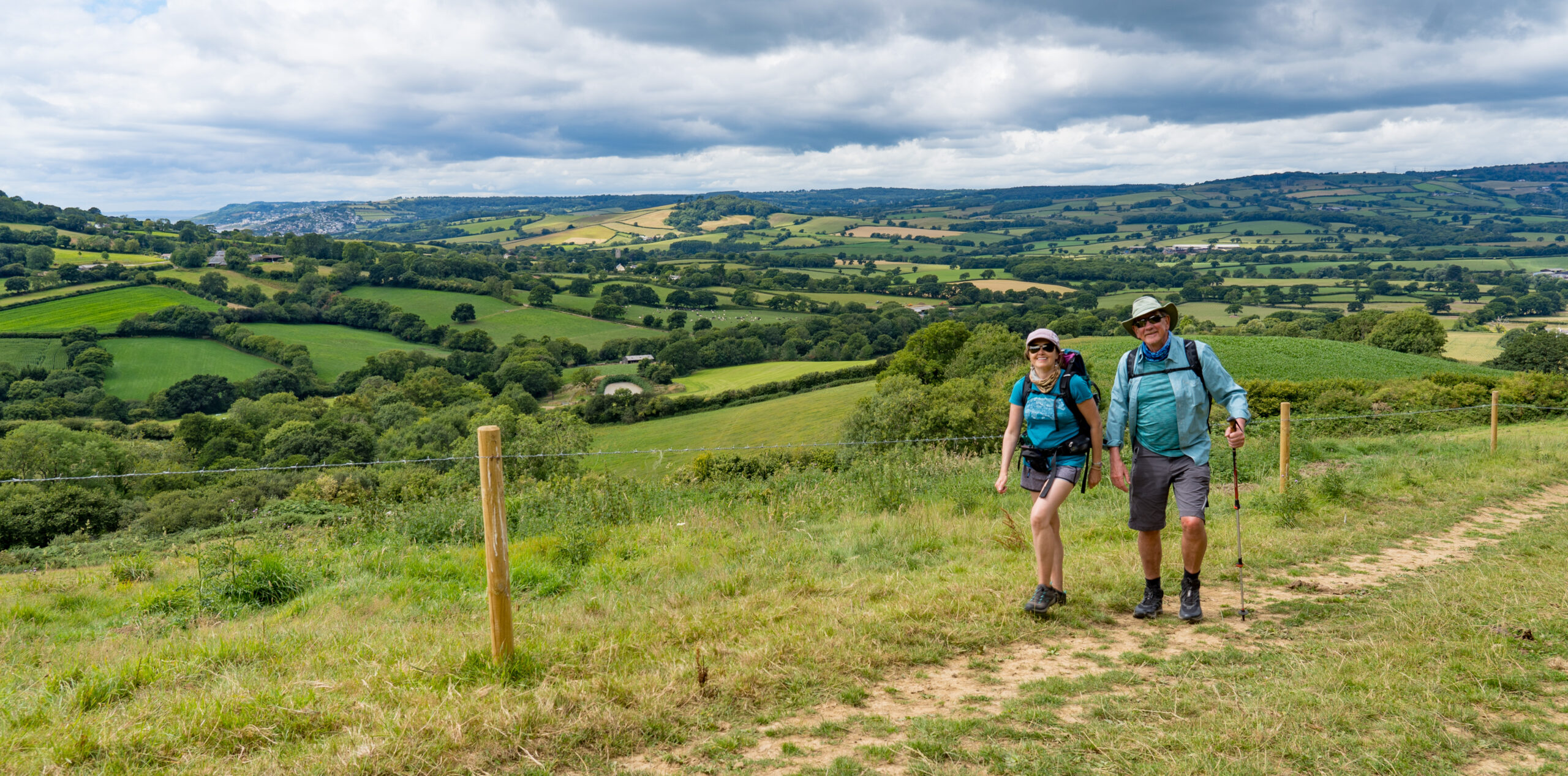
All was going so well. We were packing up camp like we so regularly do, me tidying and locking things away inside, while Mark was busy on the outside, putting away the eye mask and filling up with water as we were planning to park at a pub that night, with no facilities. He called out for me to check how full the tank was. “50%” I called back….Mark looked at me quizzically, “But it’s overflowing…..” It was at this point his face dropped, as he realised what was happening. He’d mistakenly inserted the water hose into the diesel tank.
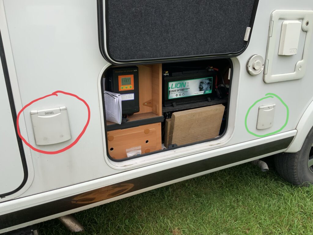
The two flaps look quite similar…except one says ‘Diesel’ and one has a picture of a tap and water….
All the colour drained out of Mark’s face, and I quickly jumped on to the Hymer Owner’s Group on Facebook to see what was recommended – I correctly assumed that this mistake had been made by others. The advice was as follows:
Do not turn on your engine
Call a specialist to drain the tank – Google ‘Wrong Fuel’ – there are plenty of companies willing to take your money!
Replace your fuel filter – especially where water is involved – the filter is made of cardboard!
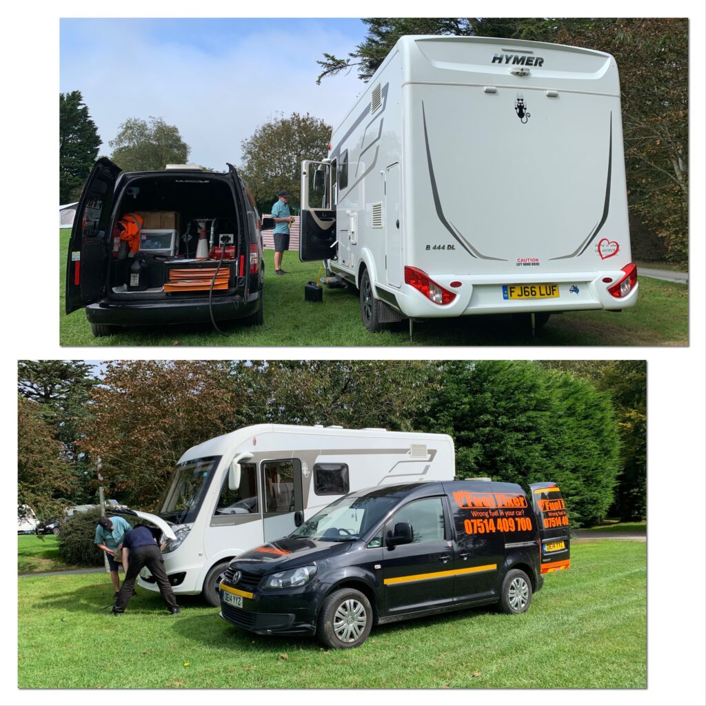
Mark made the call which was answered by a very sympathetic lady who for the price of a kidney would immediately send out someone to help. We had to agree, and within two hours our tank-cleaner was busily draining us of water and diesel, and popped in a few litres to get us to a fuel station to fill up.
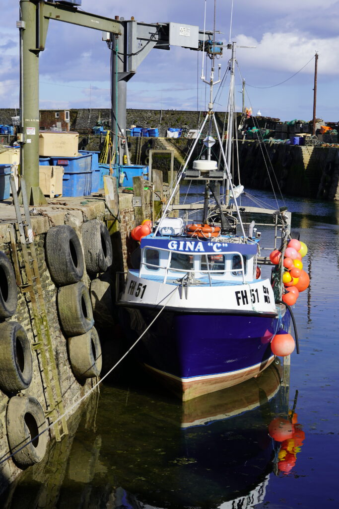
Getting the last drops of water out of the system
Thankfully all the water had been pumped out and Truffy ran like clockwork. A few hours late and slightly less money in the bank, we headed off on our way towards our next destination, Tintagel.
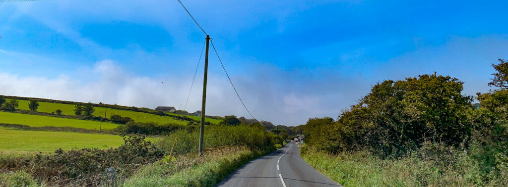
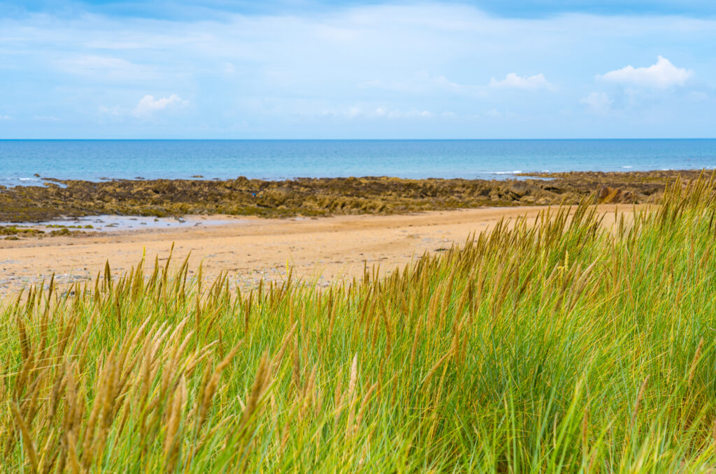
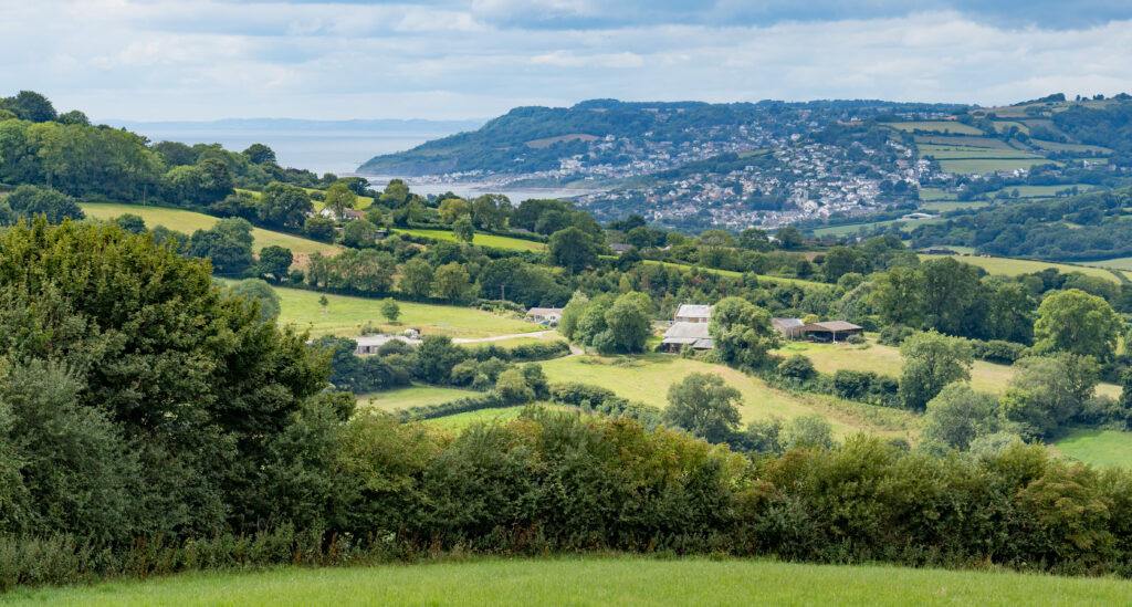
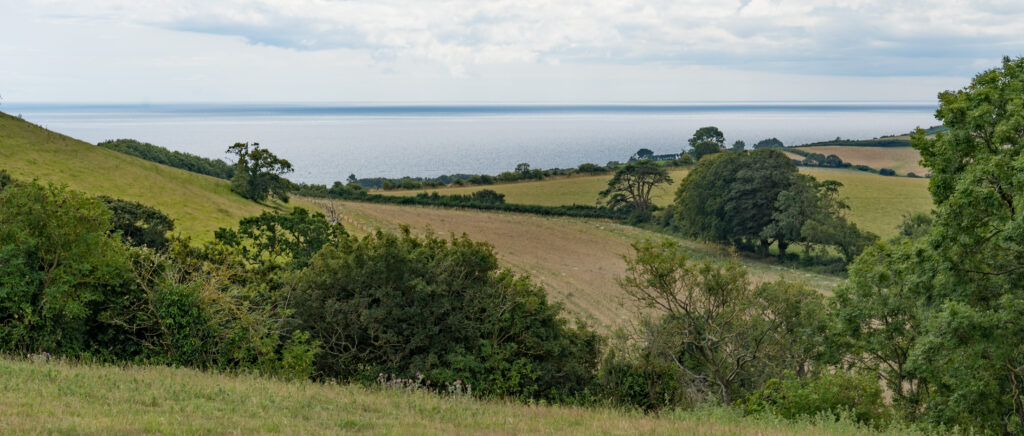
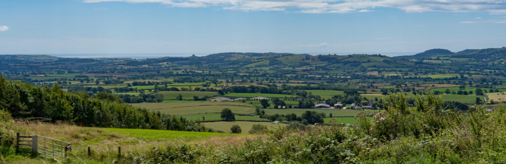
As we approached Tintagel we could see a grey haze on the horizon. From my childhood living on the Sussex coast I could recognise it as sea fog. I remember playing in the sunshine in the garden and mum suggesting we catch the bus down to the beach…only to arrive in thick fog and temperatures several degrees lower than those we left.
Our first glimmers of fog on the horizon as we drive towards Tintagel
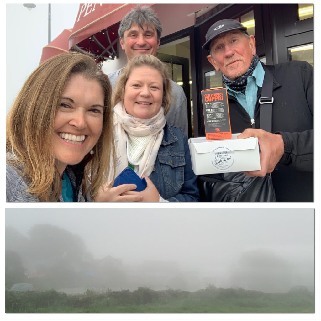
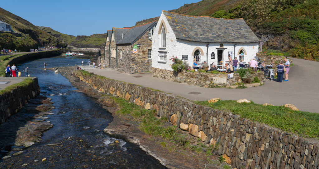
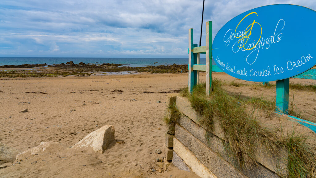
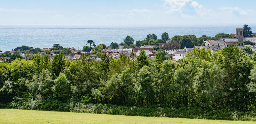
Arriving in Tintagel, indeed it was. Fog so thick you could hardly see across the road and chilly temperatures that encouraged us to ditch the shorts and pop on long trousers. It didn’t matter to us though, we were meeting my friend Kelly (she also has subglottic stenosis) and her husband Patrick.
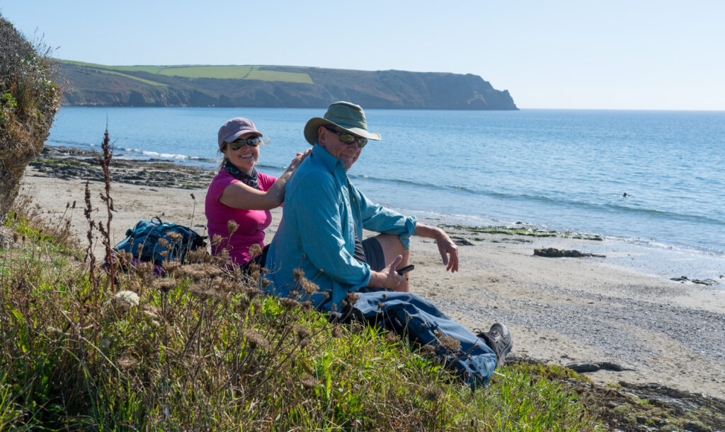
We enjoyed a lovely pub lunch, Mr A allowing a pint of beer to help him calm down after the stresses of the morning, before having a walk around the village. Kelly kindly treated us to a Cornish cream tea – scones, cream, jam and black tea to enjoy back at Truffy. Fabulous!
Cream tea and fog!
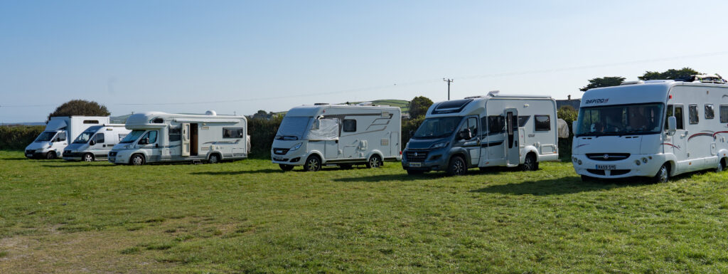
We stayed overnight in the car park, waking up early to the sound of wind. When there’s wind, that means there cannot be fog…and indeed, we had a perfect morning!
Truffy and his overnight friends
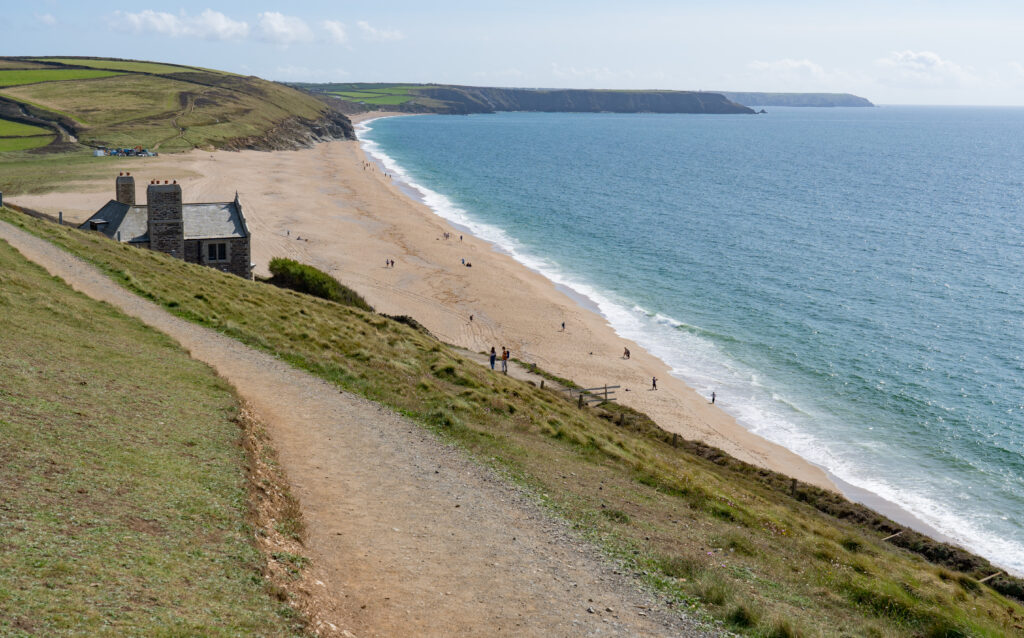
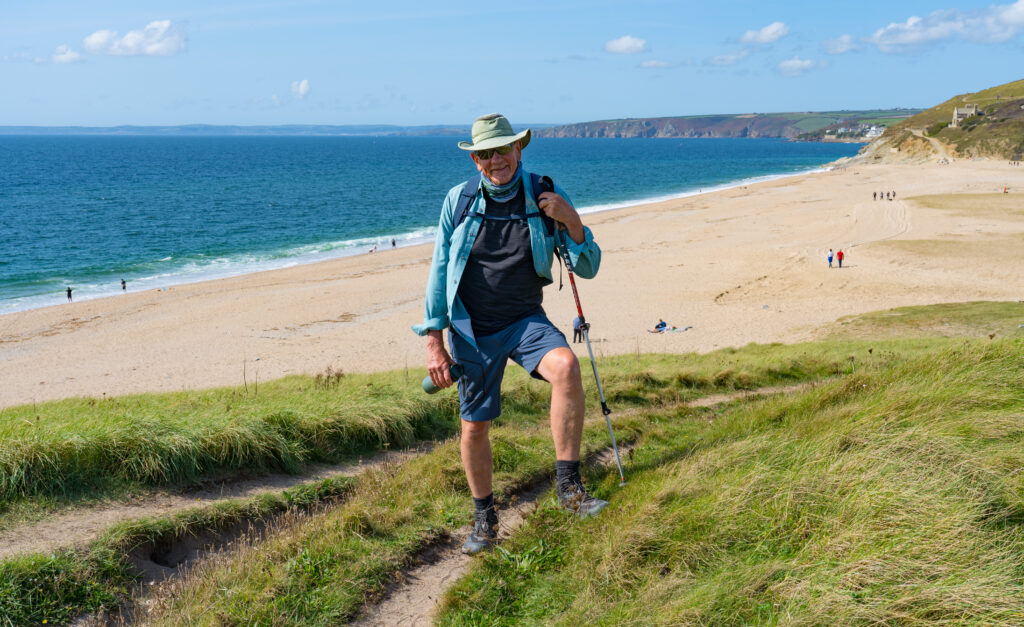
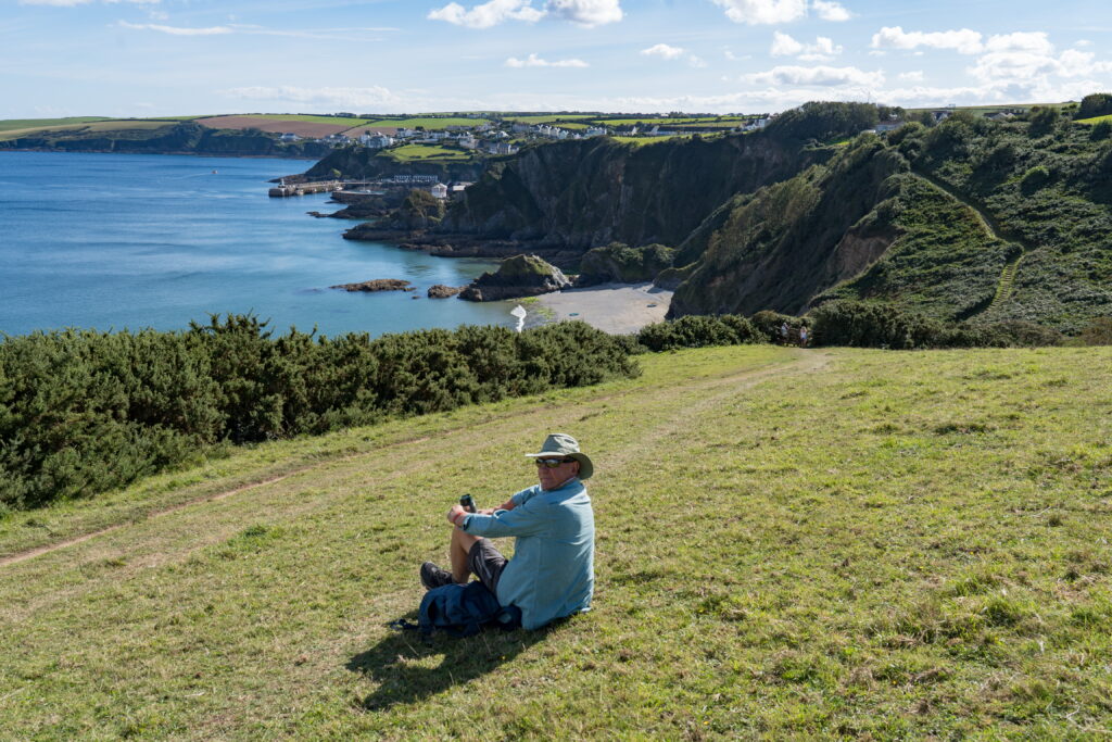
We were eager to see Tintagel in the sunshine, knowing we had to leave by lunchtime to drive up to Somerset to have a new fuel filter fitted in the morning. We were off out exploring by 7.30am – mug of tea in hand, beating most of the tourists (Strava link).
The village of Tintagel dates back to possibly the year 700, at which point there may have just been a castle there on the cliff, but there are also many clues to previous lives nearby with Bronze Age barrows and Iron Age hill forts in the district. There are many legends relating to King Arthur and the wizard Merlin, including one that suggests King Arthur was conceived in Tintagel. Of course that means there are a handful of magic crystal shops and other tourist traps to avoid.
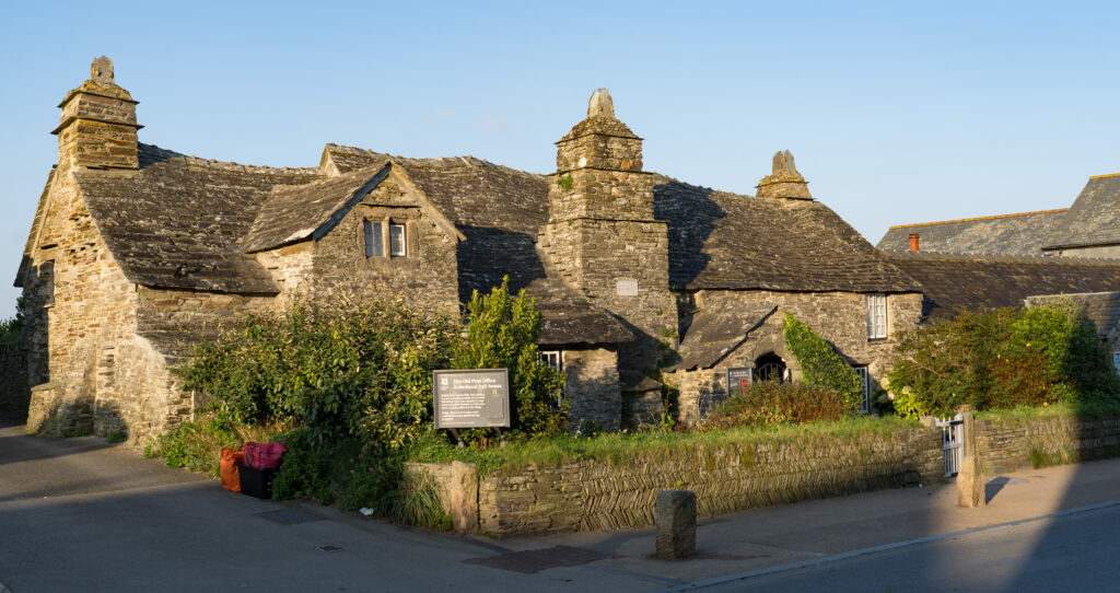
In the main street is the Tintagel Post Office which dates to the 14th century.
This stone building with its old sagging roof is Grade I listed and owned by the National Trust
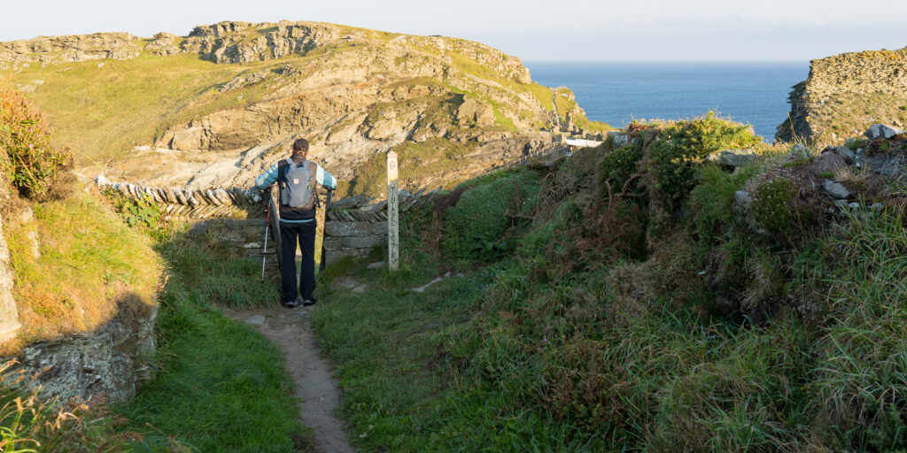
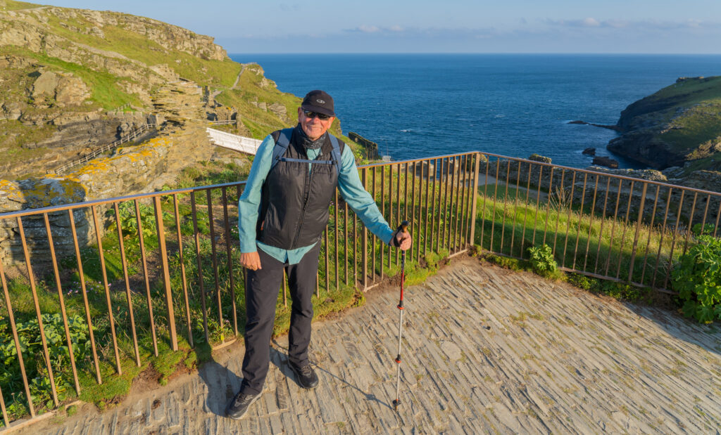
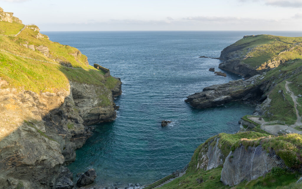
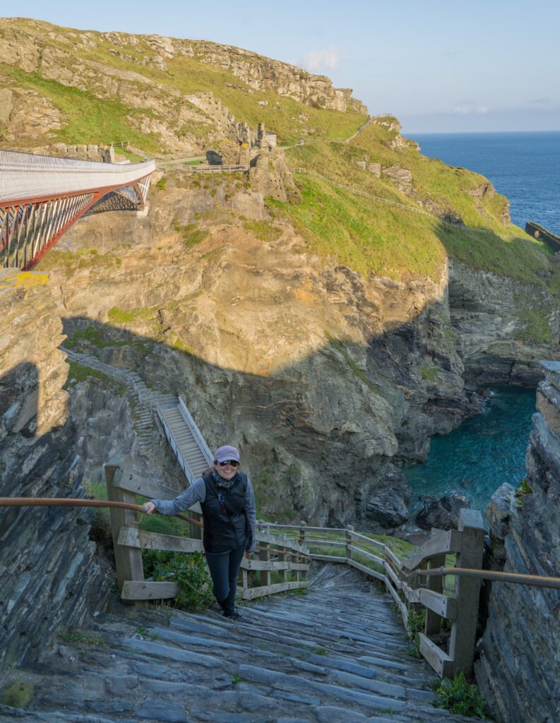
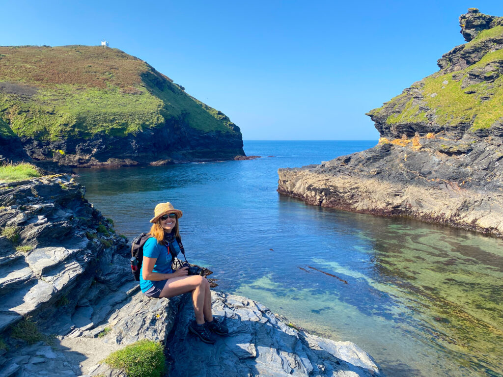
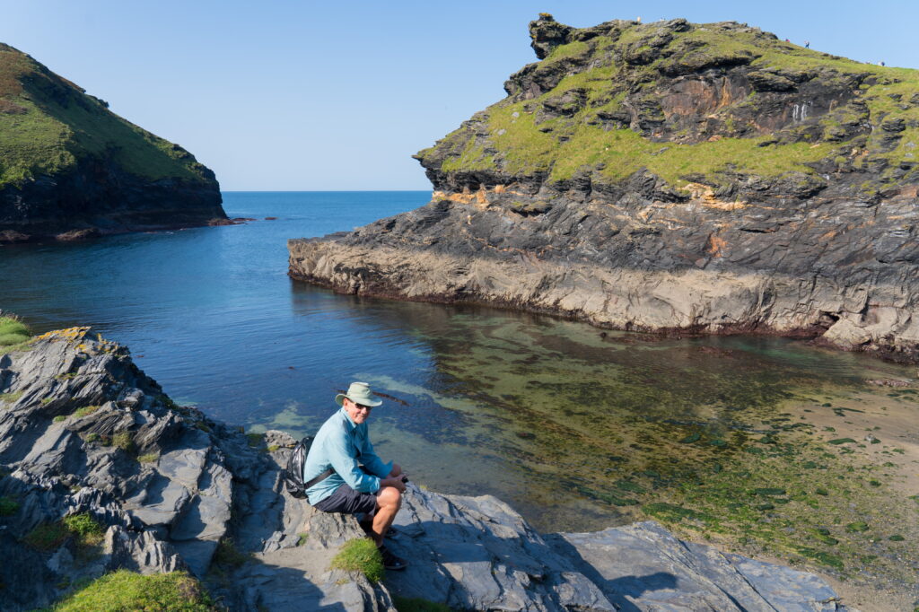
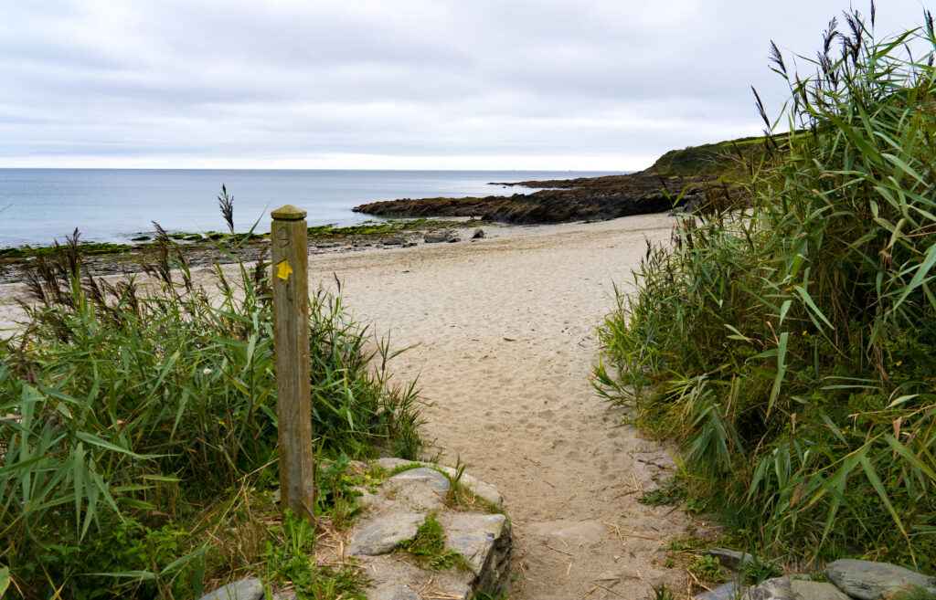
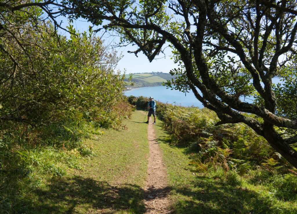
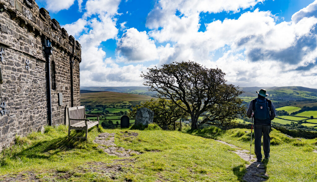
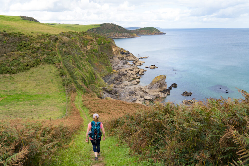
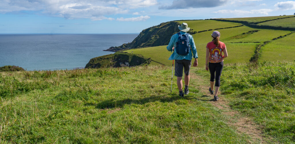
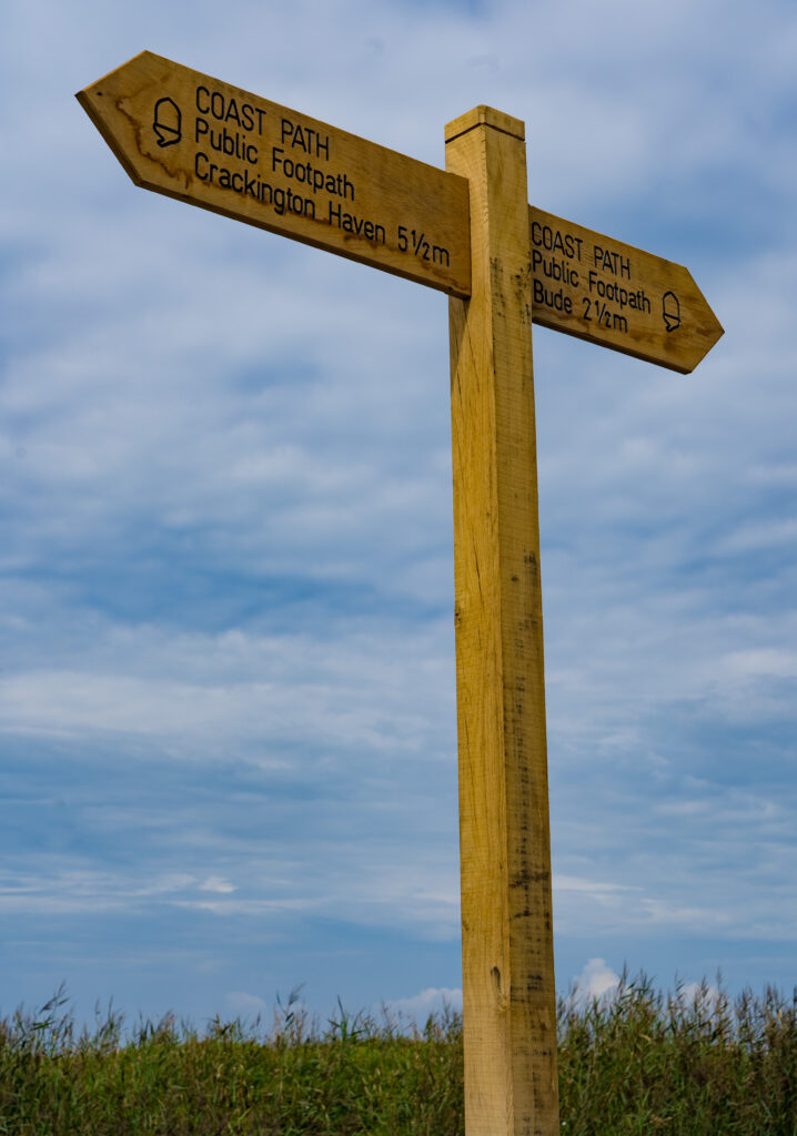
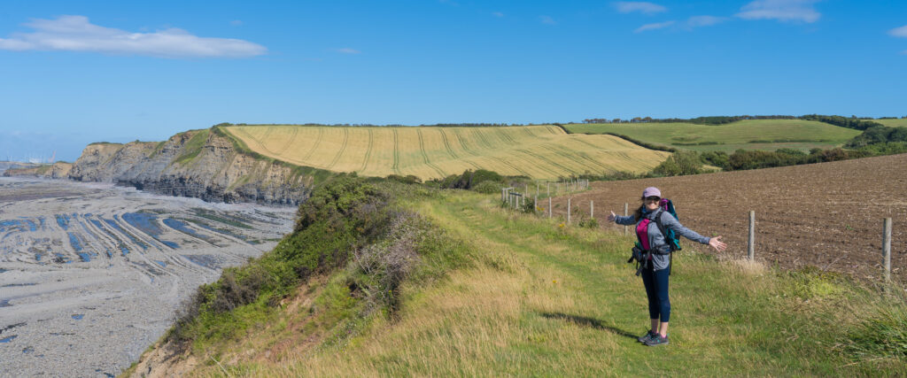
As we walked down the street we saw a familiar sign, pointing us to the South West Coast Path and Tintagel Castle. We followed a trail to the cliff tops.
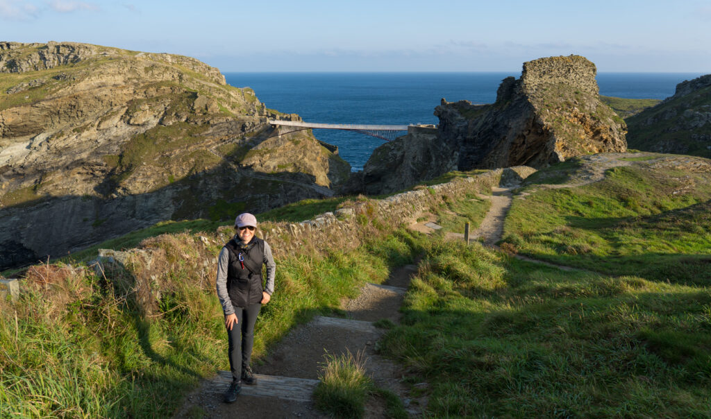
The light is so pure on this sunny morningWe reach a lookout near the castle ruinsTintagel Castle (in the background on the right) is in a similar state of repair as Hastings CastleThe view out to sea from within the castle wallsThere were some people snorkelling down below in this bay…brrr…..A bridge takes visitors over to what is now an island, but when the castle was built was land. We were too early to visit
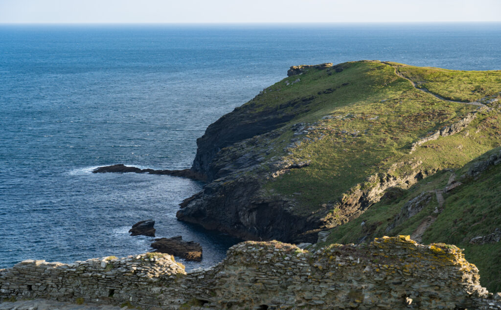
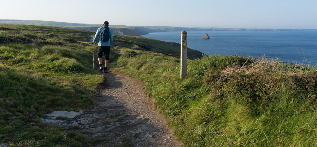
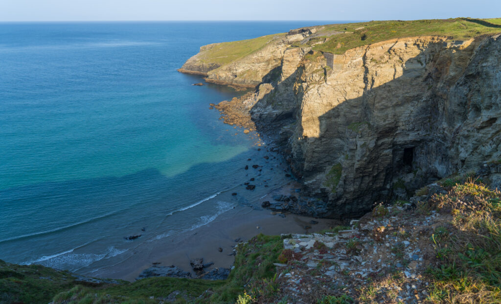
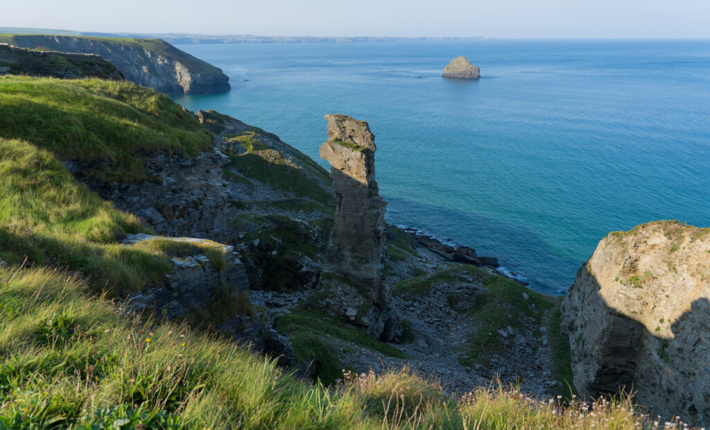
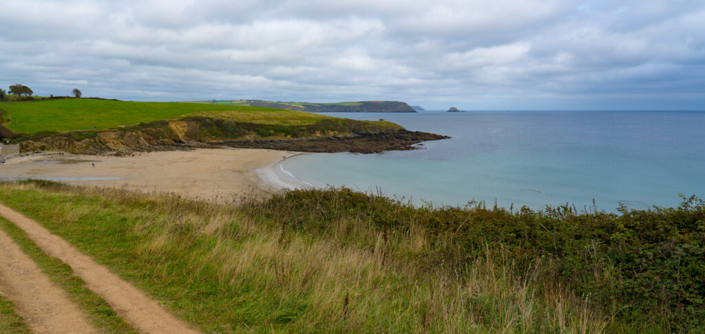
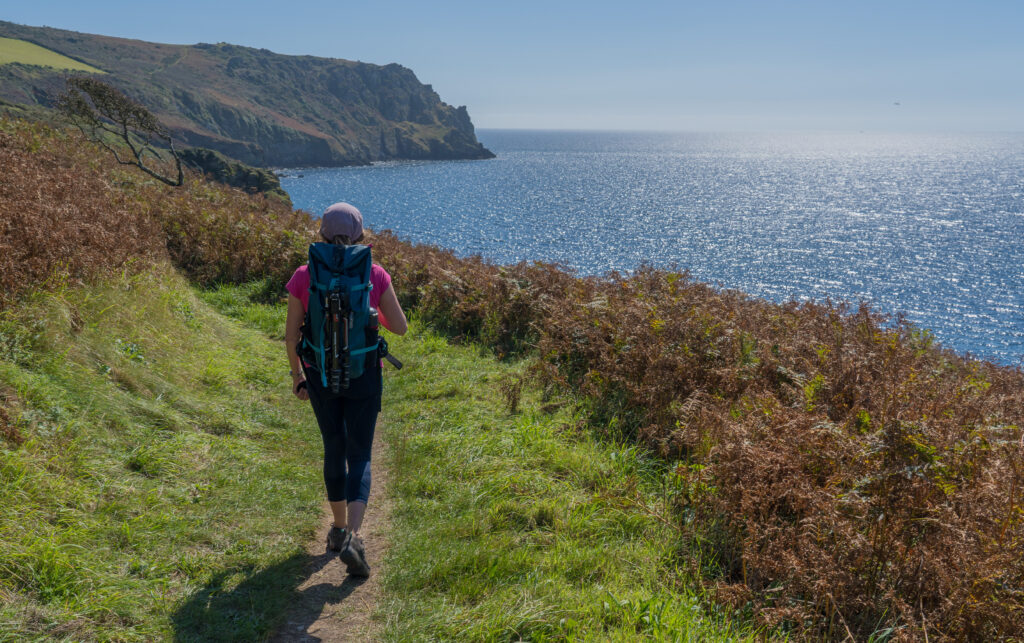
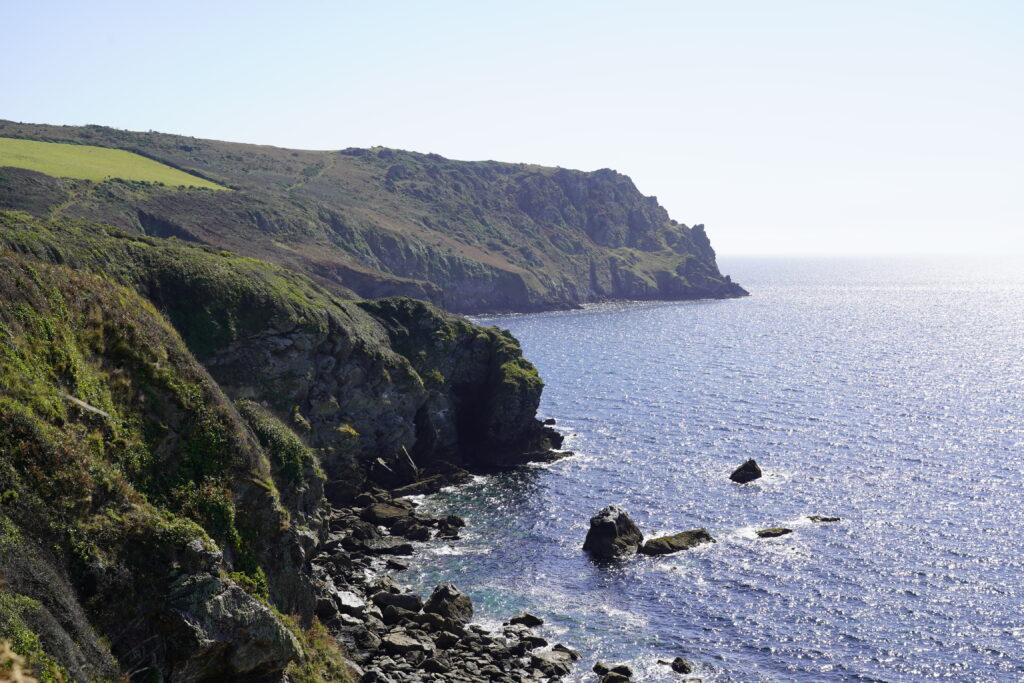
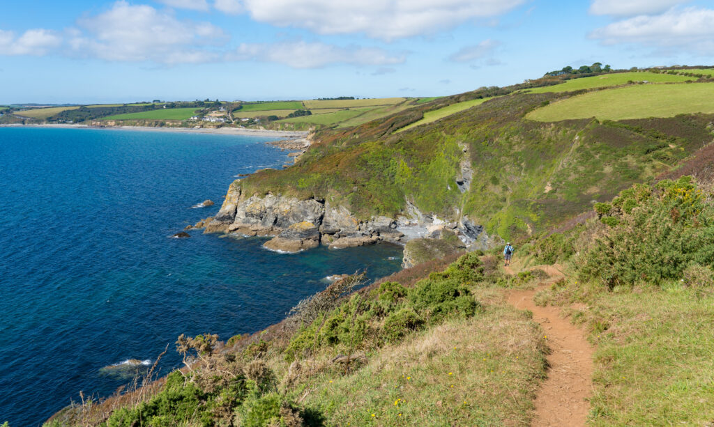
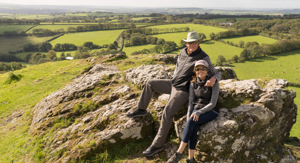
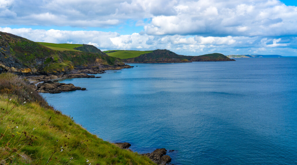
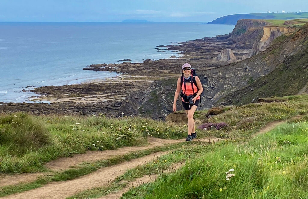
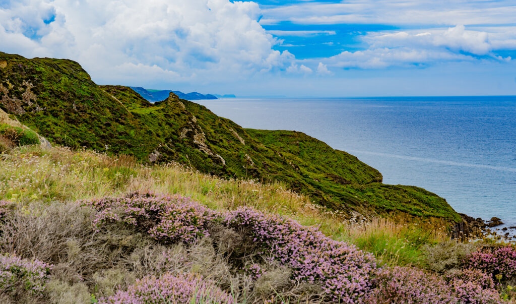
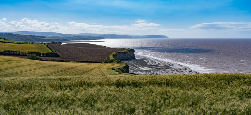
We decided to follow the coast path south for a few kilometres, the views along the coast continuing to be spectacular on this sparkling morning.
A stunning vista awaits usThe rugged North Cornwall coastlineSecluded little bays and enticing cavesCoastal erosion had left this sea stack
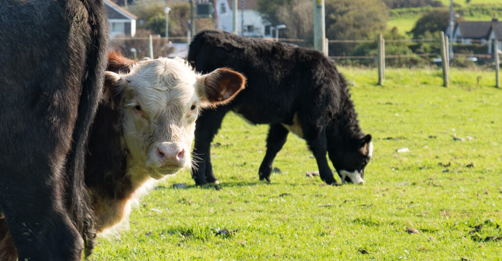
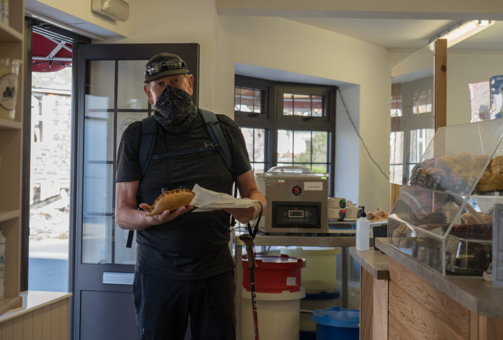
We looped back to the village across the fields, calling into the bakery Kelly had taken us to. There we purchased a proper (and incredibly delicious) Cornish Pasty to share for lunch. Delicious!
A curious calf looks out from behind mum as we walk through her fieldOne Cornish Pasty (traditional) coming up
After our very tasty brunch we moved on a short way up the coast to the small settlement of Boscastle. Boscastle was in the news back in 2004 for a devastating flood which swept through the village. Due to the high sided and narrow valley, coupled with extremely heavy rain, flood waters were funnelled though the town, sweeping aside and destroying everything in their path. There is little evidence of it now, other than a couple of signs telling the story.
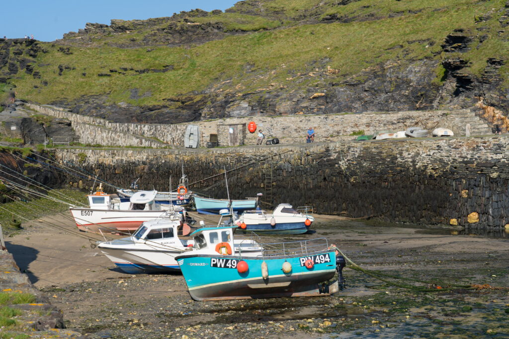
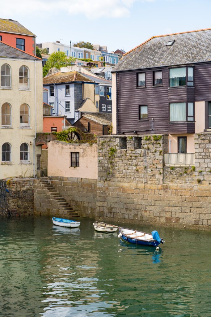
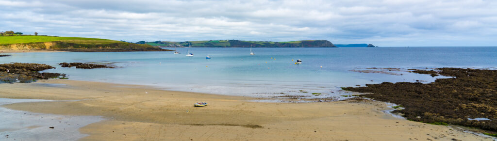
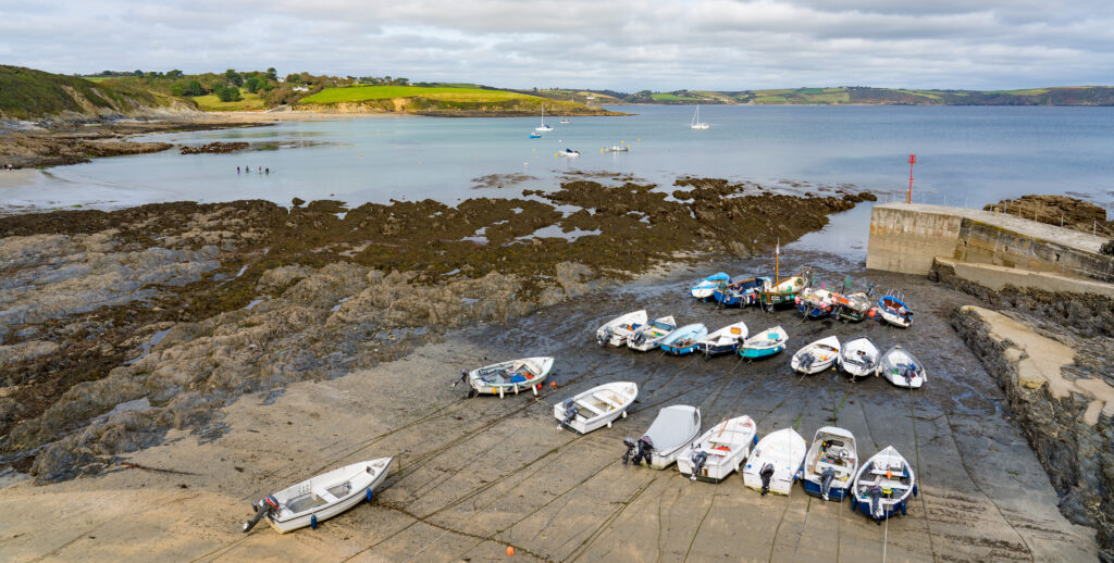
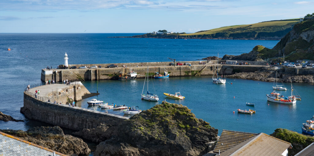
We had an explore through the predominantly one street village, centred around the river which leads to a tiny port. Fishing and pleasure boats were tied up on the sandy harbour bottom at low tide.
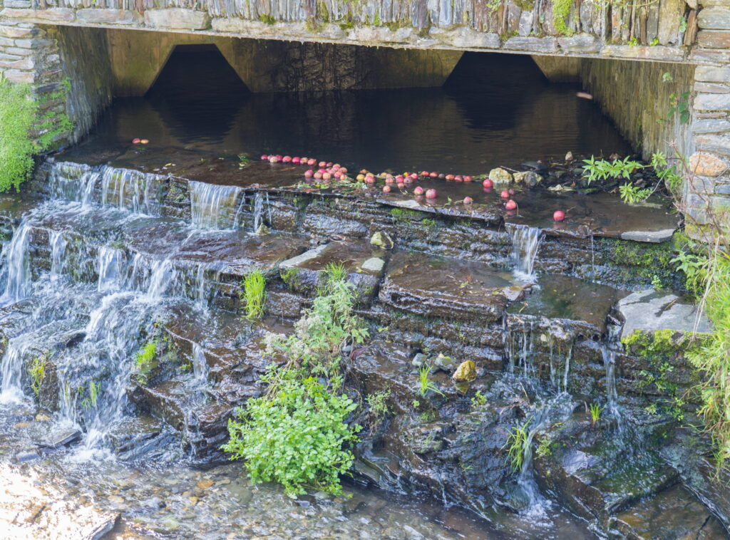
An old church is now a tea roomFishing boats at low tideA very picturesque harbour mouthColours of BoscastleA dangerous harbour to enter if you don’t understand where the hazards lieApple bobbing? A few windfalls floating down the stream into harbour
Leaving Boscastle we headed north, one of our biggest drives in a long while, a couple of hours up to Bridgewater in Somerset. We camped up in a little village on the outskirts for the night in anticipation of an early start at the mechanic’s in the morning.
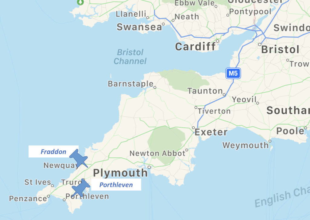
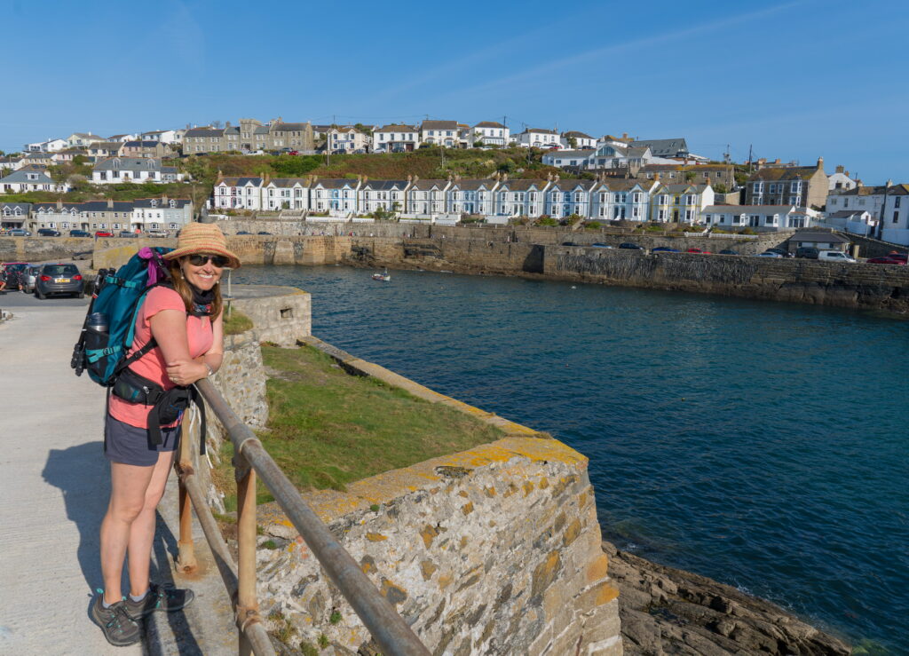
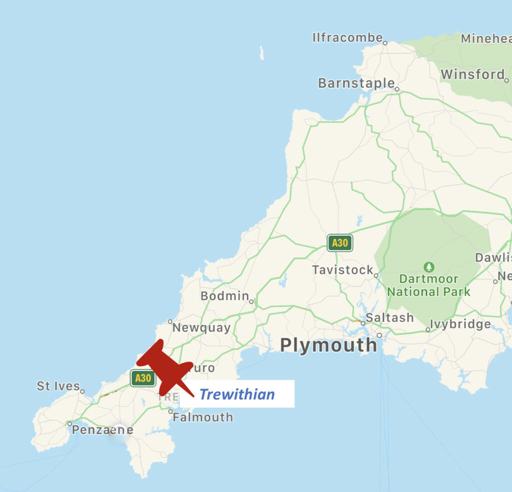
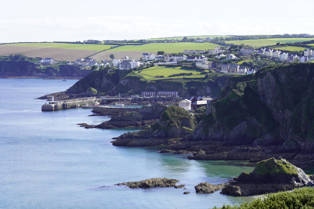
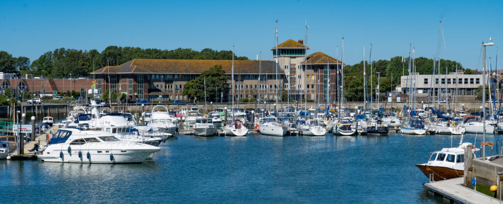
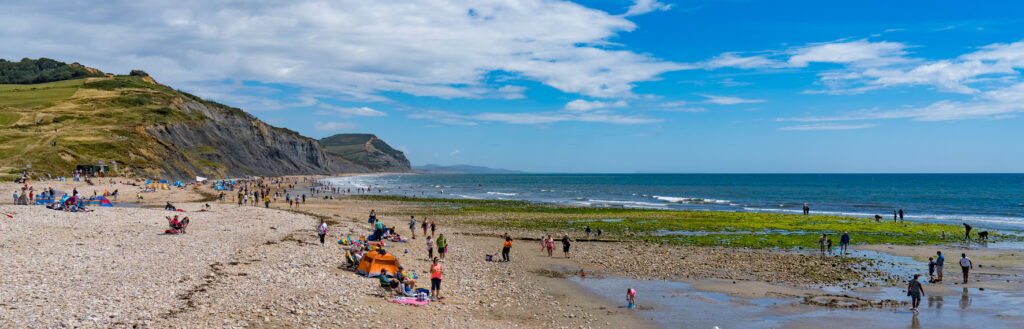
Porthleven on the south coast, and Fraddon on the west
Leaving Falmouth we drove a short way around the coast to a near empty field just outside the village of Porthleven. It was Friday afternoon when we arrived, the sky grey and uninspiring, and the past few days of hiking and travelling had worn us down. We needed an afternoon off – we enjoyed a chance to stop and read and just relax.
So when we awoke on Saturday morning with sunshine and clear skies, we were excited to pull on our boots and get exploring (Strava link).
It was a brief walk down into town from our camp, which was fairly bustling on this hot weekend. It did not take long to escape the crowds though, as once again we made our way towards the South-west Coast Path.
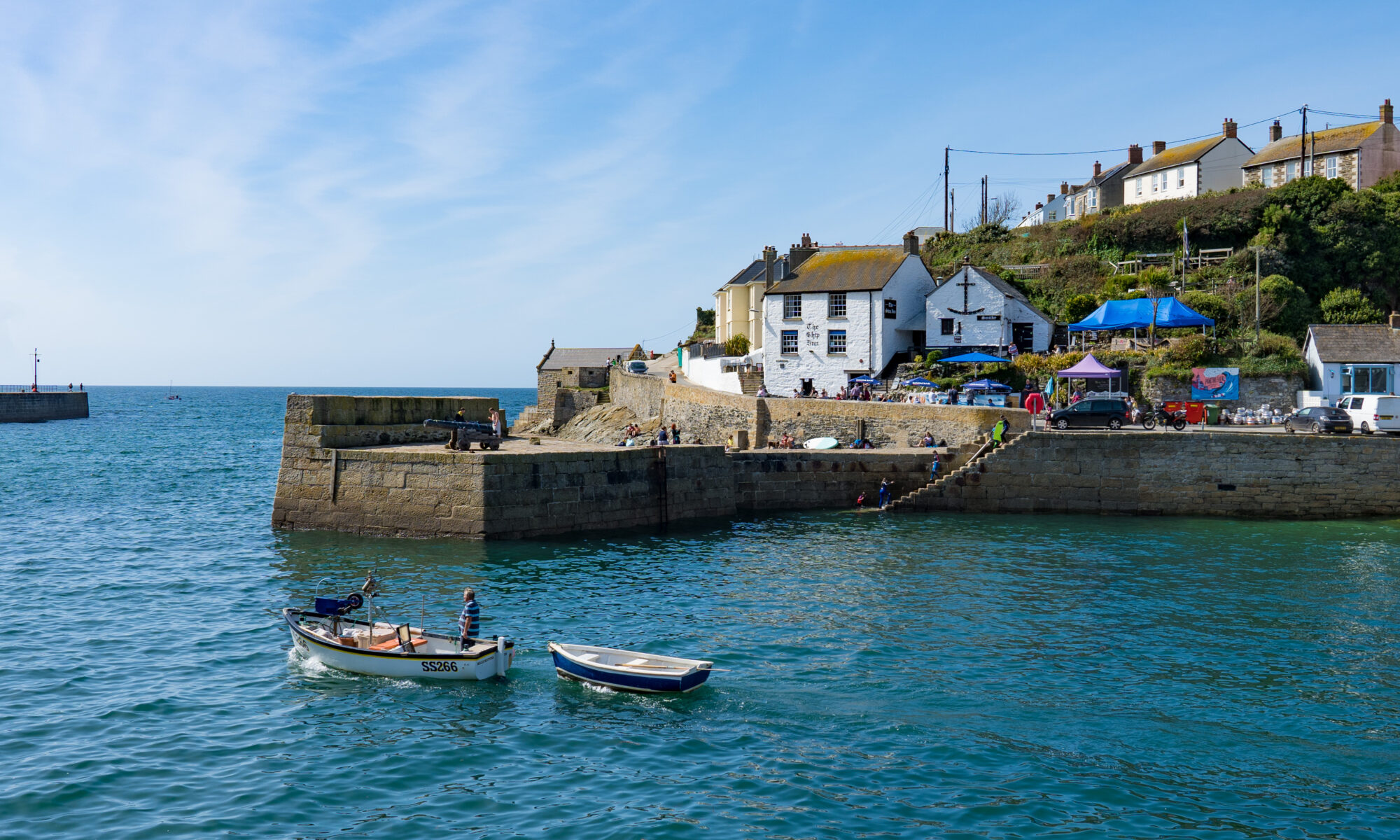
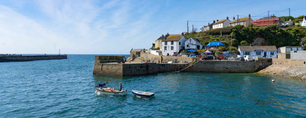
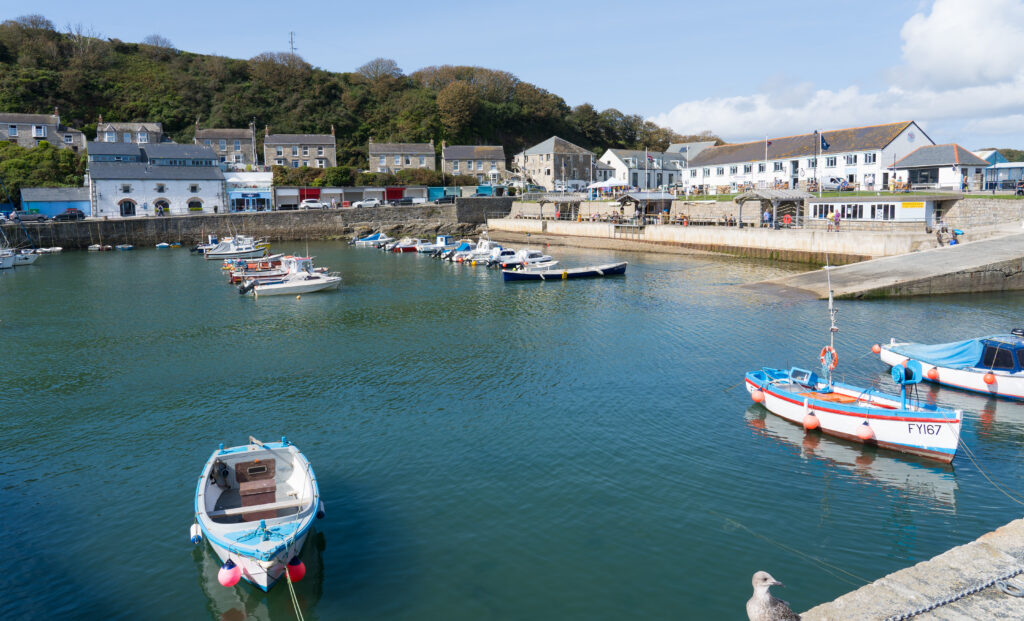
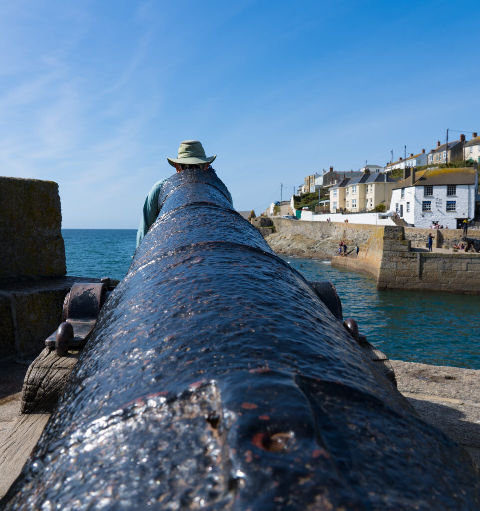
The village is built up around the harbour as a centrepointPlenty of boats heading out fishing, and children (in wetsuits) jumping off the wall into the waterThe boats are small hereMr A checking out the canon
Porthleven is the most southerly port in the UK, originally developed as a safe haven for shipwrecked sailors when such events were common on this rocky coastline. It appears to be popular with tourists with a lot of holiday homes overlooking the coast, but most of the visitors seemed to be milling around the pubs and cafes surrounding the harbour.
We think we might be developing a combination of phonophobia (fear of loud noises, such as cars) and enochlophobia (fear of crowds) as we can literally feel our anxiety levels rise when surrounded by people and vehicles. It is such a relief to take a few steps and head back to nature, where the sounds of the waves, chirping birds and crying seagulls are the only interruptions to the peace.
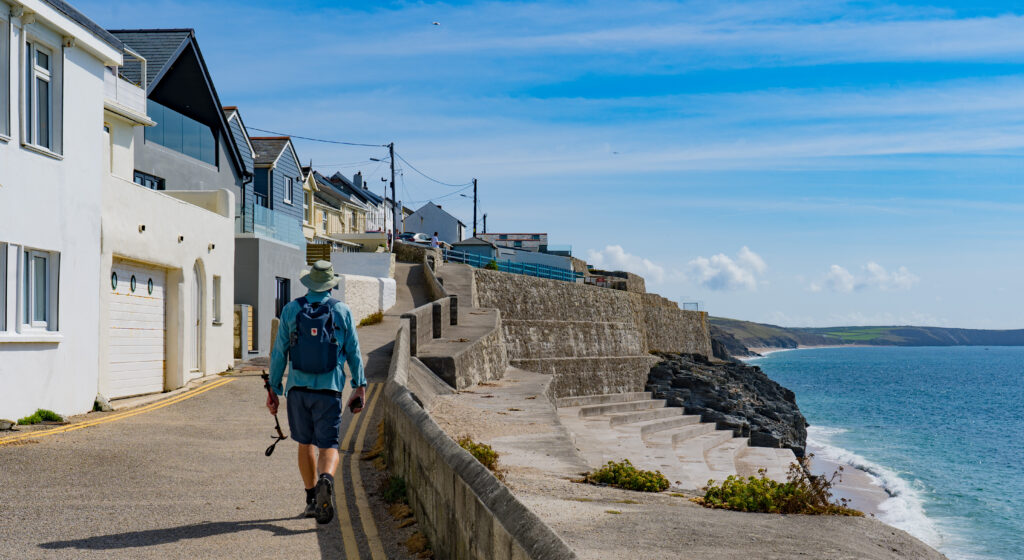
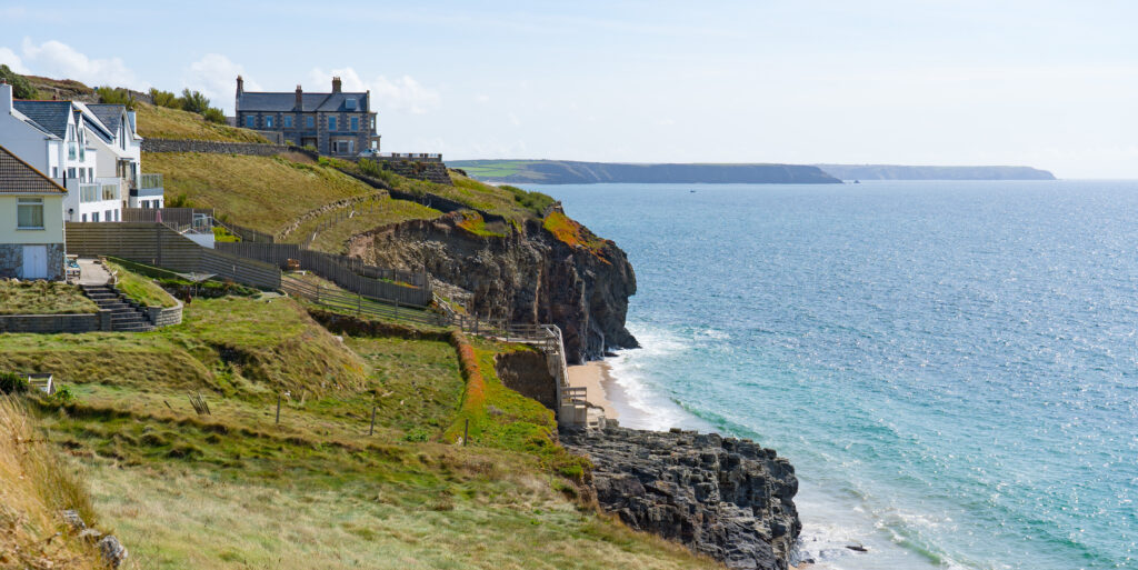
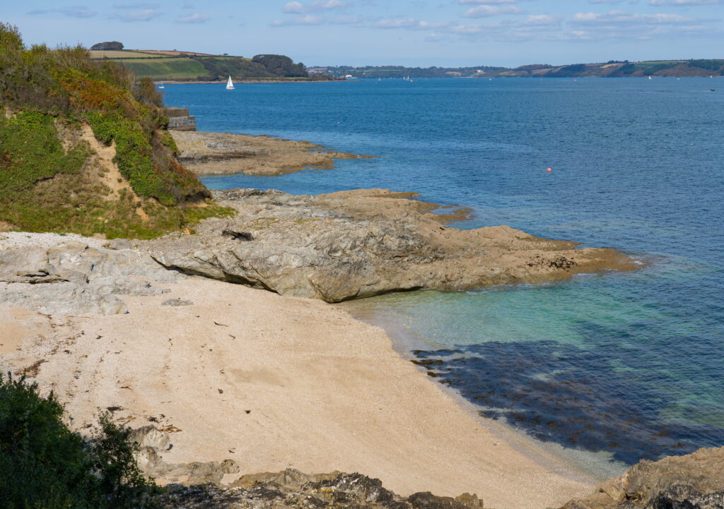
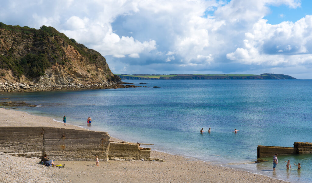
The walk out of town …and breathe…Some impressive houses sit on top of the cliffs, magnificent views out to sea…you’d just want to hope no more collapses happen if you owned one of these…A ship wrecked just off this beach in the 1685 apparently was carrying treasure of pearls and diamonds…it is still lying on the ocean bed. with treasures found by divers as recently as 2018Loe Bar Beach – squeaky fine sand reminiscent of Australian beaches…other than the water temperatures (17°C)In the distance at the end of the beach you can see Bar Lodge, a fancy holiday house owned by the National Trust. The lagoon on the right of the beach used to open up to the sea, but now has drains for when it floods.No pearls to be found as we walk along the water’s edge today….
Returning to town we had a look around the cafes and restaurants, with one fish and chip shop advertising local oysters. If you’ve followed our posts for a while, you’ll know we love a good oyster….but not at £3.50 each ($7!)…we moved on. Any thoughts of eating out were soon quashed, with most restaurants charging in the region of £25 ($50) for a main. We continued back to camp.
The views are free at least
Back in our field, we settled down to admire the view with a gin and tonic. Moments later the owners of a nearby Hymer motorhome popped over to invite us to join them for drinks with their friends which we gladly accepted. A lovely hour was spent exchanging stories over a few wines….experiences like that are priceless and part of what we most enjoy about travelling – the chance to meet new and interesting people, share experiences and learn new tips. Sadly in these Covid times, this type of mingling (we were suitably distanced and there were only six of us in total) has been quite infrequent, people more inclined to keep themselves in their own bubbles. We greatly appreciated the chance to socialise with people other than each other!
Sunday morning was also bright and sunny and we had planned to make our first foray on to the west coast of Cornwall, with an overnight stay just north of St Ives. Unfortunately the combination of blue skies and a 26°C day meant that every single person with a surf or boogie board within a three hour radius had the same idea. It was literally heaving. We felt so uncomfortable. We knew it wasn’t for us, and felt that anywhere by the coast would be the same. We pointed Truffy’s nose inland.
We ended up finding a friendly pub in the quiet village of Fraddon to let us stay the night. Fraddon overlooks the coastal town of Newquay, up in the hills.
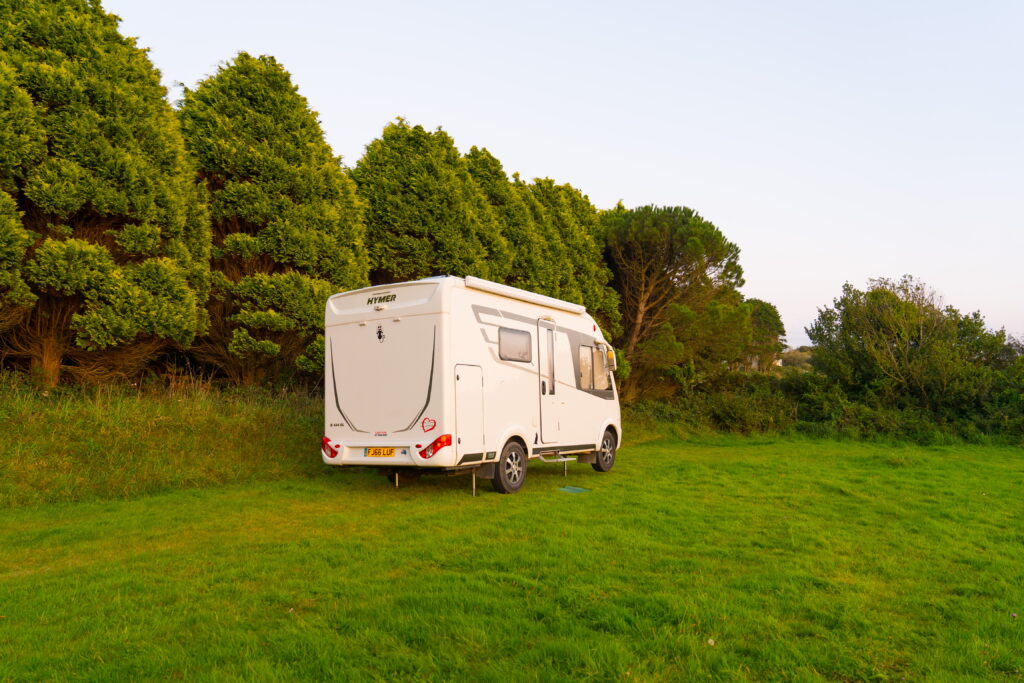
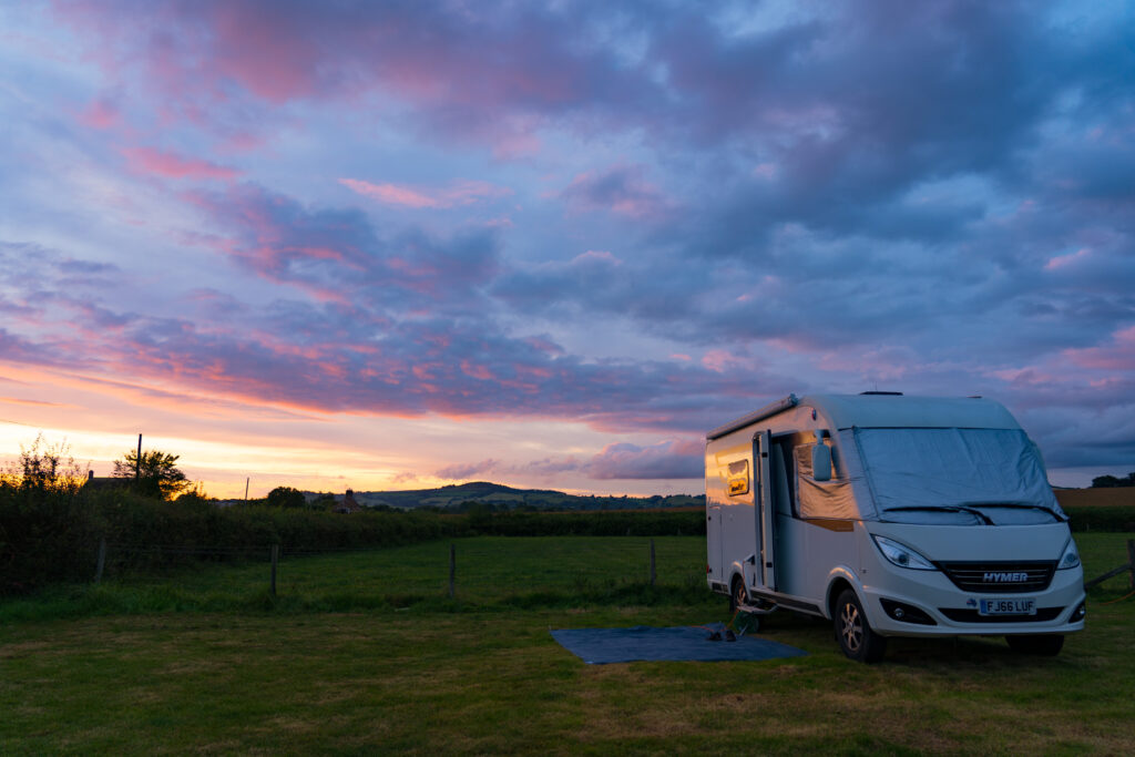
Truffy had the whole area to himself
We had a relaxed afternoon catching up on some more reading (we are both now absorbed by The Salt Path by Raynor Winn, which covers a couple’s experiences hiking the whole of the South West Coast Path – all 630 miles of it (1,114km)). An evening in the pub enjoying a Sunday roast topped off our weekend.
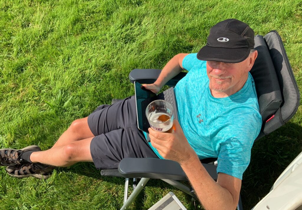
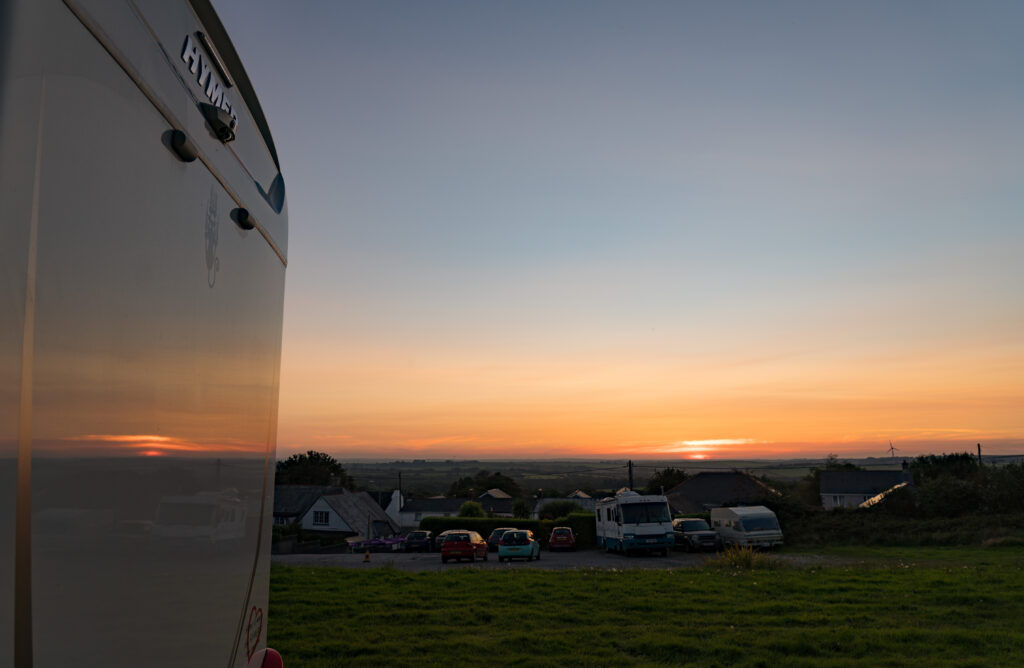
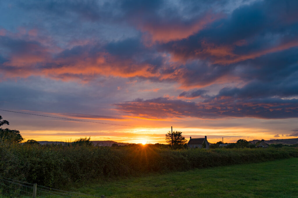
Mr A took advantage of the proximity to pints of beer on tap to complete the experience A fine sunset viewing spot
A birthday always gets me musing. Another year, what has been accomplished? What has it taught me? What will I do differently this next year? Given the current challenges that face the world and impact us , those are particularly difficult questions to answer this year. We are not in as much control to shape our lives as we wish, given the constraints of travel and risk to health. Throw in financial uncertainty, and you have a real mix to try and navigate a path.
Compared to so many, we are living a wonderful life, we are still travelling around, albeit not where we planned to, but still enjoying exploring the great outdoors in England. So many places we are finding that are still away from the crowds.
Falmouth is our first big town for a while, and it remind us of that when we can’t even book a table at any of the nice restaurants there for a celebratory dinner. But we are living with a really big risk. If we get the virus we have no home to run to and recover. Our tiny motorhome is not somewhere you want to be seriously ill in., and what campsite would accept us anyway? What rental property would have us?
Its a risk that we understood we were taking when we got on the plane to Europe last March – but then we thought it would be over in weeks, not years. Now it looks like a second wave is hittingt the UK. It is a threat that seems very real, espcially if there is even the sign of a sore throat or cough. Are we putting ourselves uneceassrily at risk? Should we have come home on the repatriation flights? Our decision not to was based on the better access to specialist medical resources here that Catherine would need, plus an unwillingness to give up our plans. Being treated for COVID-19 when you already have an impaired airway requires understanding of her specific disease. Here in England (in fact especially where we are in the south-west) there are multiple senior doctors who know her and would understand how best to care for her. In Australia there’s only a couple.
So in the middle of these musings, our flights back to Australia were cancelled. We had not been following the situation closely, naively thinking that as we had tickets booked months ago, our airline would be obliged to find us an alternative option to fulfil their contract. Apparently not. There are currently between 20-30,000 Australians who want to return, and only a few airlines who are still flying to Sydney. Plus the Australian government had said in the early stages of the pandemic, get back quick or settle in for the long haul where you are. So they are now severely restricting the numbers of incoming international passengers they will process. Sydney is 300-350 a day, Brisbane and Adelaide 75 a day each, not sure on Darwin and Perth, but it means at this rate it will be a long long wait. Meanwhile, the airlines are bumping people off economy and just selling business and first class tickets. Bless them…I guess they have to make money to survive.
So what this year will bring? It‘s hard to tell. We only know we want to get back to Australia to see our friends and fur child, check on our assets (car and caravan still stored and all our house contents). When and how are unknown. And what about next year? When we store our beloved little home on wheels here, when we will be able to return? We have no idea. Should we just move back into our property when the current tenant’s lease is up in December, give up our travel dreams for a year? We don’t know…it depends on so many variables connected to the pandemic and therefore out of our control.
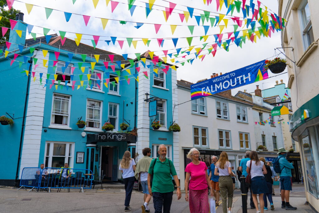
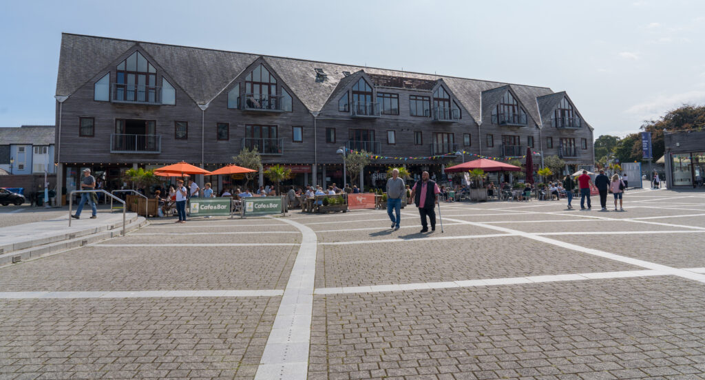
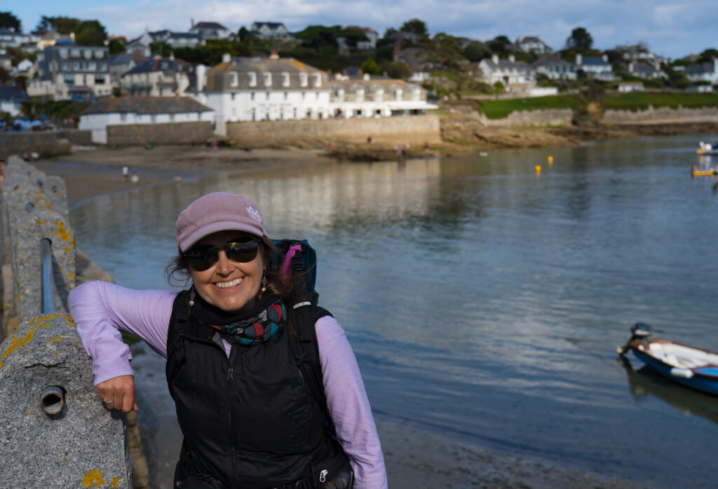
Central Falmouth – semi-pedestrianised main shopping street
Meanwhile the historic port city of Falmouth shows us her beautiful side. On my birthday we took a cab into town. Even that felt a bit weird…then a couple of outdoor drinks and an Indian. That will do us. Some lovely digital catch ups with people the next morning then on with the walking boots once again.
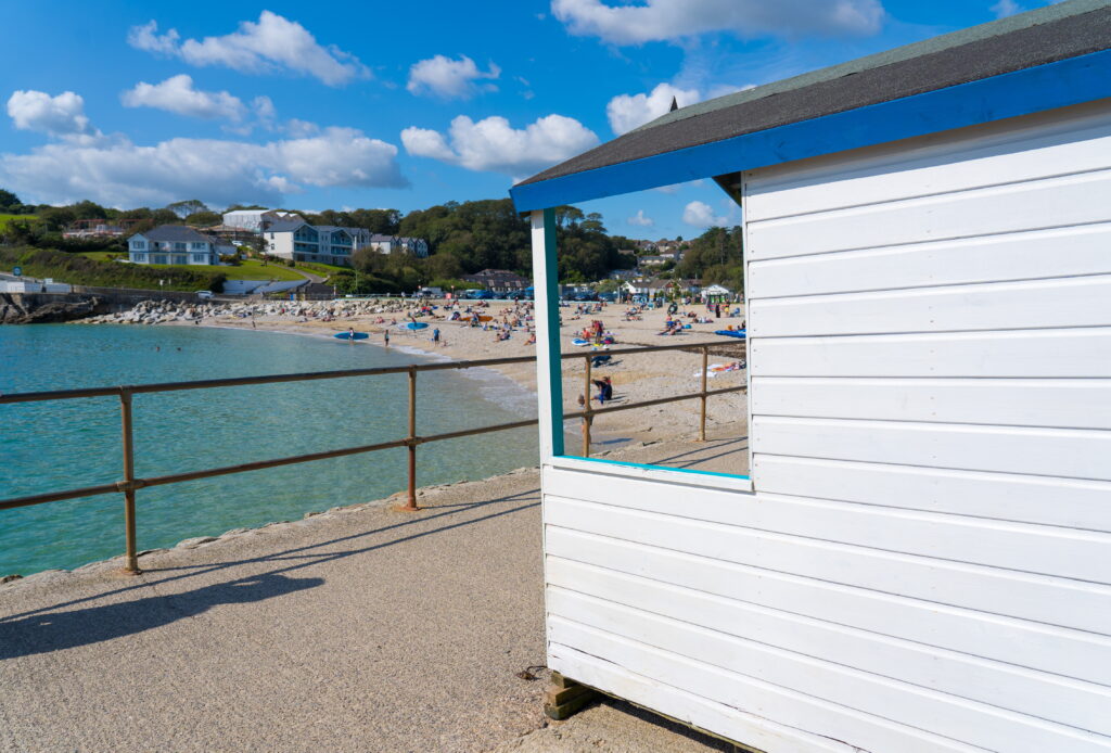
Swanpool Beach looks sparkling but not too many folks in the waterLooking out towards St Anthony Head
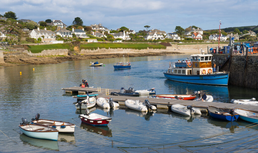
We wander around the harbour foreshore on a blue sky day, watch the boats come and go, sit and have a lovely lunch by the beach, its like a mini Sydney!
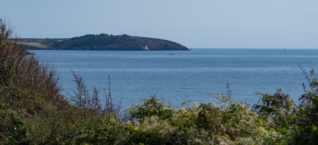
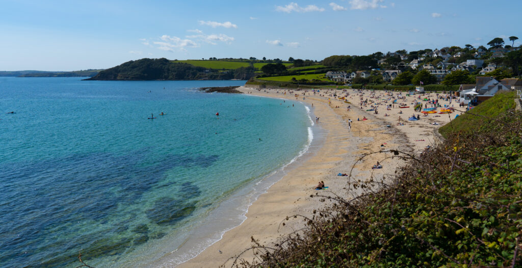
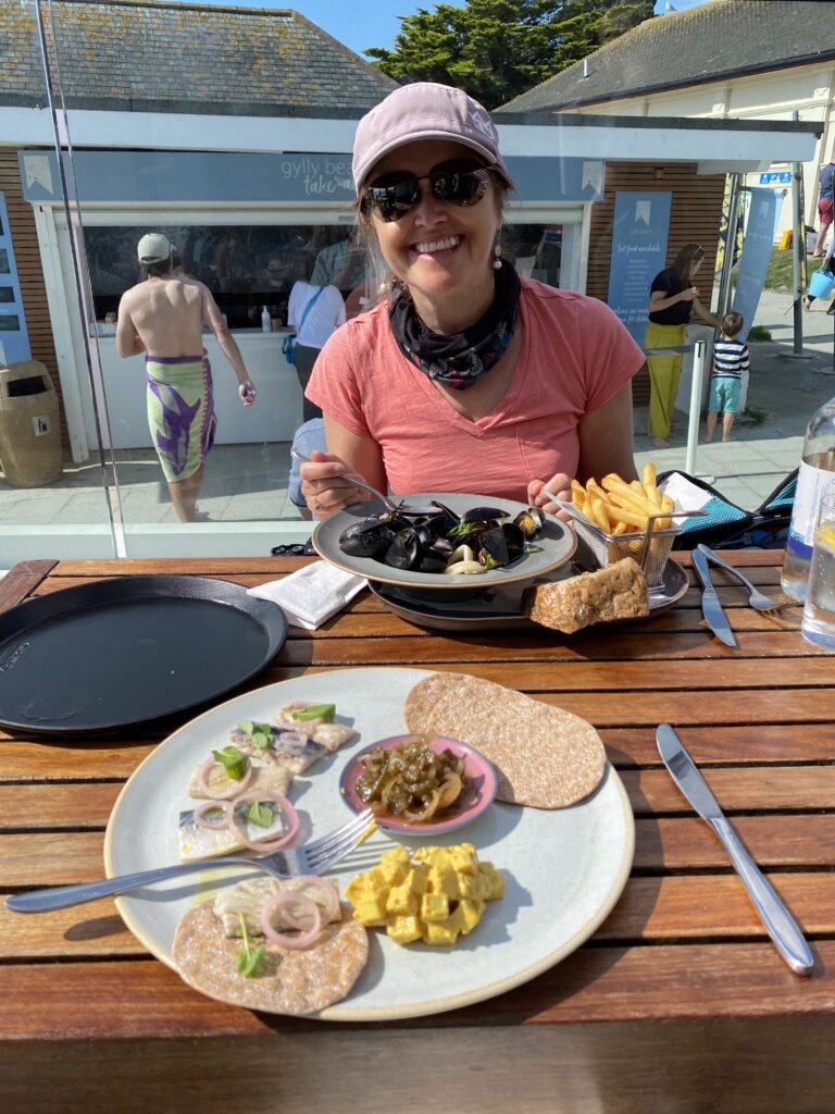
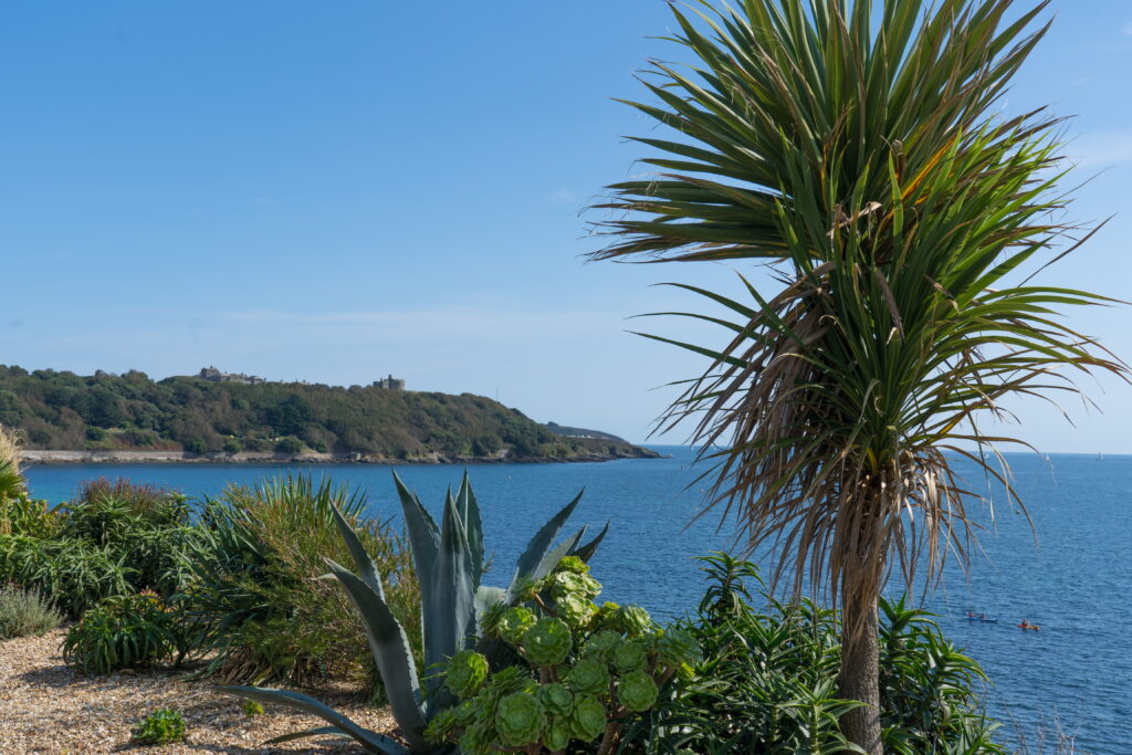
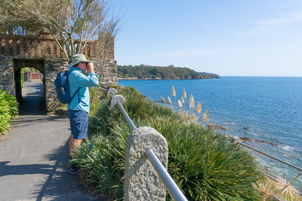
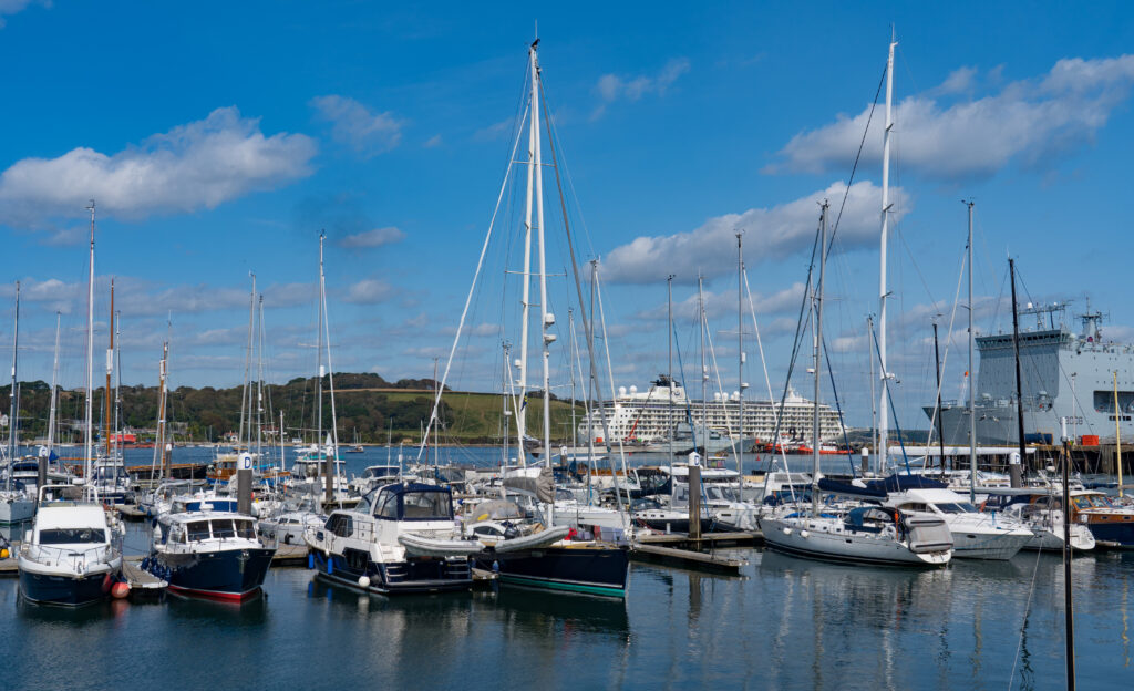
Gyllynvase BeachMussels for Mrs A and pickled herring for me – it could be Bondi Beach!The coast path has a distinctly tropical feel around hereSpying on the ships out at sea, behind me an old Victorian follyThis beach around Pendennis Head was empty…we could see ourselves kayaking into this one for a picnic…A sparkling marina of course…FalmouthA dining and entertainment area, reminding us of a mini Darling Harbour
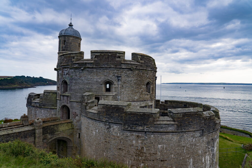
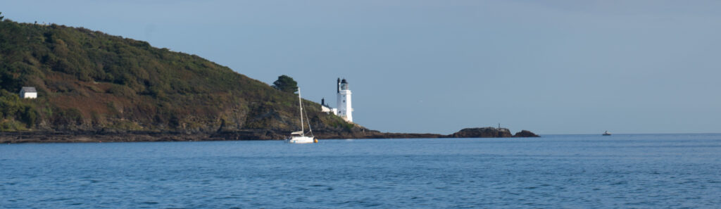
No harbour town visit is complete without a boat trip, so off we scuttled over on a little ferry to the little village of St Mawes, famous for the artillery fort built by Henry the VIII to keep those pesky French Catholics at bay.
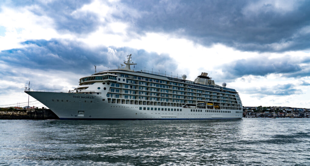
On the way across we got a good view of “The World”, largest luxury yacht in the world. If you have US$10 million in assets you can buy in to have a cabin ranging from a few million up to US$15 million and then you have your “maintenance fees” of…around $900,000 a year! I’d love to have a look around the wine cellar, with 12,000 bottles of wine in their collection…mmm. And now…moored up – for the first time in 18 years, it has stopped moving. So many firsts in this new world we live in.
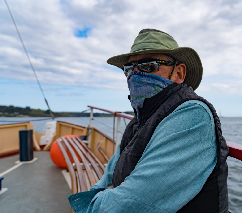
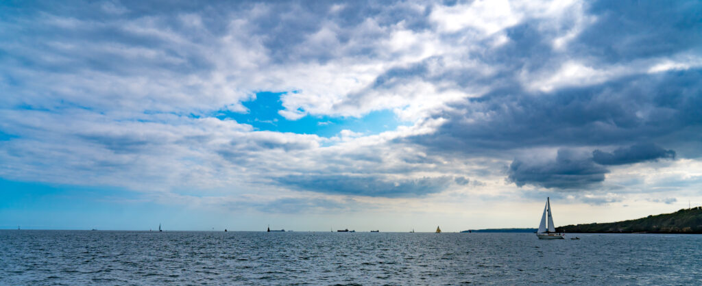
The WorldAs the near-empty boat is considered ‘public transport’ it is on with the face covering…Quite a few yachts out sailing on this calm afternoonSt Mawes Castle – the best preserved of King Henry VIII’s coastal fortressesA quiet little village, again not too crowdedAll dressed up ready for the boatSt Mawes has a little harbour – with the old ferry boat this photo could be from the 1950s! The sun re-emerges from behind a cloud to light up St. Andrews Lighthouse
So you can see by the blue skies in Cornwall at the moment, there is no shortage of vitamin D in our systems to fight off that virus, fingers crossed.
A burger for dinner, sat on a bench by the harbour and we are done with Falmouth. A little too busy with tourists for us, too many crowds to distance from, and many of them don’t seem to bother. Was this the best birthday I’ve had? No, but under the circumstances pretty damm good. What was missing was physically being around some friends and family, to feel connected with them. But thats how it is, and with Catherine by my side, not much else matters other than our health.
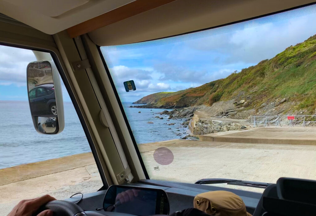
Leaving Pentewan we supposedly only had a 30 minute drive to our next campsite on a farm a few miles outside St Mawes. Unfortunately Google Maps lost GPS signal on the way and we ended up driving one way down a tiny lane, branches brushing the roof of Truffy, not knowing whether we could turn around anywhere at the bottom. Fortunately we popped out at the tiny little village of Portholland. With one general store, a post office and 40 residents, we got a few shocked looks as we appeared, turned around and returned back up the road. A tense journey!
Our unexpected white knuckle drive to the tiny village of Portholland…we didn’t stay long!
Luckily there were no further mishaps with the navigation and we arrived safely on our farm. Our location for the next two nights was purely for the walking – other than a farm shop a short walk away, there was little else on our doorstep other than another stage of the south-west coast track. Suits us perfectly!
After setting up camp and a little lunch we headed off, following quiet lanes and spotting footpath signs until we could see the sea. Our next decision was whether to turn left or right. We chose right and followed a track across the cliff tops (Strava link).
Another deserted Cornish beach…Even on this cloudy day the water looks turquoiseWhere are all the people?Mr & Mrs A
The thing we love about hiking is that there are so few other people about, the fresh air is abundant, and sights so interesting. We picked our way down to quiet sandy bays, maybe one other person visiting, the oyster catchers and seagulls ever present with their calls.
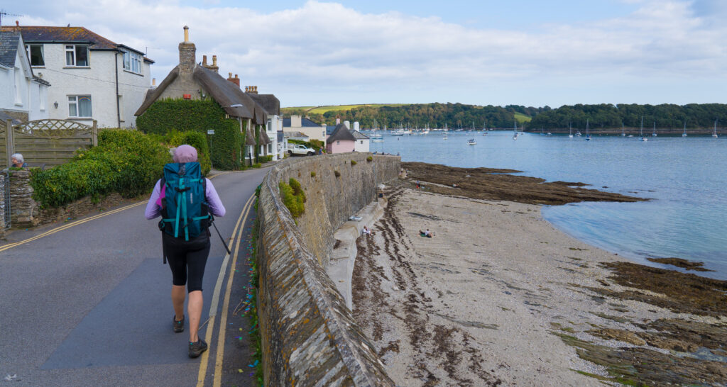
After about an hour’s walking, we emerged at a tiny fishing village, Portscatho. Although it is clear there are several holiday homes here, it didn’t feel touristy at all. It is still an active fishing port, and has been for more than three hundred years, with pilchards the primary catch.
Portscatho Harbour – quite rocky, with little boats waiting for the tide to turn
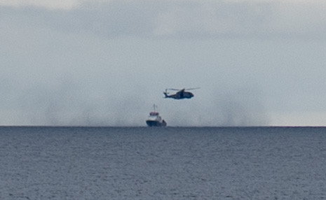
We had a look around before making our way back. We’d spotted what appeared to be a helicopter making a rescue from a boat while walking over. According to the coastguard station volunteer we chatted to, it was the Royal Navy folks from nearby Falmouth conducting training.
They’re a long way out to sea! The helicopter whipping up the water looks a little like smoke
We called into Curgurrel Farm Shop on our way back and picked up some freshly cooked and dressed local crab for dinner – delicious!
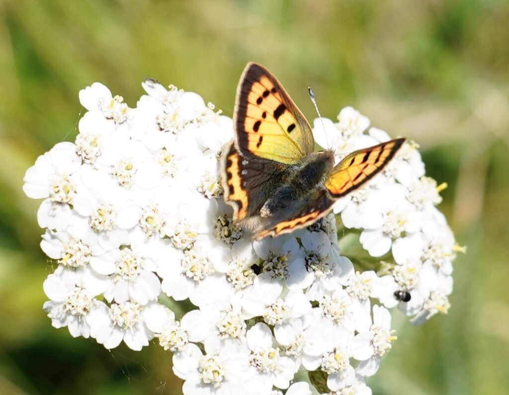
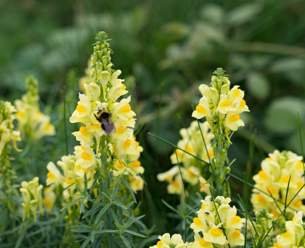
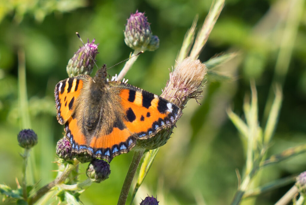
A little copper butterfly
The following day dawned bright and sunny, so we pulled on those hiking boots again and made our way back to the coast path, this time heading east (Strava link).
Patches of shade briefly dot the path
We left earlier in the day and carried our lunch this time. The weather was spectacular – blue skies and sparkling waters beside us the whole walk. We enjoyed many blackberries from the plentiful bushes alongside the path, and collected some to take back with us as well.
Picnic lunch beside a quiet beach…again…and yes, that black dot in the water is someone swimming (17°C! Brrr). Off in the distance is Nare Head, our halfway point destination for today.Me and my trusty tripod…A rugged and unspoilt coastline
It was a long, hilly (and warm) walk, with Nare Head our intended destination, rewarding us with incredible views and a soaring osprey circling over us. We even braved paddling our feet in the water on the sandy Carne Beach on our way back.
On the top of Nare Head watching the ospreyThe next land mass from here is France, way off out of sightMr A picking his way back along the cliff topThe fresh water makes your feet feel like new!
We now can hardly believe we almost decided to give visiting Cornwall a miss, anticipating it would be really busy, The absence of any crowds has been an absolute delight – avoiding the main holiday destinations has definitely helped. We can tell by the fully booked caravan sites around the likes of Newquay and St Ives that those areas would tell a different story, but by sticking to the little, less touristy spots, we have been enriched with a far quieter experience.
Locations: Dartmoor, Devon and Pentewan, Cornwall UK
Our locations
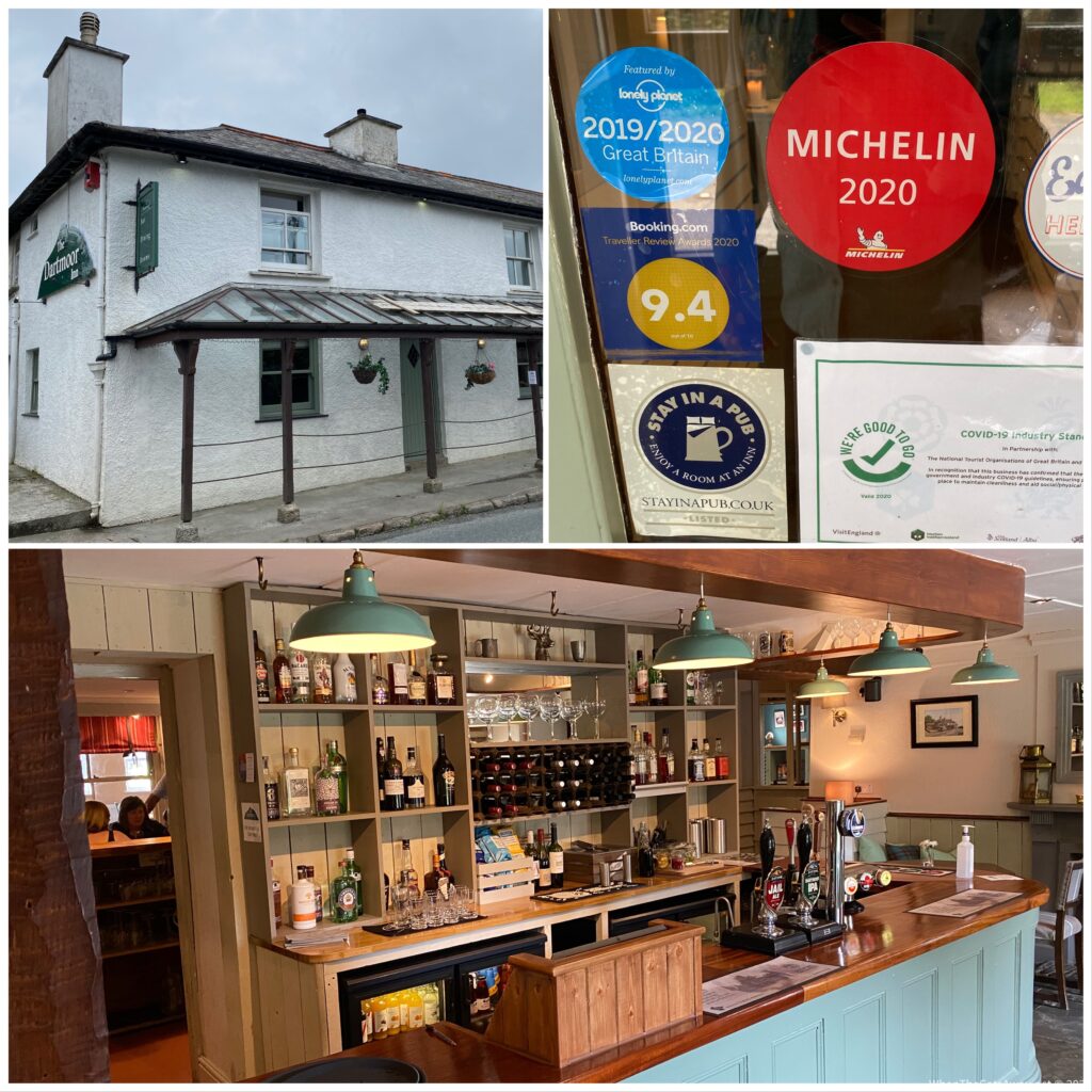
A couple of weeks ago we had “discovered” (i.e. a new to us) a gastro pub, The Dartmoor Inn, which was… you guessed it, right there on the moor‘s doorstep. We had lunch there last time, this visit we were splurging for dinner. With my birthday coming up on Wednesday, we had tried to book up some restaurants in the town we will be at then, but each one was either closed or booked out. Its ‘Staycation UK’ time still. So “Carpe Diem” I said, quoting a Roman poet with the somewhat ridiculous name of Horace. Let’s seize the day.
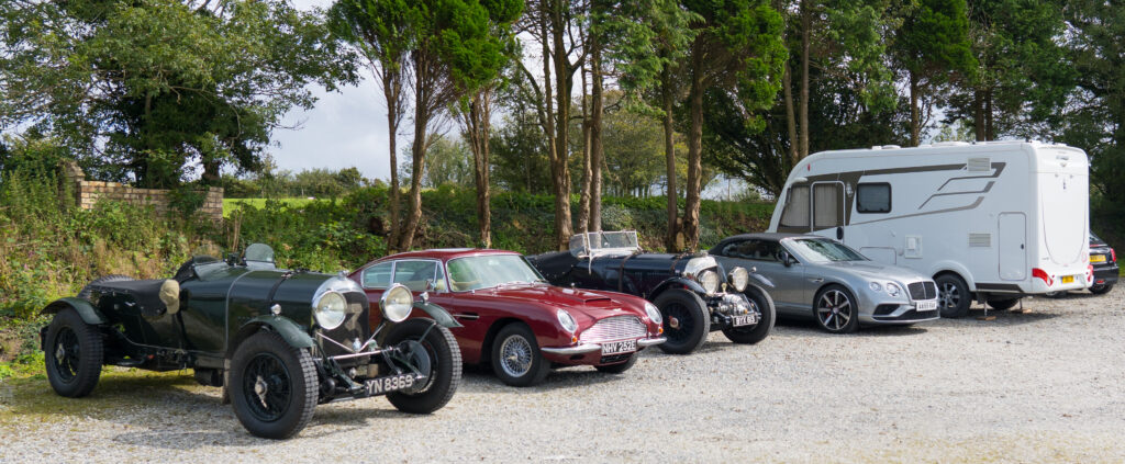
Spot the odd one out….yes, Truffy is parked nose in…!
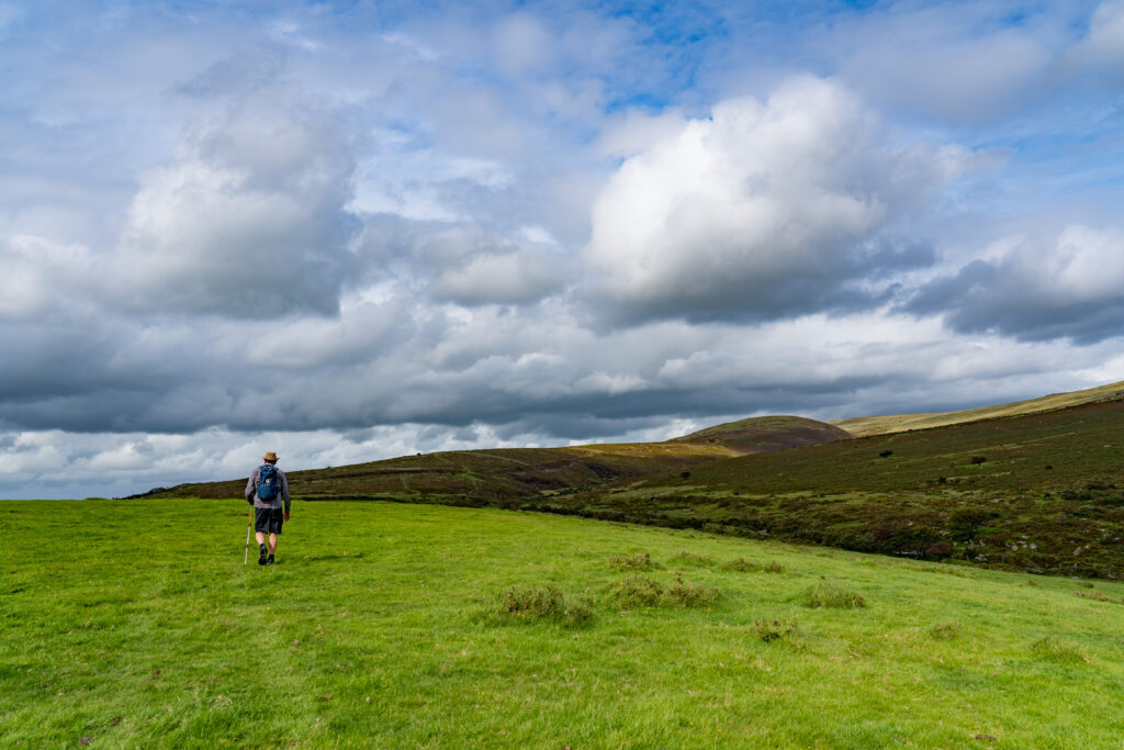
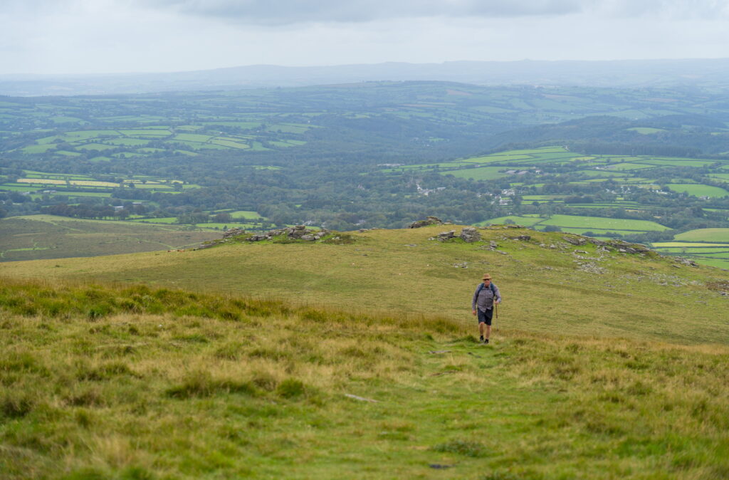
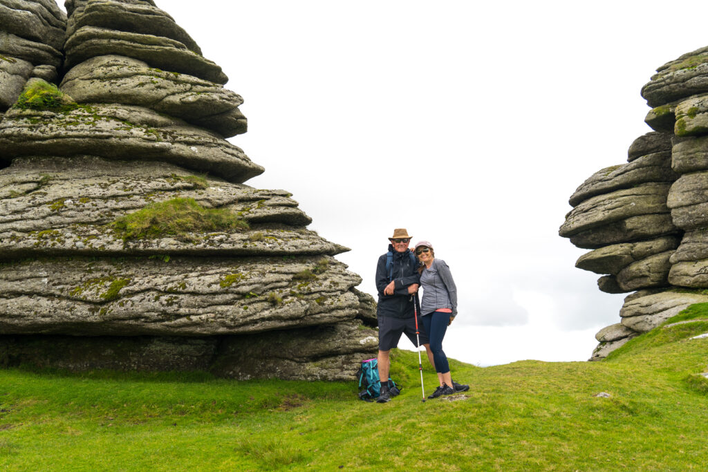
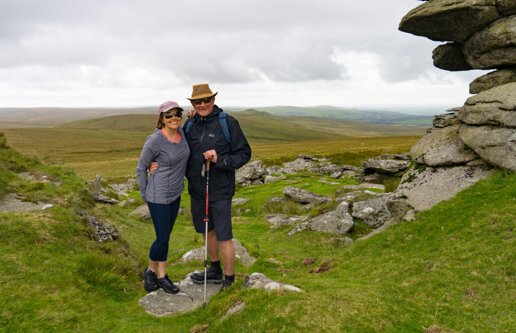
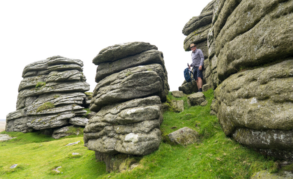
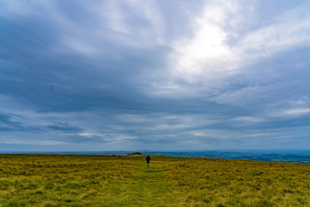
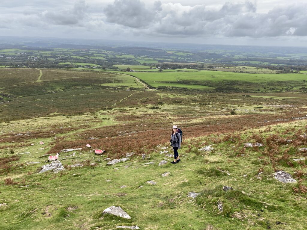
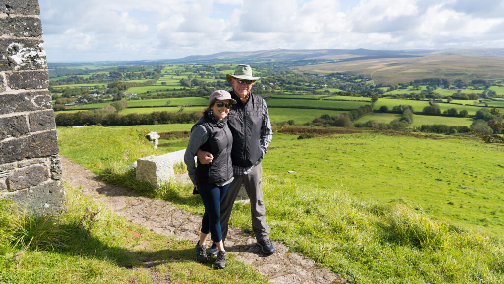
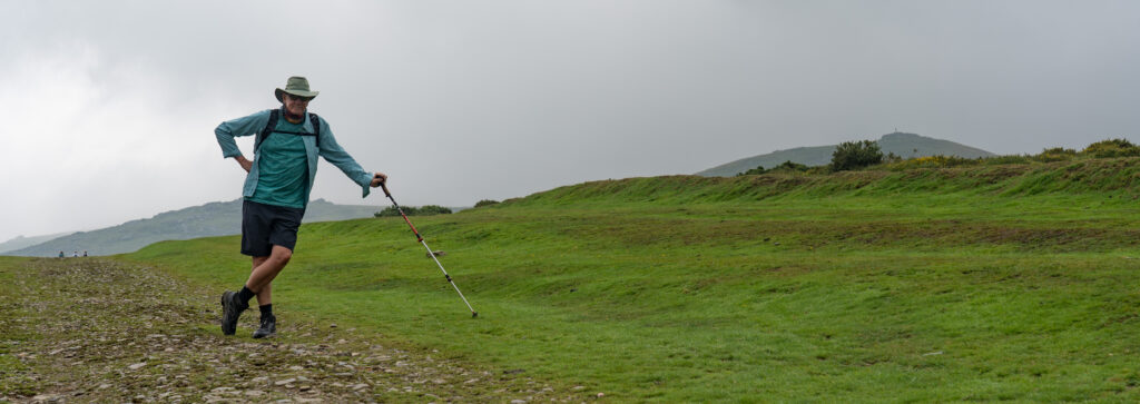
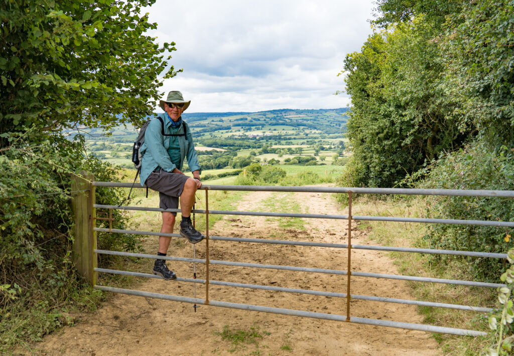
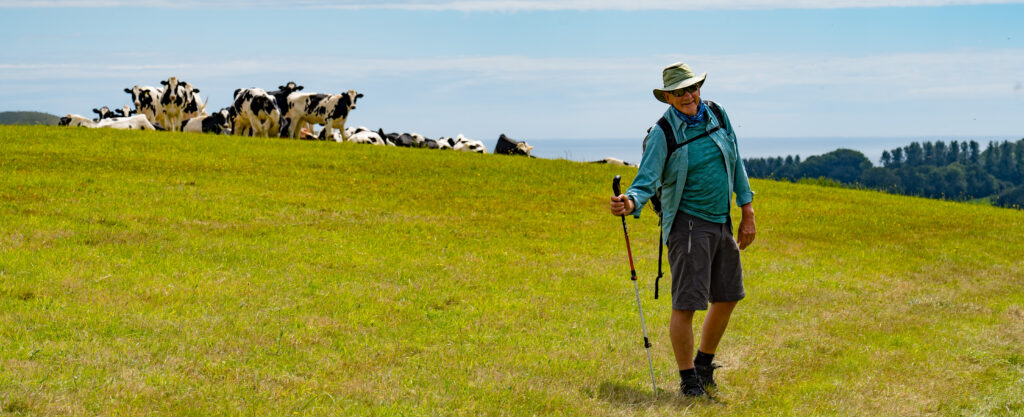
We arrived to find the car park full of vintage Bentleys, and a modern Aston presiding over them. Truffy looked positively clunky, but we didn’t care. None of those cars would be providing a home for the night like ours does. We had sought permission from the Inn to stay overnight in the car park, a very small stagger in mind to bed. But before dinner we had too earn our supper, and marched up one of the highest tors (read small hill) on Dartmoor called Great Links (Strava link).
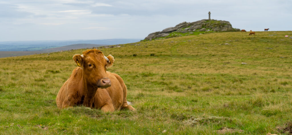
Hiking across the fields, reminding us of the Scottish HighlandsA moody sky bringing no rain thankfully 352 metres of climbing stretched out the leg muscles somewhatUp by the sculpture-looking peak of the granite torIncredible views across DartmoorSheltering from the wind – it must have been about 9°C up hereNot much shelter from the breeze hereDartmoor is home to cattle and sheep as well as hill poniesSpeeding up with dinner on the horizon
With thankfully not a golf course in sight, and at 582m above sea level, we were treated to a pretty special view. We have come to love this largest area of open space in the southern part of England. It has a Scottish Highland feel to it, and so easy to get away from the other ’walkers’ who barely stray from the car parks. We came across one young lady on the trail as we walked our final kilometre back to Truffy. She was stood in the middle of the path with her phone on speaker while she shouted into it: “IT IS SO QUIET AND PEACEFUL UP HERE”. I groaned at the irony lost on this millennial .
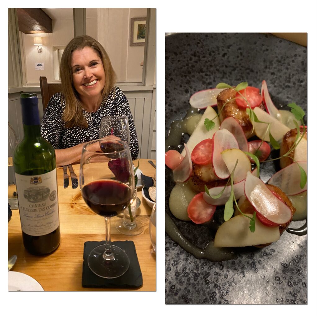
Dinner was a sumptuous affair. Catherine had tender scallops, for me it was the wood pigeon. I tried to withhold the thought of it flying around, cooing in the treetops, unsuspecting of its coming fate. I picked a wine from Saint Emilion, one of our favourite terroirs in France. This was a classic of the area with a blend of Merlot, Cab Franc and Cab Sav. Simply delicious with my main of slow roasted shoulder of beef. Maybe a little powerful for Catherine’s fish dish but hey…I was claiming birthday voting rights.
Not only delicious, but beautifully presented food too
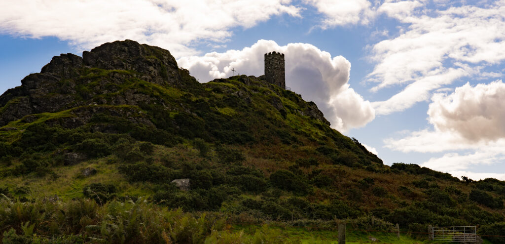
Saturday dawned for us a little groggily, a pre-dinner drink and a whole bottle of wine between us more than our usual quota these days! We decided to clear our heads and hike up to a church we had noticed up on a hill, anticipating another magnificent view, which indeed we were rewarded with.
Driving across Dartmoor towards the village of BrentorBrentor Church – dates back to the Norman invasion with links back to the iron age found near by
Brentor Church sits presiding over the rolling country, and is a favourite (very short) walk it would seem, so we moved on.
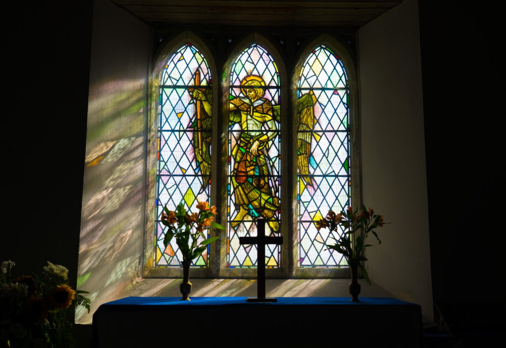
A peaceful light through the stained glass windowSpécial viewsWalking around the churchyardA sheltered spot with a view (Strava link)
So next it was off to our home for the new two nights down in the south-east corner of Cornwall in a small coastal settlement called Pentewan.
This was not our usual type of campground, it was a massive holiday park. Feeling a little underwhelmed we donned our walking boots and pottered down to the beach. Wow! Its so rewarding to have low expectations! What a gorgeous stretch of coast we had landed at.
Pentewan BeachHuge tides reveals endless stretches of sand
Off we trotted up the ever present South West Coast Path (well, if you’re in the south west of England between Poole in Dorset and Minehead in Somerset!). What a feast for the eyes, and the belly with all the plump blackberries we were scoffing on the way. Even the locals were friendly here, having a chat with one out gardening. A pleasant change from Rude in Bude.
Blown away by the wonderful viewsWhere in the world are we?
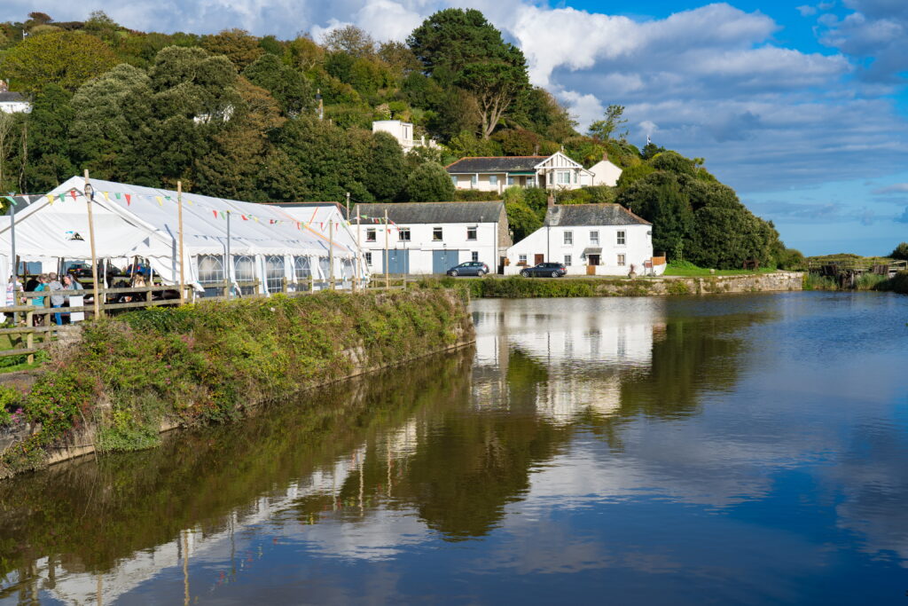
On the way back we had a poke around the old harbour that once had been bustling with ships carting away the china clay mined locally. Now all silted up, it did provide a lovely backdrop to the pub perched on its edge. Oh that was a beer well earned on the steep paths (Strava link).
A peaceful and picturesque locationA pint is calling….consumed in a marquee in the field opposite the pub
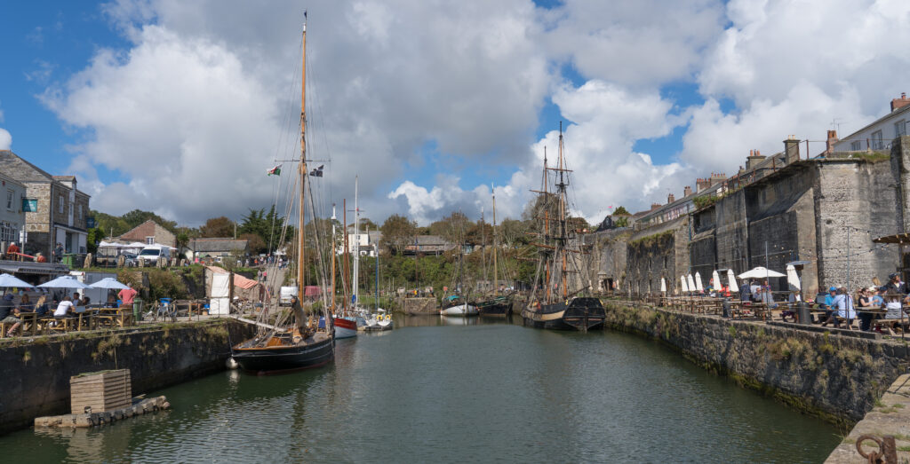
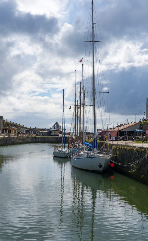
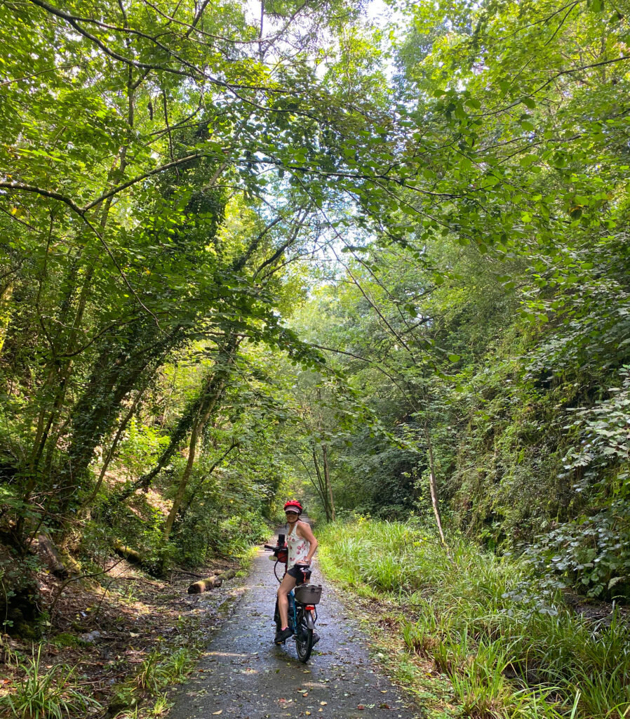
Sunday dawned with the rainy showers that have been ever present since the dry spring, but we donned our cycle gear and headed off anyway. We had noticed a rail trail (the Pentewan Valley Trail), our favourite traffic free riding option, and had an explore inland initially, then up and down some country lanes and just followed our noses. once again with no expectatations we were delighted to emerge in the small port of Charlestown (Strava link). Another wow moment. I just love old harbours like this, and these old ships, the stories they could tell. It seems the port and its ships has been a favourite movie set for classics like Poldark. Catherine, with her movie star looks, blended in perfectly.
Charlestown is bustling on this Sunday morningThe rain disappears to reveal a glorious dayAn interesting harbourA sea lock allows these magnificent vessels to remain docked here, even at low tide
Returning to camp, the day was not done yet. After madly getting some washing done in our little on-board twin tub washing machine and hung out, it was once again on with the walking boots, and off up the coast path, this time in the opposite direction towards the small port of Mevagissey (Strava link).
Just loving these viewsOur first view of the fishing port of MevagisseyA short tea break to admire the sceneryA sweet little harbour
Two ports in one day…lucky boy. The walk there was definitely in our ‘Top 10 Global Afternoon Wanders‘ (no we don’t have that list but if we did…). This is world class scenery though, and when we were more than a 5 minute stretch from car parks, not too crowded.
One of several fishing boats in this working harbourLovely reflections on this still afternoonThe tide is starting to turn, but many boats remain strandedClusters of rowing boatsAnother sip of tea on the harbour wall
Walking into the village though, and the proximity of their cars, the crowds returned, but not enough to spoil the views of this quintessential Cornish fishing port. An ice cream savoured to fortify us for the return walk, we were off once again along this magnificent coastal scenery.
Its hard to keep a smile off your face when in scenery this lovely
We are reminded this will be the third season in which we have seen and enjoyed a section of the South-West Coast Path. What a wonderful asset to the country this piece of infrastructure is. All praise to the many individual campaigners, as well as local and national councils who have fought off developers and landowners that sought to restrict walkers’ access to this fabulous coastline.
Eighteen years is more than half of Catherine‘s adult life – married to me. Jeez …how can she still look so good?! But she does.
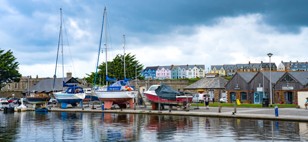
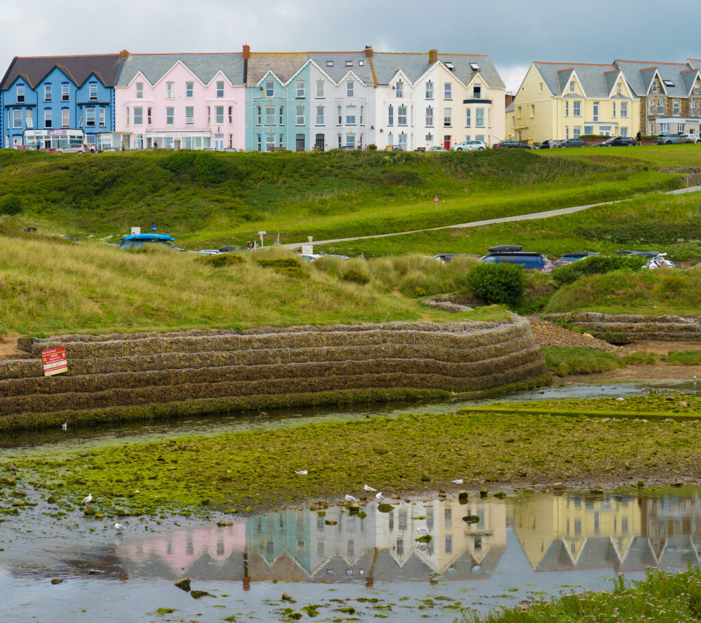
We usually stay away from beach resorts in school holidays, but Bude happened to be close to where we will spend the rest of August on a campsite a little further inland, so we thought we would experiment.
Accomodation was secured at a pub right in the middle of town. We were so looking forward to a long, long shower after a month using the one in our motorhome. Sadly the one in our motorhome produces a stronger jet of water than our pub. But the room was confy and we set off to explore the town.
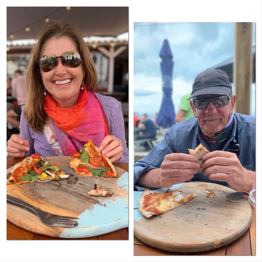
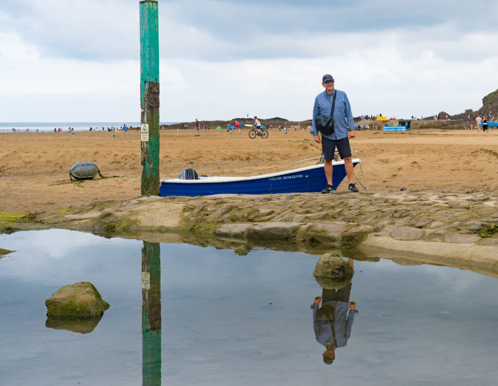
Summerleaze Beach, BudePizza for lunch by the beach
We walked alongside the Bude Canal. It was opened in 1823 to transport lime rich sand up into the poor surrounding soils of Devon and Cornwall, eventually reaching 35 miles through hilly country via inclined planes.
Yes. I‘ve become a bit of a canal geek/lover. Growing up in the Midlands and then living in Milton Keynes, the Grand Union Canal was about the only interesting thing for me in the area. I’ve been reading up on the history of the UK network, and we’ve been watching the delightful series “Grand Canal Journey’s”, hosted by Timothy West and Prunella Scales. We can feel a canal trip in our future! It’s about the right speed for me these days…
The combined estuary of the Rivers Neet and Strat runs parallel to the canalHouses overlooking the combination of the River Neet and River Strat as it works its way out to sea
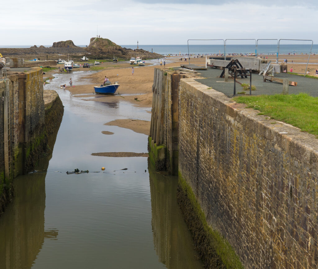
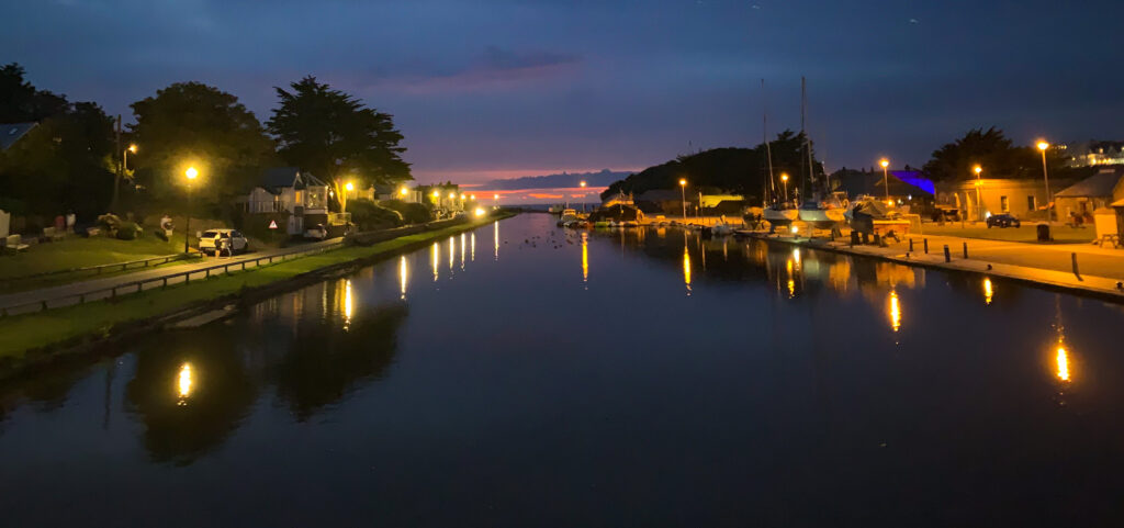
At the beginning (end?) of the Bude Canal a gigantic sea lock is opened at high tide and sea state permitting. It forms now a lovely focus to the town, with people strolling and riding along the parts that still remain open.
The tide is out so they lock is closedA popular place to walk and cycle…as you can see on this busy August Sunday…Lots of holiday rentals along the canal
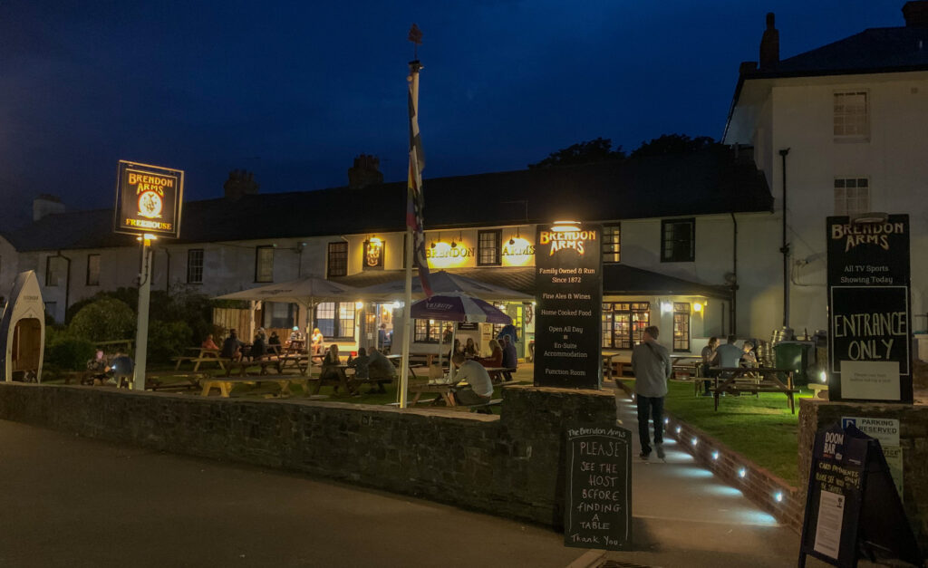
We had tried to book a bit of a special dining experience for our anniversary dinner, but sadly Bude has very limited options, and the ones they do have are booked out until mid September! So it was off to the local Indian for us, a far cry from our anniversary spent last year in a fancy hotel in Slovenia. Well, we had a lovely night anyway, and were treated to a glorious sunset.
Matching sky and skirtThe last glimmers of the magnificent sky reflect in the river on our walk back to our accomodationThe Brendan Arms…our room above the smoking area….
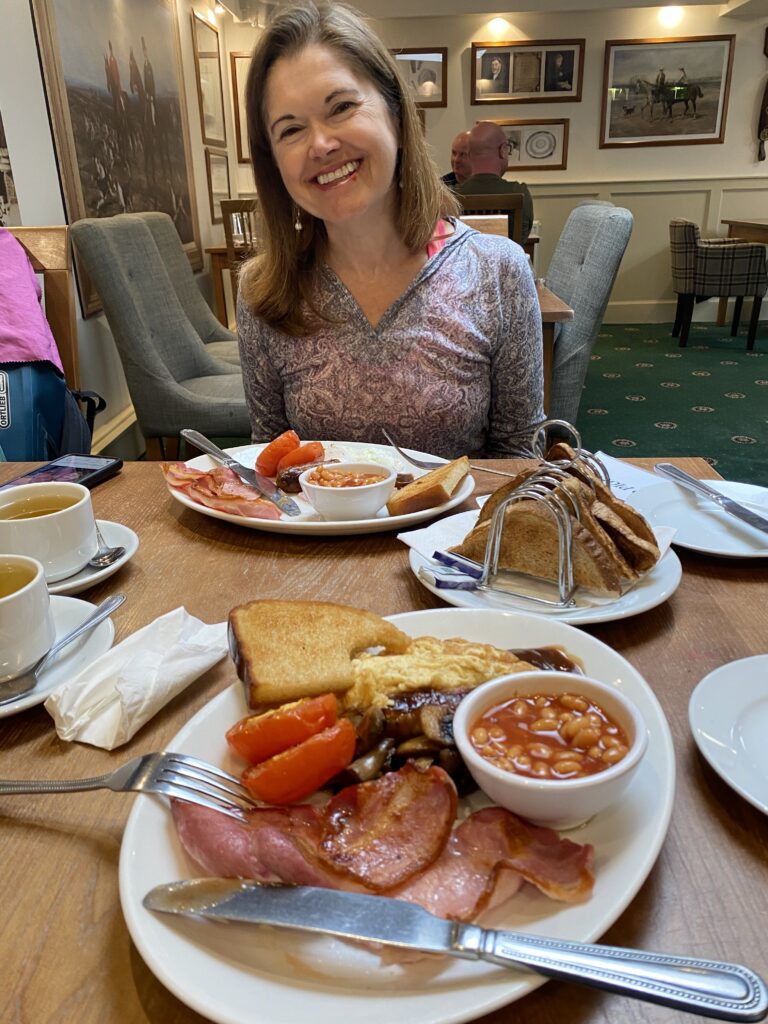
We saw that the South West Coast Path literally went by our front door, so off we set in the morning, fortified by a big old fry up. We have stopped eating breakfast nowadays, but it was thrown in the room so we were not going to see that go to waste (it went to waist instead!)!
So much food! We felt like a nap after this, not a 10km hike!
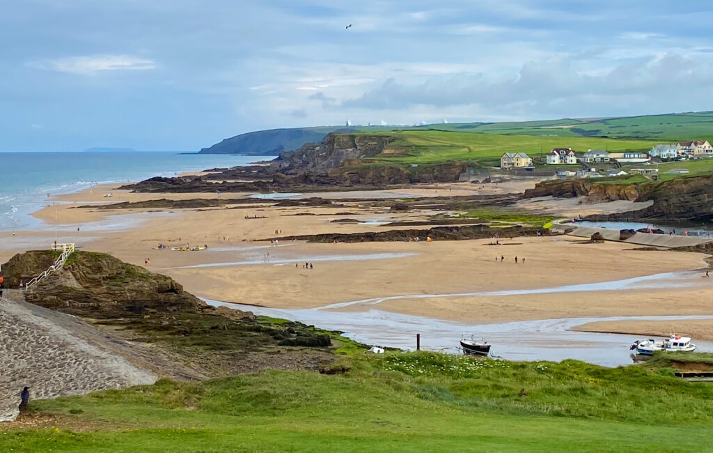
The path took us along spectacular cliff tops (Strava link), with views north up to GCHQ Bude, which gained some notoriety when Edward Snowden blew the whistle on some of the activities going on there. Basically they were intercepting and copying large amounts of data that comes through the submarine cables landing at the beach we walked to at Widemouth Bay.
Spot the huge satellite dishes on the headland in the distanceHalf way to Widemouth Bay, the coastline of north Cornwall stretching off into the distanceA beautiful pathwayAmazing colours of the heather on the headlandSometimes signs are in miles (like this) and other times in kilometres…it’s a country in flux…!Widemouth Bay is not too busy, with plenty of rock-pooling opportunitiesAn ice cream stall with dairy free options cannot be resisted before we head backAn approaching storm makes us walk faster on the return route
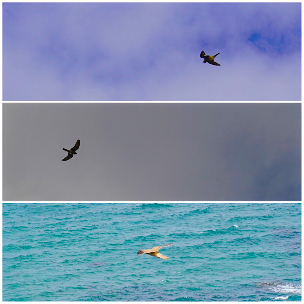
The path was none too crowded, it‘s not hard to find peace and quiet even at this peak season, by just walking away from shops and roads. We watched several kestrels performing amazing flying feats in a stiff breeze, then with an eye on the approaching storm clouds, turned our feet back to Bude.
Some of the many kestrels we saw hovering expertly in the increasing wind
Our fabulous 66km ride out to Okehampton and back left us curious to tour more of this stunning area, in particular to explore Dartmoor National Park. It is the largest area of open space in the south of England, and has been shaped by centuries of human activity.
First though, we got some unexpected news. I had emailed an old work colleague from Australia, who, I recalled in the depths of my memories, had moved to Devon from Sydney several years ago. We weren’t sure where in Devon she was living, but given we are here until the end of the month, we thought it might be possible for us to pay her a visit and learn more about her new life on this side of the world. Her response was just as surprised as ours – she had moved to none other than Tavistock!
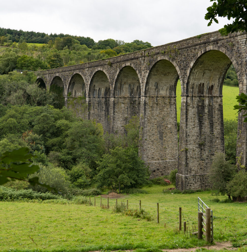
We jumped on our bikes and cycled over to her house via the Tavistock Viaduct. The viaduct is pretty much all that remains from the old railway which ran through here and closed in the 1960s – now turned into a short 2km walking and cycleway through a cool leafy reserve and offering fabulous views over the town.
Lovely and cool in the reserve, with its waterfalls and stream running alongide the pathRefreshing waterfalls on the 2km long Viaduct Walk (and cycleway) in TavistockThe characteristic white and grey slate of the houses in TavistockLooking over town, with the tall tower of Tavistock Parish Church in the centreThe River Tavy goes through the middle of town, and alongside The Meadows (Tavistock Park)
We joined Mary for cold drinks in the garden and proceeded to ask her lots of questions. It was a lovely afternoon and helped us understand more about the decisions behind a big and brave move back around the world after more than 20 years living in Australia.
Old friends in new places – Mary and Catherine used to work together in research – Mary is now a yoga teacher
Thunder storms rumbled around us but we remained dry, with the rain fortunately holding off until we were back holed up in Truffy.
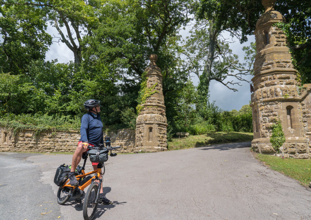
Mary had given us some advice on where to start a walk, and despite continuing wet weather forecast, we were keen to get out on the moors. We drove a short way out of Tavistock and parked up behind a pub, The Dartmoor Inn. We decided to book in for lunch after our walk.
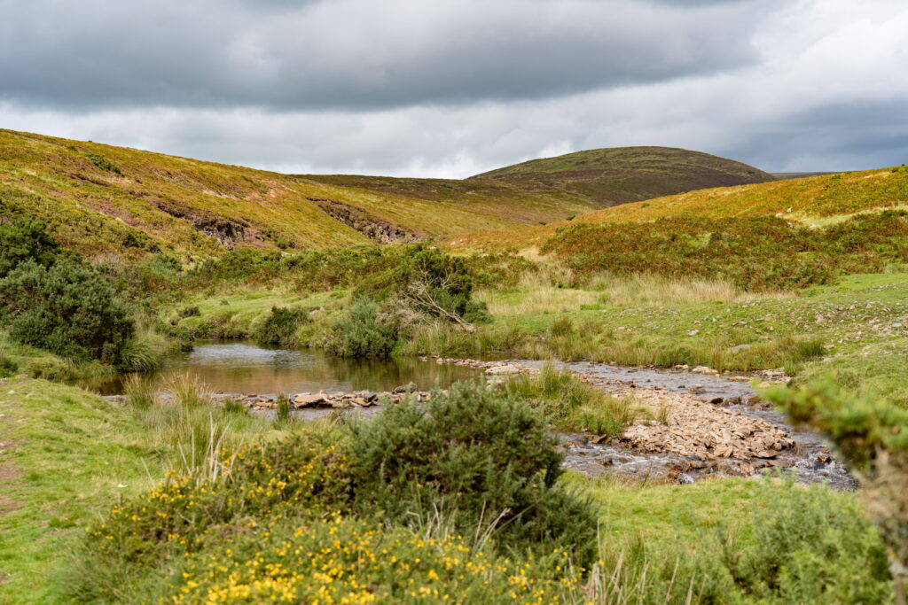
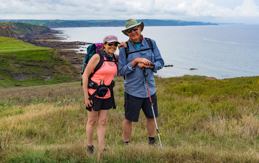
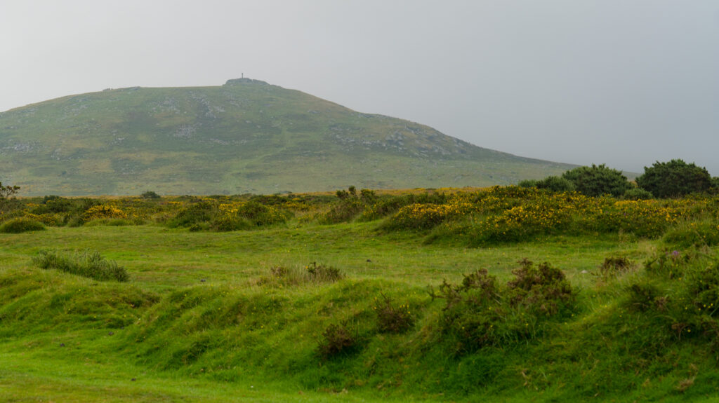
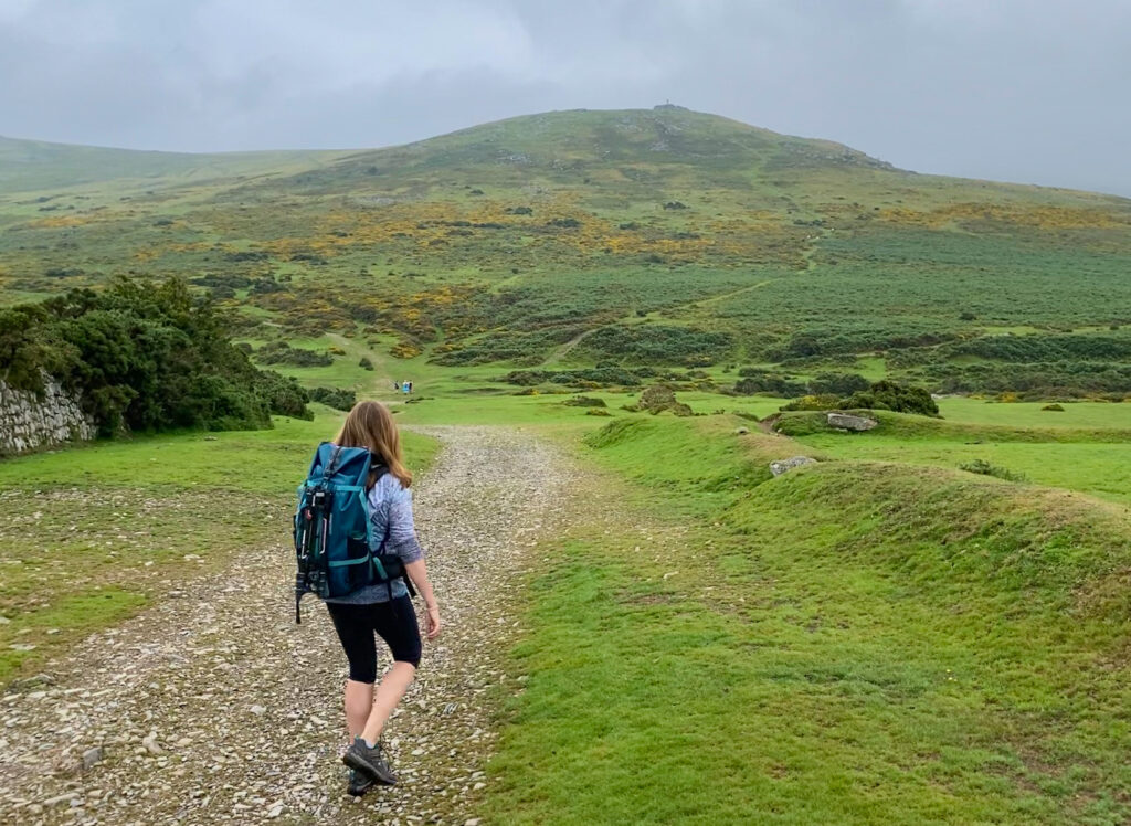
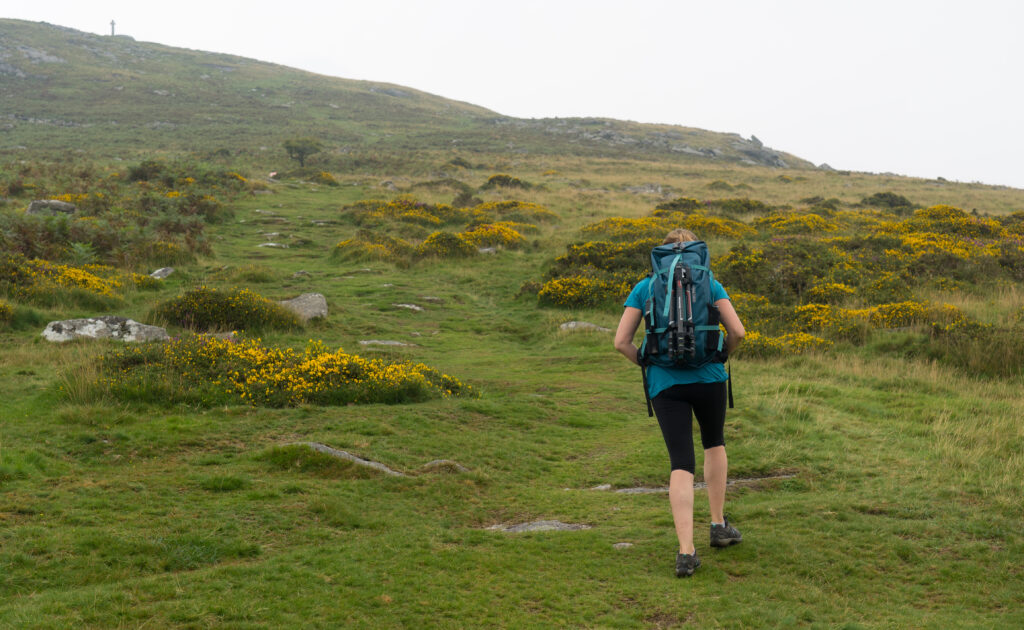
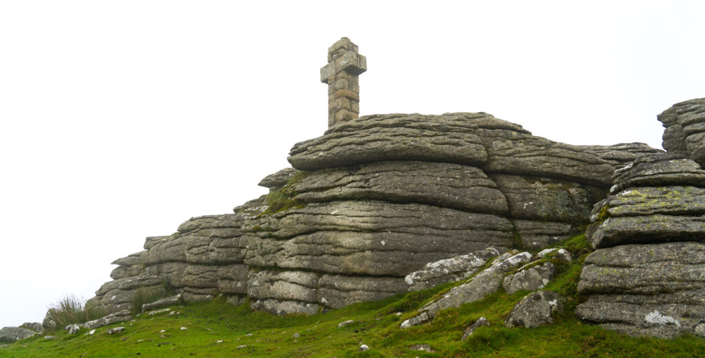
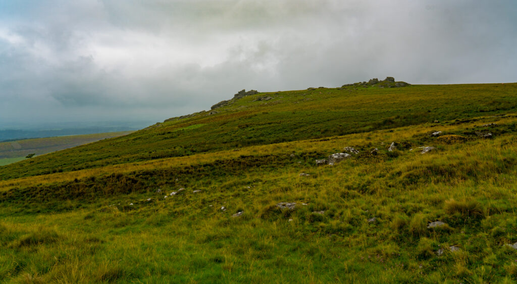
First though, we had to work up that appetite. A lane beside the pub led us directly onto Dartmoor, a completely different scenery to the bright green fields and farmland we have been used to. We decided to take a walk up to Widgery’s Cross up on Brat tor. This was erected in 1887 to celebrate Queen Victoria’s Jubilee, and is the tallest of all the crosses on Dartmoor, made from slabs of granite. A tor is the name given to peaks topped with rock, most frequently granite. Dartmoor National Park has more than 160 tors.
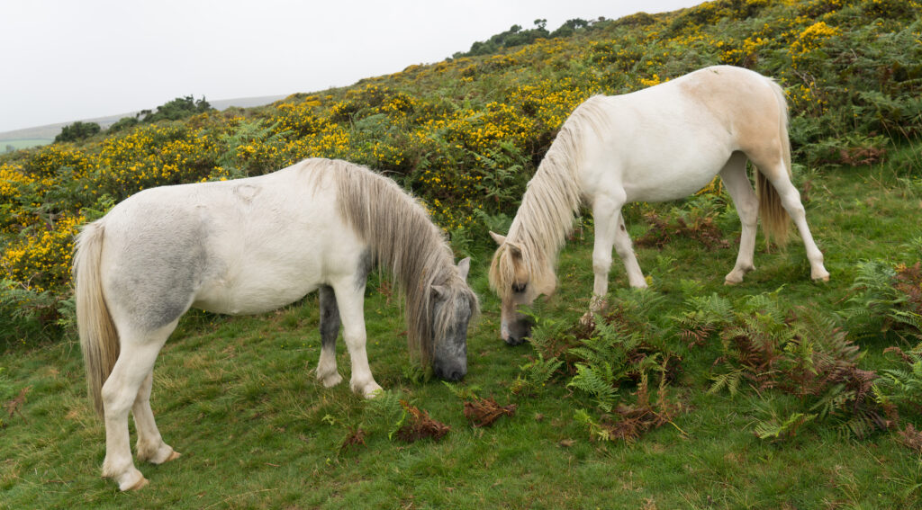
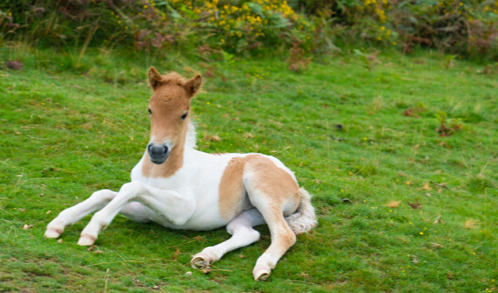
Look carefully in the distance you can just about see the cross on top of Brat torHeading off to conquer our first torEnjoying our first taster of the moorsHill ponies are one of the many hardy types of horse found on Dartmoor – this pair were clearly used to seeing people walking pastA very young Hill Pony foal is clearly not used to people yet…we chuckle at his tail which is more like a dog’s than a horse’s at this young ageGiving the calf muscles a workout on this steep uphill climb
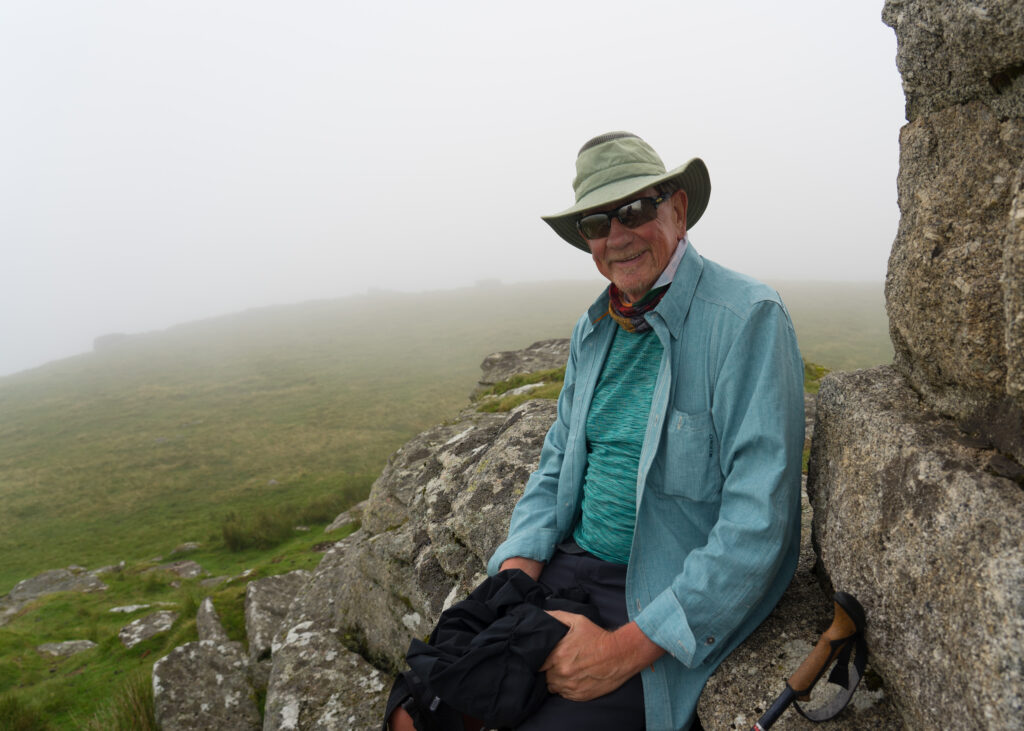
As we climbed up the hill, the ‘Devon sunshine’ descended around us, with swirling cloud obscuring the views and settling thick around us. We clambered up the rocky tor, and sat at the base of the cross enjoying a cup of tea.
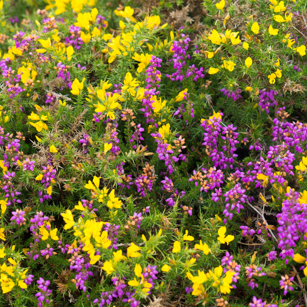
Widgery’s CrossWhere’s our view?A break in the cloud gives us a glimpse of another tor across the wayThe vibrant shades of yellow and magenta in the gorse and heather
At just over 5.5km (Strava link), this was not a long walk, but a great taster of what’s potentially on offer for us on Dartmoor. We are certainly hungry to see more in the future.
Our lunch at the Dartmoor Inn was a wonderful surprise. The new owners have only been there 12 months, but in that time spent several thousand pounds renovating the interior and bringing the menu up to date. We opted for two entrees each – crab salad and scallops for myself and a roasted tomato soup for Mark, followed by scallops as well. Absolutely delicious and accompanied by some fabulous wine options – just one glass for myself and half a beer for Mr A.
Head chef and co-owner Jay Barker-Jones popped out to chat as we finished our meal – explaining his food philosophy and dreams for the pub. We wished them every success – the food quality is definitely in line with Jay’s training in Michelin starred restaurants around the UK. We would say this meal has been the most outstanding of our visit to the UK so far.
Bonus fact for travelling folks like us – they welcome motorhomes to come and park up for the night, as long as they’re dining there that evening. If you’re travelling this way, I would definitely take up that offer and enjoy more than just one glass of wine!
Leaving our campsite in Dorset, it was just a hop skip and a jump into Devon, the adjoining county. Our next destination was a campground near Tavistock in Devon, just north of Plymouth.
We first became aware of The Old Rectory, Camping and Caravan Park when we were desperately looking for a place to live, just before Easter. The nephew of Declan (the campground owner), knows someone we know, as he contacted us via Facebook and suggested we park up here. As it turned out we were able to find and rent Honeysuckle Cottage in West Bagborough instead, and the rest is history.
Still, we had taken note of this location, surrounded by interesting hikes and cycleways, and nestled a short way from the tors and moors of Dartmoor, and had decided to book in for two weeks. What a great decision!
The weather has been variable since we arrived, with temperatures similar to winter in Australia (daytimes at 16-18 degrees) with a good dose of rain and drizzle ranging to a hot and humid late 20s the past couple of days.
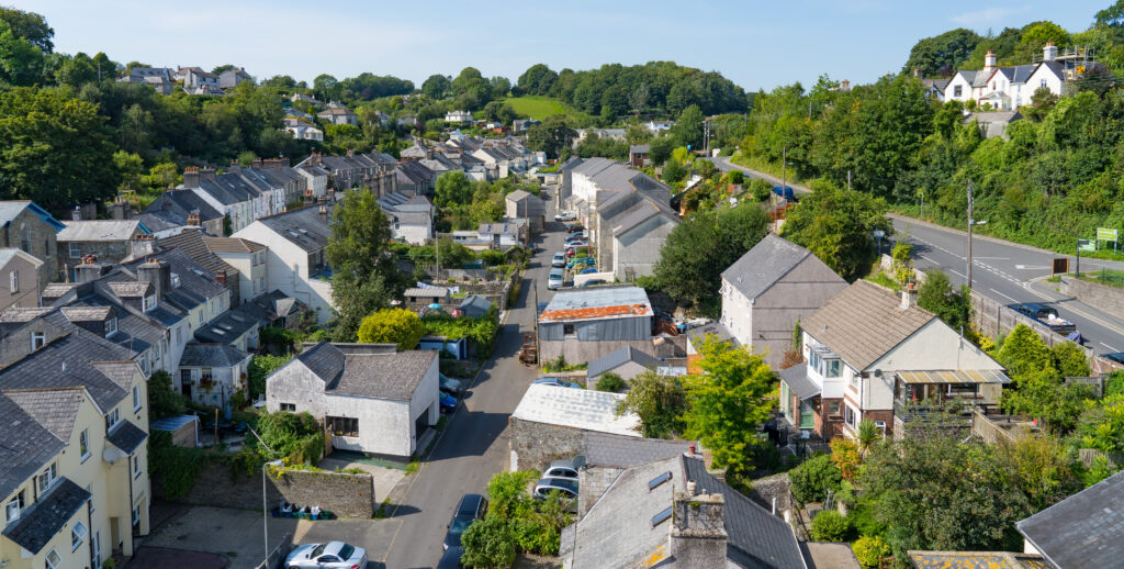
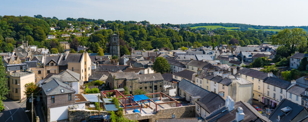
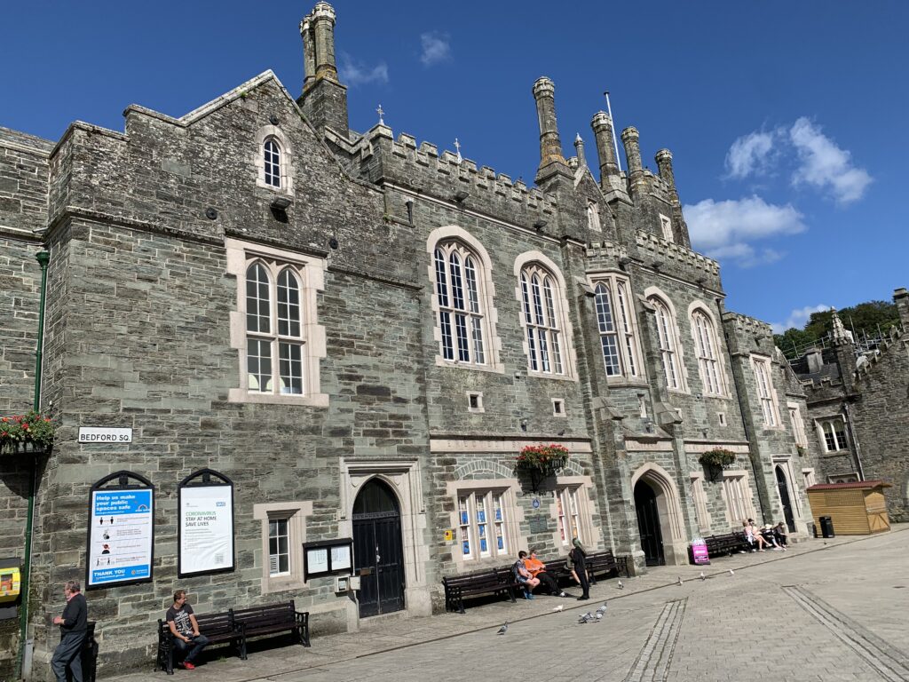
Our first impression of Tavistock was of a grand, good looking town, with its central square centred around its Pannier Markets. These were purpose built in the 1850s by the 7th Duke of Bedford using money made from the local copper and asbestos mining operations. The river was re-routed to allow for this building and the square (Bedford Square). There are still markets held here every Wednesday, Thursday and Friday.
The Tavistock Town Hall on Bedford Square
The sunshine of our first day was not set to last, so on Tuesday morning we decided we would cycle into town and have a good look around. Our campsite, The Old Rectory is just out of town, but we managed to ride in with only a short distance travelled on roads.
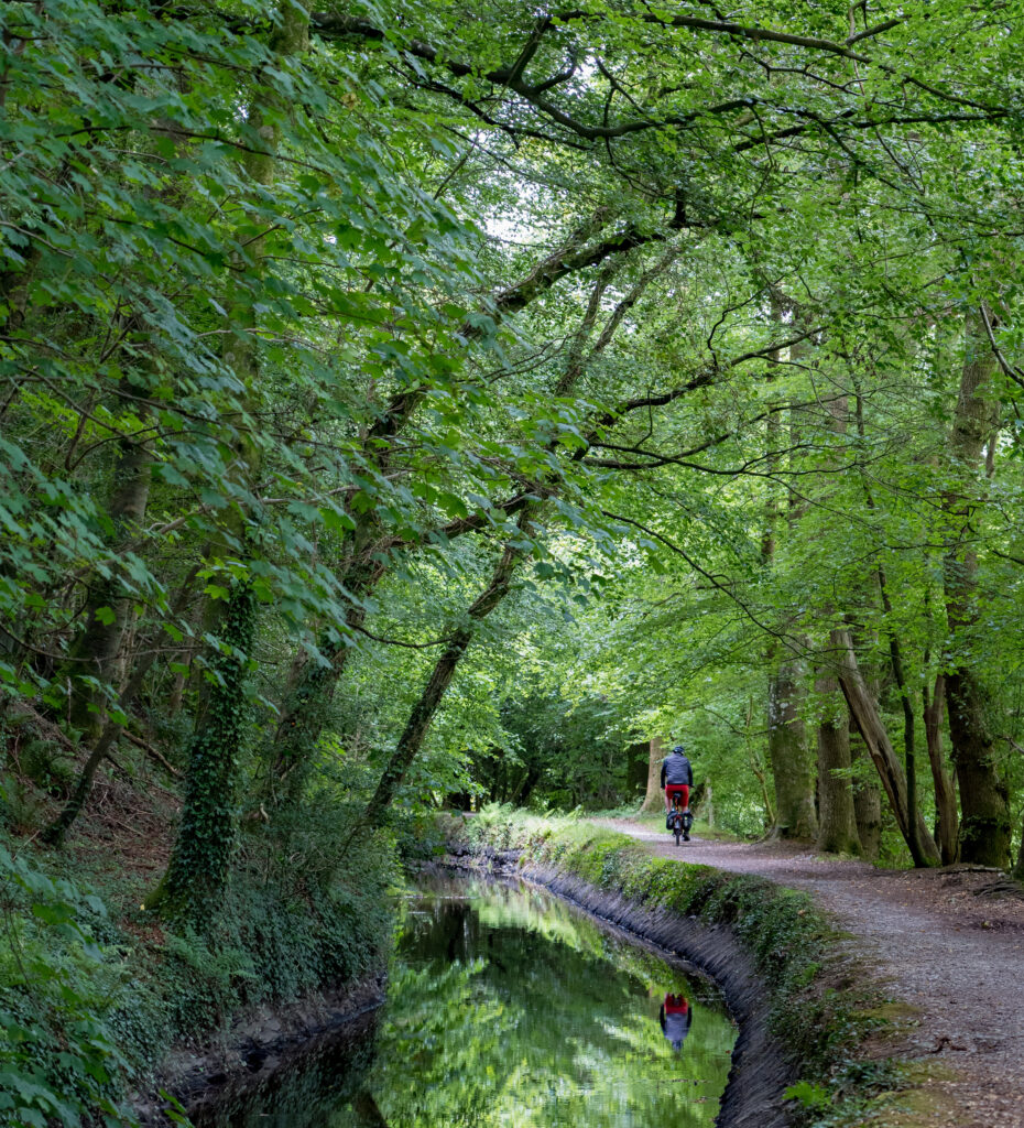
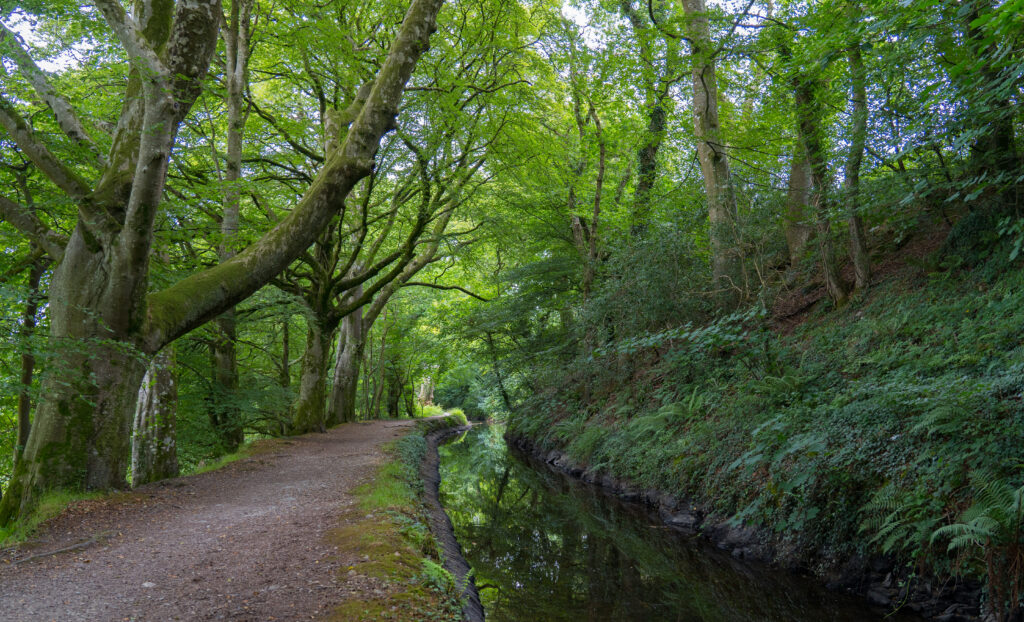
Diverting down a narrow farm track, we soon arrived at the Tavistock Canal. This picturesque area is now primarily a footpath (bikes tolerated with care), but has an interesting history dating back to 1817. It links to the River Tamar and Morwellham Quay, and was used to transport goods for shipping. These days it’s home primarily to waterfowl, but the excellent craft involved in building this watercourse is still holding strong.
Mr A riding along the Tamworth CanalOn this moist morning the dark trunks of the beech trees stand out like sculpturesThe path takes you beneath the Shillamill Viaduct – opened in 1890 to carry trains across the valley..
We had a good explore around town on our bikes, the rain holding off enough for us to enjoy a picnic of Cornish Pasties (a vegan one for me – one of the benefits of this latest food trend is dairy-free goodies!) and a hot chocolate.
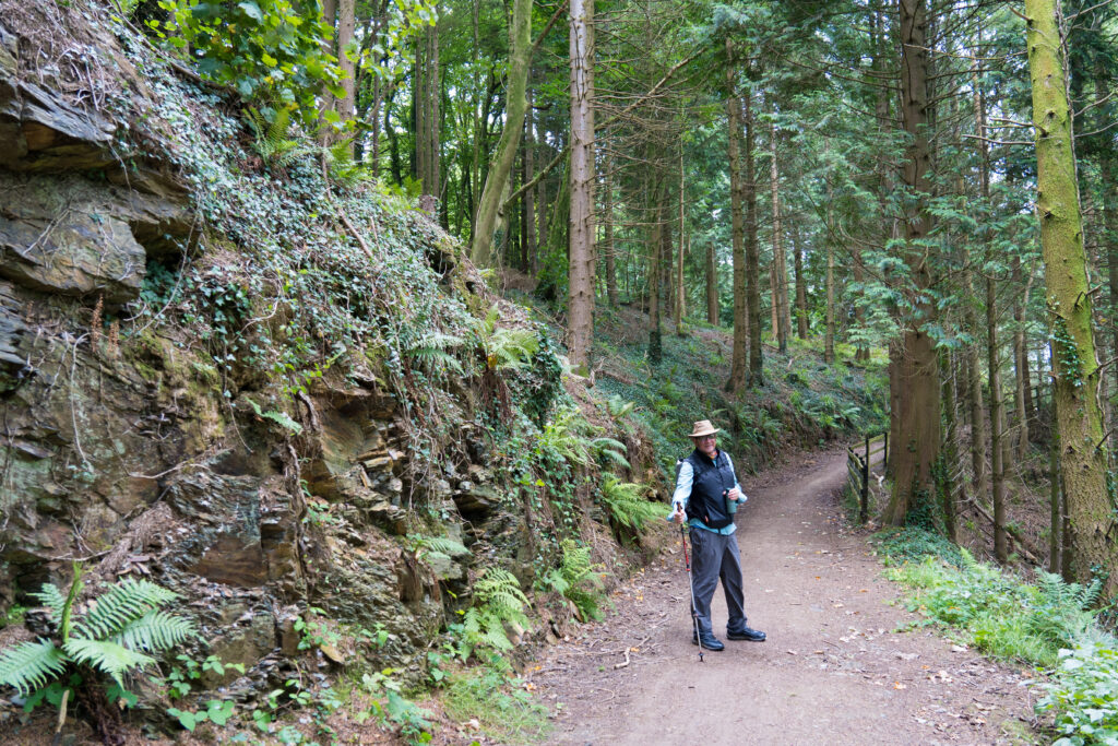
Wednesday dawned grey, but the rain continued to hold off, so we donned our walking boots and decided to hike to see the aforementioned Morwellham Quay (Strava link). Our campground is located in the hamlet of Gulworthy, on the edge of a huge network of mountain biking and hiking tracks known as the Tamar Trails. The trail network is open for all to use, with maps around detailing which are for walkers only versus shared with bikes.
Mark heading off along a track which was once a railway carrying copper to the port
This whole area is part of the Cornish and West Devon Mining Landscape World Heritage Site – protected along with the likes of the Taj Mahal and the Great Barrier Reef in Australia. The Tamar Valley was home to numerous successful copper mines in the 19th and 20th centuries.
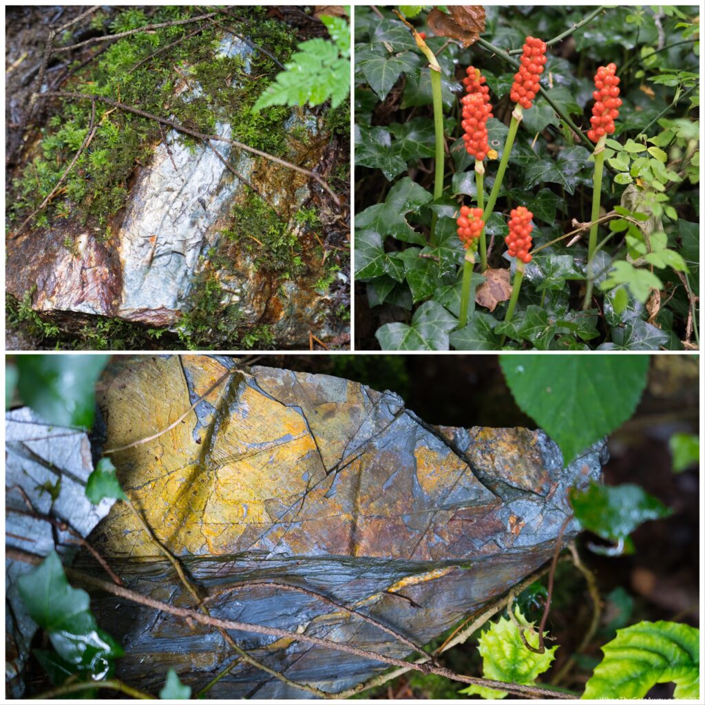
You can see the line of raw copper in this stone near one of the old minesRestored old mining buildings
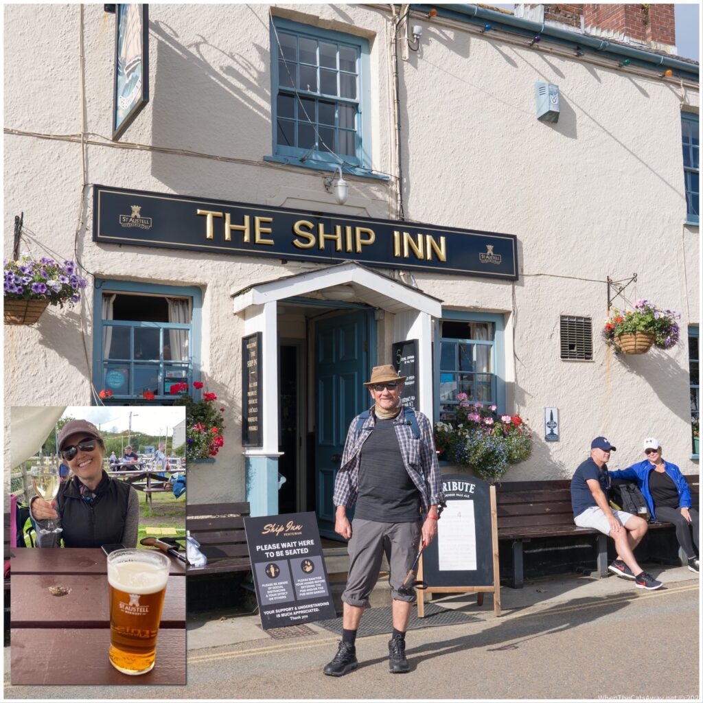
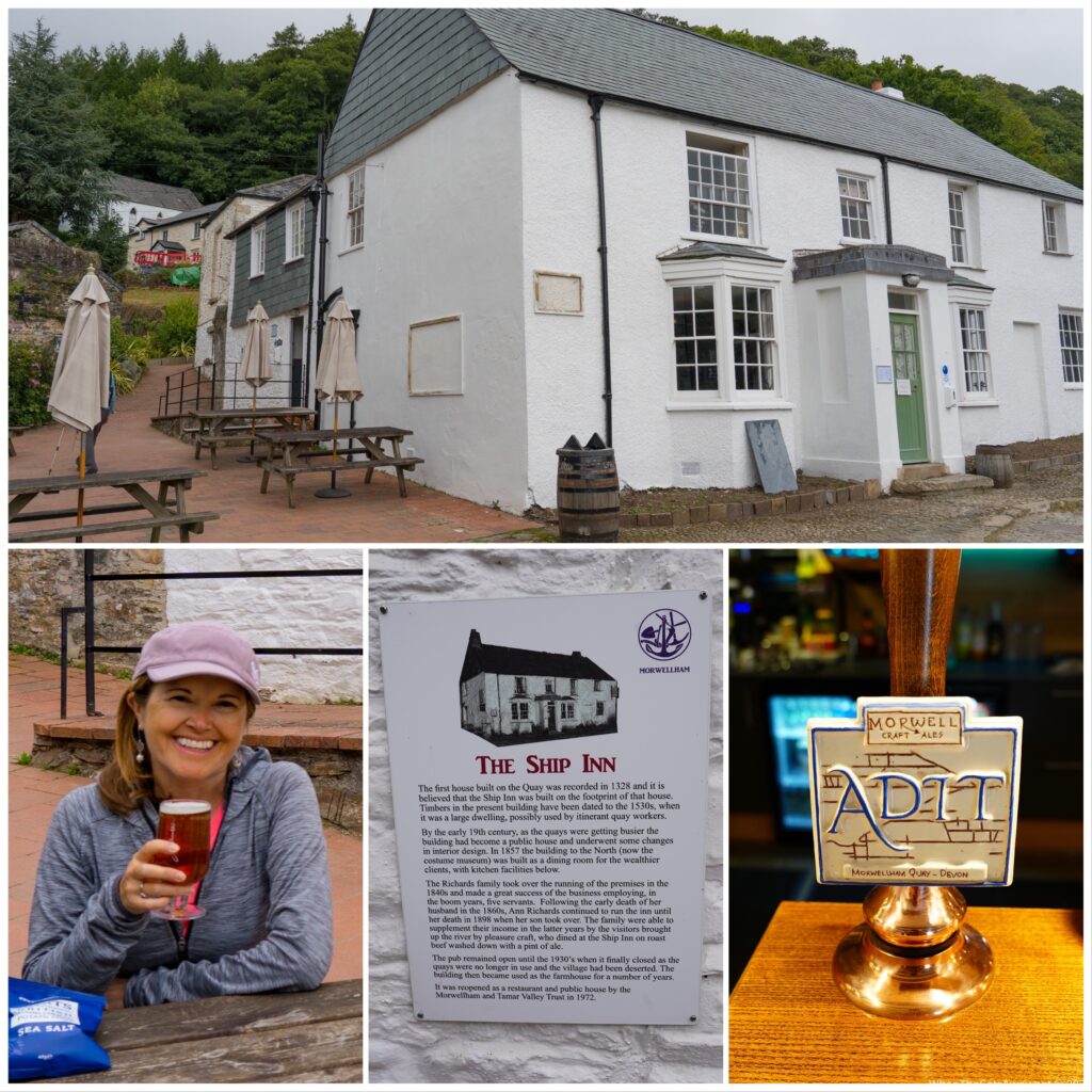
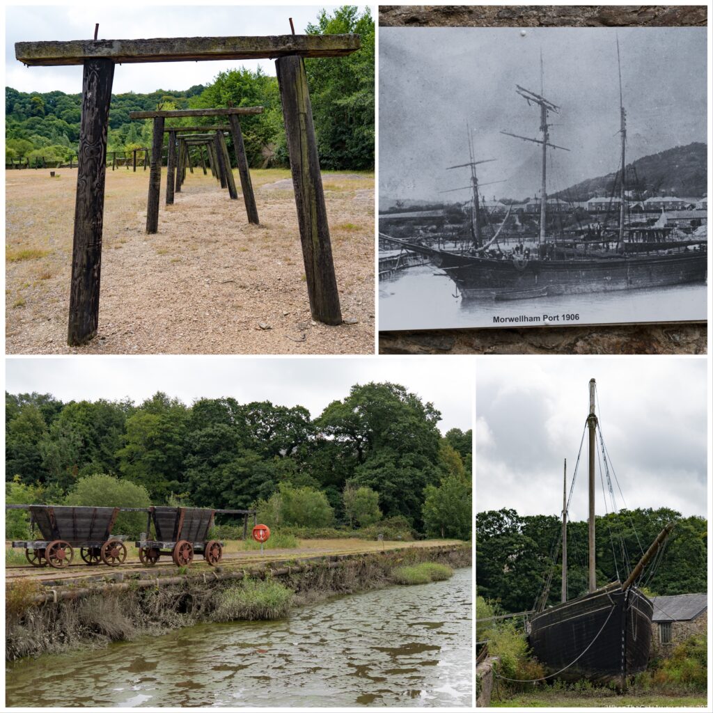
We made it down to Morwellham Quay, the site of what used to be a busy bustling port – shipping copper to Swansea to be smelted, and receiving other goods such as coal from Wales. Today it’s a museum, with carefully restored mining artefacts and (when there is no Covid), theatre and exhibits depicting life for the mine workers and their families.
Mark had read that the pub, The Ship Inn, had just reopened its doors to the public, and spotting empty benches and an open door, checked to see whether they were serving yet. It was 11.30am, but yes indeed, two half pints of a locally brewed beer were soon drawn and we enjoyed those sitting outside on the cobbled streets.
A half pint of the very tasty Morwell Quay Ale enjoyed
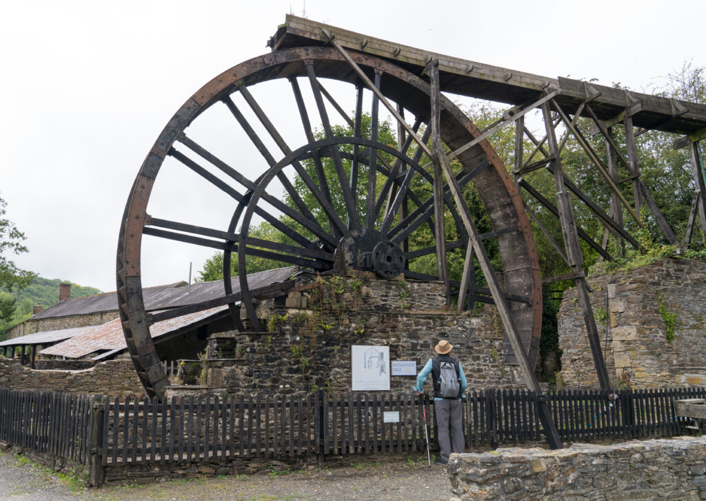
It was very quiet on this afternoon, just a few people camping in the nearby field, and none of the usual attractions open. We explored what we could around the quay, all very interesting and somewhat hard to imagine with the river not looking deep enough to cater to much more than small pleasure boats, much less the huge ships required to transport goods.
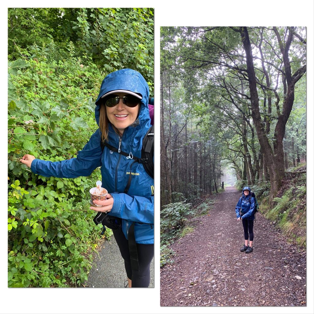
Exploring more restored mining memorabilia On this sleepy afternoon it is hard to imagine the busy port this once wasThe rain kicked in on our return walk, but I still managed to pick some fresh blackberries to go with my dairy-free ice cream!
The following day was wet and drizzly, our location high up on the edge of Dartmoor meaning we were surrounded by cloud and fog. We caught a bus into Tavistock to have a look around the Pannier Markets and shops. It’s such a shame the experience has been tainted by this virus. Masks have to be adorned, the market stalls have been halved to allow for social distancing, and people are somewhat on edge. I think the whole experience of not being able to see peoples’ faces has tainted perceptions. A visage hidden behind a mask can look threatening and unfriendly and sadly that is how we were treated in a few of the stores. We didn’t spend long in town, stopping only for lunch in a cafe and returning to Truffy earlier than anticipated.
Friday morning we woke early for us (before 7am!) as fine weather was promised and we had an exciting day planned.
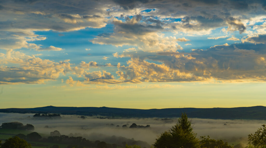
Our view up on the hill at sunrise, looking down at the misty valley below
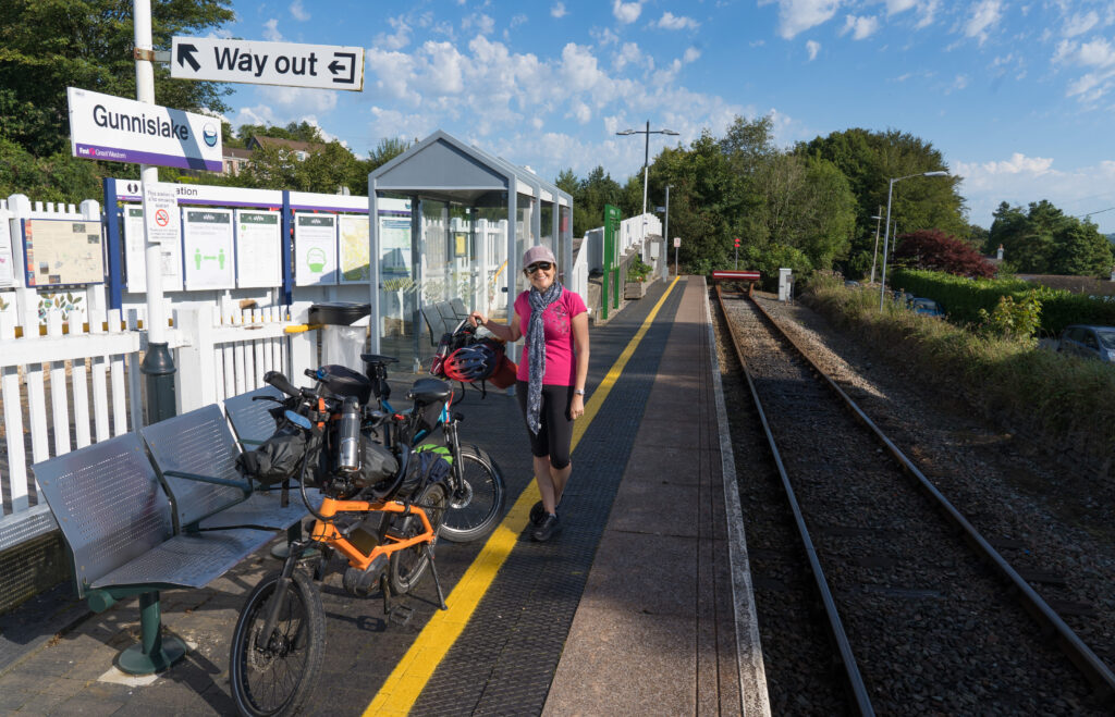
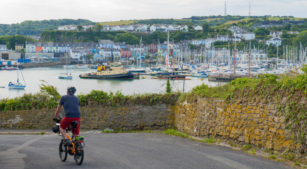
We cycled to the next village of Gunnislake and caught the train from there into Plymouth.
Gunnislake is the end of the line
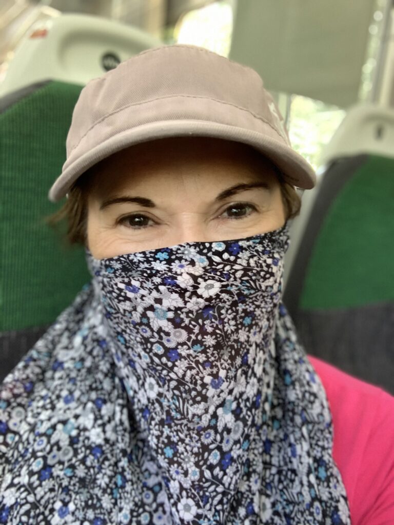
Face coverings are required on trains, and I didn’t much fancy wearing a hot mask for the best part of an hour. I experimented with my scarf, which worked quite nicely.
Still covered, but much airier than a tight fitting mask
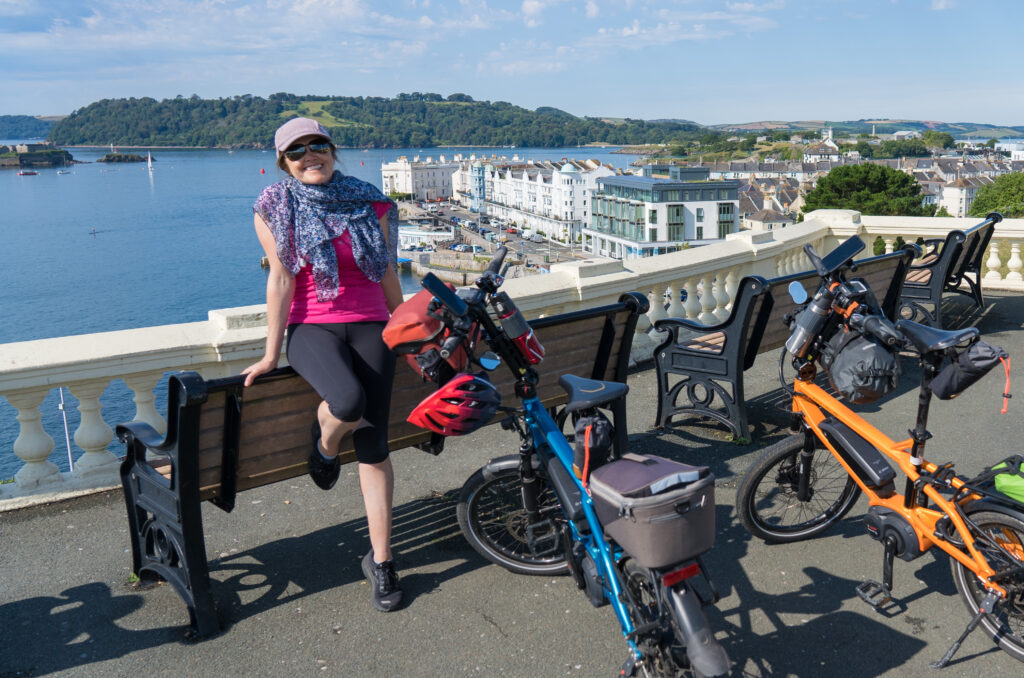
Neither of us can remember ever visiting Plymouth before and were both impressed on arrival. It was a short cycle from the train station down to the front, adorned with magnificent hotels with incredible views.
A sparkling Friday morningBeautiful scenes from Hoe ParkHoe Park and hotels with commanding views
We explored around the Barbican area, a buzzing harbourside suburb
Perfect reflections in the marina – an approaching thunder storm making for dramatic coloursThe cobbled streets and cafes of Plymouth’s Barbican areaLooking out towards Clovelly Bay – a ferry goes across to here
We had an explore around the foreshore, enjoying the authenticity of the port buildings and fish markets, not simply providing sights for tourists. When the storm hit, we ducked into a pub to find lunch.
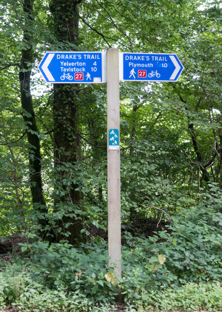
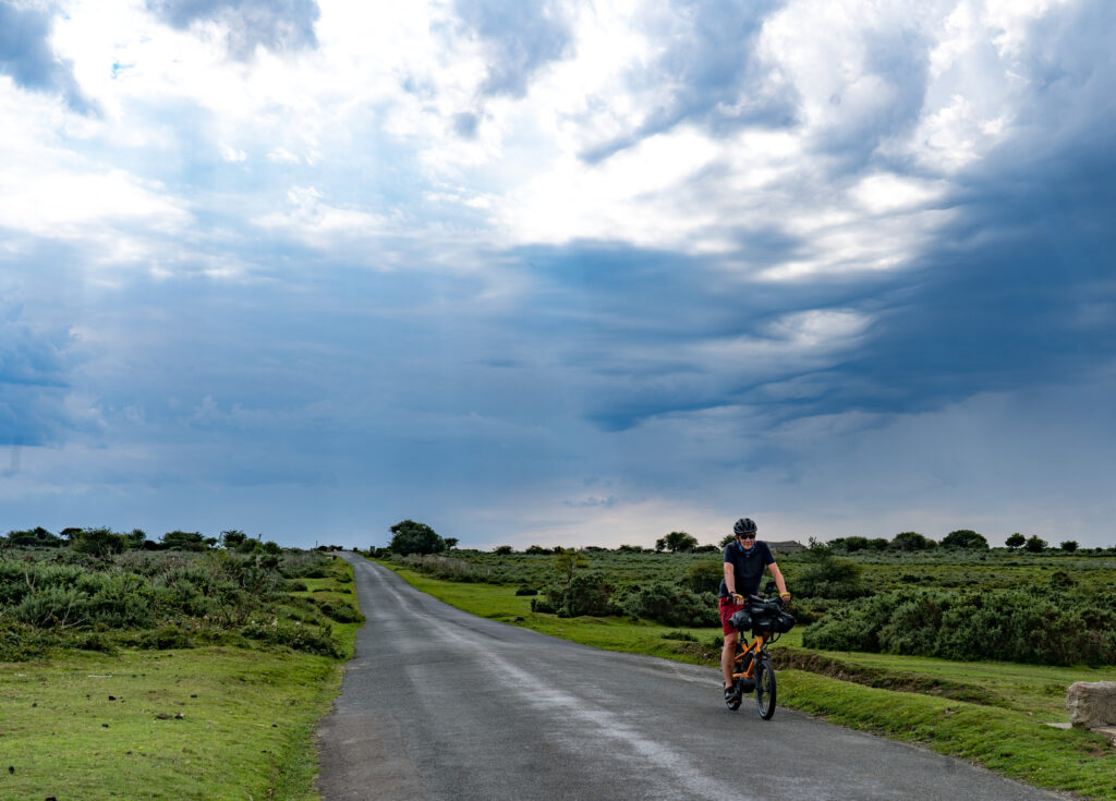
Sated, we set off on our way back to Tavistock. We rode along National Cycle Route 27, following a section known as Drake‘s Trail, named after Sir Frances Drake, the famous Elizabethan seafarer. The track is a 33km (21 mile) route which winds through riverside fauna, forest and through part of Dartmoor National Park.
Mark cycling along the River Plym estuary, home to many birdsThe half way markerMore threatening skies as we ride across the edge of Dartmoor
It was a great day out, and we left Plymouth keen to visit again. It is such an interesting city – with islands, forts, and a lot of history to explore. It’s on our list for a longer trip in the future.
A hot day dawned on Saturday so we had a chilled out day. Next month I have been invited to present at an online conference (for the Patient Centred Outcomes Research Institute – PCORI) about conducting research via the rare disease support group I run, so worked on my biography and presentation, while we caught up with the washing before the next rain arrives.
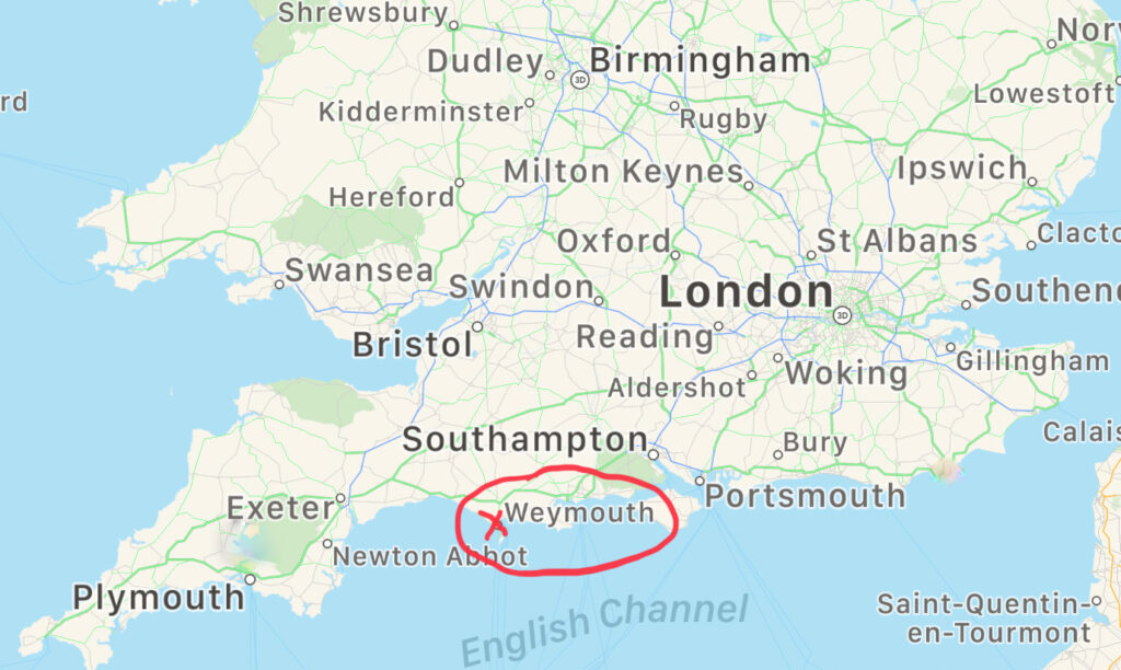
Location: Moreton, Weymouth, Bridport and Charmouth, Dorset
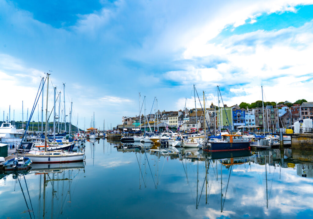
Arriving at our next campsite, another Camping and Caravan Club site, it was becoming “normal” to have to wait in the motorhome and be given a list of all things you couldn’t do because of the restitutions designed to minimise the spread of the COVID-19 virus. But the sun was shining and we tried to cast aside our concerns, deciding to catch the train into the nearby seaside resort of Weymouth. Not a place either of us had recalled visiting before when we lived in England, but the wow factor on this blue sky day was huge.
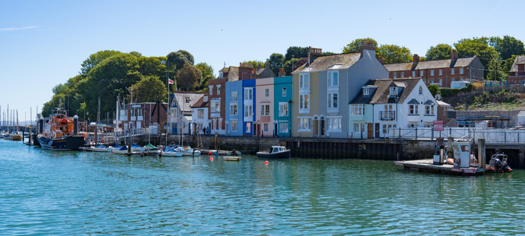
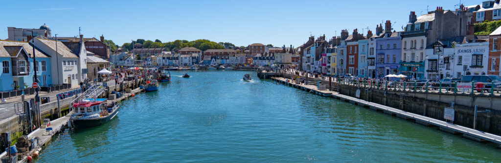
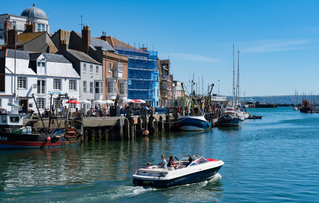
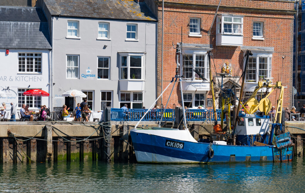
We walked around the old harbour area, I’m always fascinated by them, and not just because that’s always where the cafes and restaurants are (although that does perk me up), but its the history that seeps out off the buildings. What tales they could tell.
One of the loveliest harbours we have visited On this stunning morning it could have been the Italian RivieraA working fishing fleet
This town just had both of us gawking at it loveliness. It seemed to have just a great balance between feeling like a working harbour, and a place you would love to holiday in. It wasn’t until afterwards that we read it was the first place to record the Black Death arriving in 1348!
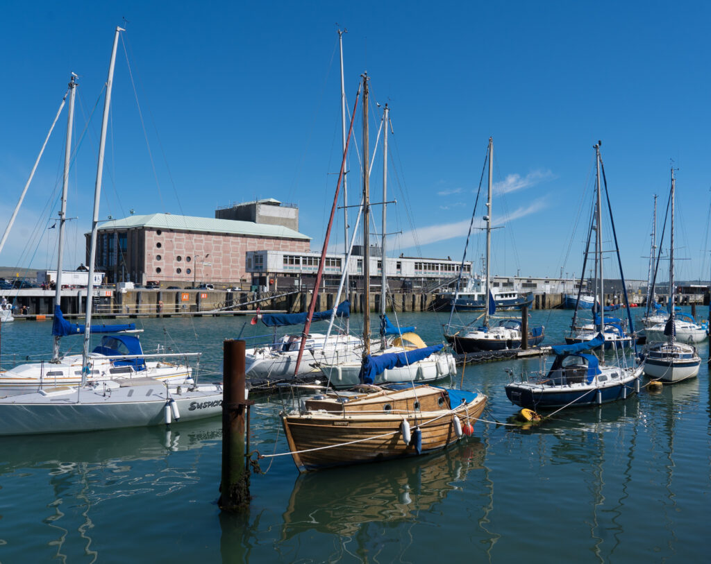
Extensive marina filled with glistening yachtsFishing boats moored up alongside the jettyWorking fishing boat Pleasure boatsA lovely coast walk, with views out towards Swanage
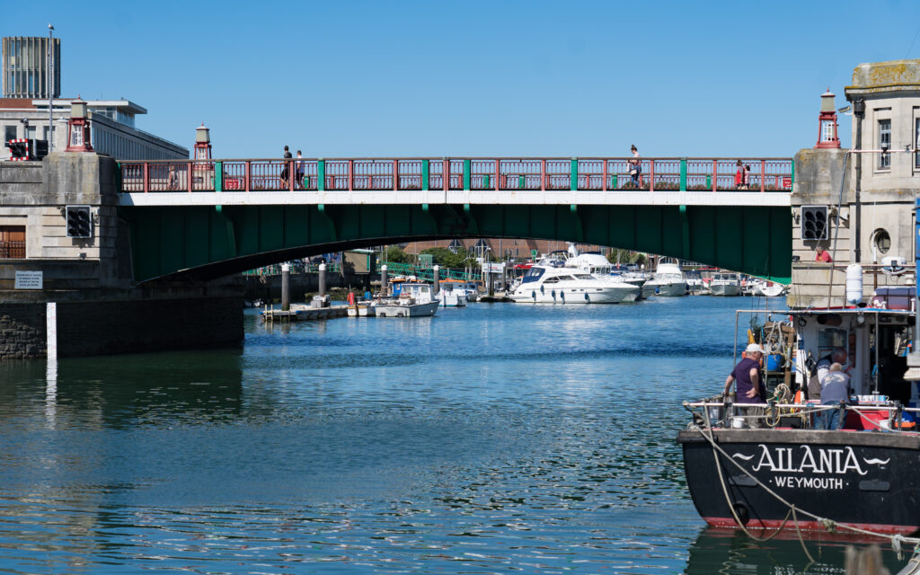
Once we moved around the edge of the harbour, walks opened up along the coast. The South West Coast walk for instance stretches for hundreds of miles in either direction from here.
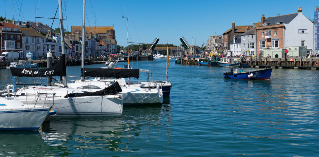
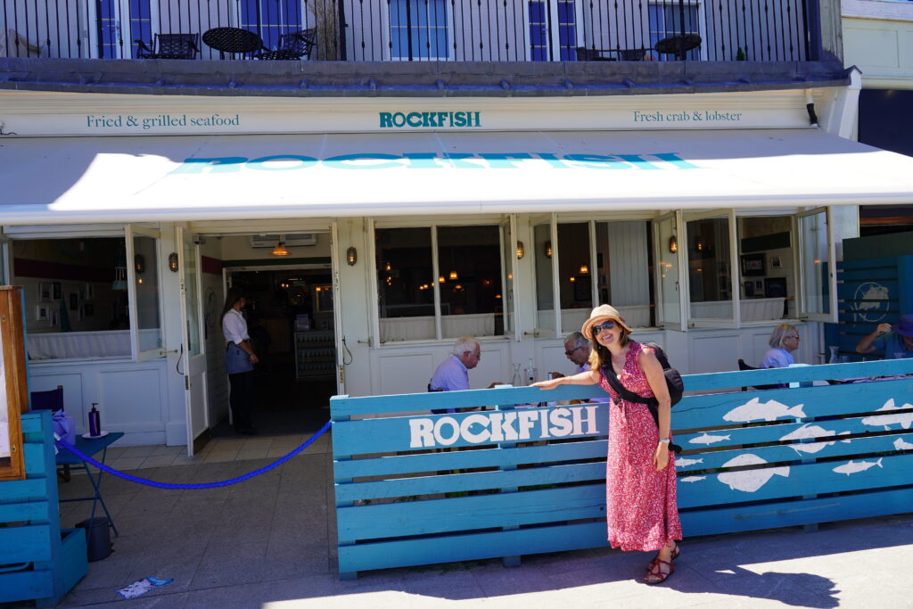
Picture perfectThe bridge opening up to allow the yachts to head out to seaWe decide to treat ourselves to lunch at Rockfish
But our tummies told us it was time to pick a lunch spot, and after chatting to one of the locals, who turned out to be a London chef with a holiday house in town, we went to the restaurant he recommended. It was our first “flash” lunch since Sydney in February. It was so perfect, until they messed up the order and brought Catherine a dish that contained dairy. But once the error was pointed they were mortified, and wouldn’t let us pay for a thing! What exceptional service.
Some places just have a great vibe about them, and this was one of them. I even managed to get my eyes pressured checked on the spot – and all was well – a great relief.
Where in the world are we?
Every time we looked up and out at the sparkling ocean, we had to remind ourselves that we hadn’t been transported to some mediterranean resort. Well until you looked at the people wandering around – definitely Brits!
Pedestrianised town centre…
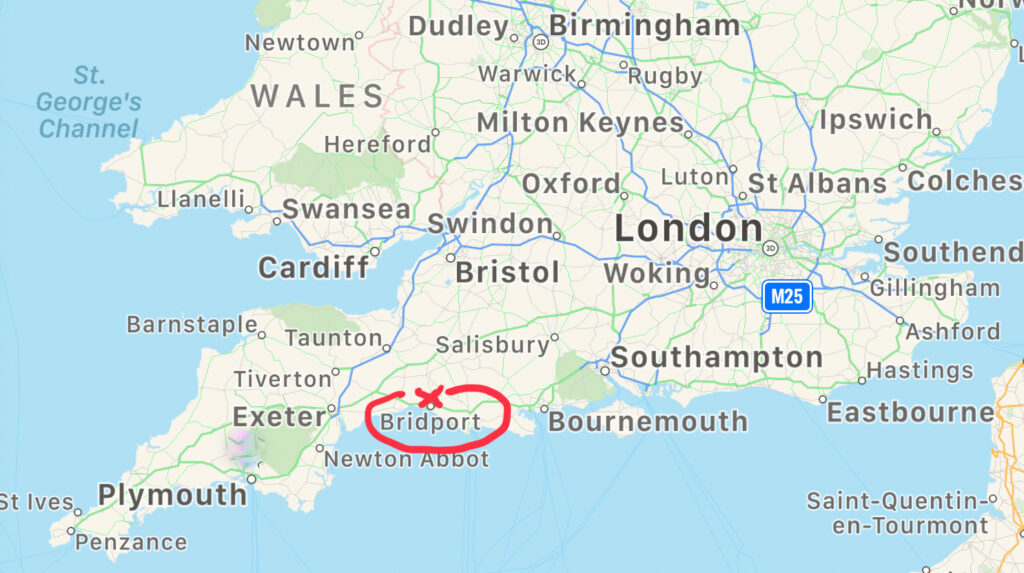
Next stop on the Dorset whistle stop tour tour close to the small town of Bridport. We had managed to find a space on a Caravan and Camping Club farm site. These are great places for us, with just a water tap, somewhere to empty your toilet waste, and on this one, mains power.
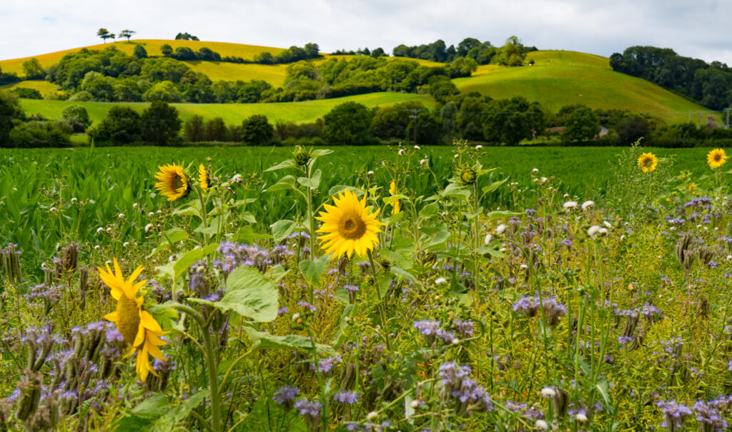
We could walk right from the site out onto the hills, and ended up doing an 18k circuit.
Walking alongside picturesque countrysideLunch on top of a hill with panoramic viewsNo other people but a lot of friendly cowsViews down towards Charmouth and Lime Regis A full body workout on this hike!Following ancient pathways criss crossing the countrysideMore friendly localsThe sea is tantalisingly close on this hikeIs this an extinct volcano we wonder? Apparently not – a sandstone hill and a local iconPoppiesThe trusty secateurs come in handyThe footpaths are certainly not well used – we have to tramp our way through plenty of undergrowth to work our way back
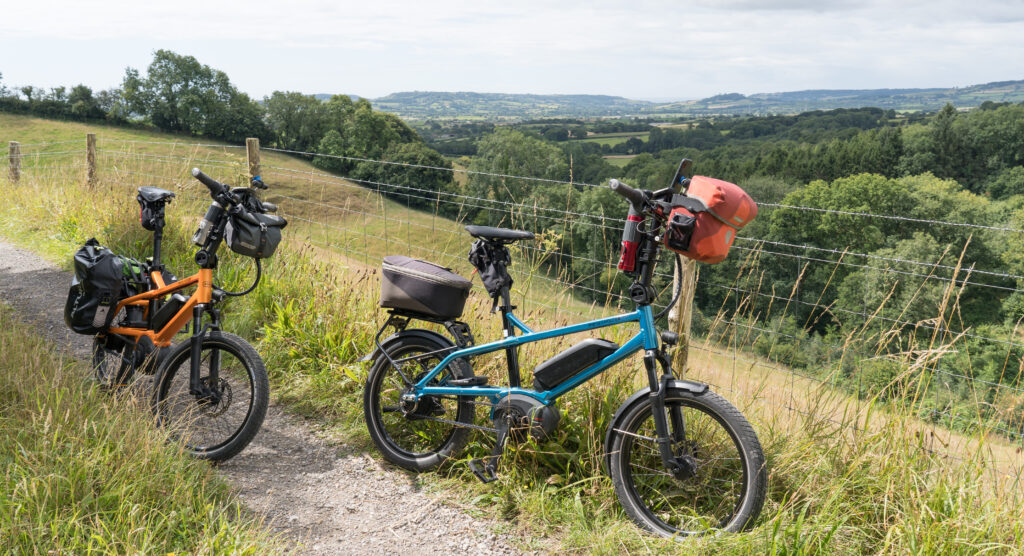
A little stiff, the following day a we pumped out a 39km cycle up through enough hills to give us decent workout, even with our batteries. People seem to think an electric bike is like a moped. You just twist the throttle. Some of them are. Ours are whats called “pedal assisted” – you get a little help – but you still need to work.
A quiet little bridleway keeping us away from the traffic as we explore across countryFabulous views, our reward for all the uphill ridingLooking down at the little town of Charmouth, the English Channel glistening like diamonds in the sunshineCatherston Leweston – and the grandest entrance gateway we have seen in a long while – apparently leading to an 18th century manor house
We then had the pleasure of a long, fast downhill into the small seaside town of Charmouth, heaving with school holiday visitors, but with almost no tourist development. The few cafes there were had massive queues for the standard fried fare. As usual we were relieved to have brought a picnic and a flask of tea.
Charmouth – looking west towards Lyme RegisCharmouth – looking east towards Weymouth
This is a part of England‘s south coast that we will come back to and explore more, ideally when its not peak season. It has ingredients we love – walking cycling, and enticing pubs. Hopefully it will at least be when we can actually get in to a pub spontaneously and not have to book – as we were told we needed to at the one place we tried. Testing times.
Sun sets on our final night in Dorset…for now….Truffy…out standing in his field (again)….
Location: West Bagborough, East Quantoxhead, Mendip Hills, Somerset, UK
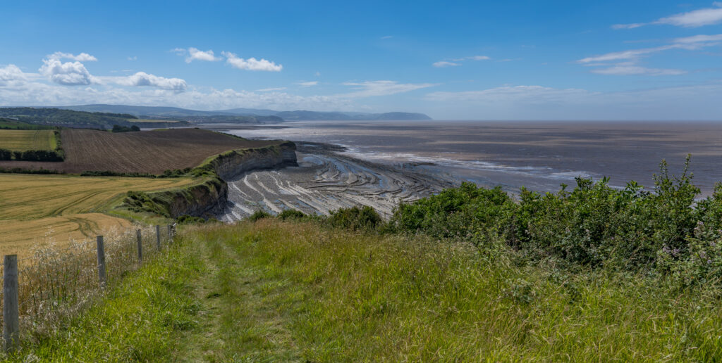
It was hard not to feel a little sad and apprehensive at our impending departure from West Bagborough, and the weather didn’t help either, with its chilly breeze and drizzly rain. With a little sunshine forecast for Monday afternoon we forced ourselves out of the house and down to East Quantoxhead for a walk.
We just love the scenery down there, and we had the whole area to ourselves. The wind was rather chilly, but when the sun came out and you were in a briefly sheltered spot you could have imagined it was summer!
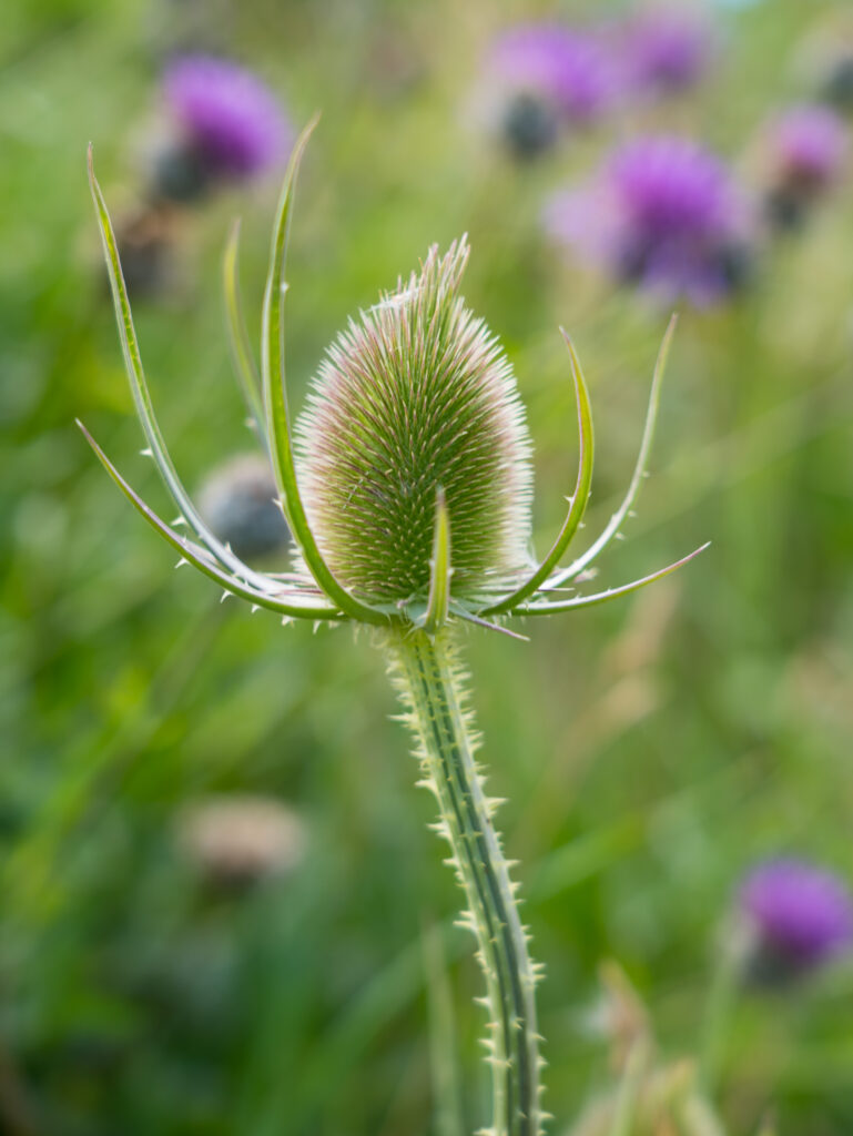
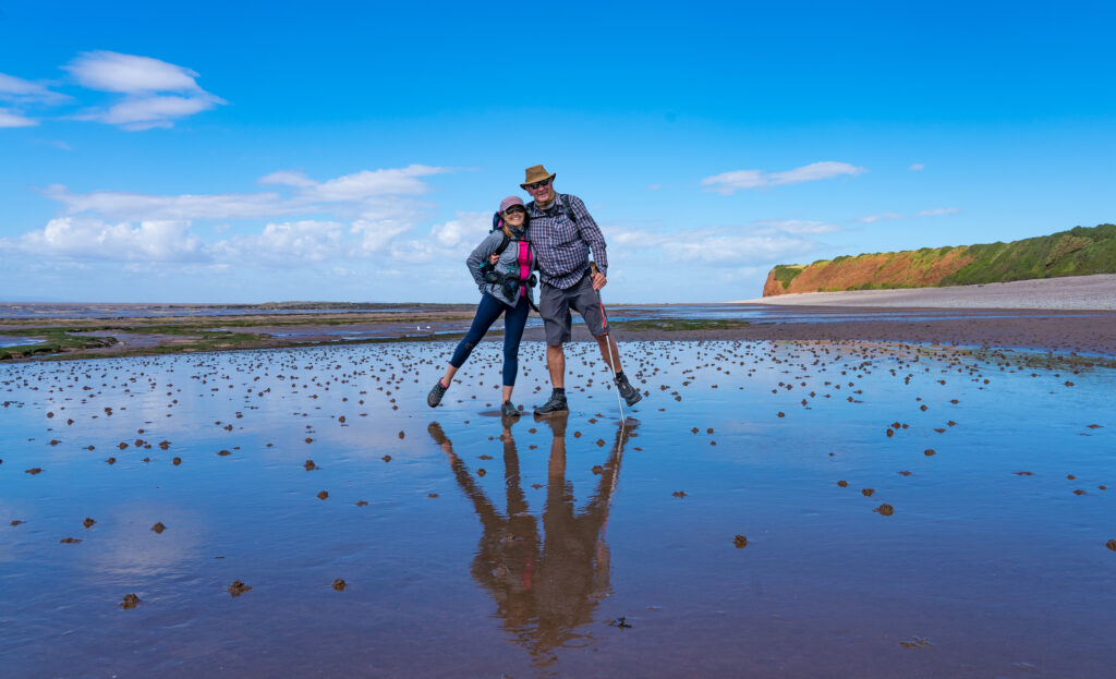
Bridgewater Bay looking wild and windsweptCommon Teasel (Dipsacus fullonum)Teasels with a viewOne very empty beach – all ours!
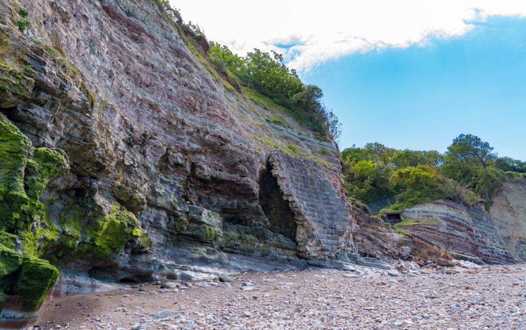
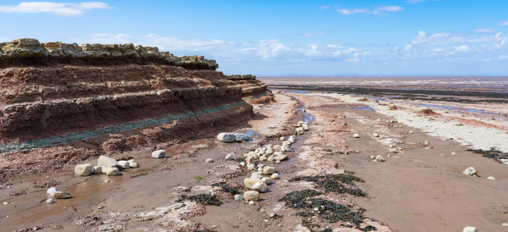
The beaches here might not have the squeaky fine white sands of Australian shores, but they are far more interesting. The tide goes out a long way here, revealing fossil filled rock pools, petrified forests, attracting herons and other fish-loving birds. The pink and mauve striped sedimentary rocks look like magnificent sculptures.
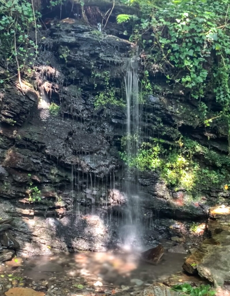
Mr A climbs up to see the St Audries Bay waterfallThe waterfall is little more than a trickle just nowSigns of times past in an old wall slowly being taken by the seaRemnants of times when goods were transported by waterOur path – so much more we have yet to seeNobody else here! We could hardly believe itLiterally can see the layers that make up this land here, raw and exposedA perfect newly hatched tortoiseshell butterfly dries its wings in the breezeOur final lingering glance at this stretch of coastline for a whileThe 14th century church sits alongside medieval barns and the Court House – a grand mansion built nearly 800 years ago. The village is steeped in history
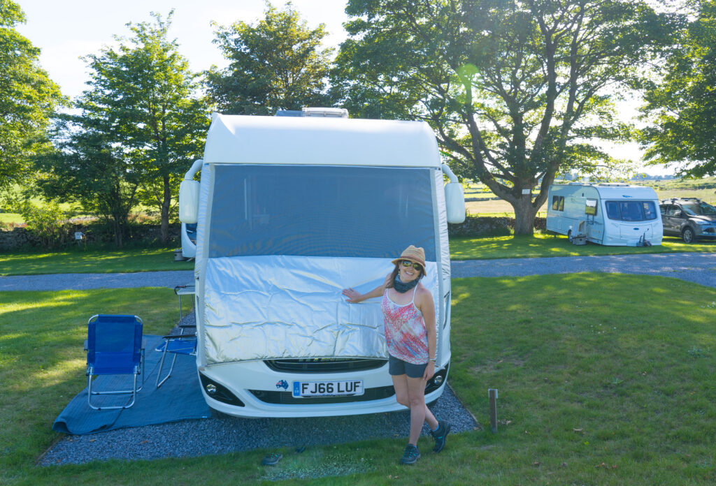
Our week was then largely spent making preparations to head on the road – getting Truffy packed up (it is amazing how everything somehow fits back in to him!), and returning the cottage to its former state, ready for the next holidaymakers to arrive.
We had some farewell drinks and fish and chips with our friends down at Quantock Camping, their site now bustling with visitors enjoying the luxury of personal toilet blocks, and also were invited for some wine and nibbles with our landlady, Jennifer.
Suddenly Friday morning was upon us, and we packed off our final bits and pieces, and hit the road.
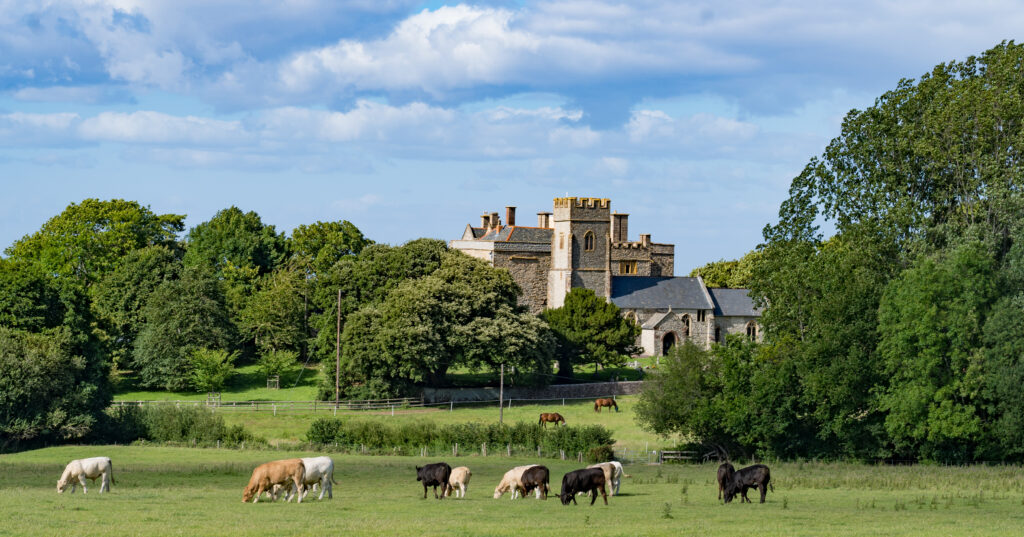
Our first stop was the village of Cheddar in Cheddar Gorge. This is located in the southern Mendip Hills, and riddled with limestone caves. In the early 1900s a complete human skeleton was found in one of the caves here which was carbon dated as being about 9,000 years old.
This is also, of course, the location which first made Cheddar cheese – with documented evidence of its particular recipe going back to the 12th century. Apparently the caves in the gorge are the perfect temperature and humidity for maturing the cheese.
On our visit however, the caves and the museums showing the evidence of first humans were closed due to Covid-19, so we donned our hiking boots and took to the hills instead (Strava link).
Our circuit walk around the Cheddar Gorge valley
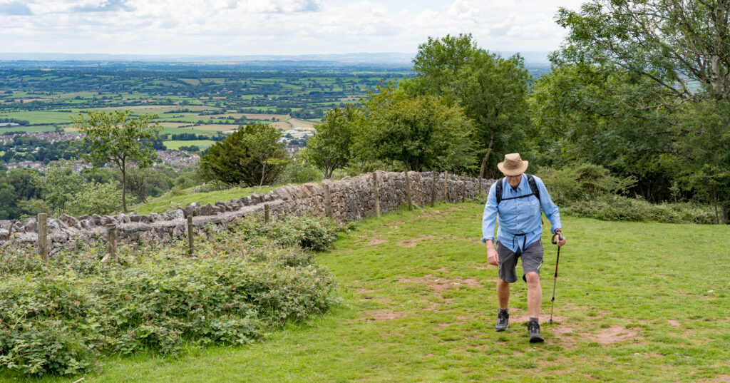
The climb up from the valley floor was rather steep, but once up on top we were rewarded with magnificent views, easily able to see the Quantock Hills and all the way down to Minehead.
A steep hike up to the gorge walls rewards us with some impressive viewsSitting on the edge of the gorgeThe steep walls and caves are popular with climbers
We climbed along the top of the cliffs, enjoying the fabulous views and fresh air. Up on the cliff walls, delicately picking their way along the greenery, are a number of Soay Sheep. They are brown in colour (and rarely, patched with ginger!) and live here accepted as a feral flock. The sheep are native to islands off the coast of Scotland, and were released here in the early 90s, these days appreciated as lawn mowers, keeping the undergrowth in control.
Originally we intended to make a circuit around the other side of the gorge, but the primary access point, Jacob’s Ladder, was closed for repairs. Instead we wound our way back to the village down the road.
We later drove back up through here in Truffy – steep gradients and blind bends made for a lovely driveA magnificent stone amphitheatre
Back in the village, a few of the local shops had recently opened to visitors – most importantly, the Cheddar Gorge Cheese Company. They still mature some of their cheddars in the caves, and Mr A could not resist a tasting.
Some of the very mature cheeses were quite stinkyA couple of unique purchases made – this is not your usual supermarket cheddar
Our destination for the night was the village of Priddy. Unlike the massive distances we are used to travelling in Australia, this is just 54km (33.5 miles) from our former cottage in West Bagborough – practically a day trip! We settled ourselves in for a peaceful night.
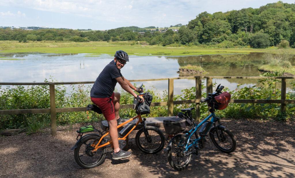
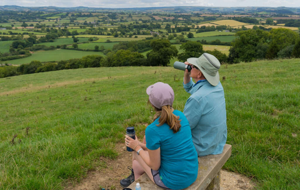
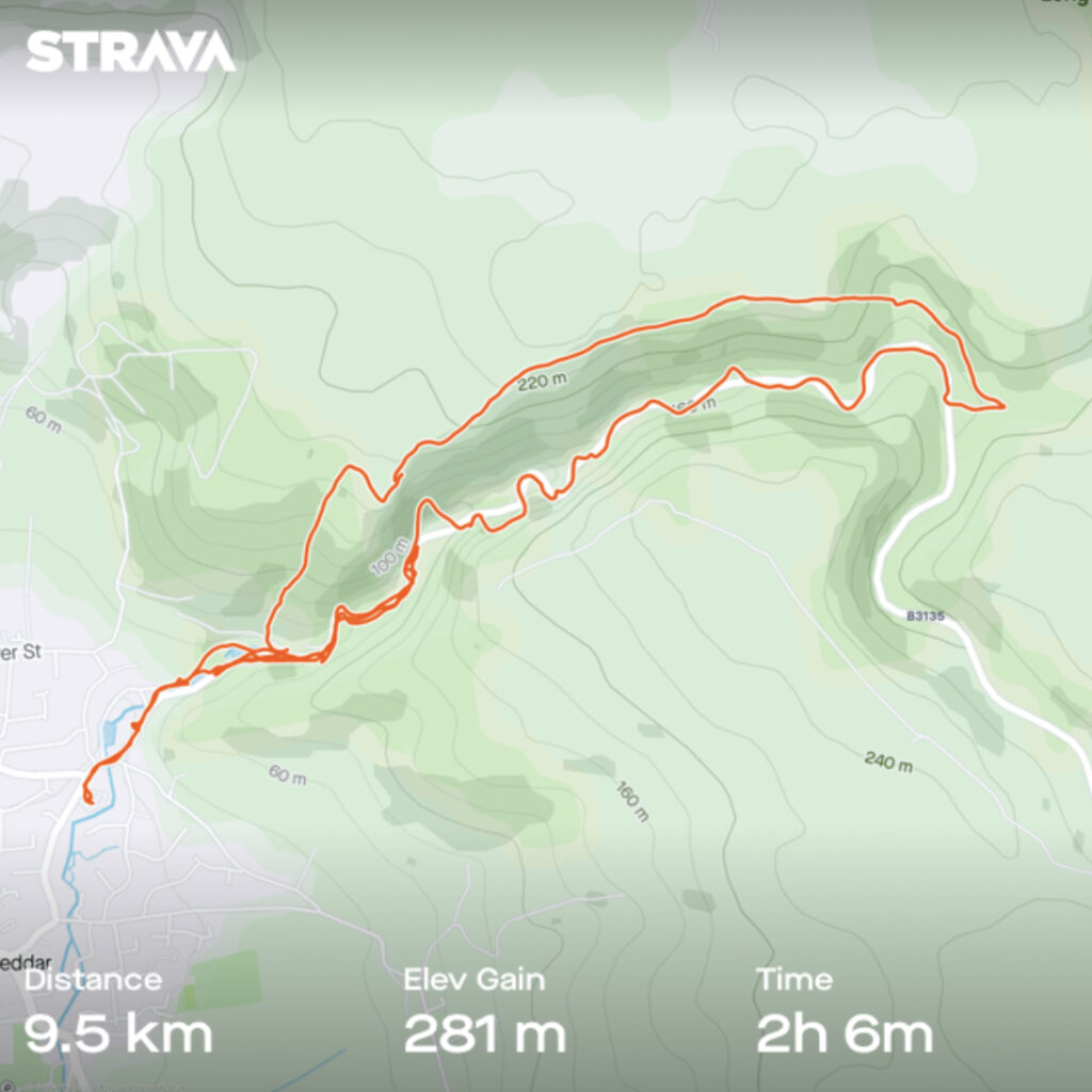
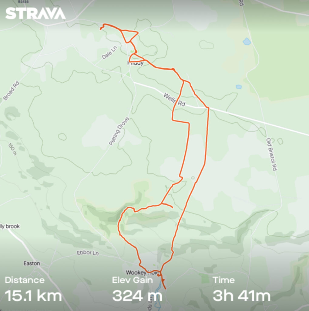
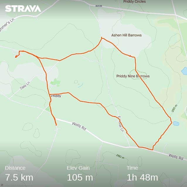
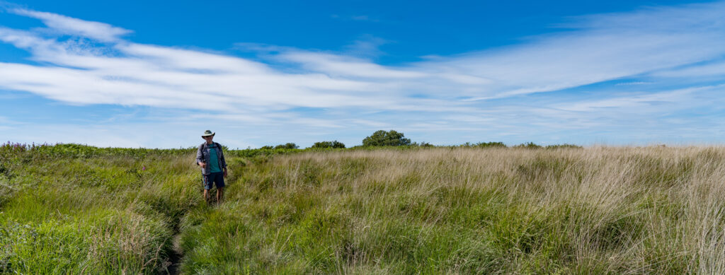
Saturday morning saw us pulling back on our walking boots and following a trail I had plotted on a new app I am using, Komoot. It’s a free app that allows you to plan and follow walking trails – I marked a 15km (9.5 miles) circuit (Strava link) from our camp to the village of Wookey Hole and back via Ebbor Gorge.
Our fabulous walk had us avoiding busy roads and was 90% across footpaths
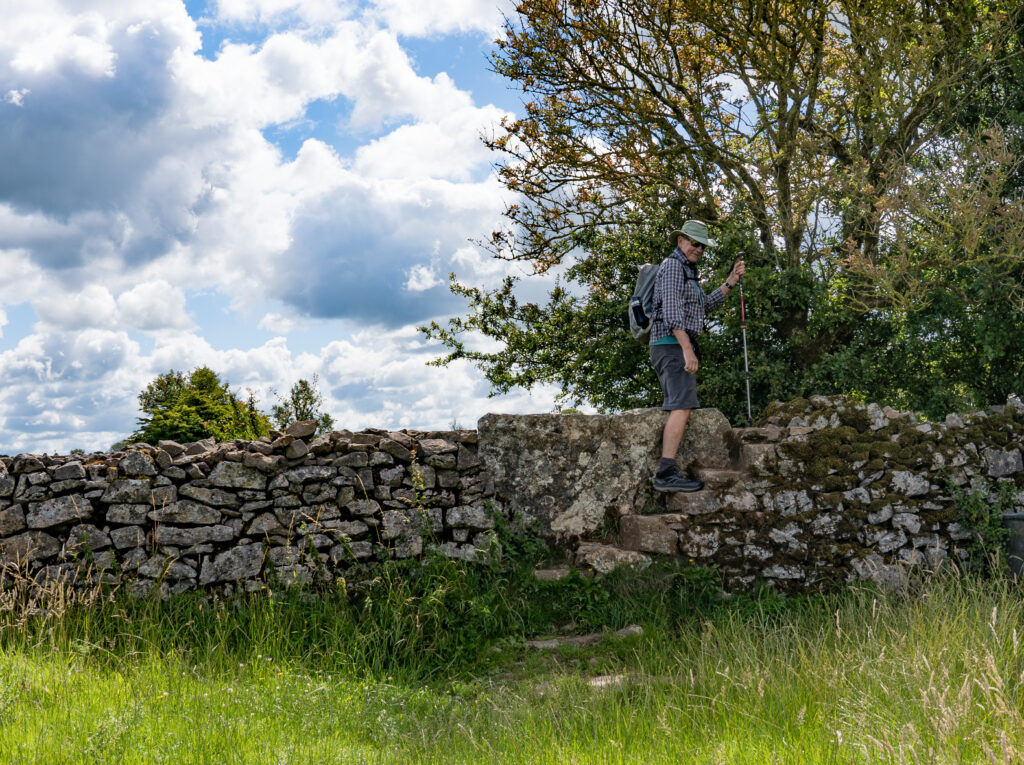
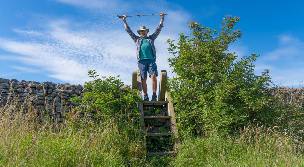
In contrast to our Quantock Hills walks, the fields here were lined with stone walls, often with steps leading us up and over. The stone slabs were frequently shining from centuries of hands and feet.
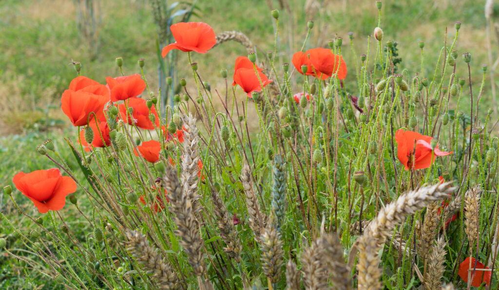
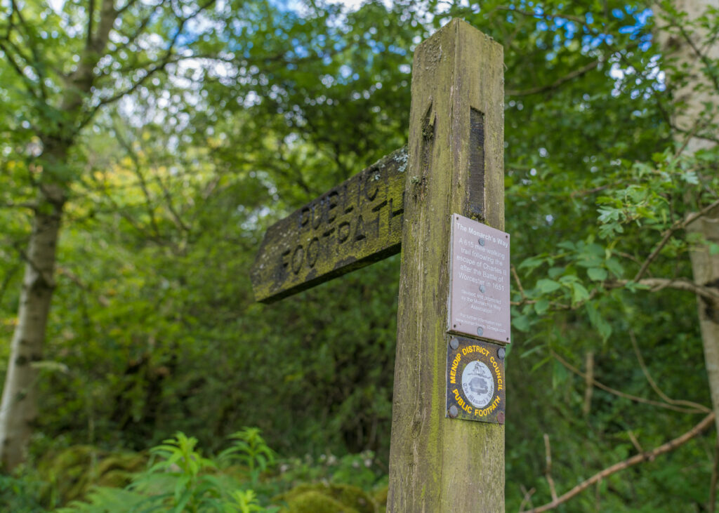
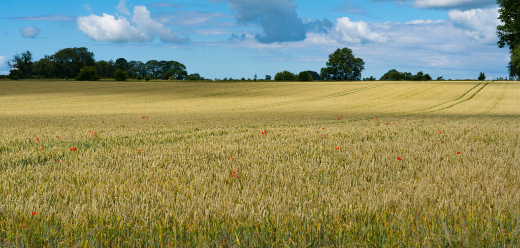
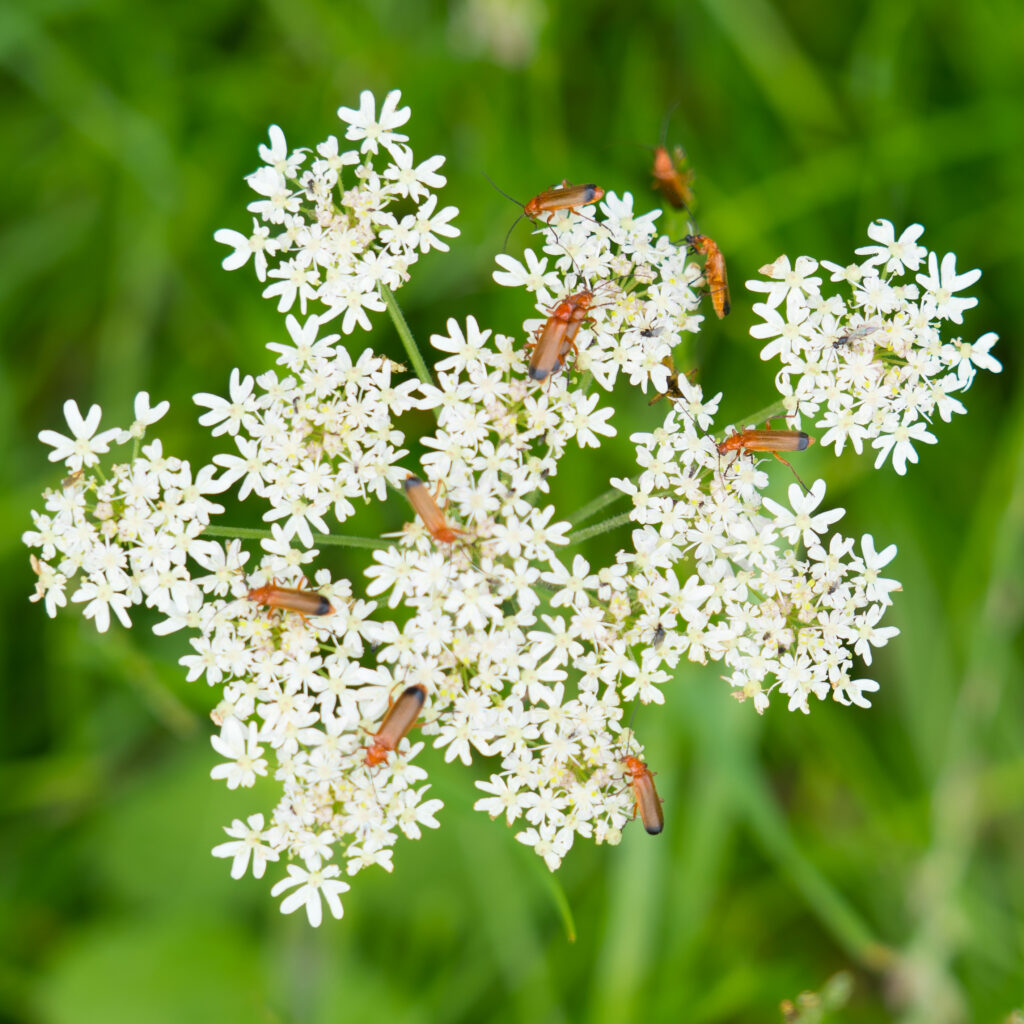
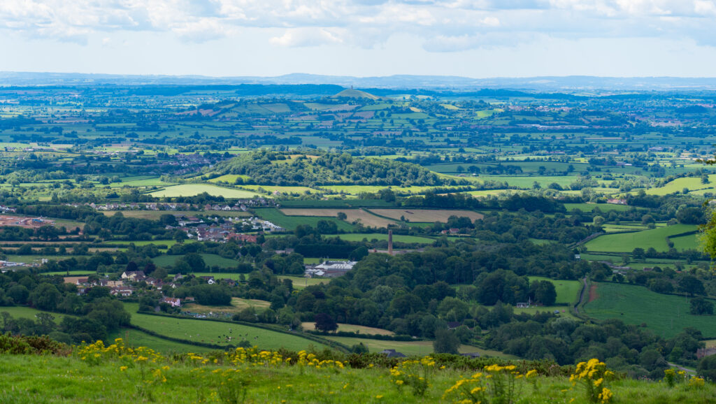
Mr A climbs up the stone steps We utilised many walkways including a pub tour – this one was the Monarchs Way which follows the escape route of Charles II after the battle of Worcester in 1651. It goes for 615 miles (just under 1000km) and is the longest inland footpath route in EnglandGleaming fields of corn dotted with red poppies – we’ve still not seen a field of poppies like the ones in Italy last year (Umbria – see post here)These are soldier beetles – as children we used to call these maters as they’re constantly copulating! It made me laugh to see an article referring to the same in The Times (headline: Nature: how the hogweed bonking beetle made a name for itself)More incredible views – the hill in the centre is Glastonbury Tor, which we visited a few weeks agoHeading down into Wookey Hole
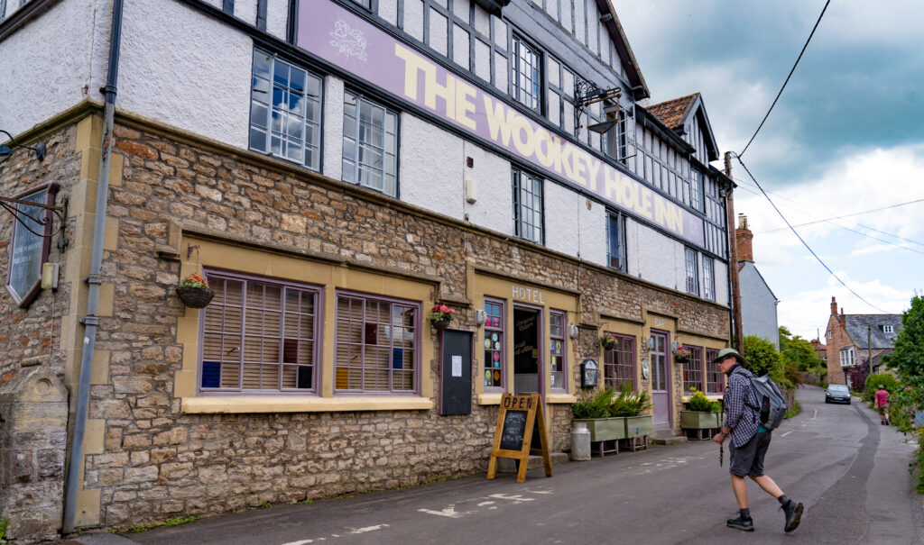
Crossing fields with wonderful views we eventually began heading downhill into the village of Wookey Hole. The village centres around the Wookey Hole Caves, in which tools have been found dating back to the Palaeolithic times – around 45,000 years ago. As a child, I visited this area as part of a school trip – my memories limited to the Witch of Wookey Hole – a stalagmite that looks vaguely like a human who has been turned to stone.
Despite the caves being open, the thought of being trapped with crowds of people underground was not too appealing, so we headed to the local pub in search of lunch.
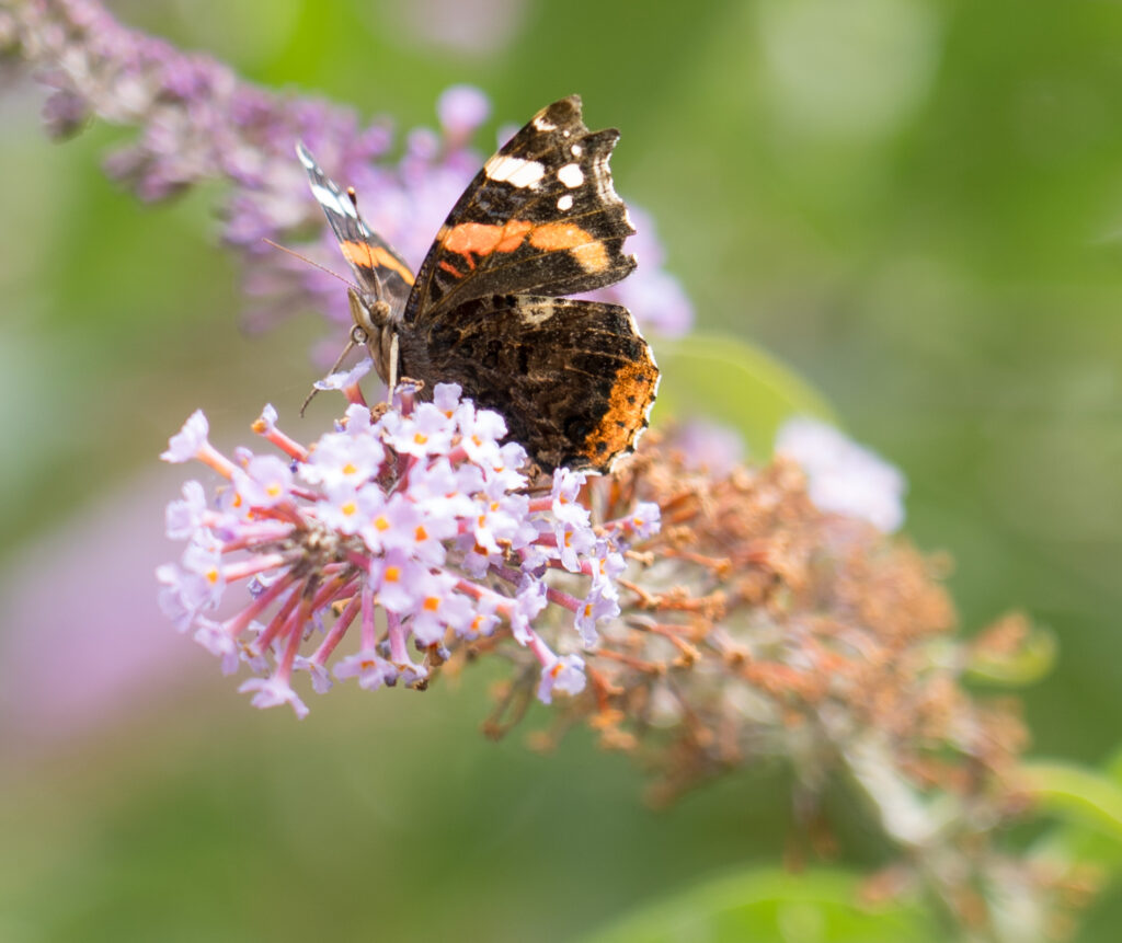
Mr A speeding up as he spots that lunch has just started at the pubA red admiral butterfly savouring the last buddleia flowers in the pub garden
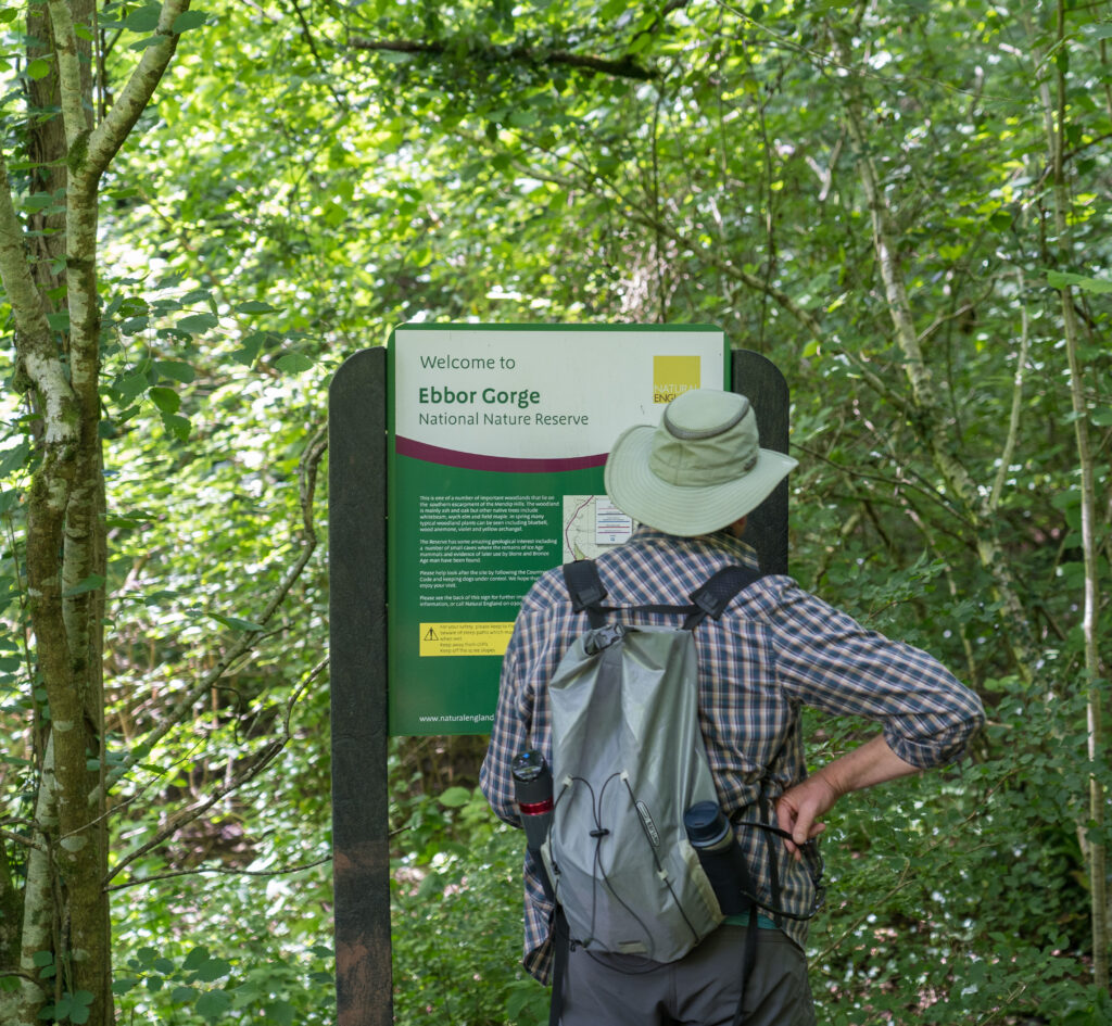
After half a pint and a sandwich in the pub garden we had to muster up the energy to head back to camp, knowing there would be a steep uphill. Our route took us to Ebbor Gorge Nature Reserve.
Mr A reads about the neolithic history within this gorge
The limestone gorge is very lush, with moss covered walls dripping with water. Like Cheddar Gorge, this is also popular with climbers and we passed a few as we hiked up.
Interesting colours where different mosses and lichens growPicking our way up through the gorgeA cluster of mushrooms growing on a rock
Upon reaching the top we found ourselves a quiet patch of field for a well deserved rest and drink of water.
Chilling out and enjoying another great viewA peacock butterfly on blackberry flowers
After two days hiking with rather steep climbs, we decided to do a somewhat tamer walk on Sunday (Strava link).
The diversion to the pub wasn’t quite on our circuit, but worth the effort!
Like the Quantock Hills, the Mendip Hills were a hotbed of activity back during the Bronze Age (and way before). Not far from our campsite are a series of Bronze Age burial mounds, known as barrows. These were created between 2200 and 1100 BCE, and originally were to be found all over the UK. Many were destroyed as towns built up, but a few survived.
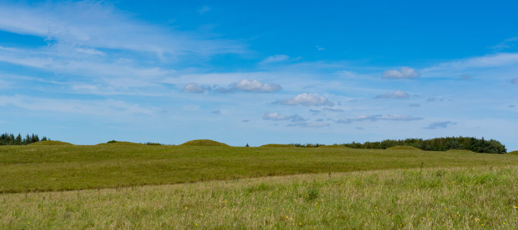
The Priddy Nine Barrows are now protected, set in farmland. Having been here for between 3 and 4,000 years, it is not surprising to read they have been raided in the past, with a reverend during the 1800s making notes about his finds, which included amber and blue beads, cups, an arrowhead or spear and of course bones.
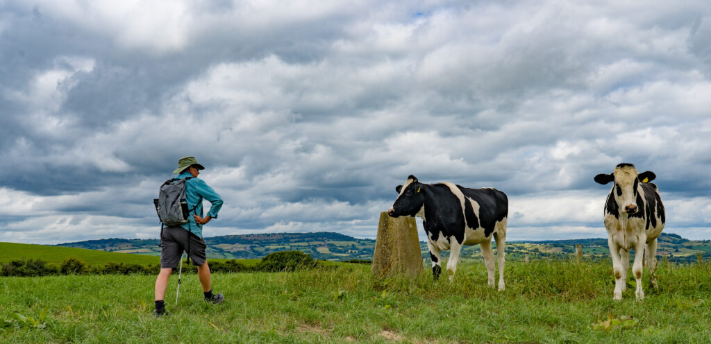
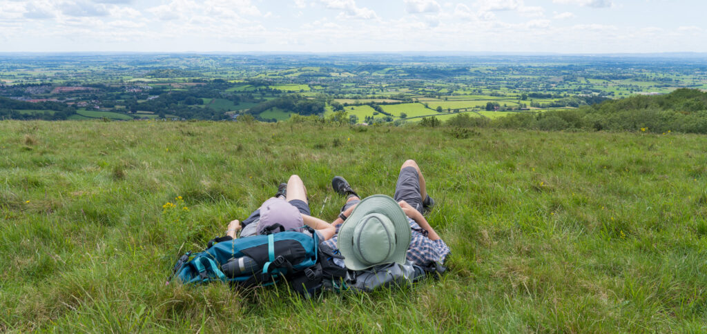
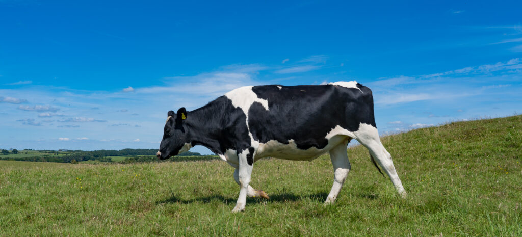
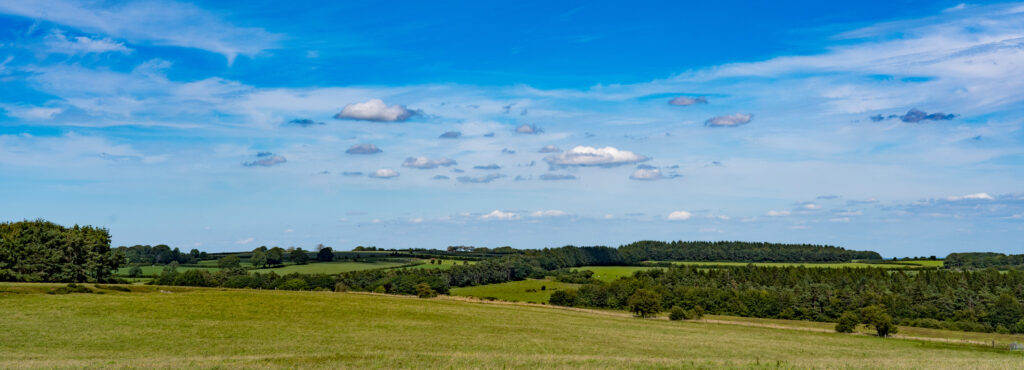
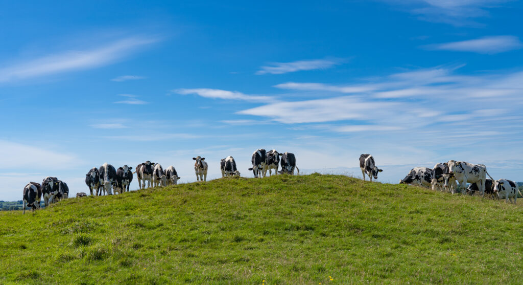
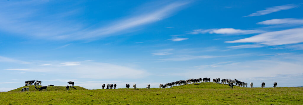
The mounds are not hard to spot in the fieldThe locals are custodians now…There’s a great view from the top of the moundsThe cows like to climb up for a view as wellA herd of cows on two of the barrows
We continued our walk passing more barrows, the warm afternoon sun just perfect. Its the kind of weather where you could walk forever.
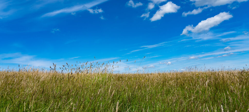
Foxgloves still flowering alongside the fieldsOur path took us through what looks like marshland, but no water to be found – most drains through the limestone into underground streams
We wound our way over styles and walls, making our way back towards the main village of Priddy. The landscape is quite interesting here, often looking like it has been carved out by a raging river or moist marshland, but without the liquid which shaped it – changes likely caused by sinkholes and underground streams.
This whole area has an incredible history, The Romans were active here with evidence of diggings for lead. Being on top of limestone, there are also many caves, with maps showing a whole 16km network winding under the village.
Another wall conquered!
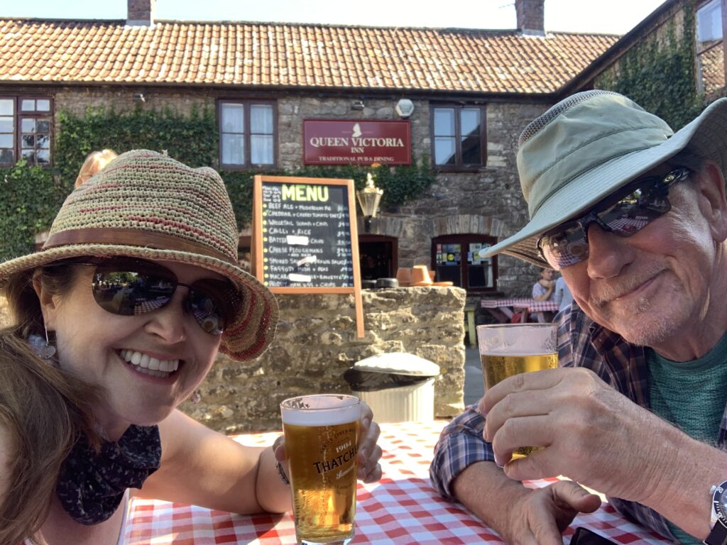
Given the pubs are now open, we found ourselves wandering through the village to our local – the Queen Victoria. They had rigged up fencing to ensure people only enter through one location, where we had to use alcohol hand gel and share a name and phone number before proceeding. Once in, we were allocated a red-tableclothed bench to sit at and our orders were taken. Half a cider each and a packet of ready salted crisps were then delivered to a blue-tableclothed table, and we had to collect them ourselves. Payment was by contactless card at arms distance. All very Covid-safe, but not quite the pub experience of old!
Cheers!
We stuck to the one drink before wandering back to camp for the evening.
Truffy in his natural habitat – doing well
It has been a brilliant commencement to our travels, which we began with great trepidation. So far we have found that people are mostly being sensible about distancing and staying healthy. We have quite a few people and places to visit in the coming days and weeks and now feel a little less nervous about our upcoming adventures.