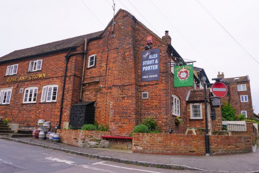
Location: Brighton, Hastings and Newhaven Ferry Port, East Sussex, UK
Saturday-Sunday: Before heading to Continental Europe, we spent our final weekend in Brighton with Catherine’s sister Helen and her family. London-on-Sea, as it is jokingly known locally, served up its usual eclectic way with everything from fine dining to a wonderful greasy spoon cafe for brunch.
Feeling a little neater after some haircutsCatherine, Helen and Isabel – just the girlsJust a small brunch to start Sunday!Miss Isabel ready to party – Catherine bravely accompanied her to a 5th birthday celebration, despite the promise of party balloons ?
Then it was time to head along the coast to Hastings and Catherine’s mum, Jenny.
Monday: Catherine and Jenny visited her nearly 97 year old grandma, good genes on that side of the family at least!
Jenny looking radiant96 years young, Jean enjoying the sunshineJean will be 97 in a few weeks’ time – this may be her first selfie!
A few more lovely home cooked meals from Jenny, and a chance to get some last minute tasks ticked off before we head over the English Channel on Thursday.
Young Marmalade enjoyed the mouse on a stick we bought for him
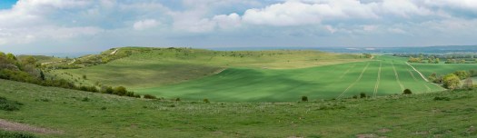
Tuesday: Jenny took us over to Hastings Country Park for a short walk and some fresh air, another place of great memories for Catherine.
Views over the gorse flowers across the countryJenny heading through the kissing gate…
The sun breaks through the cloud…team photoA lovely woodland walk on our return circuitMore bluebells adorn the woodland here
A mother-daughter shot to complete the walk
Later in the day, Catherine took me on her and her sister’s favourite after school activity, a ride down to the beach and along the coast. It was a cold day, but the sun shone and Hastings showed us her good side.
Warming up in a sheltered spot on Hastings PierYes, there is sand (at low tide) in Hastings!Matching bikes and hutsMingling with the local wildlife on the pier…odd….Riding the bike path along to Bexhill-On-Sea
It’s an interesting mix here of demographics, with everyone from a scattering of celebrities, and working class housing estates. If feels an authentic town, with the largest beach based fishing fleet in Europe still bringing in the delicious fish and cockles that we just had to sample.
So many memories from Catherine, shared with me, and it does draw you even closer together understanding someone’s childhood, as I had shown her mine in Kettering.
Wednesday: Now it’s our last day in the UK, with a ferry across to France early tomorrow. I few nerves on my part as I keep running through all the things we need to have sorted. Catherine as ever the calm one, thank goodness.
We are parked up at Newhaven Ferry Port for the night. Little Truffy is dwarfed next to his bigger HGV cousins all waiting for the 9am ride across the Channel to Dieppe. What adventures await us in France?
Location: Ivinghoe, Bucks, Little Gaddesden, Herts & London UK
Tuesday: Leaving Milton Keynes we headed south, travelling just half an hour to reach our next destination. We settled for the night at a farm in the hamlet of Ivinghoe Aston, close to the rolling hills of the Chilterns. The evenings here are light until about 8.30pm, allowing us a chance to go for a stroll.
Ten kilometres (about 6 miles) later we had crossed beautiful countryside via a bridleway and had explored the village of Ivinghoe. We even managed to pop into the local pub for a quick drink before heading back for dinner.
A bee swarm in the apple orchard at our farm-stayMany workers surrounding their queenQuiet lanes in Ivinghoe Aston
Dandelions line our pathway as we walkHard to resist a pub with a good reputationOld cottages in Ivinghoe – few with parkingMr A strolling through the village of Ivinghoe
Mr A swears a half pint goes down much faster than half-a-pint within a pintTruffy, outstanding in his field…
Wednesday: The following morning we departed and drove up to Ivinghoe Beacon. Ivinghoe Beacon is a hill standing 233 metres above sea level. It sits within the Ashridge Estate and is managed by the National Trust, but it has great significance historically. In the past, this location was used to send signals from and was also a fort during the Iron Age (around 800 BCE). More recently it has appeared in Harry Potter and Star Wars movies… For us though, it was a spot to enjoy lunch and a few cups of tea as we sheltered from the blustery cold wind and showers. A good day to be behind glass, as we say!
Fabulous views from the beaconA couple of long distance walks/cycles start from this pointTruffy with dramatic skies
Eventually there was a break in the weather and we drove a short way down the hill towards Dockey Wood. This woodland is famous for its incredible display of bluebells, and my cousin Karen had let me know they were in full bloom after the warm Easter weekend.
We had only driven a few minutes and we spotted a carpet of purple by the side of the road. We quickly pulled over and went in for an explore. It was incredible, and unbeknownst to us, we were in the quieter less visited woodland area – the main display (and crowds) we found were just down the road where the official car park was.
Mr A wanders through the sea of blueJust breathtaking – set off by the bright green new leavesA mass of purple
Dizzy with the delicate perfume of the bluebells, we headed on down to our home for the next three nights, parked up on a farm track close to my cousin and her family in Little Gaddesden.
Before long a taxi arrived to take Mr A, my cousin Karen, her husband Iain and I into nearby Berkhamstead. There we caught up with my old school friend Jo and her husband Stuart for a beverage at a local wine bar, The Berkeley. From there we enjoyed a fabulous Thai meal at The Giggling Squid – delicious food and probably the best Thai we have tried in the UK so far.
The years flash on by with nearly 30 years of friendshipMuch laughter – L-R: Stuart, Karen and IainMr A finds himself beside a nude….
Thursday: After a relaxing night’s sleep, Iain gave Mr A and I a lift up to the cafe in Ashridge Estate so we could catch up with an old friend of mine from way back, Amanda. We last met up when she was visiting her sister in Sydney Australia, more than 15 years ago. It was great to see her, and we had a stroll through the woodlands, admiring yet more bluebells.
Footpath windings through the wild flowersAmanda caught between two AndersonsOld friends reunitedMr & Mrs A – (incidentally, I left my lens cap on this tree trunk, in case you find it!)Walking back to Karen & Iain’s house via Ashridge House
Mr A and I walked back to Karen’s house through the estate, spotting many deer and enjoying the sunshine as we went.
We’d been back a few moments and I was back in the car with Karen off to visit my aunt while Karen took my uncle to the doctors. It was just enough time for a cup of tea and a tour of the house and garden before heading back for the evening.
Mrs A with auntie Pam and uncle Brian
Friday: Mr A and I hitched a lift into Berkhamsted when Karen was dropping off her daughters, Hannah and Ella to school. From there, we caught a train into London – Mr A heading off to do some shopping, while I went to Hammersmith and Charing Cross Hospital to take part in a focus group about the major airway surgery I had there back in 2014.
After the group I caught up for an hour with Jacky, a lovely lady with iSGS I have met through the support group I run, before heading back across town to meet up with Mr A, and some more friends at a pub near Warren Street.
L-R: Karen, Mrs A, Mr A, Martin, Karen’s sister, Chris
It was a fun catch up, with Martin (who was best man at our wedding 17 years ago) plus friends from Australia, Karen and Chris, who are staying with Karen’s sister near Greenwich.
It wasn’t a late night though, we were back on the train to Berkhamsted by 6.30pm and back tucked up in Truffy for the night by 9.30pm. A great end to the week.
Saturday: It was time to say goodbye to Karen and Iain and the girls, and continue our journey south. We really appreciate the hospitality we’ve been shown by the whole family.
L-R: Ella, Ryan, Merryn, Karen, Iain, Hannah, Mrs A
Mr A and I are both are loving rekindling old friendships and making new friends on our travels, and particularly cherish the time such as this with family who are also good friends. I hope we are leaving each time with stronger relationships and a better understanding of one another and look forward to spending more time together when we’re back from our European travels.
Thursday: It was a novelty at first hearing rain crashing onto the roof of the caravan. An excuse to brew endless cups of tea, finalise our trip plans for Europe, and snuggle down with Miss Tasmania!
An attempt at an evening walk is cut short by our first rain dropsJervis Bay looking dramatic as the horizon disappears under torrential rain heading our way
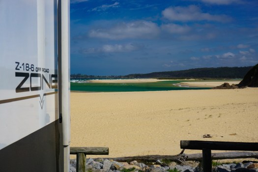
Friday: We managed a short 13km cycle along Jervis Bay’s shoreline shared path, with a hot chocolate reward for our minor efforts:
Half way along our ride the grey skies part to allow fingers of sunlight to beam down onto the bayNice to wrap up warm and enjoy a hot drink
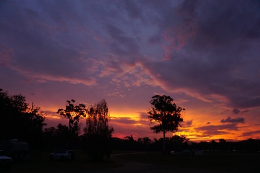
The late afternoon cleared allow for a fabulous sunset:
The last sunbeams catch a turquoise wave as it breaks on the shoreGrid-like rock pools at the water’s edge reflecting the sunlightA copse of gum trees catching the last of the lightWe’ve not seen the sun all day, but still it goes downSunsetTime to go back to the Zone for dinner!
Saturday: After a couple of days of little activity we were getting a bit van crazy, so drove into Booderee National Park to tackle one of the longer circuit walks. Booderee translates as “Bay of Plenty” in the local language of the Koori people, who have now been handed back this land to continue with over 20,000 recorded years of custodianship.
Well, didn’t we get lucky with the weather. The park was looking fabulous, all glistening and shiny with the foliage recently washed clean.
Setting off from Steamers Beach Car ParkWalking down towards Steamers BeachThe ferns gleaming in the sunlight after their wash in the rain last night
A Jacky Lizard also seems pleased to see the sunlight, and wasn’t keen to move off the step to let us passMrs A on the walk down to Steamers Beach – with another 10km left to hike we decided against going all the way down and back again
There wasnt a heap of birdlife, but plenty of wallabies bounding around. The flora certainly looks like it has recovered pretty well with the lush cover back after the devastating fires of Christmas 2001. We drove back from Tasmania through the area a few weeks after those fires and both shed tears for all the animals burned to death in the inferno that took 400 firefighters to get under control.
In 2017 fire once again ravaged the park. You can still some some of the impact, but it once again is looking mostly healthy. As for species lost, then it is not such a happy story. Since 2004 a monitoring program has been in place and sadly has seen local extinction of some glider species and the “common” ringtail possum. Inexplicably mammals in both fire affected and non-affected areas seem to have suffered. Researchers are at a loss. My uninformed view – this is a pattern we are seeing all over Australia as climate events become more extreme and humans continue to encroach on habitat at a shocking pace. You may have seen the more alarmist articles that are predicting complete ecosystem collapse as insect numbers fall drastically.
On that cheery note check out some of these fab photos from the ever talented Mrs A!
Mr & Mrs at the lookoutThe beautiful Blacks Harbour – named for the aboriginal residentsApple time at Blacks HarbourSuch a picturesque locationWould be great snorkelling hereCalm waters with Caves Beach just around the headland, popular with surfersCould spend hours checking out these rock pools, full of little fishAnother bay, further around – the water looking amazing through the trees
We always love visiting this area – this was where I proposed to Mrs A back in September 2000 after all – and we will definitely be back again. We just love how we are still able to find something new in the region every time we come, whatever the weather.
Sunday: Driving north from Lakes Entrance it wasn’t long before we were back in southern New South Wales, pulling into Boydtown for the night. Boydtown was the original settlement in Twofold Bay, settled by Benjamin Boyd in the mid 1800s.
This is the area where Thaua aboriginal people had developed a special relationship with killer whales, which would herd humpback whales towards their spears. The first Europeans learned of this and recruited the Thaua people to help them with their whaling activities, There are still the remains of whaling stations and a whale spotting tower in the area.
Today, the settlement is home to the beautifully refurbished Seahorse Inn and a growing community as land is sold off around the pub. There is also a 40 acre campground at reasonable prices and beach access.
Not crammed in at Boydtown Camping GroundMiss Tassie wondering where her Victorian haven has gone!
As we pulled into the camping area we saw market stall holders packing up outside the hotel, and several coaches parked up on the lawns nearby. Apparently the hotel had just hosted a couple of hundred people on a P&O cruise calling in at nearby Eden for afternoon refreshments. All very nice but sadly no oysters left for the likes of us!
We set up camp in the spacious grounds, and headed off for a walk on the beach. The cloud was rolling in, threatening rain, but very little fell after all.
Beautiful views across the rangesPrancing along the water’s edge
We had a special sunset however.
Best sunset in agesA fabulous sky show you just can’t stop watching
Monday: From Boydtown we called into Eden to complete a few tasks at the post office, before heading to Pambula Lake to the fabulous Broadwater Oyster shack there. We last visited about 12 months ago, and our memories of the delicious shucked oysters were still fresh. We were not disappointed – a dozen each and two dozen to take away. Fabulous and well worth the wait!
Our destination for the day was Tuross Head. We last stayed there about 2 years ago, having had to smuggle Miss Tassie ‘the wallaby’ in, as pets were not allowed. This time she was fully permitted, and enjoyed a bit of an exploration around the grounds (full of rabbit smells!).
Cat walking does not burn many calories…
Tassie proving to be a poor hunter – didn’t even notice the skink in front of her nose!
Tuesday: Tuross Head is a lovely settlement – not really much there in terms of entertainment, with a handful of small shops, a Chinese restaurant and a combination Thai and fish and chip shop.
But that doesn’t matter – it is surrounded by white sand beaches, sparkling turquoise waters and a shared pathway which explores the coastline. It’s perfect for those who enjoy peace and quiet as well as outdoors activities like kayaking, cycling and fishing.
After a lot of car time the past couple of days we were determined to get out and explore under our own power, and did a 13km cycle around the coast, following the pathway around to Coila Creek and back.
Mr A peddling off along the quiet cycle waysCoils Bar behind me – the border between ocean and lakeRiding alongside Coila Creek which is currently a lagoon, closed to the oceanStill perfection – Coila Creek behind the dunesDead tree provides a sculpture alongside the creekMr A enjoying the day!
Our afternoon stroll took us in the other direction, to a lookout overlooking the Tuross River and Horse Island. There are so many opportunities to explore this area by boat, we are certain to return again with our big kayak and a longer booking at the campground.
Looking out the tumultuous mouth of the Tuross River
Hold onto your hats! The wind picking up in lieu of a change in the weatherEnjoying the view from the lookoutBeautiful tree-lined streets
We’d been able to nab ourselves a beachside campsite, having booked in just after a long weekend, the perfect location to set up our chairs and enjoy our take away oysters with a glass of Chardonnay.
,
A home with a view…couldn’t get much closer to the sand
Wednesday: We moved on again, initially planning to visit Ulladulla, but finding the campgrounds either ridiculously expensive ($50 a night) or allowing dogs but not cats – even mostly indoor ones which come out only accompanied on a lead. We bypassed the town completely and moved on to Milton, camped up on the showground.
The blue sky has left us for a few days, with the coast expected to receive some very welcome rain. It was much cooler today with heavy overcast skies. We took the opportunity to start our packing for our next adventure – in 17 days we leave Australia and head back to the UK to begin travelling there and in Europe. We continue up the coast tomorrow to Huskisson on Jervis Bay…we’re expecting to use our rain coats!
Location: Yanakie, Victoria (just outside Wilsons Promontory)
With a forecast of 39 degrees centigrade on Friday we decided to head away from Marysville and drive to the coast, Wilsons Promontory National Park our ultimate destination for some hiking amongst spectacular scenery. As we are travelling with Miss Tassie we were unable to camp in the park itself, but we checked in to a caravan park in Yanakie, just 30 minutes drive away. The temperature was much cooler beside the water, a great relief.
Saturday morning dawned clear and blue, with the mercury climbing early. We moved into a site right beside the beach with uninterrupted views over to the Prom.
Amazing sunrise over the waterA Zone with a view…
As the water was so still, we decided to take advantage and inflated our pack rafts for a paddle, planning to head for a walk in the national park in the afternoon.
Mirror-like perfection on the bayThe water is quite shallow in Corner Inlet Marine & Coastal Park
It was while we were out paddling in these serene waters that we suddenly both received messaged on our mobile phones:
Bushfire Advice from Parks Victoria. Wilsons Promontory and surrounding areas. Stay informed re park closure. Check local radio or www.emergency.vic.gov.au
I checked the website. It turned out the whole national park was being evacuated due to an out of control fire…so no walking for us. The evacuation included all campers – so it was fortunate we were not staying in there after all.
Yanakie sits on the edge of the Corner Inlet Marine National Park, part of Bass Straight, the waterway between mainland Australia and Tasmania. It’s a critical waterway for migratory birds and has been designated a wetland of international significance under the Ramsar Convention.
After lunch we took a walk along the beach to see what birds were about.
Strolling along the beach, dead trees standing out like sculpturesLiterally dozens of black swans and ibis fed on the sea grass at low tideCopper grasses blowing in the afternoon breeze on the dunesWispy clouds crossing the sky
Black backed gulls, silver gulls, black swans, ibis, egrets and herons were the main bird life, enjoying the mudflats at low tide. It reminded us of our time in Omokoroa in New Zealand, the peace and quiet, punctuated by the occasional bird call.
Nature’s artwork
After a couple of kilometres we came across this twisted wood, standing up out of the sand like a marker for something….we had a look and behind it was a footpath. We followed it for another couple of kilometres and wound up right back at the campground. Perfect!
Heading off down the mystery path
As we turned back, we could see the bushfire smoke spreading across the hills, the afternoon wind fanning the flames and increasing its impact.
By wine-o’clock the fire was quite large and easily visible from where we were camped (at a safe distance).
Sunset starting to reflect on the smoke haze
Sunday morning’s sunrise was quite dramatic as a result, with the air quite obviously smoky. Despite the fact I am breathing quite well at the moment, my throat began to feel the effects of inhaling the ashy polluted air, burning and sore.
Sunrise provides a dramatic start to the day with the absolutely still waterA juvenile gull floats on the still waterLake or ocean? I bet most people wouldn’t guess this was Bass Straight!
We decided to drive over to the other side of the peninsular where there was some breeze, meaning cleaner air.
We checked out Waratah Bay which looked like it had not changed in about 50 years, the main landmark on Google Maps being the Telstra Payphone! It had a lovely beginners surf beach and plenty of sand which stretched on for miles.
From there we had a look at Shallow Inlet, where the tide was going out and kite surfers enjoyed catching the breeze across the water.
We returned for another stroll around ‘our’ beach and then to enjoy the sun set as the wind changed direction and cleared all the smoke.
A little drama as the weather changed during the afternoon, bringing a few meagre drops of rain but not enough to douse the firesThe sun setting behind us reflected on the clouds over the water giving us a lovely show
We checked the Parks Victoria emergency site as soon as we woke on Monday morning, and found the fire was still raging and the park would be closed for the foreseeable future. So, as our last day here we decided to get the pack-rafts out again and explore another part of Corner Inlet.
We rolled our boats up into our backpacks, and hiked a couple of kilometres down the beach before we inflated them.
Can you believe there is a boat in here?At not much more than 2kg our boats and paddles are easy to carry
We then paddled down further into the bay, a very picturesque area full of old boat sheds and unofficial camping sites. There were plenty of birds down here too, mostly not used to seeing people paddling. I imagine most people who visit here stick to visiting Wilsons Prom and rarely make it in to the bay here – I know we probably would not have explored it this thoroughly had the national park been open.
Inflated and ready to paddle!Looking at some of the old boat sheds on the edge of the waterOur crafts awaiting captainsMr A on very calm watersHeading back to camp, not wanting the adventure to endNervous terns on the beach
After 7km paddling we are both aching tonight – we are definitely not paddle-fit, and the pack rafts are not as streamlined as our fibreglass double kayak we’d have loved to have brought with us. But we’re so pleased we had these little boats to give us the option to explore the water, their weight and portability giving them a unique benefit.
Our visit to Wilsons Promontory has not quite been the one we planned, but nevertheless has been surprisingly gorgeous. We have really enjoyed the peace and quiet of this location, which has probably been exacerbated by the fires, keeping other visitors away.
We definitely plan to put this area on our wish list to return to in the future (hopefully fire-free next time!), and would recommend Yanakie as a base to explore from, especially if you appreciate bird life and the serenity of the water. Off to pastures new tomorrow…
We returned to collect our caravan from its temporary home in Marysville and decided to stay a couple of days and have a look around this little town nestled in the foothills of the Victorian High Country.
One of the resident King Parrots – they find plenty of food in the trees around the property
For our international readers, and a reminder to locals, I need to explain that this town was almost totally destroyed by bushfires 10 years ago, on a hot and windy February day known as Black Saturday. The summary would be that 173 people lost their lives as a massive firestorm engulfed this town and several others in this heavily forested area. I can’t and won’t describe the horror that ensued, enough has been said and our impression was after 10 years the residents of this town want to move on and look forwards not backwards.
A very moving memorial
Over $400 million was donated from public and private funds. The town has been almost completely rebuilt. Children’s laughter once again fills the streets as they walk to their newly built school…although chillingly I heard one child impersonating the bushfire siren that regularly is tested in the town, too young to know the potential disaster that alarm could signify.
The new architect designed police station
It is a fabulous little community from what we experienced. Everyone was super friendly and keen to promote the town and what it offers. Surrounded by hills, every direction you look is just so picturesque. We picked up a walks leaflet and were off on one of the many trails that start right in the town centre. This one led up to a waterfall that is one of the highest in Victoria.
Admiring Steavenson Falls – five cascades with a total descent of 122 metresThe final cascade of Steavenson Falls drops more than 21 metresMr & Mrs A
We also explored some tracks on our bikes, following the Tree Fern Gully Trail up to Yellow Dog Road and back, providing us with some gorgeous dawn views of the mountain ash and gum forests.
The sun just peeps over the hills to light up the bush – looking quite sculptural with the bleached dead trees rising above the new green growthEarly morning shadowsSurprisingly fresh first thing in the morning!
Another hike took us out to Keppel Falls, also picturesque
We followed the Taggerty River upstream to reach these fallsThe evening sun lighting up the bush behind Mrs ADriving off back to the Zone, the forest lit up by the setting sun
We could have easily spent a few weeks here and just scratched the surface. There’s a pub serving great food, a bakery, multiple cafes, a small supermarket, everything the visitor would need.
Come and spend some money here and support this community who have faced so much and have rebuilt a vibrant new town.
After a few initial culture shocks of being back in Sydney (lots of traffic, very warm, and a lot of time spent complaining to Telstra!) we have settled back in with our generous ‘flat mates’ Jenny and David in Matraville. We have had a busy few days ticking off the usual medical appointments – a biopsy and 90 minutes in a dentist’s chair for Mr A, an airway procedure with an ENT specialist for me (with tentatively great news about how my airway is looking – nice and wide open!), plus a few nice experiences tossed in for luck – hairdressers and a catch up with friends at a new restaurant.
Saturday Mark and I decided we needed to get some fresh air and headed off a short drive from where we’re staying to the coast, just a 5 minute drive to Kamay Botany Bay National Park.
Ever wondered where Matraville and Botany Bay National Park is?
We have both lived in Sydney for more than 20 years, and could hardly believe we are still being introduced to beautiful natural areas such as this as we set off to explore somewhere new.
Dramatic skies accompany us as we walk along the cliff top
And not a breath of wind to stir the waters…
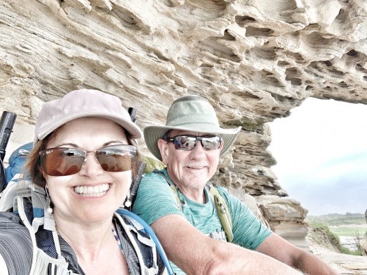
Our destination is Cape Banks, and the ‘island’ we reach via footbridge. We had no idea this existed before today and the grey humid skies only added to the mysterious atmosphere.
Mr A takes the bold step off mainland Australia onto the bridge to the islandDespite the calm winds the surf crashes over the rocksWe find a little rock shelter to watch the water fromMore sculptural rocks…
Once on the island we have fabulous views over to the mouth of Botany BayContainer ships constantly enter and leave from Botany Bay…The Minmi – a ship wreck from 1937 – It was originally built in Glasgow, Scotland and is gradually disappearing into the seaMore of the Minmi wreck – two crew members died when it ran aground here
We continued our walk a little around the bay, driving around to Little Bay where we took to the beach and followed the soft sand around to Yarra Bay. We had never heard of Yarra Bay, but found out it is a nominee for the best beach in Australia. We called into the Skiff Club for lunch.Oysters and calamari sustaining us, we then decided to inflate our peak rafts (handily stowed in our backpacks) and paddle back to the start of the walk. Perfect!Our day concluded with a delicious barbecued roast lamb dinner with Jenny and David, simply delicious.
Sunday morning saw us joining Jenny and David for another new experience, strolling along the Hermitage Foreshore Walk from Vaucluse to Nielsen Park. Just a short 1.8km each way, it links several little bays alongside Sydney Harbour and provides some gorgeous views.
Our first view of the bridge, helping justify the high price of property in this areaJen, David & Mark set off along the walkway
A lovely crested bird – a Shrike-Tit perhaps?
My favourite view of all, through a sculptural tree creating multiple windows…
We farewelled Jenny and David after a swim and returning to the start of the walk, and headed off to Sydney’s north shore for a catch up with two more friends, Donna and Andy.
They treated us to a couple of delicious gin and tonics – including a non-alcoholic one for Mark as he was driving. Together with a delicious platter of cheese, biscuits and pickles and a great catch-up, it was as ever, lovely to spend time with our friends.
An exotic selection of gins and tonic waters
Soon though, it was time for more farewells as we drove to our final destination for the night and the coming days, Forestville with more friends, John and Eveliene.
I’m about to head into hospital for an operation and they have kindly offered a bed for my convalescence. It’s a strange feeling being ‘homeless’ in what has been our home town for so many years, moving from destination to destination with a car full of cases and possessions. We couldn’t do this without the kindness and generosity of our friends here in Sydney, and for that we will be forever grateful.
Friday: It was another fine day in New Zealand, I’m sure you’re tired of hearing. Blue skies over Omokoroa prompted Mr A and I to pull out the walking shoes and head off on another hike. We drove just 10km up the coast to Aongatete and set off on another walk in the lower Kaimai Range. The cloud hung down over the peaks but did not rain.
Heading up hill to commence our hike…no gentle warm up for the legs on this walk!Lush forest with a path cris-crossed by tree rootsA little fan-tail keeps us company as we walk
We saw a lady with her two young children who were doing a shorter hike, but otherwise no other people as we walked the circuit. I relished my open airway and good breathing as we hiked up and down some relatively steep valleys, crossing a couple of streams as we went.
Other than slipping on a green rock and getting a wet foot, there were no mishaps, and we were reminded once again the contrast with similar hikes in Australia – no ticks, leeches or snakes here.
Mark stops a moment to enjoy the sounds of the forest and breathe in the clean air…The stream which captured my foot…I forgave it since it’s so pretty…
It’s almost like a stairway of tree roots, guiding the way…very Lord of the Rings…What goes up must also climb down…
Saturday & Sunday: With one more week left here in New Zealand I decided to paint a couple of artworks for dad and Sue as a thank you for their hospitality. Over the weekend I clocked up about 8 hours of painting – it was good to get back working on paper!
Four hours into my painting… more to go…will post the finished item on the Arty-Cat page…
Saturday night dad and Sue hosted neighbours Den and Angie for dinner – delicious mussels and prawns with a couple of tasty sauces. Much laughter ensued as we had an enjoyable evening with a few bottles of wine under a starlit sky.
Sunday morning started with rain and a low rainbow over the golf course…
Mark and I strolled down to the beach on Sunday afternoon at low tide, feeling wistful at the fact we only have a few more days left to enjoy this very special location. The sand flats were covered with birds; herons, black swans, Canada geese and oyster catchers mingled with godwits, gulls and stilts. We were the only people down there as we sat and enjoyed the peace and quiet from the white sand.
A flock of godwits in formation…Variable and pied oyster catchers…these used to be shot for food in the 1800s and early 1900sA white-faced heron glides past on its way to a new pool of snacksEasily spooked, the black swans show off their white wing tips as they fly off to less disturbed waters
Monday morning began nice and early, with workmen arriving to commence repaving the back patio. Mark and I packed up the car with some clothes and our camping gear and headed off a couple of hours up the coast to the Coromandel peninsular.
It’s a lovely drive up, with the Coromandel mountain range on our left, and fleeting turquoise water views alongside the forest and valleys to our right. The road is very windy and popular with motorcyclists, but less so with me and my weak stomach. I was relieved when the winding ceased and my travel sickness abated.
We set up camp at Hot Water Beach, stopping in the garden beside an orchard of an old house near the beach. It wasn’t a fancy location by any stretch of the imagination, but it was peaceful and the ground was flat.
A New Zealand wood pigeon looks down on us
The owner of the location came down to see us, showing us the resident eels living in the stream behind our camp. “Keep your toes away from the edge, they’ll attach onto one and suck off all the flesh, leaving a bone.” Ugh!
One of several eels in the stream…this one was just a baby…
I revisited my foot slipping into the stream a couple of days ago with a new perspective! Maybe there are things in New Zealand that can hurt you after all!
We stuck to the beach instead, doing a lovely long walk along the coast. What we didn’t do was dig a hole in the sand and sit in it, like so many other visitors. Hot Water Beach is named for the hot springs which rise in the sand, accessible by shovel. The springs only appear in about a 50 metre wide stretch of the beach, and it is here that people sit in wet holes, cheek by jowl admiring the incoming tide. We very briefly considered doing this, before returning our shovel and exploring the quieter parts of the beach instead, no tourists around.
Horror of horrors – the crowds in the warm water area of the beach…The serenity at the other end of the beach…the off shore wind creating beautiful wavesA heron battling the strong windA pair of southern black-backed gulls stand over their lunch…good to see gulls hunting for their own food and not picking through bins…
Tuesday – after a slightly disturbed sleep (very strong winds) we arose and drove a short way up the coast to Hahei. A very pretty settlement, this is the gateway to the famous Cathedral Cove. Accessible only by foot or boat, this is on everyone’s ‘must visit’ lists for the Coromandel.
Mr A prepares hot cross buns for breakfast…it must be nearly Easter….?!
Mr A and I have been there at least twice in the past, loving its picturesque gentle turquoise waters dotted with rocks and islands and white sand beaches. We parked up on the seafront at Hahei and took the coastal walk along.
Things have changed somewhat in the five years since we last came this way. Firstly, there is a water taxi that loads up people for $15 a head and whizzes them along the coast, meaning there are many more families with young children at the cove. Secondly, the pathway that follows the coast has now been surfaced, making it more of a footpath than a bush walk.
We hiked our way along, passing many people approaching and coming back from the beach, finding them differing from the usual hikers we come across. When you see someone on a bush walk, 99% of the time they will look at you, smile and say hello as you pass. Here, people avoid eye contact and rarely have a smile. If they are under the age of 30 then they will fill the path three abreast and scowl if they have to step aside to allow you to squeeze past single file. Very different souls indeed!
Mr A heads off from Hahai along the coastal walk…blessed with spectacular viewsLooking back to Hahai beach from the first headlandThe official start of the walk to Cathedral Cove…(do Helen, Stu, Simon, dad or Sue recognise this?)Spectacular views…we were sad it was too windy to pack raft along here…
Of course the beach and cove was beautiful, but with many visitors. I jumped in for a refreshing dip (fulfilling a promise to my sister that I would do – brr! Helen I hope you appreciate my sacrifice) but Mark got no deeper than his ankles.
The cathedral like archway that gives the cove its nameDon’t look too closely…shivering as I enter the water…Floating with toes up, in memory of Granddad Ernest…Warming up on the sand before we head off…
After half an hour we headed back, calling in to Stingray Bay on our way around. In contrast to Cathedral Cove, there was hardly anyone here, but it was equally spectacular. I wish I had saved my swim for the turquoise waters here instead. True to its name, we watched stingrays whizz around the water’s edge catching lunch, and a couple of feral goats munching on some trees on the side of the bay. If you visit these parts, I suggest you plan to spend most of your time in the serenity of this beach rather than Cathedral Cove – total bliss.
A very healthy looking goat…The serenity of Stingray Bay…Now this is more like it – no water taxis here…A single boat in the bay…Yes, Mr & Mrs A approve….
We tore ourselves away and continued our return to Hahei and lunch – 8.5km having worked up a nice appetite!
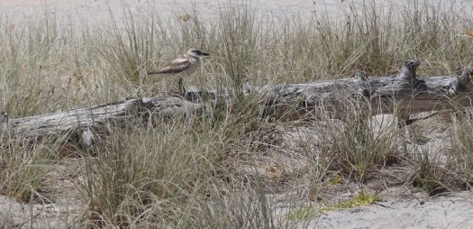
An endangered New Zealand plover (also known as a dotterel), nicely disguised in the dunes on Hahei beach
I decided to fight the travel sickness and do the winding road driving on the way back to Omokoroa – a wise decision it turned out – I felt fine being in control!
Another lovely evening ensued with dad and Sue – a glass of wine on the patio followed by pork steaks, rice and vegetables. Delicious.
Location: Omokoroa, Kaimai Range, Waihi Beach, New Zealand
Monday: The Kaimai Range watches moodily over the Bay of Plenty, its dark craggy peaks regularly obscured in thundery clouds. We keep looking up at them from our haven down by the beach in Omokoroa and are inspired to keep reaching for the hiking shoes and driving up for a wander around.
It’s really hard to remember a more beautiful spot we have ever based ourselves, a huge thanks to Catherine’s dad Richard and wife Sue, who have shared their lovely home with us all these weeks. It’s a tough choice whether to head out on the water, paddling around the seemingly endless sheltered bays, or stride up into the hills. I know…life’s tough.
It literally poured with rain on Monday morning, so we dressed up in our waterproofs and took a short walk over to Omokoroa Beach.
Still looks lovely in the rainAfter a bite of lunch the skies cleared and the Kaimai Range appears again
Tuesday: With a break in the rain, we headed up to the Kaimais to try out a walk on the Tuahu Track, one of the many that crosses the range a short drive from us.
Heading off on the track…so many options from here – we chose the Sentinel Rock lookoutStarting off along a civilised six foot track…
After an innocent enough start along a well formed track, the path headed almost vertically upwards, in the time honoured Kiwi fashion! We came across the all too rare remnants of the Kauri forest that once dominated the landscape before settlers realised their value as timber. The oldest specimen remaining has watched over the forest for 1200 years. Just writing that gave me goose bumps! What a timescale. Finally they are being protected and efforts to restore the forests are making some slow progress. In 1987 all the remaining tracts of Kauri forest came under government protection…it’s a nasty disease spread by walkers which is threatening the remaining trees now (Kauri dieback) – we made sure to brush and spray our shoes before starting or finishing any walks.
This tree is a young 600 years oldFeeling pleased these giants are now protected from the saw
With a lot of huffing and puffing we finally reached our lookout, and I got the stove on for a brew.
Time for a brew!The view from the lookout…extra dramatic with an approaching stormMrs A heads off down the slope
Almost immediately thunder started rumbling around the peaks, and it was a quick gulp or two before we donned rain jackets and slithered and stumbled our way back down. Thankfully the storm ebbed away and moved past us to the coast. I can’t imagine how tricky it would have been to get get down that path when it was even more slippery in the rain.
A dramatic Omokoroa sunset ended our day, the mountains in the distance
Wednesday: The rain returned again the next day so took a nostalgic drive out to where Richard and Sue used to live at Waihi Beach. Dramatic skies shed an eerie light over this glorious place.
After a morning of rain, a stroll along the beach is in order, Waihi Beach looking dramaticAnd at the end of the day, Sue and Richard enjoying another fine sunset from the front of their property
Thursday: The next day dawned fresh and bright, so we headed off down the road to a volunteer maintained park, the Te Puna Quarry Park, with a lovely network of paths running around an old quarry. The views from the lookouts were spectacular.
Enjoying the view from the butterfly gardenSculptures dotted around the park add to its beauty, many with interesting storiesA fantastic panorama across the eastern Bay of Plenty – Here is Mount Maunganui in the south, we could see all the way up to the Coromandel Range in the northAnd the time is….? 2pmMore sculptures overlook the vista
Enjoying the views
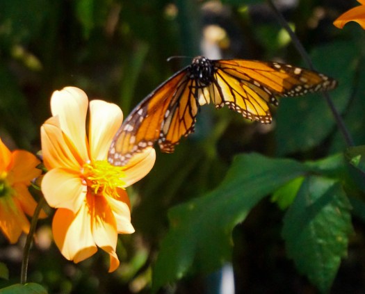
Mount Maunganui as usual dominates the scene, cruise ships clustered around the docks, and the endless channels and bays glistened in the afternoon light. Monarch butterflies flitted through the forest, and Catherine was in her element with her lens snapping away. It’s lovely to see her so happy, and breathing well at the moment (touching my head, ie wood!).
Monarch butterflies are everywhereA newly hatched butterfly drying its wingsThe gardens are planted to attract these beautiesOne of the many caterpillars feeding on a Swan Plant – they are ferocious eaters – not many of the plants had leaves left!
Oh what a relief to be here in these temperatures and not back in Australia (currently experiencing temperatures over 40 degrees centigrade in some areas!)! For New Zealand it is exceptionally warm, with the mercury going over 30 some days. But there always seems to be a cooling breeze that kicks in, and we have never felt too hot to stop us heading off on a jaunt. It’s really making us wonder about the future of Autralia for us, to be living there in the summer in a caravan. Not so good. Maybe a Plan B is called for? Let’s see.
On the way home we stopped off to top up with avocados from one of the many roadside stalls. They taste incredible freshly picked of course, so creamy and exploding with flavour. Then we got chatting to a couple who had just pulled up in their motorhome for the night in the most beautiful spot at Plummers Point, right on the edge of a well kept reserve, looking out over the bay towards Omokoroa.
Apparently their club has 80,000 members in New Zealand, and you can see why it’s so popular with so many awesome places to pull up (free!) as long as you have a self contained motorhome.
We bid them a good night and wandered back for yet another fantastic meal of fresh local produce whisked up by Richard. Oh…and a decent bottle of Cote du Rhone to wash it down of course! The local pinots come rather pricey for our everyday quaffing budget!
Thursday: After paying a visit to the local supermarket and cheese deli in Cambridge, we started to wind our way across country towards Ohakune, on the southern reaches of Tongariro National Park. It was a spectacular drive, travelling through New Zealand’s now familiar lush green farmland, with volcanic looking hills.
Fabulous view over Lake Taupo as we headed south
As we headed through Tongariro National Park the cloud descended and all hope of seeing the snow capped peaks disappeared with it. We arrived in Ohakune around 2.30pm, checking into a motel for the night. As we parked up we recognised the view from six years ago – we’ve stayed at the same place before!
We then drove up into Tongariro National Park, firstly doing a short walk to see a splendid waterfall where the Mangawhero plunges down into the valley.
The water plunging over the cliff – all snow melt, so we weren’t game for a dip!
From here we drove further down the mountain, and did a longer walk to Waitonga Falls. This hike took us through native mountain beech, climbing up high to an alpine bog. Unfortunately there was some wind up there, as on a calm day, there are some fabulous views of Mount Ruapehu reflected in the pools. We then climbed down steeply to the falls, a chance for a little water photography and a cup of tea before we headed back.
We needed all the climbing after our car journey…or so we convinced ourselves!Walking over the alpine bogI climb down to capture a different angleSuch a lovely riverRestricted myself to just a couple of photosA nice cup of tea
After all that activity we headed out to a local eatery for dinner. Strangely named The Blind Finch, the restaurant calls itself a ‘hamburgeria’ selling a variety of interesting burgers (Mark had the Vietnamese – a pork mince burger with crackling and Vietnamese slaw, I had a Japanese version with Teryiaki beef) plus locally brewed beers and New Zealand wines. A great meal, and a fabulous view of the setting sun reflecting on Ruapehu’s snow capped peak as we walked back to the motel.
Mt Ruapehu glowing at sunsetOhakhune as the sun sets
Friday: We arose early to do one more hike before we checked out, heading back into the national park, and doing a short walk through the Mangawhero Forest. We’re loving the cool lushness of the undergrowth here, every tree dripping in mosses and orchids, the ever present flutter and tweet of birds accompanying the rushing of the Mangawhero River. The track crossed a large volcanic crater on our way through, changing the fauna as we went.
Did you know Mr A is a bit of a tree hugger? Especially with a giant like this…The river winds peacefully through the forestMore water….Our last glimpse of the river before we head off
After showering and checking out of the motel, we were away again, heading just a short way down to Pipiriki, a tiny little village on the banks of the Whanganui River. We decided to head off for a walk along the riverside. River ‘side’ in this case, is a relative term, as the cliffs alongside the river are 50-100 metres high, offering great views, but a terrifying death if the ground gives way! We did about 7km return trip, before returning for a late lunch.
Pretty special views up the Whanganui RiverAbandoned shed on a farm at the end of the trailAmazing skiesMr A strolling along
We had a relaxing afternoon – there was no phone or internet access, so Mark read while I practiced a little drawing on my new iPad. I love how I can pretty much duplicate what I do on paper – still learning to use it and getting used to a smaller medium, but had fun.
Our little camp siteMy artists impression of the view from my green chair in the shade…later to become the helicopter landing pad!
We had some neighbours join us for dinner in the evening, given we were camped beside the picnic table. Mother and son from The Netherlands, Claudia and Fabian joined us for a lot of laughter and a glass of wine, and medical student Igor from Berlin, Germany shared our dinner, having earned it with a 40km cycle today after completing the Tongariro Crossing (an 8 hour mountain hike) yesterday.
We were just heading to bed, when the campground owner came over to tell us there was a medical emergency, and a helicopter was on its way to rush another guest to Palmerston North hospital with a suspected heart attack. We moved the car and packed away the tent, and waited in anticipation.
After about 90 minutes of waiting, the helicopter landed in the carpark alongside us, a challenging night landing, and the patient loaded up. We chatted to the pilot, who told us he had night vision goggles to help navigate and as ex-Air Force was used to challenging situations.
The calm before the excitement…the ambulance awaits the helicopterThe helicopter finally arrives…Ready to load the patient…
Soon the excitement was all over and we put up our tent and went to sleep.
Saturday: Another fine day dawned, with early fog drifting down the river valley clearing to blue skies. Mr A rustled up a fine breakfast while I prepared some lunch to take with us – a river adventure was ahead. By 10.30am we were whizzing up the Whanganui River on a jet boat, along with our Dutch friends and a German couple, two large Canadian canoes and two small white water kayaks loaded on the back.
Heading up the river on the jet boat
It took us about three and a half hours to paddle back down the river, with about six sets of rapids, including two ‘fifty-fifties’. These are so named because one in two paddlers comes down upside down! Fortunately neither of us tipped out – possibly because we had lower centres of gravity being the only people in whitewater kayaks! Nevertheless, we felt pretty proud of ourselves as we climbed out after 15.5km and headed off for showers.
Paddling past one of many waterfallsFabian and Claudia attempting to paddle their canoe up a waterfall…it’s no wonder they came acropper on the rapids!Claudia doing all the work while Fabian relaxes in the frontThat little yellow dot is Mr A, dwarfed by the valley sidesMr A again dwarfed by what is called ‘the dress circle’. The line where the foliage starts up above him is where the river flooded to in 2015I come on through some smaller gravel races…some canoeists tipped over on here even!A little rock scrambling took us to a waterfall in a cave at the side of the valleyAs we paddle down river we try to imagine the paddle steamers making it up this way in the early 1900s…back then it was known as ‘The Rhine of the South’. The first regular steam boat service started in 1892, and they were the only real way to see this area prior to the river road opening in 1934, winched along the very shallow parts of the river, and cruising on through the deeper parts…Made it without tipping out once! Yay team Anderson!
Our Dutch friends, Claudia and Fabian were less fortunate, tipping out on at least two occasions on their journey, and we watched several other groups having unplanned dips on their trips back too.
Once clean, Mark and I set off down the 79km Whanganui River Road towards Whanganui. The road wound alongside the river south of Pipiriki, through interesting Maori villages, each with a meeting house – we often heard singing as we travelled through.
Beautiful scenery accompanied us the whole way, culminating in a fabulous lookout from which we could see all the way to the snow capped peaks of Mt Ruapeau.
Looking all the way back up the river valley
We finally arrived at Whanganui feeling tired at about 5pm, and drove down to the windswept coast in the hope of setting up camp. The wind was incredibly strong, and we could imagine the tent canvas flapping all night long. It took us moments to change our minds and decide on alternative accomodation for the night. A quick Google and we ended up at the Riverview Motel – just fabulous. For NZ$100 we had a one bedroom apartment, with fully equipped kitchen, lounge (with lazy boy chairs – how much did we appreciate those?!) and dining area. Just perfect.
We had a relaxing evening, spaghetti bolognaise, a glass of red wine and the new series of Travellers on Netflix. Perfect. What an incredible day.


 Still perfection – Coila Creek behind the dunes


 Oysters and calamari sustaining us, we then decided to inflate our peak rafts (handily stowed in our backpacks) and paddle back to the start of the walk. Perfect!
 Our day concluded with a delicious barbecued roast lamb dinner with Jenny and David, simply delicious.